Embed Size (px)
Citation preview
SRI LANKA1
1. General Information
1.1 Geography
Sri Lanka is an island country located in the Indian Ocean. Total land area is about 65,610 square
kilometers. The central part of the southern half of the island is mountainous with heights more than
2.5 Km. The core regions of the central highlands contain many complex topographical features such
as ridges, peaks, plateaus, basins, valleys and escarpments. The remainder of the island is practically
flat except for several small hills that rise abruptly in the lowlands. These topographical features
(Figure 1) strongly affect the spatial patterns of winds, seasonal rainfall, temperature, relative
humidity and other climatic elements, particularly during the monsoon season. Sri Lanka's highest
1 Disclaimer: This report was compiled by an ADRC visiting researcher (VR) from ADRC member
countries. The views expressed in the report do not necessarily reflect the views of the ADRC. The
boundaries and names shown and the designations used on the maps in the report also do not
imply official endorsement or acceptance by the ADRC.
Figure 1
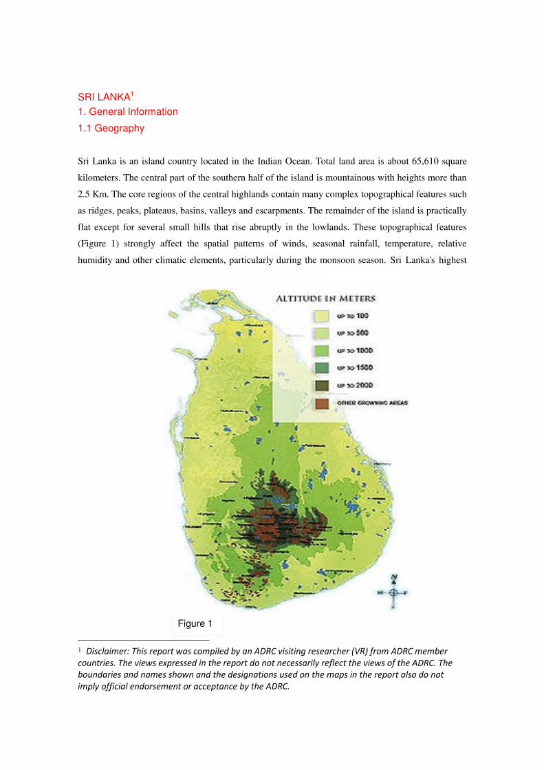
mountain is Pidurutalagala which is 2,524 meters in height. Most of the island's surface consists of
plains between 30 and 200 meters above sea level. Hundred and three rivers rise in the Central
Highlands and flow in a radial pattern toward the sea (Figure 2).
1.2 Climate
Due to the location of Sri Lanka, within the tropics between 5o 55' to 9o 51' North latitude and
between 79o 42' to 81o 53' East longitude, the climate of the island could be characterized as tropical.
The Climate of Sri Lanka is dominated by the above mentioned topographical features of the country
and the Southwest and Northeast monsoons regional scale wind regimes. The Climate experienced
Figure 2
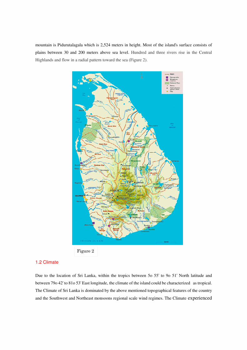
during 12 months period in Sri Lanka can be characterized in to 4 climate seasons (Figure 3) as
follows.
1. First Intermonsoon Season - March - April
2. Southwest monsoon season - May - September
3. Second Intermonsoon season - October - November
4. Northeast Monsoon season - December - February
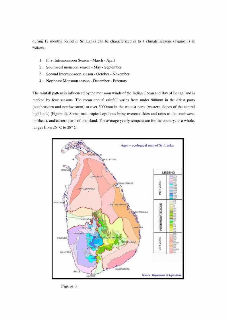
The rainfall pattern is influenced by the monsoon winds of the Indian Ocean and Bay of Bengal and is
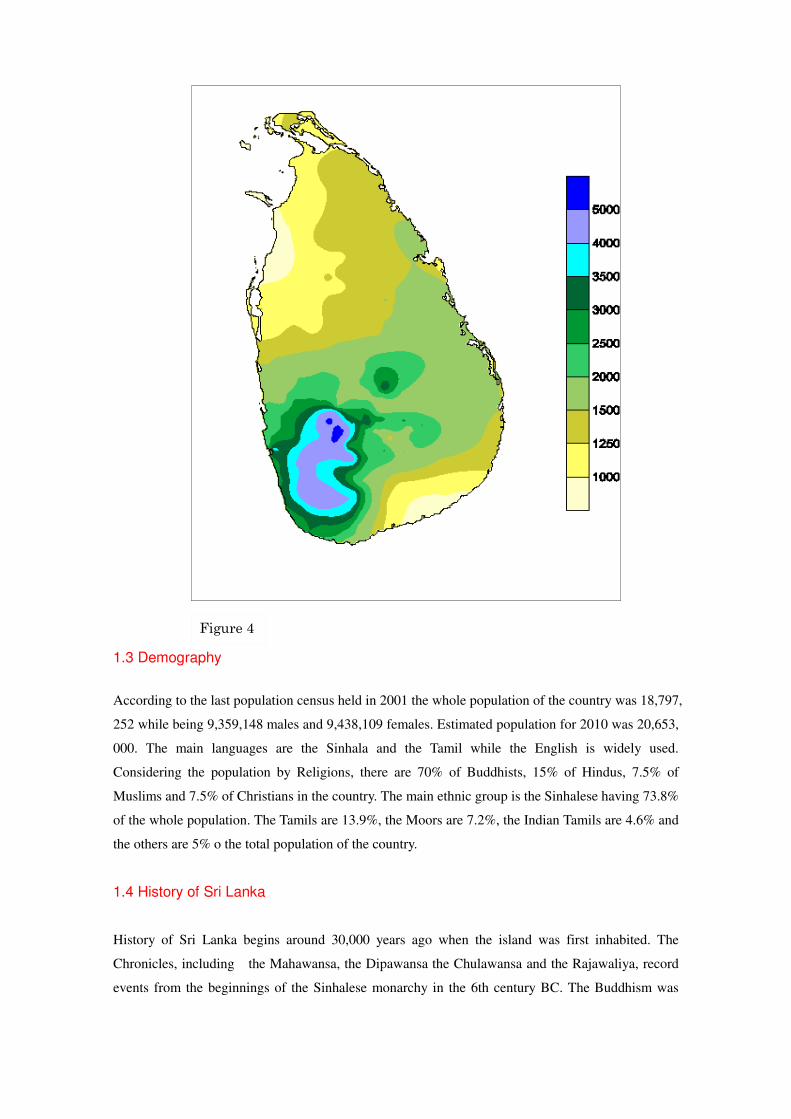
marked by four seasons. The mean annual rainfall varies from under 900mm in the driest parts
(southeastern and northwestern) to over 5000mm in the wettest parts (western slopes of the central
highlands) (Figure 4). Sometimes tropical cyclones bring overcast skies and rains to the southwest,
northeast, and eastern parts of the island. The average yearly temperature for the country, as a whole,
ranges from 26° C to 28° C.
Figure 3
1.3 Demography
According to the last population census held in 2001 the whole population of the country was 18,797,
252 while being 9,359,148 males and 9,438,109 females. Estimated population for 2010 was 20,653,
000. The main languages are the Sinhala and the Tamil while the English is widely used.
Considering the population by Religions, there are 70% of Buddhists, 15% of Hindus, 7.5% of
Muslims and 7.5% of Christians in the country. The main ethnic group is the Sinhalese having 73.8%
of the whole population. The Tamils are 13.9%, the Moors are 7.2%, the Indian Tamils are 4.6% and
the others are 5% o the total population of the country.
1.4 History of Sri Lanka
History of Sri Lanka begins around 30,000 years ago when the island was first inhabited. The
Chronicles, including the Mahawansa, the Dipawansa the Chulawansa and the Rajawaliya, record
events from the beginnings of the Sinhalese monarchy in the 6th century BC. The Buddhism was
Figure 4

introduced in the 3rd
century BC by Arhath Mahinda (son of the Indian emperor Ashoka the Great).
The European Colonialist arrived in the 16th
century and disestablishment of the monarchy in 1815.
The Portuguese arrived in 1505 and ruled a part of the country’s coastal Area. Then the Dutch rule
lasted from 1656 to 1796 and ruled a part of the country. The British ruled the country from 1796 to
1948. However by a peaceful process and constitutional evolution, Sri Lanka won back her
independence in 1948 and is now a sovereign republic. In 1983 a civil war was started and it ended
in 2009.
2 Natural Hazards in the Country.
2.1 Natural Hazards likely to affect the country
Over the past few decades disaster losses in Sri Lanka have increased substantially.
The country is prone to natural disasters caused by floods, cyclones, landslides,
droughts and coastal erosion with increasing instances of environmental pollution
related hazards. The devastation caused by the Indian Ocean tsunami of 2004 has
highlighted that Sri Lanka also vulnerable to tsunami. Except tsunami, Sri Lanka is
affected by different kind of natural hazards such as floods, droughts, cyclones, land
slights and coastal erosion. Other localized hazards include lightning strikes, epidemics,
high winds, fires and wild elephant attacks. Figure 5 shows the loss of human Lives due
to disasters from 1974 to 2007 in the country.
Figure 5
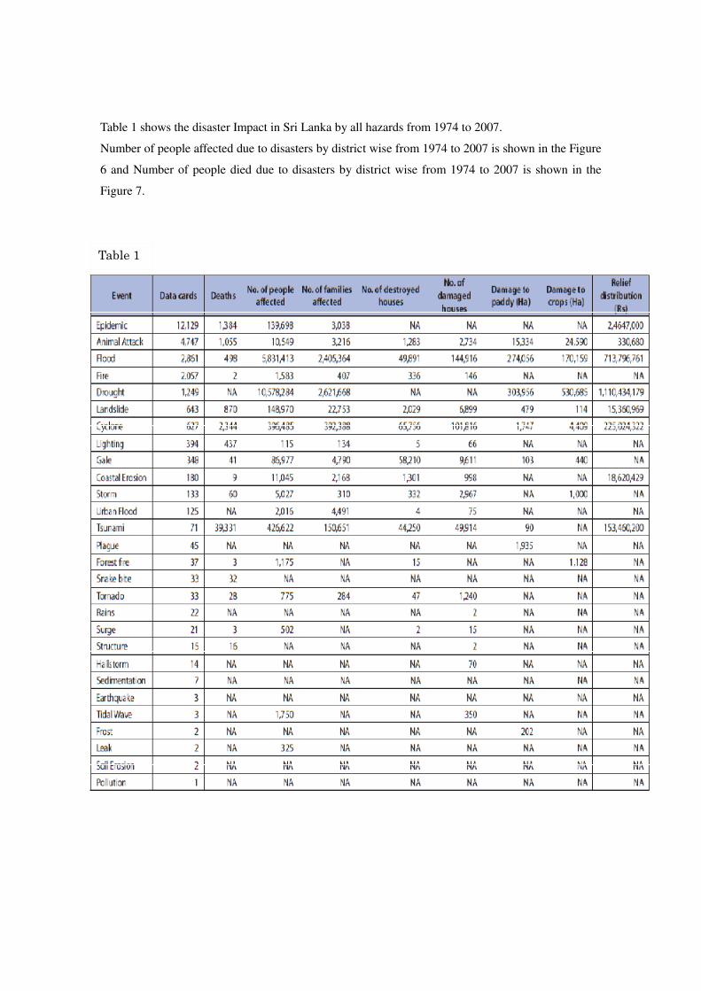
Table 1 shows the disaster Impact in Sri Lanka by all hazards from 1974 to 2007.
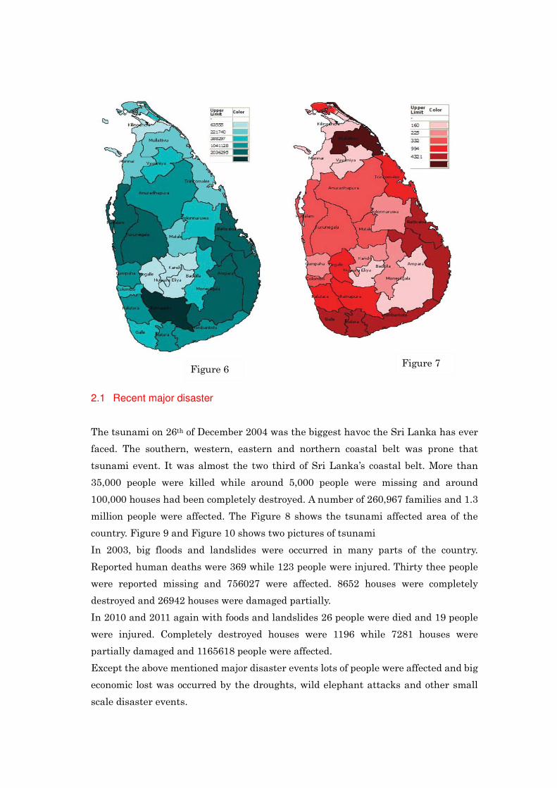
Number of people affected due to disasters by district wise from 1974 to 2007 is shown in the Figure
6 and Number of people died due to disasters by district wise from 1974 to 2007 is shown in the
Figure 7.
Table 1
2.1 Recent major disaster
The tsunami on 26th of December 2004 was the biggest havoc the Sri Lanka has ever
faced. The southern, western, eastern and northern coastal belt was prone that
tsunami event. It was almost the two third of Sri Lanka’s coastal belt. More than
35,000 people were killed while around 5,000 people were missing and around
100,000 houses had been completely destroyed. A number of 260,967 families and 1.3
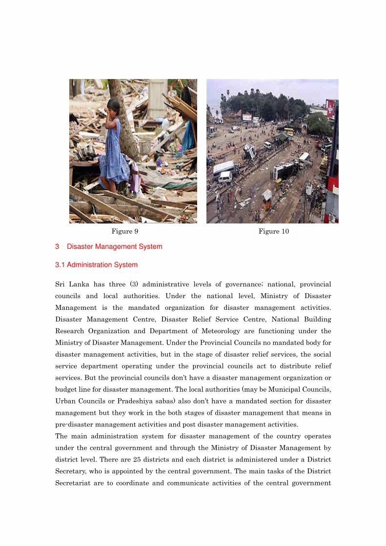
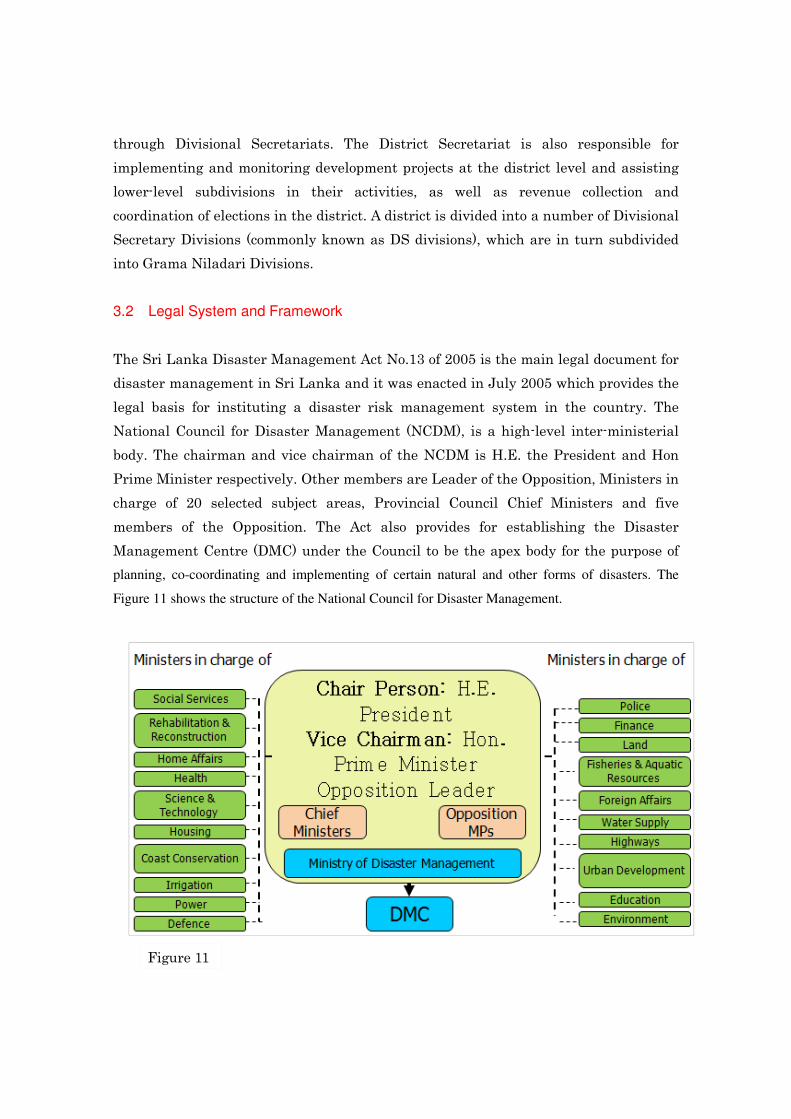
million people were affected. The Figure 8 shows the tsunami affected area of the
country. Figure 9 and Figure 10 shows two pictures of tsunami
In 2003, big floods and landslides were occurred in many parts of the country.
Reported human deaths were 369 while 123 people were injured. Thirty thee people
were reported missing and 756027 were affected. 8652 houses were completely
destroyed and 26942 houses were damaged partially.
In 2010 and 2011 again with foods and landslides 26 people were died and 19 people
were injured. Completely destroyed houses were 1196 while 7281 houses were
partially damaged and 1165618 people were affected.
Except the above mentioned major disaster events lots of people were affected and big
economic lost was occurred by the droughts, wild elephant attacks and other small
scale disaster events.
Figure 6 Figure 7
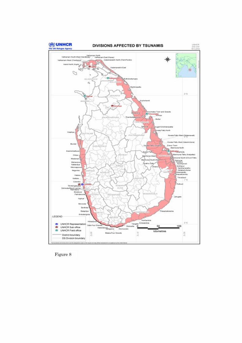
Figure 8
3 Disaster Management System
3.1 Administration System
Sri Lanka has three (3) administrative levels of governance; national, provincial
councils and local authorities. Under the national level, Ministry of Disaster
Management is the mandated organization for disaster management activities.
Disaster Management Centre, Disaster Relief Service Centre, National Building
Research Organization and Department of Meteorology are functioning under the
Ministry of Disaster Management. Under the Provincial Councils no mandated body for
disaster management activities, but in the stage of disaster relief services, the social
service department operating under the provincial councils act to distribute relief
services. But the provincial councils don’t have a disaster management organization or
budget line for disaster management. The local authorities (may be Municipal Councils,
Urban Councils or Pradeshiya sabas) also don’t have a mandated section for disaster
management but they work in the both stages of disaster management that means in
pre-disaster management activities and post disaster management activities.
The main administration system for disaster management of the country operates
under the central government and through the Ministry of Disaster Management by
district level. There are 25 districts and each district is administered under a District
Secretary, who is appointed by the central government. The main tasks of the District
Secretariat are to coordinate and communicate activities of the central government
Figure 9 Figure 10
through Divisional Secretariats. The District Secretariat is also responsible for
implementing and monitoring development projects at the district level and assisting
lower-level subdivisions in their activities, as well as revenue collection and
coordination of elections in the district. A district is divided into a number of Divisional
Secretary Divisions (commonly known as DS divisions), which are in turn subdivided
into Grama Niladari Divisions.
3.2 Legal System and Framework
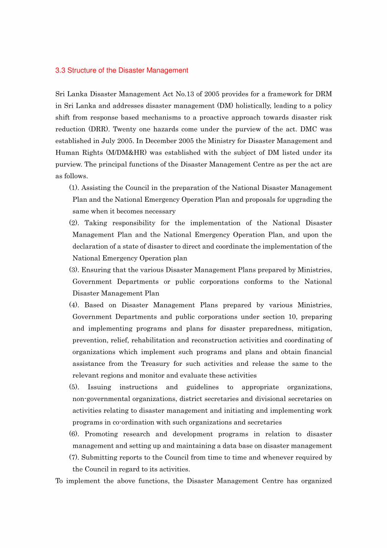
The Sri Lanka Disaster Management Act No.13 of 2005 is the main legal document for
disaster management in Sri Lanka and it was enacted in July 2005 which provides the
legal basis for instituting a disaster risk management system in the country. The
National Council for Disaster Management (NCDM), is a high-level inter-ministerial
body. The chairman and vice chairman of the NCDM is H.E. the President and Hon
Prime Minister respectively. Other members are Leader of the Opposition, Ministers in
charge of 20 selected subject areas, Provincial Council Chief Ministers and five
members of the Opposition. The Act also provides for establishing the Disaster
Management Centre (DMC) under the Council to be the apex body for the purpose of
planning, co-coordinating and implementing of certain natural and other forms of disasters. The
Figure 11 shows the structure of the National Council for Disaster Management.
Figure 11
3.3 Structure of the Disaster Management
Sri Lanka Disaster Management Act No.13 of 2005 provides for a framework for DRM
in Sri Lanka and addresses disaster management (DM) holistically, leading to a policy
shift from response based mechanisms to a proactive approach towards disaster risk
reduction (DRR). Twenty one hazards come under the purview of the act. DMC was
established in July 2005. In December 2005 the Ministry for Disaster Management and
Human Rights (M/DM&HR) was established with the subject of DM listed under its
purview. The principal functions of the Disaster Management Centre as per the act are
as follows.
(1). Assisting the Council in the preparation of the National Disaster Management
Plan and the National Emergency Operation Plan and proposals for upgrading the
same when it becomes necessary
(2). Taking responsibility for the implementation of the National Disaster
Management Plan and the National Emergency Operation Plan, and upon the
declaration of a state of disaster to direct and coordinate the implementation of the
National Emergency Operation plan
(3). Ensuring that the various Disaster Management Plans prepared by Ministries,
Government Departments or public corporations conforms to the National
Disaster Management Plan
(4). Based on Disaster Management Plans prepared by various Ministries,
Government Departments and public corporations under section 10, preparing
and implementing programs and plans for disaster preparedness, mitigation,
prevention, relief, rehabilitation and reconstruction activities and coordinating of
organizations which implement such programs and plans and obtain financial
assistance from the Treasury for such activities and release the same to the
relevant regions and monitor and evaluate these activities
(5). Issuing instructions and guidelines to appropriate organizations,
non-governmental organizations, district secretaries and divisional secretaries on
activities relating to disaster management and initiating and implementing work
programs in co-ordination with such organizations and secretaries
(6). Promoting research and development programs in relation to disaster
management and setting up and maintaining a data base on disaster management
(7). Submitting reports to the Council from time to time and whenever required by
the Council in regard to its activities.
To implement the above functions, the Disaster Management Centre has organized

under five sections as shown in figure 12.
The coordination mechanism of disaster management from the national level to
divisional level is shown in Figure 13.
Figure 12
Figure 13
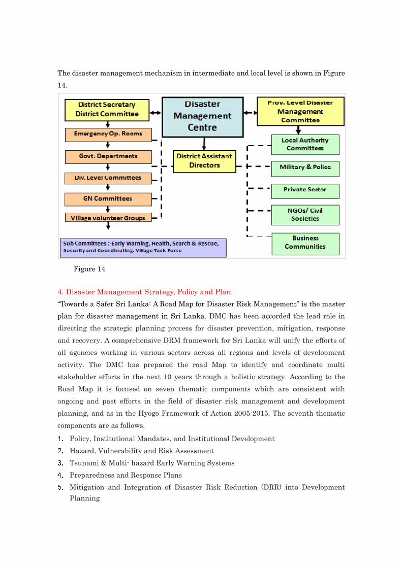
The disaster management mechanism in intermediate and local level is shown in Figure
14.
4. Disaster Management Strategy, Policy and Plan
“Towards a Safer Sri Lanka: A Road Map for Disaster Risk Management” is the master
plan for disaster management in Sri Lanka. DMC has been accorded the lead role in
directing the strategic planning process for disaster prevention, mitigation, response
and recovery. A comprehensive DRM framework for Sri Lanka will unify the efforts of
all agencies working in various sectors across all regions and levels of development
activity. The DMC has prepared the road Map to identify and coordinate multi
stakeholder efforts in the next 10 years through a holistic strategy. According to the
Road Map it is focused on seven thematic components which are consistent with
ongoing and past efforts in the field of disaster risk management and development
planning, and as in the Hyogo Framework of Action 2005-2015. The seventh thematic
components are as follows. 1. Policy, Institutional Mandates, and Institutional Development 2. Hazard, Vulnerability and Risk Assessment 3. Tsunami & Multi- hazard Early Warning Systems 4. Preparedness and Response Plans 5. Mitigation and Integration of Disaster Risk Reduction (DRR) into Development Planning
Figure 14
6. Community-based Disaster Risk Management 7. Public Awareness, Education and Training The projects and activities for disaster management of the country are going on based
on above seventh components.
5.Progress of Implementation of Hyogo framework for Action (HFA)
Sri Lanka has prepared the National progress report on the implementation of the Hyogo Framework
For Action (2009-2011) – interim. According to the report, lot of outcomes, have been able to
achieve by the Sri Lanka. Only a few of them have been mentioned here.
• National Planning Department of the Ministry of Finance has agreed to consider DRR in
approving development plans provided guidelines are developed for such a process. DMC is
working with Central Environmental Authority (CEA) and other agencies to develop such
guidelines. National Water Supply and Drainage Board has initiated implementation of
augmentation programme in western, central, and southern provinces. New water supply
schemes are been developed for northern and eastern provinces. (Area 1)
• NDMCC meets regularly and discuss programmes implemented by members and policy
requirements to make the implementation more effective. Hazard cycle for Sri Lanka has been
developed and given to district administration to prepare disasters such as floods, landslides
and cyclones. Nearly 40% of the activities identified in the Road Map have been
commenced.DM Act is being modified giving more authority to DMC for coordination of DM
Activities. Draft Act has been forwarded to Attorney general Department.Disaster
Management concepts were included in the Local Government policy which has been
approved by the govt. DMC has already provided disaster concerns to be incorporated in to the
act based on the LG policy. Development DM plans for Northern Province has been
commenced. Training of officials in Govt and LG sector on DM and development of plans
commenced. (Area 2)
• DMC with the assistance of Urban Development Authority, practical Action and ADPC has
commenced three pilot projects in southern and eastern provinces to prepare Urban
development plans for selected towns. UDA has agreed to issue instructions to planning
officers to follow Guidelines developed in future urban development planning process.
Mainstreaming disaster risk reduction in to housing is being undertaken with the assistance of
ADPC. All agencies in state sector were involved. Training programme conducted for
technical Officers in the Eastern province to introduce the guidelines developed for
construction of disaster resistance buildings. Building application used by Local Authorities
for for approval of land subdivision plans and building plans are being modified with the

concurrence of UDA to included DRR concepts. Draft format has been submitted to UDA for
their consideration. Environment Authority invites DMC for the meetings where EIA reports
are discussed. Integrated Strategic Environment Assessment (ISEA) for the Northern Province
is been developed with the assistance of all stakeholders. proposed development plans are
incorporated in the ISEA and areas for development are been identified. Discussion are in
progress with relevant development agencies to identify conflict areas and find solutions.
Hazard maps for landslides in Nuwaraeliya districts were given to agencies involved in
development and development control and officers were trained for the used hazard maps.
References:
1.http://www.dmc.gov.lk/attchments/Corporate%20Plan/document.pdf
2. http://www.dmc.gov.lk/Publications/Roadmap%20Vol.1.pdf
3. www.desinventar.lk
4. http://www.preventionweb.net/english/professional/news/?cid=162
5.http://www.preventionweb.net/english/hyogo/gar/2011/en/bgdocs/hfa/15598_lka_NationalHFAp
rogress_2009-11.pdf
6. http://www.meteo.gov.lk
7. http://www.treasury.gov.lk/FPPFM/fpd/pdfdocs/annualReport2010/AnnualReport2010-eng.pdf