Embed Size (px)
Citation preview
S U R V E Y I N G A N D M A P P I N G C O N S U L T A N T SSMC


The challenge: to align a five million, seven
hundred and fifty thousand-ton edifice to the cardinal direc-
tions. Not only was the Great Pyramid oriented within 1/10th
of one degree, the 756-foot base of the Great Pyramid falls
within seven inches of a perfect square.
This amazing accuracy was achieved nearly 5,000
years ago by the surveyors of ancient Egypt using primitive
techniques, which included the stretching of a knotted rope
and leveling with water-filled trenches.
Over the centuries, the art of surveying has
advanced from chains to optical theodolites and microwave
measuring devices to today’s Global Positioning System
(GPS) technology with real time centimeter-level accuracy.
However, one thing has never changed. The key to
accurate surveying and mapping still lies in the skillful use
of the right instruments and techniques, guided by seasoned
judgment. This is the philosophy behind SMC – Surveying
and Mapping Consultants, Inc.
In today’s private-and public-sector construction
environments, the need for cost-effective, high-quality surveying
and mapping information is greater than ever. More complex
environmental regulations, increasing costs of construction and
maintenance, and a rigorous competitive atmosphere demand
attention to detail, accuracy, and more timely data – delivered at
a reasonable cost.
SMC was founded in 1989 for the purpose of providing
specialized surveying and mapping services for engineers, utility
companies, planners and architects.
Possessing more than 100 years of combined experi-
ence, SMC has completed a wide variety of complex projects
for clients ranging from large engineering firms and utilities to
municipalities, hospitals, schools and developers involved with
the B.R.A.C. program.
At SMC, we believe that the key to providing clients
with cost-effective project solutions is using the right instrumenta-
tion and applying decades of experience to the task at hand.
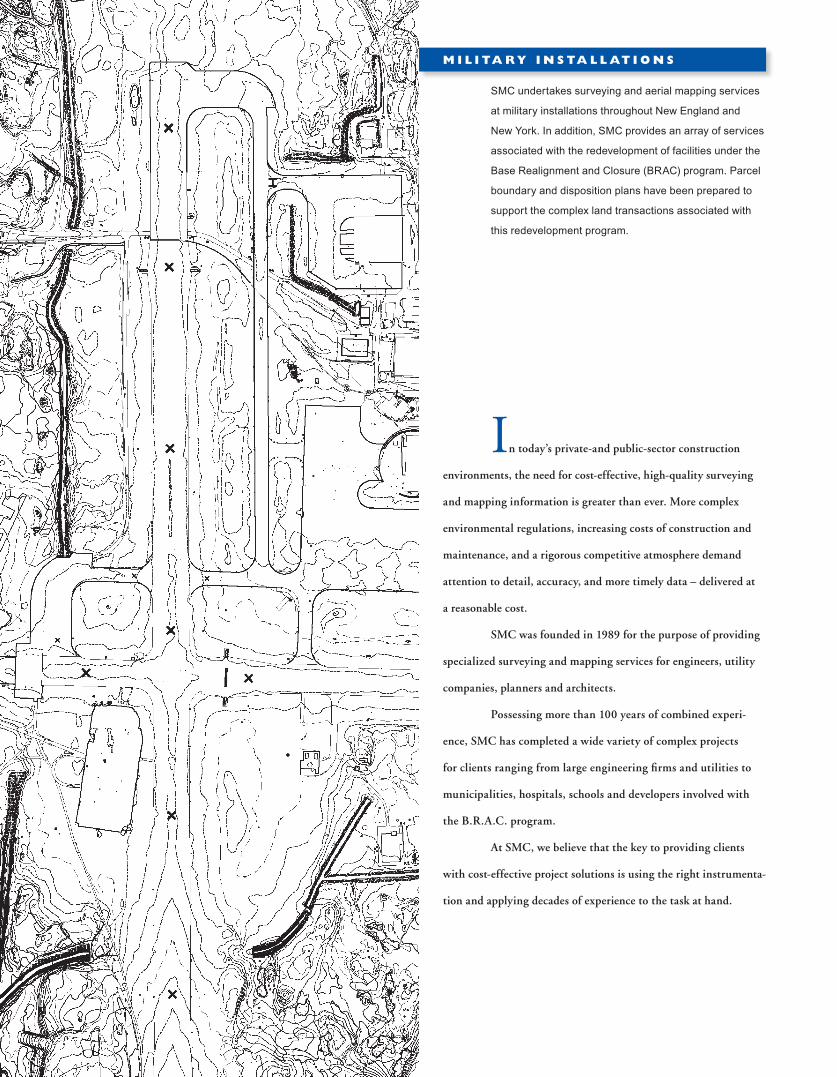
SMC undertakes surveying and aerial mapping services
at military installations throughout New England and
New York. In addition, SMC provides an array of services
associated with the redevelopment of facilities under the
Base Realignment and Closure (BRAC) program. Parcel
boundary and disposition plans have been prepared to
support the complex land transactions associated with
this redevelopment program.
M I L I TA RY I N S TA L L AT I O N S

I N F R A S T R U C T U R E
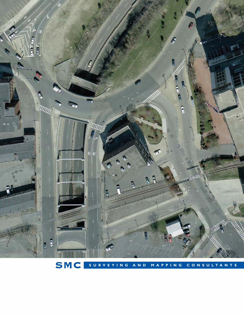
B R I D G E S & H I G H W AY S
This combination of skill and experience has earned for
SMC the trust of our clients and has contributed to our healthy
growth. Depending on the requirements of the project, SMC will
employ the specific techniques and instrumentation most appro-
priate for the project. These may range from measuring wheels,
robotic total stations, image scanning, to real time GPS technology
or aerial mapping.
SMC has significant expertise in the preparation of map-
ping for sewer and water infrastructure projects.
Depending on a project’s design requirements, SMC
utilizes detailed ground surveys or aerial surveys supple-
mented with ground survey. The need to know the location
of buried utilities has become a more significant technical
component for today’s environmental engineers. SMC
can utilize ground penetrating radar and other technologies
to pinpoint the location of buried utilities.
SMC has worked with engineers and state and municipal
authorities to provide land survey services, aerial mapping,
and topographic and hydrographic surveying for a wide
variety of design tasks including sound barrier, roadway
and interchange projects. Services provided by SMC
include right-of-way surveys, detail surveys, creation of
digital terrain models, and the preparation of profiles and
cross sections. Depending on the individual project re-
quirements, control networks have been established with
GPS technology, and aerial and ground survey data have
been combined digitally for final plan presentation.
Since the first days of the company, SMC has success-
fully undertaken projects for clients nationwide, calling for such
services as:
n Land surveys for highway and bridge design
n Topographic and property surveys for military bases
n Topographic surveys for property development
n ALTA/ACSM Land Title surveys
n GPS surveys for geodetic control networks
n Digital mapping of highway and utility corridors
n Location of utilities using real time GPS techniques
n Development of Digital Terrain Models (DTM)
n Preparation of maps, plans, profiles, and cross sections using
state-of-the-art surveying software
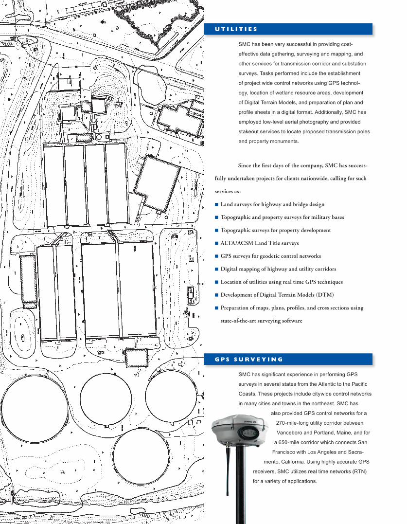
U T I L I T I E S
SMC has been very successful in providing cost-
effective data gathering, surveying and mapping, and
other services for transmission corridor and substation
surveys. Tasks performed include the establishment
of project wide control networks using GPS technol-
ogy, location of wetland resource areas, development
of Digital Terrain Models, and preparation of plan and
profile sheets in a digital format. Additionally, SMC has
employed low-level aerial photography and provided
stakeout services to locate proposed transmission poles
and property monuments.
SMC has significant experience in performing GPS
surveys in several states from the Atlantic to the Pacific
Coasts. These projects include citywide control networks
in many cities and towns in the northeast. SMC has
also provided GPS control networks for a
270-mile-long utility corridor between
Vanceboro and Portland, Maine, and for
a 650-mile corridor which connects San
Francisco with Los Angeles and Sacra-
mento, California. Using highly accurate GPS
receivers, SMC utilizes real time networks (RTN)
for a variety of applications.
G P S S U RV E Y I N G

SMC offers turnkey aerial mapping
services, including project and flight planning,
development of specifications, control surveys, mapping, and
complete program management.
Over the years, SMC has enjoyed repeat business from
many of its clients. We believe that a job well done, on schedule,
and within budget is the best reference we can offer. Whether a
project is large or modest, involving either straightforward
surveying or a complex combination of techniques, SMC stands
ready to assist you with our full range of capabilities.
Experience, skill, and seasoned judgment: these are
the tools SMC brings to every project. Whatever the size of the
project, SMC focuses on providing cost-effective solutions to the
challenges faced by our clients in such diverse areas as:
n Topographic and property surveys
n Digital mapping and terrain modeling
n Mapping of highway and utility corridors
n GPS real time positioning using RTN technology
n Image scanning
To learn more about how SMC can assist you with
an upcoming project, visit our website www.smcsurvey.com
or call 781-380-7766
C O R P O R AT I O N S & I N S T I T U T I O N S
Working with institutions and their architects, SMC has
developed extensive experience in a variety of project
areas ranging from a golf course drainage rehabilitation
to laying submarine cables. These projects frequently
call for assistance with such tasks as physical
plant expansion, subdivision planning and parcel
consolidation, and the development of master
plans. Tasks performed range from as-built,
topographic, property line, and land title surveys
to the preparation of digital drawing files,
including the development of utility inventories.
A variety of techniques may be used on these
projects, ranging from traditional surveying
methods to preparation of data and plans
using the latest in digital mapping technology.

S U R V E Y I N G A N D M A P P I N G C O N S U L T A N T SSMC3 2 5 W O O D R O A D , S U I T E 1 0 9 , B R A I N T R E E , M A 0 2 1 8 4
T E L E P H O N E : ( 7 8 1 ) 3 8 0 - 7 7 6 6
F A X : ( 7 8 1 ) 3 8 0 - 7 7 5 7
W W W . S M C S U R V E Y. C O M


![NERC this page%PDF-1.6 %âãÏÓ 7766 0 obj > endobj 7781 0 obj >/Filter/FlateDecode/ID[951F5A69D98AA94890BB9A97C64DA060>3A840F817421A049A37DF140A3FB73DB>]/Index[7766 32]/Info 7765](https://img.pdfslide.us/doc/110x75/5af201477f8b9abc788f2452/this-pagepdf-16-7766-0-obj-endobj-7781-0-obj-filterflatedecodeid951f5a69d98aa94890bb9a97c64da0603a840f817421a049a37df140a3fb73dbindex7766.jpg)