Embed Size (px)
Citation preview
© AREE 2009 Airborne Research and Remote Sensing 1
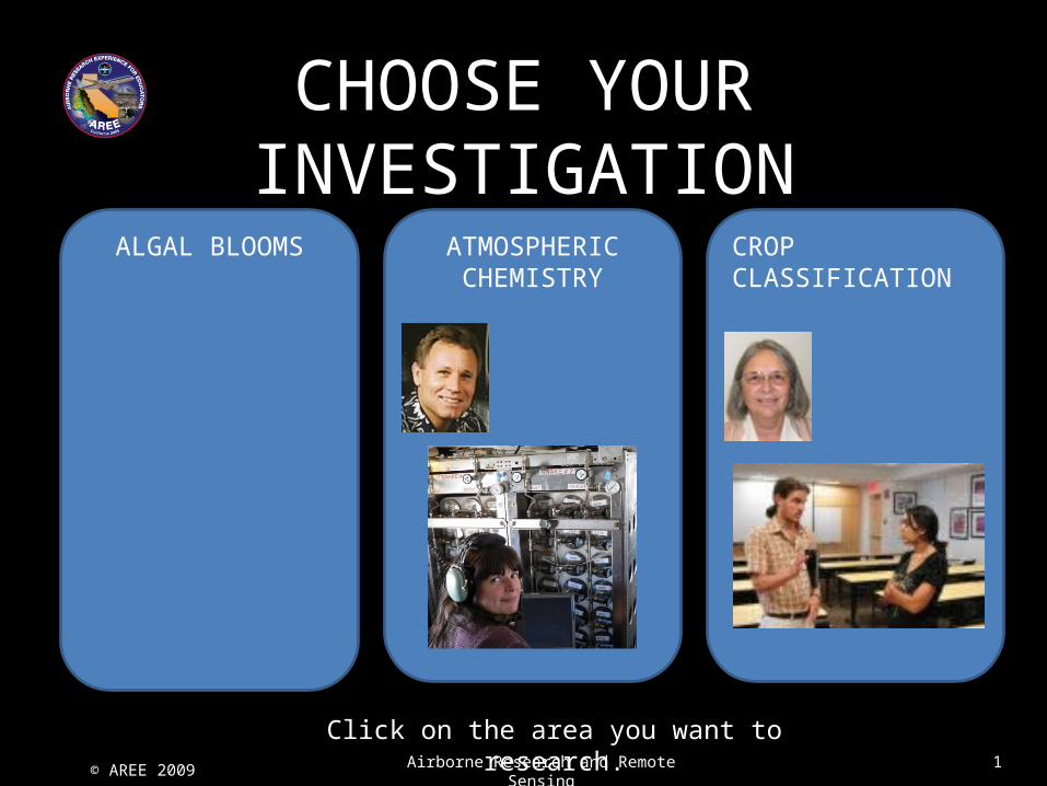
CHOOSE YOUR INVESTIGATION
ALGAL BLOOMS ATMOSPHERIC CHEMISTRY
CROP CLASSIFICATION
Click on the area you want to research.

© AREE 2009 Airborne Research and Remote Sensing 1
CROP CLASSIFICATION RESEARCHData for the almond orchards was collected on both flights, but the data on the first flight is useable because it wasn’t collected in the right area. Click on the plane below to attend a pre-flight briefing.
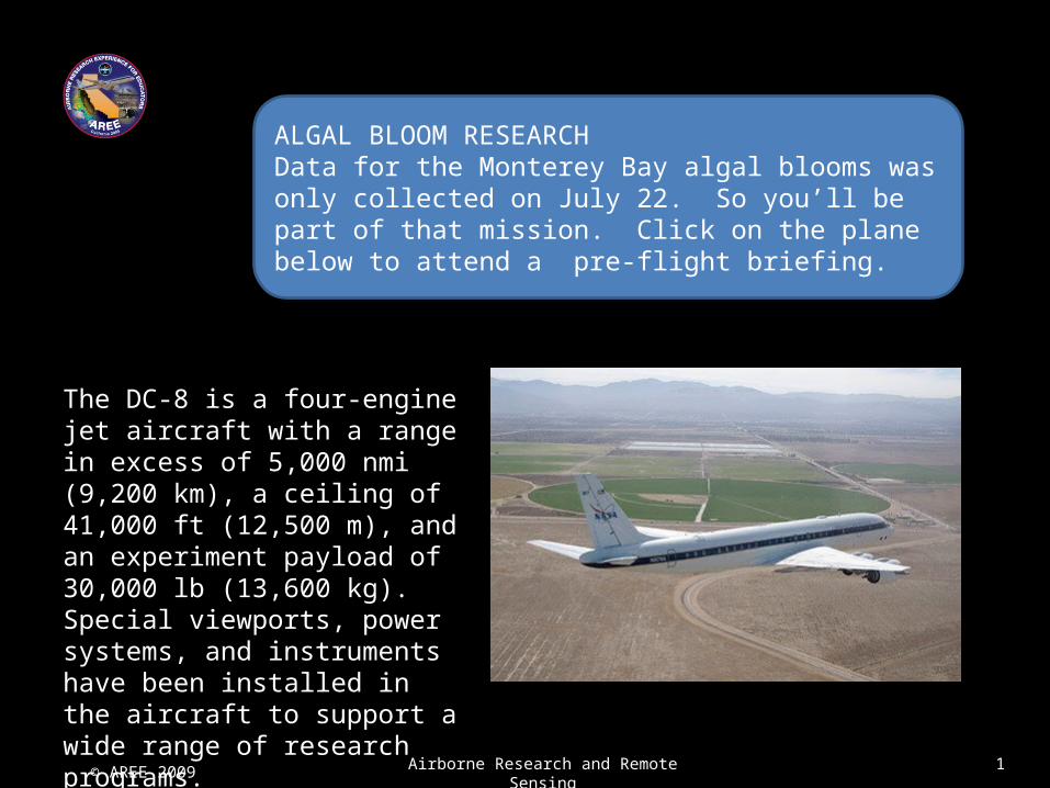
The DC-8 is a four-engine jet aircraft with a range in excess of 5,000 nmi (9,200 km), a ceiling of 41,000 ft (12,500 m), and an experiment payload of 30,000 lb (13,600 kg). Special viewports, power systems, and instruments have been installed in the aircraft to support a wide range of research programs.
© AREE 2009 Airborne Research and Remote Sensing 1
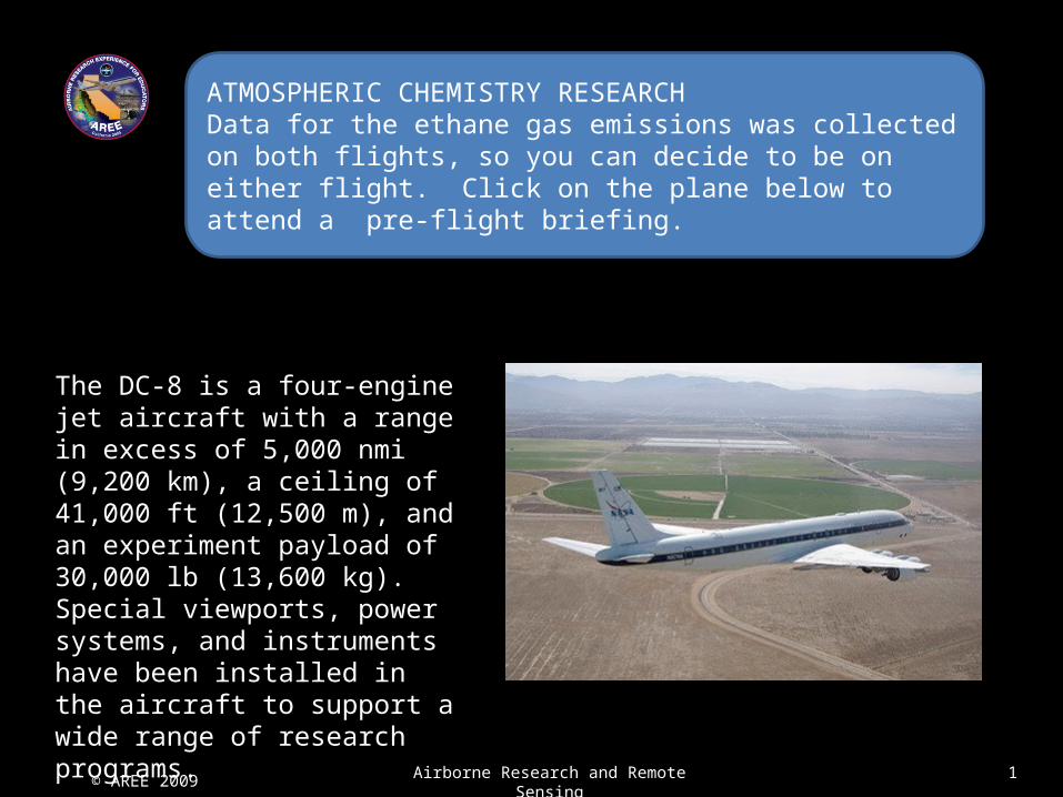
ATMOSPHERIC CHEMISTRY RESEARCHData for the ethane gas emissions was collected on both flights, so you can decide to be on either flight. Click on the plane below to attend a pre-flight briefing.
The DC-8 is a four-engine jet aircraft with a range in excess of 5,000 nmi (9,200 km), a ceiling of 41,000 ft (12,500 m), and an experiment payload of 30,000 lb (13,600 kg). Special viewports, power systems, and instruments have been installed in the aircraft to support a wide range of research programs.
© AREE 2009 Airborne Research and Remote Sensing 1
ALGAL BLOOM RESEARCHData for the Monterey Bay algal blooms was only collected on July 22. So you’ll be part of that mission. Click on the plane below to attend a pre-flight briefing.
The DC-8 is a four-engine jet aircraft with a range in excess of 5,000 nmi (9,200 km), a ceiling of 41,000 ft (12,500 m), and an experiment payload of 30,000 lb (13,600 kg). Special viewports, power systems, and instruments have been installed in the aircraft to support a wide range of research programs.
© AREE 2009 Airborne Research and Remote Sensing 1
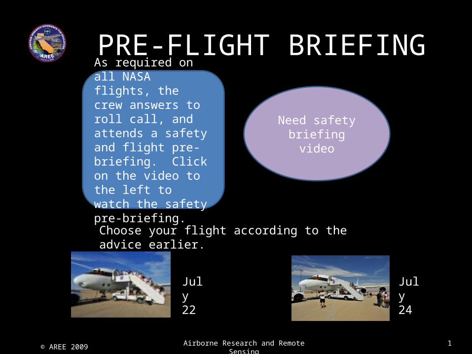
As required on all NASA flights, the crew answers to roll call, and attends a safety and flight pre-briefing. Click on the video to the left to watch the safety pre-briefing.
Need safety briefing video
PRE-FLIGHT BRIEFING
Choose your flight according to the advice earlier.
July 24
July 22
© AREE 2009 Airborne Research and Remote Sensing 1
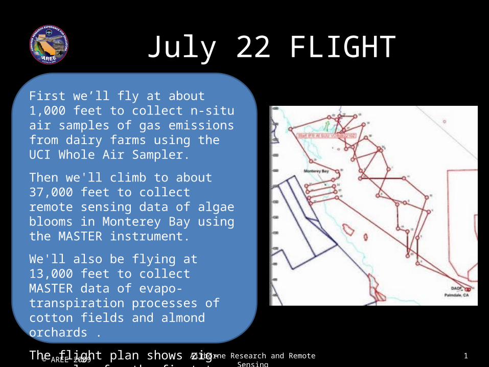
First we’ll fly at about 1,000 feet to collect n-situ air samples of gas emissions from dairy farms using the UCI Whole Air Sampler.
Then we'll climb to about 37,000 feet to collect remote sensing data of algae blooms in Monterey Bay using the MASTER instrument.
We'll also be flying at 13,000 feet to collect MASTER data of evapo-transpiration processes of cotton fields and almond orchards .
The flight plan shows zig-zag plan for the first two legs of the flight as well as the multiple over-flights planned for the Bay.
July 22 FLIGHT
© AREE 2009 Airborne Research and Remote Sensing 1
Doors close on the DC-8 at 11:10 am PDT and take-off is scheduled for 11:40 am PDT.
.

© AREE 2009 Airborne Research and Remote Sensing 1
© AREE 2009 Airborne Research and Remote Sensing 1
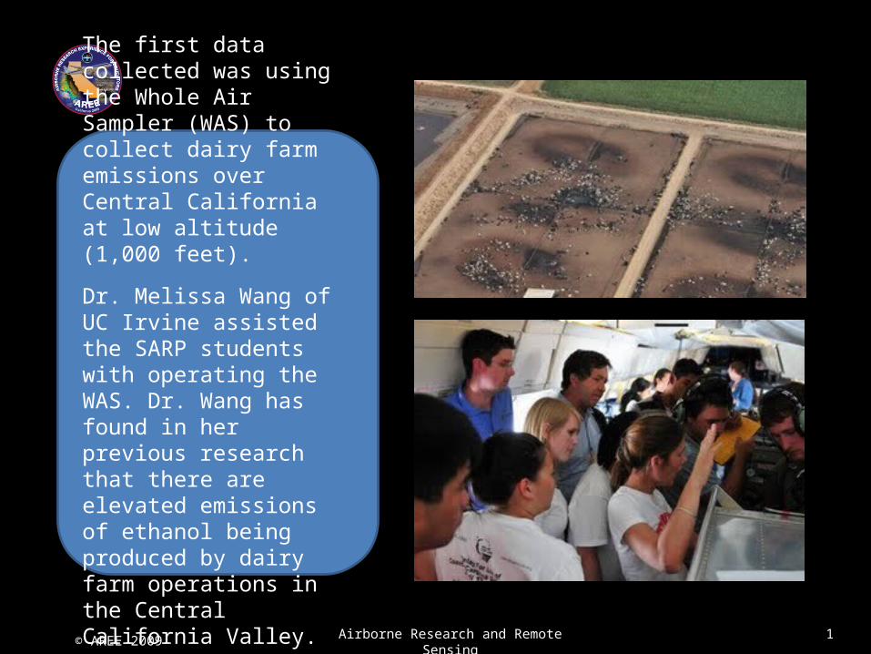
The first data collected was using the Whole Air Sampler (WAS) to collect dairy farm emissions over Central California at low altitude (1,000 feet).
Dr. Melissa Wang of UC Irvine assisted the SARP students with operating the WAS. Dr. Wang has found in her previous research that there are elevated emissions of ethanol being produced by dairy farm operations in the Central California Valley.
© AREE 2009 Airborne Research and Remote Sensing 1
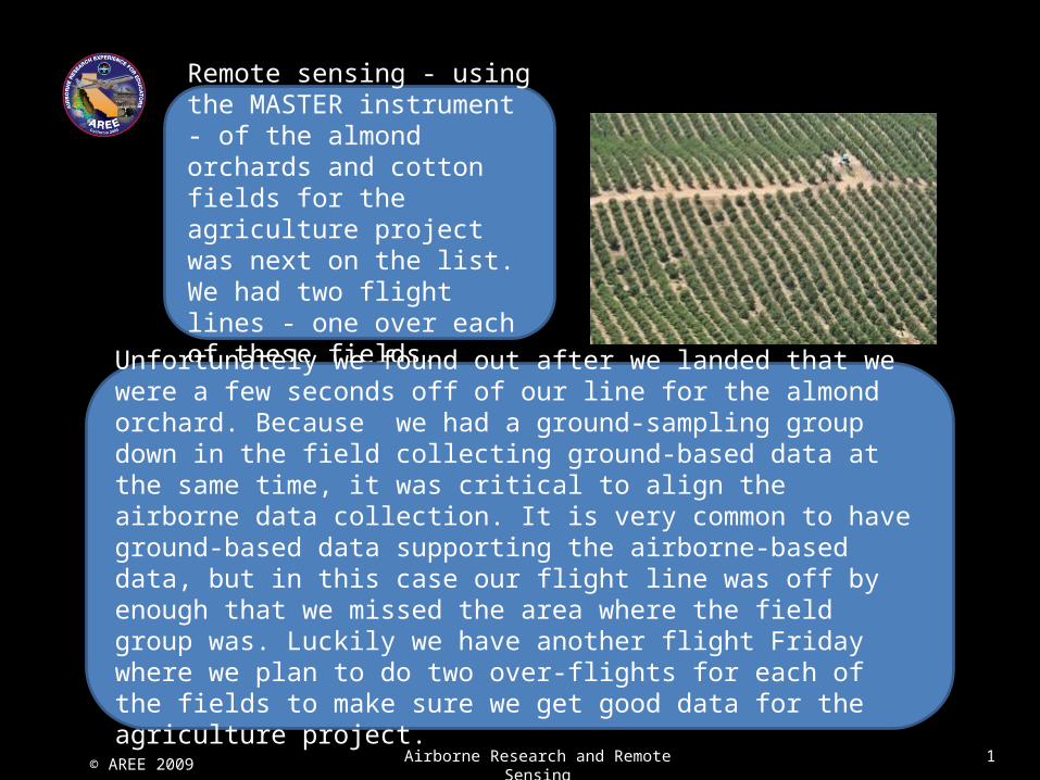
Remote sensing - using the MASTER instrument - of the almond orchards and cotton fields for the agriculture project was next on the list. We had two flight lines - one over each of these fields.
Unfortunately we found out after we landed that we were a few seconds off of our line for the almond orchard. Because we had a ground-sampling group down in the field collecting ground-based data at the same time, it was critical to align the airborne data collection. It is very common to have ground-based data supporting the airborne-based data, but in this case our flight line was off by enough that we missed the area where the field group was. Luckily we have another flight Friday where we plan to do two over-flights for each of the fields to make sure we get good data for the agriculture project.
© AREE 2009 Airborne Research and Remote Sensing 1
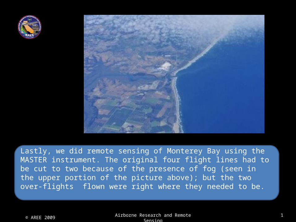
Lastly, we did remote sensing of Monterey Bay using the MASTER instrument. The original four flight lines had to be cut to two because of the presence of fog (seen in the upper portion of the picture above); but the two over-flights flown were right where they needed to be.
© AREE 2009 Airborne Research and Remote Sensing 1
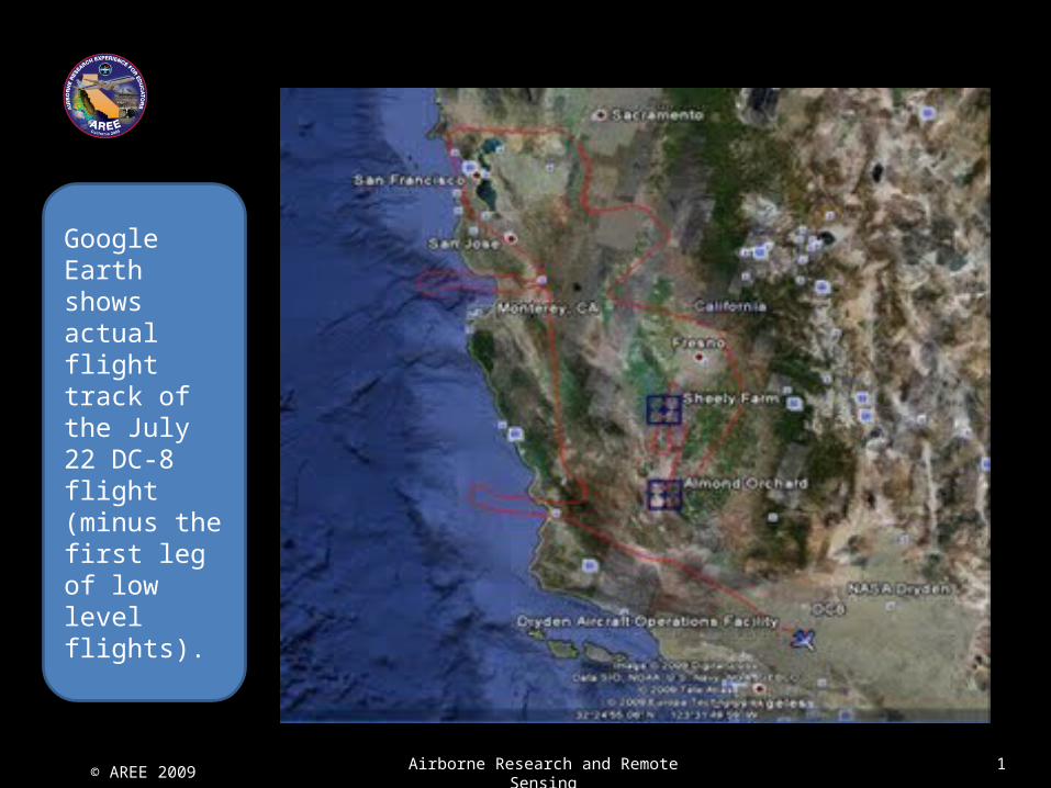
Google Earth shows actual flight track of the July 22 DC-8 flight (minus the first leg of low level flights).
© AREE 2009 Airborne Research and Remote Sensing 1
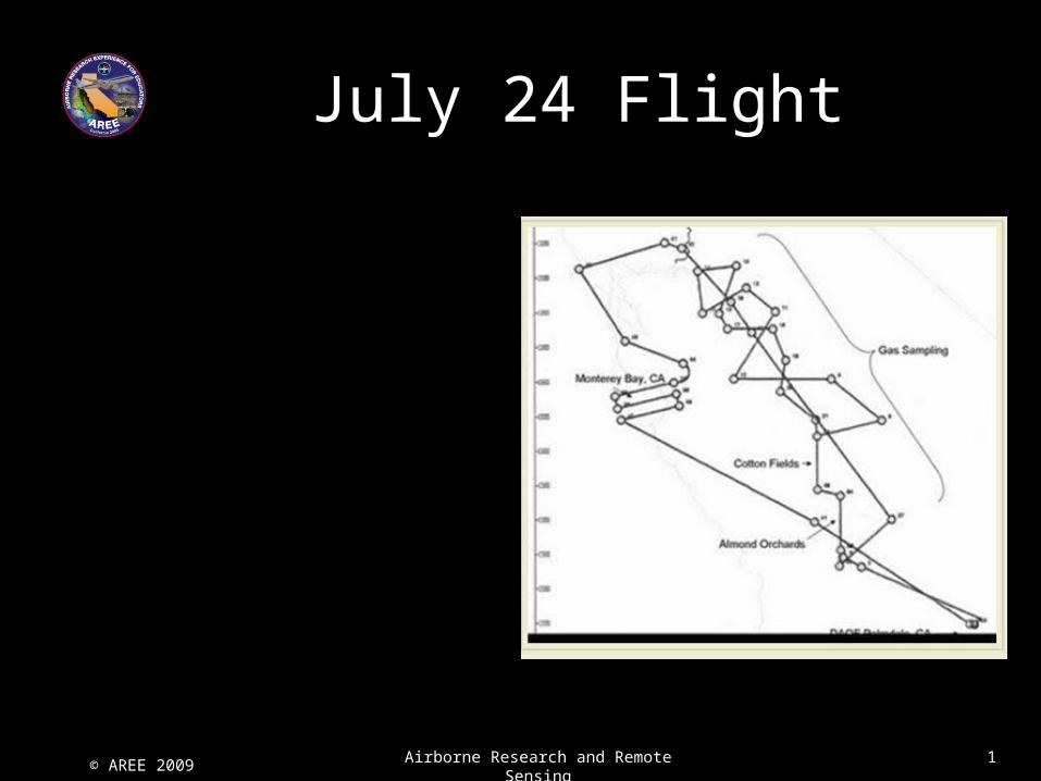
July 24 Flight
© AREE 2009 Airborne Research and Remote Sensing 1
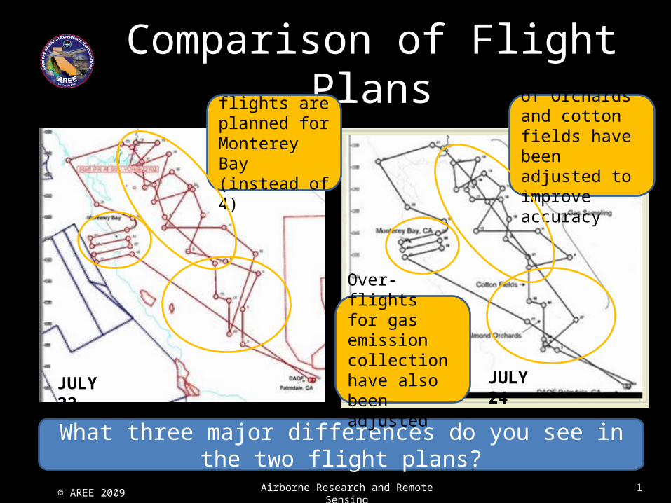
Comparison of Flight Plans
What three major differences do you see in the two flight plans?
3 over-flights are planned for Monterey Bay (instead of 4)
Over-flights of Orchards and cotton fields have been adjusted to improve accuracy
Over-flights for gas emission collection have also been adjustedJULY
22
JULY 24
© AREE 2009 Airborne Research and Remote Sensing 1
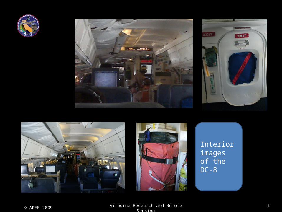
Interior images of the DC-8
© AREE 2009 Airborne Research and Remote Sensing 1
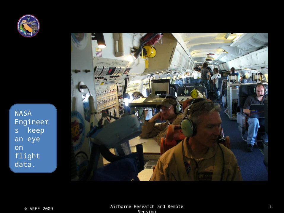
NASA Engineers keep an eye on flight data.
© AREE 2009 Airborne Research and Remote Sensing 1
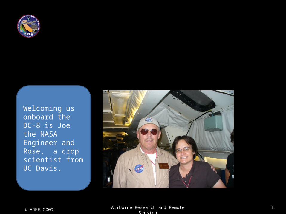
Welcoming us onboard the DC-8 is Joe the NASA Engineer and Rose, a crop scientist from UC Davis.
© AREE 2009 Airborne Research and Remote Sensing 1
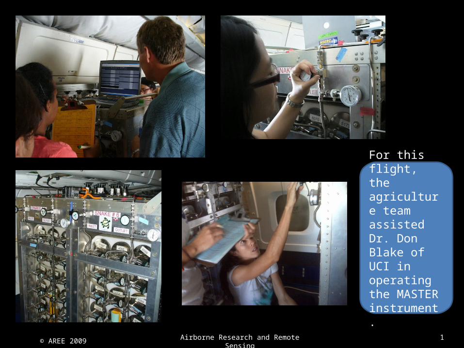
For this flight, the agriculture team assisted Dr. Don Blake of UCI in operating the MASTER instrument.
© AREE 2009 Airborne Research and Remote Sensing 1
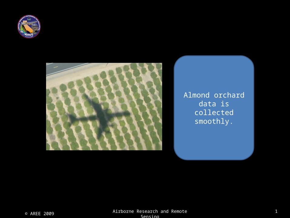
Almond orchard data is collected smoothly.
© AREE 2009 Airborne Research and Remote Sensing 1
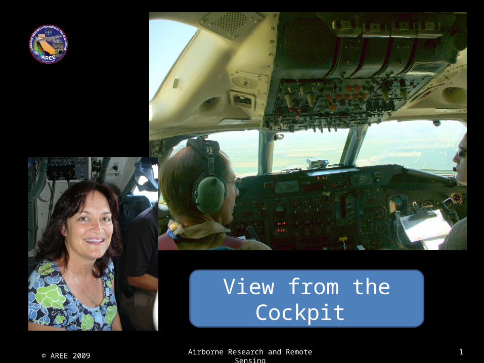
View from the Cockpit
© AREE 2009 Airborne Research and Remote Sensing 1
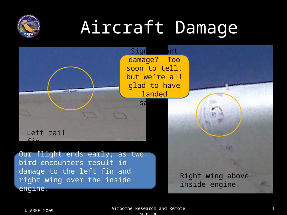
Our flight ends early, as two bird encounters result in damage to the left fin and right wing over the inside engine.
Aircraft Damage
Significant damage? Too soon to tell,
but we’re all glad to have landed safely.
Left tail fin
Right wing above inside engine.