Embed Size (px)
Citation preview
~ 10 km
Beachfront at Pangandaran whereover 200 people were killed. Tsunami height was 4 to 6 m.
Pangandaran National ParkEarthquake epicenterabout 200 km away
Map of Pangandaran area
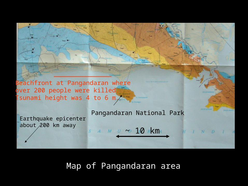
Beach at Pangandaran. There were many restaurants and shopsalong the beachfront that were washed away

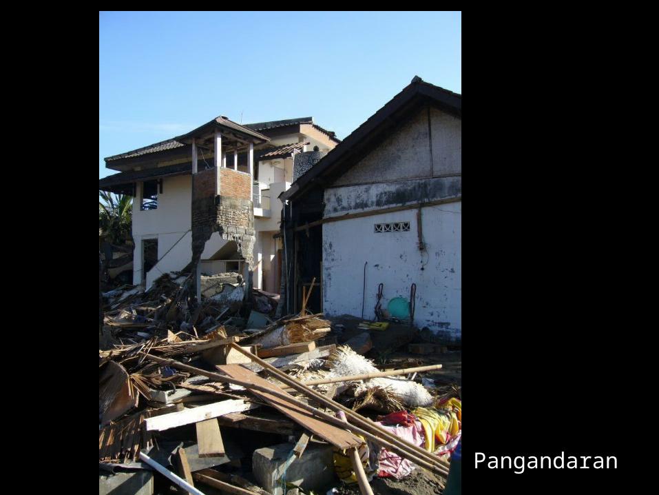
Pangandaran

Pangandaran
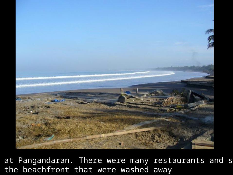
Pangandaran. Walls perpendicular to wave are oftenknocked down and walls parallel remain.
Pangandaran

Pangandaran

Pangandaran

Pangandaran. Undamaged buildings close to tsunami damage. Therewas no damage from earthquake shaking. A few people did not feel theearthquake. This was a ‘tsunami earthquake’, with low levels of high-frequency seismic radiation.

Center for displaced person in Pangandaran

Delivering donations of food from the Kyoto Univ. COE (KAGI21)summer school and the Faculty of Earth Sciences and Mineral Technologies of Bandung Institute of Technology

Pangandaran National Park.Line of leaves onbeach shows the heightof tsunami. Tsunamiwas not very high here,about 1-2 m.

Pangandaran National Park. Killed vegetation shows level of tsunami

Pangandara National Park
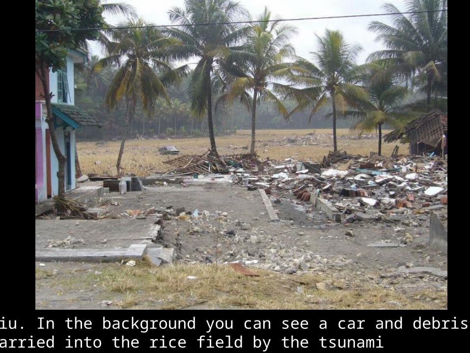
Batu Hiu. In the background you can see a car and debris thatwere carried into the rice field by the tsunami
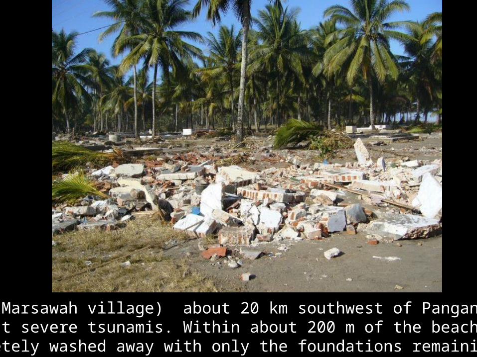
Bulaklaut (Marsawah village) about 20 km southwest of Pangandaran had the most severe tsunamis. Within about 200 m of the beach, buildingswere completely washed away with only the foundations remaining

Marsawah village. There is one building standing in this area, all the rest have been completely destroyed. 70 people were killed in this area.

Marsawah village. Area several hundred meters from the beach

Small debris on wire shows height of tsunami
Marsawah village