Embed Size (px)
Citation preview

WORKSHOP ON COMPLIANCE
Dr. Luis BermudezOpen Geospatial Consortium (OGC)GeoBuiz Summit 2016April 27, 2016
Copyright: 2016, Open Geospatial Consortium

Outline
• Why Standards?
• The Open Geospatial Consortium
• Why do we need compliance?
• Benefits of compliance for solution providers and buyers
• How do we verify compliance?
• Process overview
• Community compliance solution
• Online demo

Why Standards?

Technology improves our cities and our lives

The glue of integration
"...integration is key. Using standard datastructures and formats all data about anyobject of interest any person, place orthing can be easily shared with andaccessed by anyone with the need toknow..."Letitia A. Long, Director, National Geospatial-Intelligence Agency, October 4,2013, KMI Interview

Global Solutions
"Standardization is one of the essentialbuilding blocks of the InformationSociety. There should be particularemphasis on the development andadoption of international standards ..."The Declaration of Principles WSIS-03/GENEVA/DOC/0004 concluded inparagraph 44, from the first phase of the World Summit on the InformationSociety, Geneva, December 10 to 12 2003.

Transparency and Openness
"Governments like to say they can publishto OGC KML instead of Google KML ...everyone has confidence we won’t takeadvantage of the format or change it in away that will harm anyone ..."Michael Weiss-Malik, Google KML product manager
The OGC Overview

Open Geospatial Consortium
• Funded in 1994
• Voluntary consensus (500+ members)
• Standards organization (40+ free available standards)
• Leads the development of standards for geospatial and location basedservices.

Open Geospatial Consortium (OGC)
Mission: To serve as a global forum for the collaboration of developers andusers of spatial data products and services, and to advance the developmentof international standards for geospatial interoperability.

OGC in Policy Worldwide
• National level policy and legislation
• European INSPIRE Directive
• Global Earth Observation System of Systems (GEOSS)
• European Space Agency
• Defense and Intelligence: NGA, NATO, ARMY
• Sub-national level: Delhi, Abu Dhabi, Western
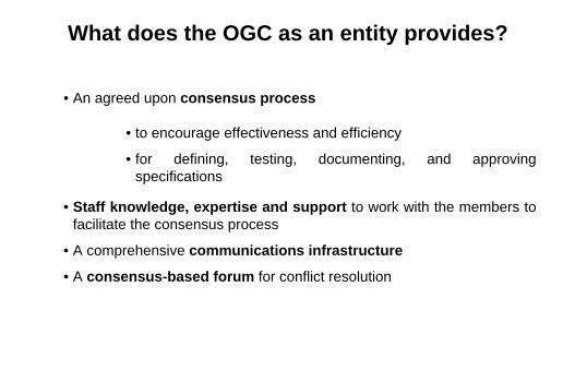
What does the OGC as an entity provides?
• An agreed upon consensus process
• to encourage effectiveness and efficiency
• for defining, testing, documenting, and approvingspecifications
• Staff knowledge, expertise and support to work with the members tofacilitate the consensus process
• A comprehensive communications infrastructure
• A consensus-based forum for conflict resolution

Members

Membership levels
• Strategic
• Principal
• Technical
• Associate

Industry Members

OGC Alliance Partners

Implementations

OGC Structure


Why Compliance?

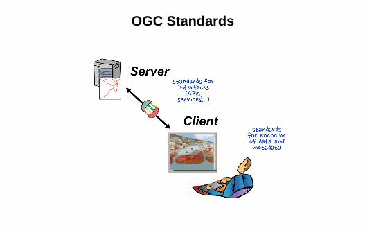
OGC Standards
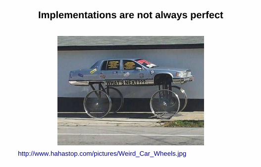
Implementations are not always perfect
http://www.hahastop.com/pictures/Weird_Car_Wheels.jpg

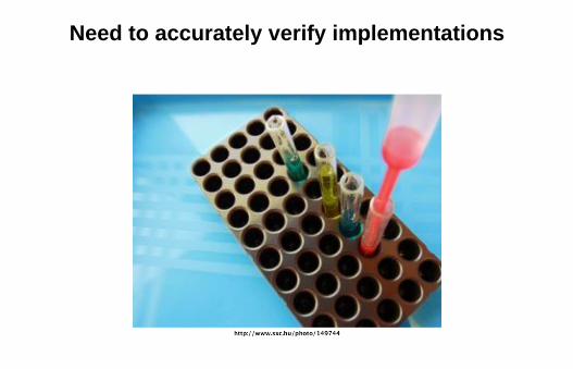
Need to accurately verify implementations

Increase confidence of solution providers
"Achieving OGC certification is extremelyimportant to us as an organization - weare proud to have more than 20 productscompliant with OGC standards."Stan Tilman | Hexagon Geospatial

Create more business opportunities forsolution providers

Benefits for buyers of solutions
Avoid the spaghetti mess: Minimize the delay, cost, frustration of reworkingdisparate implementations.

How do we verify compliance?


Compliance Program
• Policies and process
• Community support
• Free open source tools
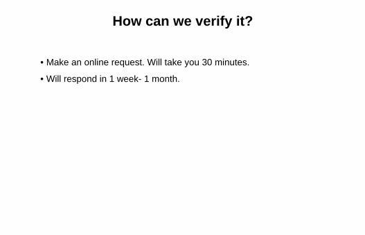
How can we verify it?
• Make an online request. Will take you 30 minutes.
• Will respond in 1 week- 1 month.

How can we verify it?
No. I'm kidding!

Easy real time online verification of OGCcompliant products
http://www.opengeospatial.org/resource/products/compliant

Community
• About 300 members participate in the forum:
• Each test suite has a lead
• OGC has alliances with groups supporting the test (answeringquestions, fixing bugs, etc.)

Forum

What is the process to get certified?


Available tests

How to ask for compliance?
“ Purchaser seeks geospatial productsthat provide maximum interoperabilitywith purchaser’s and data sharingpartner’s systems. To accomplish this,purchaser seeks to make maximum use ofopen standards provided by the OpenGeospatial Consortium (OGC), ISO ...”OGC Compliance Overview - Guide for Software Acquisition White paper(15-002r5) http://docs.opengeospatial.org/wp/15-002r5/15-002r5.html

What about community profiles?

Testing community profiles
• Communities can create their own test (TestNG or XSLT - ComplianceTesting Language)
• Invoke tests: GML 3.2.1 with your own schemas
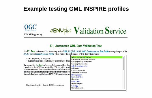
Example testing GML INSPIRE profiles

Online Demo

OGC compliance web landing page
http://www.opengeospatial.org/compliance
• Video
• Benefits
• Link to policies
• Link to fees
• Link to testing facility

Verifying implementing and compliant products
http://www.opengeospatial.org/resource/products/stats
• look by implementation
• look by product
• check compliance details

Testing facility
Production: http://cite.opengeospatial.org/teamengine/
Beta: http://cite.opengeospatial.org/te2

Open source code
Validation tool (TEAM Engine) source code
Test code repositories
Building the testing facility on the cloud