Embed Size (px)
Citation preview
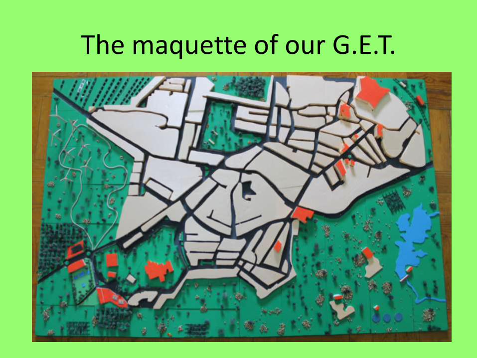
The maquette of our G.E.T.

Our maquette is based on the map of Crato:
. It respects the real village planning, according to its:
- Dimension;
- Streets and houses;
- Number of official public
buildings;
- Types of buildings;
- Green public areas;
- Sport and leisure areas;

So…
What did we do
to improve it and make it greener?
We took profit of the kind of landscape which surrounds the village.
As it has huge uninhabited landscape around it, we could add a lot of infra-structures to provide a greener place to live in, such as:
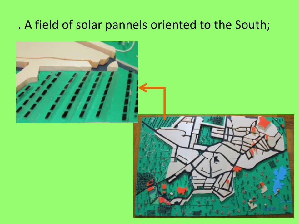
. A field of solar pannels oriented to the South;

. A section with wind mills on the highest zone;

. A wastewater treatment plant

. A mini hydroelectric power plant on the River Seda.
The artificial lake thus created can be used for sport activities such as canoeing, fishing, etc.

. A centre where biomass is collected in order to be transformed into another green source of energy

. An underground system of collecting domestic waste, next to the wastewater power plant, to be transformed into green energy

. A tram station to connect Crato to the closest villages and towns.

. A fitness circuit next to the sport and leisure area to promote a healthier lifestyle.

. Community vegetable gardens to make people eat healthier food and to be more self-efficient
Part of the production will be given to social institutions

And, most of all, our aim is to change people’s minds in order to make the village self-efficient and sustainable by :
. Making the bike the main means of transport within Crato;
. Making more inhabitants grow their own fruit and vegetables;
. Encouraging the installation of solar pannelson the roofs of the houses where people live.

First, we drew the streets and the blocks of houses;
What were the different steps of the creation of our maquette?

After, we cut the blocks using this machine.

Then we stuck the blocks and painted some buildings (the public ones).
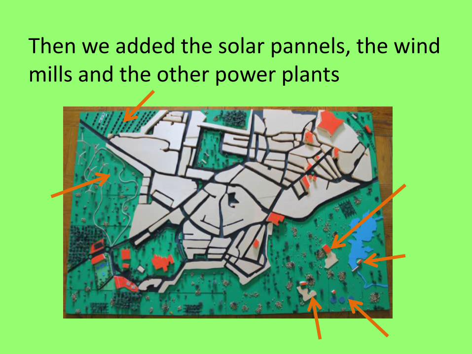
Then we added the solar pannels, the wind mills and the other power plants

The final step was to handmake and plant trees and stick rocks to recreate the wild surroundings.

Let’s give a hand to our planet!
It’s worth it…