Embed Size (px)
Citation preview
Esri® GIS Improves Adaptive Integrated Water Resource Management
Historically, water has been measured by quantity and quality. Due to current and predicted water stresses, today’s water managers need to look holistically at the water cycle and include adaptability and sustainability in their resource management plans. Utilities are being asked to shift from a narrow operational focus on water service delivery and wastewater treatment to a watershed-scale management approach.
Esri® geographic information system (GIS) technology offers a common platform for managing water resources on a broad scale. Its ArcGIS® technology integrates all types of enterprise water-related data into one dynamic system that helps keep track of water resources in real time. It
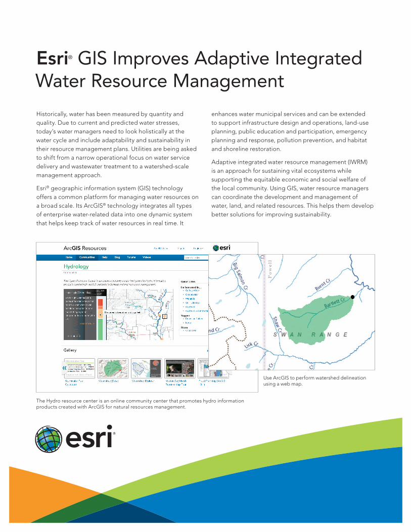
Use ArcGIS to perform watershed delineation using a web map.
enhances water municipal services and can be extended to support infrastructure design and operations, land-use planning, public education and participation, emergency planning and response, pollution prevention, and habitat and shoreline restoration.
Adaptive integrated water resource management (IWRM) is an approach for sustaining vital ecosystems while supporting the equitable economic and social welfare of the local community. Using GIS, water resource managers can coordinate the development and management of water, land, and related resources. This helps them develop better solutions for improving sustainability.
The Hydro resource center is an online community center that promotes hydro information products created with ArcGIS for natural resources management.
Copyright © 2013 Esri. All rights reserved. Esri, the Esri globe logo, ArcGIS, and esri.com are trademarks, service marks, or registered marks of Esri in the United States, the European Community, or certain other jurisdictions. Other companies and products or services mentioned herein may be trademarks, service marks, or registered marks of their respective mark owners.
137927 ESRI6C11/13sp
Learn more about Esri solutions for water resources at esri.com/waterresources.
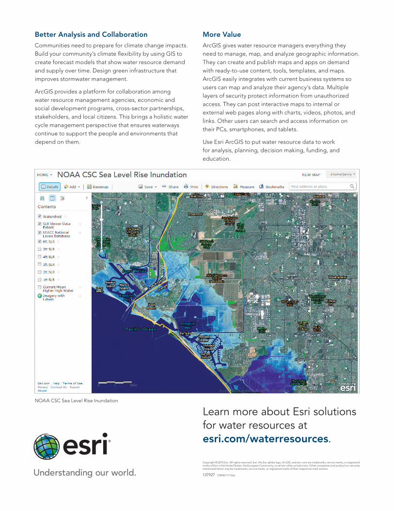
Better Analysis and CollaborationCommunities need to prepare for climate change impacts. Build your community’s climate flexibility by using GIS to create forecast models that show water resource demand and supply over time. Design green infrastructure that improves stormwater management.
ArcGIS provides a platform for collaboration among water resource management agencies, economic and social development programs, cross-sector partnerships, stakeholders, and local citizens. This brings a holistic water cycle management perspective that ensures waterways continue to support the people and environments that depend on them.
NOAA CSC Sea Level Rise Inundation
More ValueArcGIS gives water resource managers everything they need to manage, map, and analyze geographic information. They can create and publish maps and apps on demand with ready-to-use content, tools, templates, and maps. ArcGIS easily integrates with current business systems so users can map and analyze their agency’s data. Multiple layers of security protect information from unauthorized access. They can post interactive maps to internal or external web pages along with charts, videos, photos, and links. Other users can search and access information on their PCs, smartphones, and tablets.
Use Esri ArcGIS to put water resource data to work for analysis, planning, decision making, funding, and education.