Embed Size (px)
Citation preview
Big Data in OpenTopography
Vishu NandigamSan Diego Supercomputer Center
NSF Big Data in Education WorkshopJan 28-29 2015
Presentation Overview
• Lidar and OpenTopography• Data and Workflow• Cyberinfrastructure• Data Growth and Challenges• Data Insights• Research and Development
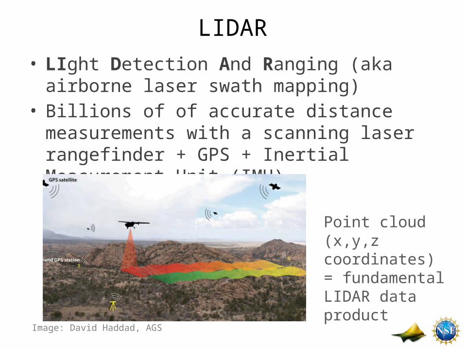
LIDAR• LIght Detection And Ranging (aka airborne laser
swath mapping)• Billions of of accurate distance measurements with a
scanning laser rangefinder + GPS + Inertial Measurement Unit (IMU)
Point cloud (x,y,z coordinates) = fundamental LIDAR data product
Image: David Haddad, AGS
Canopy Height (ft)
OpenTopography
• NSF Earth Science Facility: 3 year support in 2009. Renewed in 2012 (Award No. 1226353 & 1225810 EAR/IF)
• CI and Science Collaboration– SDSC, ASU & UNAVCO
• Related research efforts– NASA ROSES: Extend to Satellite-based LIDAR (waveform data)– NSF SI2 CyberGIS: OpenTopo as an exemplar of cyber GIS– NSF CluE: Investigate Computer Science issues in big data
• Partnerships with state and local agencies to support data hosting and processing capabilities
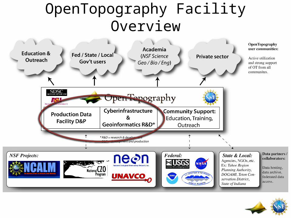
OpenTopography Facility Overview
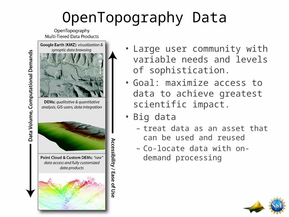
OpenTopography Data
• Large user community with variable needs and levels of sophistication.
• Goal: maximize access to data to achieve greatest scientific impact.
• Big data – treat data as an asset that can
be used and reused– Co-locate data with on-demand
processing
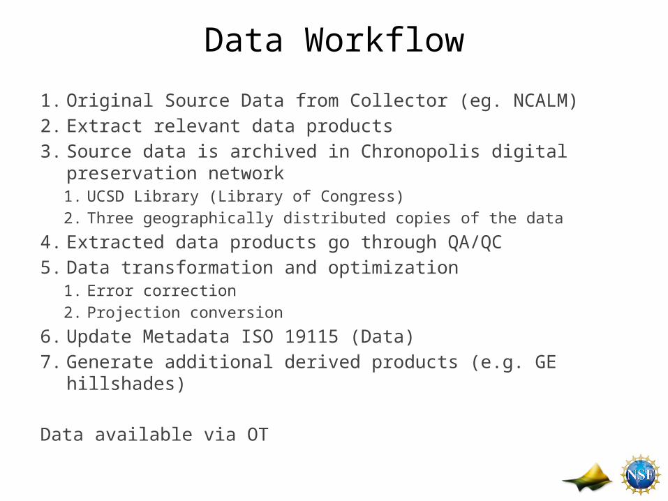
Data Workflow
1. Original Source Data from Collector (eg. NCALM)2. Extract relevant data products3. Source data is archived in Chronopolis digital preservation network
1. UCSD Library (Library of Congress)2. Three geographically distributed copies of the data
4. Extracted data products go through QA/QC 5. Data transformation and optimization
1. Error correction2. Projection conversion
6. Update Metadata ISO 19115 (Data)7. Generate additional derived products (e.g. GE hillshades)
Data available via OT
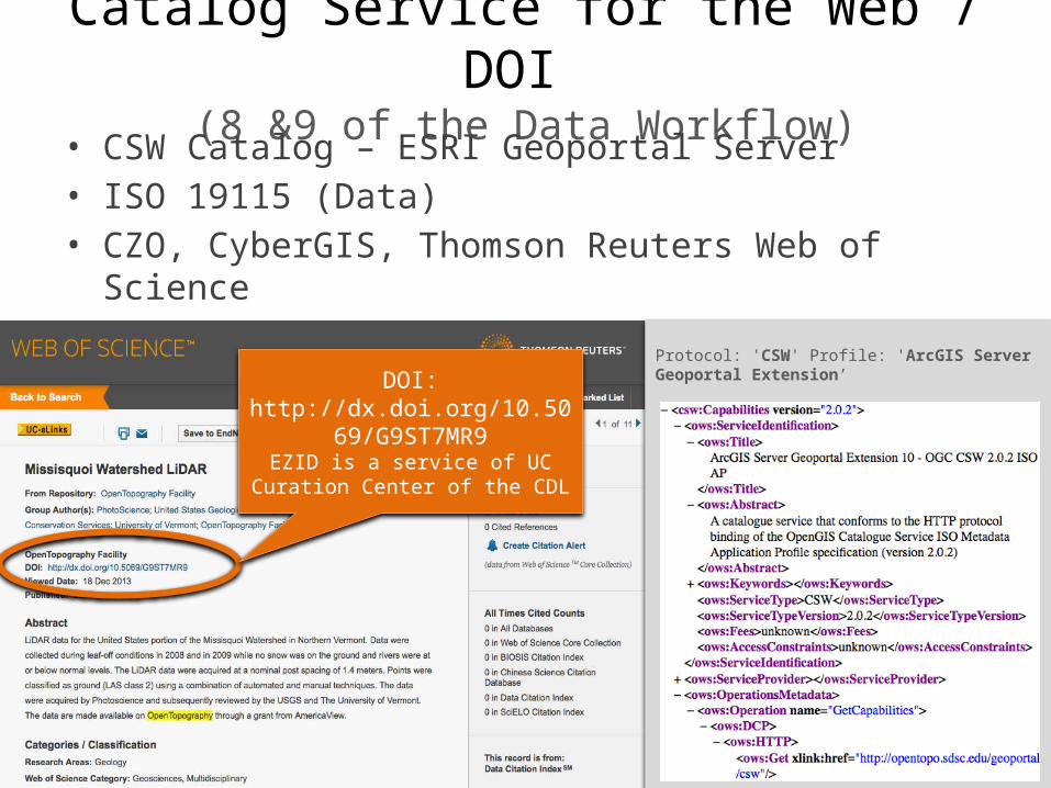
Catalog Service for the Web / DOI (8 &9 of the Data Workflow)
• CSW Catalog – ESRI Geoportal Server• ISO 19115 (Data)• CZO, CyberGIS, Thomson Reuters Web of Science
Protocol: 'CSW' Profile: 'ArcGIS Server Geoportal Extension’DOI:
http://dx.doi.org/10.5069/G9ST7MR9
EZID is a service of UC Curation Center of the CDL
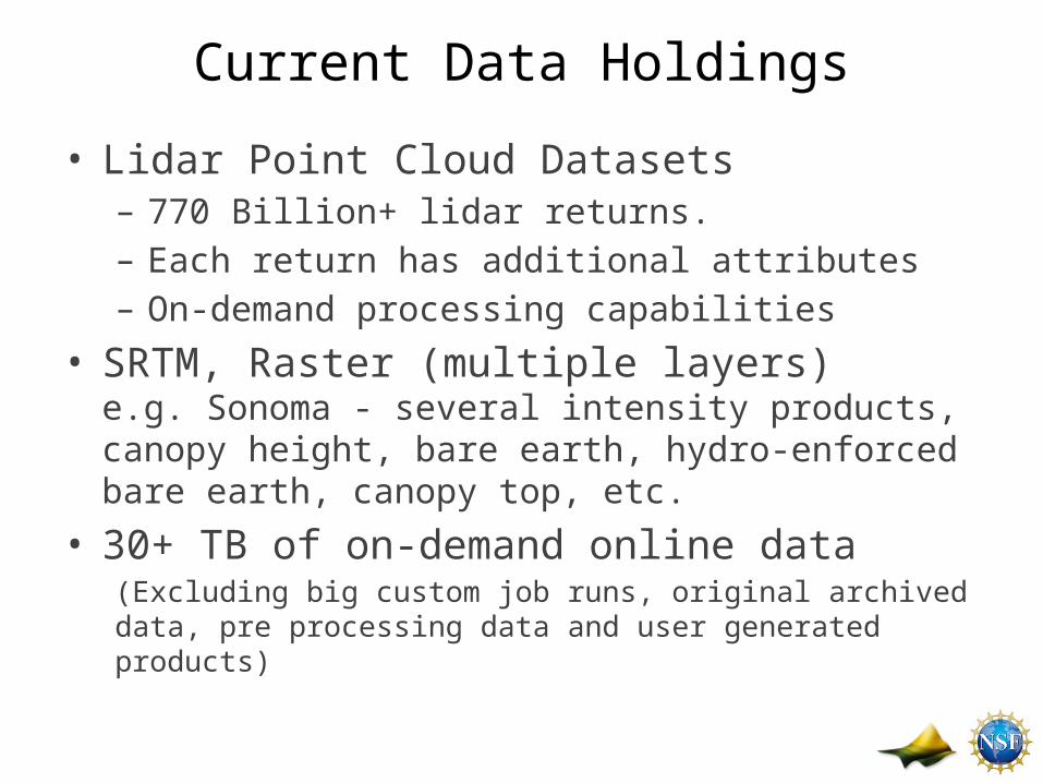
Current Data Holdings
• Lidar Point Cloud Datasets– 770 Billion+ lidar returns. – Each return has additional attributes– On-demand processing capabilities
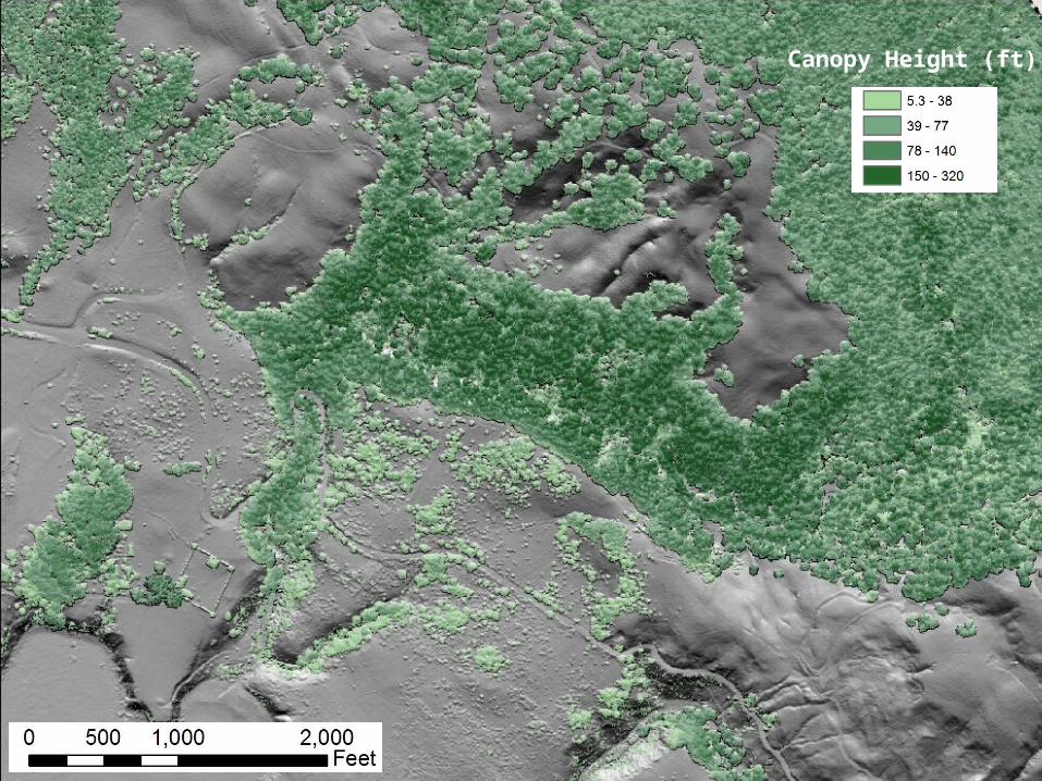
• SRTM, Raster (multiple layers)e.g. Sonoma - several intensity products, canopy height, bare earth, hydro-enforced bare earth, canopy top, etc.
• 30+ TB of on-demand online data(Excluding big custom job runs, original archived data, pre processing data and user generated products)
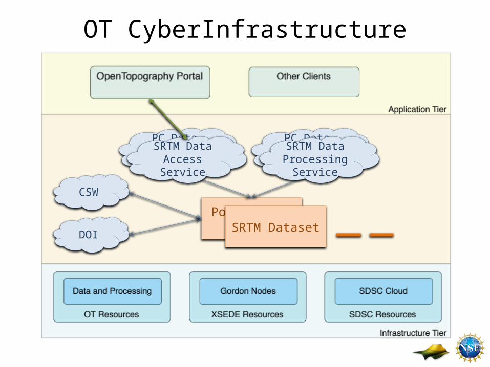
OT CyberInfrastructure
Point Cloud Data
PC Data Access Service
PC Data Processing
Service
DOI
CSW
SRTM Dataset
SRTM Data Access Service
SRTM Data Processing
Service
OT Challenges (Keeping pace with data and user growth
and advancing science!)
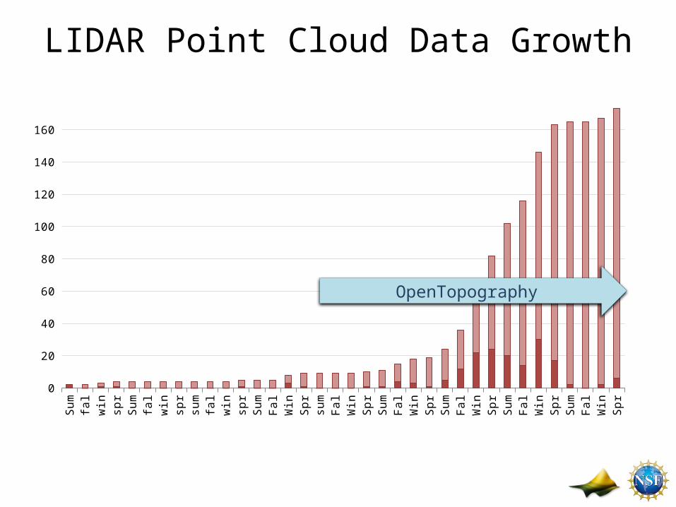
LIDAR Point Cloud Data GrowthSu
mm
...fa
ll200
5w
inte
...sp
rin.
..Su
mm
...fa
ll ...
win
te...
spri
n...
sum
m...
fall
...w
inte
...sp
rin.
..Su
mm
...Fa
ll ...
Win
te...
Spri
n...
sum
m...
Fall
...W
inte
...Sp
rin.
..Su
mm
...Fa
ll ...
Win
te...
Spri
n...
Sum
m...
Fall
...W
inte
...Sp
rin.
..Su
mm
...Fa
ll ...
Win
te...
Spri
n...
Sum
m...
Fall
...W
inte
...Sp
rin.
..
0
20
40
60
80
100
120
140
160
OpenTopography
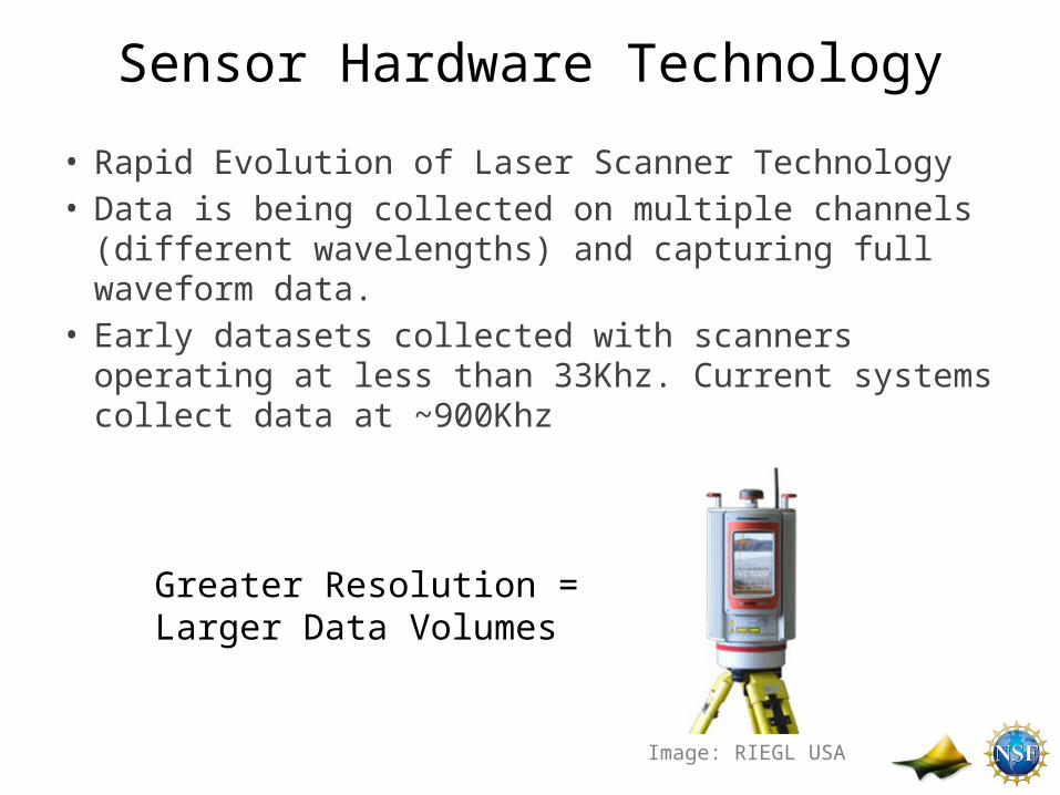
Sensor Hardware Technology
• Rapid Evolution of Laser Scanner Technology• Data is being collected on multiple channels (different
wavelengths) and capturing full waveform data.• Early datasets collected with scanners operating at less
than 33Khz. Current systems collect data at ~900Khz
Greater Resolution = Larger Data Volumes
Image: RIEGL USA
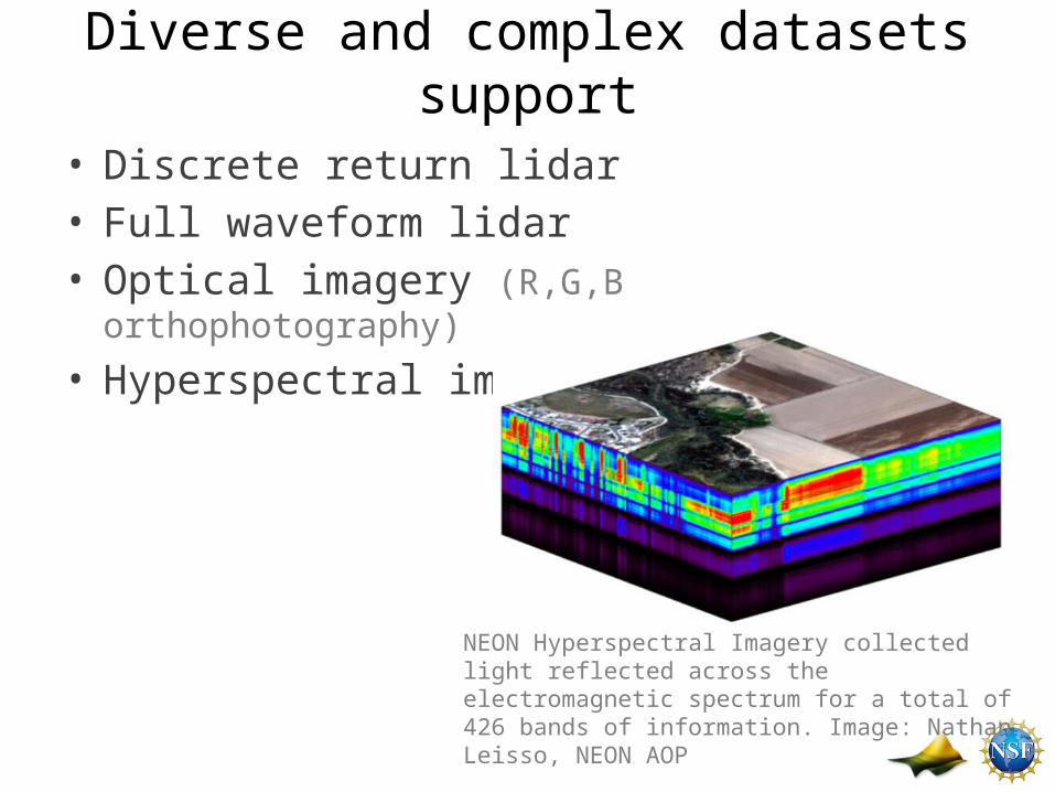
Diverse and complex datasets support
• Discrete return lidar• Full waveform lidar • Optical imagery (R,G,B orthophotography)
• Hyperspectral imagery
NEON Hyperspectral Imagery collected light reflected across the electromagnetic spectrum for a total of 426 bands of information. Image: Nathan Leisso, NEON AOP
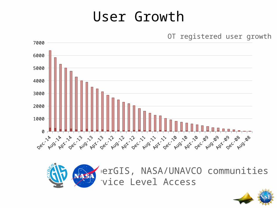
User Growth
Aug-08
Nov-08
Feb-09
May-0
9
Aug-09
Nov-09
Feb-10
May-1
0
Aug-10
Nov-10
Feb-11
May-1
1
Aug-11
Nov-11
Feb-12
May-1
2
Aug-12
Nov-12
Feb-13
May-1
3
Aug-13
Nov-13
Feb-14
May-1
4
Aug-14
Nov-14
0
1000
2000
3000
4000
5000
6000
7000
CyberGIS, NASA/UNAVCO communities Service Level Access
OT registered user growth
Pluggable Services Infrastructure
• Methods for scientific data processing are evolving• Users demanding more processing services• Pluggable services infrastructure– OT development sandbox– Assist researchers with their code– Deployment of the algorithm as a service– Update processing workflow and UI
Increase in user Generated Derived products!
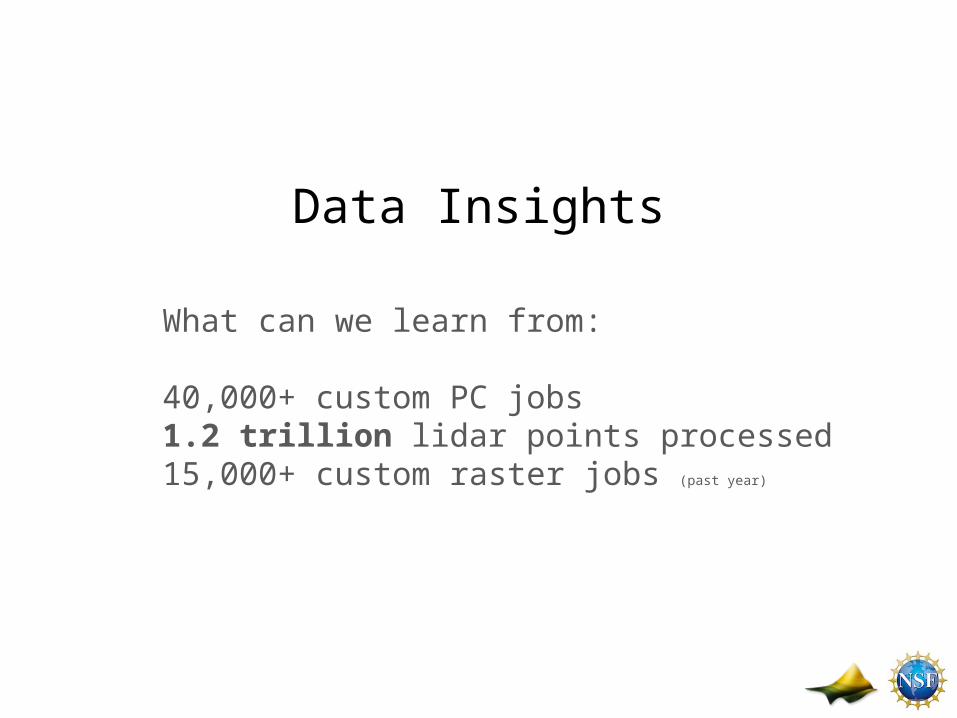
Data Insights
What can we learn from:
40,000+ custom PC jobs 1.2 trillion lidar points processed15,000+ custom raster jobs (past year)
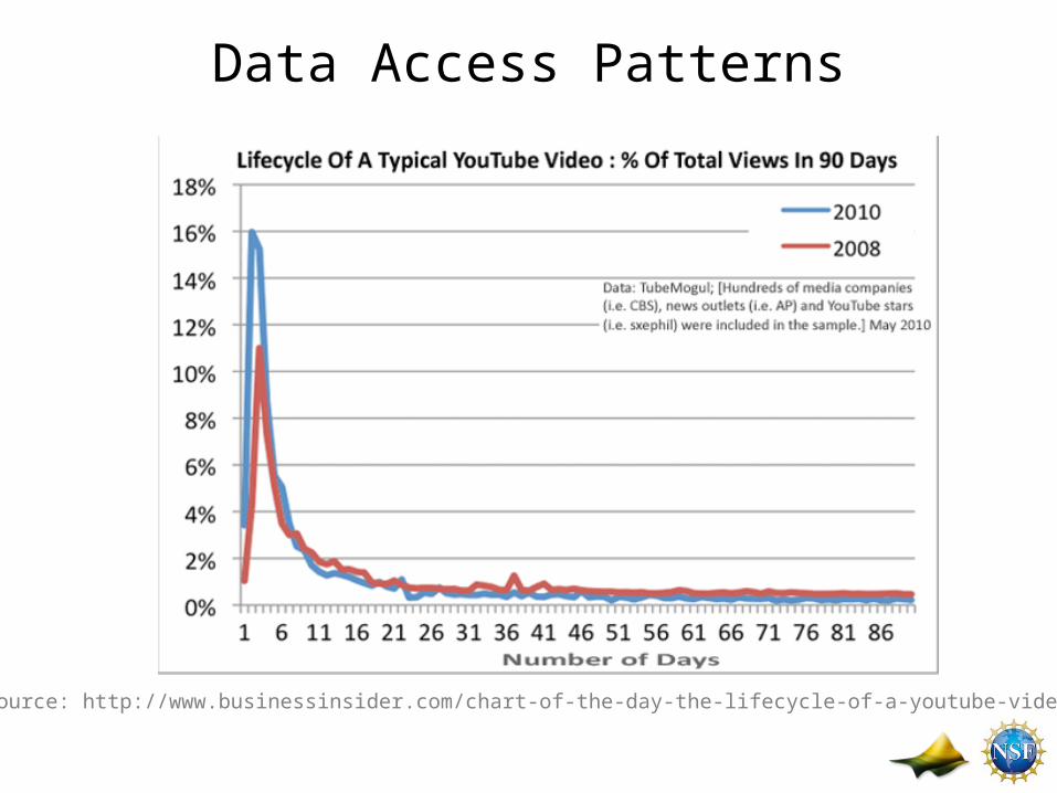
Data Access Patterns
Source: http://www.businessinsider.com/chart-of-the-day-the-lifecycle-of-a-youtube-video-2010-5
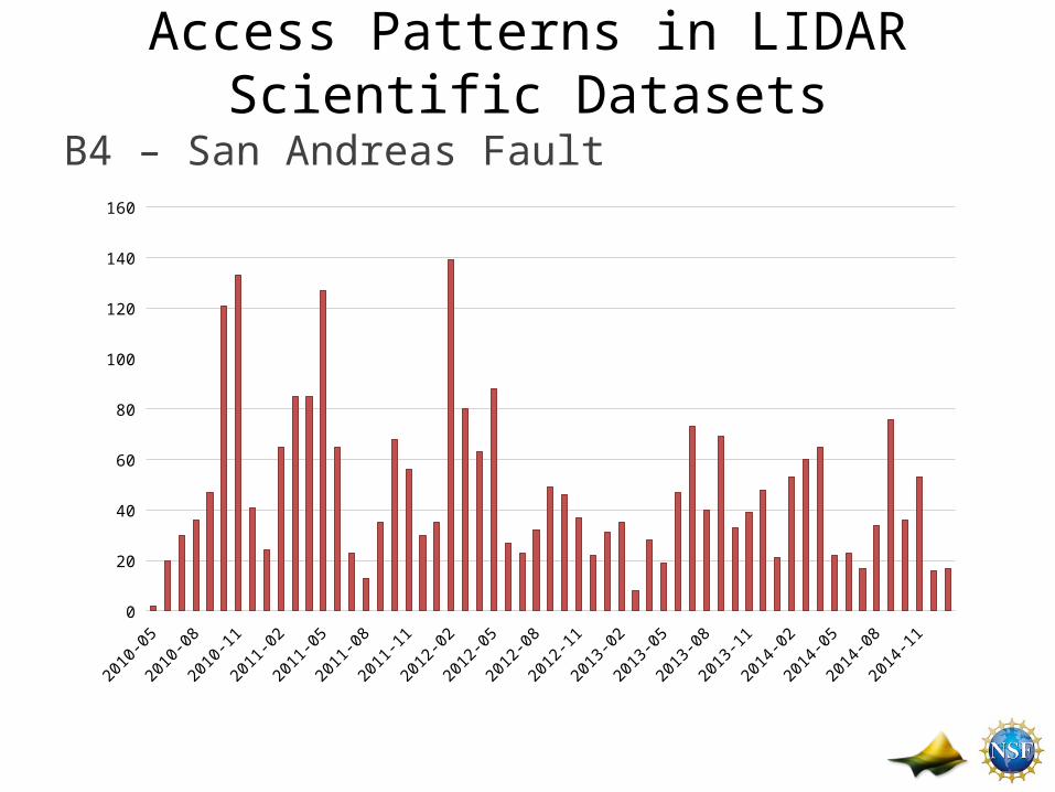
Access Patterns in LIDAR Scientific Datasets
B4 – San Andreas Fault
2010-05
2010-07
2010-09
2010-11
2011-01
2011-03
2011-05
2011-07
2011-09
2011-11
2012-01
2012-03
2012-05
2012-07
2012-09
2012-11
2013-01
2013-03
2013-05
2013-07
2013-09
2013-11
2014-01
2014-03
2014-05
2014-07
2014-09
2014-11
2015-01
0
20
40
60
80
100
120
140
160
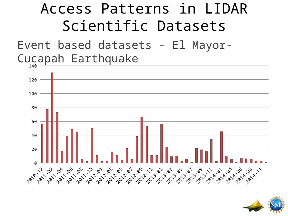
Access Patterns in LIDAR Scientific Datasets
Event based datasets - El Mayor-Cucapah Earthquake
2010-12
2011-02
2011-04
2011-06
2011-08
2011-10
2012-01
2012-03
2012-05
2012-07
2012-09
2012-11
2013-01
2013-03
2013-05
2013-07
2013-09
2013-11
2014-01
2014-04
2014-06
2014-08
2014-110
20
40
60
80
100
120
140
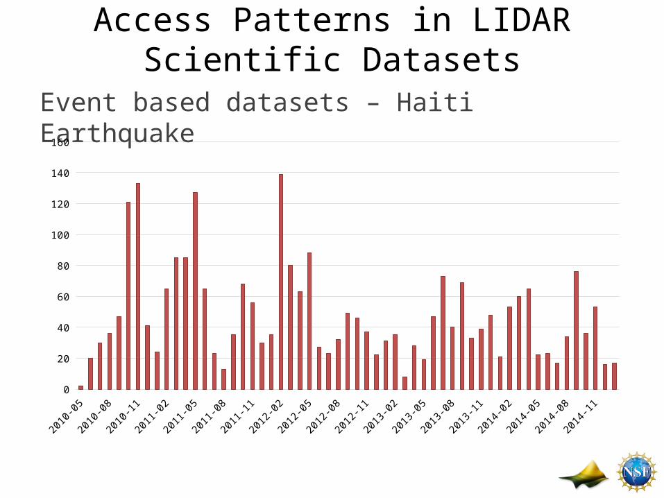
Access Patterns in LIDAR Scientific Datasets
Event based datasets – Haiti Earthquake
2010-05
2010-07
2010-09
2010-11
2011-01
2011-03
2011-05
2011-07
2011-09
2011-11
2012-01
2012-03
2012-05
2012-07
2012-09
2012-11
2013-01
2013-03
2013-05
2013-07
2013-09
2013-11
2014-01
2014-03
2014-05
2014-07
2014-09
2014-11
2015-01
0
20
40
60
80
100
120
140
160
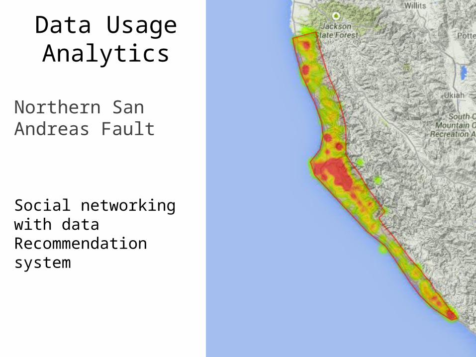
Data Usage Analytics
Northern San Andreas Fault
Social networking with data Recommendation system
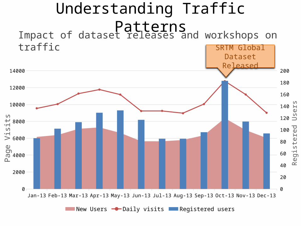
Understanding Traffic PatternsImpact of dataset releases and workshops on traffic
Jan-13 Feb-13 Mar-13 Apr-13 May-13 Jun-13 Jul-13 Aug-13 Sep-13 Oct-13 Nov-13 Dec-130
2000
4000
6000
8000
10000
12000
14000
0
20
40
60
80
100
120
140
160
180
200
New Users Daily visits Registered users
Page
Vis
its
Regi
ster
ed U
sers
SRTM Global Dataset Released
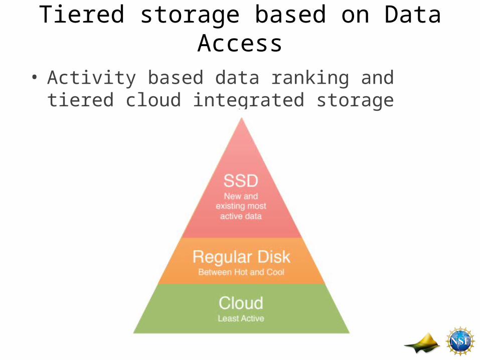
Tiered storage based on Data Access
• Activity based data ranking and tiered cloud integrated storage
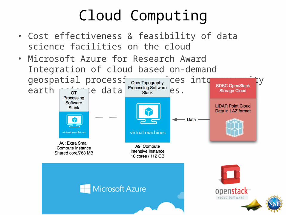
Cloud Computing• Cost effectiveness & feasibility of data science facilities on the cloud • Microsoft Azure for Research Award Integration of cloud based on-
demand geospatial processing services into community earth science data facilities.
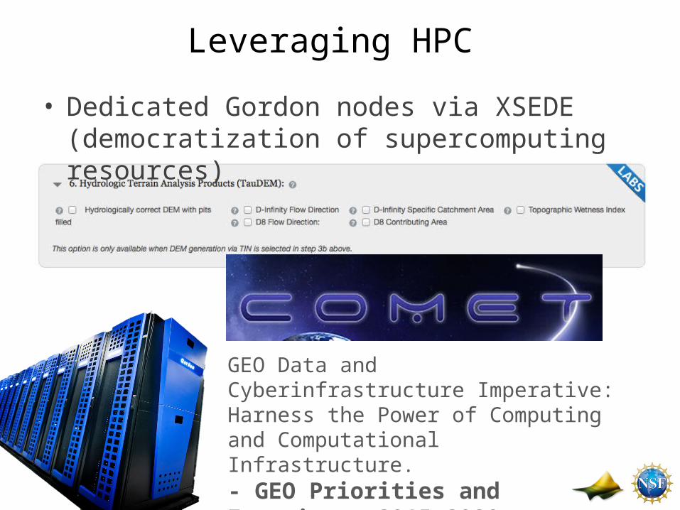
Leveraging HPC
• Dedicated Gordon nodes via XSEDE (democratization of supercomputing resources)
GEO Data and Cyberinfrastructure Imperative: Harness the Power of Computing and Computational Infrastructure.- GEO Priorities and Frontiers: 2015-2020
Summary
• OpenTopography is an modern agile data facility• Cyberinfrastructure driven by science use cases – CI
and science collaboration• Big Data needs to be usable - Community not only
wants access to data but also wants tools for processing these data.
• Concept of OT can be used as a template for other large data facilities
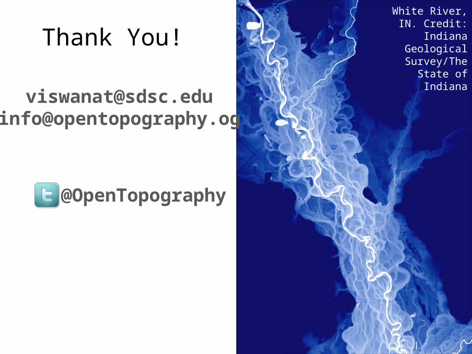
Thank You!
@OpenTopography
[email protected]@opentopography.og
White River, IN. Credit: Indiana Geological
Survey/The State of Indiana