Embed Size (px)
Citation preview
Rain Equipment The right rain equipment for hiker
Canoeing in the Wilderness, pg 1
by HOSTMEIR on NOVEMBER 19, 2011[EDIT]
Canoeing in the Wilderness, pg 1
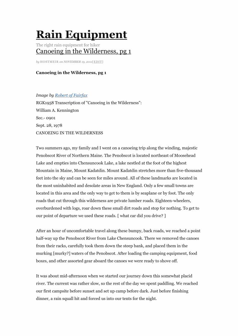
Image by Robert of Fairfax
RGK1958 Transcription of "Canoeing in the Wilderness":
William A. Kennington
Sec.- 0901
Sept. 28, 1978
CANOEING IN THE WILDERNESS
Two summers ago, my family and I went on a canoeing trip along the winding, majestic
Penobscot River of Northern Maine. The Penobscot is located northeast of Moosehead
Lake and empties into Chensuncook Lake, a lake nestled at the foot of the highest
Mountain in Maine, Mount Kadatdin. Mount Kadatdin stretches more than five-thousand
feet into the sky and can be seen for miles around. All of these landmarks are located in
the most uninhabited and desolate areas in New England. Only a few small towns are
located in this area and the only way to get to them is by seaplane or by foot. The only
roads that cut through this wilderness are private lumber roads. Eighteen-wheelers,
overburdened with logs, roar down these small dirt roads and stop for nothing. To get to
our point of departure we used these roads. [ what car did you drive? ]
After an hour of uncomfortable travel along these bumpy, back roads, we reached a point
half-way up the Penobscot River from Lake Chensuncook. There we removed the canoes
from their racks, carefully took them down the steep bank, and placed them in the
murking [murky?] waters of the Penobscot. After loading the camping equipment, food
boxes, and other assorted gear aboard the canoes we were ready to shove off.
It was about mid-afternoon when we started our journey down this somewhat placid
river. The current was rather slow, so the rest of the day we spent paddling. We reached
our first campsite before sunset and set up camp before dark. Just before finishing
dinner, a rain squall hit and forced us into our tents for the night.
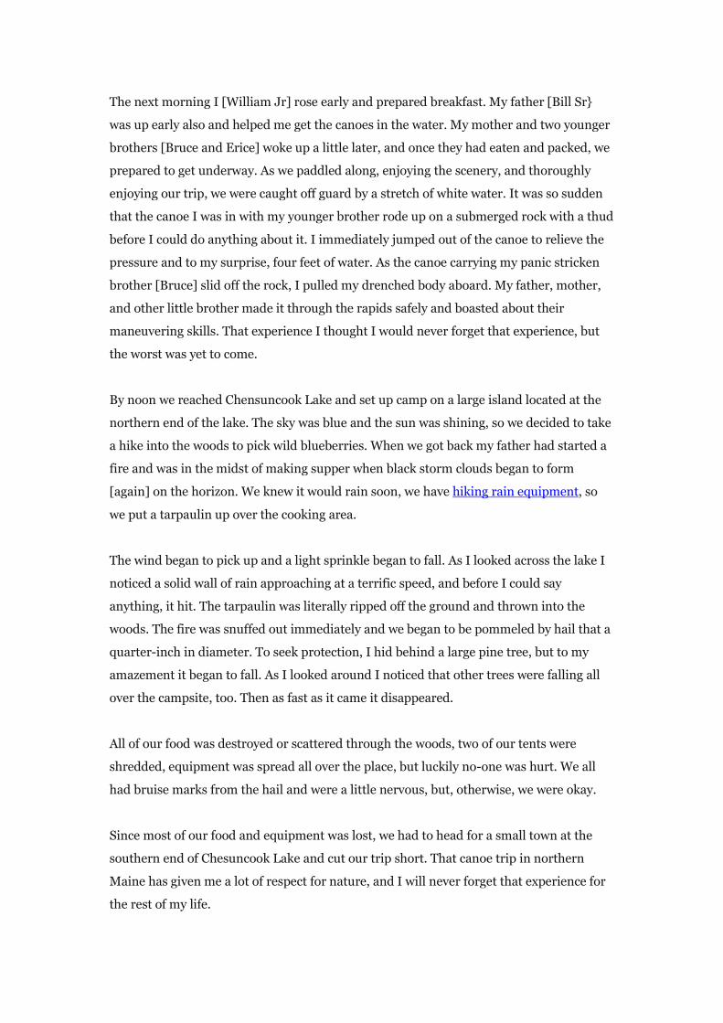
The next morning I [William Jr] rose early and prepared breakfast. My father [Bill Sr}
was up early also and helped me get the canoes in the water. My mother and two younger
brothers [Bruce and Erice] woke up a little later, and once they had eaten and packed, we
prepared to get underway. As we paddled along, enjoying the scenery, and thoroughly
enjoying our trip, we were caught off guard by a stretch of white water. It was so sudden
that the canoe I was in with my younger brother rode up on a submerged rock with a thud
before I could do anything about it. I immediately jumped out of the canoe to relieve the
pressure and to my surprise, four feet of water. As the canoe carrying my panic stricken
brother [Bruce] slid off the rock, I pulled my drenched body aboard. My father, mother,
and other little brother made it through the rapids safely and boasted about their
maneuvering skills. That experience I thought I would never forget that experience, but
the worst was yet to come.
By noon we reached Chensuncook Lake and set up camp on a large island located at the
northern end of the lake. The sky was blue and the sun was shining, so we decided to take
a hike into the woods to pick wild blueberries. When we got back my father had started a
fire and was in the midst of making supper when black storm clouds began to form
[again] on the horizon. We knew it would rain soon, we have hiking rain equipment, so
we put a tarpaulin up over the cooking area.
The wind began to pick up and a light sprinkle began to fall. As I looked across the lake I
noticed a solid wall of rain approaching at a terrific speed, and before I could say
anything, it hit. The tarpaulin was literally ripped off the ground and thrown into the
woods. The fire was snuffed out immediately and we began to be pommeled by hail that a
quarter-inch in diameter. To seek protection, I hid behind a large pine tree, but to my
amazement it began to fall. As I looked around I noticed that other trees were falling all
over the campsite, too. Then as fast as it came it disappeared.
All of our food was destroyed or scattered through the woods, two of our tents were
shredded, equipment was spread all over the place, but luckily no-one was hurt. We all
had bruise marks from the hail and were a little nervous, but, otherwise, we were okay.
Since most of our food and equipment was lost, we had to head for a small town at the
southern end of Chesuncook Lake and cut our trip short. That canoe trip in northern
Maine has given me a lot of respect for nature, and I will never forget that experience for
the rest of my life.
{ Comments on this entry are closed }
Arnold Arboretum, 18 May 2010: View from Bussey Hill south to Great Blue Hill (―Massachusett‖) in Quincy
by HOSTMEIR on NOVEMBER 18, 2011[EDIT]
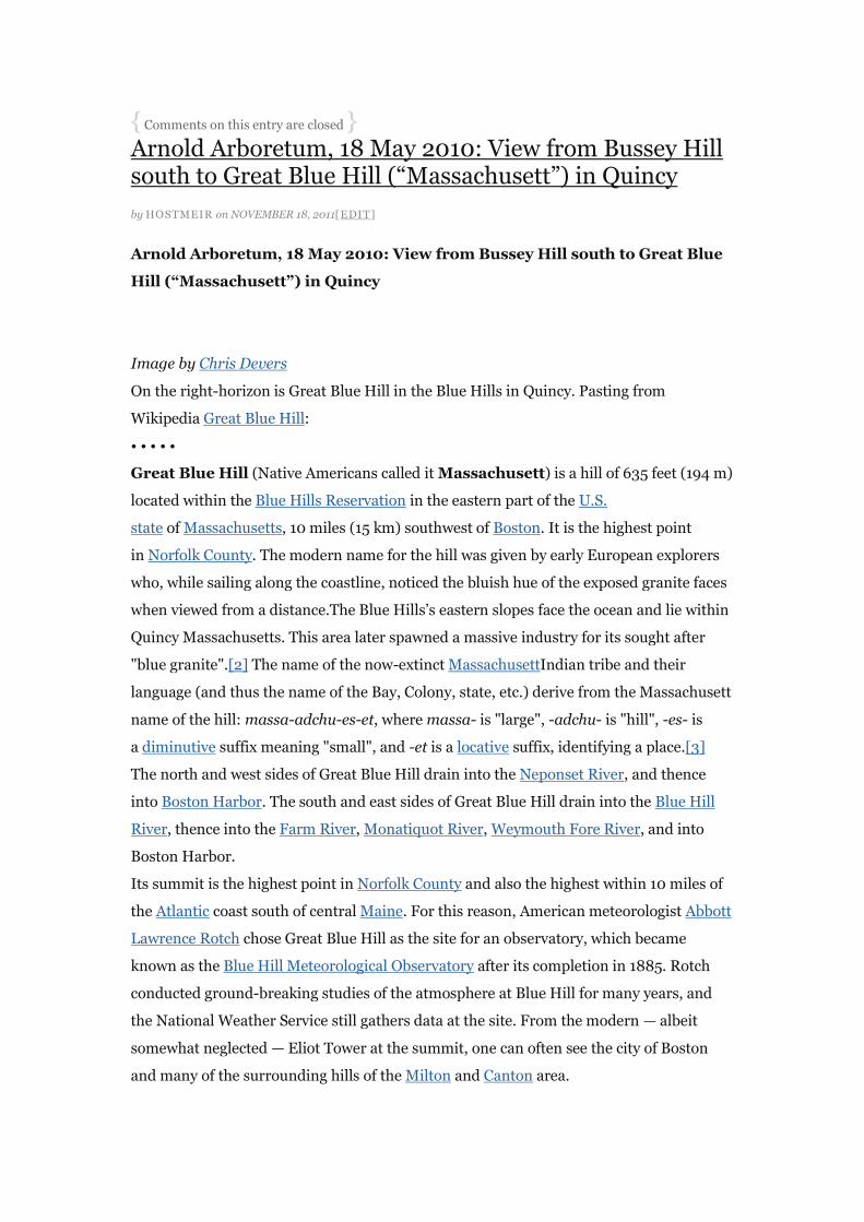
Arnold Arboretum, 18 May 2010: View from Bussey Hill south to Great Blue
Hill (“Massachusett”) in Quincy
Image by Chris Devers
On the right-horizon is Great Blue Hill in the Blue Hills in Quincy. Pasting from
Wikipedia Great Blue Hill:
• • • • •
Great Blue Hill (Native Americans called it Massachusett) is a hill of 635 feet (194 m)
located within the Blue Hills Reservation in the eastern part of the U.S.
state of Massachusetts, 10 miles (15 km) southwest of Boston. It is the highest point
in Norfolk County. The modern name for the hill was given by early European explorers
who, while sailing along the coastline, noticed the bluish hue of the exposed granite faces
when viewed from a distance.The Blue Hills‘s eastern slopes face the ocean and lie within
Quincy Massachusetts. This area later spawned a massive industry for its sought after
"blue granite".[2] The name of the now-extinct MassachusettIndian tribe and their
language (and thus the name of the Bay, Colony, state, etc.) derive from the Massachusett
name of the hill: massa-adchu-es-et, where massa- is "large", -adchu- is "hill", -es- is
a diminutive suffix meaning "small", and -et is a locative suffix, identifying a place.[3]
The north and west sides of Great Blue Hill drain into the Neponset River, and thence
into Boston Harbor. The south and east sides of Great Blue Hill drain into the Blue Hill
River, thence into the Farm River, Monatiquot River, Weymouth Fore River, and into
Boston Harbor.
Its summit is the highest point in Norfolk County and also the highest within 10 miles of
the Atlantic coast south of central Maine. For this reason, American meteorologist Abbott
Lawrence Rotch chose Great Blue Hill as the site for an observatory, which became
known as the Blue Hill Meteorological Observatory after its completion in 1885. Rotch
conducted ground-breaking studies of the atmosphere at Blue Hill for many years, and
the National Weather Service still gathers data at the site. From the modern — albeit
somewhat neglected — Eliot Tower at the summit, one can often see the city of Boston
and many of the surrounding hills of the Milton and Canton area.

Great Blue Hill, and the Blue Hills Reservation in general, is a popular hiking destination,
valued as much for its splendid trails and views as for its proximity to the metropolitan
area. There is also alpine skiing available at Blue Hills Ski Area, consisting of eight trails
served by a double chair and two surface lifts.
The well-known Boston public television and radio station WGBH takes its call letters
from Great Blue Hill, the original location of the station‘s FM and TV transmitters.
WGBH-FM still transmits from the site and has a backup transmitter there as well. The
TV station moved its antenna to a taller tower in the 1960s.[4]
• • • • •
The Arboretum has an interactive map on their web site. This map is found at the
Arborway Gate.
Pasting from Wikipedia: Arnold Arboretum:
• • • • •
The Arnold Arboretum of Harvard University is an arboretum located in the Jamaica
Plain and Roslindalesections of Boston, Massachusetts. It was designed by Frederick Law
Olmsted and is the second largest "link" in the Emerald Necklace.
History
The Arboretum was founded in 1872 when the President and Fellows of Harvard
College became trustees of a portion of the estate of James Arnold (1781–1868).
In 1842, Benjamin Bussey (1757–1842), a prosperous Boston merchant and scientific
farmer, donated his country estate Woodland Hill and a part of his fortune to Harvard
University "for instruction in agriculture,horticulture, and related subjects". Bussey had
inherited land from fellow patriot Eleazer Weld in 1800 and further enlarged his large
estate between 1806 and 1837 by acquiring and consolidating various farms that had
been established as early as the seventeenth century. Harvard used this land for the
creation of the Bussey Institute, which was dedicated to agricultural experimentation.
The first Bussey Institute building was completed in 1871 and served as headquarters for
an undergraduate school of agriculture.
Sixteen years after Bussey‘s death, James Arnold, a New Bedford, Massachusetts whaling
merchant, specified that a portion of his estate was to be used for "…the promotion
of Agricultural, or Horticultural improvements". In 1872, when the trustees of the will of
James Arnold transferred his estate to Harvard University, Arnold‘s gift was combined
with 120 acres (0.49 km2) of the former Bussey estate to create the Arnold Arboretum. In
the deed of trust between the Arnold trustees and the College, income from Arnold‘s
legacy was to be used for establishing, developing and maintaining an arboretum to be

known as the Arnold Arboretum which "shall contain, as far as practicable, all the trees
[and] shrubs … either indigenous or exotic, which can be raised in the open air of West
Roxbury". The historical mission of the Arnold Arboretum is to increase knowledge of
woody plants through research and to disseminate this knowledge through education.
Charles Sprague Sargent was appointed director and Arnold Professor of Botany shortly
after the establishment of the institution in 1872.[2] Together with landscape
architect Frederick Law Olmsted he developed the road and pathway system and
delineated the collection areas by family and genus, following the then current and widely
accepted classification system of Bentham and Hooker. The Hunnewell building was
designed by architectAlexander Wadsworth Longfellow, Jr. in 1892 and constructed with
funds donated by H. H. Hunnewell in 1903. From 1946 to 1950 the landscape
architect Beatrix Farrand was the landscape design consultant for the Arboretum. Her
early training in the 1890s included time with Charles Sprague Sargent and chief
propagator and superintendent Jackson Thornton Johnson.[3] Today the Arboretum
occupies 265 acres (107 hectares) of land divided between four parcels, viz. the main
Arboretum and the Peters Hill, Weld-Walter and South Street tracts. The collections,
however, are located primarily in the main Arboretum and on the Peters Hill tract. The
Arboretum remains one of the finest examples of a landscape designed by Frederick Law
Olmsted and it is aFrederick Law Olmsted National Historic Site) and a National Historic
Landmark.
Robert E. Cook is the seventh and current Director of the Arnold Arboretum. He is also
the Director of the Harvard University Herbaria located in Cambridge, Massachusetts.
Status
The Arboretum is privately endowed as a department of Harvard University. The land,
however, was deeded to the City of Boston in 1882 and incorporated into the so-called
"Emerald Necklace". Under the agreement with the City, Harvard University was given a
thousand-year lease on the property, and the University, as trustee, is directly responsible
for the development, maintenance, and operation of the Arboretum; the City retains
responsibility for water fountains, benches, roads, boundaries, and policing. The annual
operating budget of ,350,644 (fiscal year 2003) is largely derived from endowment,
which is also managed by the University, and all Arboretum staff are University
employees. Other income is obtained through granting agencies and contributors.
Location
The main Arborway gate is located on Route 203 a few hundred yards south of its
junction with the Jamaicaway. Public transportation to the Arboretum is available on
the MBTA Orange Line to its terminus at Forest Hills Station and by bus (#39) to the

Monument in Jamaica Plain. The Arboretum is within easy walking distance from either
of these points.
Hours
The grounds are open free of charge to the public from sunrise to sunset 365 days of the
year. The Visitor‘s Center in the Hunnewell Building, 125 Arborway, is open Monday
through Friday 9 a.m.–4 p.m.; Saturdays 10 a.m.–4 p.m.; Sundays 12 p.m.–4 PM. The
Visitor‘s Center is closed on holidays. The Library, located in the Hunnewell Building, is
open Monday through Saturday, 10 a.m.–4 p.m.. The Library is closed on Sundays and
holidays. Stacks are closed and the collection does not circulate.
Area
Two hundred and sixty-five acres (107 hectares) in the Jamaica Plain and Roslindale
sections of Boston, Massachusetts, located at 42°19′N 71°5′W / 42.317°N 71.083°W /
42.317; -71.083, with altitudes ranging from 46 feet (15 m) in the meadow across the
drive from the Hunnewell Building to 240 feet (79 m) at the top of Peters Hill.
Climate
Average yearly rainfall is 43.63 inches (1,102 mm); average snowfall, 40.2 inches (102
centimeters). Monthly mean temperature is 51.5 °F (10.8 °C); July‘s mean temperature is
73.5 °F (23 °C); January‘s is 29.6 °F (-1.3 °C). The Arboretum is located in USDA
hardiness zone 6 (0 to −10 °F, −18 to −23 °C).
Collections (as of September 14, 2007)
At present, the living collections include 15,441 individual plants (including nursery
holdings) belonging to 10,216 accessions representing 4,099 taxa; with particular
emphasis on the ligneous species of North Americaand eastern Asia. Historic collections
include the plant introductions from eastern Asia made by Charles Sprague
Sargent, Ernest Henry Wilson, William Purdom, Joseph Hers, and Joseph Rock. Recent
introductions from Asia have resulted from the 1977 Arnold Arboretum Expedition
to Japan and Korea, the 1980 Sino-American Botanical Expedition to western Hubei
Province, and more recent expeditions to China and Taiwan.
Comprehensive collections are maintained and augmented for most genera, and genera
that have received particular emphasis
include: Acer, Fagus, Carya, Forsythia, Taxodium, Pinus, Metasequoia, Lonicera, Magnoli
a,Malus, Quercus, Rhododendron, Syringa, Paulownia, Albizia, Ilex, Gleditsia and Tsuga.
Other comprehensive collections include the Bradley Collection of Rosaceous Plants, the
collection of conifers and dwarf conifers, and the Larz Anderson Bonsai Collection.
Approximately 500 accessions are processed annually.

Collections policy
The mission of the Arnold Arboretum is to increase our knowledge of the evolution and
biology of woody plants. Historically, this research has investigated the global
distribution and evolutionary history of trees, shrubs and vines, with particular emphasis
on the disjunct species of East Asia and North America. Today this work continues
through molecular studies of the evolution and biogeography of the floras of temperate
Asia, North America and Europe.
Research activities include molecular studies of gene evolution, investigations of plant-
water relations, and the monitoring of plant phenology, vegetation succession, nutrient
cycling and other factors that inform studies of environmental change. Applied work in
horticulture uses the collections for studies in plant propagation, plant introduction, and
environmental management. This diversity of scientific investigation is founded in a
continuing commitment to acquire, grow, and document the recognized species and
infraspecific taxa of ligneous plants of the Northern Hemisphere that are able to
withstand the climate of the Arboretum‘s 265-acre (1.07 km2) Jamaica Plain/Roslindale
site.
As a primary resource for research in plant biology, the Arboretum‘s living collections are
actively developed, curated, and managed to support scientific investigation and study.
To this end, acquisition policies place priority on obtaining plants that are genetically
representative of documented wild populations. For each taxon, the Arnold Arboretum
aspires to grow multiple accessions of known wild provenance in order to represent
significant variation that may occur across the geographic range of the species.
Accessions of garden or cultivated provenance are also acquired as governed by the
collections policies herein.
For all specimens, full documentation of both provenance and history within the
collection is a critical priority. Curatorial procedures provide for complete and accurate
records for each accession, and document original provenance, locations in the
collections, and changes in botanical identity. Herbarium specimens, DNA materials,
and digital images are gathered for the collection and maintained in Arboretum data
systems and the herbarium at the Roslindale site.
Research
Research on plant pathology and integrated pest management for maintenance of the
living collections is constantly ongoing. Herbarium-based research focuses on the
systematics and biodiversity of both temperate and tropical Asian forests, as well as the
ecology and potential for sustainable use of their resources. The Arboretum‘s education
programs offer school groups and the general public a wide range of lectures, courses,
and walks focusing on the ecology and cultivation of plants. Its quarterly
magazine, Arnoldia, provides in-depth information on horticulture, botany, and garden
history. Current Research Initiatives
Plant Records
Plant records are maintained on a computerized database, BG-BASE 6.8 (BG-Base Inc.),
which was initiated in 1985 at the request of the Arnold Arboretum and the Threatened
Plants Unit (TPU) of the World Conservation Monitoring Centre (WCMC). A
computerized mapping program (based on AutoCAD (Autodesk)) is linked to BG-BASE,
and each accession is recorded on a series of maps at a scale of 1-inch (25 mm) to 20 feet
(1:240) or 1-inch (25 mm) to 10 feet (1:120). A computer-driven embosser generates
records labels. All accessioned plants in the collections are labeled with accession
number, botanical name, and cultivar name (when appropriate), source information,
common name, and map location. Trunk and/or display labels are also hung on many
accessions and include botanical and common names and nativity. Stake labels are used
to identify plants located in the Leventritt Garden and Chinese Path.
Grounds Maintenance
The grounds staff consists of the superintendent and assistant superintendent,
three arborists, and ten horticultural technologists. A service garage is adjacent to the
Hunnewell Building, where offices and locker rooms are located. During the summer
months ten horticultural interns supplement the grounds staff. A wide array of vehicles
and modern equipment, including an aerial lift truck and a John Deere backhoe and front
loader, are used in grounds maintenance. Permanent grounds staff, excluding the
superintendents, are members ofAFL/CIO Local 615, Service Employees International
Union (SEIU).
Nursery and Greenhouse Facilities
The Dana Greenhouses, located at 1050 Centre Street (with a mailing address of 125
Arborway), were completed in 1962. They comprise four service greenhouses totaling
3,744 square feet (348 m²), the headhouse with offices, cold rooms, storage areas, and a
classroom. Staffing at the greenhouse includes the manager of greenhouses and
nurseries, the plant propagator, two assistants, and, during the summer months, two
horticultural interns. Adjacent to the greenhouse is a shade house of 3,150 square feet
(293 m²), a 12,600 cubic foot (357 m³) cold storage facility, and three irrigated, inground
nurseries totaling approximately one and one-half acres (6,000 m²). Also located in the
greenhouse complex is the bonsai pavilion, where the Larz Anderson Bonsai Collection is
displayed from the middle of April to the end of October. During the winter months the
bonsai are held in the cold storage unit at temperatures slightly above freezing.
Isabella Welles Hunnewell Internship Program

The living collections department of the Arnold Arboretum offers a paid summer
internship program [2] that combines hands-on training in horticulture with educational
courses. Intern trainees will be accepted for 12- to 24-week appointments. Ten interns
will work with the grounds maintenance department and two in the Dana Greenhouses.
As part of the training program, interns participate in mandatory instructional sessions
and field trips in order to develop a broader sense of the Arboretum‘s horticultural
practices as well as those of other institutions. Sessions and field trips are led by Arnold
staff members and embrace an open question and answer format encouraging all to
participate. Interns often bring experience and knowledge that everyone, including staff,
benefits from. It is a competitive-free learning environment.
Horticultural Apprenticeship
The Arboretum created the horticultural apprenticeship program in 1997 to provide
hands-on experience in all aspects of the development, curation, and maintenance of the
Arboretum‘s living collections to individuals interested in pursuing a career in an
arboretum or botanical garden.
The Living Collections department of the Arnold Arboretum offers a summer internship
program[4] that combines practical hands-on training in horticulture with educational
courses. Fourteen Interns/Horticultural Trainees are accepted for twelve to twenty-four
week appointments. Interns receive the majority of their training in one of three
departments: Grounds Maintenance, Nursery and Greenhouse, or Plant Records.
Lilac Sunday
The second Sunday in May every year is "Lilac Sunday". This is the only day of the year
that picnicing is allowed. In 2008, on the 100th anniversary of Lilac Sunday, the
Arboretum website touted:
Of the thousands of flowering plants in the Arboretum, only one, the lilac, is singled out
each year for a daylong celebration. On Lilac Sunday, garden enthusiasts from all over
New England gather at the Arboretum to picnic, watch Morris dancing, and tour the
lilac collection. On the day of the event, which takes place rain or shine, the Arboretum
is open as usual from dawn to dusk.[5]
Associated Collections
The Arboretum‘s herbarium in Jamaica Plain holds specimens of cultivated plants that
relate to the living collections (ca. 160,000). The Jamaica Plain herbarium, horticultural
library, archives, and photographs are maintained in the Hunnewell building at 125
Arborway; however, the main portions of the herbarium and library collections are
housed in Cambridge on the campus of Harvard University, at 22 Divinity Avenue.

Publications
The inventory of living collections is updated periodically and made available to sister
botanical gardens and arboreta on request; it is also available on the Arboretum‘s website
(searchable inventory). Arnoldia, the quarterly magazine of the Arnold Arboretum,
frequently publishes articles relating to the living collections. A Reunion of Trees[6] by
Stephen A. Spongberg (curator emeritus) recounts the history of the introduction of
many of the exotic species included in the Arobretum‘s collections. New England
Natives[7] written by horticultural research archivist Sheila Connor describes many of
the trees and shrubs of the New England flora and the ways New Englanders have used
them since prehistoric times. Science in the Pleasure Ground[8] by Ida Hay (former
curatorial associate) constitutes an institutional biography of the Arboretum.
Institutional Collaborations
The Arboretum maintains an institutional membership in the American Public Garden
Association (APGA) and the International Association of Botanical Gardens and
Arboreta. Additionally, members of the staff are associated with many national and
international botanical and horticultural organizations. The Arboretum is also a
cooperating institution with the Center for Plant Conservation (CPC), and as an active
member of the North American Plant Collections Consortium (NAPCC), it is committed
to broadening and maintaining its holdings of:Acer, Carya, Fagus, Stewartia, Syringa,
and Tsuga for the purposes of plant conservation, evaluation, and research. The
Arboretum is also a member of the North American China Plant Exploration Consortium
(NACPEC).
See also
Larz Anderson Bonsai Collection, donated by businessman and ambassador Larz
Anderson
The Case Estates of the Arnold Arboretum
List of botanical gardens in the United States
North American Plant Collections Consortium
Adams-Nervine_Asylum
External links
Arnold Arboretum Official Website
Arnold Arboretum Visitor Information
Harvard University Herbaria
American Public Gardens Association (APGA)
Flora of China
Virtual Information Access (VIA) Catalog of visual resources at Harvard University.
Garden and Forest A Journal of Horticulture, Landscape Art, and Forestry (1888–1897)
Boston’s Arnold Arboretum: A Place for Study and Recreation, a National Park Service
Teaching with Historic Places (TwHP) lesson plan
The Emerald Necklace: Boston’s Green Connection, a National Park Service Teaching
with Historic Places (TwHP) lesson plan
{ Comments on this entry are closed }
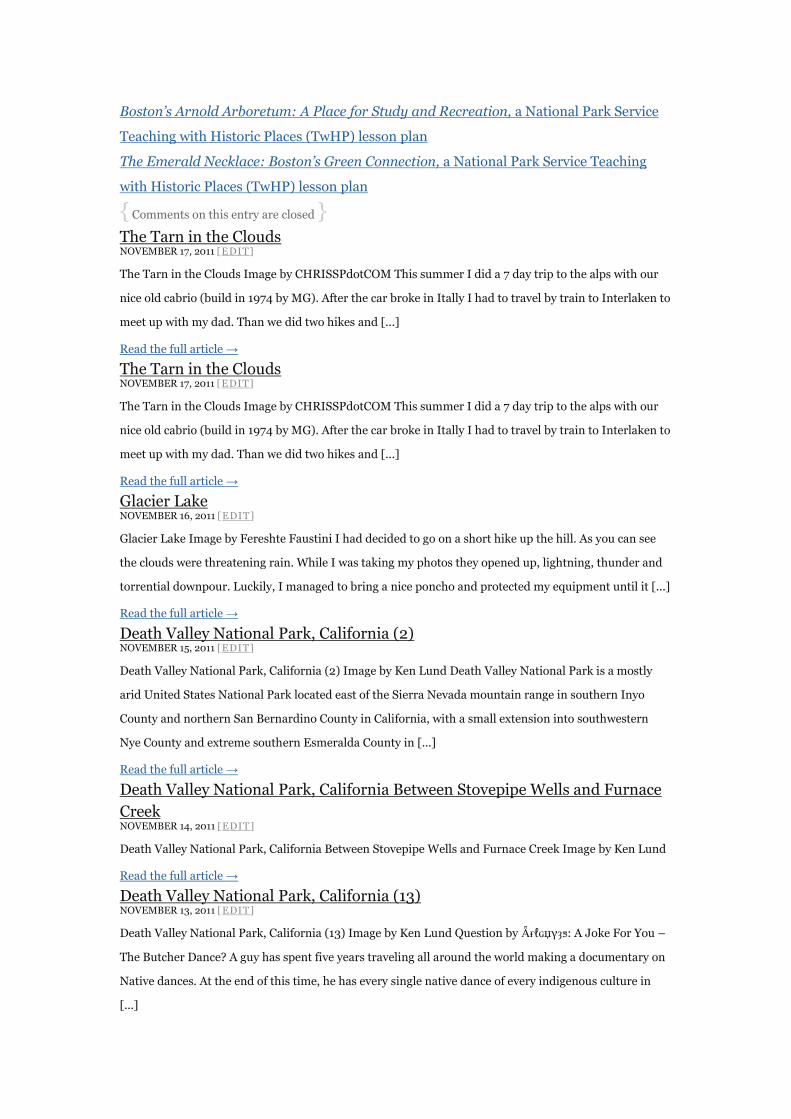
The Tarn in the Clouds NOVEMBER 17, 2011 [EDIT]
The Tarn in the Clouds Image by CHRISSPdotCOM This summer I did a 7 day trip to the alps with our
nice old cabrio (build in 1974 by MG). After the car broke in Itally I had to travel by train to Interlaken to
meet up with my dad. Than we did two hikes and [...]
Read the full article →
Glacier Lake NOVEMBER 16, 2011 [EDIT]
Glacier Lake Image by Fereshte Faustini I had decided to go on a short hike up the hill. As you can see
the clouds were threatening rain. While I was taking my photos they opened up, lightning, thunder and
torrential downpour. Luckily, I managed to bring a nice poncho and protected my equipment until it [...]
Read the full article →
Death Valley National Park, California (2) NOVEMBER 15, 2011 [EDIT]
Death Valley National Park, California (2) Image by Ken Lund Death Valley National Park is a mostly
arid United States National Park located east of the Sierra Nevada mountain range in southern Inyo
County and northern San Bernardino County in California, with a small extension into southwestern
Nye County and extreme southern Esmeralda County in [...]
Read the full article →
Death Valley National Park, California Between Stovepipe Wells and Furnace
Creek NOVEMBER 14, 2011 [EDIT]
Death Valley National Park, California Between Stovepipe Wells and Furnace Creek Image by Ken Lund
Read the full article →
Death Valley National Park, California (13) NOVEMBER 13, 2011 [EDIT]
Death Valley National Park, California (13) Image by Ken Lund Question by Ǟғℓɢџγȝƽ: A Joke For You –
The Butcher Dance? A guy has spent five years traveling all around the world making a documentary on
Native dances. At the end of this time, he has every single native dance of every indigenous culture in
[...]
Read the full article →
Death Valley National Park, California (4) NOVEMBER 12, 2011 [EDIT]
Death Valley National Park, California (4) Image by Ken Lund Death Valley National Park is a mostly
arid United States National Park located east of the Sierra Nevada mountain range in southern Inyo
County and northern San Bernardino County in California, with a small extension into southwestern
Nye County and extreme southern Esmeralda County in [...]
Read the full article →
Death Valley National Park, California (8) NOVEMBER 11, 2011 [EDIT]
Death Valley National Park, California (8) Image by Ken Lund Death Valley National Park is a mostly
arid United States National Park located east of the Sierra Nevada mountain range in southern Inyo
County and northern San Bernardino County in California, with a small extension into southwestern
Nye County and extreme southern Esmeralda County in [...]
Read the full article →
Sleeping Equipments The right sleeping equipments for hiker
Three-Day Kayak and Hiking Tour of the Channel Islands (San Miguel, Santa Rosa, Santa Cruz)
by HOSTMEIR on NOVEMBER 30, 2011[EDIT]
Three-Day Kayak and Hiking Tour of the Channel Islands (San Miguel, Santa
Rosa, Santa Cruz)
Image by mikebairdThree-Day Kayak and Hiking Tour of the Channel Islands (San
Miguel, Santa Rosa, Santa Cruz – seewww.nps.gov/chis/ ) in Southern California, 02-04
July 2009. Five of us from the Morro Bay, CA kayakmorrobay Yahoo! Group (Mike Baird,
Steve Cohen, Rouvaishyana, Betty Tegner, Ron Gabel) joined eight others on a
Truthaquatics (Santa Barbara, CA – see truthaquatics.com ) adventure outing that may
have been the best vacation I‘ve ever taken. Leaving Santa Barbara harbor at 4AM, we
arrived at San Miguel Island‘s Cuyler Harbor, opposite beautiful Prince Island, and hiked
to Harris Point on San Miguel the first day, July 2, 2009, under the leadership and
interpretation of the most affable and knowledgeable Sabine Faulhaber, a volunteer for
the Channel Islands National Park Service, who is a German University of California
Materials Dept. graduate student who had just finished her degree. Endemic plant life
and many Chumash archeological sites abounded. Remnants of the Chumash civilization
can still be seen in thousands of ―shell middens‖ on the island. San Miguel Island is the
only known place in the world where 4 different species of seals and sea lions breed and
up to 6 species can be found. Also on Day one, July 2, 2009, we paddled a few caves near
our Santa Miguel harbor mooring. On Day two in the morning, July 3, 2009, we paddled
caves, arches, coves, and beaches along Santa Rosa Island near Bechers Bay and Torrey
Pines. That afternoon, we paddled Santa Cruz Island, including the legendary Painted
Cave, one of the largest and deepest sea caves in the world. Painted Cave, is on the
northwest coastline of Santa Cruz, and is so named because of its colorful rock types,
lichens, and algaes. Painted Cave is a quarter-mile long and 100 feet wide, with an
entrance ceiling of 160 feet. It was within the halls of this "cathedral" created by nature‘s
raw power of wind and water that I experienced what could only be called a religious
experience while listening to the amazing voice of Rouvaishyana sing opera and perform
a chant in Hebrew, lighting up the chamber‘s darkness with pure emotion, which brought
tears to my eyes for the joy for being alive and present amidst such magnificence. That
evening we made an unscheduled turbulent round-trip back to Santa Barbara to replace a
burned out water pump that disabled the generator required for operation of the boat. On
Day three, July 4, 2009, by now very confident in our equipment and abilities, we
paddled a number of caves and arches in turbulent surf amongst wash rocks and swells.
We returned to Santa Barbara late afternoon on July 4th, 2009. Thanks to Rouvaishyana
for arranging such a magnificent experience. I have taken the liberty to add some
comments made by Rouvaishyana after the trip: "San Miguel Island was a real treat. As
you know, I had been expecting foggy, windy weather so it was a treat to hike across the
sunny, yet eerily barren plains with great views of the ocean all around. A late-afternoon
paddle was the perfect way to end our first day. The long coastal paddle at Santa Rosa
Island was perfect for all of us. Lots of exploring, long-distance cruising, thousands of sea
lions, and a bald eagle to top it off! It‘s great that the captain saw fit to trust us to our own
strengths and abilities. I knew we could do it. The afternoon paddle at Santa Cruz was
even more challenging in some ways, with the need to travel into a 15-knot headwind,
though not even for half an hour. Painted Cave was the grand prize, the realization of
more than 10 years of dreaming, and only a real storm would have kept me from making
it there. Sea caves have long held a mystique for me, and for many people, representing
the unknown, entrances into the innards of the earth, places of unique rock formations
and hidden life, and even as sacred places. Painted Cave is the greatest and deepest of
them all in the ocean world. What a privilege to explore it with others by kayak, and it was

just as gratifying that Betty and Sabine, our naturalist, were able to come by Zodiac after
being turned back by winds. I didn‘t mind the unplanned return trip to Santa Barbara,
and I found the motion of the sea to be an aid to sleep and relaxation. This was especially
true the following morning, when we went back to the east end of Santa Cruz Island. We
became an elite group of paddlers when the captain dropped us off at Potato Harbor,
announcing that he didn‘t recommend that day‘s paddle to anyone except experienced sea
kayakers, which we all are. By the way, I learned from reading that Ron is correct about
the rocks in that harbor being volcanic. Santa Cruz Island in general is underlain by a
layer of basalt and agglomerate volcanic rocks, with shale and other sedimentary rocks on
top. The sea cave explorations that day were wonderful, and the clear water an
inspiration."
{ Comments on this entry are closed }
Three-Day Kayak and Hiking Tour of the Channel Islands (San Miguel, Santa Rosa, Santa Cruz)
by HOSTMEIR on NOVEMBER 29, 2011[EDIT]
Three-Day Kayak and Hiking Tour of the Channel Islands (San Miguel, Santa
Rosa, Santa Cruz)
Image by mikebaird
Three-Day Kayak and Hiking Tour of the Channel Islands (San Miguel, Santa Rosa, Santa
Cruz – seewww.nps.gov/chis/ ) in Southern California, 02-04 July 2009. Five of us from
the Morro Bay, CA kayakmorrobay Yahoo! Group (Mike Baird, Steve Cohen,
Rouvaishyana, Betty Tegner, Ron Gabel) joined eight others on a Truthaquatics (Santa
Barbara, CA – see truthaquatics.com ) adventure outing that may have been the best
vacation I‘ve ever taken. Leaving Santa Barbara harbor at 4AM, we arrived at San Miguel
Island‘s Cuyler Harbor, opposite beautiful Prince Island, and hiked to Harris Point on
San Miguel the first day, July 2, 2009, under the leadership and interpretation of the
most affable and knowledgeable Sabine Faulhaber, a volunteer for the Channel Islands
National Park Service, who is a German University of California Materials Dept. graduate
student who had just finished her degree. Endemic plant life and many Chumash
archeological sites abounded. Remnants of the Chumash civilization can still be seen in
thousands of ―shell middens‖ on the island. San Miguel Island is the only known place in
the world where 4 different species of seals and sea lions breed and up to 6 species can be
found. Also on Day one, July 2, 2009, we paddled a few caves near our Santa Miguel
harbor mooring. On Day two in the morning, July 3, 2009, we paddled caves, arches,
coves, and beaches along Santa Rosa Island near Bechers Bay and Torrey Pines. That
afternoon, we paddled Santa Cruz Island, including the legendary Painted Cave, one of
the largest and deepest sea caves in the world. Painted Cave, is on the northwest coastline
of Santa Cruz, and is so named because of its colorful rock types, lichens, and algaes.
Painted Cave is a quarter-mile long and 100 feet wide, with an entrance ceiling of 160
feet. It was within the halls of this "cathedral" created by nature‘s raw power of wind and
water that I experienced what could only be called a religious experience while listening
to the amazing voice of Rouvaishyana sing opera and perform a chant in Hebrew, lighting
up the chamber‘s darkness with pure emotion, which brought tears to my eyes for the joy
for being alive and present amidst such magnificence. That evening we made an
unscheduled turbulent round-trip back to Santa Barbara to replace a burned out water
pump that disabled the generator required for operation of the boat. On Day three, July
4, 2009, by now very confident in our equipment and abilities, we paddled a number of
caves and arches in turbulent surf amongst wash rocks and swells. We returned to Santa
Barbara late afternoon on July 4th, 2009. Thanks to Rouvaishyana for arranging such a
magnificent experience. I have taken the liberty to add some comments made by
Rouvaishyana after the trip: "San Miguel Island was a real treat. As you know, I had been
expecting foggy, windy weather so it was a treat to hike across the sunny, yet eerily barren
plains with great views of the ocean all around. A late-afternoon paddle was the perfect
way to end our first day. The long coastal paddle at Santa Rosa Island was perfect for all
of us. Lots of exploring, long-distance cruising, thousands of sea lions, and a bald eagle to
top it off! It‘s great that the captain saw fit to trust us to our own strengths and abilities. I
knew we could do it. The afternoon paddle at Santa Cruz was even more challenging in
some ways, with the need to travel into a 15-knot headwind, though not even for half an
hour. Painted Cave was the grand prize, the realization of more than 10 years of
dreaming, and only a real storm would have kept me from making it there. Sea caves have
long held a mystique for me, and for many people, representing the unknown, entrances
into the innards of the earth, places of unique rock formations and hidden life, and even
as sacred places. Painted Cave is the greatest and deepest of them all in the ocean world.
What a privilege to explore it with others by kayak, and it was just as gratifying that Betty
and Sabine, our naturalist, were able to come by Zodiac after being turned back by winds.
I didn‘t mind the unplanned return trip to Santa Barbara, and I found the motion of the
sea to be an aid to sleep and relaxation with hiking sleeping equipments. This was
especially true the following morning, when we went back to the east end of Santa Cruz
Island. We became an elite group of paddlers when the captain dropped us off at Potato
Harbor, announcing that he didn‘t recommend that day‘s paddle to anyone except
experienced sea kayakers, which we all are. By the way, I learned from reading that Ron is

correct about the rocks in that harbor being volcanic. Santa Cruz Island in general is
underlain by a layer of basalt and agglomerate volcanic rocks, with shale and other
sedimentary rocks on top. The sea cave explorations that day were wonderful, and the
clear water an inspiration."
{ Comments on this entry are closed }
Three-Day Kayak and Hiking Tour of the Channel Islands (San Miguel, Santa
Rosa, Santa Cruz) NOVEMBER 29, 2011 [EDIT]
Three-Day Kayak and Hiking Tour of the Channel Islands (San Miguel, Santa Rosa, Santa Cruz) Image
by mikebaird Three-Day Kayak and Hiking Tour of the Channel Islands (San Miguel, Santa Rosa, Santa
Cruz – see www.nps.gov/chis/ ) in Southern California, 02-04 July 2009. Five of us from the Morro Bay,
CA kayakmorrobay Yahoo! Group (Mike [...]
Read the full article →
Three-Day Kayak and Hiking Tour of the Channel Islands (San Miguel, Santa
Rosa, Santa Cruz) NOVEMBER 27, 2011 [EDIT]
Three-Day Kayak and Hiking Tour of the Channel Islands (San Miguel, Santa Rosa, Santa Cruz) Image
by mikebaird Three-Day Kayak and Hiking Tour of the Channel Islands (San Miguel, Santa Rosa, Santa
Cruz – see www.nps.gov/chis/ ) in Southern California, 02-04 July 2009. Five of us from the Morro Bay,
CA kayakmorrobay Yahoo! Group (Mike [...]
Read the full article →
Three-Day Kayak and Hiking Tour of the Channel Islands (San Miguel, Santa
Rosa, Santa Cruz) NOVEMBER 26, 2011 [EDIT]
Three-Day Kayak and Hiking Tour of the Channel Islands (San Miguel, Santa Rosa, Santa Cruz) Image
by mikebaird Three-Day Kayak and Hiking Tour of the Channel Islands (San Miguel, Santa Rosa, Santa
Cruz – see www.nps.gov/chis/ ) in Southern California, 02-04 July 2009. Five of us from the Morro Bay,
CA kayakmorrobay Yahoo! Group (Mike [...]
Read the full article →
Three-Day Kayak and Hiking Tour of the Channel Islands (San Miguel, Santa
Rosa, Santa Cruz) NOVEMBER 25, 2011 [EDIT]
Three-Day Kayak and Hiking Tour of the Channel Islands (San Miguel, Santa Rosa, Santa Cruz) Image
by mikebaird Three-Day Kayak and Hiking Tour of the Channel Islands (San Miguel, Santa Rosa, Santa
Cruz – see www.nps.gov/chis/ ) in Southern California, 02-04 July 2009. Five of us from the Morro Bay,
CA kayakmorrobay Yahoo! Group (Mike [...]
Read the full article →
Three-Day Kayak and Hiking Tour of the Channel Islands (San Miguel, Santa
Rosa, Santa Cruz) NOVEMBER 24, 2011 [EDIT]

Three-Day Kayak and Hiking Tour of the Channel Islands (San Miguel, Santa Rosa, Santa Cruz) Image
by mikebaird Three-Day Kayak and Hiking Tour of the Channel Islands (San Miguel, Santa Rosa, Santa
Cruz – see www.nps.gov/chis/ ) in Southern California, 02-04 July 2009. Five of us from the Morro Bay,
CA kayakmorrobay Yahoo! Group (Mike [...]
Read the full article →
Three-Day Kayak and Hiking Tour of the Channel Islands (San Miguel, Santa
Rosa, Santa Cruz) NOVEMBER 23, 2011 [EDIT]
Three-Day Kayak and Hiking Tour of the Channel Islands (San Miguel, Santa Rosa, Santa Cruz) Image
by mikebaird Three-Day Kayak and Hiking Tour of the Channel Islands (San Miguel, Santa Rosa, Santa
Cruz – see www.nps.gov/chis/ ) in Southern California, 02-04 July 2009. Five of us from the Morro Bay,
CA kayakmorrobay Yahoo! Group (Mike [...]
Read the full article →
Three-Day Kayak and Hiking Tour of the Channel Islands (San Miguel, Santa
Rosa, Santa Cruz) NOVEMBER 22, 2011 [EDIT]
Three-Day Kayak and Hiking Tour of the Channel Islands (San Miguel, Santa Rosa, Santa Cruz) Image
by mikebaird Three-Day Kayak and Hiking Tour of the Channel Islands (San Miguel, Santa Rosa, Santa
Cruz – see www.nps.gov/chis/ ) in Southern California, 02-04 July 2009. Five of us from the Morro Bay,
CA kayakmorrobay Yahoo! Group (Mike [...]
Read the full article →
Three-Day Kayak and Hiking Tour of the Channel Islands (San Miguel, Santa
Rosa, Santa Cruz) NOVEMBER 21, 2011 [EDIT]
Three-Day Kayak and Hiking Tour of the Channel Islands (San Miguel, Santa Rosa, Santa Cruz) Image
by mikebaird Three-Day Kayak and Hiking Tour of the Channel Islands (San Miguel, Santa Rosa, Santa
Cruz – see www.nps.gov/chis/ ) in Southern California, 02-04 July 2009. Five of us from the Morro Bay,
CA kayakmorrobay Yahoo! Group (Mike [...]
Read the full article →
Sandals The right sandals for hiker
Hiking at Third Beach
by HOSTMEIR on NOVEMBER 30, 2011[EDIT]
Hiking at Third Beach
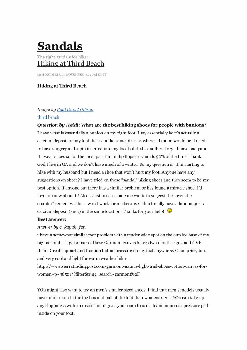
Image by Paul David Gibson
third beach
Question by Heidi: What are the best hiking shoes for people with bunions?
I have what is essentially a bunion on my right foot. I say essentially bc it‘s actually a
calcium deposit on my foot that is in the same place as where a bunion would be. I need
to have surgery and a pin inserted into my foot but that‘s another story…I have bad pain
if I wear shoes so for the most part I‘m in flip flops or sandals 90% of the time. Thank
God I live in GA and we don‘t have much of a winter. So my question is…I‘m starting to
hike with my husband but I need a shoe that won‘t hurt my foot. Anyone have any
suggestions on shoes? I have tried on those ―sandal‖ hiking shoes and they seem to be my
best option. If anyone out there has a similar problem or has found a miracle shoe..I‘d
love to know about it! Also….just in case someone wants to suggest the ―over-the-
counter‖ remedies…those won‘t work for me because I don‘t really have a bunion..just a
calcium deposit (knot) in the same location. Thanks for your help!!
Best answer:
Answer by c_kayak_fun
i have a somewhat similar foot problem with a tender wide spot on the outside base of my
big toe joint — I got a pair of these Garmont canvas hikers two months ago and LOVE
them. Great support and traction but no pressure on my feet anywhere. Good price, too,
and very cool and light for warm weather hikes.
http://www.sierratradingpost.com/garmont-natura-light-trail-shoes-cotton-canvas-for-
women~p~3650r/?filterString=search~garmont%2F
YOu might also want to try on men‘s smaller sized shoes. I find that men‘s models usually
have more room in the toe box and ball of the foot than womens sizes. YOu can take up
any sloppiness with an insole and it gives you room to use a foam bunion or pressure pad
inside on your foot,
I have used Teva and Keen hiking sandals also — problem with them is that they don‘t
really protect your feet and I find they seem to make me more apt to get blisters and to
get stones and other debris inside the shoe. Better for sidewalks than forest trails.
Being as they are canvas, you could probably cut out a section of the Garmont hikers if
there was pressure over the area, which would remove the lining and padding. Then glue
a piece of fabric over the cut out hole and you would have a void inside that would not
press on the sore spot — or you could fill it from inside with lamb‘s wool for cushioning.
Know better? Leave your own answer in the comments!
{ Comments on this entry are closed }
me and painted toes in hiking sandals
by HOSTMEIR on NOVEMBER 29, 2011[EDIT]
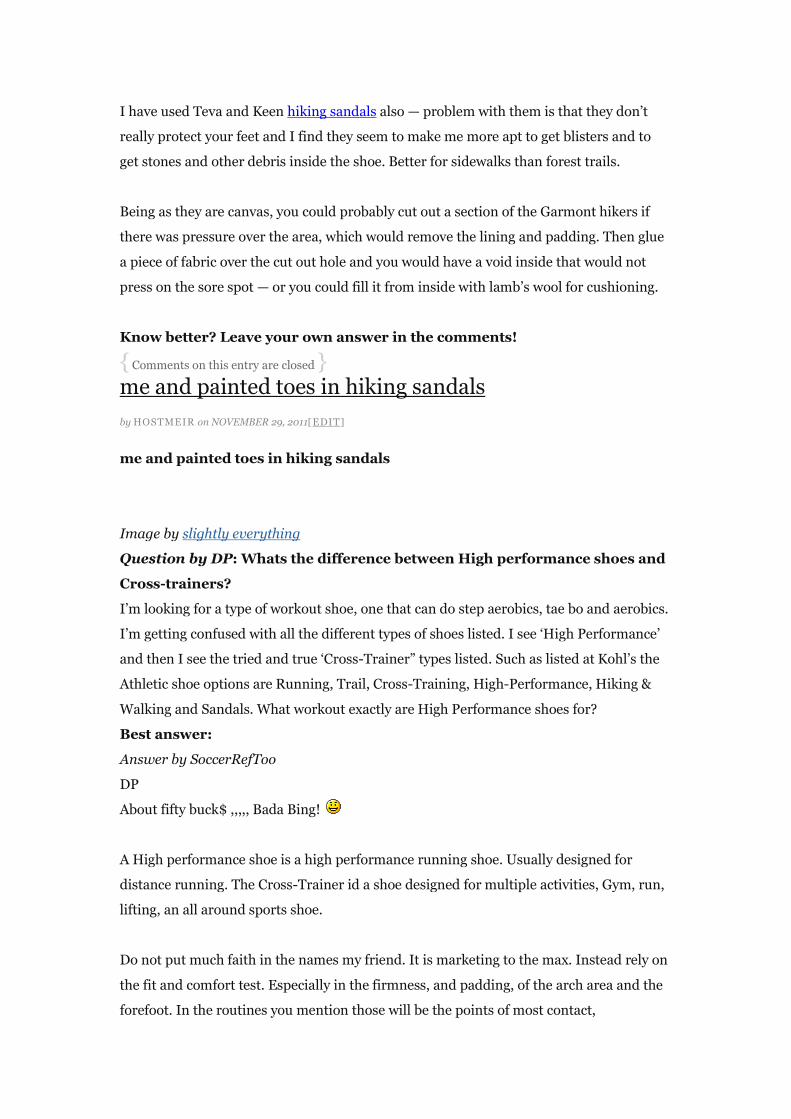
me and painted toes in hiking sandals
Image by slightly everything
Question by DP: Whats the difference between High performance shoes and
Cross-trainers?
I‘m looking for a type of workout shoe, one that can do step aerobics, tae bo and aerobics.
I‘m getting confused with all the different types of shoes listed. I see ‗High Performance‘
and then I see the tried and true ‗Cross-Trainer‖ types listed. Such as listed at Kohl‘s the
Athletic shoe options are Running, Trail, Cross-Training, High-Performance, Hiking &
Walking and Sandals. What workout exactly are High Performance shoes for?
Best answer:
Answer by SoccerRefToo
DP
About fifty buck$ ,,,,, Bada Bing!
A High performance shoe is a high performance running shoe. Usually designed for
distance running. The Cross-Trainer id a shoe designed for multiple activities, Gym, run,
lifting, an all around sports shoe.
Do not put much faith in the names my friend. It is marketing to the max. Instead rely on
the fit and comfort test. Especially in the firmness, and padding, of the arch area and the
forefoot. In the routines you mention those will be the points of most contact,

Soccerref
Know better? Leave your own answer in the comments!
{ Comments on this entry are closed }
i found my spot NOVEMBER 28, 2011 [EDIT]
i found my spot Image by hash trivial promoting chacos, fine hiking sandals Question by Rey: Has
anyone been to a Sandals Resort in Jamiaca? Which do reccomend? We are going there for our
honeymoon in November and want to do lots of activities, horsebback riding, ATVing, hiking, rafting .
Which do you reccommend? Best [...]
Read the full article →
Sedona Sandals NOVEMBER 27, 2011 [EDIT]
Sedona Sandals Image by Jenny Lee Silver The red sand and dust gets everywhere. After hours of hiking
the feet and sandals match the ground below them. Question by jonny: They say socialism is bad, but,
don‘t the uniforms look cool? I think the armbands need some updating, and let‘s look at some low heels
[...]
Read the full article →
Hike NOVEMBER 26, 2011 [EDIT]
Hike Image by oh snap Question by rodrigue k: How do I prepare for a hiking trip? Should I wear
slippers, or sandals? Do I have to carry a tent on my back? Will there be a place to plug in my psp?? Can
I play fifa? Best answer: Answer by Bali Villa HolidaysShould I [...]
Read the full article →
James Peak Hike – Roosevelt National Forest, Colorado NOVEMBER 25, 2011 [EDIT]
James Peak Hike – Roosevelt National Forest, Colorado Image by gregor_y 1993 hike to the top of
13,294-foot James Peak with international students from the Economics Institute. In August 2002, the
James Peak Wilderness Area was officially dedicated. The Congress designated the 14,000-acre area,
which straddles the Continental Divide in Boulder, Clear Creek, and Gilpin [...]
Read the full article →
hiking NOVEMBER 24, 2011 [EDIT]
hiking Image by Julie K in Taiwan So Saturday my husband went hiking by himself, six grueling hours. I
stayed home as I wasn‘t feeling well, and Jaylene and I had a blast playing around. Sunday, Ahji decides
he wants us to go hiking together to the same place. I‘m still not feeling well, but [...]
Read the full article →
Road 15 – Me! NOVEMBER 23, 2011 [EDIT]
Road 15 – Me! Image by AA(Noname) Me, wiping the sweat from my forehead (near the local cemetery).
I like this shot. From my two-hours trip that my brother and I did on August 26th (taken by him).

Question by Gabrielle Michel: Are Chaco sandals sturdy and comfortable? I have been wanting to buy a
[...]
Read the full article →
Chaco Sandal Test NOVEMBER 22, 2011 [EDIT]
Chaco Sandal Test Image by Let Ideas Compete My wife and I decided to try to hike in sandals rather
than the usual hiking boot. These worked out quite well (perhaps a boot would have been nicer IF we‘d
turned an ankle). They are cooler and lighter than boots. However, your feet get dirty – [...]
Read the full article →
―Before‖ NOVEMBER 21, 2011 [EDIT]
―Before‖ Image by scholz Question by k2mayo757: For hiking through Costa Rica, what brand of sandals
would you recommened? Why? Best answer: Answer by Kitty Englishno sandals …. hiking in sandals
bad idea Give your answer to this question below!
Read the full article →
Stock Phote The right photo for hiking University of Essex, Southend Campus
by HOSTMEIR on NOVEMBER 30, 2011[EDIT]
University of Essex, Southend Campus
Image by Arty Smokes (deaf mute)
This image is based on a fairly ordinary mobile phone grab. I wanted to see if I could
make it look like a hike stock photo worthy of the University website by using a few
Photoshop tweaks.
I corrected the perspective, removed an overhanging lamppost and did a bit of
sharpening, as well as altering the colours a bit.
LARGE.
Question by Double E: To sell a stock photo of the golden gate bridge, do I
need a release signed?
What are the laws governing building releases for stock photography?
Best answer:
Answer by Rengim M
No since the Golden Gate Bridge is a national landmark basically. It‘s not a private owned
road (that‘s what would make you need a release but you‘d see a big sign in front of it
with the owner‘s name and you‘d need permission just to cross it). The bridge is also part
of the US state road system, but it‘s not a government office so it counts as public, so
don‘t worry.
I hope I was of help, but if you‘re asking for a stock company, they usually tell you which
buildings and/or models need releases (if they choose your photo that is).
Good luuck!
Give your answer to this question below!
{ Comments on this entry are closed }
Stock eye candy
by HOSTMEIR on NOVEMBER 29, 2011[EDIT]
Stock eye candy
Image by kevin dooley
No symbolism, no messages, just a visual snack…
Question by Taylor: where can i legally obtain a stock photo of an ipad for
my school newspaper?
i would just go and take one, but i have to go to an Apple store, the electronic stores in my
area don‘t carry them & there isn‘t a close Apple store.
Best answer:
Answer by casperskitty
Have you thought of just taking a photo of one yourself?
Add your own answer in the comments!
{ Comments on this entry are closed }
Free Grass Photo NOVEMBER 28, 2011 [EDIT]
Free Grass Photo Image by taylor.a Some free grass photos for my blog Free to use. Enjoy Question by
Yankie Roo: What stock photo websites are good ones? I‘m a freelance photographer, and I‘m looking to
sell my photos online. does anyone know of any good sites that don‘t charge me to get paid?
Shutterstock.com, [...]
Read the full article →
A Spider in a Web, Yesterday NOVEMBER 27, 2011 [EDIT]
A Spider in a Web, Yesterday Image by Arty Smokes (deaf mute) Stranded in the garden of your mum‘s
house with nothing better to do? Take stock photos of flora and fauna. LARGE. Question by : Using a
stock photo without buying it? The graphic designer I deal with merged parts of different stock photos
[...]
Read the full article →
Westlcliff Seafront at Dusk NOVEMBER 26, 2011 [EDIT]
Westlcliff Seafront at Dusk Image by Arty Smokes (deaf mute) Boring so-called "stock photo". Uploading
just to get it out of my "yet to be processed" folder. LARGE. Question by Survival: How do the stock
photo sites work? How does that payment work, for example Shutterstock or Fotolia, do you get paid
each time someone [...]
Read the full article →
Pink and Copenhagen Blue NOVEMBER 25, 2011 [EDIT]
Pink and Copenhagen Blue Image by Mikael Colville-Andersen The blue, blue bike lanes of Copenhagen
go with any colour. Normal people on normal bikes. A bike-geek free zone.
www.copenhagencyclechic.com – Copenhagen Cycle Chic Blog www.copenhagenize.com – The
Copenhagen Bike Culture Blog © All Rights Reserved. Stock photos of Copenhagen, Denmark. City Life.
Stock Photos from [...]
Read the full article →
Stock Photo: American Chipmunk NOVEMBER 24, 2011 [EDIT]
Stock Photo: American Chipmunk Image by SnowFoxCreations Stock image. Need a chipmunk? Take a
chipmunk. [filename for personal reference: 20111005-chipmunk.jpg] Question by Cristi C: What is the
best stock-photo site with free photo and layout design? I have interested for free photos, layout design,
web design, icons, illustrations … and another 2D graphic elements. 10x [...]
Read the full article →
Auditorio Telmex Guadalajara NOVEMBER 23, 2011 [EDIT]
Auditorio Telmex Guadalajara Image by memoflores Auditorio Telmex de Guadalajara Buy this photo /
Comprar esta foto Question by Gina: I want to sell my photo‘s as stock photo‘s- how do I go about? I live
in South Africa and would like to sell my photo‘s over the internet. Which stock photo dealers are the
[...]
Read the full article →
curling stone– stock quality NOVEMBER 22, 2011 [EDIT]
curling stone– stock quality Image by Wyoming_Jackrabbit Photos taken at the Knoxville Ice Chalet,
Knoxville, TN. Question by Spongebob: Where i can find a cms fron tend / back end to make website for
stock photo or digital products? I‘m planning to make a stock / digital file marketplace. Which cms is
possible i can [...]
Read the full article →
Autumn Leaves NOVEMBER 21, 2011 [EDIT]
Autumn Leaves Image by Arty Smokes (deaf mute) So-called stock photo. Handheld macro with none of
that bokeh crap that amateurs love. LARGE. Question by willy t: Anyone know any good free stock photo
sites? Anyone know any good stock photo sites that are free? Best answer: Answer by Melanie
JessicaPhotobucket What do you think? [...]
Read the full article →
Camping Supplies The right camping supplies for hiker
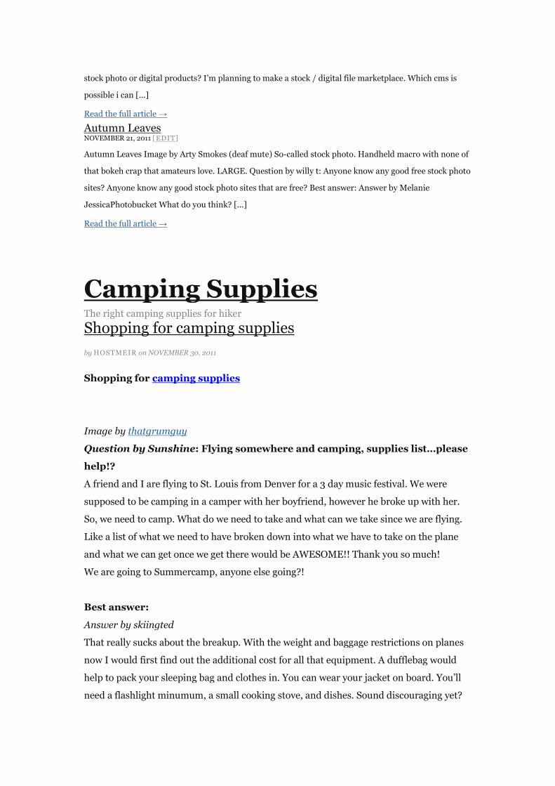
Shopping for camping supplies
by HOSTMEIR on NOVEMBER 30, 2011
Shopping for camping supplies
Image by thatgrumguy
Question by Sunshine: Flying somewhere and camping, supplies list…please
help!?
A friend and I are flying to St. Louis from Denver for a 3 day music festival. We were
supposed to be camping in a camper with her boyfriend, however he broke up with her.
So, we need to camp. What do we need to take and what can we take since we are flying.
Like a list of what we need to have broken down into what we have to take on the plane
and what we can get once we get there would be AWESOME!! Thank you so much!
We are going to Summercamp, anyone else going?!
Best answer:
Answer by skiingted
That really sucks about the breakup. With the weight and baggage restrictions on planes
now I would first find out the additional cost for all that equipment. A dufflebag would
help to pack your sleeping bag and clothes in. You can wear your jacket on board. You‘ll
need a flashlight minumum, a small cooking stove, and dishes. Sound discouraging yet?

Just watch the weight restrictions.
I am afraid to say, You may find it cost prohibitive to take the trip.
Sorry.
Give your answer to this question below!
{ Comments on this entry are closed }
Bepakte kajak
by HOSTMEIR on NOVEMBER 30, 2011
Bepakte kajak
Image by ianus
Alle kampeerspullen klaar in de kajak
Question by munna: Financial Statements for Manufacturing and
Merchandising Companies Base One Equipment (BOE) Camping Supplies I?
Financial Statements for Manufacturing and Merchandising Companies
Base One Equipment (BOE) Camping Supplies International (CSI) both sell tents. BOE
purchases its tents from a manufacturer for $ 96 each and then sells them for $ 180. It
purchased 10,000 tents in 20X4.
CSI produces its own tents. In 20X4 CSI produced 10,000 tents. Costs were as follows.
Direct materials purchased $ 570,000
Direct materials used $ 520,000
Direct labor 290,000
Indirect manufacturing:
Depreciation $ 50,000
Indirect labor 60,000
Other 40,000 150,000
Total cost of production $ 960,000
Assume that CSI had no beginning inventory of direct materials. There was no beginning
inventory of finished tents, but ending inventory consisted of 1,000 finished tents.
Ending work-in-process inventory was negligible.
Each company sold 9,00 tents for $ 1,620,000 in 20X4 and incurred the following selling
and administrative costs:
Sales salaried and commission $ 105,000
Depreciation on retail store 40,000
Advertising 25,000
Other 15,000

Total selling and administrative cost $ 185,000
1.Prepare the inventories section of the balance sheet for December 31, 20X4, for BOE.
2.Prepare the inventories section of the balance sheet for December 31, 20X4, for CSI.
3.Using the cost of goods, sold format on page 149 as a model, prepare an income
statement for the year 20X4 for BOE.
4. Using the cost of goods, sold format on page 149 as a model, prepare an income
statement for the year 20X4 for CSI.
5.Summarize the differences between the financial statement of BOE, a merchandiser,
and CSI, a manufacturer.
6.What purpose of a cost management system is being served by reporting the items in
requirements 1 through 4?
Best answer:
Answer by Ramon
1. Merchandise Inventory – $ 96,000 (computed as: ($ 960,000 / 10,000) x 1,000 units
remaining))
2. Raw Materials Inventory – $ 50,000 (computed as ($ 570,000 purchased less $
520,000 used in production)
Finished Goods Inventory – $ 96,000 (computed as: Cost of Goods Manufactured $
960,000 / 10,000) x 1,000 units remaining)
Total Inventory – $ 146,000
3. Sales $ 1,620,000
Less: Cost of Sales
Purchases 960,000
Less: Ending Inventory 96,000 864,000
Gross Profit 756,000
Less:
Selling and Admin Expense 185,000
Net Income 571,000
4. Sales $ 1,620,000
Less: Cost of Sales
Direct Materials 520,000
Direct Labor 290,000
Factory Overhead 150,000
Cost of Goods Manufactured 960,000
Less: Finished Goods Invty, end 96000 864,000
Gross PRofit 756,000
Less:
Selling and Admin Expense 185,000
Net Income 571,000
What do you think? Answer below!
{ Comments on this entry are closed }
Chinese camp supply shop NOVEMBER 28, 2011
Chinese camp supply shop Image by vfowler Watch this video on Vimeo. Video created by Vernon
Fowler. Question by Julie: What supplies are necessary for a three day camping trip? My husband and I
will be going into the woods alone for three days but I want to make sure I have everything I need. [...]
Read the full article →
IMG_7461 NOVEMBER 27, 2011
IMG_7461 Image by radloff best camp box ever (both the bota box and the Hoppe camp supply box that
is) Question by Mitch: Good gas mileage with room for camping supplies and a big dog? Your Question
Good gas milage with room for a big dog and camping supplies?? Right now I am driving a [...]
Read the full article →
Some camping supplies NOVEMBER 26, 2011
Some camping supplies Image by ebel Question by Twin Won the Random One: Question about
camping supplies? Well I‘m going to camp with the 6th grades and the camp name is called ―Camp
Hightrails‖ and i want to ask some question…… If i‘m going to camping which one should one should I
take?Duffel bag or [...]
Read the full article →
Emergency camping supplies NOVEMBER 25, 2011
Emergency camping supplies Image by kellan (iPhone brevity in effect.) Question by shawn c: What are
the supplies ill need for camping and what are some funa activities to do while camping? Best answer:
Answer by anne cTent with a good rain fly (get one with a fly that comes down close to the ground. [...]
Read the full article →
No space left unpacked NOVEMBER 24, 2011
No space left unpacked Image by ratsinis Question by : What are good camping supplies to take? Best
answer: Answer by joynpplA tent sleeping bags lighter some food and whatever else u think u will need
for ur trip please make sure to bring lots of water to drink and use What do you think? [...]
Read the full article →
Occupy Portland Camp – 61 NOVEMBER 23, 2011
Occupy Portland Camp – 61 Image by merrick_monroe Supplies tent Question by junglegymgeorge:
What are the basic supplies I need for camping besides a tent and sleeping bag? No extreme
temperatures, so I wouldn‘t need special snow gear or anything. Best answer: Answer by Lizztoliet
paper, bug spray, something to eat, flash light What do [...]
Read the full article →
shakta kids camp 2004 005 NOVEMBER 21, 2011
shakta kids camp 2004 005 Image by saritarobinson supplies for arts/crafts Question by Kenzie: What
supplies would you need when you‘re going on a two month camping trip? What supplies would you
need when you‘re going on a two month camping trip? I need every detail: tents, sleeping bag, back
packet, ECT. Anything you can [...]
Read the full article →
Supply Run NOVEMBER 20, 2011
Supply Run Image by TuttleTree I have a love-hate relationship with "car-camping." On one hand, it‘s
convenient to keep things like food and dishes in the bed of the truck; but on the other hand, it doesn‘t
feel as much like camping as I‘m used to. I can‘t wait until the kids are into scouts [...]
Read the full article →
Hiking Smart hiking
WRC hike near Downtown Memphis
by ADMIN on NOVEMBER 30, 2011
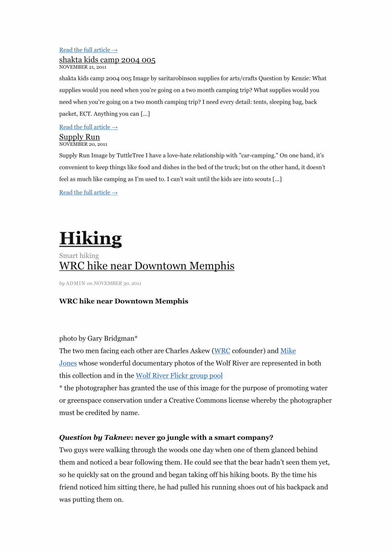
WRC hike near Downtown Memphis
photo by Gary Bridgman*
The two men facing each other are Charles Askew (WRC cofounder) and Mike
Jones whose wonderful documentary photos of the Wolf River are represented in both
this collection and in the Wolf River Flickr group pool
* the photographer has granted the use of this image for the purpose of promoting water
or greenspace conservation under a Creative Commons license whereby the photographer
must be credited by name.
Question by Taknev: never go jungle with a smart company?
Two guys were walking through the woods one day when one of them glanced behind
them and noticed a bear following them. He could see that the bear hadn‘t seen them yet,
so he quickly sat on the ground and began taking off his hiking boots. By the time his
friend noticed him sitting there, he had pulled his running shoes out of his backpack and
was putting them on.

His friend said, ―What are you doing ?‖
His friend pointed up the trail to reveal the bear coming towards them slowly but surely.
He said,‖ Man you‘re crazy. There‘s no way you can outrun that bear!!‖
As he was standing up, his friend said, ‖ I don‘t have to outrun the bear, I just have to
outrun you!‖
Best answer:
Answer by as 1
this was a scene from the film ‗without a paddle‘
and it wasnt funny then!
Add your own answer in the comments!
{ Comments on this entry are closed }
Inside Smarts Mountain Tower
by ADMIN on NOVEMBER 29, 2011
Inside Smart hiking Mountain Tower
Question by MRCOOL: Is pet smart good for socializing my 8 month German
Shepherd puppy?
So basically when my dog was a younger puppy I could only find small dogs to play with
him but he met sooooo many of my friends and family, short and tall he met them all. But
a week and half of bad weather kept us inside he started to get scared of tall people but
was still okay with small children and friends that were average height but then another
two weeks later he started to bark in a low tone but not lunging or growling, nothing to
show signs of aggression. He is trained to the point where he‘ll track with his nose,sit,stay
to a certain point, lay down, speak on command and shake paws. Hes very friendly to
friends cautious of big people as was demonstrated at pet smart where he started barking
at everyone. But when a small dog passed by he was waggin his tail and wanted to play.
When I signed up for training the trainer told me he just needed to get used to many
situations and even suggested to join her facebook page called (paws on the shore) where
he would meet many other dogs and situations on a hike. So I‘m wondering does it seem
like a good training plan for my scaredy cat shepherd. If not please tell me of better
training place near york region or Toronto, that you have experienced. Thank You.
Best answer:

Answer by King Les The Lofty
The socialisation period ended when Pup became 13 weeks old, although if well started
before that it can continue through 16 weeks old.
Although everyone calls it ―socialisation‖, that is actually a bad term, deluding people
such as yourself into thinking it means playing with people & pups. A more accurate term
would be exposure or familiarisation. The purpose is to (once Pup trusts you) expose it –
from a distance PUP considers safe – to every movement, reflection, scent, sight, sound,
texture to be found in its environment. It should be done on a 6ft/2m lead where there
are NO dogs running loose, with Pup allowed to try to ―explore in all directions at once‖
except when you need to haul it away from dangerous or disgusting things, or from a
scared human. And if Pup wants to sit & think about a new thing, or to hide behind you,
you should let it, patiently waiting still & silent until Pup decides to ignore or investigate
this new thing, whereupon you praise it – and, if it is still close enough, give it a rub or
pat of encouragement.
YOU should then have been in a training-club class (NOT a pet-shop play-group) starting
when Pup was 18-22 weeks old, so that you were coached to be an effective trainer.
You should NOT be encouraging Pup to play with other dogs. His attention should be
focussed on YOU and the other people & animals in your household.
Next time he barks, instantly wrap the leash around his muzzle so that he can‘t open it
enough to bark, then command him with ―Quiet!‖ or ―No bark!‖ or whatever simple
phrase you will CONSISTENTLY use when he is noisy at the wrong time.
Facebook pages, web-pages, commercial videos, books, telephone conversations – ALL of
them have the same flaw: They cannot OBSERVE YOU to see & hear your errors in use of
―the voices‖, timing, body-language, balance, use of rewards vs reprimands. Nor can they
observe your pet‘s reactions. And so they cannot coach you, they can only suggest
principles.
Most pet-shop ―trainers‖ have never subjected themselves to the ―proof of the pudding‖ of
competing in Agility or Companion-Utility Trials or Obedience Tests or SchutzHund
Trials.
If you (or a family member) had a phobia, would you force yourself (that person) to be
surrounded by what you (he/she) is scared of?
A far better plan is to keep your dog interested in as much as he is confident about, and
let scary-to-him things stay outside his ―bubble‖ (the distance outside which he couldn‘t
care less about things, but inside which he reacts – it‘s like birds that will let you reach
their ―bubble‖ before taking flight). In training classes you keep his attention fixed on
YOU, so that he comes to realise that if he ignores what other dogs & people are doing
they will ignore him but you will praise-&-reward him. At 8 months old he is salvageable,
although he will never be a bold pooch.
• Add http://pets.groups.yahoo.com/group/The_GSD_Source to your browser‘s
Bookmarks or Favorites so that you can easily look up such as feeding, vaccinations,
worming, clubs, weights, teething, neutering, disorders, genetics.
In its Links section click GSD_Clubs to get the head offices of the GSDCC and GSSCC and
find out where their nearest training class is (you don‘t want show-training, nor do you
want bite-work training, you want obedience training – and the agility+obedience and
tracking sections of SchutzHund might suit you well). Then switch to the Kennel_Clubs
to get the web-site of the CKC and find out which of its all-breeds clubs have training
classes near you.
Toronto has enough humans that there OUGHT to be several clubs you can choose from,
if you are happy to drive a bit. Even just York should have at least half a dozen.
• To ask about GSDs, join some of the 400+ YahooGroups dedicated to various aspects of
living with GSDs. Each group‘s Home page tells you which aspects they like to discuss,
and how active they are. Unlike YA, they are set up so that you can have an ongoing
discussion with follow-up questions for clarification. Most allow you to include photos.
Les P, owner of GSD_Friendly: http://pets.groups.yahoo.com/group/GSD_Friendly
―In GSDs‖ as of 1967
Give your answer to this question below!
{ Comments on this entry are closed }
Me and foliage, Smarts Mountain NOVEMBER 28, 2011
Me and foliage, Smarts Mountain Image by ellentk Question by Cocubloo: Ok, So I need a person who‘s
ready to come hitch hiking with me…? Preferably a girl (they‘re cleaner lol) …. no homophobes please.
Some one as crazy as me… someone humourous/sarcastic, who gets sick of being in one place for too
long… loves [...]
Read the full article →
Christmas decorations NOVEMBER 27, 2011
Christmas decorations Image by simonov Someone has been decorating many of the trees around the
Ski Hut and the summit with Christmas ornaments. This doesn‘t seem very smart to me as it‘s unlikely
the people who did it will come back after the holidays to clean up, especially as winter storms will have
blown all [...]
Read the full article →
I Love Lucy NOVEMBER 26, 2011
I Love Lucy Image by scottjlowe This is also one of my favorite Miata colors–it‘s quite similar to my own.
Question by I ♥ Field Hockey!: Please help me! Any smart people out there?PLEASE???!! (algebra 1)?
How do I figure this out?? Mr. Jones surveyed a group of college students. He noticed in a sample [...]
Read the full article →
the fae in the glen NOVEMBER 25, 2011
the fae in the glen Image by r c photographic Question by Yahoo Answer Angel: Is it a slippery slope
when a majority with less income vote to tax only those with higher incomes? A smarter politician would
draw the line at the top 40% of the earners getting a tax hike, and hope that [...]
Read the full article →
Julie & I wait near the bottom NOVEMBER 24, 2011
Julie & I wait near the bottom Image by eclecticlibrarian We‘re smart like that. Question by Alicia: For
those of you very deep thinkers and smart people.? Imagine all the water was drained out of the Atlantic
ocean. What do you think your hike across the Atlantic would be like, describing the deep ocean basin,
[...]
Read the full article →
Impassable NOVEMBER 23, 2011
Impassable Image by °Florian I went about 100 feet farther to the top of the first drop off. I‘m smart
enough to not try hiking down Tahquitz Creek to PS. Although the thought did cross my mind. Question
by Rebecca M: Why do most students in college always talk about school and exams, even after [...]
Read the full article →
Mount Pisgah Fire Tower NOVEMBER 22, 2011
Mount Pisgah Fire Tower Image by metimbers2000 Not the smartest thing I‘ve done in awhile. Last
Thursday, while the sun was out but the wind was gusting like 60 mph, I decided to walk up to the
Mount Pisgah Fire Tower. It wouldn‘t have been such a big deal, except that it was the middle [...]
Read the full article →
Smarts Mountain Tower NOVEMBER 21, 2011
Smarts Mountain Tower Image by mjtsai Question by Meg P: Smart people, PLEASE please help me!?
When hiking through a national park ou notice some pretty cool rock layers are exposed on the side of a
cliff. Your friend tries to say that the oldest rocks are the ones on the very bottom,but you notice [...]
Read the full article →