Embed Size (px)
Citation preview
September 13, 2016
David J. Gochis Scientist National Center for Atmospheric Research Boulder, Colorado !Large!integrated!NOAA/OWP,!NCAR!team!and!CUAHSI!team!
OWP Office(ofWaterPrediction
The Community WRF-Hydro and its Implementation as the NOAA National Water Model
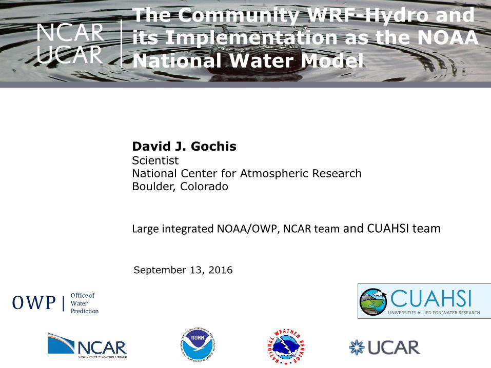
The Community WRF-Hydro Modeling System
NOAA National Water Model using WRF-Hydro
WRF$Hydro*$*A*community$based,*supported*water*modeling*system*designed*to*provide:*
1. Adaptable!modeling!system!for!assimila&on)&)predic&on!of!precipitaCon,!soil!moisture,!snowpack,!groundwater,!streamflow,!inundaCon!
2. ‘Accurate’!and!‘reliable’!streamflow!predicCon!across!scales!from!hillslopes!to!larger!river!basins!
Water&Informa,on&Across&Scales&
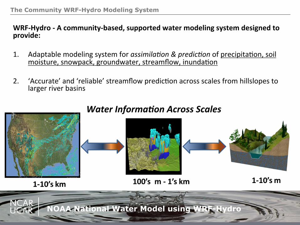
National Water Model Technical Details:
NOAA National Water Model using WRF-Hydro
Data*Throughput:*• Input!data!per!day:!!4.45!Terabytes!• Output!data!per!day:!3!Terabytes!• #!of!river!channels:!2.7!million!• #!of!reservoirs:!1,260!• Total!#!of!computaConal!elements:!
~360,000,000!
Model*Details:*• Number!of!lines!of!code:!74,740!• Computer!usage:!>!100,000!cpuX
hours!per!day!
AssimilaAon*of*real$Ame*streamflow:*• ~8,000!USGS!stream!gauges!!
NaAonal*Streamflow*Anomaly*Map*
Available*online*at:)h1p://water.noaa.gov/tools/nwm9image9viewer)
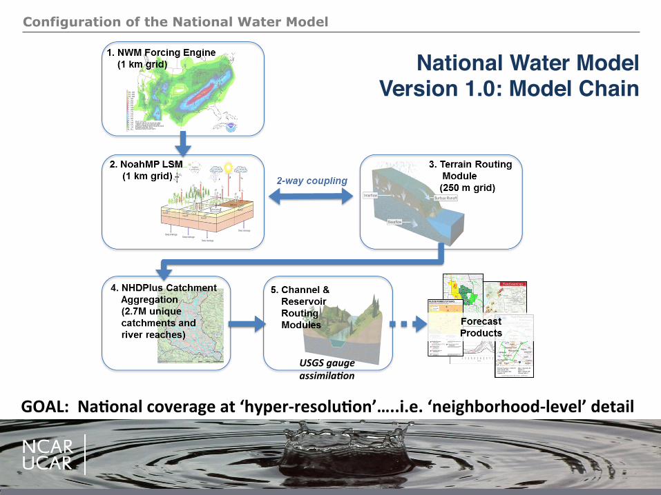
Configuration of the National Water Model
GOAL:**NaAonal*coverage*at*‘hyper$resoluAon’…..i.e.*‘neighborhood$level’*detail*
National Water ModelVersion 1.0: Model Chain
USGS&gauge&assimila,on&
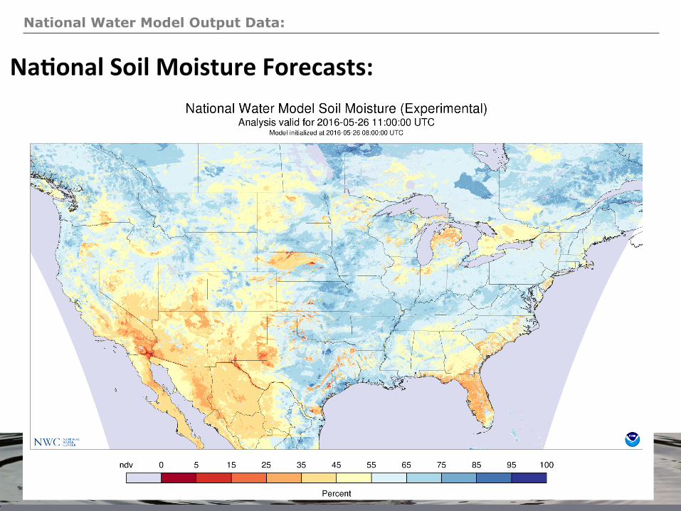
National Water Model Output Data:
NOAA National Water Model using WRF-Hydro
NaAonal*Soil*Moisture*Forecasts:*
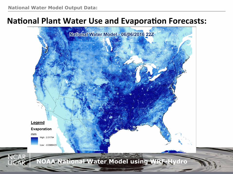
National Water Model Output Data:
NOAA National Water Model using WRF-Hydro
NaAonal*Plant*Water*Use*and*EvaporaAon*Forecasts:*
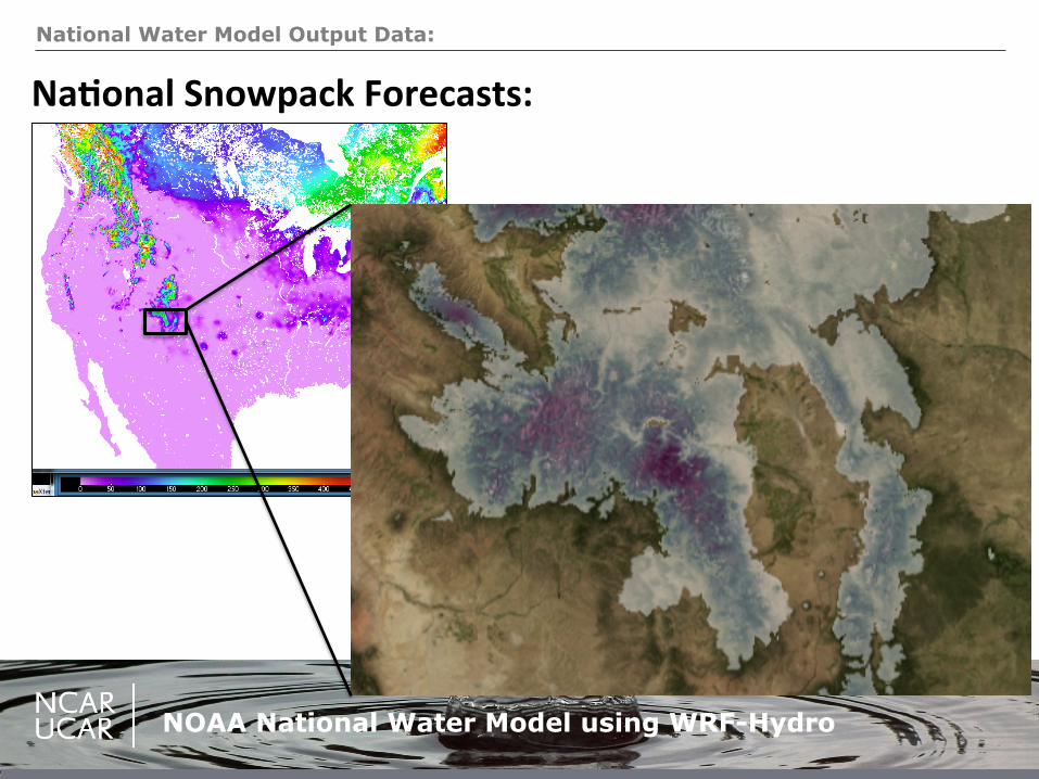
National Water Model Output Data:
NOAA National Water Model using WRF-Hydro
NaAonal*Snowpack*Forecasts:*
National Water Model Output Data:
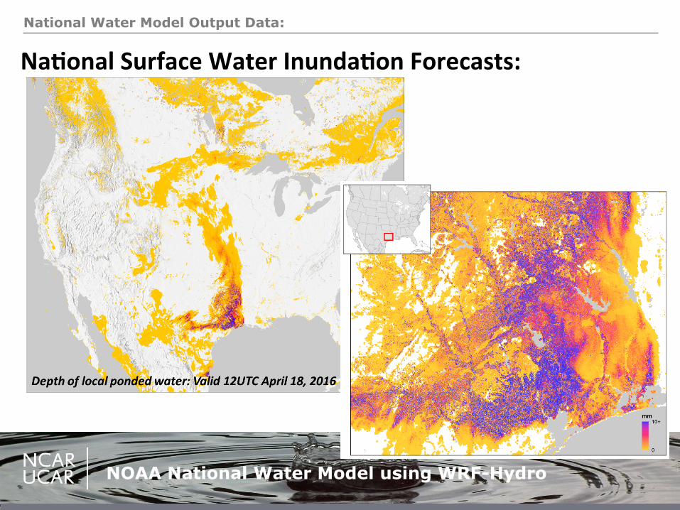
NOAA National Water Model using WRF-Hydro
NaAonal*Surface*Water*InundaAon*Forecasts:*
National Water Model Output Data:
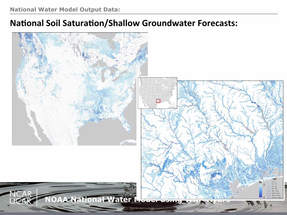
NOAA National Water Model using WRF-Hydro
NaAonal*Soil*SaturaAon/Shallow*Groundwater*Forecasts:*
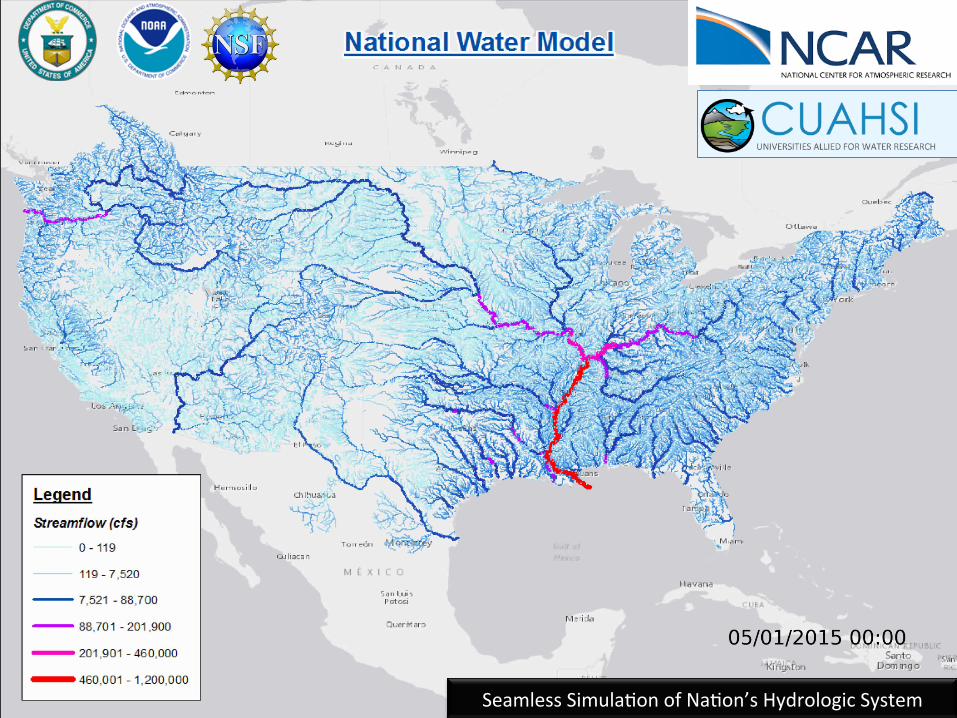
Seamless!SimulaCon!of!NaCon’s!Hydrologic!System!
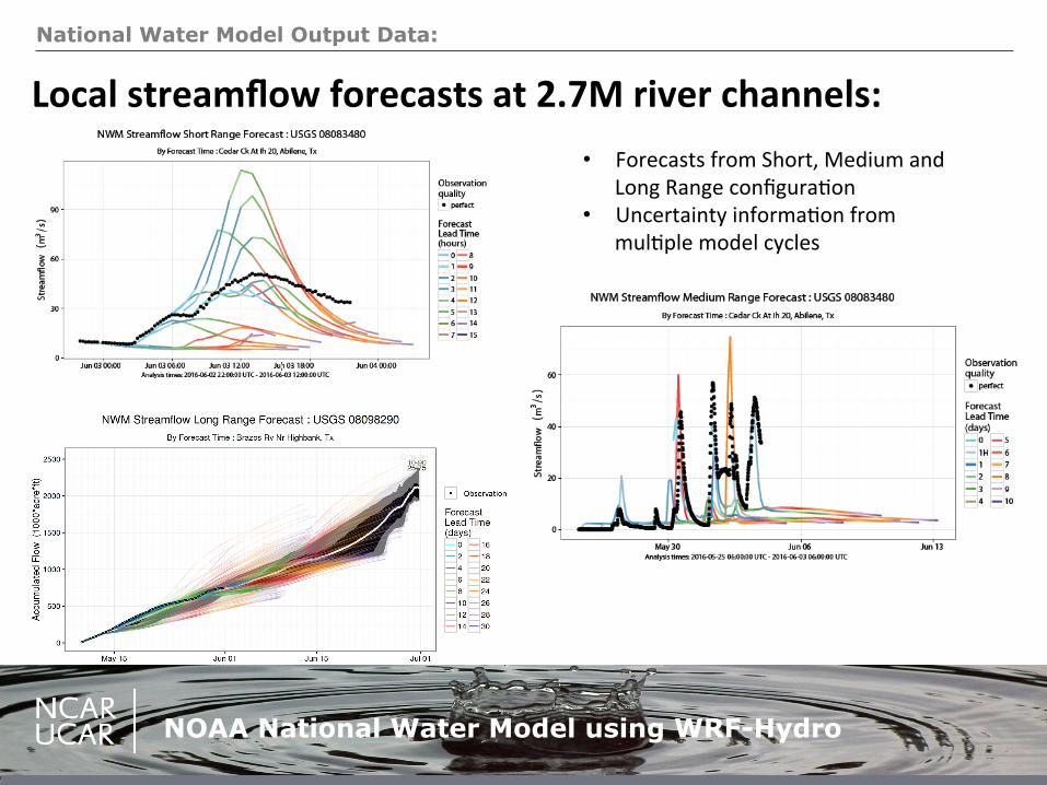
National Water Model Output Data:
NOAA National Water Model using WRF-Hydro
• Forecasts!from!Short,!Medium!and!Long!Range!configuraCon!
• Uncertainty!informaCon!from!mulCple!model!cycles!
Local*streamflow*forecasts*at*2.7M*river*channels:*
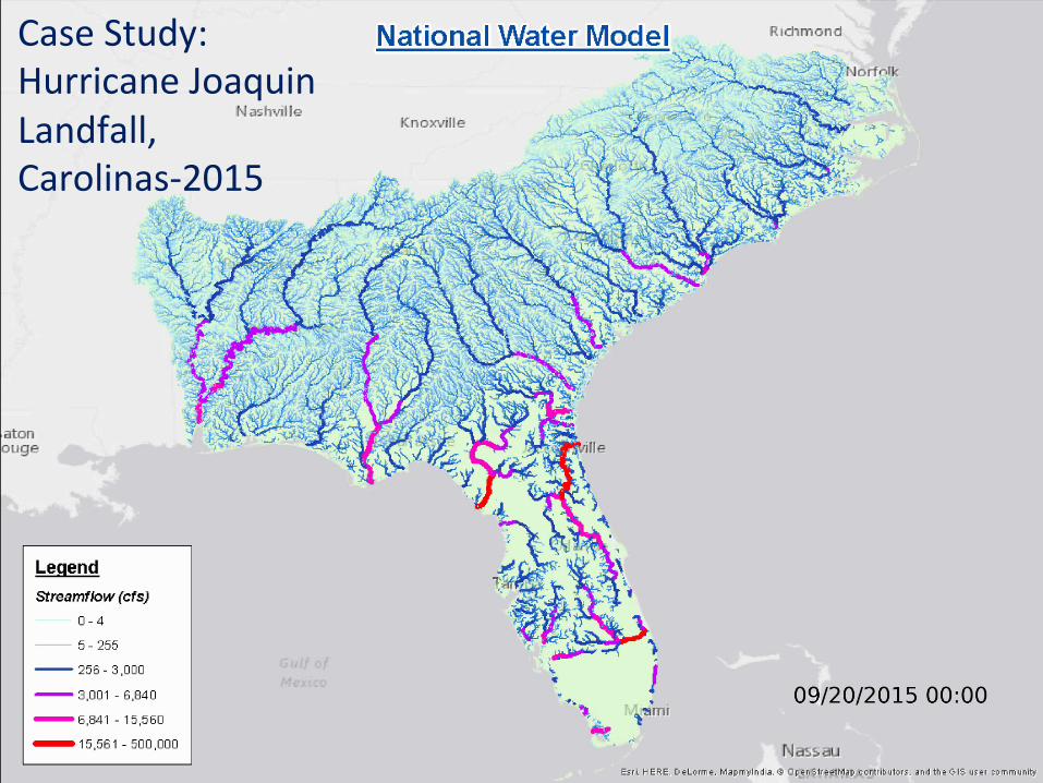
Case!Study:!!Hurricane!Joaquin!Landfall,!CarolinasX2015*
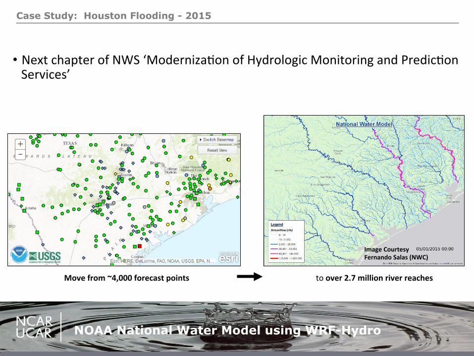
Case Study: Houston Flooding - 2015
NOAA National Water Model using WRF-Hydro
• Next!chapter!of!NWS!‘ModernizaCon!of!Hydrologic!Monitoring!and!PredicCon!Services’!
Move*from*~4,000*forecast*points!!!!!!!!!!!!!!!!!!!!!!!!!!!!!!!!!!!!!!!!!!!!!!!!!!!!!!!!!!!!!!!to!over*2.7*million*river*reaches*
Image*Courtesy**Fernando*Salas*(NWC)*
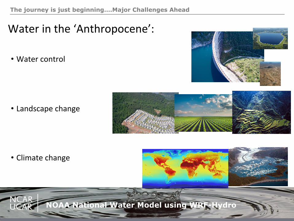
The journey is just beginning….Major Challenges Ahead
NOAA National Water Model using WRF-Hydro
Water!in!the!‘Anthropocene’:*!
• Water!control!
• Landscape!change!
• Climate!change!
!
Parting Thoughts:
NOAA National Water Model using WRF-Hydro
Community*Engagement:*– Move!from!Building!Models…to!Building!CommuniCes!• ProducCve!communiCes!are!build!through!sharing!of!perspecCves!and!resources!• Engaging!scienCsts,!pracCConers!and!decision!makers!to!solve!realXworld!problems!
– Build!a!beeer!observaConal!network!– Revolu&onize)public)access)to)water)intelligence)