Embed Size (px)
Citation preview
USING LOCAL & SATELLITE MAPPING TO FIGHT FGM–CROWD2MAP TANZANIA
State of the Map, HOT SummitSeptember 2016
Janet Chapman
LUCKY MEETUP AT
MOZILLA
FESTIVAL 2015
“TEST” PROJECT TO
ENGAGE LOCALS IN
CROWDSOURCING /
CITIZEN SCIENCE
DATA COULD BE USED TO
MAKE A MAP!!!
HOW DID CROWD2MAP TANZANIA COME TO BE?
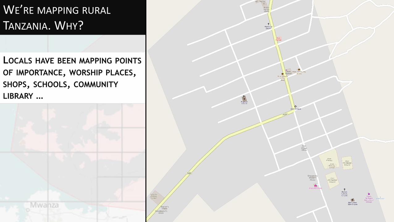
WE’RE MAPPING RURAL TANZANIA. WHY?
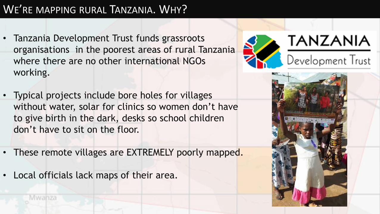
• Tanzania Development Trust funds grassroots
organisations in the poorest areas of rural Tanzania
where there are no other international NGOs
working.
• Typical projects include bore holes for villages
without water, solar for clinics so women don’t have
to give birth in the dark, desks so school children
don’t have to sit on the floor.
• These remote villages are EXTREMELY poorly mapped.
• Local officials lack maps of their area.
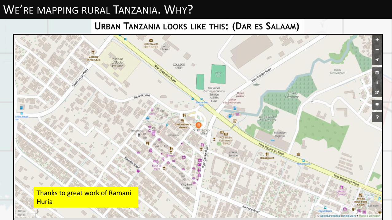
WE’RE MAPPING RURAL TANZANIA. WHY?URBAN TANZANIA LOOKS LIKE THIS: (DAR ES SALAAM)
Thanks to great work of RamaniHuria
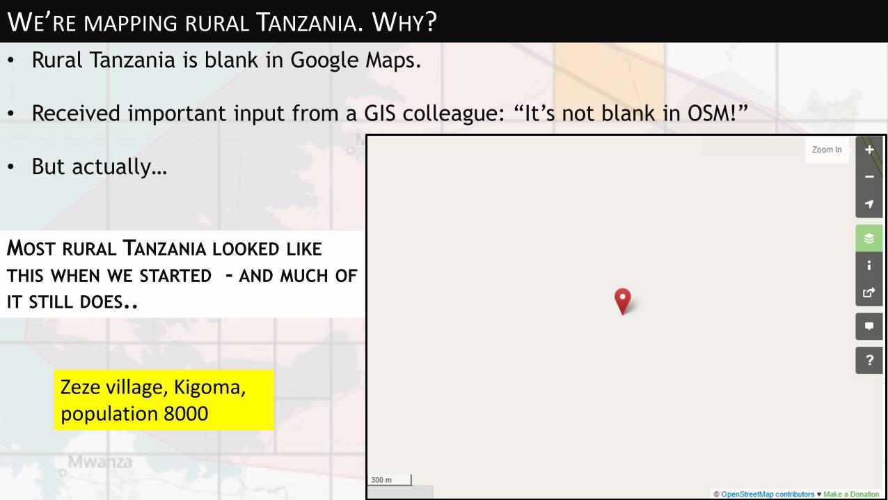
WE’RE MAPPING RURAL TANZANIA. WHY? • Rural Tanzania is blank in Google Maps.
• Received important input from a GIS colleague: “It’s not blank in OSM!”
• But actually…
MOST RURAL TANZANIA LOOKED LIKE
THIS WHEN WE STARTED - AND MUCH OF
IT STILL DOES..
Zeze village, Kigoma, population 8000

WE’RE MAPPING RURAL TANZANIA. WHY?THANKS TO MISSING MAPS, SOME OF IT LOOKED LIKE THIS (ZEZE, -4.8987578, 30.0577604)
Roads added in Kigoma from http://tasks.hotosm.org/project/1069 due to influx of Burundi refugees. But Zeze still not named.
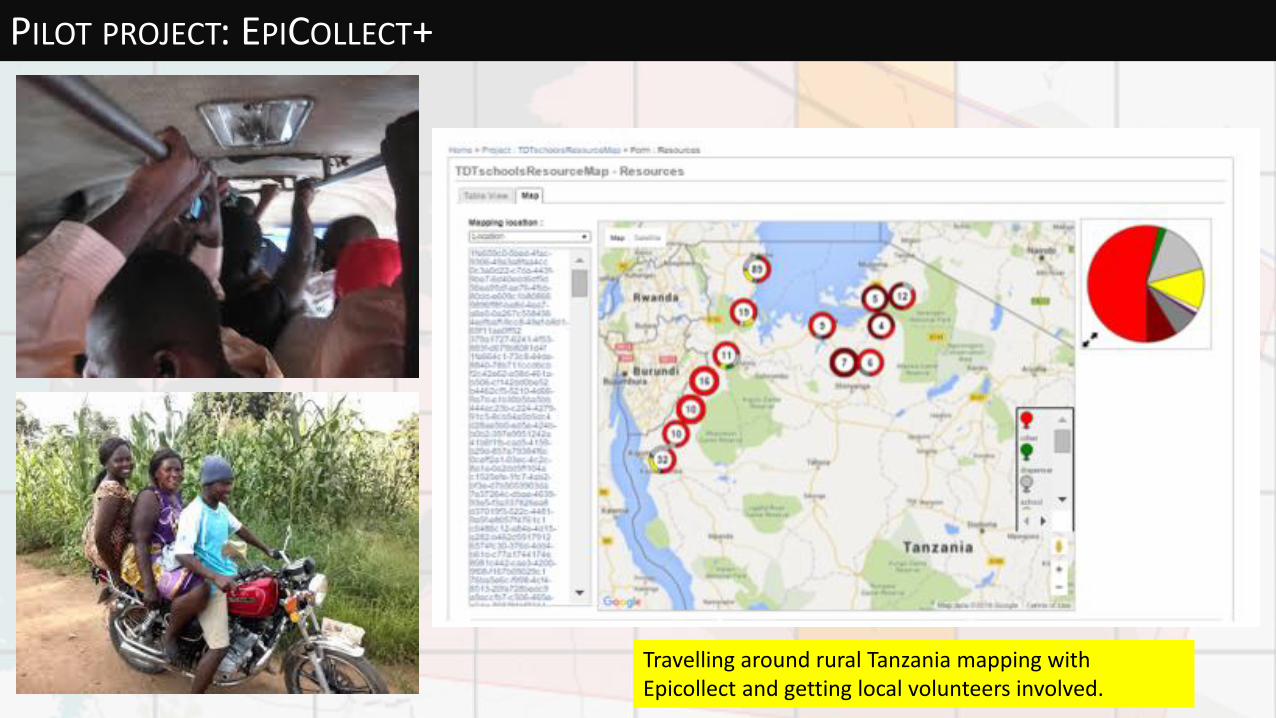
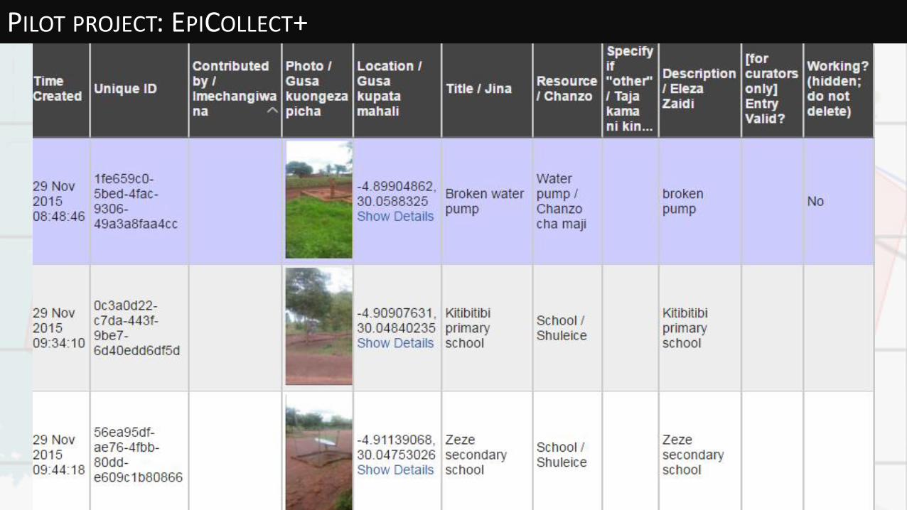
PILOT PROJECT: EPICOLLECT+
Travelling around rural Tanzania mapping with Epicollect and getting local volunteers involved.
PILOT PROJECT: EPICOLLECT+

LOCALS LEARNING TO USE OSM ON LAPTOPS
OSM training session in Zeze secondary school. Only 1 laptop available.
WE’RE MAPPING RURAL
TANZANIA. WHY?
LOCALS HAVE BEEN MAPPING POINTS
OF IMPORTANCE, WORSHIP PLACES,
SHOPS, SCHOOLS, COMMUNITY
LIBRARY …
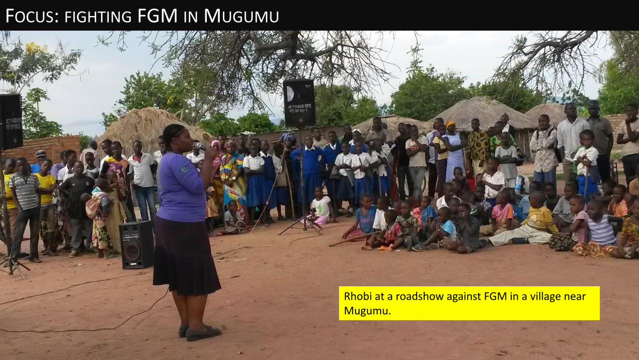
FOCUS: FIGHTING FGM IN MUGUMU
Rhobi at a roadshow against FGM in a village near Mugumu.
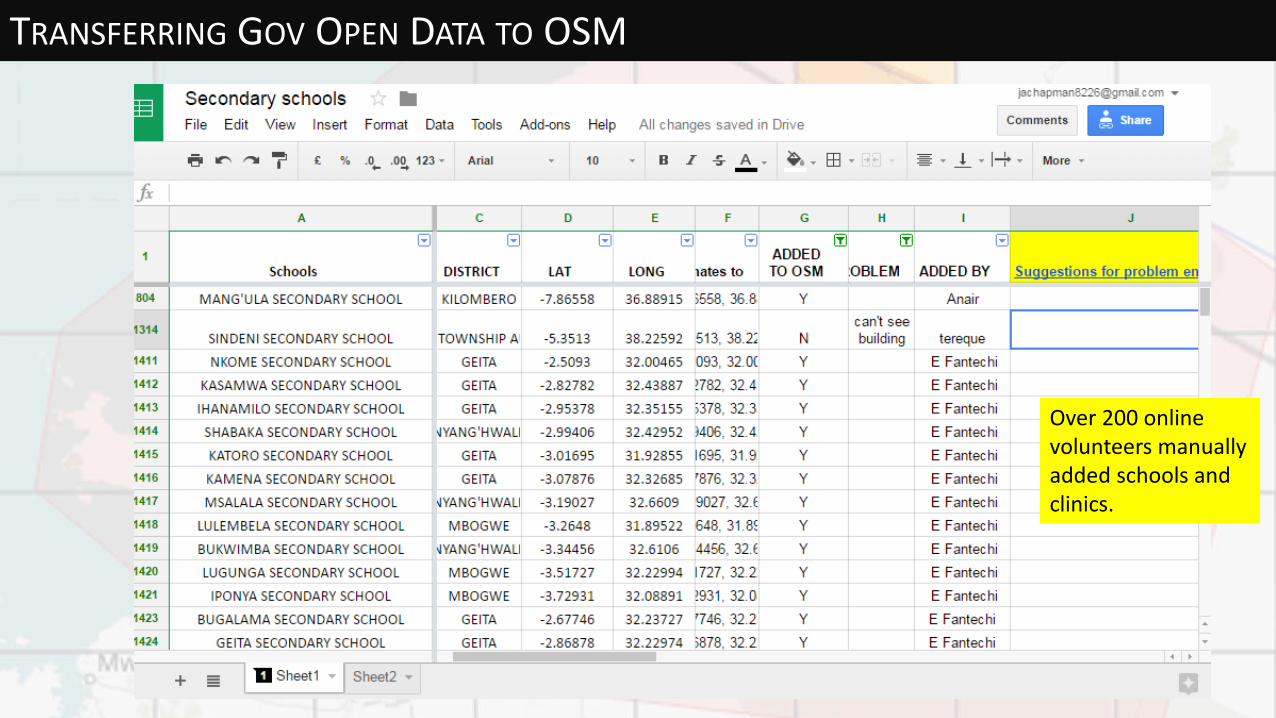
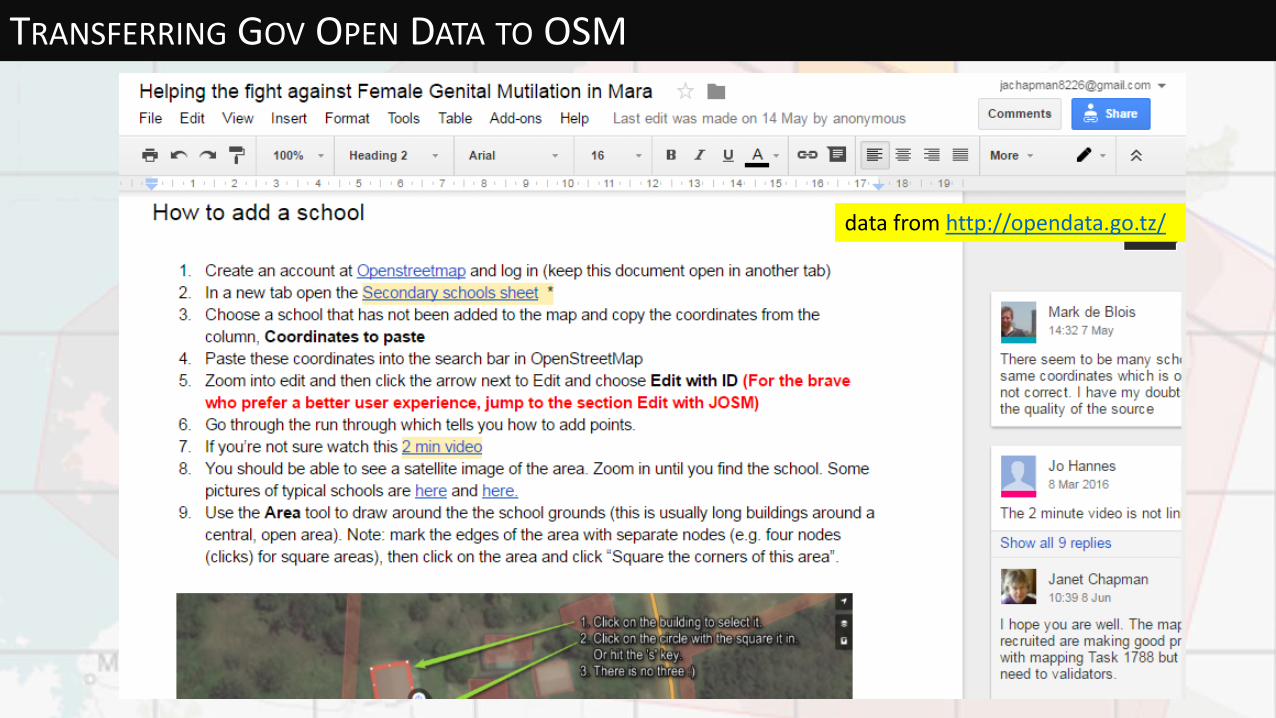
TRANSFERRING GOV OPEN DATA TO OSM
Over 200 online volunteers manually added schools and clinics.
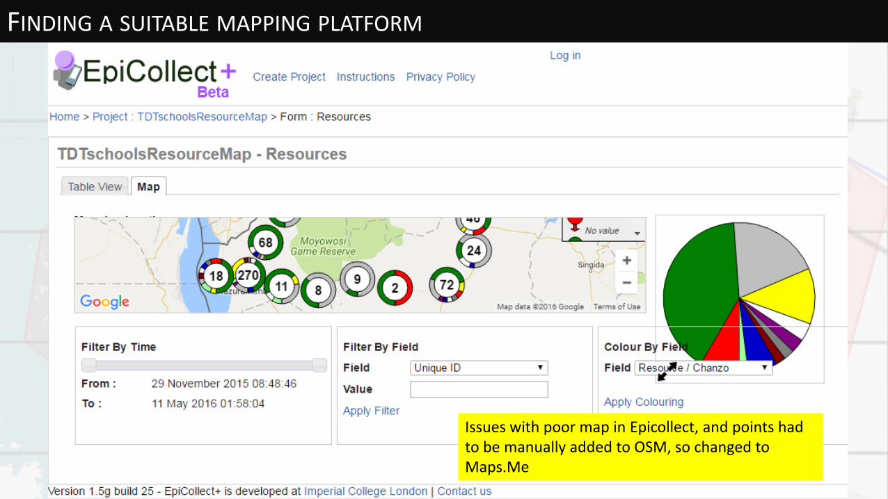
FINDING A SUITABLE MAPPING PLATFORM
Issues with poor map in Epicollect, and points had to be manually added to OSM, so changed to Maps.Me
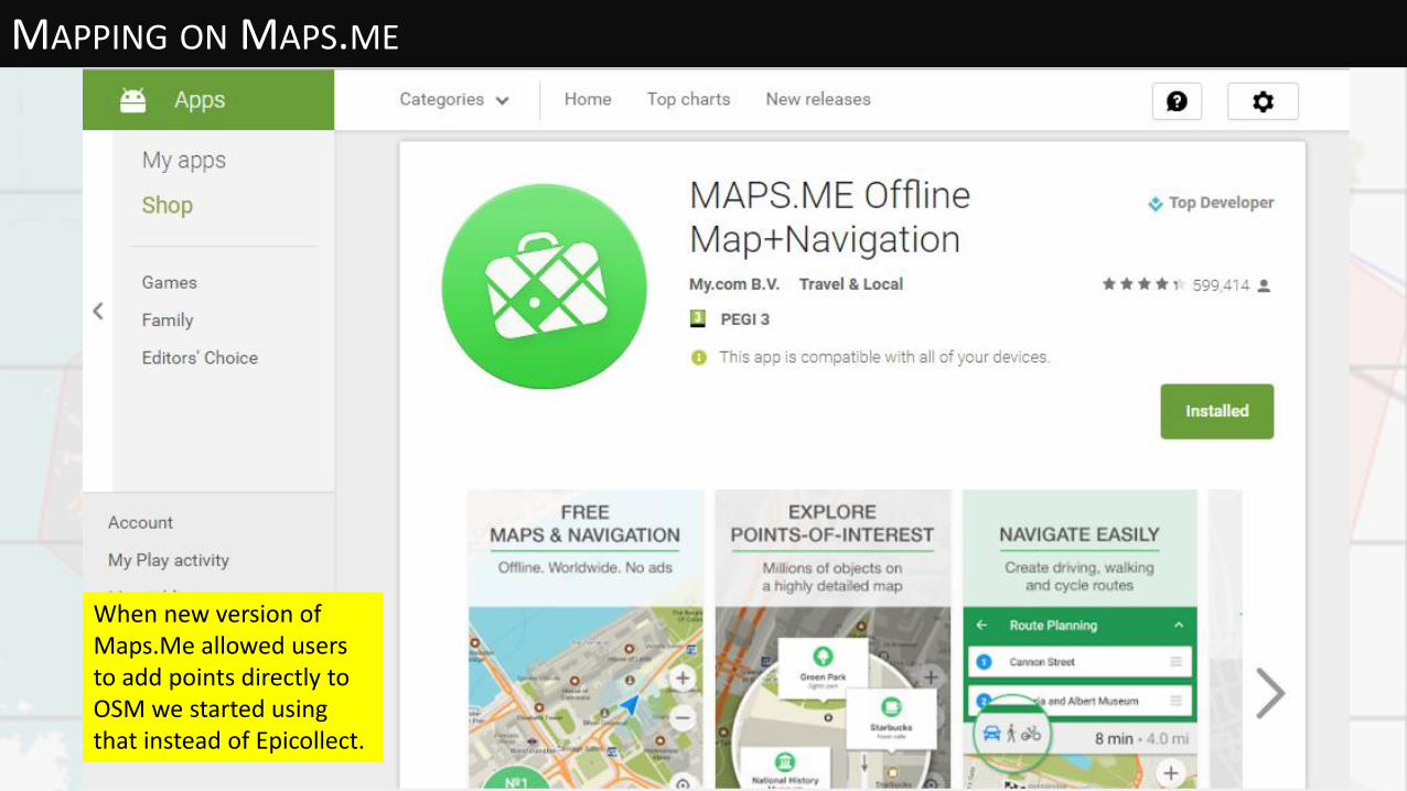
MAPPING ON MAPS.ME
When new version of Maps.Me allowed users to add points directly to OSM we started using that instead of Epicollect.

MAPPING ON MAPS.ME
Users in Tanzania loved Maps.Me, but long list of irrelevant categories causes confusion so Maps.Me are producing a cut down version, initially in English, but later in Swahili too.

MAPPING COMPETITION!
Sharing the leader board on What’s App groups was good at increasing motivation
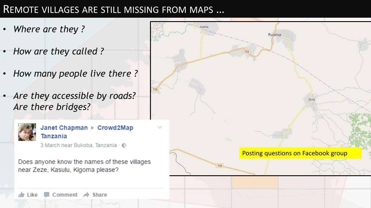
REMOTE VILLAGES ARE STILL MISSING FROM MAPS …
• Where are they ?
• How are they called ?
• How many people live there ?
• Are they accessible by roads?
Are there bridges?
Posting questions on Facebook group
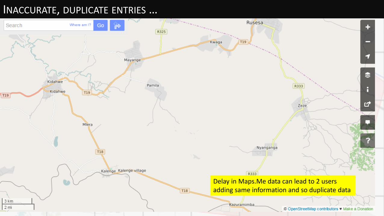
INACCURATE, DUPLICATE ENTRIES …
Delay in Maps.Me data can lead to 2 users adding same information and so duplicate data

COMMUNICATION: FACEBOOK
Volunteer mappers were using their own smartphones which were generally low spec and often had issues with finding GPS
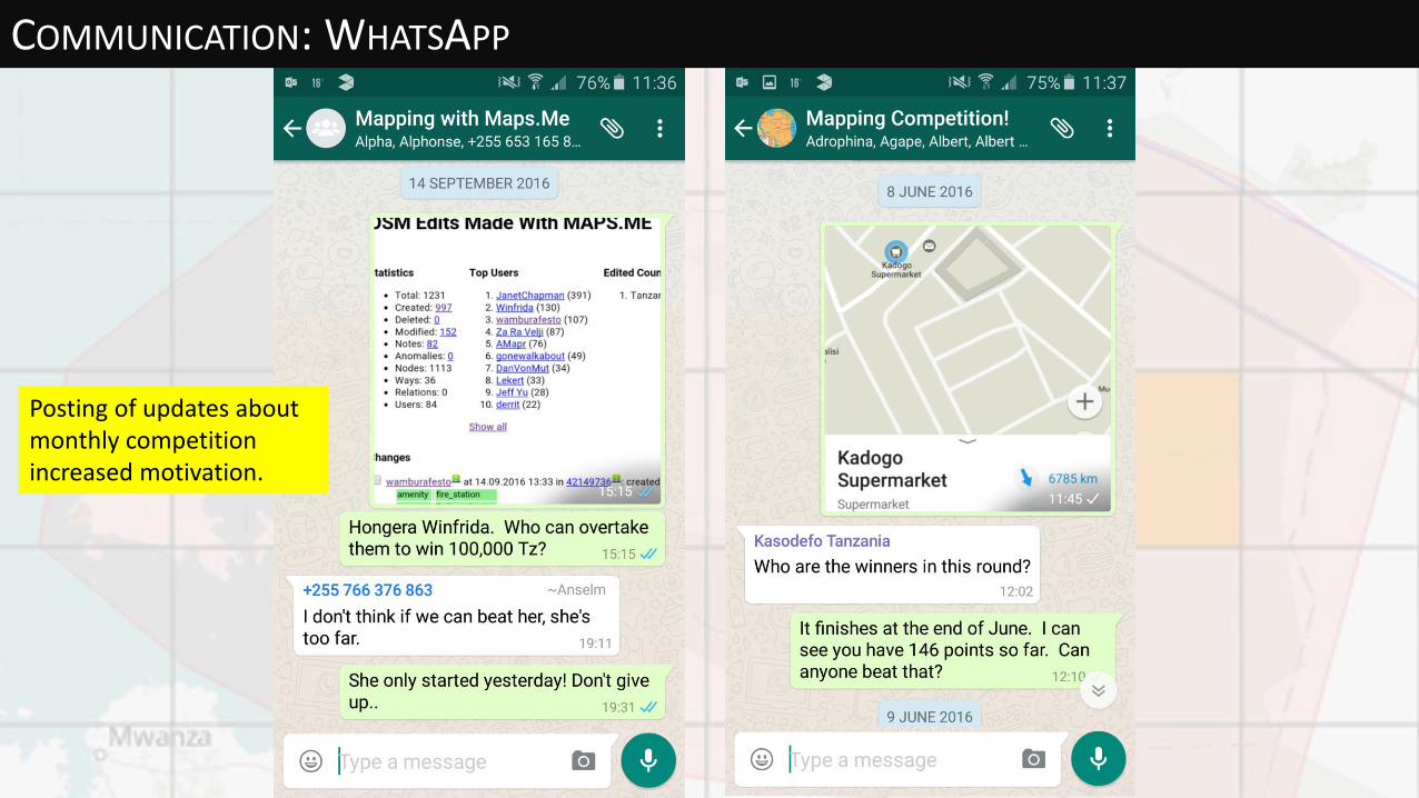
COMMUNICATION: WHATSAPP
Posting of updates about monthly competition increased motivation.

SATELLITE MAPPING VIA HOT TASK MANAGER /project/1788
http://tasks.hotosm.org/project/1788#
We need to finish this before the cutting season starts in December.
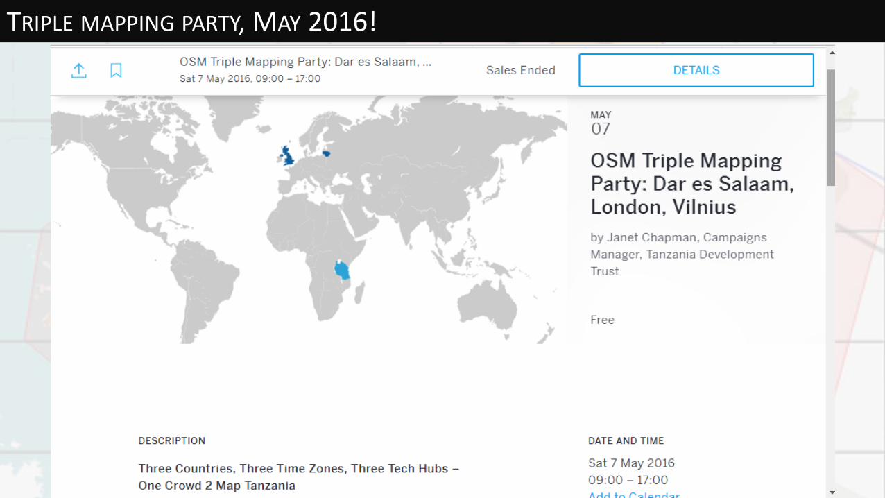
TRIPLE MAPPING PARTY, MAY 2016!

SATELLITE MAPPING EVENTS BY VOLUNTEERS
Ramani Huriavolunteers mapping Mugumu on May 7th
2016 in Dar es Salaam.
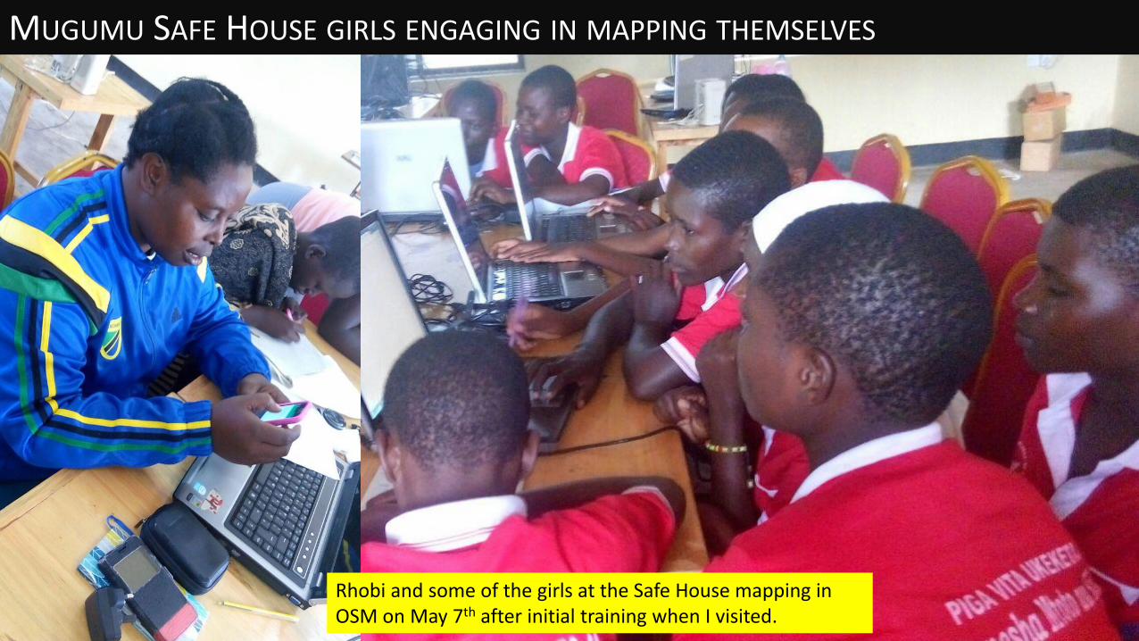
MUGUMU SAFE HOUSE GIRLS ENGAGING IN MAPPING THEMSELVES
Rhobi and some of the girls at the Safe House mapping in OSM on May 7th after initial training when I visited.

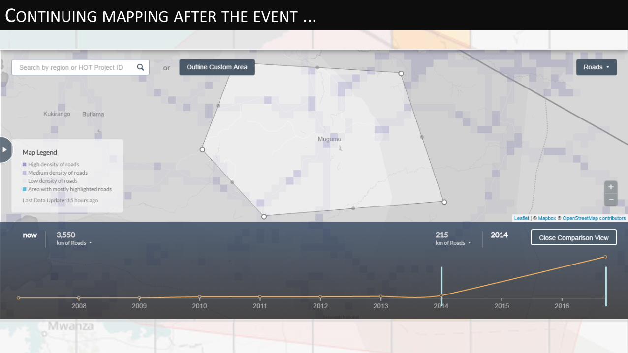
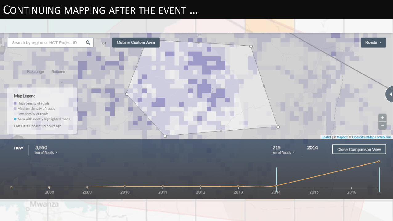
CONTINUING MAPPING AFTER THE EVENT …
http://osm-analytics.org/#/
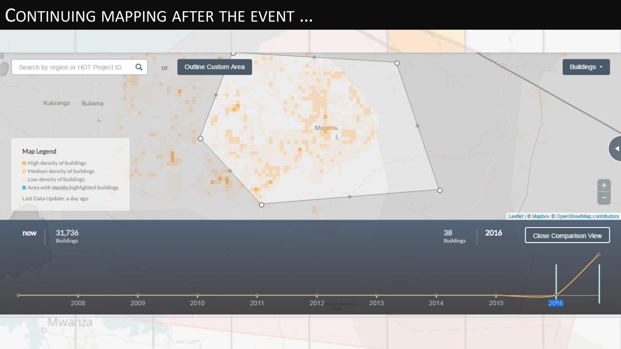
CONTINUING MAPPING AFTER THE EVENT …
CONTINUING MAPPING AFTER THE EVENT …
CONTINUING MAPPING AFTER THE EVENT …
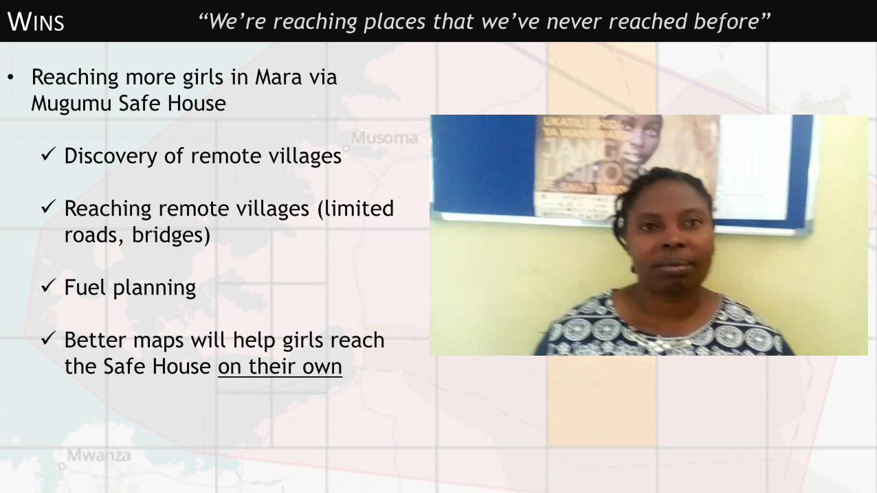
WINS
• Reaching more girls in Mara via
Mugumu Safe House
Discovery of remote villages
Reaching remote villages (limited
roads, bridges)
Fuel planning
Better maps will help girls reach
the Safe House on their own
“We’re reaching places that we’ve never reached before”

MAPILLARY IN TANZANIA
Starting to add photos of terrain using Mapillary – particularly useful to show road conditions in the rainy season.
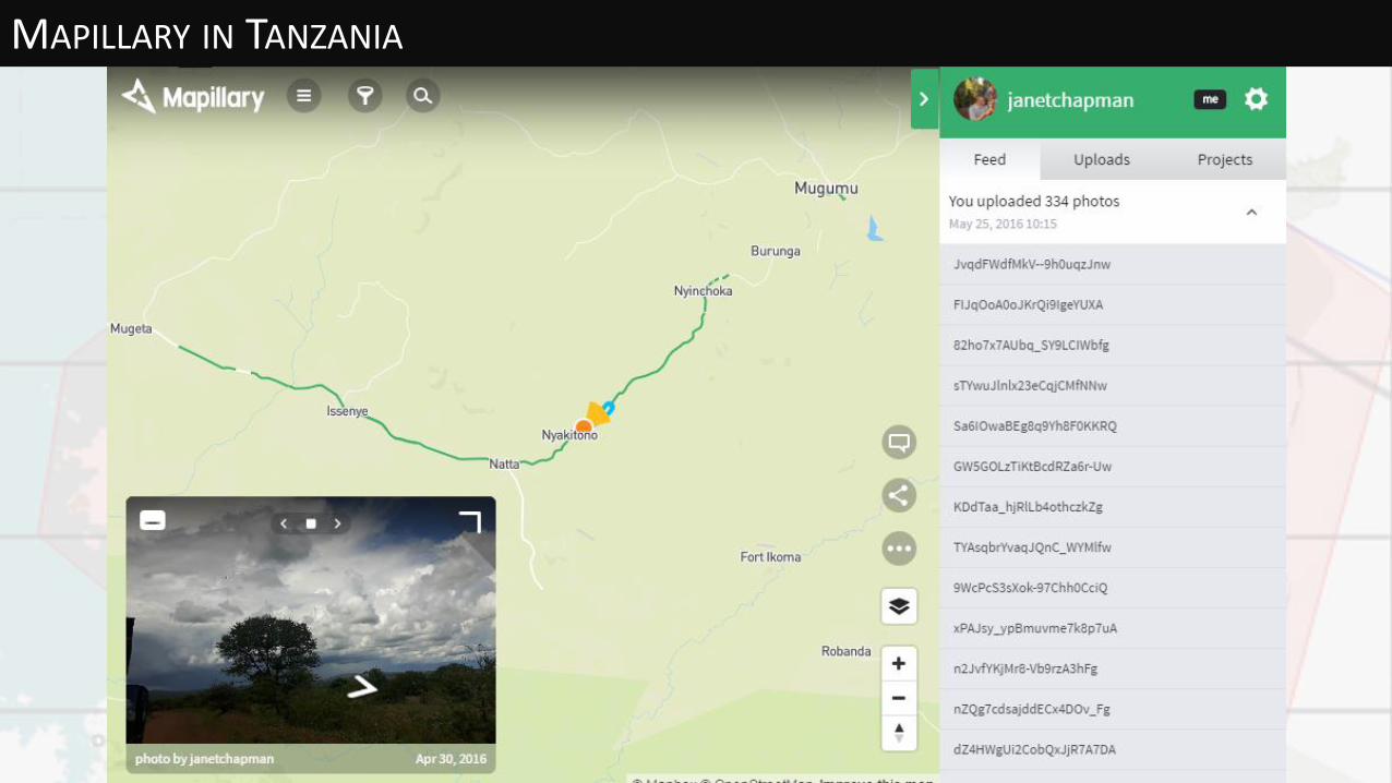
MAPILLARY IN TANZANIA
Develop Swahili version of Maps.Me
Get more phones before next training round in November 2016
Project to map clinics and villages in Maswa requested by District Medical
Officer
Validators needed
Funding to continue Mapping Competitions for locals & mapathons
Funding for training local “mapping experts”
Bimonthly Crowd2Map mapathons to be organized in Vilnius, Technarium
from this autumn
NEXT STEPS
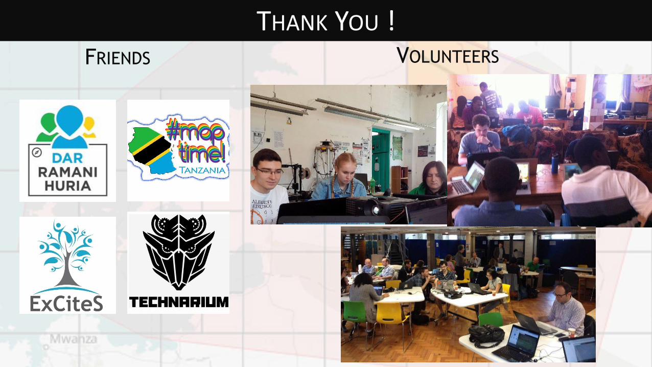
FRIENDS
THANK YOU !VOLUNTEERS