Embed Size (px)
Citation preview
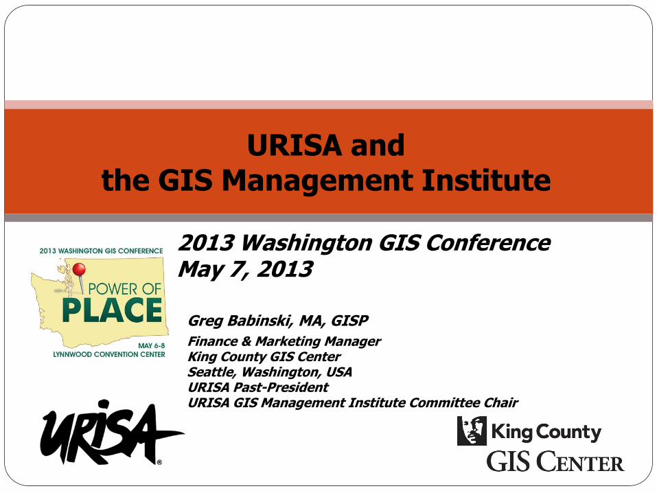
URISA and the GIS Management Institute
Greg Babinski, MA, GISP
Finance & Marketing Manager King County GIS Center Seattle, Washington, USA URISA Past-President URISA GIS Management Institute Committee Chair
2013 Washington GIS Conference May 7, 2013
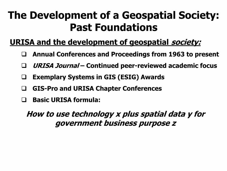
URISA and the development of geospatial society:
Annual Conferences and Proceedings from 1963 to present
URISA Journal – Continued peer-reviewed academic focus
Exemplary Systems in GIS (ESIG) Awards
GIS-Pro and URISA Chapter Conferences
Basic URISA formula:
How to use technology x plus spatial data y for government business purpose z
The Development of a Geospatial Society: Past Foundations
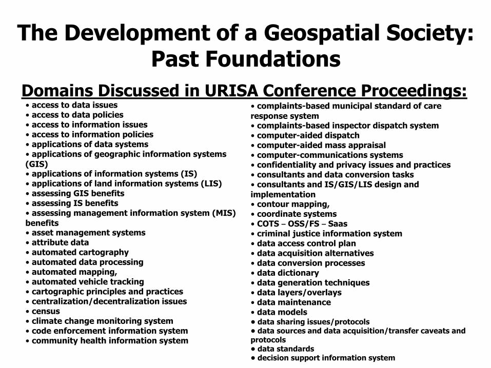
Domains Discussed in URISA Conference Proceedings:
The Development of a Geospatial Society: Past Foundations
• access to data issues
• access to data policies
• access to information issues
• access to information policies
• applications of data systems
• applications of geographic information systems
(GIS) • applications of information systems (IS)
• applications of land information systems (LIS)
• assessing GIS benefits
• assessing IS benefits
• assessing management information system (MIS)
benefits • asset management systems
• attribute data
• automated cartography
• automated data processing
• automated mapping, • automated vehicle tracking
• cartographic principles and practices
• centralization/decentralization issues
• census
• climate change monitoring system
• code enforcement information system
• community health information system
• complaints-based municipal standard of care
response system • complaints-based inspector dispatch system
• computer-aided dispatch
• computer-aided mass appraisal • computer-communications systems
• confidentiality and privacy issues and practices
• consultants and data conversion tasks
• consultants and IS/GIS/LIS design and
implementation • contour mapping, • coordinate systems
• COTS – OSS/FS – Saas
• criminal justice information system
• data access control plan
• data acquisition alternatives
• data conversion processes
• data dictionary
• data generation techniques
• data layers/overlays
• data maintenance
• data models • data sharing issues/protocols • data sources and data acquisition/transfer caveats and protocols • data standards • decision support information system

URISA and the development of geospatial society: Daylong URISA Workshops:
3D Geospatial: Project Implementation Methods and Best Practices
Addresses and IS/GIS Implementation: Key to GIS Success
An Overview of Open Source GIS Software
Asset Management: Planning, Strategy, and Implementation
Business Intelligence and Data Integration for the GIS Professional -NEW
Building Quality Spatial Data
Cartography and Map Design
eGovernment-Planning, Policy and the Portal
Field Automation Options for Local Government
GIS Enterprise Architecture & System Integration
GIS Program Management
GIS Strategic Planning
Introduction to Agile: Project Management and Development
An Introduction to Public Participation GIS: Using GIS to Support Community Decision Making
LIDAR Concepts, Principles and Application
Public Data, Public Access, Privacy, and Security: U.S. Law and Policy
Transportation Spatial Database Design
Quality Management: Introduction to Issue Tracking
The Development of a Geospatial Society: Present Contributions
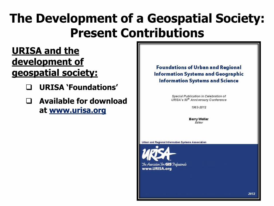
URISA and the development of geospatial society:
URISA ‘Foundations’
Available for download at www.urisa.org
The Development of a Geospatial Society: Present Contributions
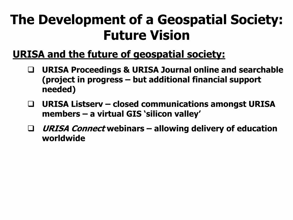
URISA and the future of geospatial society:
URISA Proceedings & URISA Journal online and searchable (project in progress – but additional financial support needed)
URISA Listserv – closed communications amongst URISA members – a virtual GIS ‘silicon valley’
URISA Connect webinars – allowing delivery of education worldwide
The Development of a Geospatial Society: Future Vision

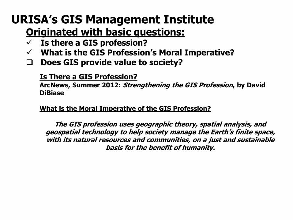
URISA’s GIS Management Institute Originated with basic questions: Is there a GIS profession? What is the GIS Profession’s Moral Imperative? Does GIS provide value to society?

URISA’s GIS Management Institute
Originated with basic questions:
Is there a GIS profession?
2010 -URISA Commits to Develop Tier 9: The Geospatial Management Competency Model
URISA GMCM Core Team: David DiBiase Patrick Kennelly Greg Babinski
Coordination with USDOLETA URISA’s GMCM delivered to DOLETA June 8, 2012
http://www.urisa.org/gmcm_review
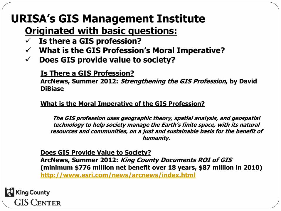
URISA’s GIS Management Institute Originated with basic questions: Is there a GIS profession? What is the GIS Profession’s Moral Imperative? Does GIS provide value to society?
Is There a GIS Profession? ArcNews, Summer 2012: Strengthening the GIS Profession, by David DiBiase What is the Moral Imperative of the GIS Profession?
The GIS profession uses geographic theory, spatial analysis, and geospatial technology to help society manage the Earth’s finite space, with its natural resources and communities, on a just and sustainable
basis for the benefit of humanity.

Consultant Team from UW Evans School of Public Affairs:
Prof. Richard W. Zerbe
Danielle Fumia & Travis Reynolds
Pradeep Singh & Tyler Scott
King County GIS ROI Study
URISA’s GIS Management Institute Originated with basic questions: Is there a GIS profession? What is the GIS Profession’s Moral Imperative? Does GIS provide value to society?
Is There a GIS Profession? ArcNews, Summer 2012: Strengthening the GIS Profession, by David DiBiase What is the Moral Imperative of the GIS Profession?
The GIS profession uses geographic theory, spatial analysis, and geospatial technology to help society manage the Earth’s finite space, with its natural
resources and communities, on a just and sustainable basis for the benefit of humanity.
Does GIS Provide Value to Society? ArcNews, Summer 2012: King County Documents ROI of GIS (minimum $776 million net benefit over 18 years, $87 million in 2010) http://www.esri.com/news/arcnews/index.html
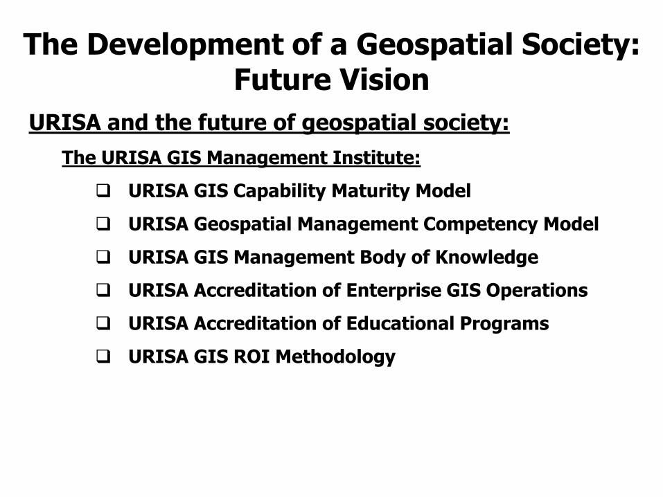
URISA and the future of geospatial society:
The URISA GIS Management Institute:
URISA GIS Capability Maturity Model
URISA Geospatial Management Competency Model
URISA GIS Management Body of Knowledge
URISA Accreditation of Enterprise GIS Operations
URISA Accreditation of Educational Programs
URISA GIS ROI Methodology
The Development of a Geospatial Society: Future Vision

GIS operations are maturing – or they should be
GIS operations manage large capital investments
GIS operations require large operating budgets
GIS is a proven technology for effective municipal administration (standard of care)
GIS operations deliver huge returns on investment
Local agency leaders and managers must deploy GIS for cost-effective government services
Local agencies will be compelled to deploy GIS to comply with ‘standard of care’ imperatives
Geospatial technology is complex, continues to evolve, and continues to provide new opportunities
The management of municipal GIS operations is complex, evolving, and requires a scientific, professional approach
URISA’s GIS Management Institute What is the Business Need?
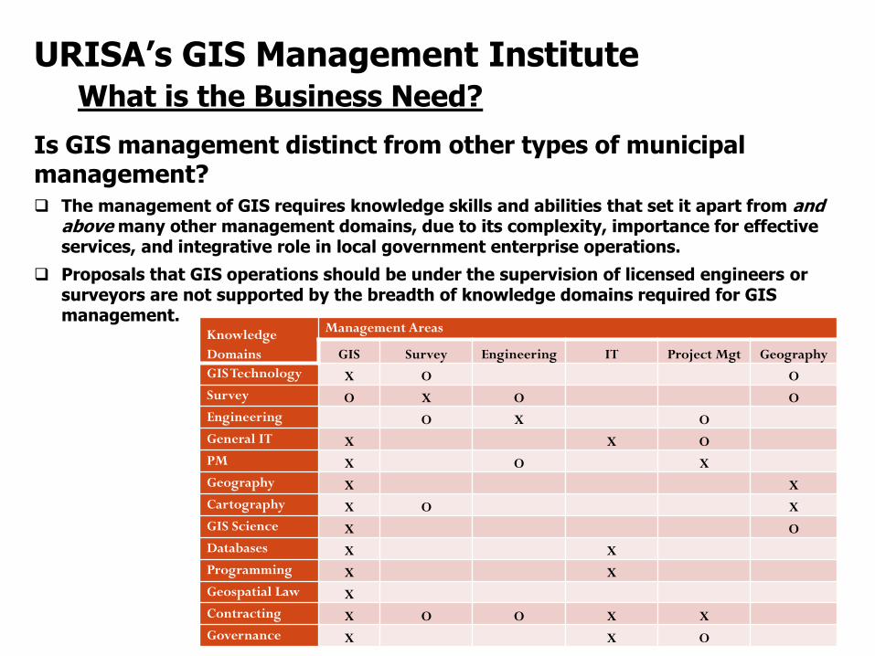
Is GIS management distinct from other types of municipal management? The management of GIS requires knowledge skills and abilities that set it apart from and
above many other management domains, due to its complexity, importance for effective services, and integrative role in local government enterprise operations.
Proposals that GIS operations should be under the supervision of licensed engineers or surveyors are not supported by the breadth of knowledge domains required for GIS management.
URISA’s GIS Management Institute What is the Business Need?
Knowledge
Domains
Management Areas
GIS Survey Engineering IT Project Mgt Geography
GIS Technology X O O
Survey O X O O
Engineering O X O
General IT X X O
PM X O X
Geography X X
Cartography X O X
GIS Science X O
Databases X X
Programming X X
Geospatial Law X
Contracting X O O X X
Governance X X O
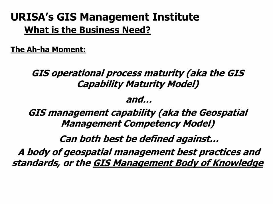
The Ah-ha Moment:
GIS operational process maturity (aka the GIS Capability Maturity Model)
and…
GIS management capability (aka the Geospatial Management Competency Model)
Can both best be defined against…
A body of geospatial management best practices and standards, or the GIS Management Body of Knowledge
URISA’s GIS Management Institute What is the Business Need?
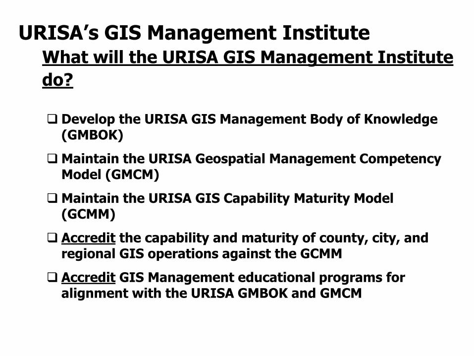
Develop the URISA GIS Management Body of Knowledge (GMBOK)
Maintain the URISA Geospatial Management Competency Model (GMCM)
Maintain the URISA GIS Capability Maturity Model (GCMM)
Accredit the capability and maturity of county, city, and regional GIS operations against the GCMM
Accredit GIS Management educational programs for alignment with the URISA GMBOK and GMCM
URISA’s GIS Management Institute What will the URISA GIS Management Institute
do?
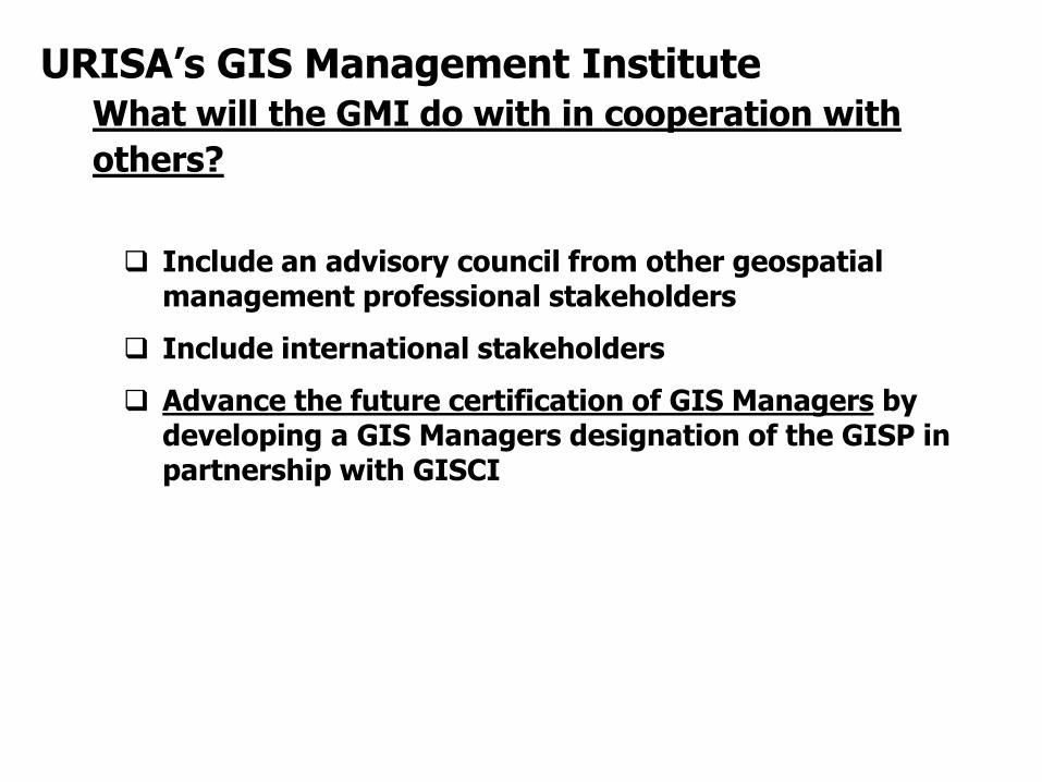
Include an advisory council from other geospatial management professional stakeholders
Include international stakeholders
Advance the future certification of GIS Managers by developing a GIS Managers designation of the GISP in partnership with GISCI
URISA’s GIS Management Institute What will the GMI do with in cooperation with
others?
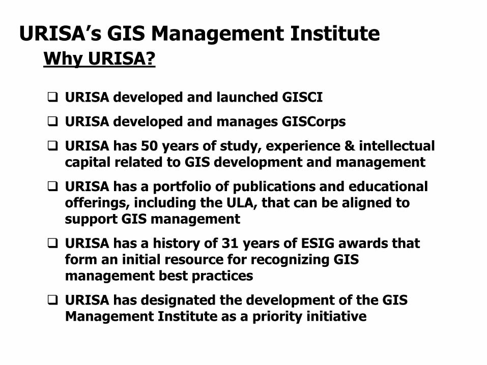
URISA developed and launched GISCI
URISA developed and manages GISCorps
URISA has 50 years of study, experience & intellectual capital related to GIS development and management
URISA has a portfolio of publications and educational offerings, including the ULA, that can be aligned to support GIS management
URISA has a history of 31 years of ESIG awards that form an initial resource for recognizing GIS management best practices
URISA has designated the development of the GIS Management Institute as a priority initiative
URISA’s GIS Management Institute Why URISA?

URISA’s GIS Management Institute Who will use the GMI, and why?
Babinski’s Theory of GIS Management:
As GIS Operational Maturity Improves, ROI Increases
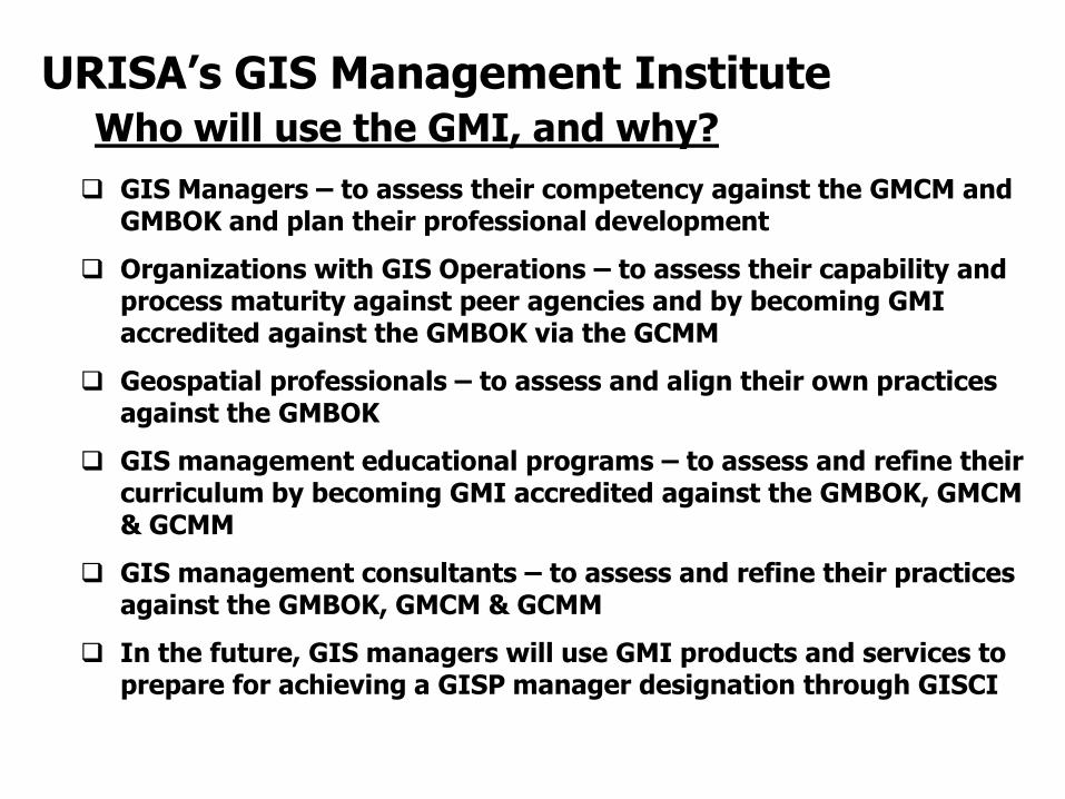
GIS Managers – to assess their competency against the GMCM and GMBOK and plan their professional development
Organizations with GIS Operations – to assess their capability and process maturity against peer agencies and by becoming GMI accredited against the GMBOK via the GCMM
Geospatial professionals – to assess and align their own practices against the GMBOK
GIS management educational programs – to assess and refine their curriculum by becoming GMI accredited against the GMBOK, GMCM & GCMM
GIS management consultants – to assess and refine their practices against the GMBOK, GMCM & GCMM
In the future, GIS managers will use GMI products and services to prepare for achieving a GISP manager designation through GISCI
URISA’s GIS Management Institute Who will use the GMI, and why?
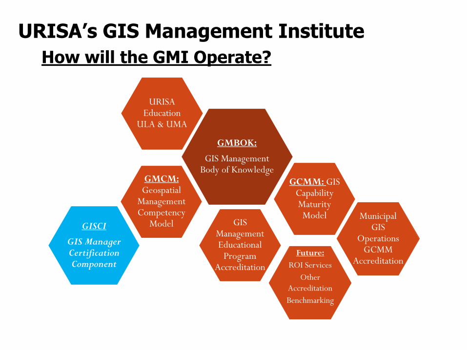
URISA’s GIS Management Institute
How will the GMI Operate?
GMBOK:
GIS Management Body of Knowledge
Municipal GIS
Operations GCMM
Accreditation
GCMM: GIS Capability Maturity Model
URISA Education
ULA & UMA
GIS Management Educational
Program Accreditation
GISCI
GIS Manager Certification Component
GMCM: Geospatial
Management Competency
Model
Future:
ROI Services
Other
Accreditation
Benchmarking
URISA’s GIS Management Institute
How will the GMI Operate?
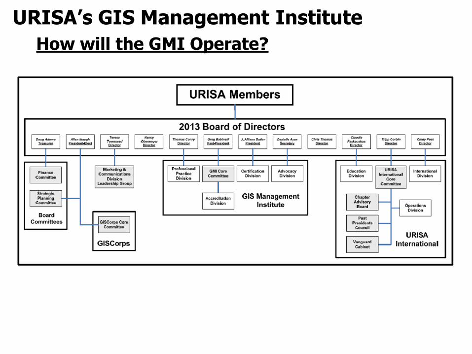
URISA’s GIS Management Institute
How will the GMI Operate?

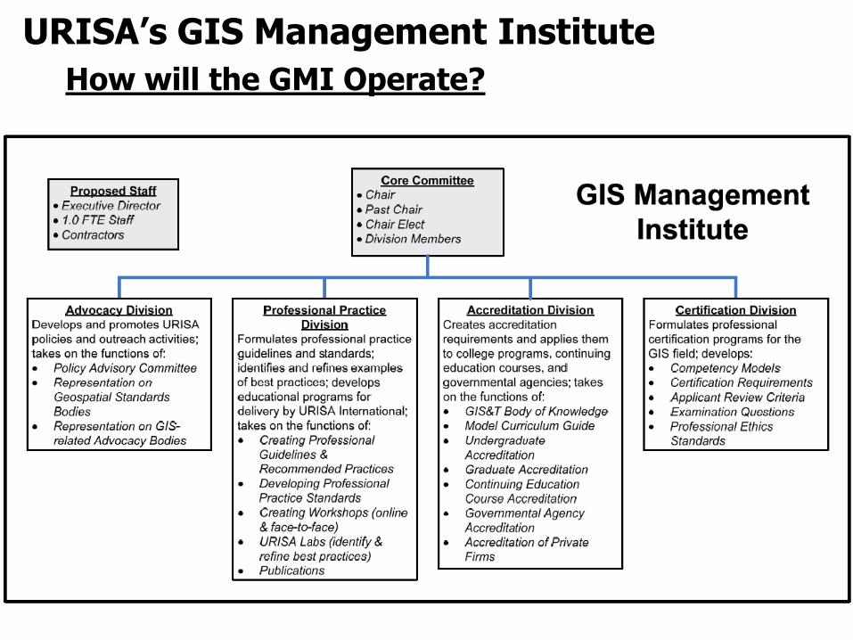
URISA’s GIS Management Institute How will the GMI Operate?
Four URISA Labs have been mobilized. First reports and Best Practices to be presented at GIS-Pro 2013
Greg Babinski, MA, GISP URISA Past-President URISA GIS Management Institute Committee Chair
Finance & Marketing Manager King County GIS Center 201 South Jackson Street, Suite 706 Seattle, WA 98104 206-263-3753 [email protected] www.kingcounty.gov/gis URISA - The Association for GIS Professionals www.urisa.org
For more information: GMI Home Page: www.urisa.org/GIS_Management_Institute
GMI Proposal: www.urisa.org/files/GMIProp20121127.pdf
GIS Capability Maturity Model Public Review: www.urisa.org/GMI_GCMM_PublicReview