Embed Size (px)
Citation preview
Wikimedia/British Library map mapping project
– review and latest update
How to find 50,000 maps in a haystack of 1,000,000 images; geolocate them, and categorise them
... on a budget of no not many euros.
James Heald,Wikimedia volunteer
(User:Jheald)
Kimberly Kowal,British Library
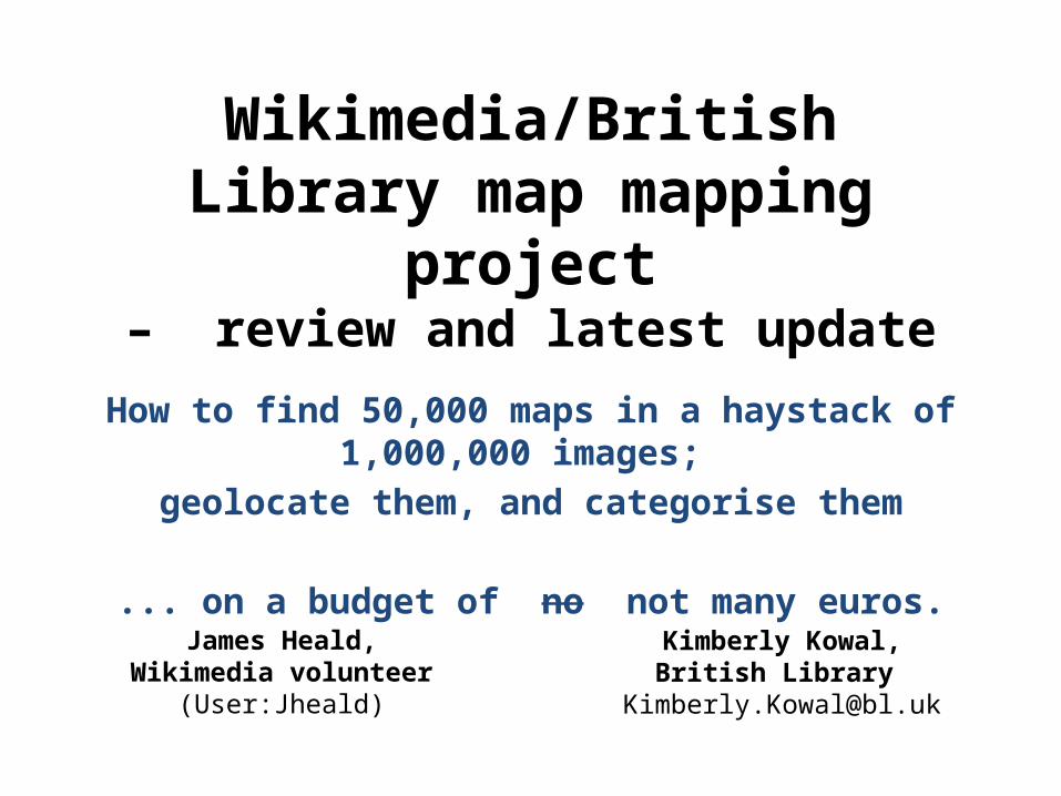
1,000,000 imagesFantastic, but …

Very limited metadata

Very limited metadataCommons said no bulk upload

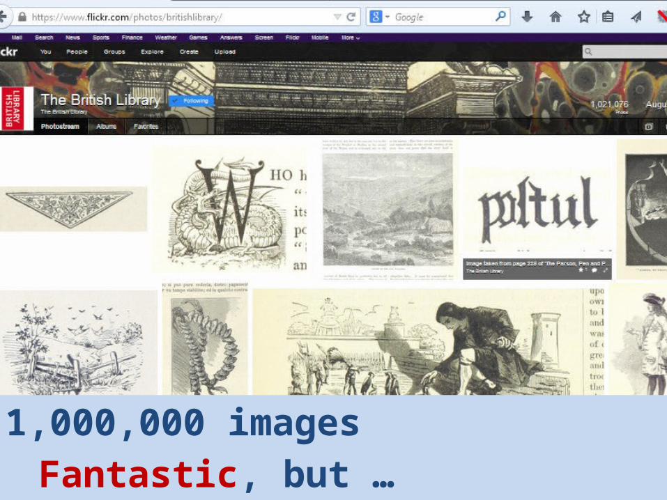
Volunteer response…
Create a subject index by book…

… encouraging images to be uploaded by the book(20,000 so far – majority by one user)
… however, manual categorisation of images isvery very time-consuming.

Could anything be done more automatically…
?
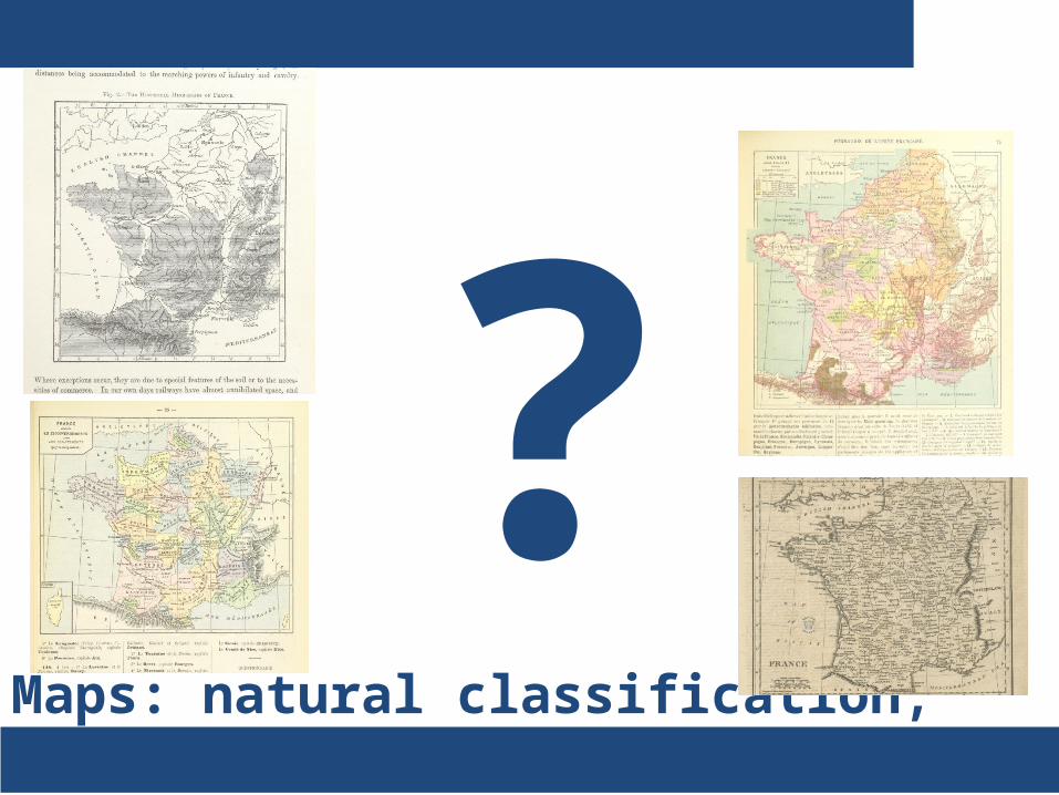
Maps: natural classification, given co-ordinates
Could anything be done more automatically…
?

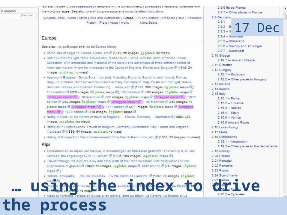
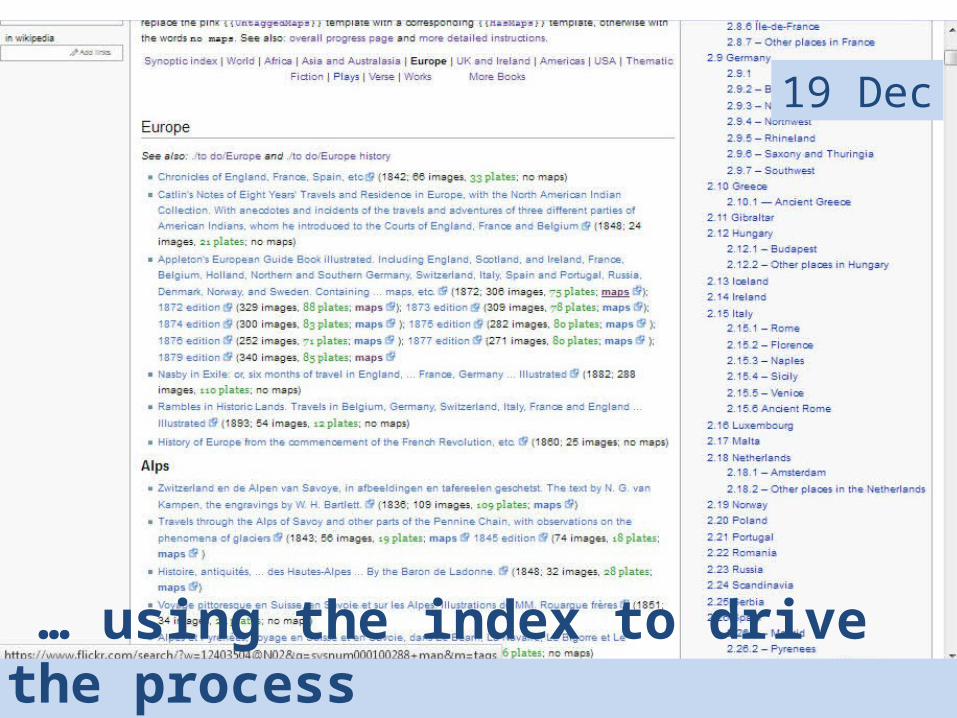
So: find the maps on Flickr, and tag them…

… using the index to drive the process
31 Oct

… using the index to drive the process
31 Oct

… using the index to drive the process
31 Oct

… using the index to drive the process
03 Nov
… using the index to drive the process
17 Dec
… using the index to drive the process
19 Dec
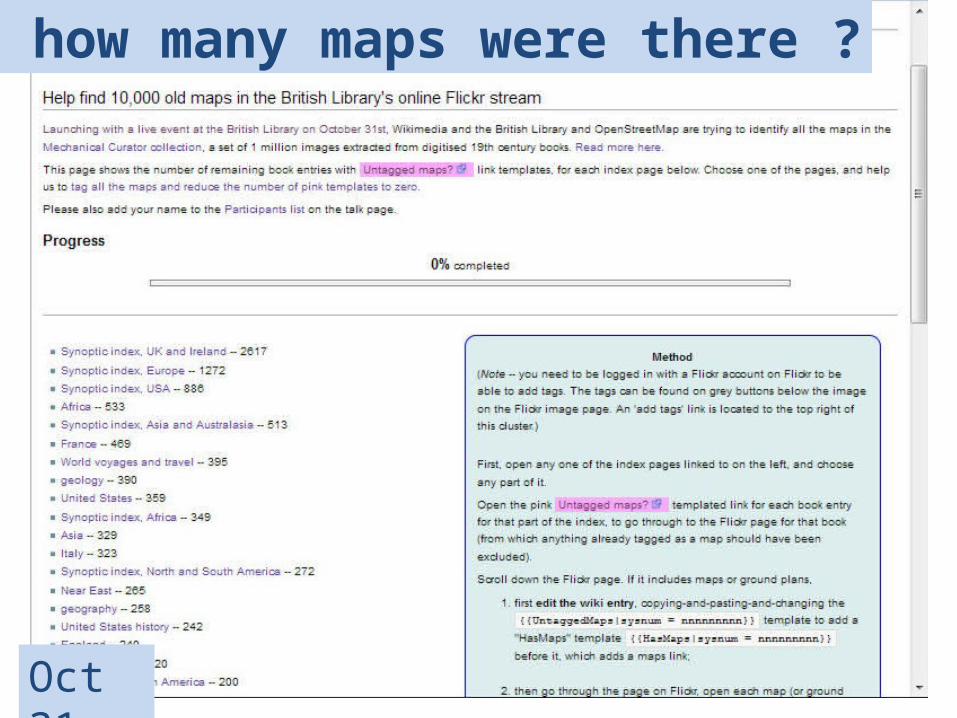
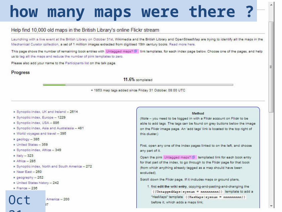
But how many maps were there ?
Oct 31
But how many maps were there ?
Oct 31
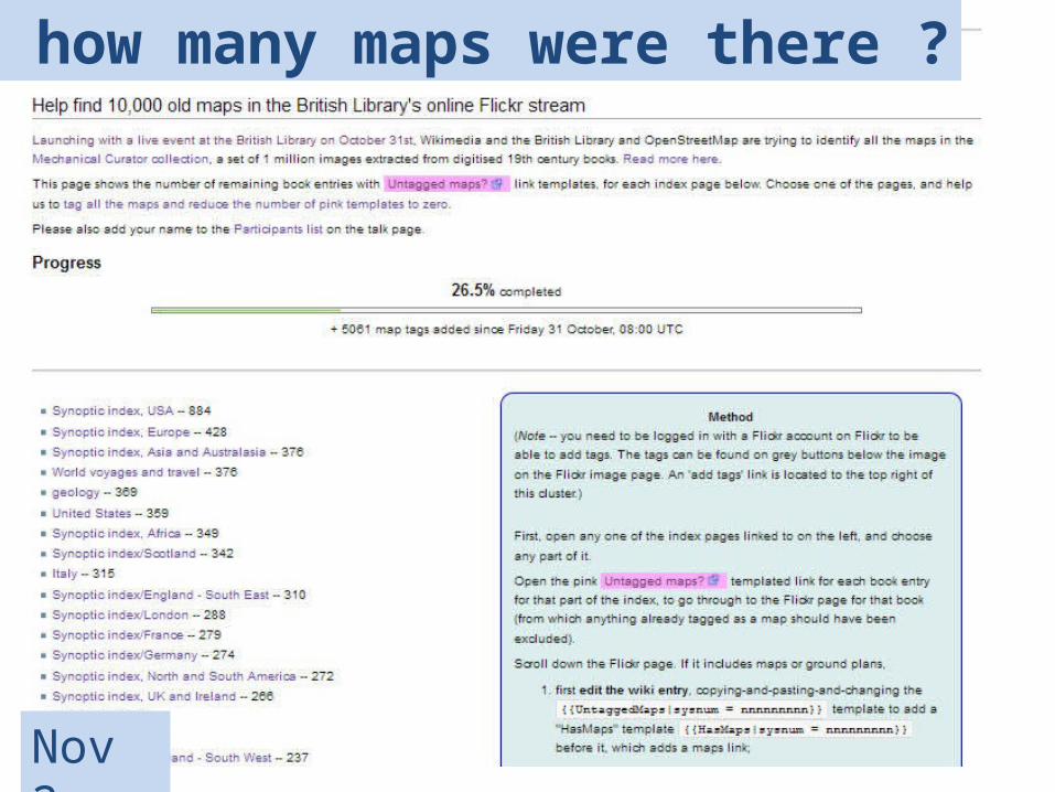
But how many maps were there ?
Nov 2
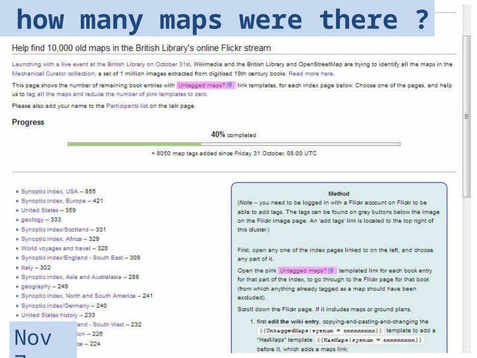
But how many maps were there ?
Nov 7
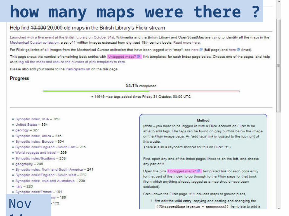
But how many maps were there ?
Nov 14
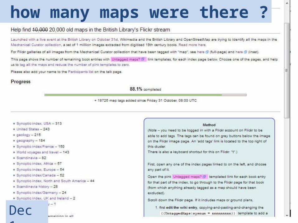
But how many maps were there ?
Dec 1
But how many maps were there ?
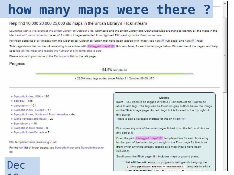
Dec 10
But how many maps were there ?
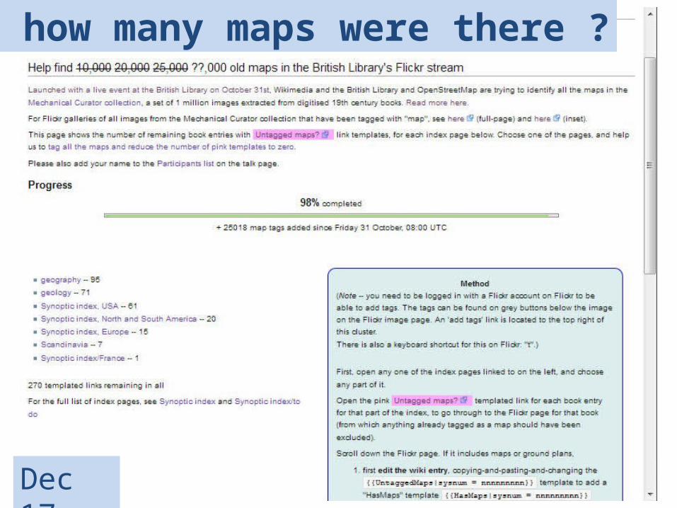
Dec 17
But how many maps were there ?
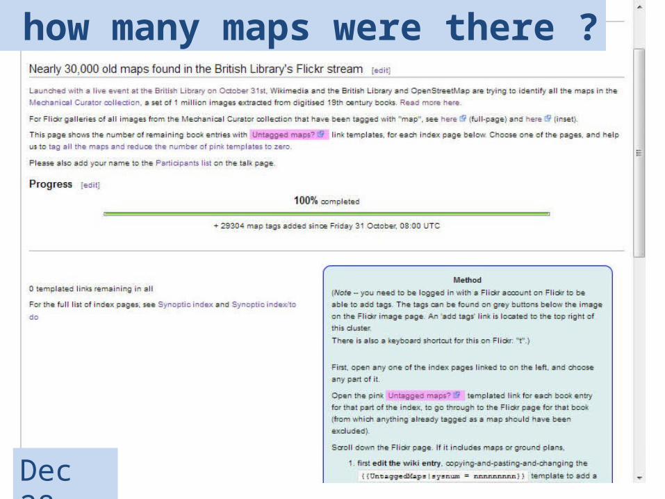
Dec 28
-- including 20,000 found independently by @Quasimondo, machine-assisted using his own pattern recognition methods
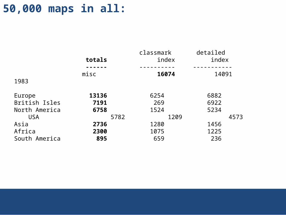
50,000 maps in all:
classmark detailed totals index index ------ ---------- ----------- misc 16074 14091 1983
Europe 13136 6254 6882British Isles 7191 269 6922North America 6758 1524 5234 USA 5782 1209 4573Asia 2736 1280 1456Africa 2300 1075 1225South America 895 659 236
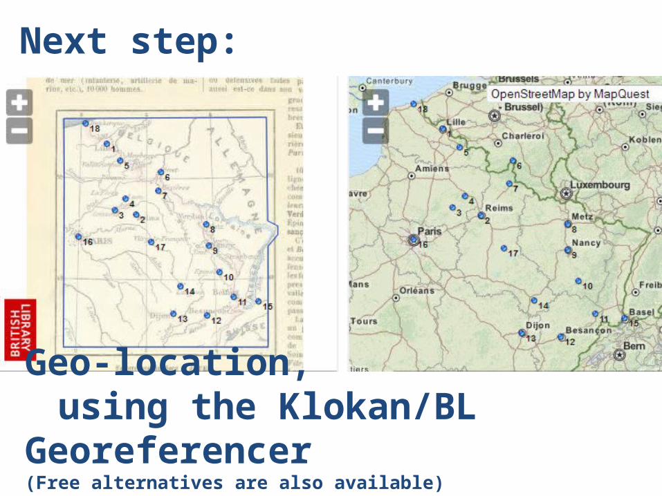
Geo-location, using the Klokan/BL Georeferencer
(Free alternatives are also available)
Next step:
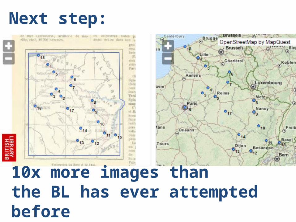
10x more images than the BL has ever attempted before
Next step:
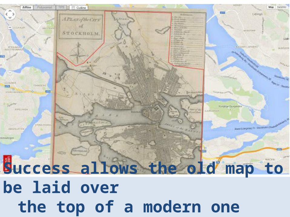
Success allows the old map to be laid over the top of a modern one
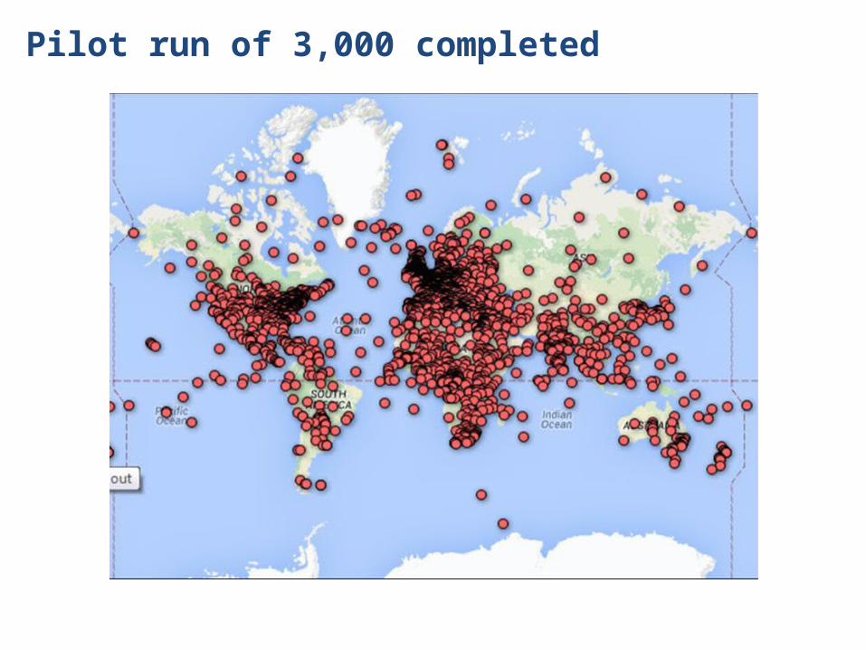
Pilot run of 3,000 completed
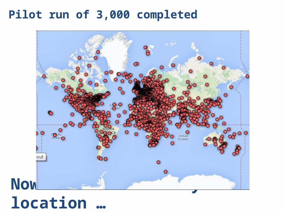
Now characterised by location …
Pilot run of 3,000 completed
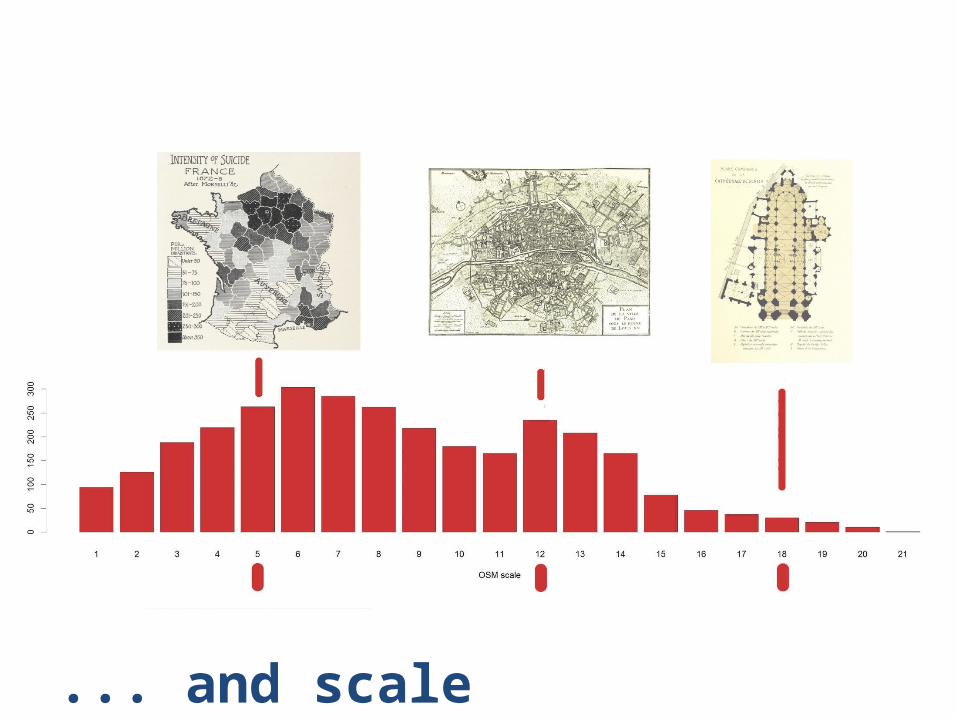
... and scale
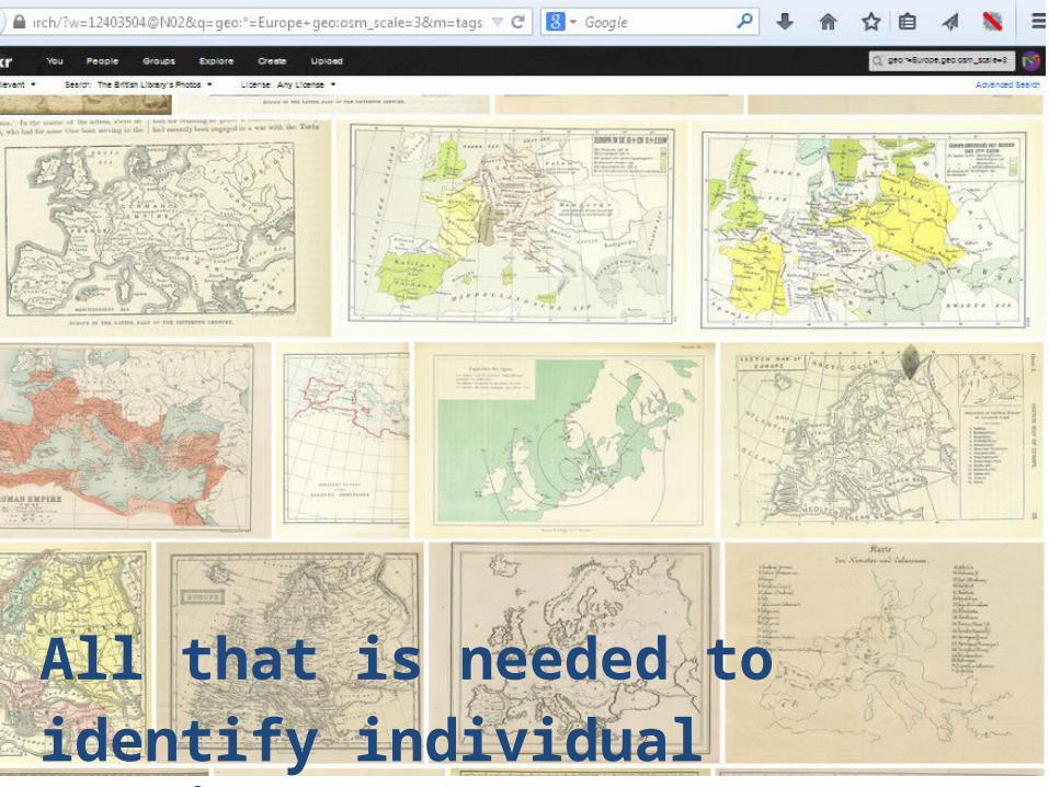
All that is needed to identify individual continents …
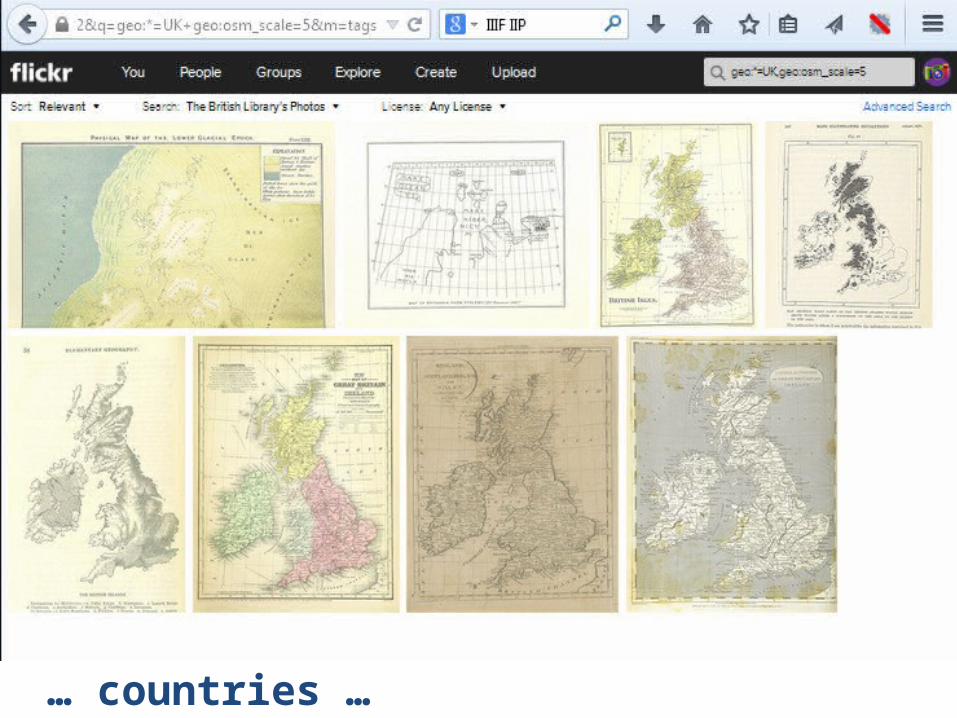
… countries …
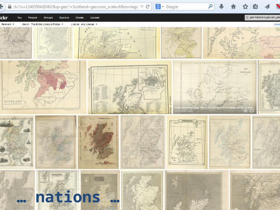
… nation …
… nations …
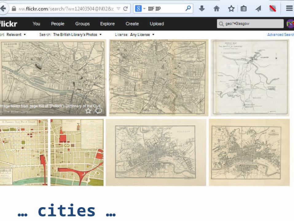
… cities …
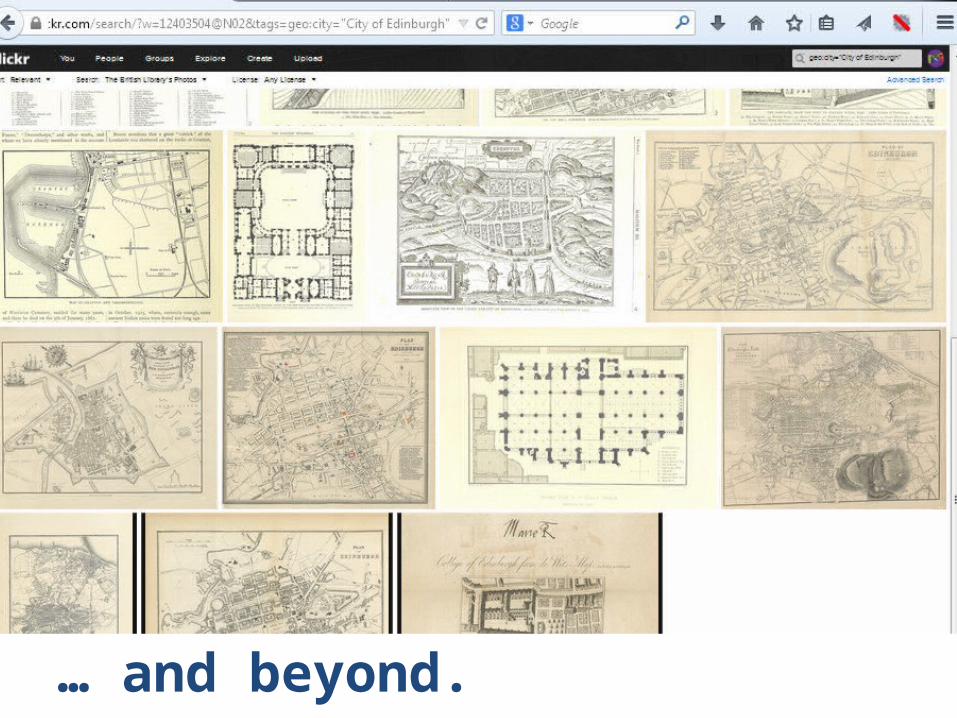
… and beyond
… and beyond.

Ready to be uploaded to Commons…
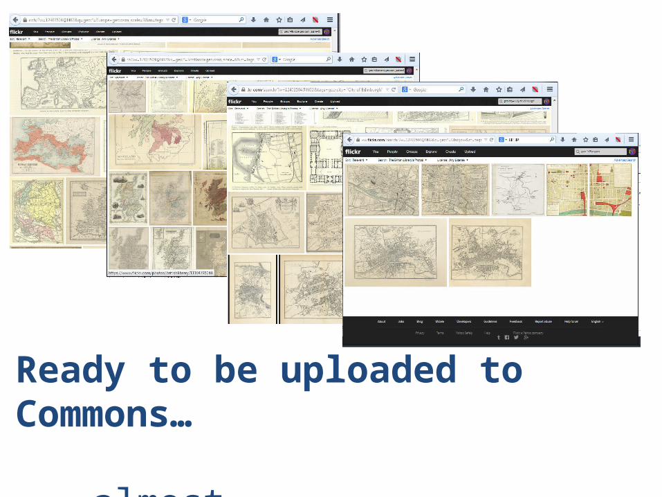
Ready to be uploaded to Commons…
… almost

To do list:
Better subject identification
Reasonable Commons categorisation
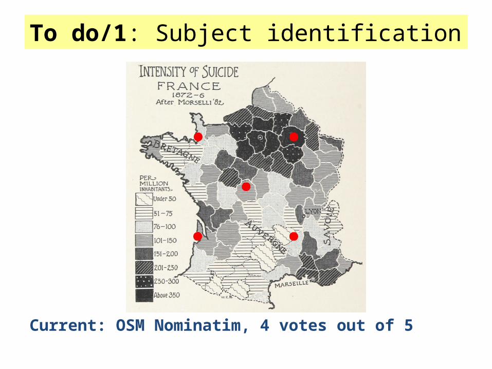
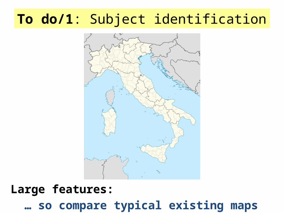
To do/1: Subject identification
Current: OSM Nominatim, 4 votes out of 5
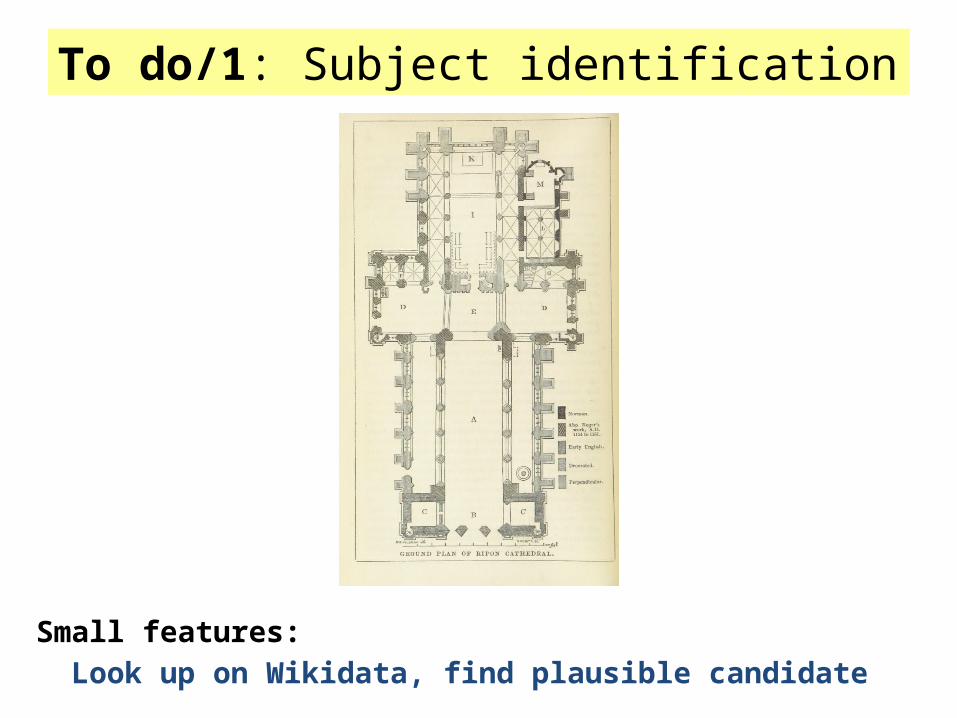
To do/1: Subject identification
Small features: Look up on Wikidata, find plausible candidate
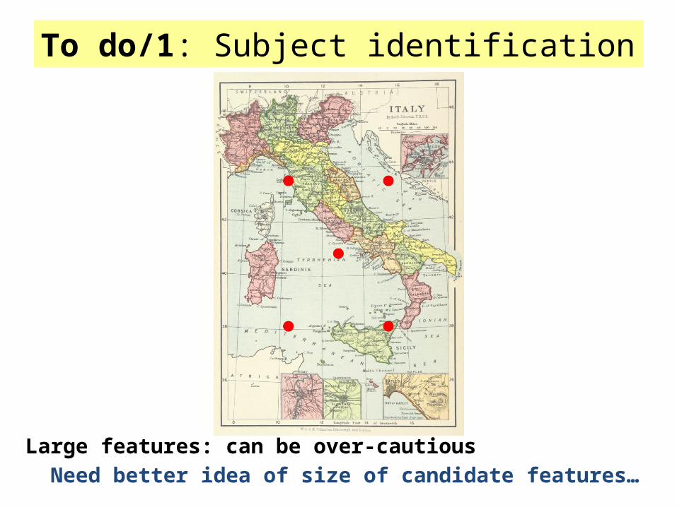
To do/1: Subject identification
Large features: can be over-cautiousNeed better idea of size of candidate features…
To do/1: Subject identification
Large features:… so compare typical existing maps
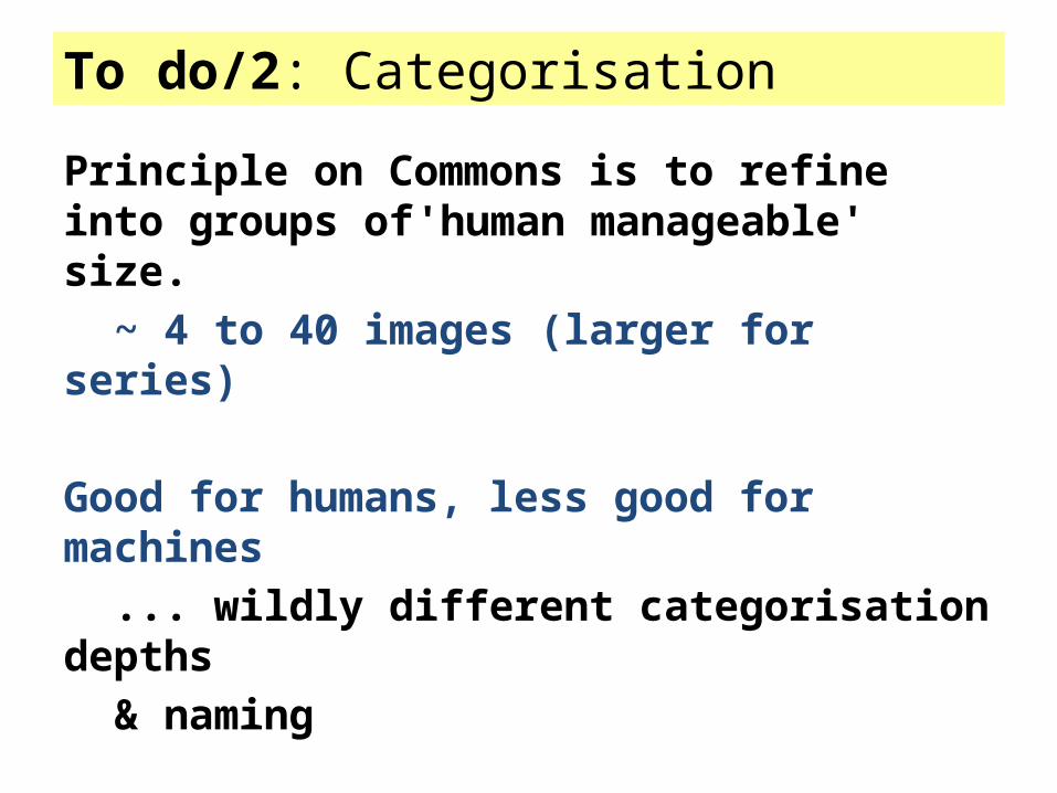
To do/2: Categorisation
Principle on Commons is to refine into groups of'human manageable' size.
~ 4 to 40 images (larger for series)
Good for humans, less good for machines... wildly different categorisation depths & naming
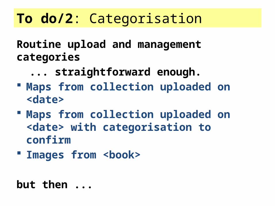
To do/2: Categorisation
Routine upload and management categories ... straightforward enough.
Maps from collection uploaded on <date> Maps from collection uploaded on <date> with
categorisation to confirm Images from <book>
but then ...
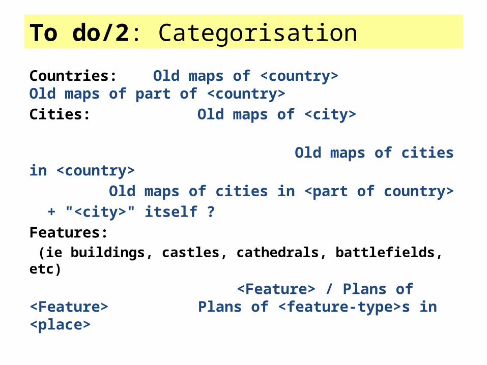
To do/2: Categorisation
Countries: Old maps of <country> Old maps of part of <country>Cities: Old maps of <city> Old maps of cities in <country>
Old maps of cities in <part of country>+ "<city>" itself ?
Features: (ie buildings, castles, cathedrals, battlefields, etc)
<Feature> / Plans of <Feature> Plans of <feature-type>s in <place>
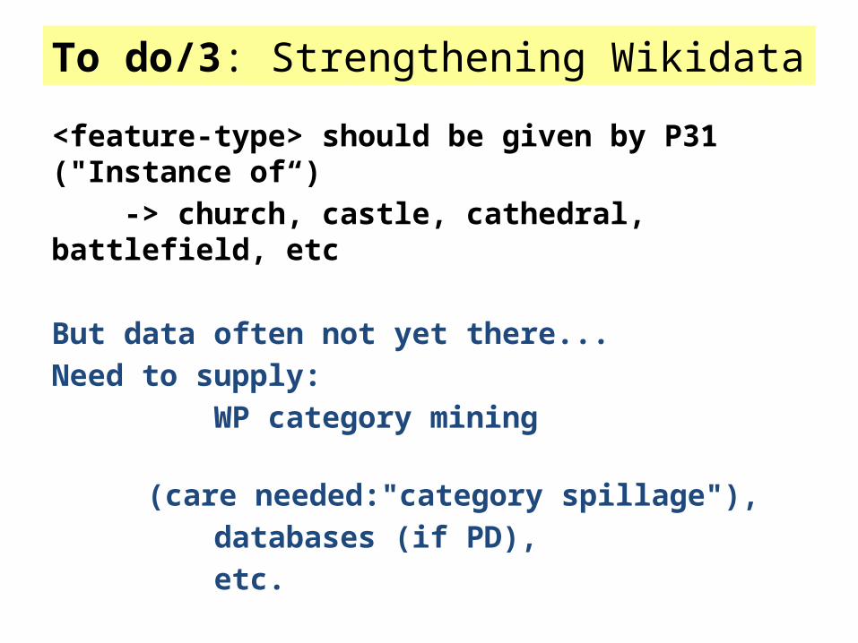
To do/3: Strengthening Wikidata
<feature-type> should be given by P31 ("Instance of“) -> church, castle, cathedral, battlefield, etc
But data often not yet there...Need to supply: WP category mining (care needed:"category spillage"), databases (if PD), etc.

To do list
There is work to do…
But with some work, (and some human mop-up),automated upload + reasonable categorisationshould be possible.
State of play
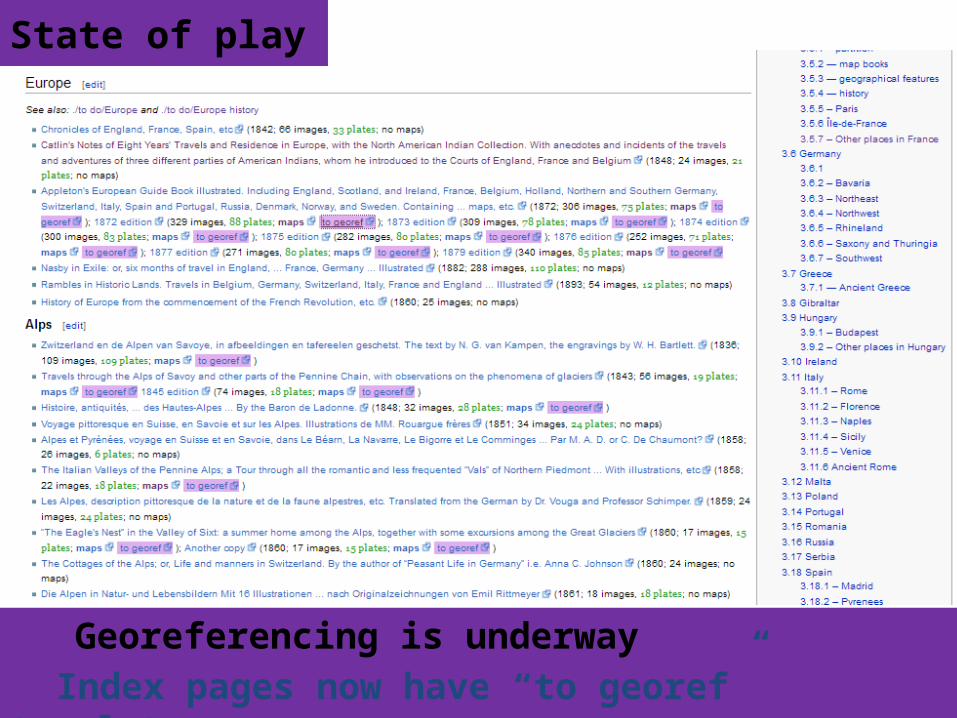
Georeferencing is underwayIndex pages now have “to georef” templates.
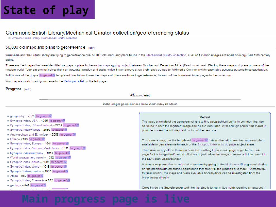
State of play
Main progress page is live
Conclusions: Tiered levels of wiki-pages leading to image searches can be used to drive large projects Even ad-hoc rough indexes are useful Commons's own old maps should be next
(~ 60,000)
Georeferencing is fun -- come and give it a try


![arXiv:1301.2756v4 [math.DG] 10 Apr 2016 · 3.2. Harmonic maps into SO+(1,n+3)/SO+(1,3) ×SO(n) 14 4. Loop group theory for harmonic maps 22 4.1. Loop groups and decomposition theorems](https://img.pdfslide.us/doc/110x75/5f8669582ec59e31960e10a2/arxiv13012756v4-mathdg-10-apr-2016-32-harmonic-maps-into-so1n3so13.jpg)


![arXiv:1512.00591v3 [astro-ph.CO] 15 Apr 2016arXiv:1512.00591v3 [astro-ph.CO] 15 Apr 2016 Preferredaxis ofCMB parity asymmetry in themasked maps Cheng Cheng1, Wen Zhao2,∗ Qing-Guo](https://img.pdfslide.us/doc/110x75/5eaa79dc042bee41aa7e9b3a/arxiv151200591v3-astro-phco-15-apr-2016-arxiv151200591v3-astro-phco-15.jpg)