Embed Size (px)
Citation preview
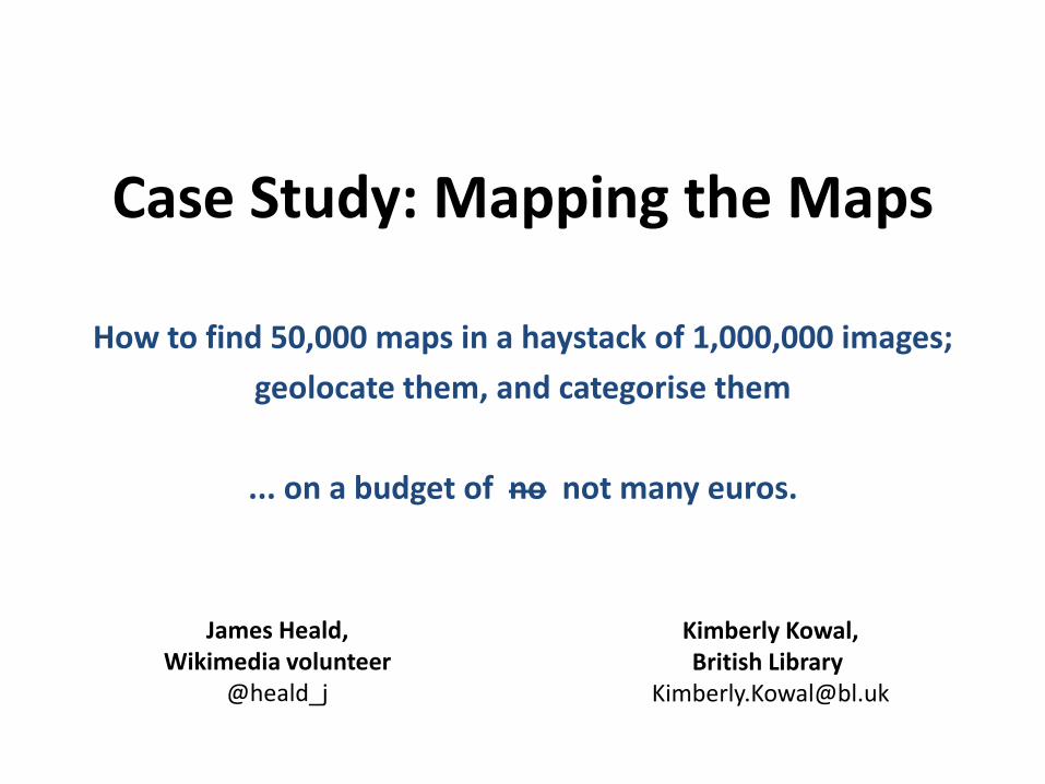
Case Study: Mapping the Maps
How to find 50,000 maps in a haystack of 1,000,000 images;
geolocate them, and categorise them
... on a budget of no not many euros.
James Heald,Wikimedia volunteer
@heald_j
Kimberly Kowal,British Library
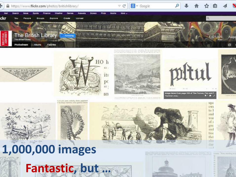
1,000,000 images
Fantastic, but …

Very limited metadata
Wikimedia said no bulk upload

Volunteer response…
Create a subject index by book…
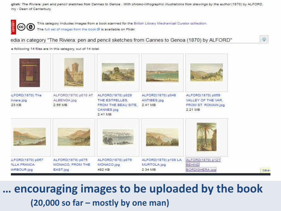
… encouraging images to be uploaded by the book(20,000 so far – mostly by one man)
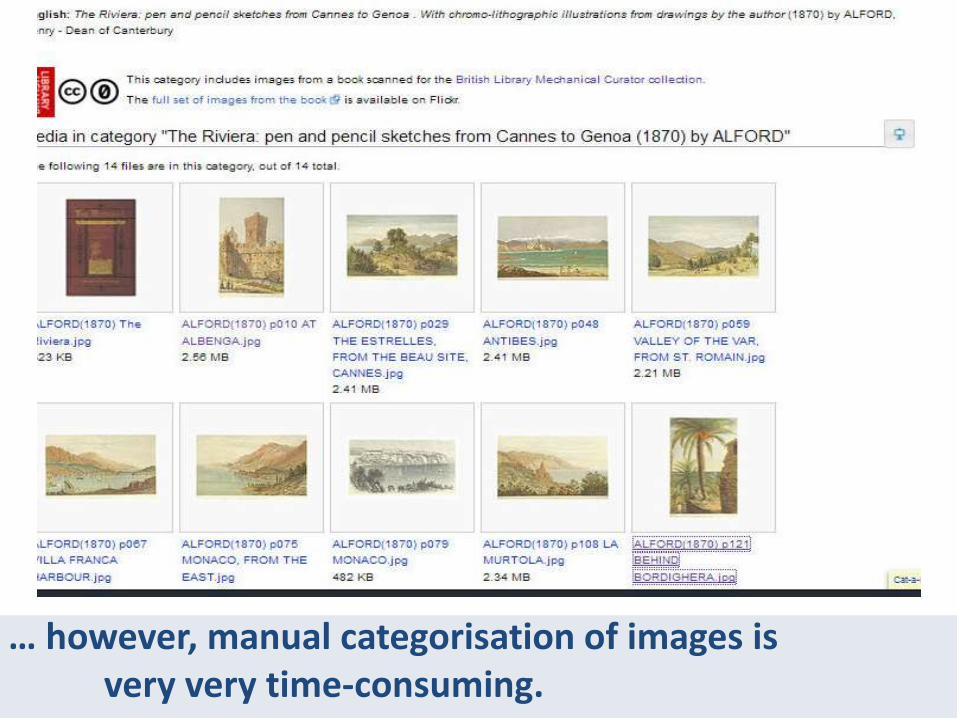
… however, manual categorisation of images isvery very time-consuming.

Could anything be done more automatically…
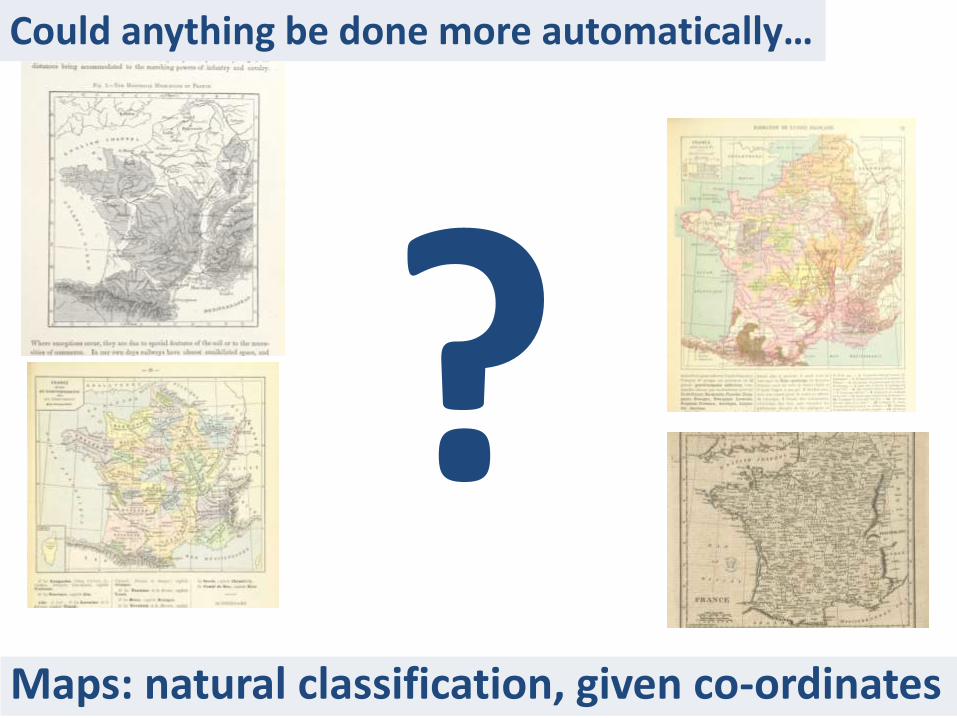
Maps: natural classification, given co-ordinates
Could anything be done more automatically…
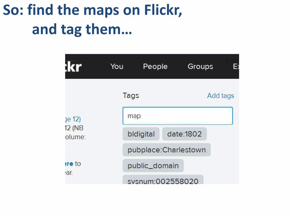
So: find the maps on Flickr, and tag them…
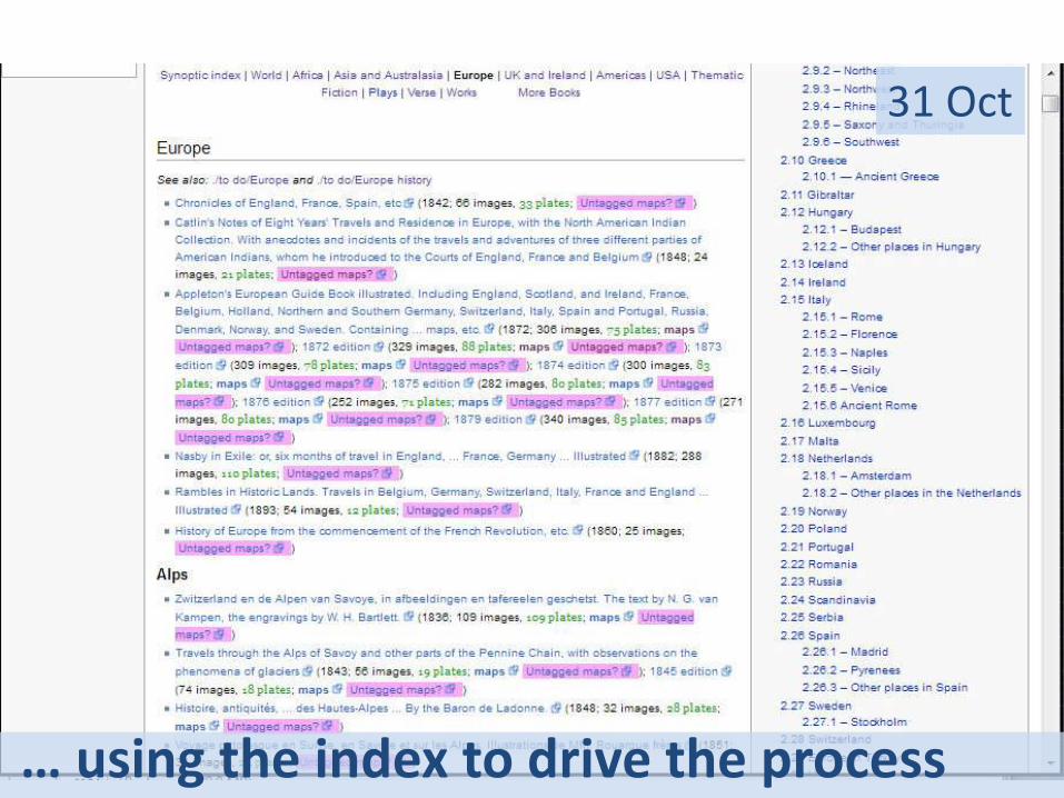
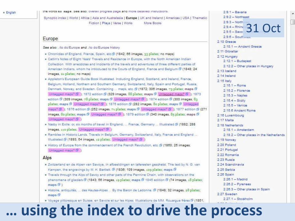
… using the index to drive the process
31 Oct
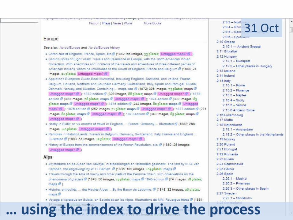
… using the index to drive the process
31 Oct
… using the index to drive the process
31 Oct
… using the index to drive the process
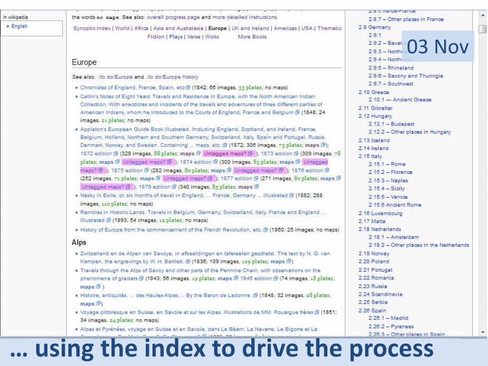
03 Nov
… using the index to drive the process
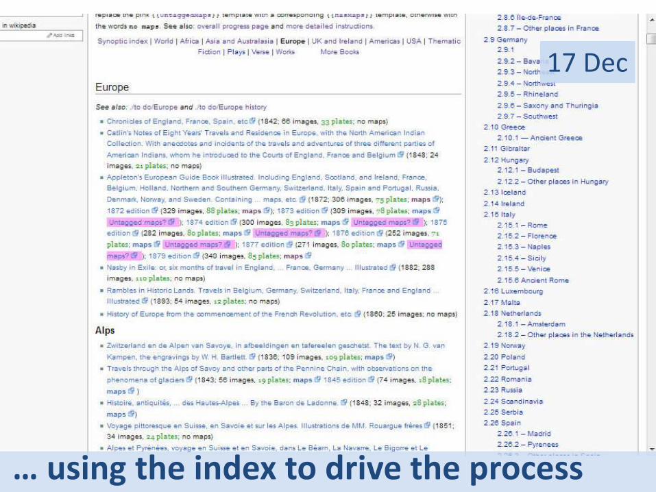
17 Dec
… using the index to drive the process
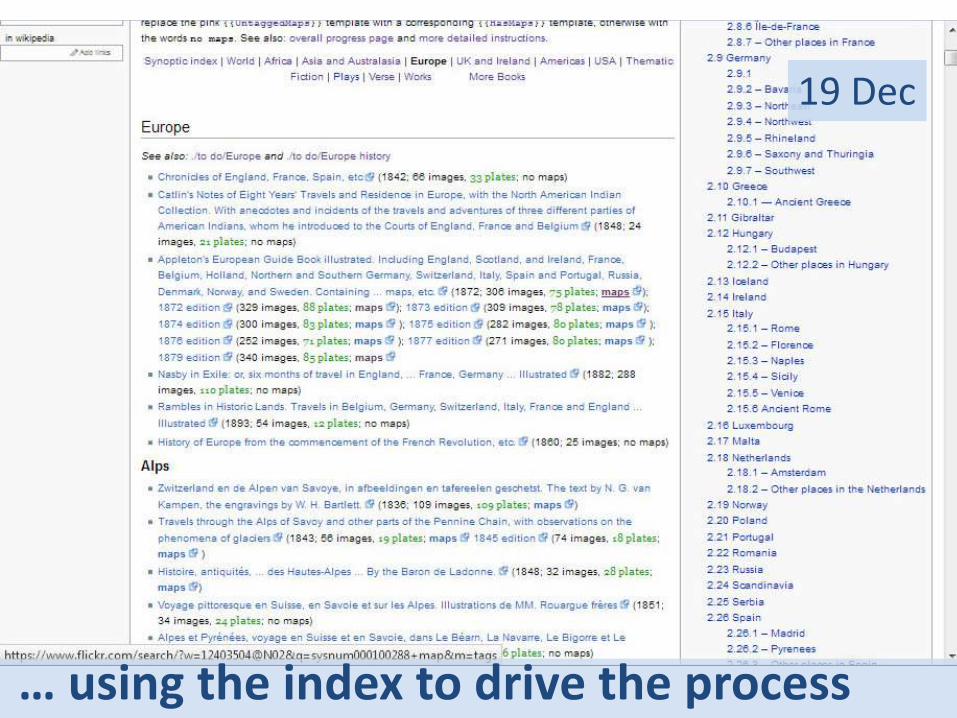
19 Dec
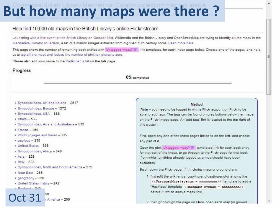
But how many maps were there ?
Oct 31
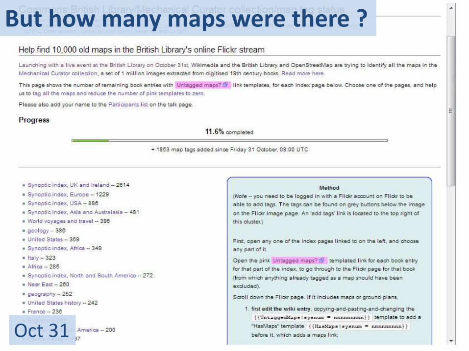
But how many maps were there ?
Oct 31
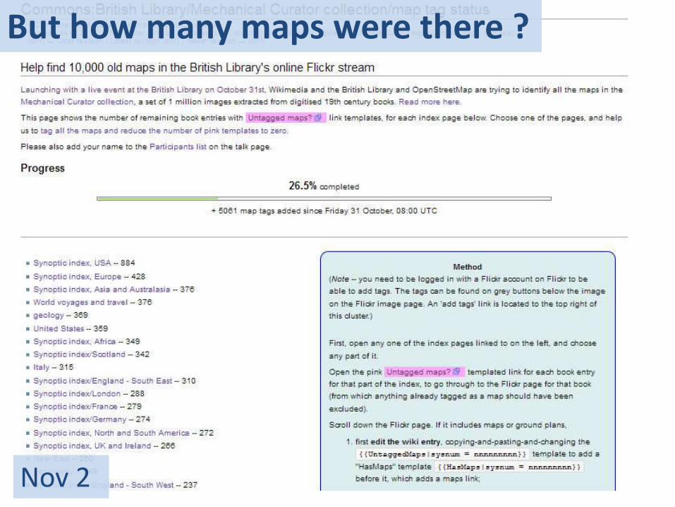
But how many maps were there ?
Nov 2
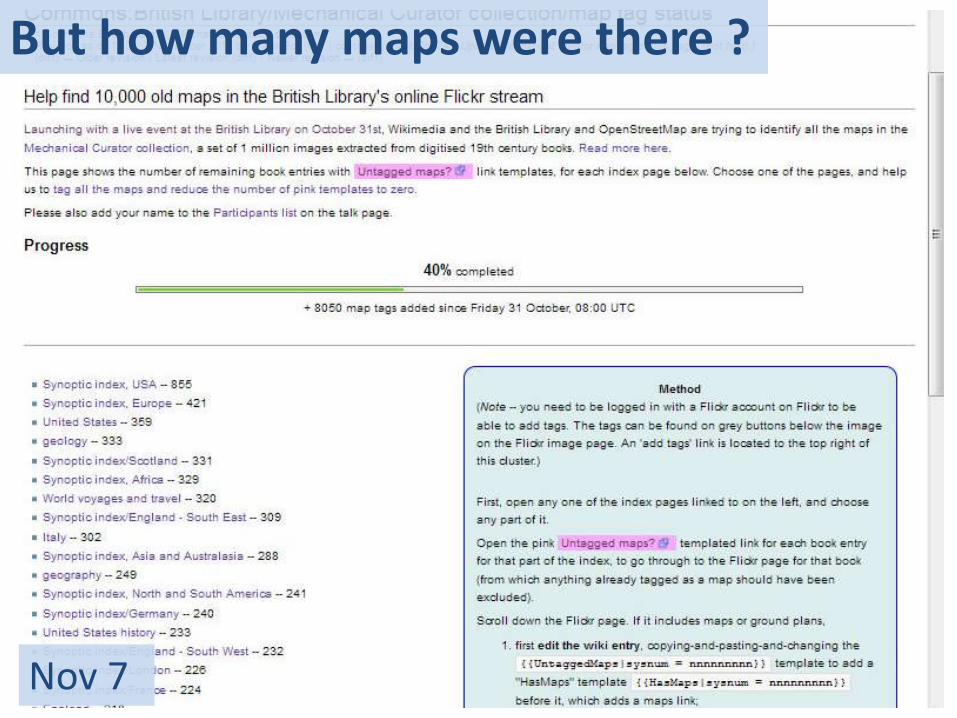
But how many maps were there ?
Nov 7
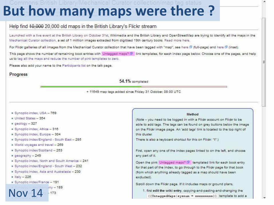
But how many maps were there ?
Nov 14
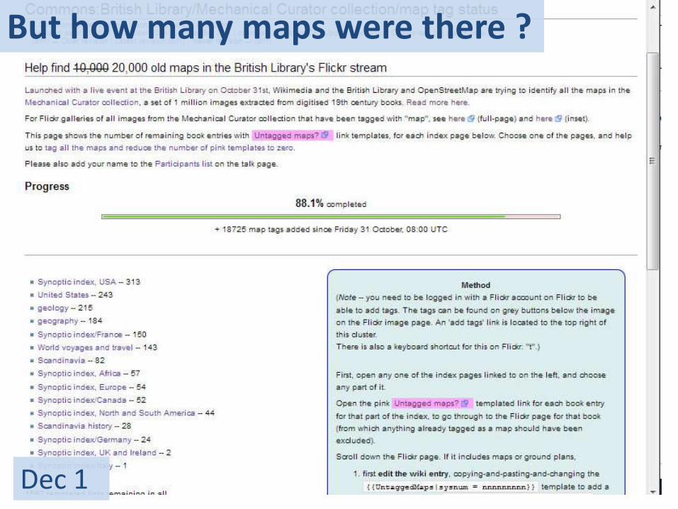
But how many maps were there ?
Dec 1
But how many maps were there ?
Dec 10
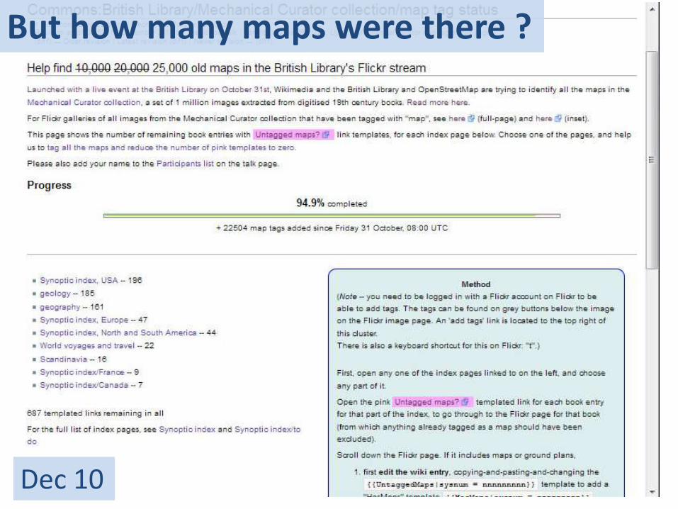
But how many maps were there ?
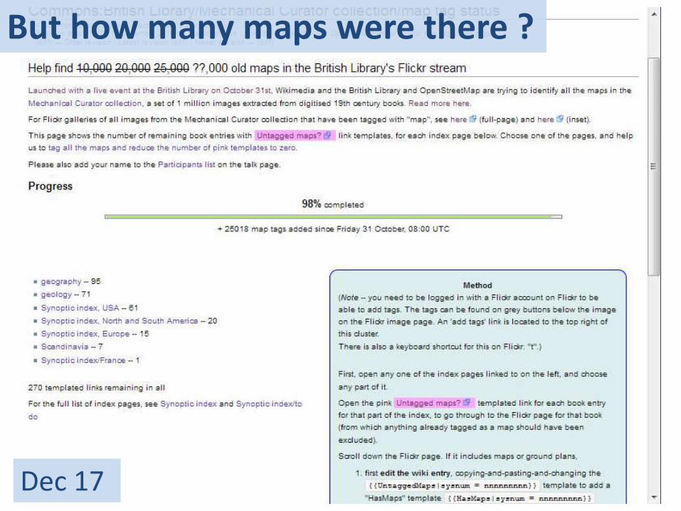
Dec 17
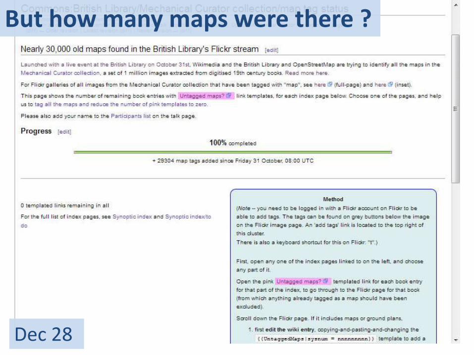
But how many maps were there ?
Dec 28
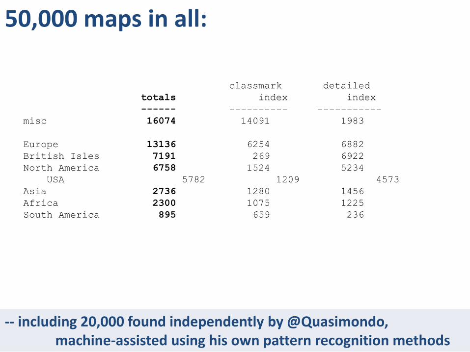
-- including 20,000 found independently by @Quasimondo, machine-assisted using his own pattern recognition methods
50,000 maps in all:
classmark detailed
totals index index
------ ---------- -----------
misc 16074 14091 1983
Europe 13136 6254 6882
British Isles 7191 269 6922
North America 6758 1524 5234
USA 5782 1209 4573
Asia 2736 1280 1456
Africa 2300 1075 1225
South America 895 659 236
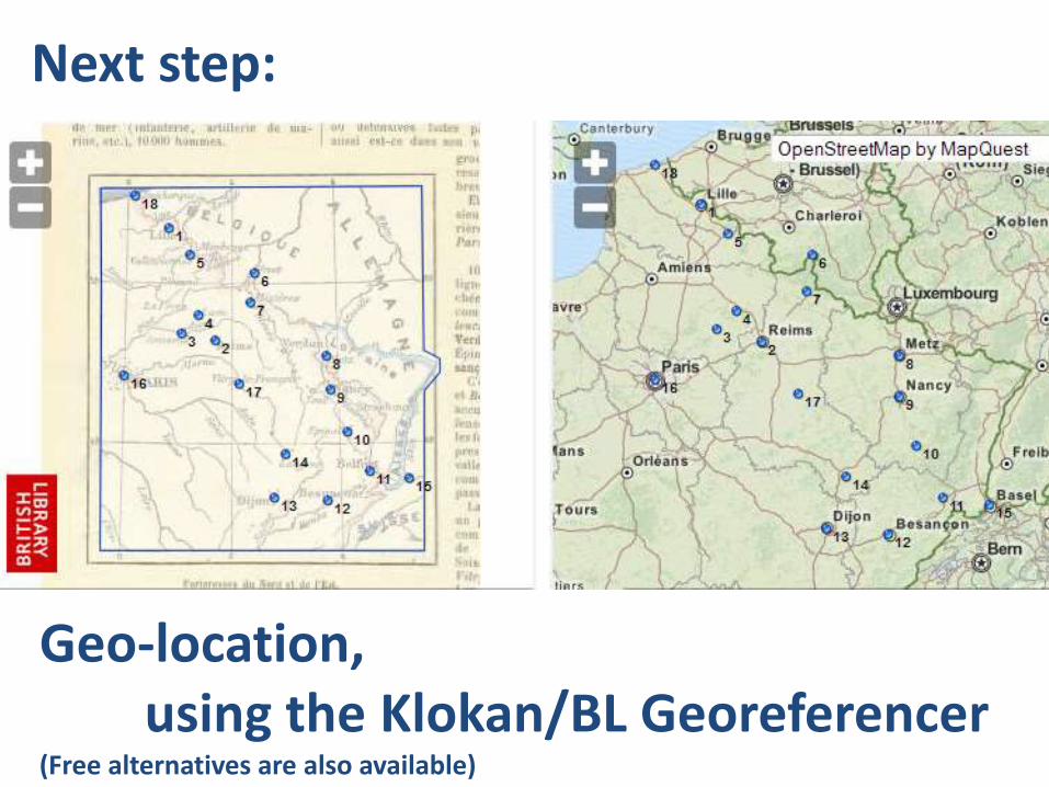
Geo-location, using the Klokan/BL Georeferencer
(Free alternatives are also available)
Next step:
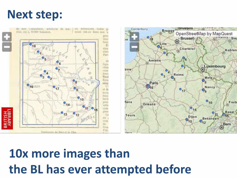
10x more images than the BL has ever attempted before
Next step:
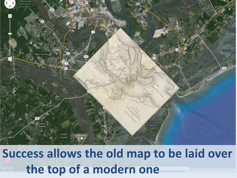
Success allows the old map to be laid overthe top of a modern one
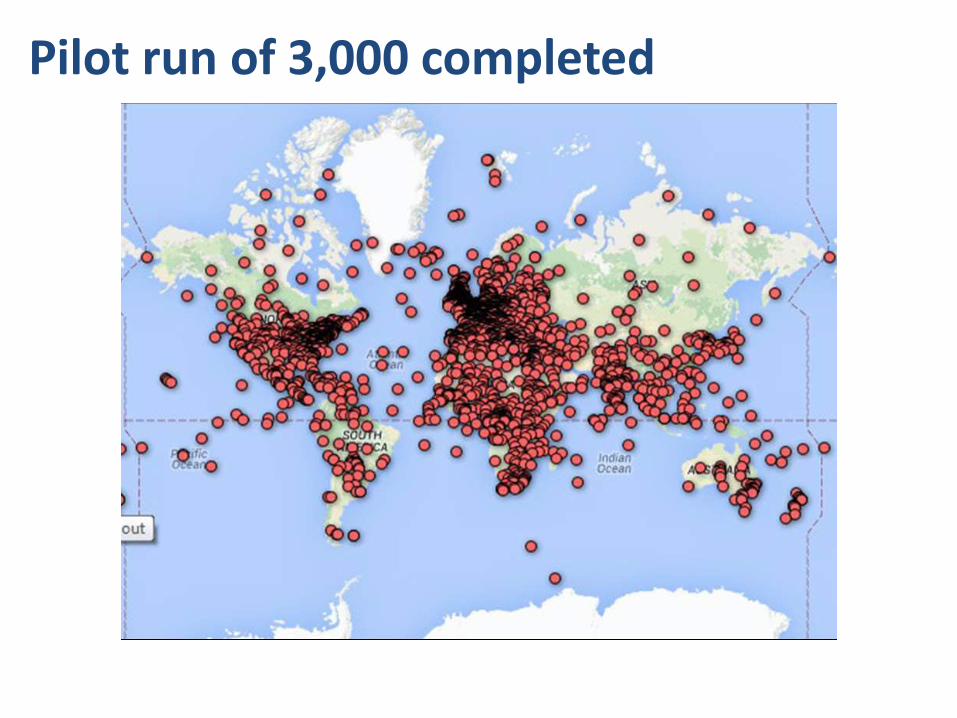
Pilot run of 3,000 completed
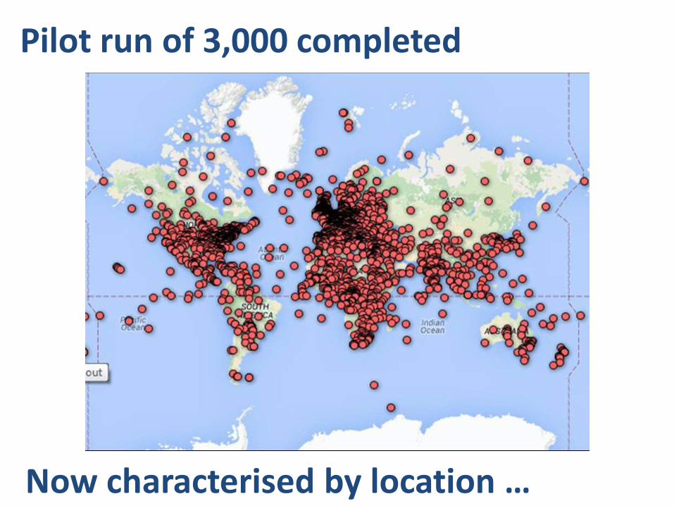
Now characterised by location …
Pilot run of 3,000 completed
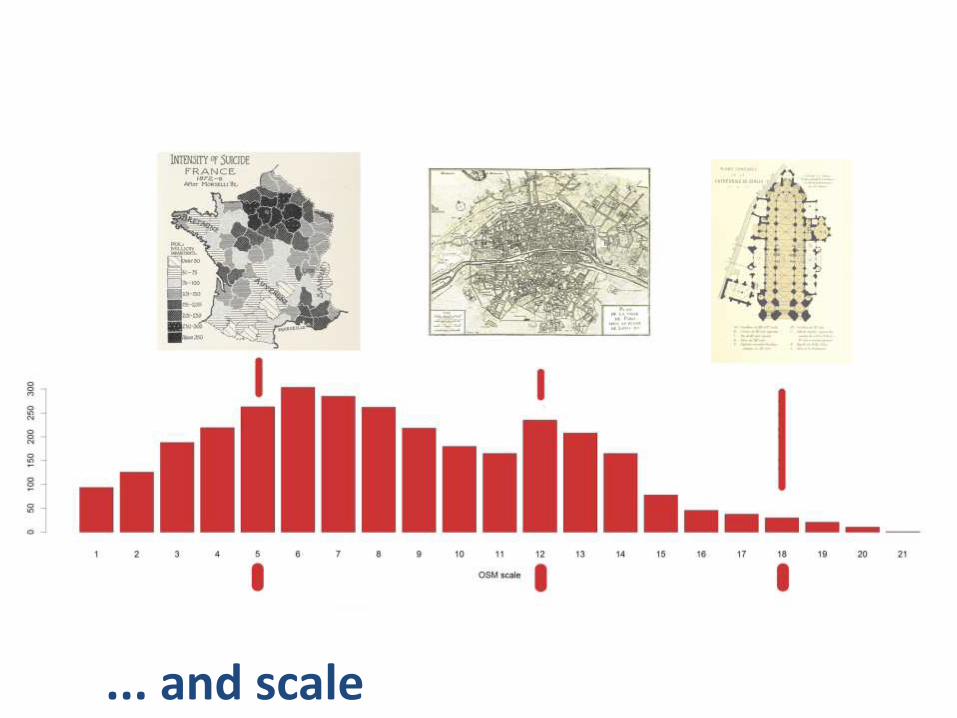
... and scale
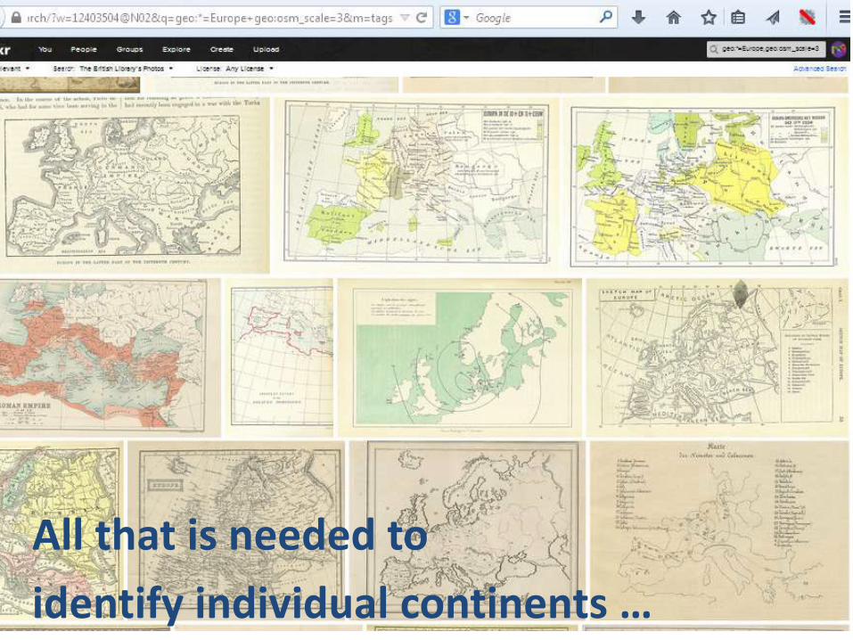
All that is needed to
identify individual continents …
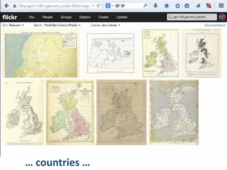
… countries …
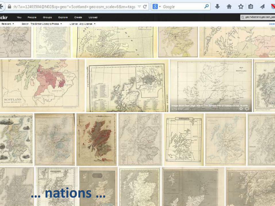
… nation …
… nations …
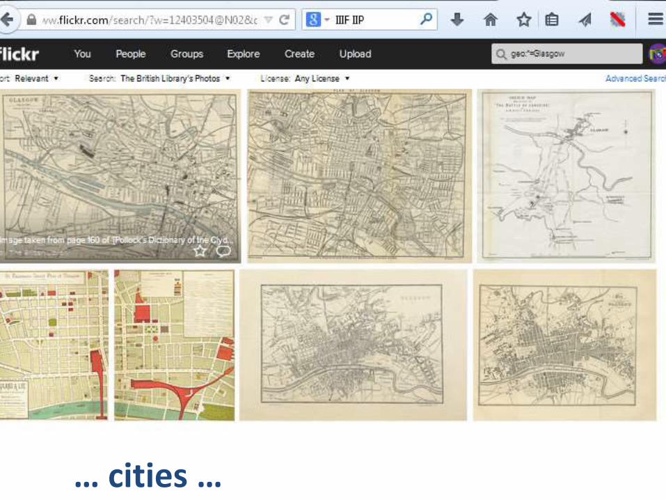
… cities …
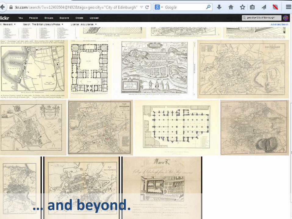
… and beyond
… and beyond.
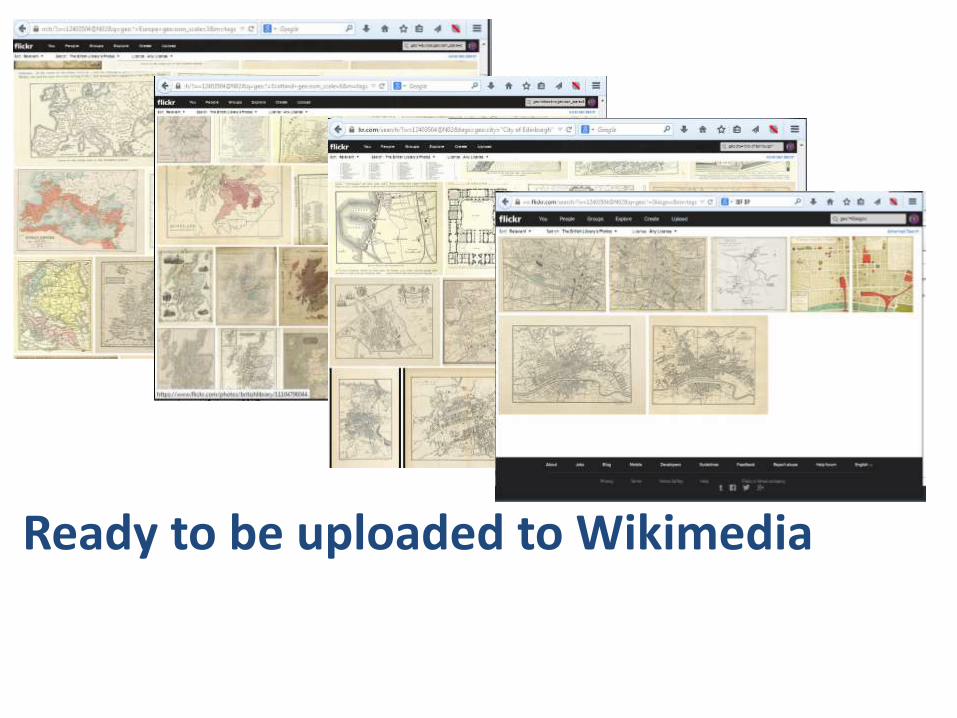
Ready to be uploaded to Wikimedia
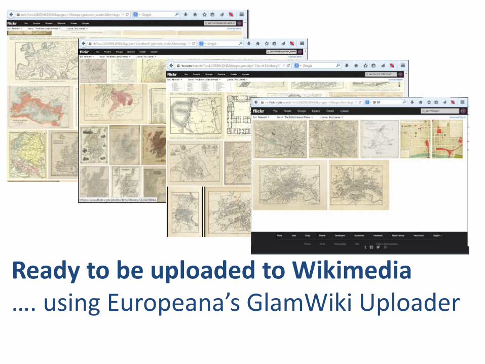
Ready to be uploaded to Wikimedia…. using Europeana’s GlamWiki Uploader

Ready to be uploaded to Wikimedia…. using Europeana’s GlamWiki Uploader
THANK YOU, Europeana!