Embed Size (px)
Citation preview

MINE SUBSIDENCE INSURANCE (MSI)
PROGRAMBy Kelsey Biondo, Samantha
Schafer, and David Svab
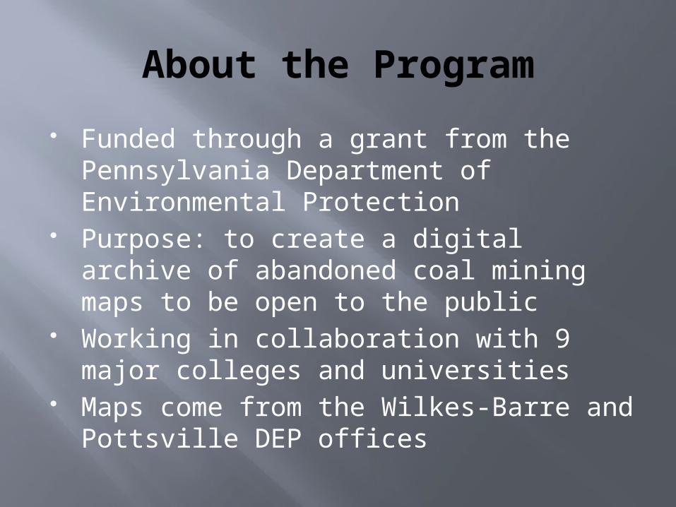
About the Program
Funded through a grant from the Pennsylvania Department of Environmental Protection
Purpose: to create a digital archive of abandoned coal mining maps to be open to the public
Working in collaboration with 9 major colleges and universities
Maps come from the Wilkes-Barre and Pottsville DEP offices
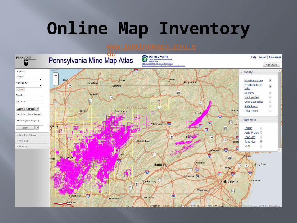
Online Map Inventorywww.paminemaps.psu.edu
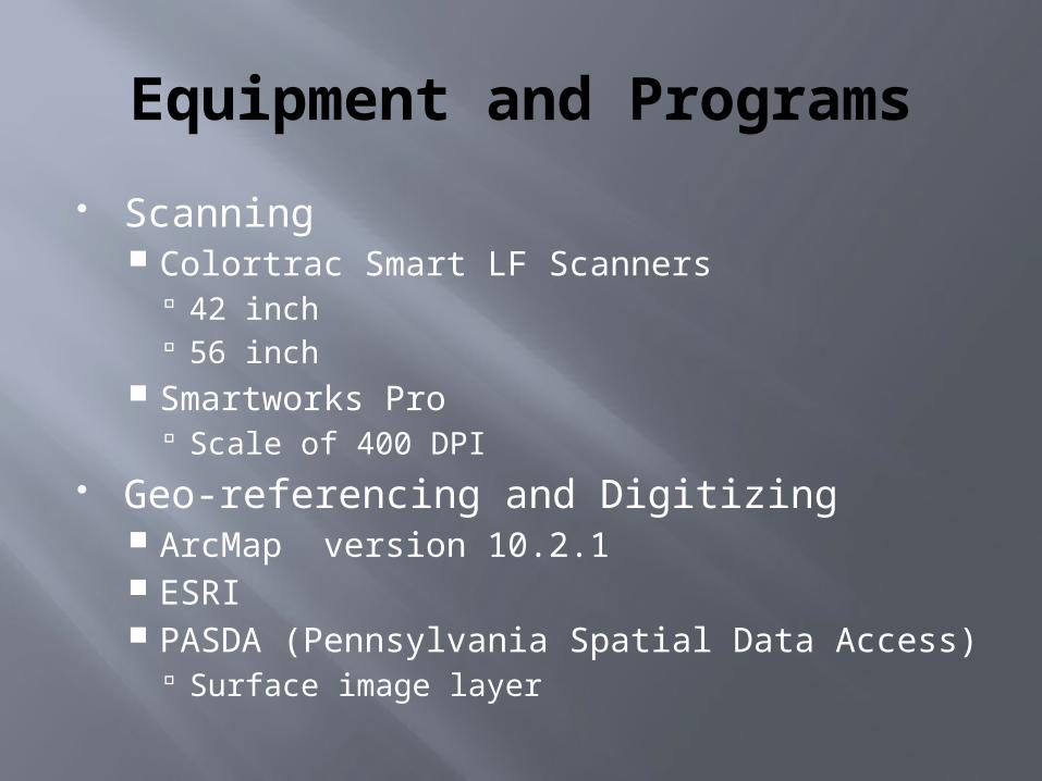
Equipment and Programs
Scanning Colortrac Smart LF Scanners
42 inch 56 inch
Smartworks Pro Scale of 400 DPI
Geo-referencing and Digitizing ArcMap version 10.2.1 ESRI PASDA (Pennsylvania Spatial Data Access)
Surface image layer
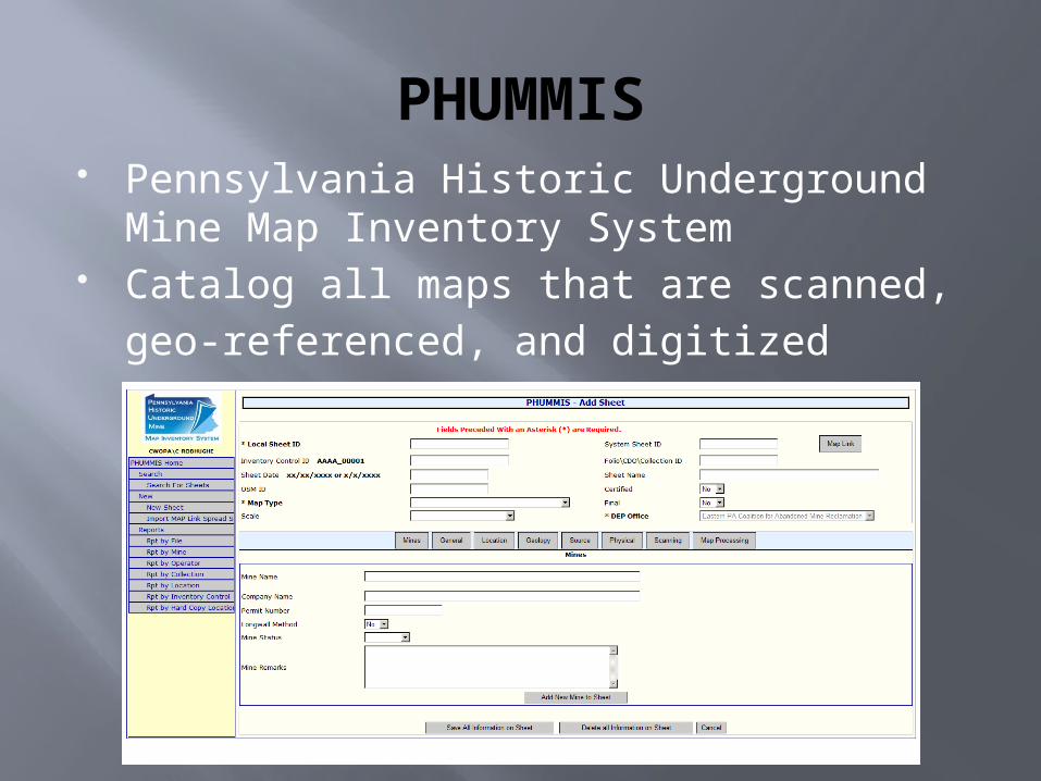
PHUMMIS Pennsylvania Historic Underground Mine
Map Inventory System Catalog all maps that are scanned,
geo-referenced, and digitized
MSI MAP SCANNING
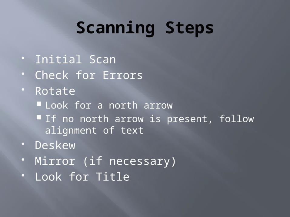
Scanning Steps
Initial Scan Check for Errors Rotate
Look for a north arrow If no north arrow is present, follow alignment
of text Deskew Mirror (if necessary) Look for Title
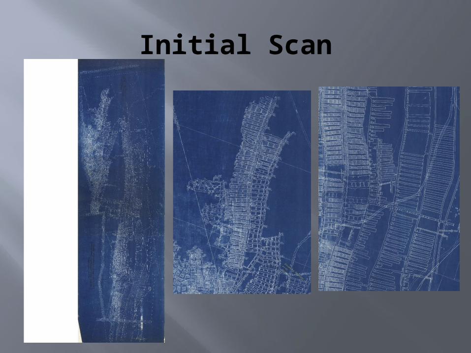
Initial Scan
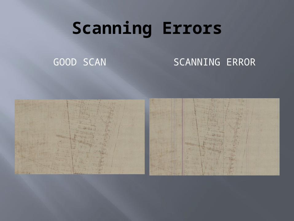
Scanning Errors
GOOD SCAN SCANNING ERROR
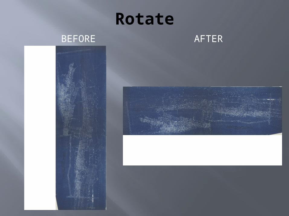
RotateBEFORE AFTER
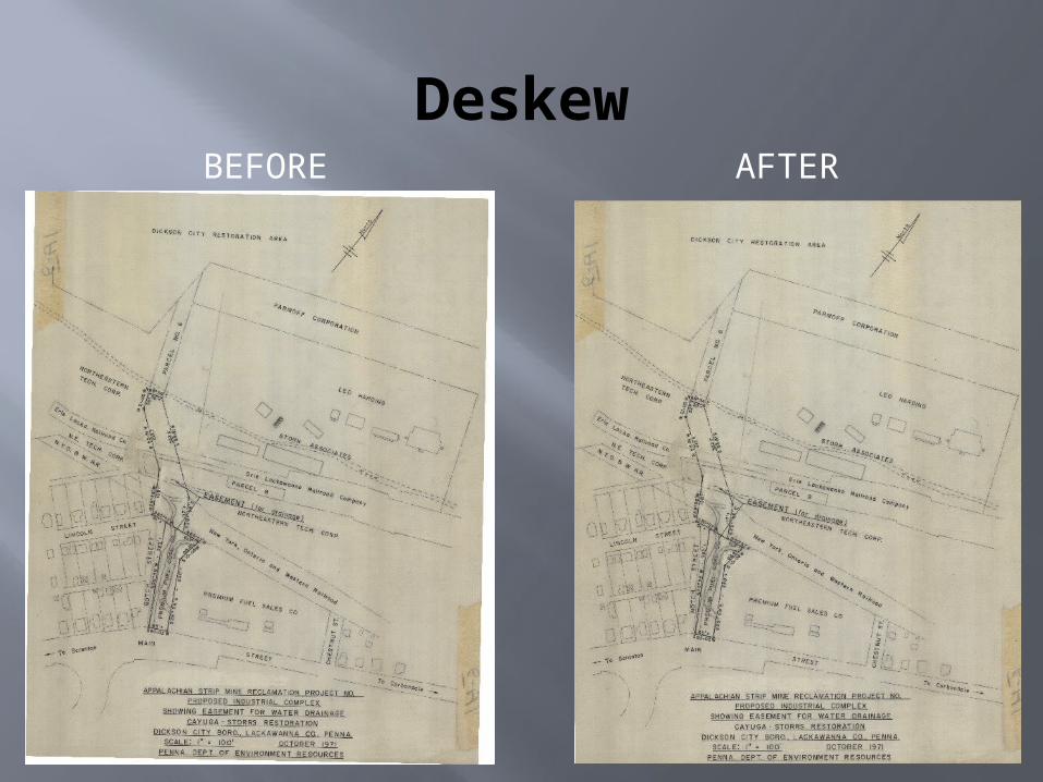
DeskewBEFORE AFTER
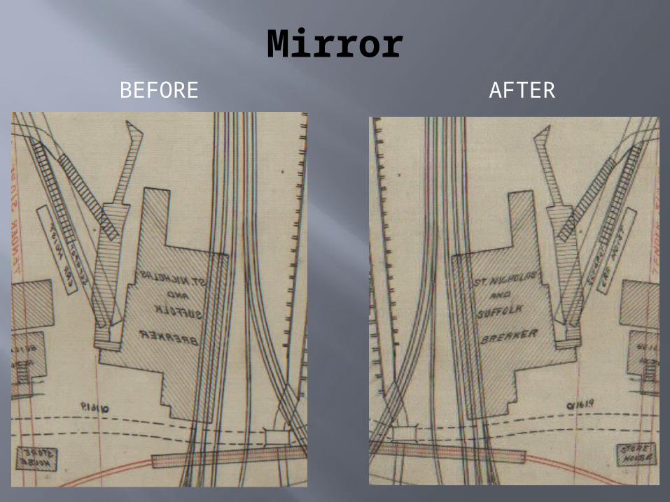
MirrorBEFORE AFTER
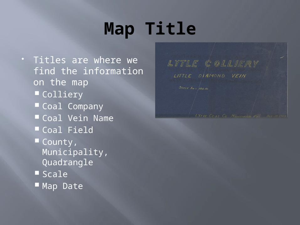
Map Title
Titles are where we find the information on the map Colliery Coal Company Coal Vein Name Coal Field County, Municipality,
Quadrangle Scale Map Date
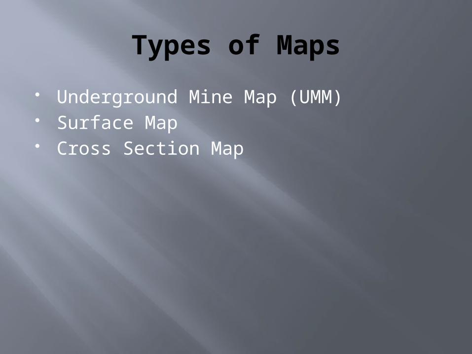
Types of Maps
Underground Mine Map (UMM) Surface Map Cross Section Map
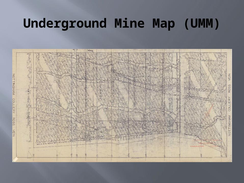
Underground Mine Map (UMM)
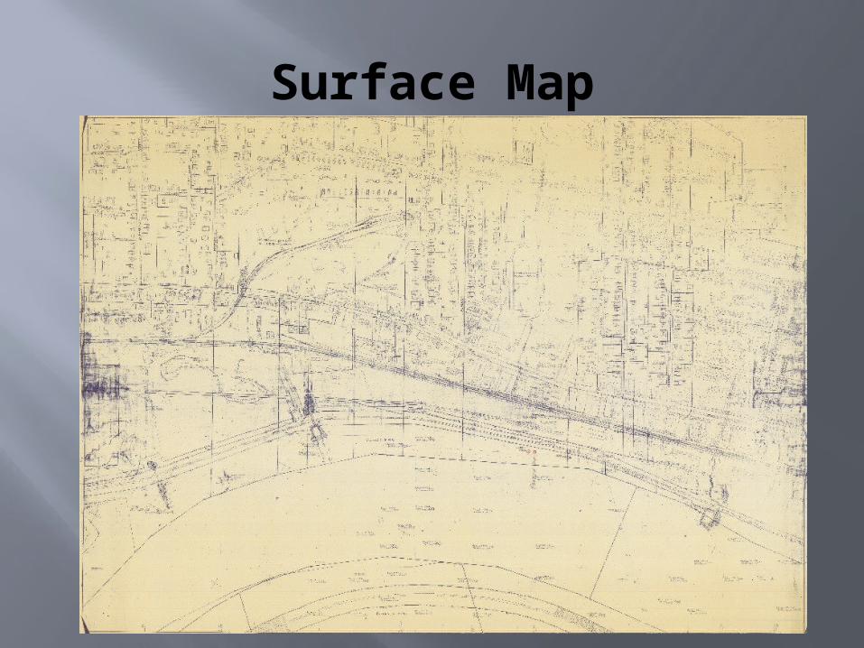
Surface Map
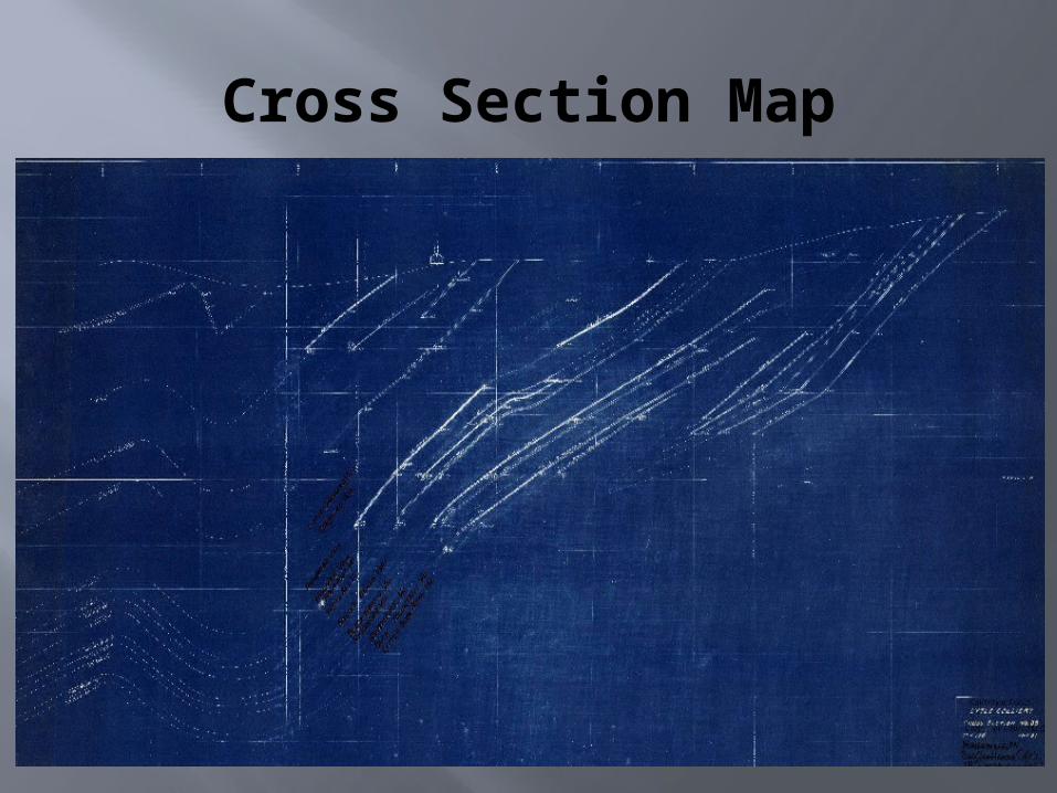
Cross Section Map
MSIGEO-REFERENCING SURFACE AND
UNDERGROUND MINE MAPS
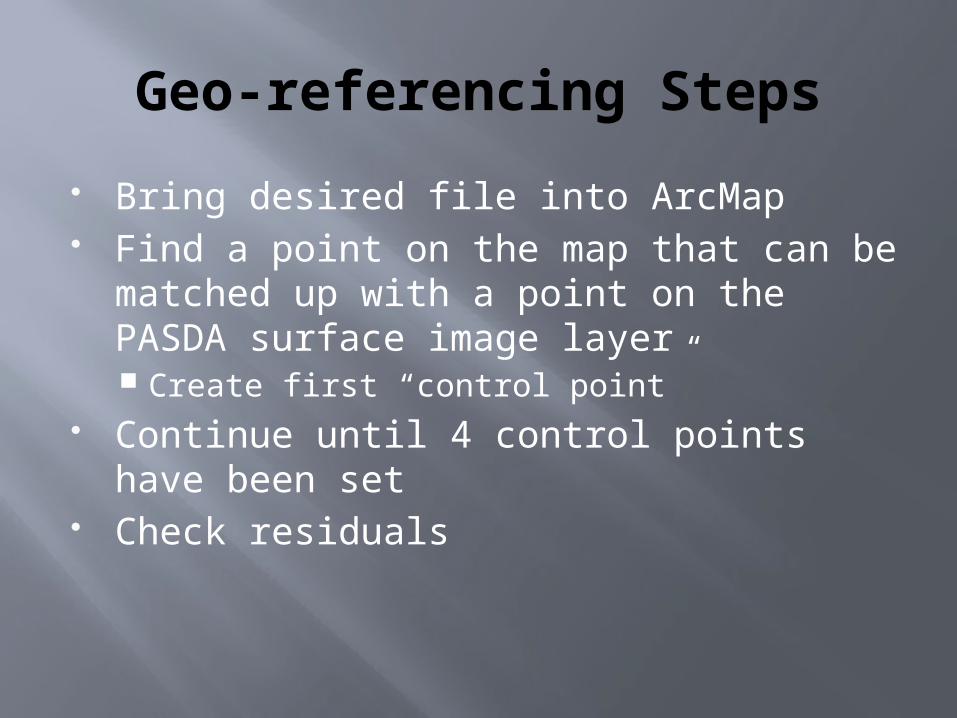
Geo-referencing Steps
Bring desired file into ArcMap Find a point on the map that can be
matched up with a point on the PASDA surface image layer Create first “control point”
Continue until 4 control points have been set
Check residuals
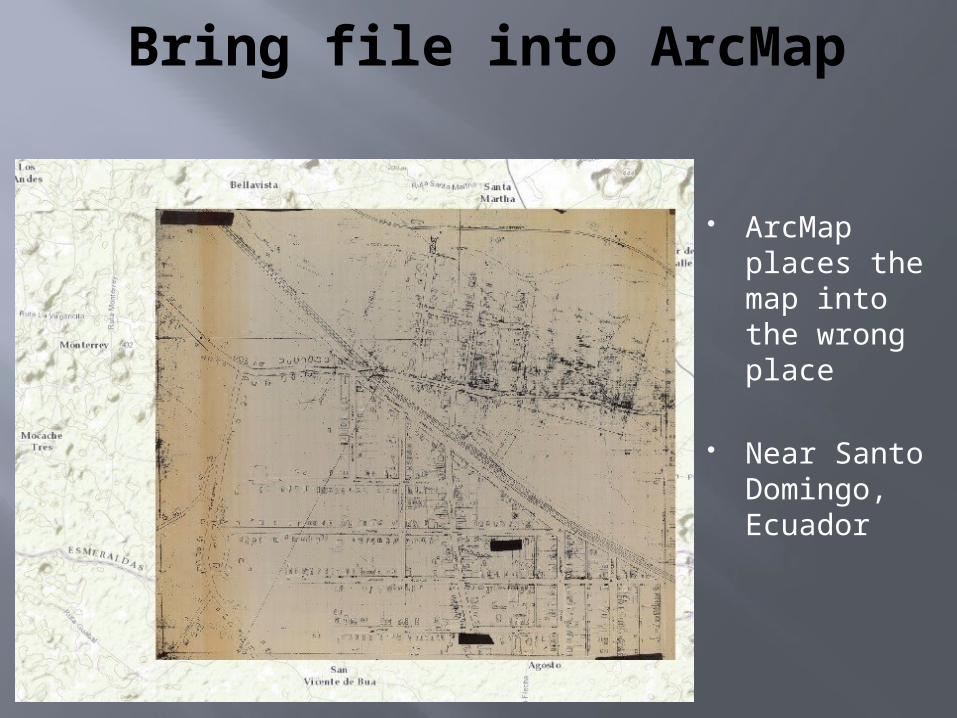
Bring file into ArcMap
ArcMap places the map into the wrong place
Near Santo Domingo, Ecuador
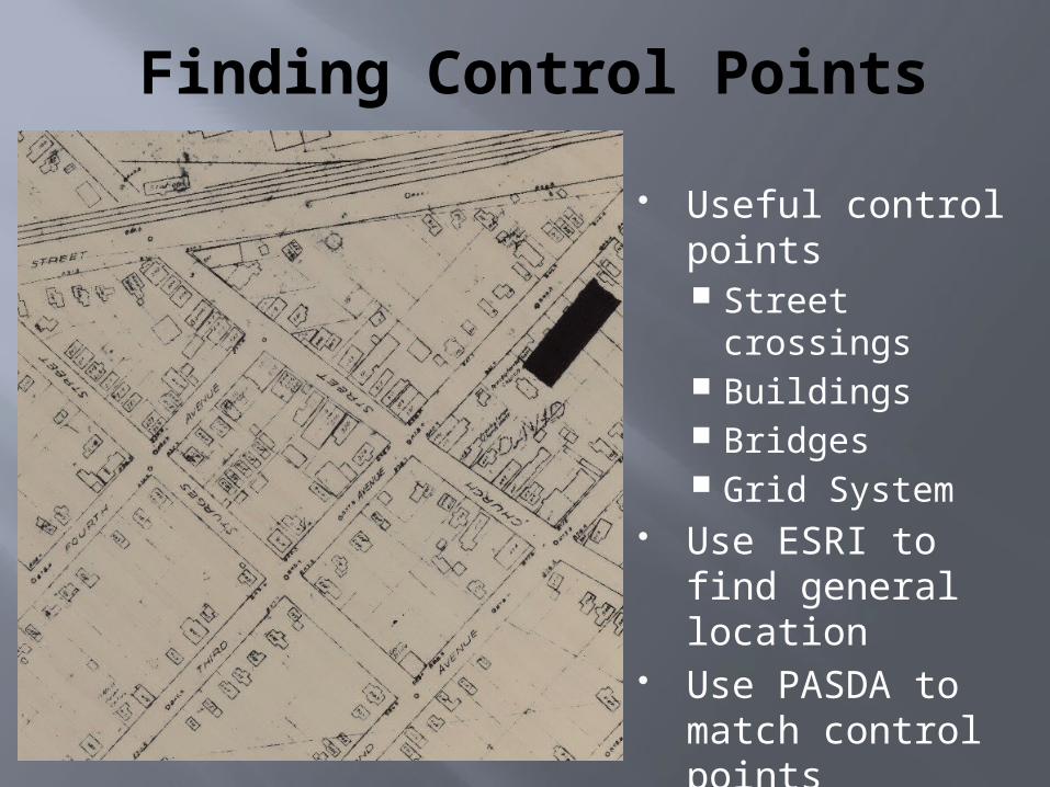
Finding Control Points
Useful control points Street crossings Buildings Bridges Grid System
Use ESRI to find general location
Use PASDA to match control points
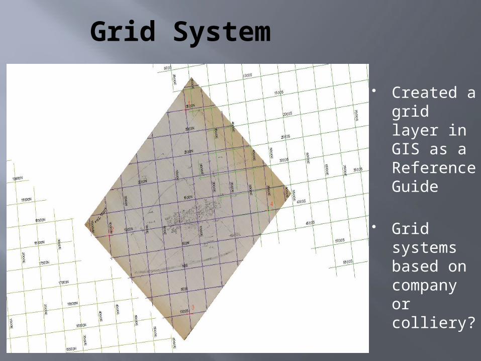
Grid System
Created a grid layer in GIS as a Reference Guide
Grid systems based on company or colliery?
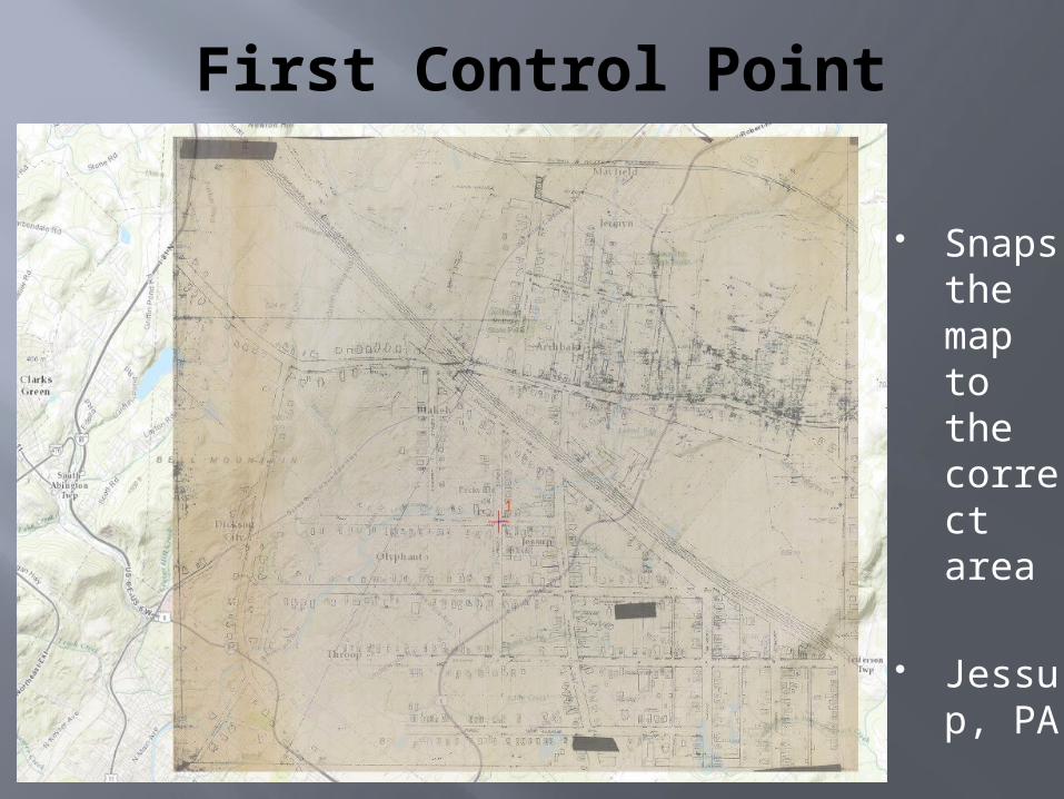
First Control Point
Snaps the map to the correct area
Jessup, PA
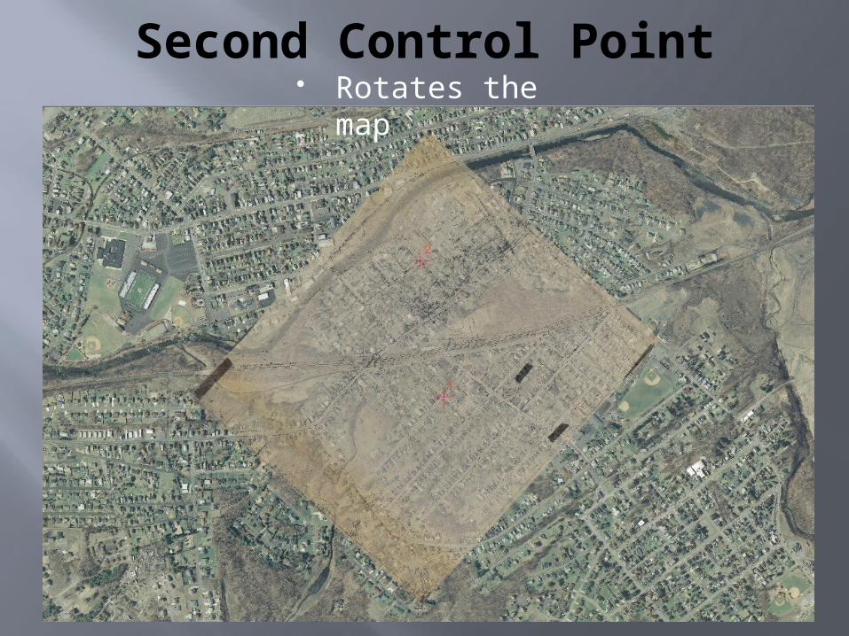
Second Control Point Rotates the
map
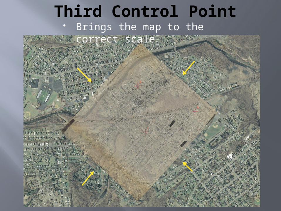
Third Control Point Brings the map to the correct
scale
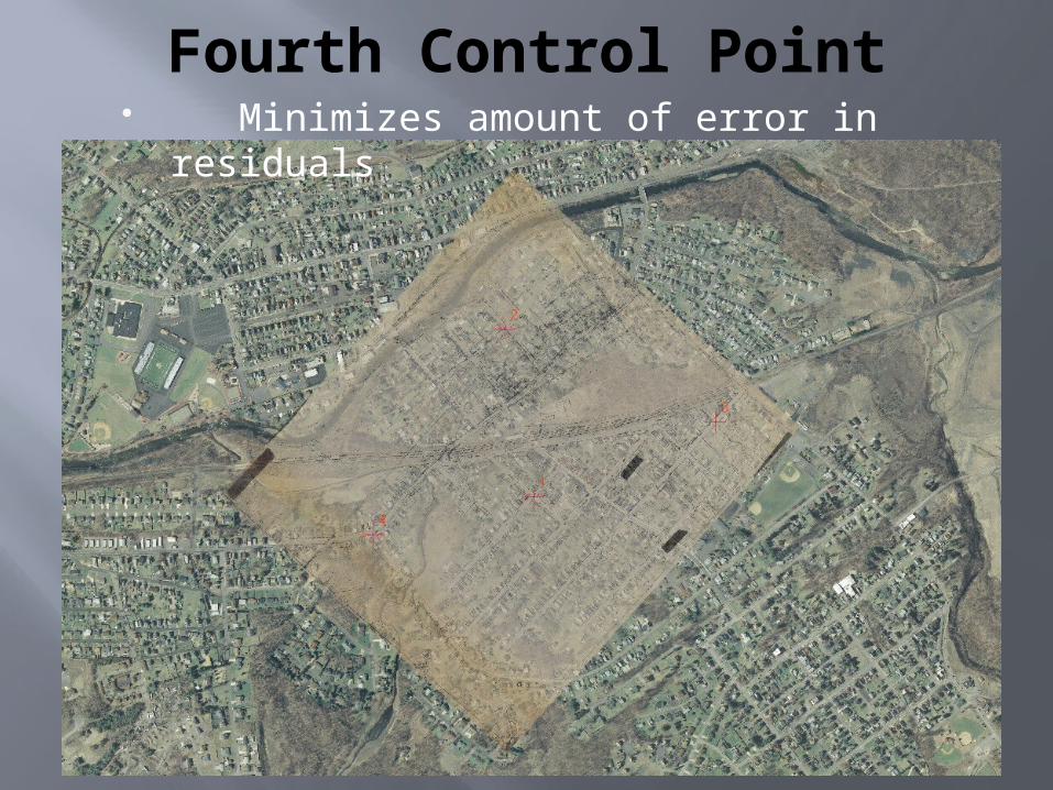
Fourth Control Point Minimizes amount of error in residuals
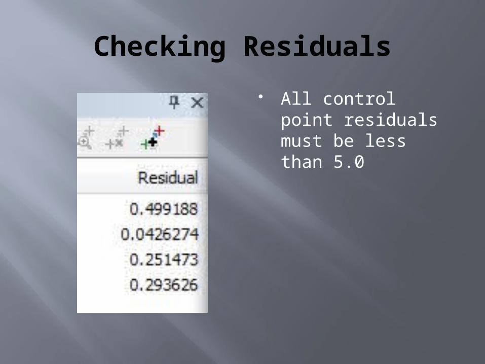
Checking Residuals
All control point residuals must be less than 5.0
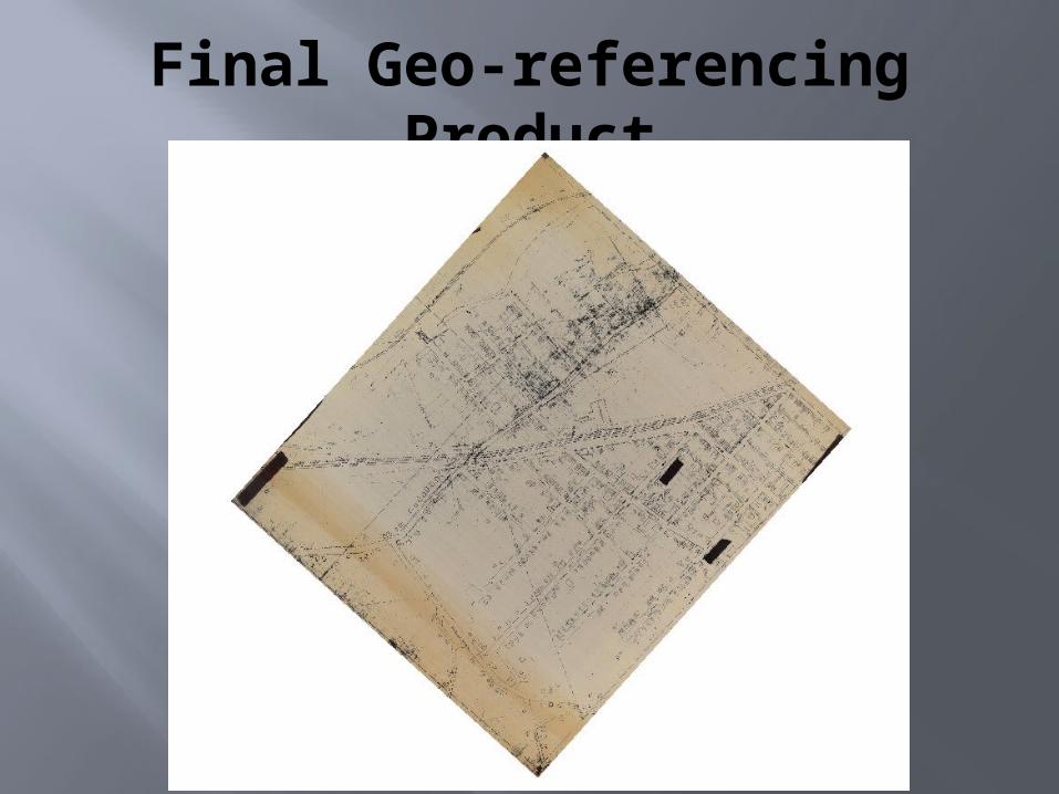
Final Geo-referencing Product
Difficult Maps
MSIDIGITIZING SURFACE AND
UNDERGROUND MINE MAPS
Digitizing Steps
Mark shafts, drifts, and slopes Only if they reach the surface
Draw a polygon around the underground mining area Cut out large areas that are not mined
(doughnuts) Mark coal elevation points
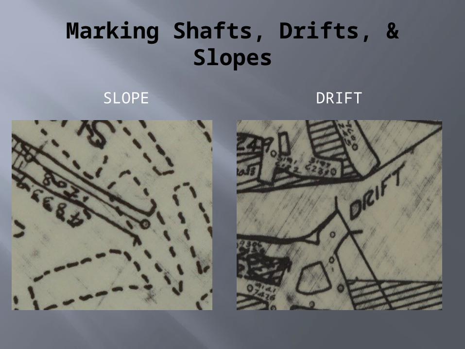
Marking Shafts, Drifts, & Slopes
SLOPE DRIFT
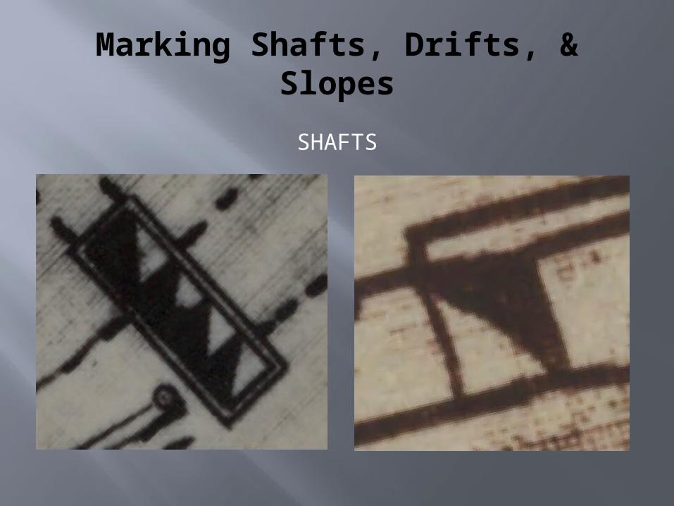
Marking Shafts, Drifts, & Slopes
SHAFTS
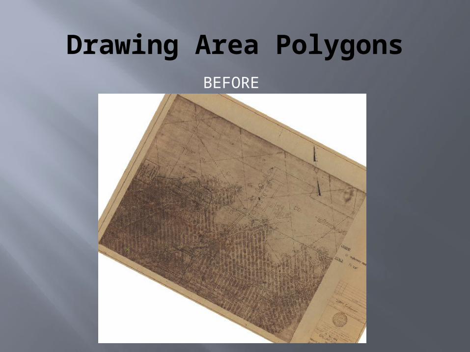
Drawing Area PolygonsBEFORE
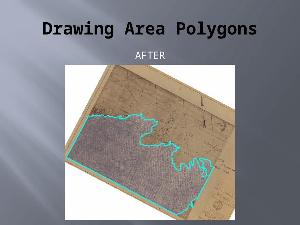
Drawing Area PolygonsAFTER
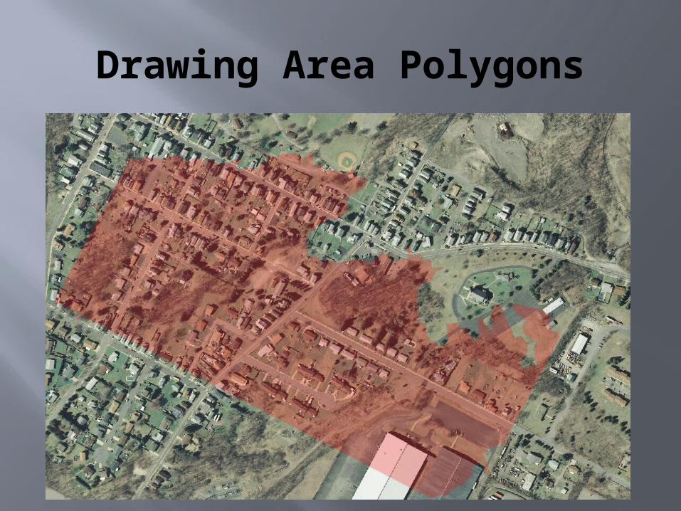
Drawing Area Polygons
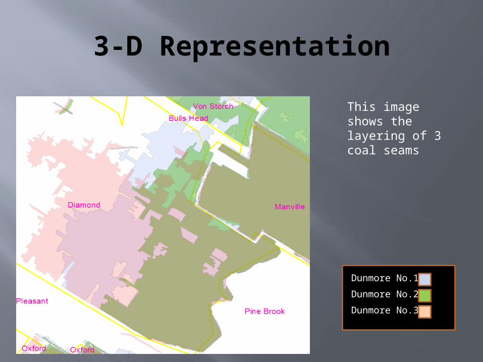
3-D Representation
Dunmore No.1
Dunmore No.2
Dunmore No.3
This image shows the layering of 3 coal seams
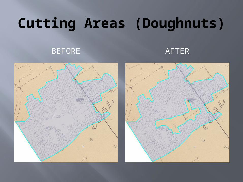
Cutting Areas (Doughnuts)
BEFORE AFTER
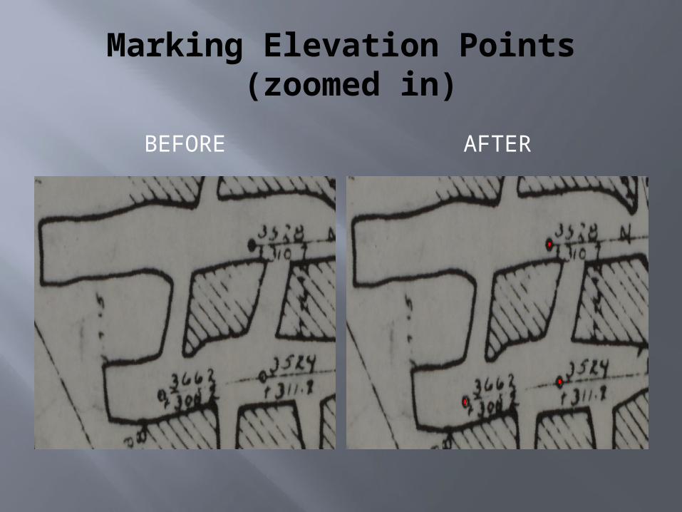
Marking Elevation Points (zoomed in)
BEFORE AFTER
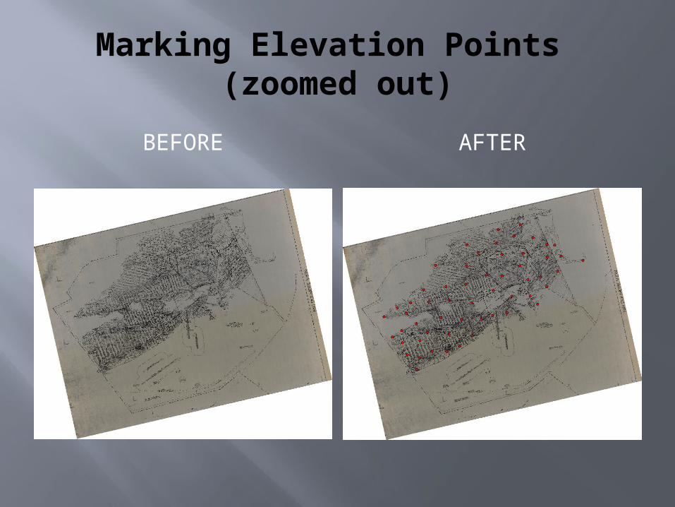
Marking Elevation Points (zoomed out)
BEFORE AFTER
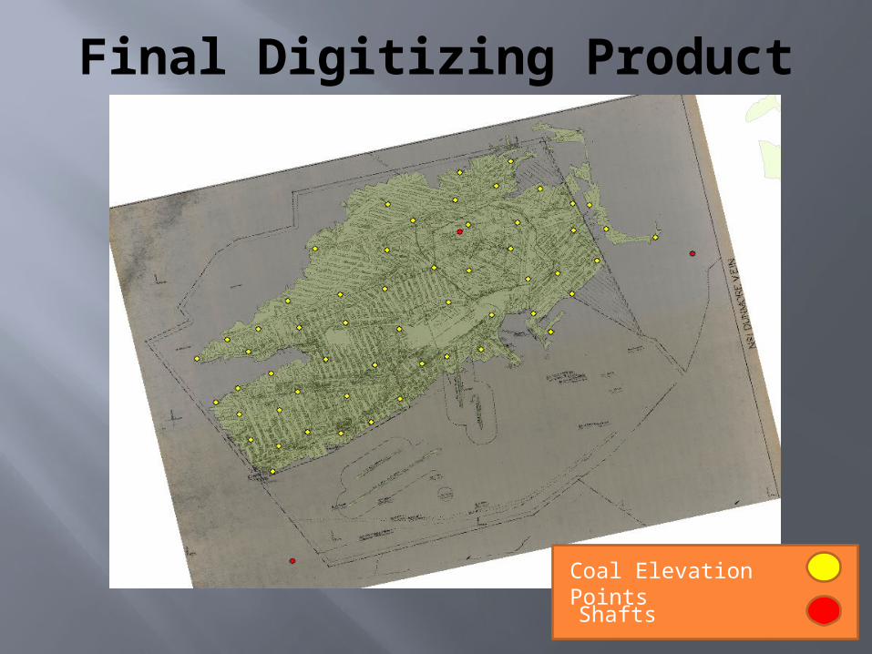
Final Digitizing Product
Coal Elevation Points
Shafts
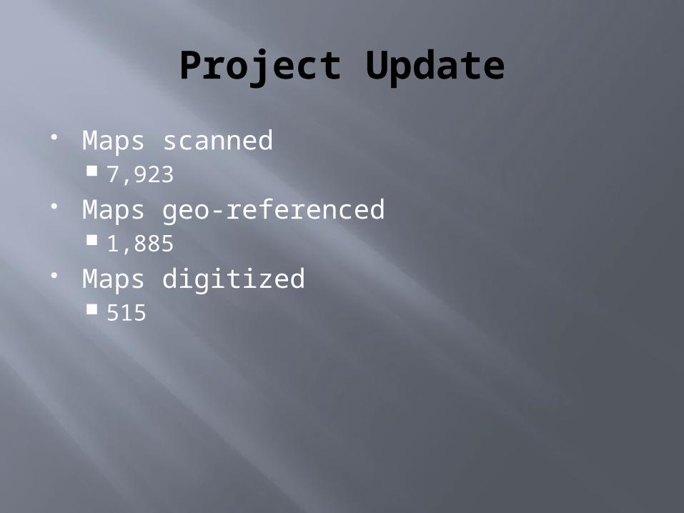
Project Update
Maps scanned 7,923
Maps geo-referenced 1,885
Maps digitized 515

QUESTIONS?