Embed Size (px)
Citation preview
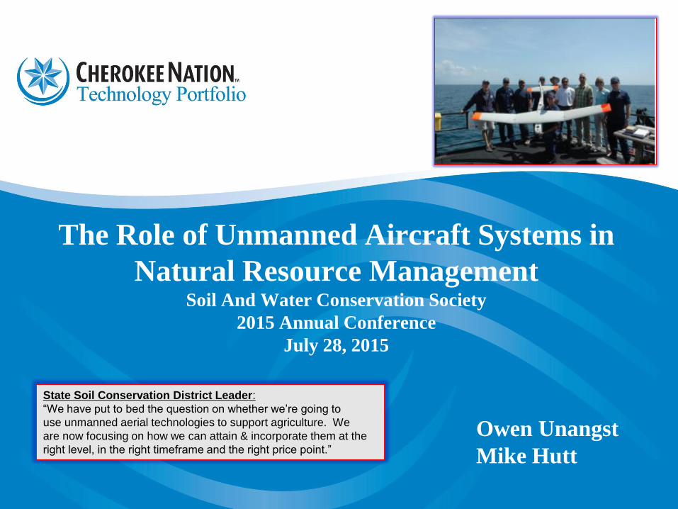
The Role of Unmanned Aircraft Systems in
Natural Resource Management Soil And Water Conservation Society
2015 Annual Conference
July 28, 2015
Owen Unangst
Mike Hutt
State Soil Conservation District Leader:
“We have put to bed the question on whether we’re going to
use unmanned aerial technologies to support agriculture. We
are now focusing on how we can attain & incorporate them at the
right level, in the right timeframe and the right price point.”
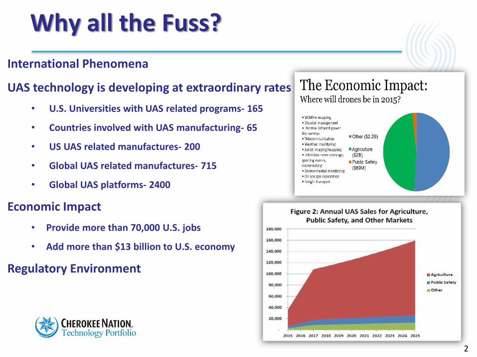
Why all the Fuss?
International Phenomena
UAS technology is developing at extraordinary rates
• U.S. Universities with UAS related programs- 165
• Countries involved with UAS manufacturing- 65
• US UAS related manufactures- 200
• Global UAS related manufactures- 715
• Global UAS platforms- 2400
Economic Impact
• Provide more than 70,000 U.S. jobs
• Add more than $13 billion to U.S. economy
Regulatory Environment
2
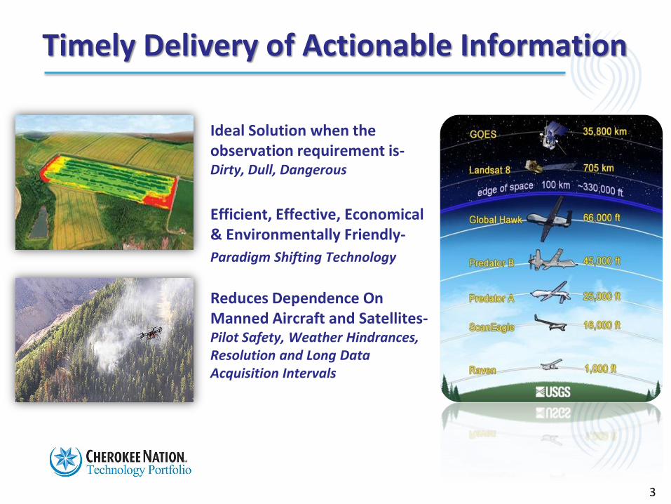
Timely Delivery of Actionable Information
Ideal Solution when the observation requirement is-Dirty, Dull, Dangerous
Efficient, Effective, Economical & Environmentally Friendly-
Paradigm Shifting Technology
Reduces Dependence On Manned Aircraft and Satellites-Pilot Safety, Weather Hindrances, Resolution and Long Data Acquisition Intervals
3
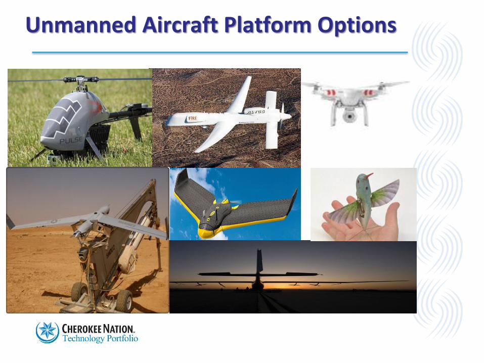
Unmanned Aircraft Platform Options
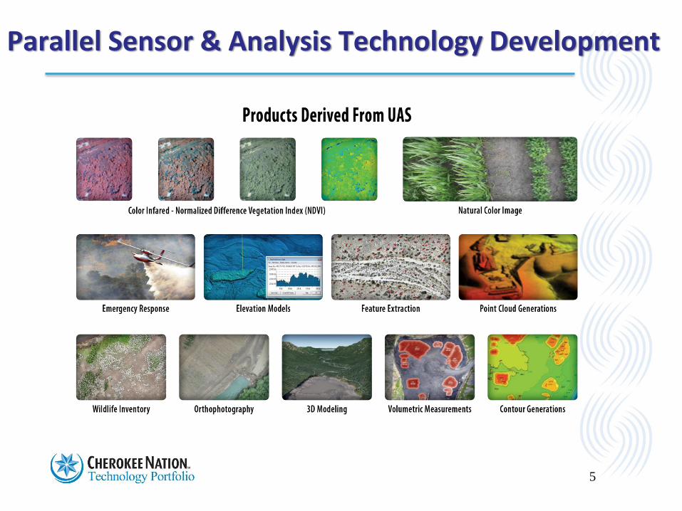
Parallel Sensor & Analysis Technology Development
5
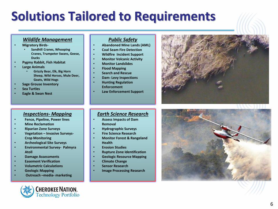
Wildlife Management• Migratory Birds-
• Sandhill Cranes, Whooping Cranes, Trumpeter Swans, Geese, Ducks
• Pygmy Rabbit, Fish Habitat• Large Animals
• Grizzly Bear, Elk, Big Horn Sheep, Wild Horses, Mule Deer, Goats, Wild Hogs
• Sage Grouse Inventory • Sea Turtles• Eagle & Swan Nest
Public Safety• Abandoned Mine Lands (AML)• Coal Seam Fire Detection • Wildfire Incident Support• Monitor Volcanic Activity• Monitor Landslides • Flood Mapping • Search and Rescue• Dam- Levy Inspections• Hunting Regulation
Enforcement• Law Enforcement Support
Solutions Tailored to Requirements
Inspections- Mapping• Fence, Pipeline, Power lines• Mine Reclamation• Riparian Zone Surveys• Vegetation – Invasive Surveys-
Crop Monitoring• Archeological Site Surveys• Environmental Survey- Palmyra
Atoll• Damage Assessments• Easement Verification• Volumetric Calculations• Geologic Mapping • Outreach –media- marketing
Earth Science Research• Assess Impacts of Dam
Removal • Hydrographic Surveys• Fire Science Research• Monitor Forest & Rangeland
Health• Erosion Studies• Rupture Zone Identification• Geologic Resource Mapping• Climate Change• Sensor Research • Image Processing Research
6
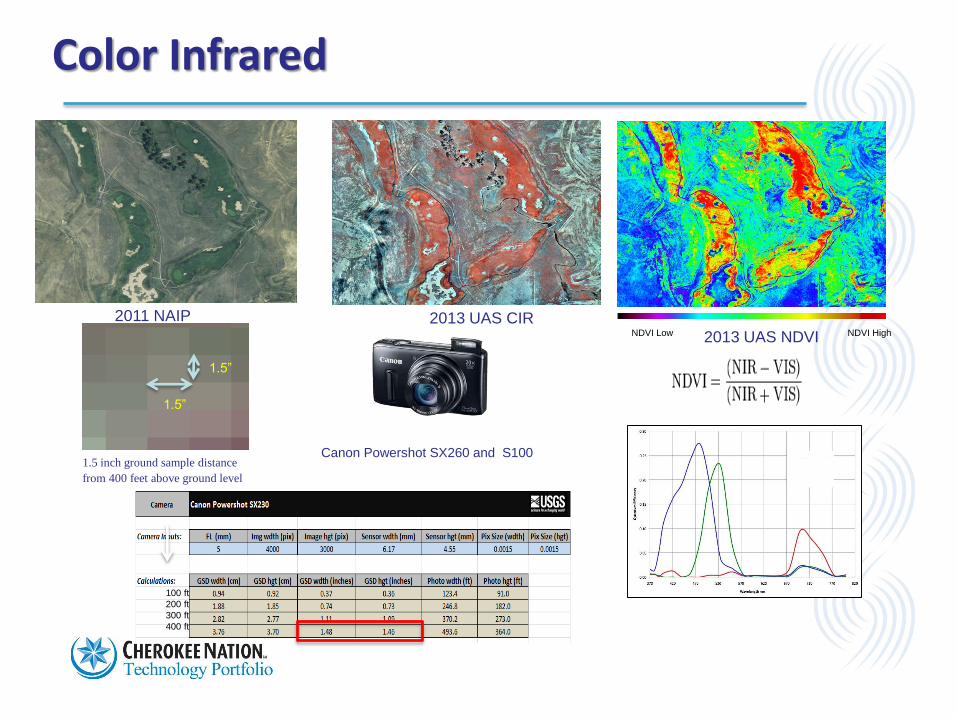
2011 NAIP 2013 UAS CIR
2013 UAS NDVI
Color Infrared
1.5 inch ground sample distance
from 400 feet above ground level
1.5”
1.5”
100 ft
200 ft
300 ft
400 ft
Canon Powershot SX260 and S100
NDVI Low NDVI High
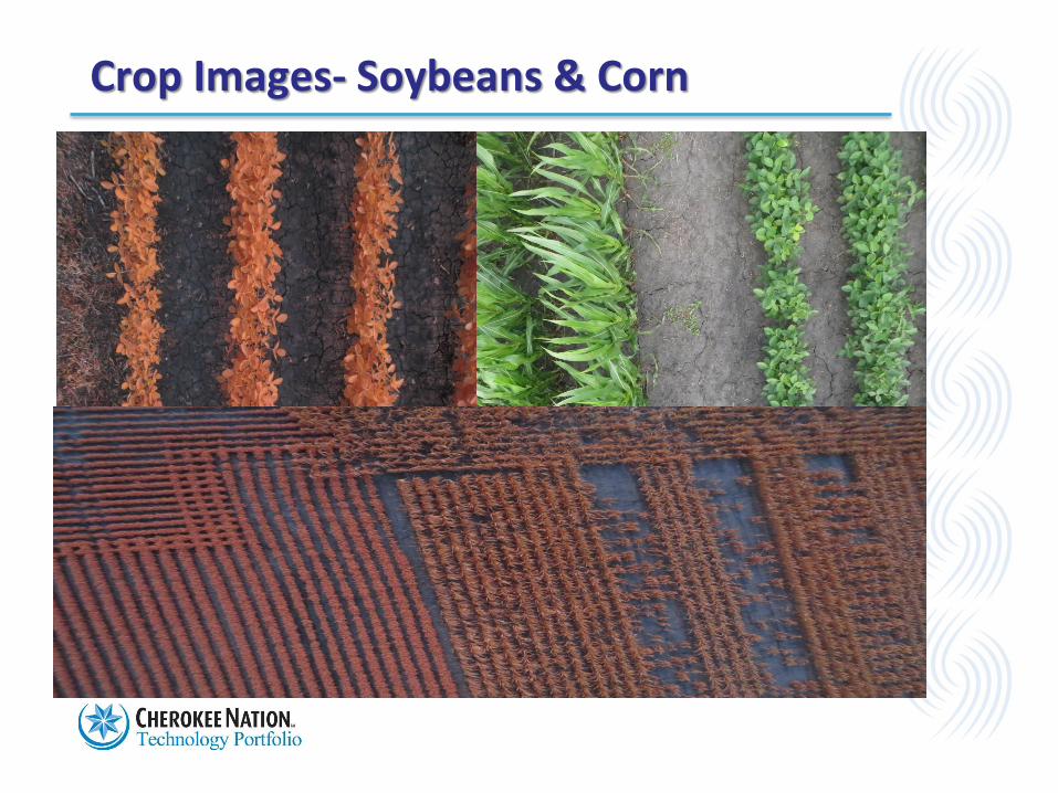
Crop Images- Soybeans & Corn
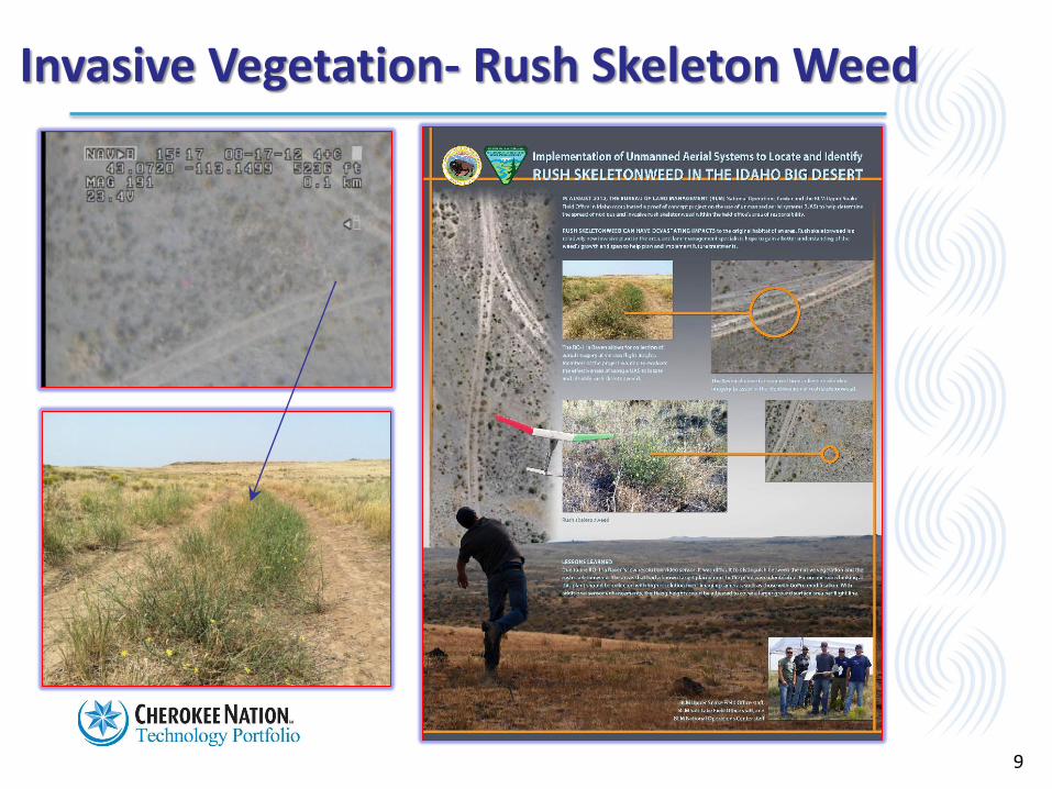
Invasive Vegetation- Rush Skeleton Weed
9
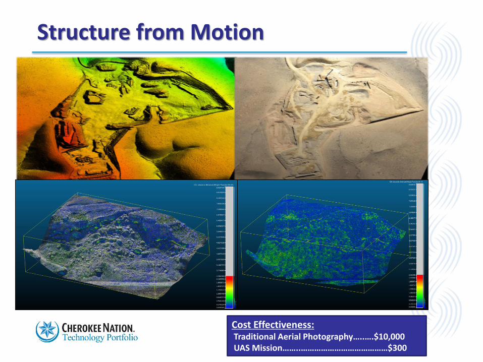
Structure from Motion
Cost Effectiveness:Traditional Aerial Photography…..….$10,000UAS Mission……..…………………………………$300
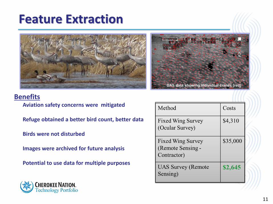
Feature Extraction
Benefits• Aviation safety concerns were mitigated
• Refuge obtained a better bird count, better data
• Birds were not disturbed
• Images were archived for future analysis
• Potential to use data for multiple purposes
UAS data showing individual cranes (red)
11
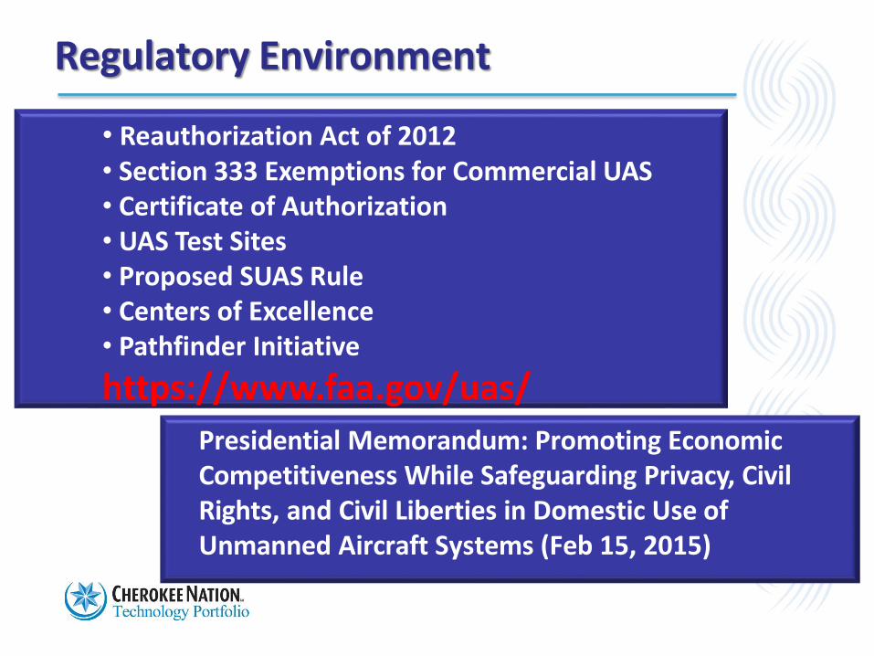
Regulatory Environment
• Reauthorization Act of 2012• Section 333 Exemptions for Commercial UAS• Certificate of Authorization• UAS Test Sites• Proposed SUAS Rule• Centers of Excellence• Pathfinder Initiative
https://www.faa.gov/uas/
Presidential Memorandum: Promoting EconomicCompetitiveness While Safeguarding Privacy, CivilRights, and Civil Liberties in Domestic Use of Unmanned Aircraft Systems (Feb 15, 2015)
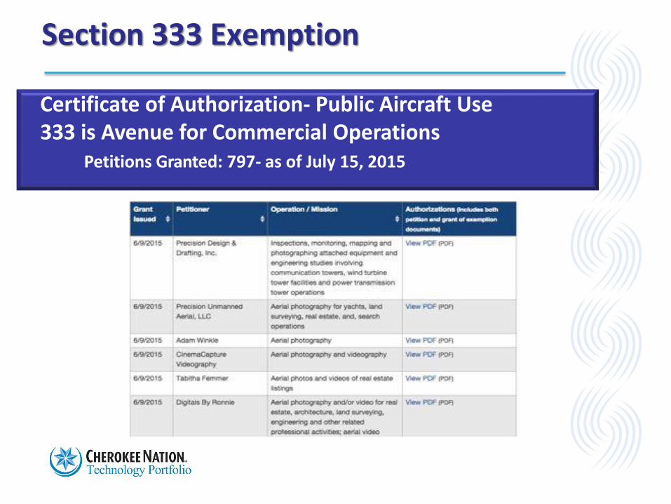
Section 333 Exemption
Certificate of Authorization- Public Aircraft Use333 is Avenue for Commercial Operations
Petitions Granted: 797- as of July 15, 2015
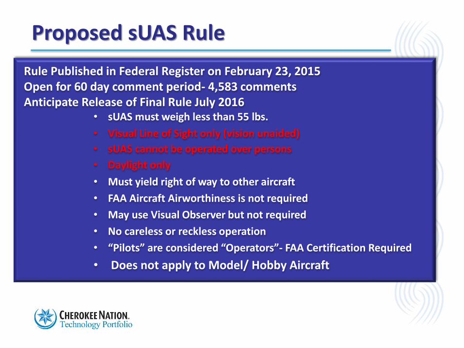
Proposed sUAS Rule
14
Rule Published in Federal Register on February 23, 2015Open for 60 day comment period- 4,583 commentsAnticipate Release of Final Rule July 2016
• sUAS must weigh less than 55 lbs.
• Visual Line of Sight only (vision unaided)
• sUAS cannot be operated over persons
• Daylight only
• Must yield right of way to other aircraft
• FAA Aircraft Airworthiness is not required
• May use Visual Observer but not required
• No careless or reckless operation
• “Pilots” are considered “Operators”- FAA Certification Required
• Does not apply to Model/ Hobby Aircraft
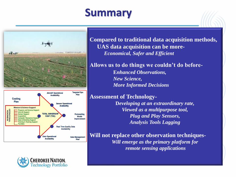
Compared to traditional data acquisition methods,
UAS data acquisition can be more-Economical, Safer and Efficient
Allows us to do things we couldn’t do before-
Enhanced Observations,
New Science,
More Informed Decisions
Assessment of Technology-Developing at an extraordinary rate,
Viewed as a multipurpose tool,
Plug and Play Sensors,
Analysis Tools Lagging
Will not replace other observation techniques-Will emerge as the primary platform for
remote sensing applications
Summary
15
16
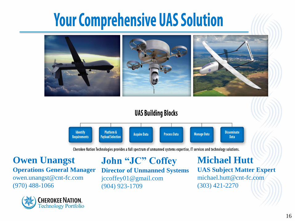
Owen UnangstOperations General Manager
(970) 488-1066
John “JC” CoffeyDirector of Unmanned Systems
(904) 923-1709
Michael HuttUAS Subject Matter Expert
(303) 421-2270