Embed Size (px)
Citation preview
Integration of the MODFLOW Lak7 package in the FREEWAT GIS modelling environment
Massimiliano Cannata1, Jakob Neumann1, Mirko Cardoso1, Rudy Rossetto2 , Laura Foglia3,
1 Institute of Earth Sciences, University of Applied Sciences and Arts of Southern Switzerland, Cannobio, Switzerland 2 Scuola Superiore Sant'Anna, Pisa, Italy
3 Technischen Universität Darmstadt, Darmstadt, Germany
www.freewat.eu
FREEWAT expected main impact
help producing scientifically and technically sounding decision and policy making based on:
• data and innovative data analysis tools and
• including participatory approach not only in the final stage of discussion but also during the phase of scenario generation.
FREEWAT is an ICT project for improving Water Resource Management (WRM)
MAIN EXPECTED RESULT
Open source and public domain GIS integrated modelling platform for promoting WRM by simplifying and strengthening the application of WFD, GWD and other water related Directives.
This project has received funding from the European Union’s Horizon 2020 research and innovation programme under grant agreement No 642224
FREEWAT - Free and Open Source Software Tools for Water Resource Management
Concept and Motivations 1. free and open source tools, numerically based, GIS integrated, to
to analyse conjunctive use of surface- and ground-water, and to
boost the application of the WFD and water related Directives;
2. use effectively data provided by the extensive monitoring required
by the WFD;
3. training technical staff at authorities and private companies on the
use of state-of-the-art innovative software for water management;
4. including participatory approach earlier than only result
discussion;
Open source characteristics of the project
initiative "ad includendum" - further research institutions, private developers etc. may contribute to the project development
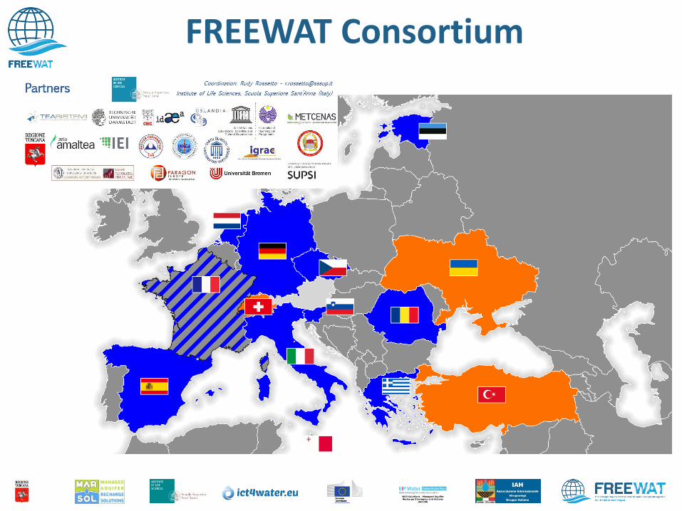
FREEWAT Consortium
DURATION: 30 months – started April 1st 2015 – to September 2017
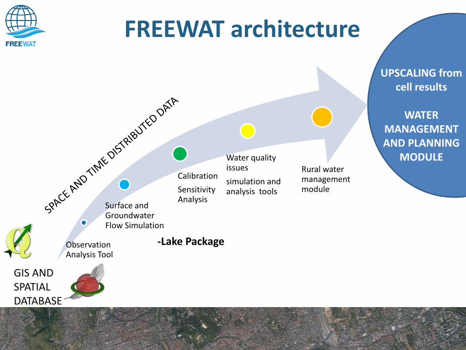
FREEWAT architecture
Surface and Groundwater Flow Simulation
Water quality issues
simulation and analysis tools
Rural water management module
UPSCALING from cell results
WATER
MANAGEMENT AND PLANNING
MODULE
GIS AND SPATIAL DATABASE
Calibration
Sensitivity Analysis
Observation Analysis Tool
-Lake Package
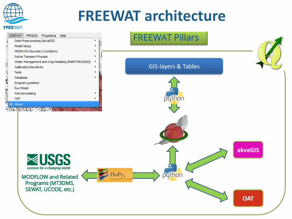
FREEWAT architecture
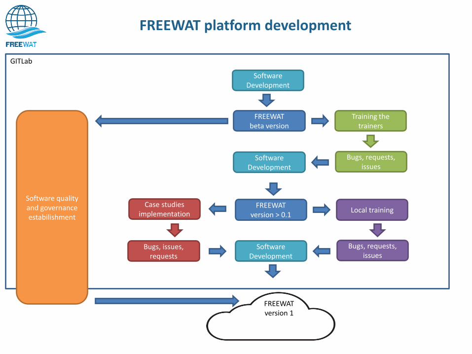
FREEWAT platform development
Software Development
FREEWAT beta version
Training the trainers
Bugs, requests, issues
Software Development
FREEWAT version > 0.1
Local training
Bugs, requests, issues
Software Development
Case studies implementation
Bugs, issues, requests
FREEWAT version 1
GITLab
Software quality and governance estabilishment
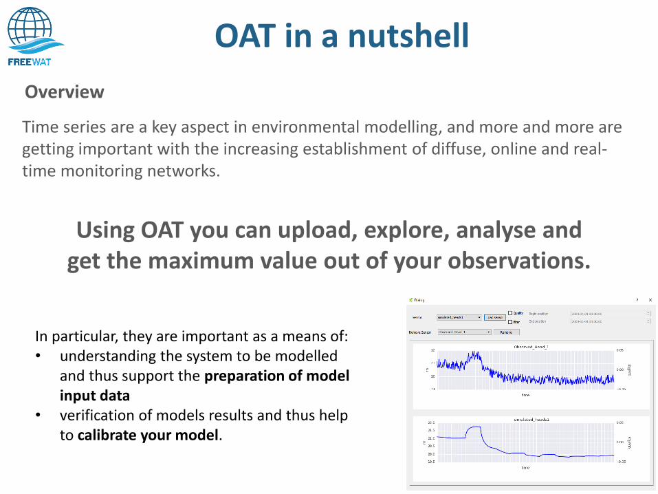
OAT in a nutshell
Time series are a key aspect in environmental modelling, and more and more are getting important with the increasing establishment of diffuse, online and real-time monitoring networks.
Using OAT you can upload, explore, analyse and get the maximum value out of your observations.
Overview
In particular, they are important as a means of: • understanding the system to be modelled
and thus support the preparation of model input data
• verification of models results and thus help to calibrate your model.
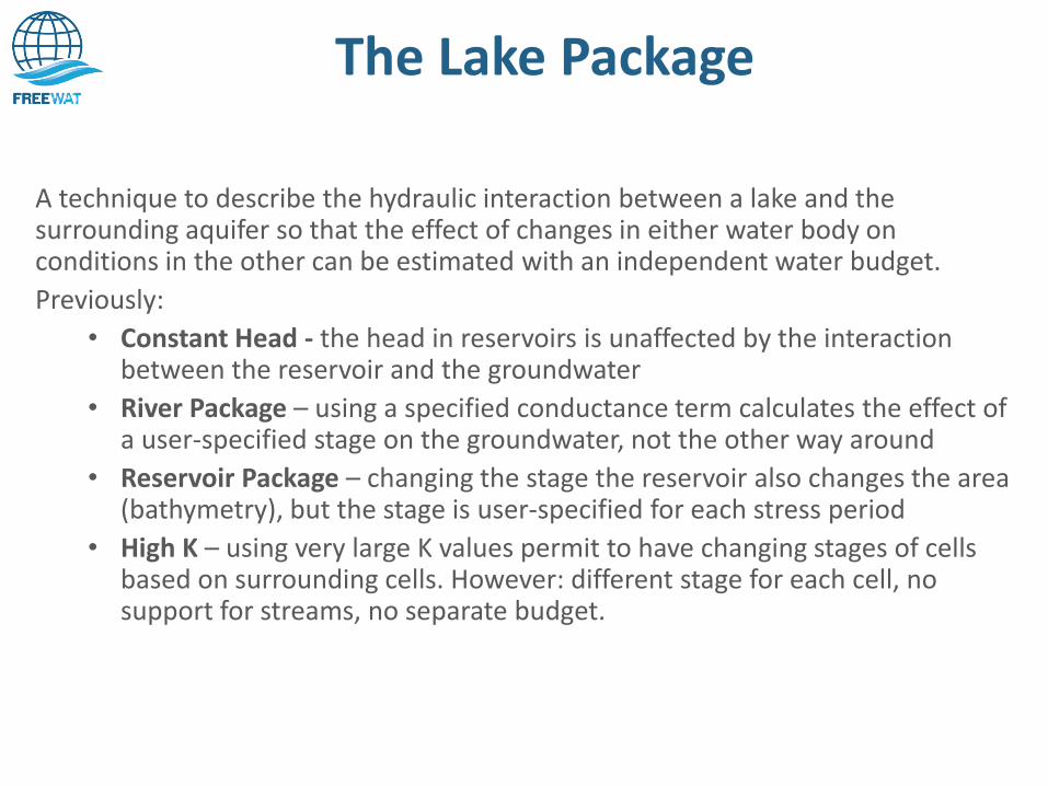
The Lake Package
A technique to describe the hydraulic interaction between a lake and the surrounding aquifer so that the effect of changes in either water body on conditions in the other can be estimated with an independent water budget.
Previously:
• Constant Head - the head in reservoirs is unaffected by the interaction between the reservoir and the groundwater
• River Package – using a specified conductance term calculates the effect of a user-specified stage on the groundwater, not the other way around
• Reservoir Package – changing the stage the reservoir also changes the area (bathymetry), but the stage is user-specified for each stress period
• High K – using very large K values permit to have changing stages of cells based on surrounding cells. However: different stage for each cell, no support for streams, no separate budget.
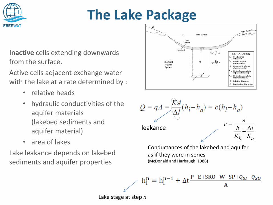
The Lake Package
Inactive cells extending downwards from the surface.
Active cells adjacent exchange water with the lake at a rate determined by :
• relative heads
• hydraulic conductivities of the aquifer materials (lakebed sediments and aquifer material)
• area of lakes
Lake leakance depends on lakebed sediments and aquifer properties
leakance
Conductances of the lakebed and aquifer as if they were in series (McDonald and Harbaugh, 1988)
Lake stage at step n
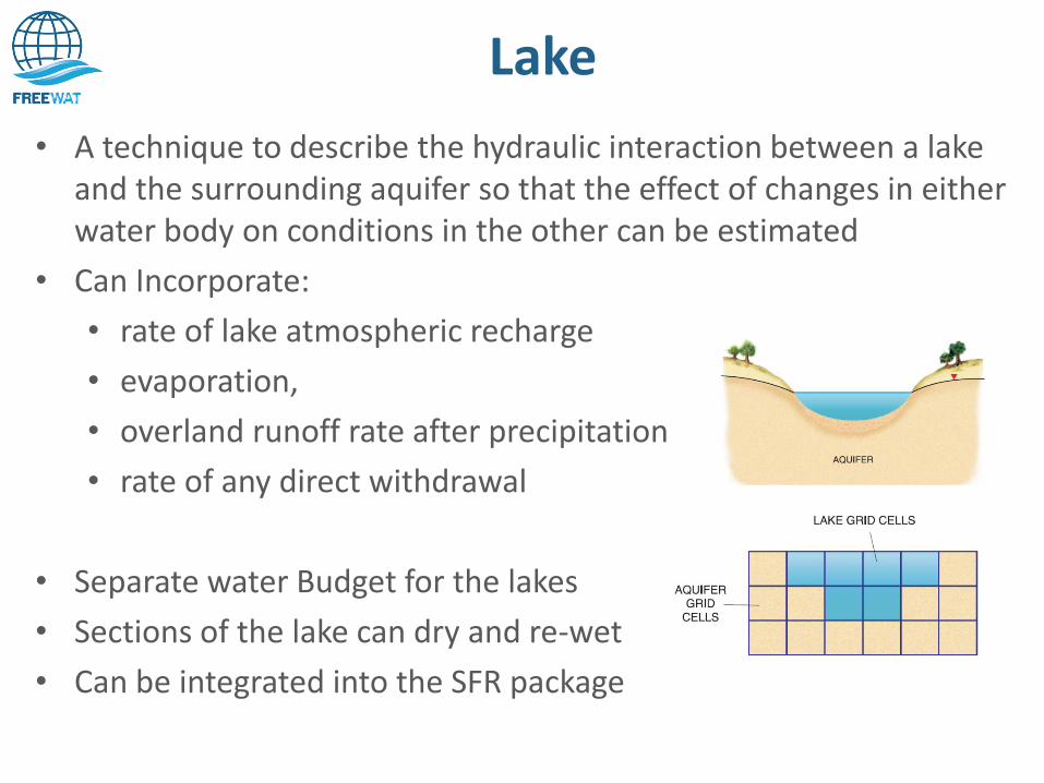
Lake
• A technique to describe the hydraulic interaction between a lake and the surrounding aquifer so that the effect of changes in either water body on conditions in the other can be estimated
• Can Incorporate:
• rate of lake atmospheric recharge
• evaporation,
• overland runoff rate after precipitation
• rate of any direct withdrawal
• Separate water Budget for the lakes
• Sections of the lake can dry and re-wet
• Can be integrated into the SFR package
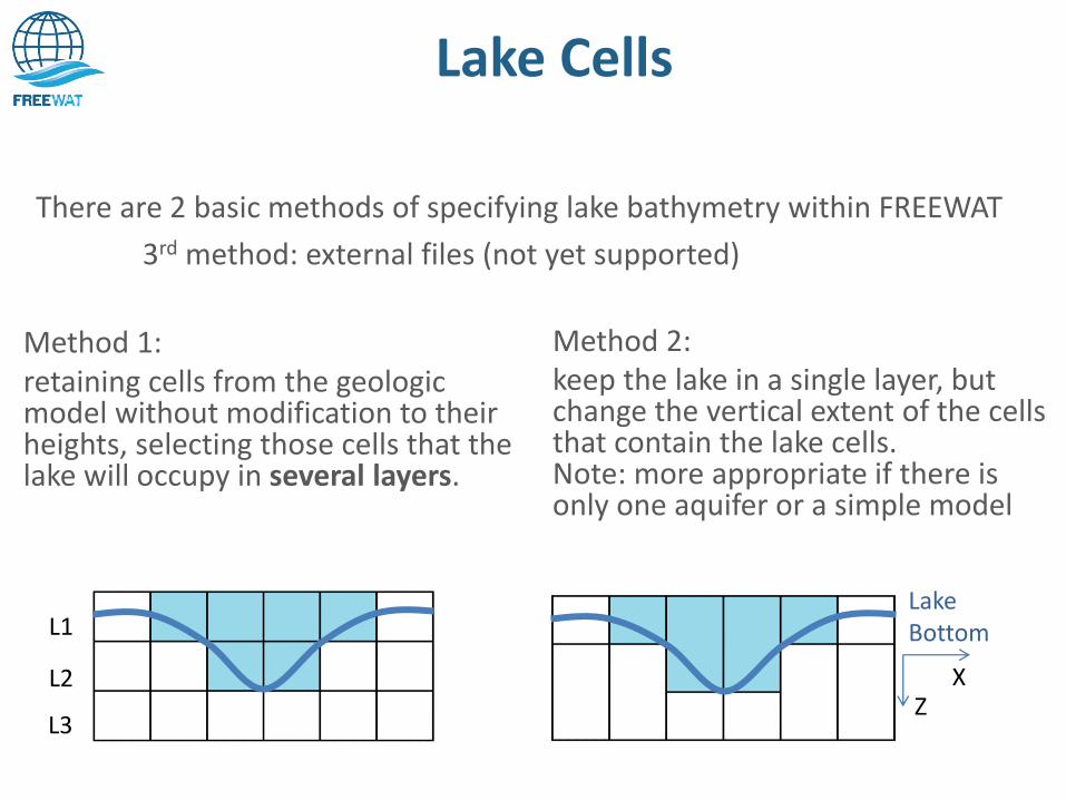
Lake Cells
There are 2 basic methods of specifying lake bathymetry within FREEWAT
3rd method: external files (not yet supported)
L1
L2
L3
Method 1: retaining cells from the geologic model without modification to their heights, selecting those cells that the lake will occupy in several layers.
Lake Bottom
X Z
Method 2: keep the lake in a single layer, but change the vertical extent of the cells that contain the lake cells. Note: more appropriate if there is only one aquifer or a simple model
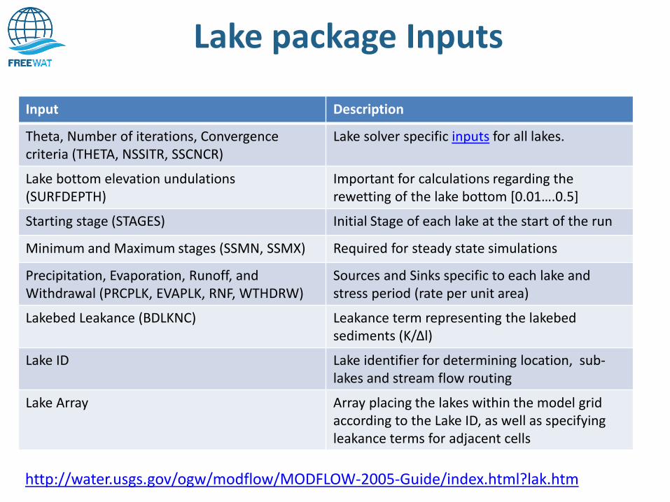
Lake package Inputs
Input Description
Theta, Number of iterations, Convergence criteria (THETA, NSSITR, SSCNCR)
Lake solver specific inputs for all lakes.
Lake bottom elevation undulations (SURFDEPTH)
Important for calculations regarding the rewetting of the lake bottom [0.01….0.5]
Starting stage (STAGES) Initial Stage of each lake at the start of the run
Minimum and Maximum stages (SSMN, SSMX) Required for steady state simulations
Precipitation, Evaporation, Runoff, and Withdrawal (PRCPLK, EVAPLK, RNF, WTHDRW)
Sources and Sinks specific to each lake and stress period (rate per unit area)
Lakebed Leakance (BDLKNC) Leakance term representing the lakebed sediments (K/Δl)
Lake ID Lake identifier for determining location, sub-lakes and stream flow routing
Lake Array Array placing the lakes within the model grid according to the Lake ID, as well as specifying leakance terms for adjacent cells
http://water.usgs.gov/ogw/modflow/MODFLOW-2005-Guide/index.html?lak.htm
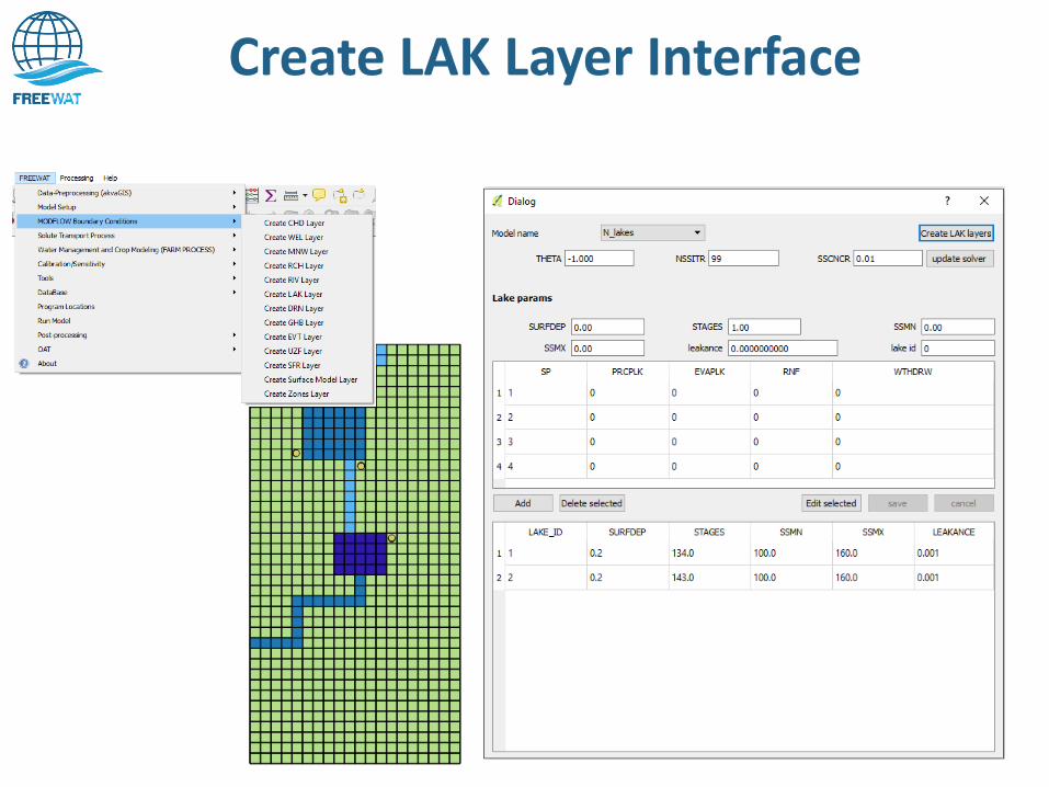
Create LAK Layer Interface
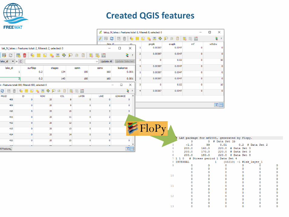
Created QGIS features
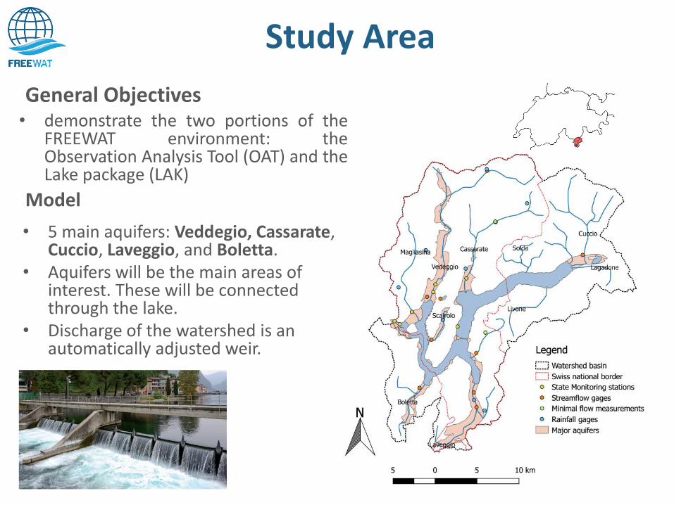
Study Area
• 5 main aquifers: Veddegio, Cassarate, Cuccio, Laveggio, and Boletta.
• Aquifers will be the main areas of interest. These will be connected through the lake.
• Discharge of the watershed is an automatically adjusted weir.
Model
• demonstrate the two portions of the FREEWAT environment: the Observation Analysis Tool (OAT) and the Lake package (LAK)
General Objectives
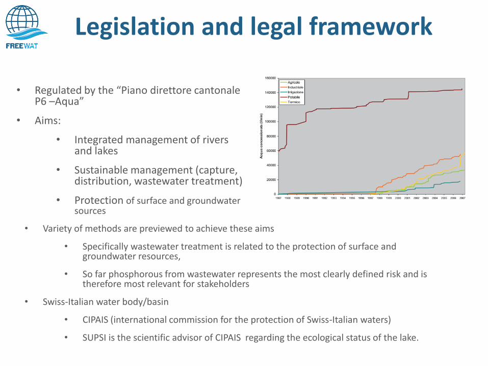
Legislation and legal framework
• Regulated by the “Piano direttore cantonale P6 –Aqua”
• Aims:
• Integrated management of rivers and lakes
• Sustainable management (capture, distribution, wastewater treatment)
• Protection of surface and groundwater sources
• Variety of methods are previewed to achieve these aims
• Specifically wastewater treatment is related to the protection of surface and groundwater resources,
• So far phosphorous from wastewater represents the most clearly defined risk and is therefore most relevant for stakeholders
• Swiss-Italian water body/basin
• CIPAIS (international commission for the protection of Swiss-Italian waters)
• SUPSI is the scientific advisor of CIPAIS regarding the ecological status of the lake.
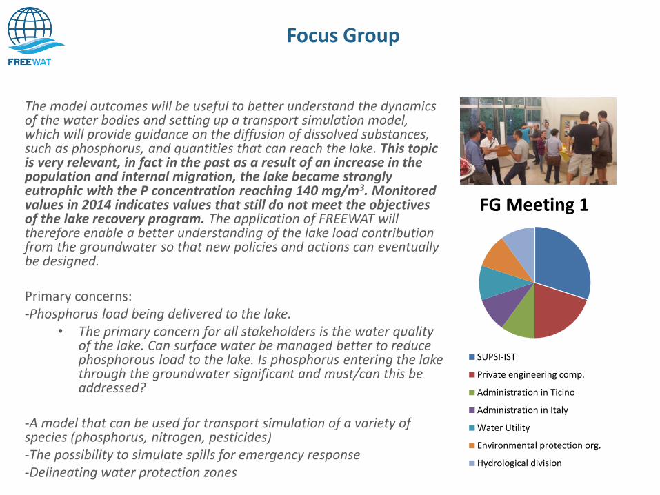
Focus Group
The model outcomes will be useful to better understand the dynamics of the water bodies and setting up a transport simulation model, which will provide guidance on the diffusion of dissolved substances, such as phosphorus, and quantities that can reach the lake. This topic is very relevant, in fact in the past as a result of an increase in the population and internal migration, the lake became strongly eutrophic with the P concentration reaching 140 mg/m3. Monitored values in 2014 indicates values that still do not meet the objectives of the lake recovery program. The application of FREEWAT will therefore enable a better understanding of the lake load contribution from the groundwater so that new policies and actions can eventually be designed. Primary concerns: -Phosphorus load being delivered to the lake.
• The primary concern for all stakeholders is the water quality of the lake. Can surface water be managed better to reduce phosphorous load to the lake. Is phosphorus entering the lake through the groundwater significant and must/can this be addressed?
-A model that can be used for transport simulation of a variety of species (phosphorus, nitrogen, pesticides) -The possibility to simulate spills for emergency response -Delineating water protection zones
FG Meeting 1
SUPSI-IST
Private engineering comp.
Administration in Ticino
Administration in Italy
Water Utility
Environmental protection org.
Hydrological division
Next Steps
• develop and hydrogeological model of the aquifers connected to Lake Ceresio to simulate the groundwater/surface water interaction
• assess the potential impacts of the diffusion of dissolved substances in relation to river-lake-groundwater interactions, especially Phosphorous.
Case Study Specific Objectives
• 14 other case studies • Software usability survey
• From all current case studies and upcoming trainings • Training Courses
• Train approx. 60 users per partner • Additional developments to tools
• Automatic bathymetry recognition for lake • Automatically assign time series to boundary conditions using
OAT
Project Objectives
Thank you for your attention!