Embed Size (px)
Citation preview

Project: The Geographical Tour of America
Earth and Space Science
Shivam Singh Sengar

“
”Hawaii
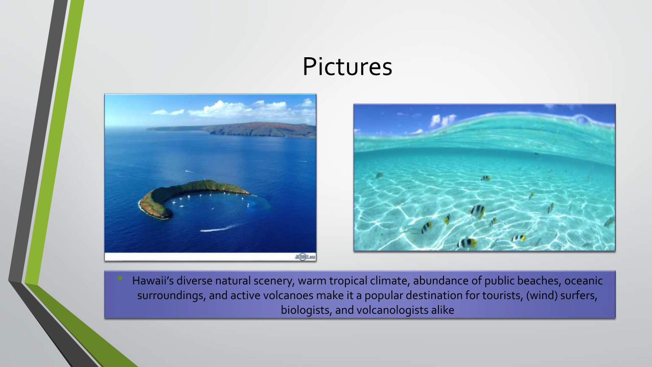
Pictures
• Hawaii’s diverse natural scenery, warm tropical climate, abundance of public beaches, oceanic surroundings, and active volcanoes make it a popular destination for tourists, (wind) surfers,
biologists, and volcanologists alike
Formation
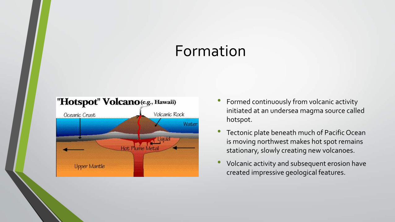
• Formed continuously from volcanic activity initiated at an undersea magma source called hotspot.
• Tectonic plate beneath much of Pacific Ocean is moving northwest makes hot spot remains stationary, slowly creating new volcanoes.
• Volcanic activity and subsequent erosion have created impressive geological features.

“
”Yellowstone National Park

Pictures
• The Continental Divide of North America runs diagonally through the south-western part of the park. The park sits on theYellowstone Plateau, at an average elevation of 8,000 feet (2,400 m) above sea level. The
plateau is bounded on nearly all sides by mountain ranges of the Middle Rocky Mountains, which range from 9,000 to 11,000 feet (2,700 to 3,400 m) in elevation

Formation
• A caldera was formed by a large explosion.
• Park is also full of geysers and hydrothermal systems.
Start forming around 17 million years ago, with the transfer of North American Plate by plate tectonic across a stationary mantle hotspot

“
”Canadian Shield

Pictures
A large area of Precambrian igneous and high grade metamorphic rocks forming an ancient geological core of the North American continent, covered by a thin layer of soil.
Formation
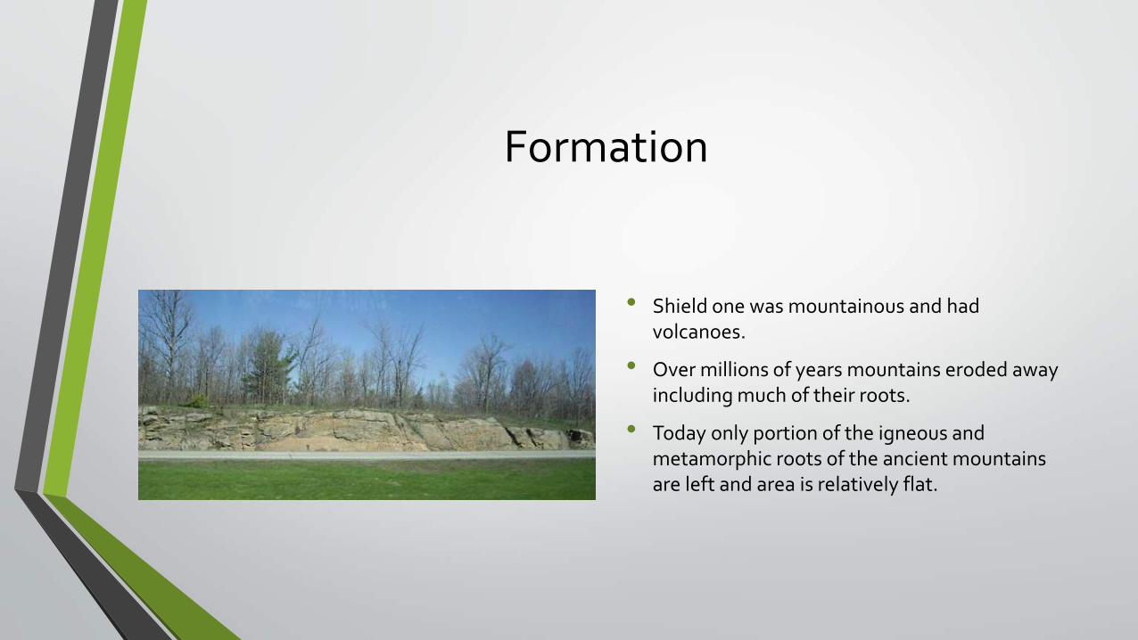
• Shield one was mountainous and had volcanoes.
• Over millions of years mountains eroded away including much of their roots.
• Today only portion of the igneous and metamorphic roots of the ancient mountains are left and area is relatively flat.

“
”Basin and Range Province
Pictures
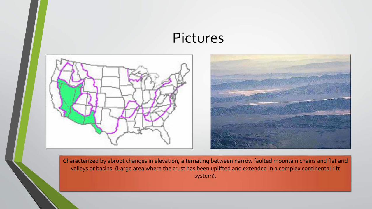
Characterized by abrupt changes in elevation, alternating between narrow faulted mountain chains and flat arid valleys or basins. (Large area where the crust has been uplifted and extended in a complex continental rift
system).

Formation• Formed as a result of extension and thinning of
lithosphere, which is composed of crust and upper mantle.
• Tectonic activity responsible for the extension in the Basin and Range is a complex and controversial.
• Mostly accepted hypothesis suggests that crustal shearing associated with the San Andreas Fault caused spontaneous extensional faulting similar to that seen in the Great Basin.
• Geologic processes that elevate heat flow are varied. Researches suggest that the heat generated at a subduction zone is transferred to the overriding plate as subduction proceeds. Fluid along fault zones then transfer heat vertical through the crust. This model led to increase interest in geothermal systems in the Basin and Range, requires consideration of the continued influence of the fully subducted Farallon plate in the extension responsible for its formation.
Formation of Basin and Range topography by crustal extension:A. No deformation has taken place.B. Formation of listric normal faults.C. Faults connect at depth forming horst and graben geometry.D. Fault blocks form series of peaks and valleys.

“
”
Snake River Plain and Columbian Basin
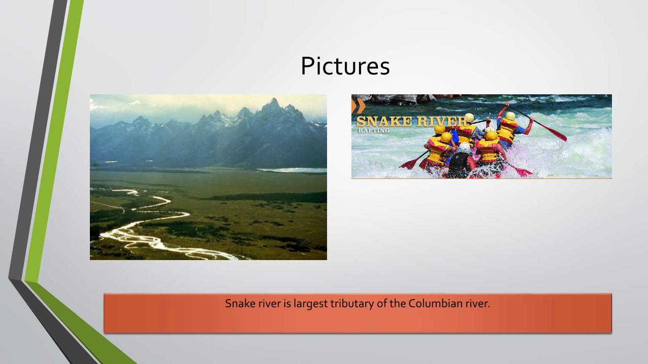
Pictures
Snake river is largest tributary of the Columbian river.
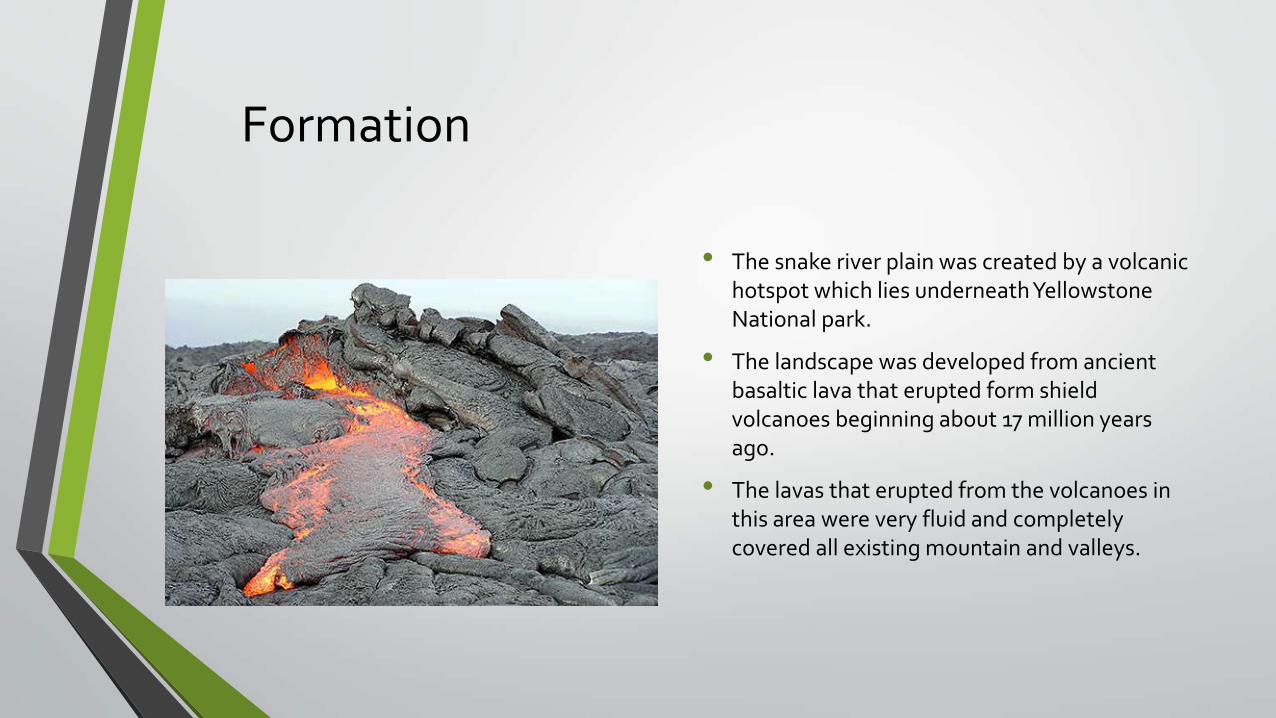
Formation
• The snake river plain was created by a volcanic hotspot which lies underneath Yellowstone National park.
• The landscape was developed from ancient basaltic lava that erupted form shield volcanoes beginning about 17 million years ago.
• The lavas that erupted from the volcanoes in this area were very fluid and completely covered all existing mountain and valleys.

“
”
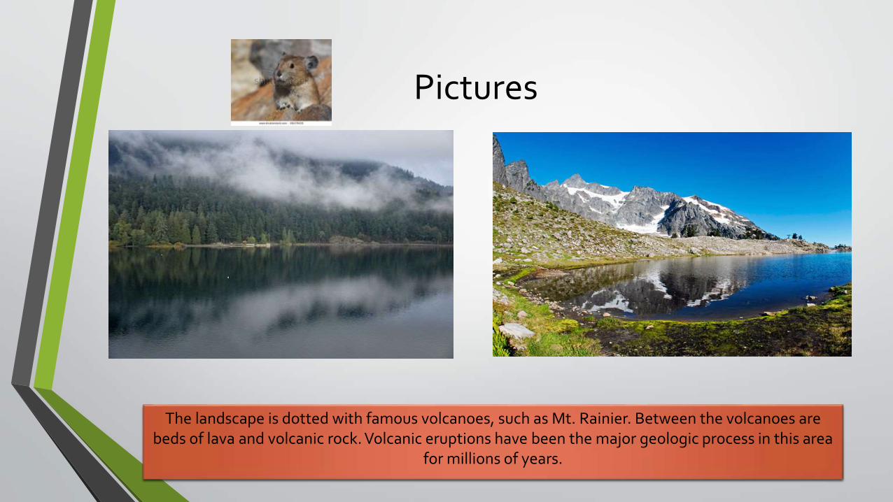
Cascades Area of America’s Pacific Northwest
Pictures
The landscape is dotted with famous volcanoes, such as Mt. Rainier. Between the volcanoes are beds of lava and volcanic rock. Volcanic eruptions have been the major geologic process in this area
for millions of years.

Formation
• The Northwest is still highly geologically active, with volcanoes and geological faults.
• Province is characterized by famous stratovolcano that have formed at convergent plate boundaries where subduction is taking place.
• Volcanic eruptions have been the major geologic process in this area for millions of years.

“
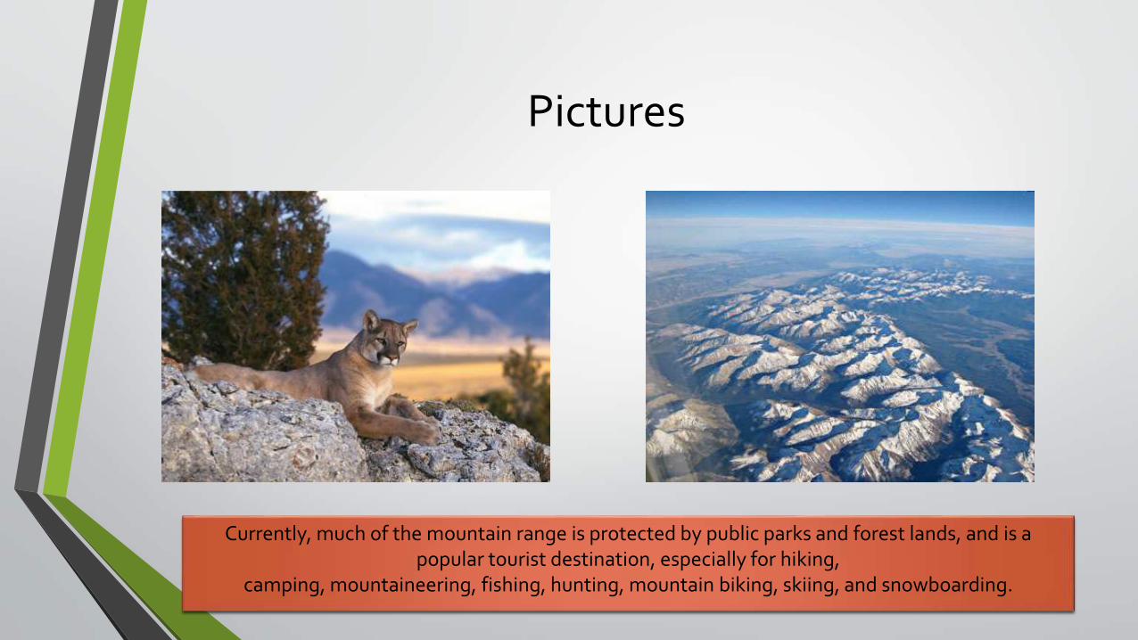
”Rocky Mountains
Pictures
Currently, much of the mountain range is protected by public parks and forest lands, and is a popular tourist destination, especially for hiking,
camping, mountaineering, fishing, hunting, mountain biking, skiing, and snowboarding.
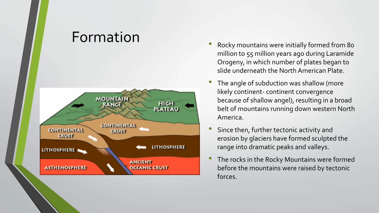
Formation• Rocky mountains were initially formed from 80
million to 55 million years ago during Laramide Orogeny, in which number of plates began to slide underneath the North American Plate.
• The angle of subduction was shallow (more likely continent- continent convergence because of shallow angel), resulting in a broad belt of mountains running down western North America.
• Since then, further tectonic activity and erosion by glaciers have formed sculpted the range into dramatic peaks and valleys.
• The rocks in the Rocky Mountains were formed before the mountains were raised by tectonic forces.

“
”Appalachian Valley

Pictures
The Ouachita Mountains in Arkansas and Oklahoma were originally part of the Appalachians as well, but became disconnected through geologic history.
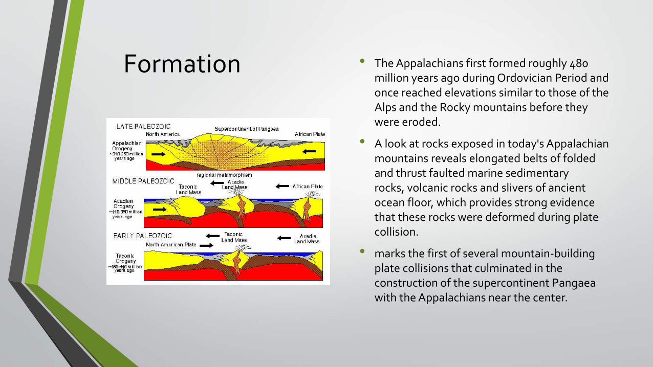
Formation • The Appalachians first formed roughly 480 million years ago during Ordovician Period and once reached elevations similar to those of the Alps and the Rocky mountains before they were eroded.
• A look at rocks exposed in today's Appalachian mountains reveals elongated belts of folded and thrust faulted marine sedimentary rocks, volcanic rocks and slivers of ancient ocean floor, which provides strong evidence that these rocks were deformed during plate collision.
• marks the first of several mountain-building plate collisions that culminated in the construction of the supercontinent Pangaea with the Appalachians near the center.