Embed Size (px)
Citation preview

GEOAVALANCHEINTEGRATED AVALANCHE
RISK MANAGEMENT SYSTEM

Problem

Problem
• Information on the
avalanche danger is
important both for
mountain professionals
(e.g. alpine guides) and
enthusiasts (e.g. hikers)
• More than 40% of avalanche accidents are fatal
for every 100 traffic accidents, there are 3 casualties, while
for every 100 avalanche accidents, there are 60 casualties

Unique selling proposition
• Mobile apps already in the market provide so far only
limited information that are based on big scale weather
forecasts
• None uses geolocation information integrated with
crowdsourcing and earth observation data

Prototype
What is GeoAvalanche?
The only app in the market capable of providing information on
the avalanche risk with a higher level of accuracy and precision
Alerts users from visiting places at high avalanche risk by
increasing their awareness of snow and avalanche conditions
and helps them plan their excursion in safer conditions
It is based on an innovative algorithm that merges meteo
forecast, crowdsourcing and earth observation data
• An innovative project for the snow and avalanche risk management
• A social mapping system
• A geospatial data infrastructure
• Mobile application (iOS and Android)
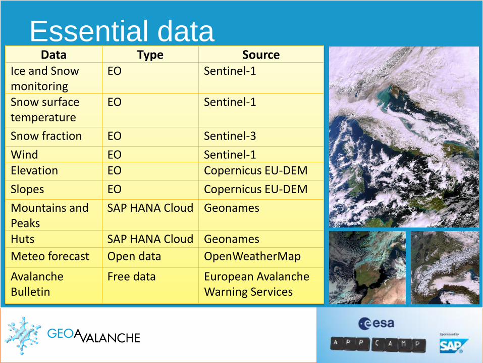
Essential data Data Type Source
Ice and Snow monitoring
EO Sentinel-1
Snow surface temperature
EO Sentinel-1
Snow fraction EO Sentinel-3
Wind EO Sentinel-1Elevation EO Copernicus EU-DEM
Slopes EO Copernicus EU-DEM
Mountains and Peaks
SAP HANA Cloud Geonames
Huts SAP HANA Cloud Geonames
Meteo forecast Open data OpenWeatherMap
Avalanche Bulletin
Free data European Avalanche Warning Services
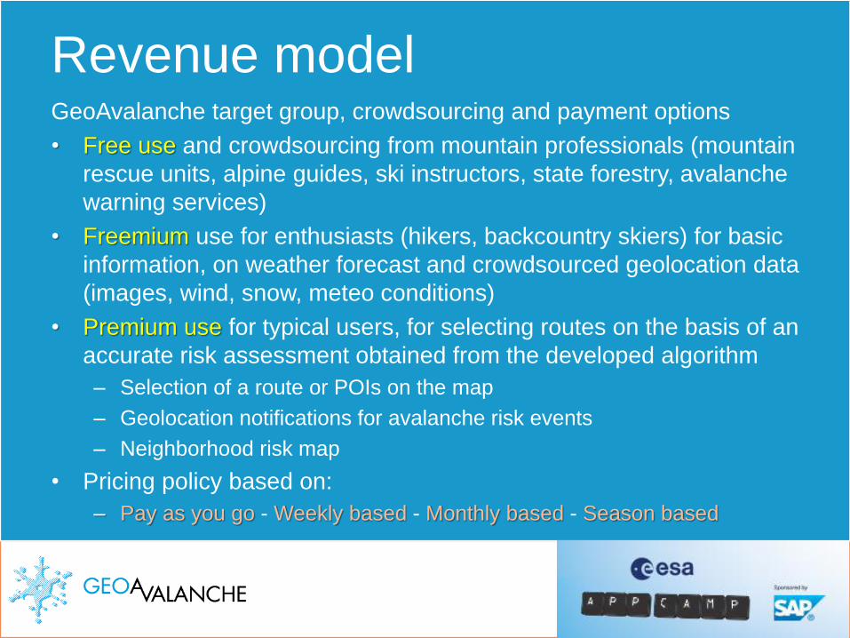
Revenue modelGeoAvalanche target group, crowdsourcing and payment options
• Free use and crowdsourcing from mountain professionals (mountain
rescue units, alpine guides, ski instructors, state forestry, avalanche
warning services)
• Freemium use for enthusiasts (hikers, backcountry skiers) for basic
information, on weather forecast and crowdsourced geolocation data
(images, wind, snow, meteo conditions)
• Premium use for typical users, for selecting routes on the basis of an
accurate risk assessment obtained from the developed algorithm
– Selection of a route or POIs on the map
– Geolocation notifications for avalanche risk events
– Neighborhood risk map
• Pricing policy based on:
– Pay as you go - Weekly based - Monthly based - Season based

Outlook – 1/2Win the EsaAppCamp Barcelona grand prize!
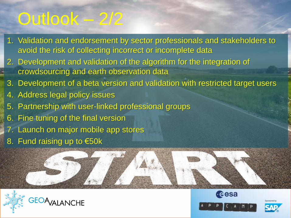
Outlook – 2/21. Validation and endorsement by sector professionals and stakeholders to
avoid the risk of collecting incorrect or incomplete data
2. Development and validation of the algorithm for the integration of
crowdsourcing and earth observation data
3. Development of a beta version and validation with restricted target users
4. Address legal policy issues
5. Partnership with user-linked professional groups
6. Fine tuning of the final version
7. Launch on major mobile app stores
8. Fund raising up to €50k

GeoAvalanche TeamFrancesco Bartoli (IT)
MountaineerGeospatial geek
Konstantinos Gkoumas (GR)
Disaster resilience expertEntrepreneur and academic
Cristiano Carducci (IT)
CreativeSoftware developer

See you in Barcelona!