Embed Size (px)
Citation preview
Developing MRV systems for REDD+
Knowledge sharing workshop Myanmar
23 February, Dr. Veronique (Niki) De Sy
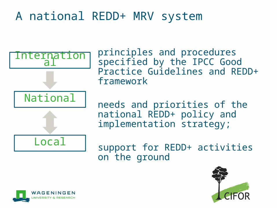
A national REDD+ MRV system
National
International
Local
principles and procedures specified by the IPCC Good Practice Guidelines and REDD+ framework
needs and priorities of the national REDD+ policy and implementation strategy;
support for REDD+ activities on the ground
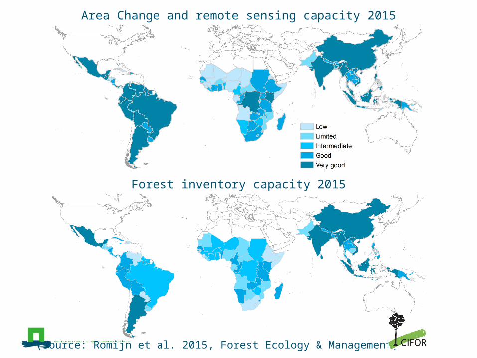
Area Change and remote sensing capacity 2015
Forest inventory capacity 2015
(Source: Romijn et al. 2015, Forest Ecology & Management)
Module 3: Forest monitoring, measurement, reporting and verification
How to incorporate multiple drivers of deforestation and forest degradation into MMRV, evaluation and RELs
Better AFOLU information: ●better data and assessment on mitigation policy
options ●the role of forests in setting country targets and
planning mitigation activities in the broader land use sector
MMRV capacity:●Stakeholder needs & gaps●Independent/transparent monitoring
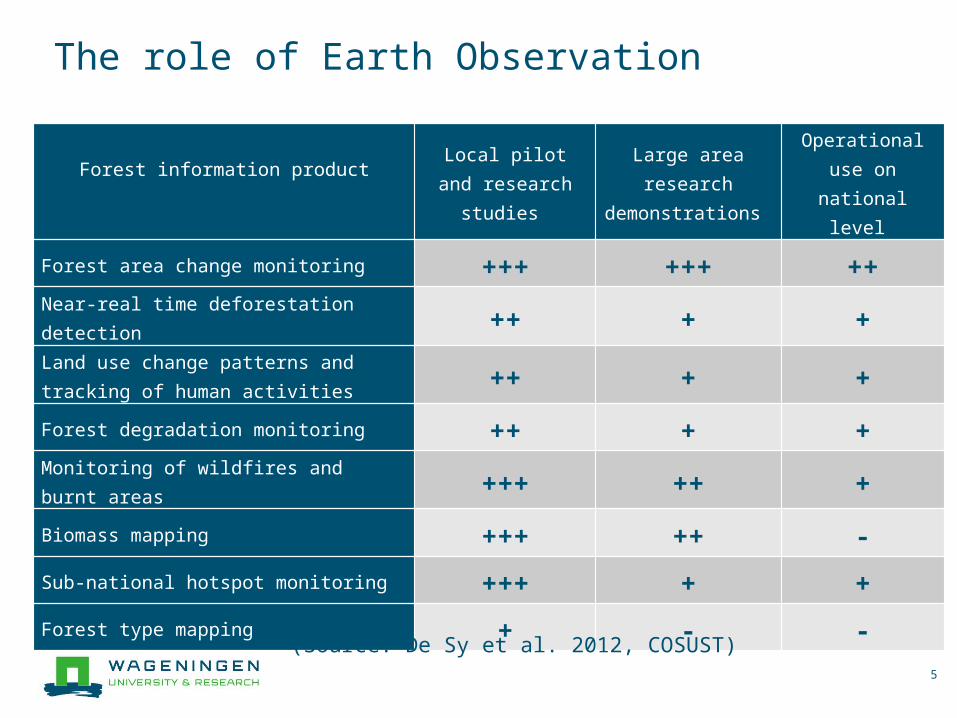
The role of Earth Observation
5
Forest information product
Local pilot and research studies
Large area research
demonstrations
Operational use on national
level
Forest area change monitoring +++ +++ ++Near-real time deforestation detection ++ + +Land use change patterns and tracking of human activities ++ + +Forest degradation monitoring ++ + +Monitoring of wildfires and burnt areas +++ ++ +Biomass mapping +++ ++ -Sub-national hotspot monitoring +++ + +Forest type mapping + - -
(Source: De Sy et al. 2012, COSUST)
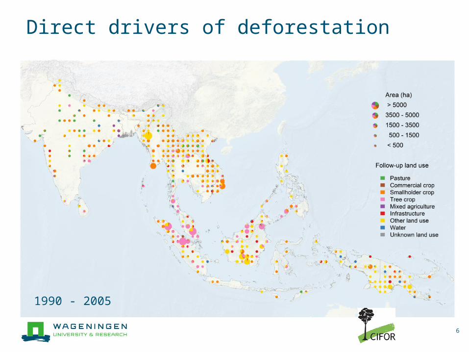
Direct drivers of deforestation
6
1990 - 2005
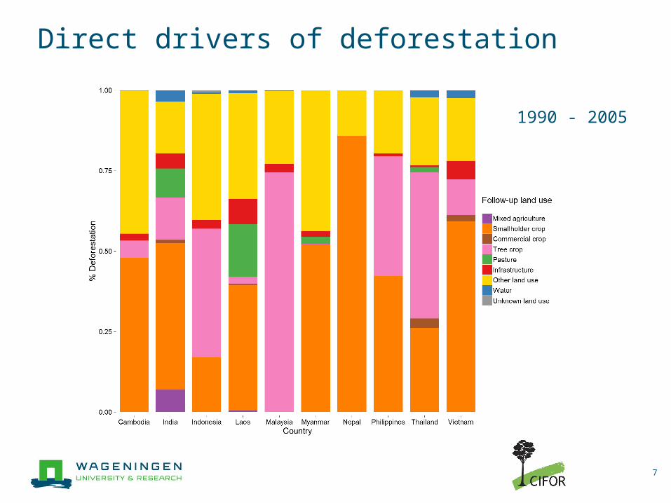
Direct drivers of deforestation
7
1990 - 2005
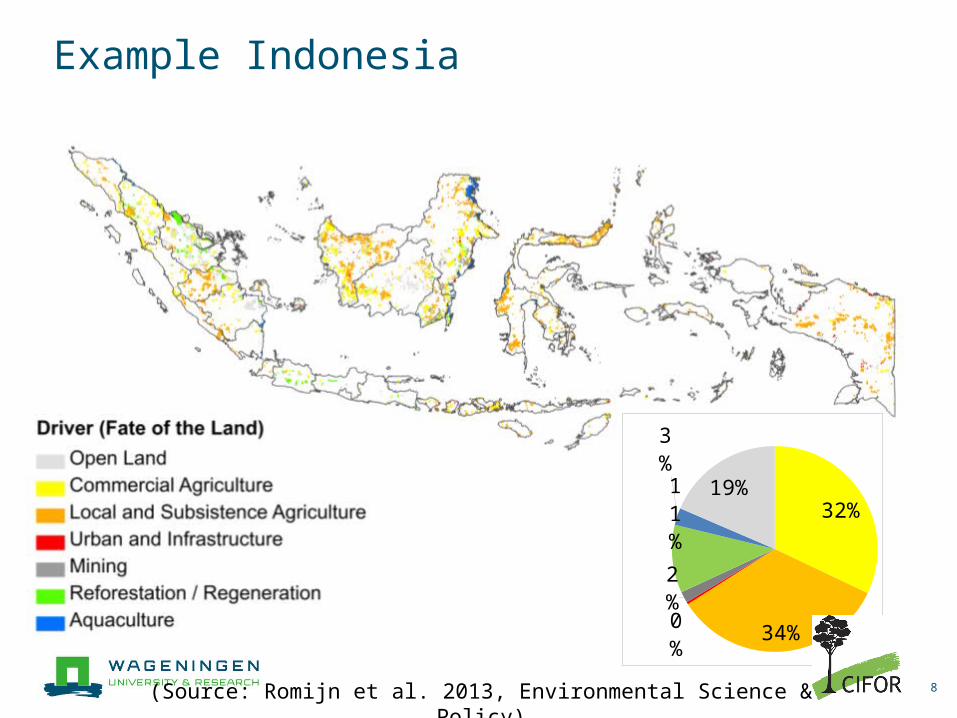
Example Indonesia
8
32%
34%0%
2%
11%
3% 19%
(Source: Romijn et al. 2013, Environmental Science & Policy)
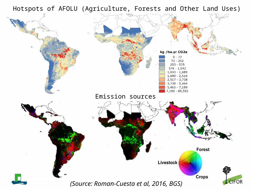
Hotspots of AFOLU (Agriculture, Forests and Other Land Uses) emissions
(Source: Roman-Cuesta et al, 2016, BGS)
Emission sources
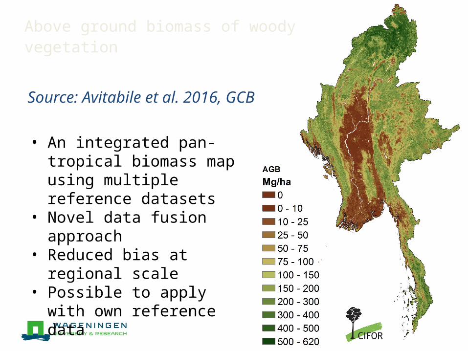
Above ground biomass of woody vegetation
Source: Avitabile et al. 2016, GCB
• An integrated pan tropical ‐biomass map using multiple reference datasets
• Novel data fusion approach• Reduced bias at regional scale• Possible to apply with own
reference data
Data available at lucid.wur.nl
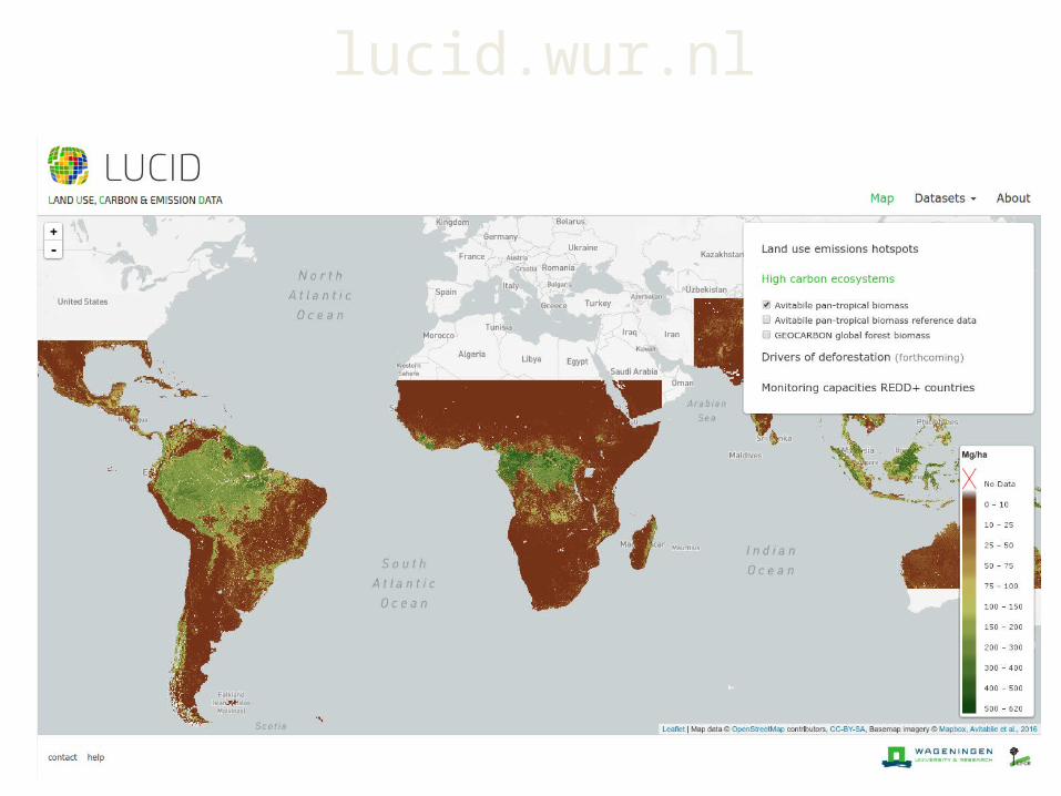
lucid.wur.nl
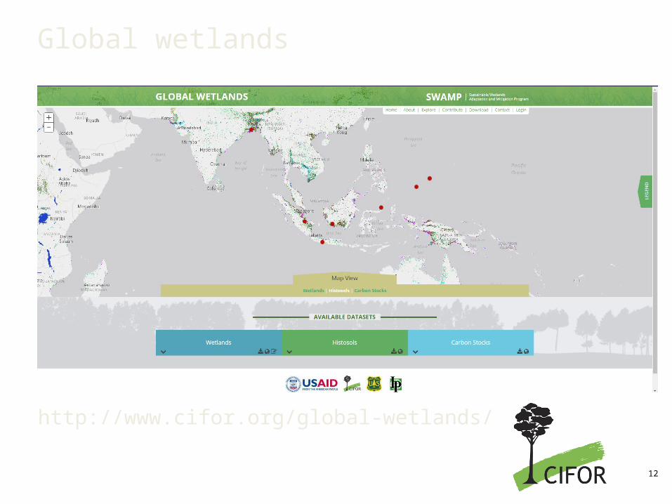
Global wetlands
http://www.cifor.org/global-wetlands/
12
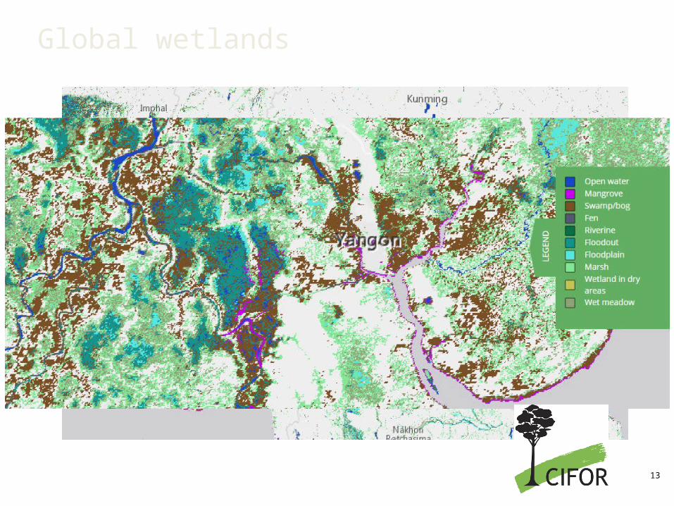
Global wetlands
13
Change Magnitudehigh
low
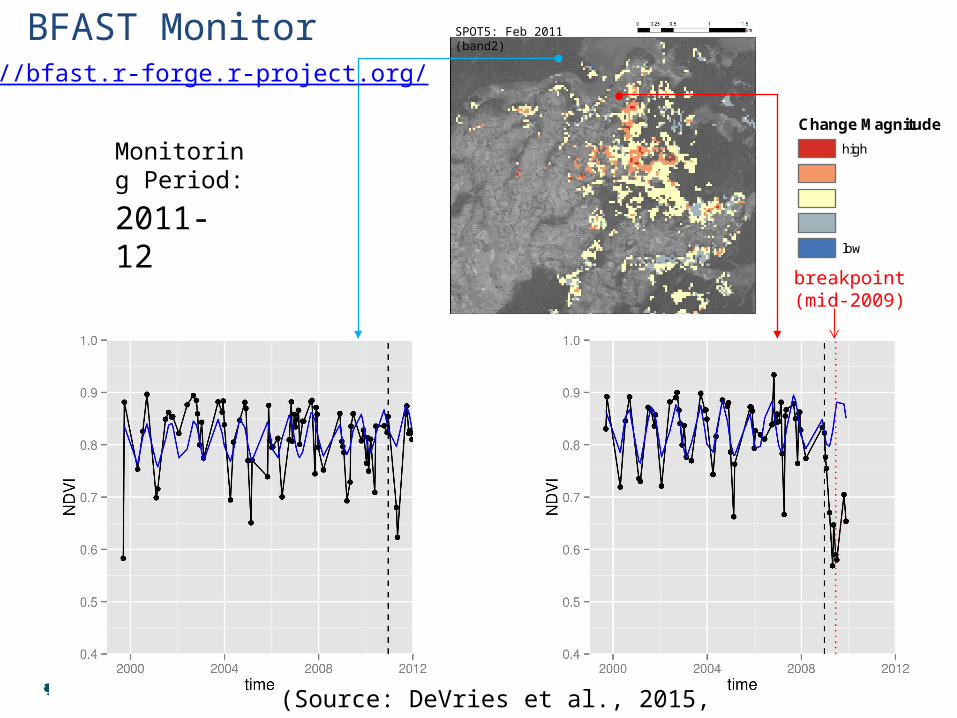
2005-62006-72007-82008-92009-102010-112011-12
SPOT5: Feb 2011 (band2)
Monitoring Period:
breakpoint(mid-2009)
BFAST Monitorhttp://bfast.r-forge.r-project.org/
(Source: DeVries et al., 2015, RSE)
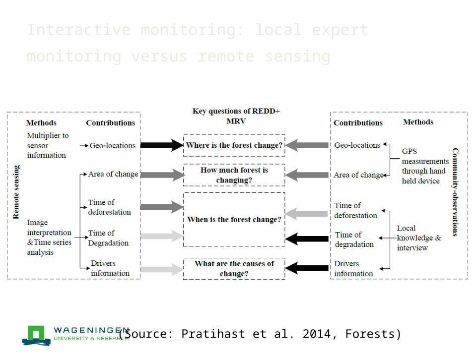
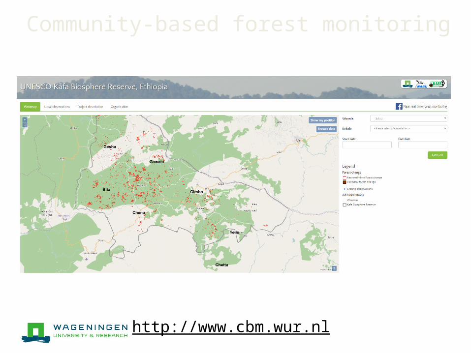
Interactive monitoring: local expert monitoring versus remote sensing
(Source: Pratihast et al. 2014, Forests)
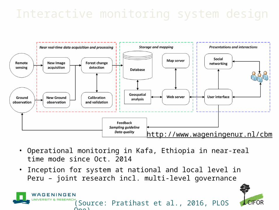
Interactive monitoring system design
• Operational monitoring in Kafa, Ethiopia in near-real time mode since Oct. 2014
• Inception for system at national and local level in Peru – joint research incl. multi-level governance
(Source: Pratihast et al., 2016, PLOS One)
http://www.wageningenur.nl/cbm
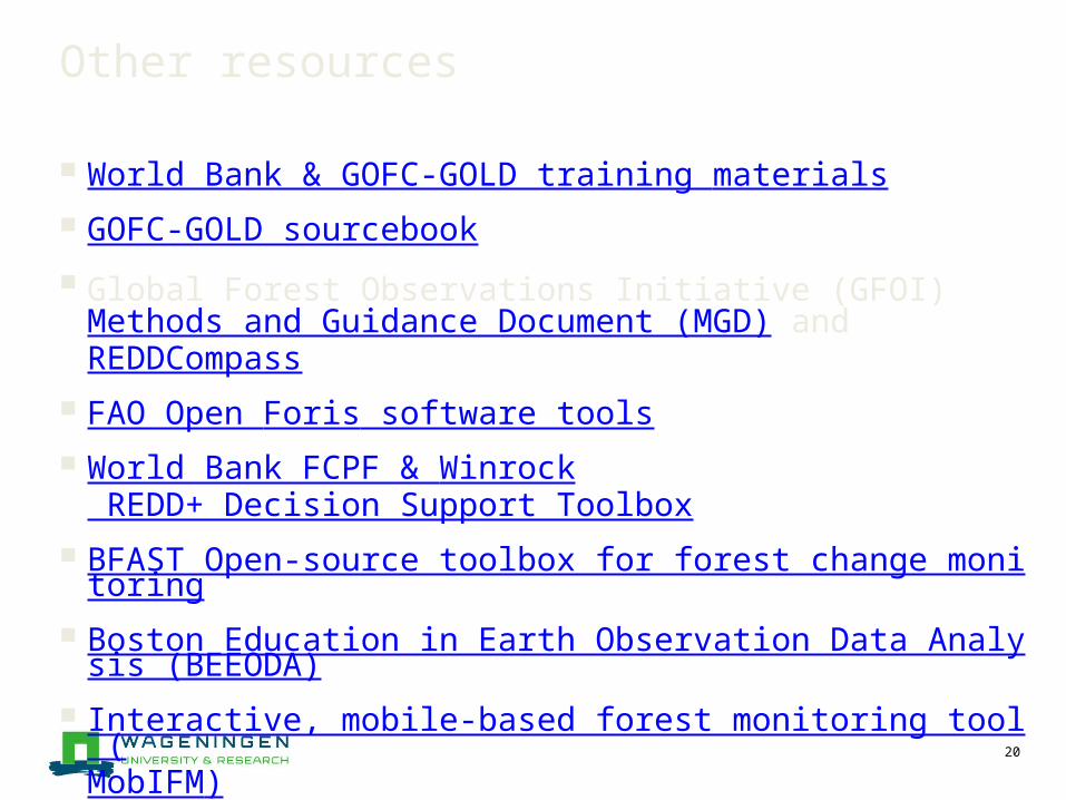
Other resources
World Bank & GOFC-GOLD training materials GOFC-GOLD sourcebook Global Forest Observations Initiative (GFOI)
Methods and Guidance Document (MGD) and REDDCompass
FAO Open Foris software tools World Bank FCPF & Winrock
REDD+ Decision Support Toolbox BFAST Open-source toolbox for forest change monitoring Boston Education in Earth Observation Data Analysis (BE
EODA) Interactive, mobile-based forest monitoring tool (MobIFM)
20
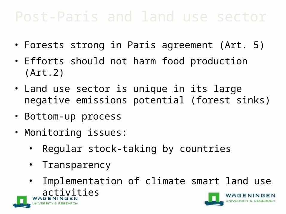
Post-Paris and land use sector• Forests strong in Paris agreement (Art. 5)• Efforts should not harm food production (Art.2)• Land use sector is unique in its large negative
emissions potential (forest sinks)• Bottom-up process • Monitoring issues:
• Regular stock-taking by countries• Transparency • Implementation of climate smart land use
activities
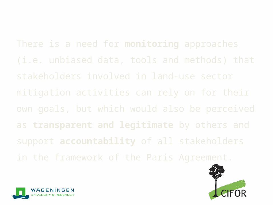
There is a need for monitoring approaches (i.e. unbiased data, tools and methods) that stakeholders involved in land-use sector mitigation activities can rely on for their own goals, but which would also be perceived as transparent and legitimate by others and support accountability of all stakeholders in the framework of the Paris Agreement.
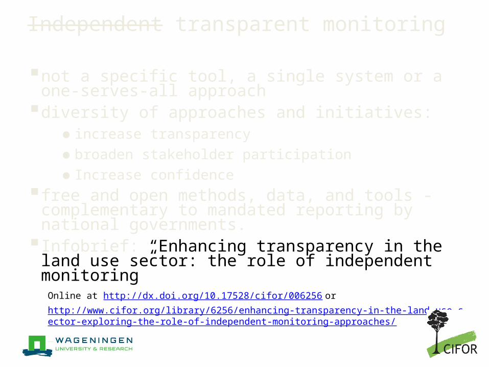
Independent transparent monitoring not a specific tool, a single system or a one-
serves-all approach diversity of approaches and initiatives:
● increase transparency ● broaden stakeholder participation ● Increase confidence
free and open methods, data, and tools - complementary to mandated reporting by national governments.
Infobrief: “Enhancing transparency in the land use sector: the role of independent monitoring”
Online at http://dx.doi.org/10.17528/cifor/006256 or http://www.cifor.org/library/6256/enhancing-transparency-in-the-land-use-sector-exploring-the-role-of-independent-monitoring-approaches/
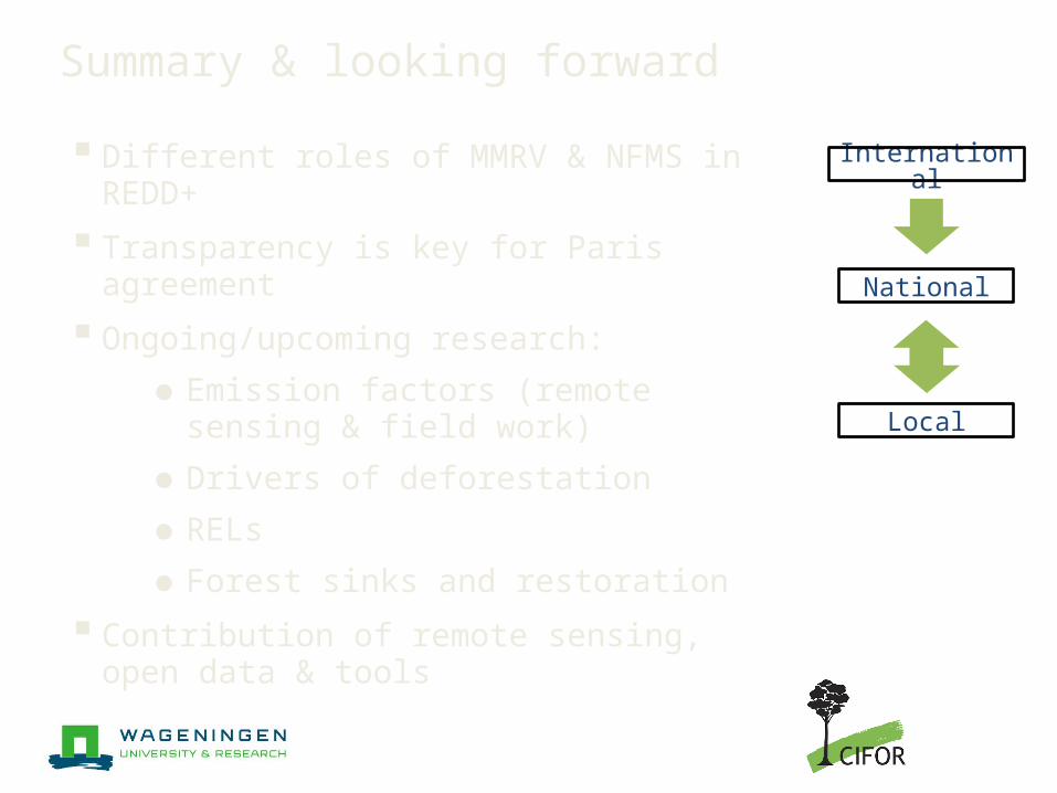
Summary & looking forward Different roles of MMRV & NFMS in REDD+ Transparency is key for Paris agreement Ongoing/upcoming research:
●Emission factors (remote sensing & field work)
●Drivers of deforestation●RELs●Forest sinks and restoration
Contribution of remote sensing, open data & tools
National
International
Local
Questions?
Dr. V. De Sy [email protected]. C. Martius [email protected]. Dr. M. Herold [email protected]
www.cifor.org/gcs/lucid.wur.nl