Embed Size (px)
Citation preview

By:Fatemeh Baratian Ghorghi
CIVL 6560February 2014
City Growth: Case Study of Denver, Colorado

Before 20th century 1858: a mining town during the
Pike's Peak Gold Rush in western Kansas Territory.
1859: grew by connecting to major railroad s and evolving into a regional service center for agriculture and mining.
1861: Denver City was incorporated.
1863: Western Union chose the city for its regional terminus.
1867: Denver became the Territorial Capital.
1870: the link to the transcontinental railroad was completed by Denver Pacific
Roads were built in much of the Front Range.
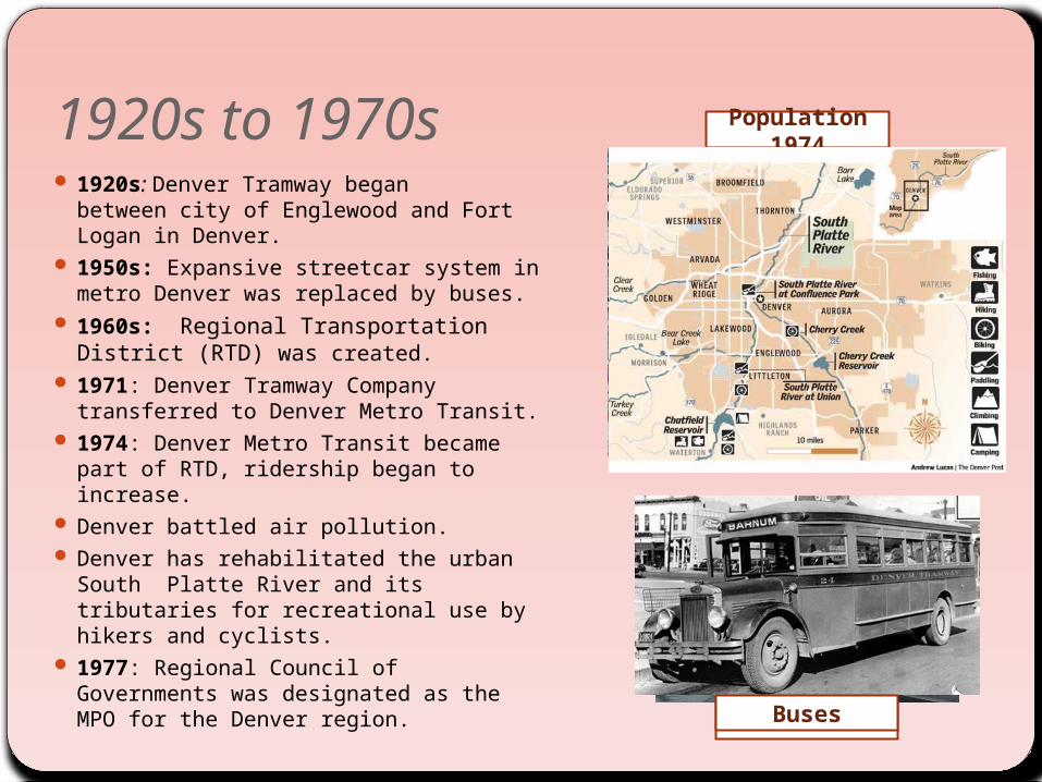
1920s to 1970s 1920s: Denver Tramway began
between city of Englewood and Fort Logan in Denver.
1950s: Expansive streetcar system in metro Denver was replaced by buses.
1960s: Regional Transportation District (RTD) was created.
1971: Denver Tramway Company transferred to Denver Metro Transit.
1974: Denver Metro Transit became part of RTD, ridership began to increase.
Denver battled air pollution. Denver has rehabilitated the urban
South Platte River and its tributaries for recreational use by hikers and cyclists.
1977: Regional Council of Governments was designated as the MPO for the Denver region.
Population 1974
Street carsBuses
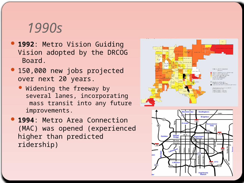
1990s 1992: Metro Vision Guiding Vision
adopted by the DRCOG Board. 150,000 new jobs projected over
next 20 years. Widening the freeway by several
lanes, incorporating mass transit into any future improvements.
1994: Metro Area Connection (MAC) was opened (experienced higher than predicted ridership)

1990s 1995: T-REX (CDOT and RTD), Major
Investment Study (DRCOG, CDOT and RTD) I-25/I-225 congestion problem
The initial MIS: light rail, highway improvements, pedestrian/bicycle facility improvements, TDM, ITS, safety improvements.
The second MIS: expanding highway lanes, adding light rail support throughout the corridor.
1995: Denver International Airport (DIA) opened
1997 : proposed “FasTracks” plan, made a strong linkage between transit and regional land use. Expansion and construction of transit
service existing and new corridorsDevelopment of the Denver Union
Station into a multimodal transit hub Regional Transportation District.
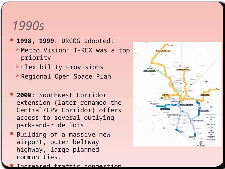
1990s 1998, 1999: DRCOG adopted:
Metro Vision: T-REX was a top priority
Flexibility Provisions Regional Open Space Plan
2000: Southwest Corridor extension (later renamed the Central/CPV Corridor) offers access to several outlying park-and-ride lots
Building of a massive new airport, outer beltway highway, large planned communities.
Increased traffic congestion and air pollution: In 1990: Residents in the Denver
region drove an average of 18 miles a day
In 1999: Residents drove 22 miles a day.(+20%)
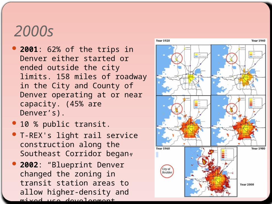
2000s 2001: 62% of the trips in Denver
either started or ended outside the city limits. 158 miles of roadway in the City and County of Denver operating at or near capacity. (45% are Denver’s).
10 % public transit. T-REX's light rail service
construction along the Southeast Corridor began.
2002: “Blueprint Denver” changed the zoning in transit station areas to allow higher-density and mixed use development .
2004: FasTracks approved by voters serve neighboring suburbs and communities.
2010: Denver adopted a comprehensive update of its zoning code.
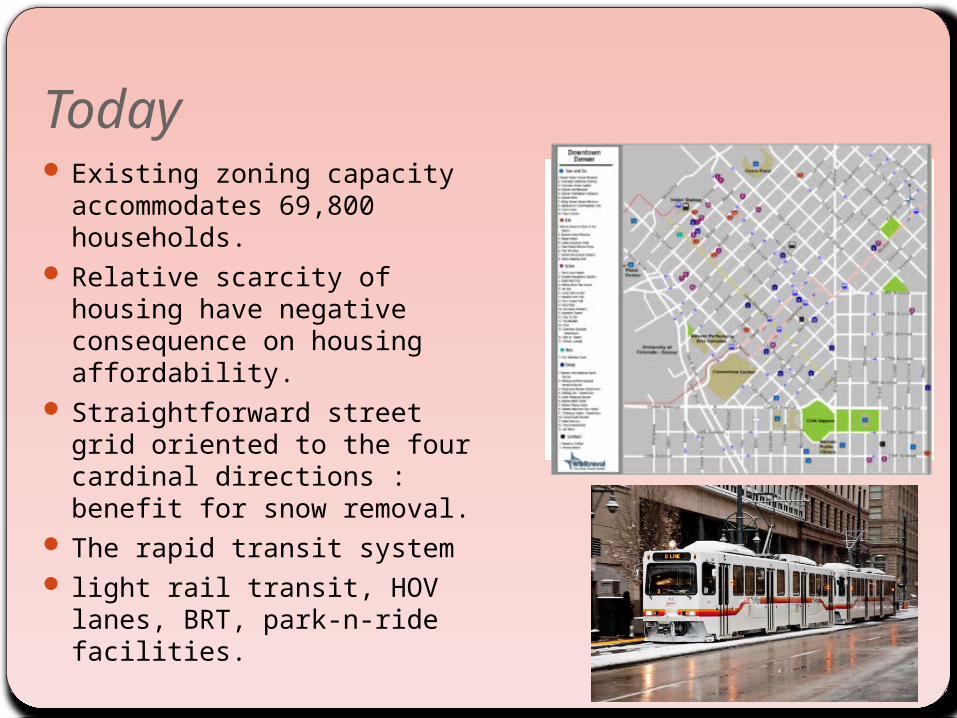
Today Existing zoning capacity
accommodates 69,800 households.
Relative scarcity of housing have negative consequence on housing affordability.
Straightforward street grid oriented to the four cardinal directions : benefit for snow removal.
The rapid transit system light rail transit, HOV lanes,
BRT, park-n-ride facilities.

Today 2009: car sharing came on the
line introduced by eGo. Many Denver streets have
bicycle lanes, Bicycle friendly city. 2010: B-Cycle 2011: Denver ranks 6th among
US cities whose workers commute by bicycle
2011: Walk Score ranked Denver sixteenth most walkable of fifty largest U.S. cities.
Denver International Airport is the tenth busiest airport in the world, fourth in the United States.
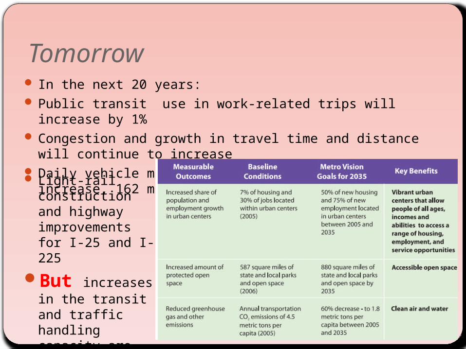
Tomorrow In the next 20 years: Public transit use in work-related trips will increase by 1% Congestion and growth in travel time and distance will
continue to increase Daily vehicle miles of travel in the region will increase, 162
miles of roads will be congested Light-rail construction and highway improvements for I-25 and I-225
But increases in the transit and traffic handling capacity are limited due to lack of regional transportation funds.