Embed Size (px)
Citation preview

AN M.Eng PRESENTATION ON
ROAD NETWORKS BY
ANDREW .A. ONOJA (SPS/15/MCE/00023)
COURSE: TRAFFIC CONTROL AND MANAGEMENT(CIV 8330)
CIVIL ENGINEERING (HIGHWAY OPTION)BAYERO UNIVERSITY, KANO
NIGERIA.
SUBMITTED TODR. H.M. ALHASSAN
19TH OCTOBER, 2016

INTRODUCTIONThe general concept of road network originated from the need of people, goods and services to move from one place to another using vehicular medium to timely engage in some kind of economic activities or otherwise.This has necessitated the formation of NODES, LINKS AND OTHER CONTROL FACILITIES at different grades and distances thereby resulting to networks of roads that connect different places all over the world.
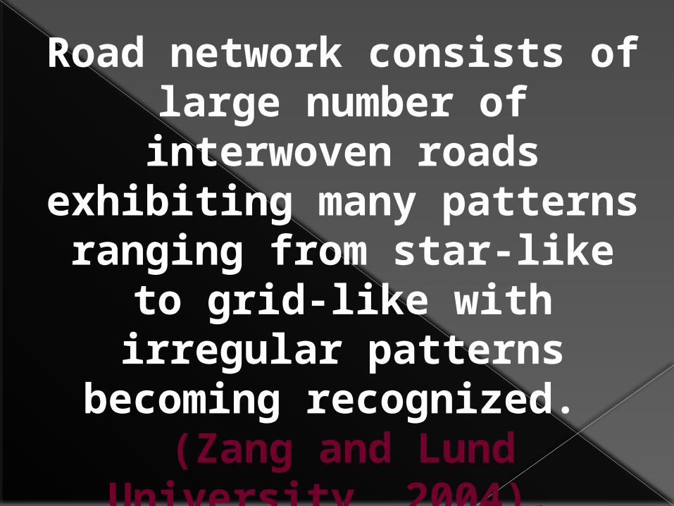
Road network consists of large number of
interwoven roads exhibiting many patterns ranging from star-like to grid-like with irregular
patterns becoming recognized.
(Zang and Lund University, 2004).

ROAD NETWORK PATTERNS

The road network is made up of Nodal Points, Links (spatial separation) and Control Facilities that
determine the degree of connectivity and accessibility
in the network.
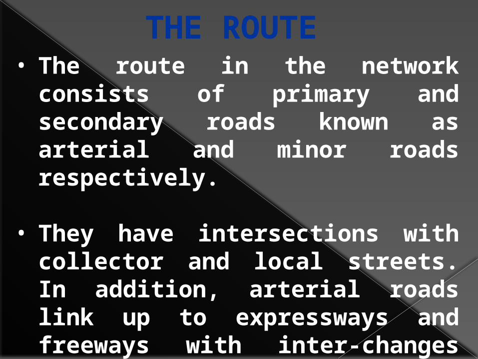
• The route in the network consists of primary and secondary roads known as arterial and minor roads respectively.
• They have intersections with collector and local streets. In addition, arterial roads link up to expressways and freeways with inter-changes (Wikipedia contributors, 2008).
THE ROUTE

A NETWORK OF CRITICAL ECONOMIC ROUTES IN NIGERIA.
SOURCE: FERMA, NIGERIA (2012)

THE URBAN SETTING

Road networks in Nigeria have come a long way from 1914 where there was less than 3,600km of paved roads to a network currently in excess of 200,000km. Amongst the network of roads developed so far, statistics indicated that the Federal Government of Nigeria is responsible for about 17%, State Government 16% and Local Government 67%.
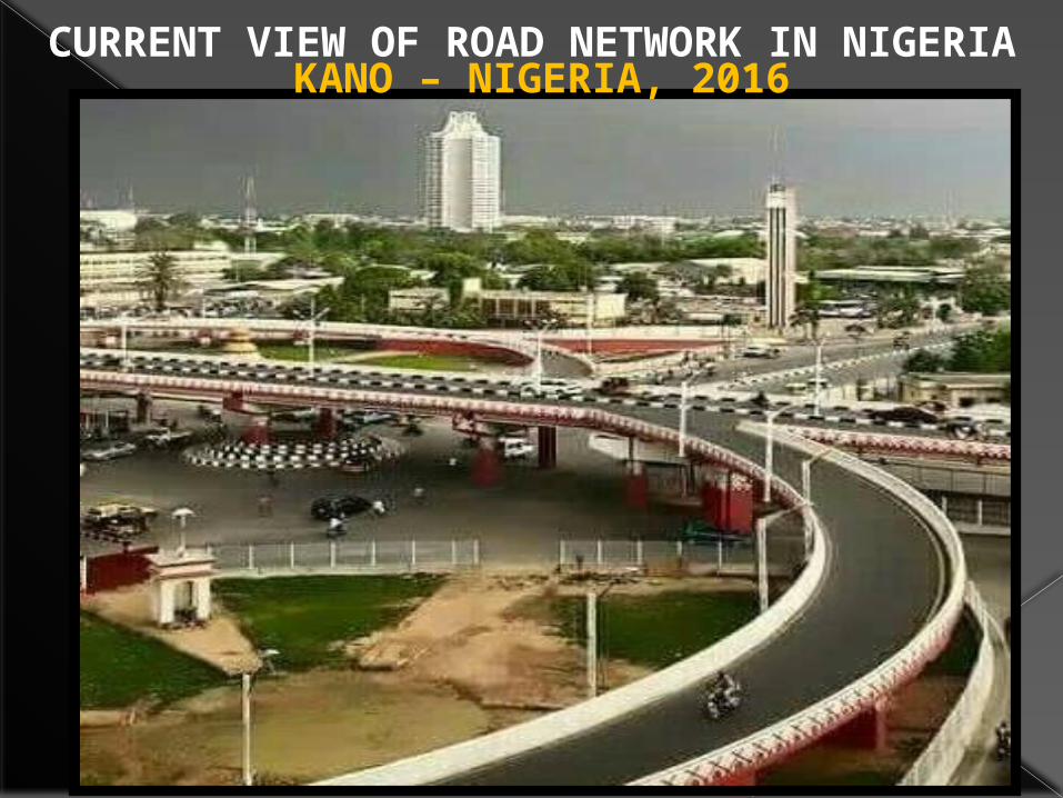
CURRENT VIEW OF ROAD NETWORK IN NIGERIAKANO – NIGERIA, 2016
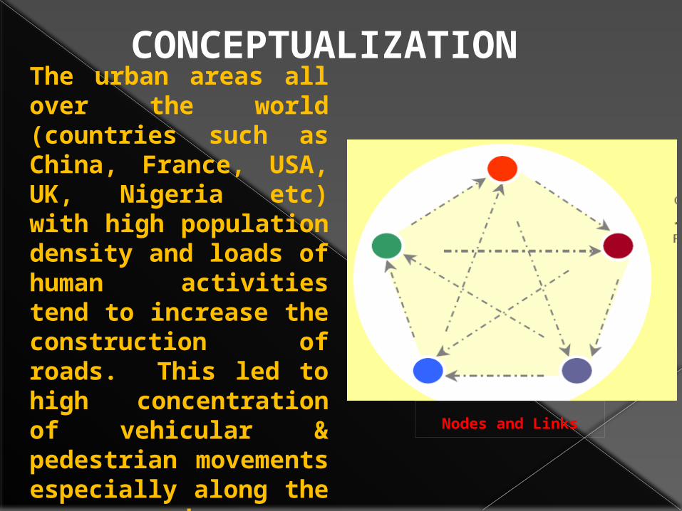
Nodes and Links
The urban areas all over the world (countries such as China, France, USA, UK, Nigeria etc) with high population density and loads of human activities tend to increase the construction of roads. This led to high concentration of vehicular & pedestrian movements especially along the access roads.
CONCEPTUALIZATION

• The seeds of tomorrow’s European road networks are sown today. The lengthy time span between planning infrastructure objects and its actual completion force policy makers and road engineers to take long views.
• Neglecting the future can result in disinvestments because of the increased risk that the functionality of the planned new infrastructure becomes outdated soon after completion.
• Although nobody is capable of predicting the future exactly, it becomes less mysterious by means of spotting, interpreting and extrapolating social, economical and mobility related trends and technical advances.
• A confrontation of these trends with the general generic developments, which will emerge in all European countries sooner or later, will help to give still more clarity of the potential image of the future.
The Vision 2040 Concept


DESIGN• Road Network Design Problem (RNDP)
has long been recognized to be one of the most difficult and challenging problems in transportation.
• In the past two decades, we have witnessed the development of a vast, growing body of research focused on formulations and solution procedures for the RNDPs, which deal with the selection of either link improvements or link additions to an existing road network, with given demand from each origin to each destination.

Design criteria consist of a detailed list of considerations to be used in negotiating a set of road standards. These include:
• Resource management objectives • Environmental constraints• Safety, physical environmental
factors (such as topography, climate, and soils)
• Traffic requirements• Traffic service levels. (i.e Level Of
Service)• Vehicle characteristics

TRAFFIC SERVICE LEVELS DEFINITIONS USED TO IDENTIFY DESIGN PARAMETERS
A B C D
FLOW
Free flowing with adequate
passing facilities.
Congested during heavy traffic such as during peak logging or recreation activities.
Interrupted by limited passing
facilities, or slowed by the
road condition.
Flow is slow or may be blocked by an activity.
Two way traffic is difficult and may
require backing to pass.
VOLUMES
Uncontrolled; will
accommodate the expected
traffic volumes.
Occasionally controlled
during heavy use periods.
Erratic; frequently controlled
as the capacity is reached.
Intermittent and usually controlled.
Volume is limited to that associated with the
single purpose.
VEHICLE TYPES
Mixed; includes the
critical vehicle and all
vehicles normally found
on public roads.
Mixed; includes the critical
vehicle and all vehicles
normally found on public roads.
Controlled mix; accommodates all
vehicle types including the
critical vehicle. Some use may be
controlled to minimize conflicts between vehicle
types.
Single use; not designed for mixed
traffic. Some vehicles may not be able to
negotiate. Concurrent use between
commercial and other traffic is restricted.
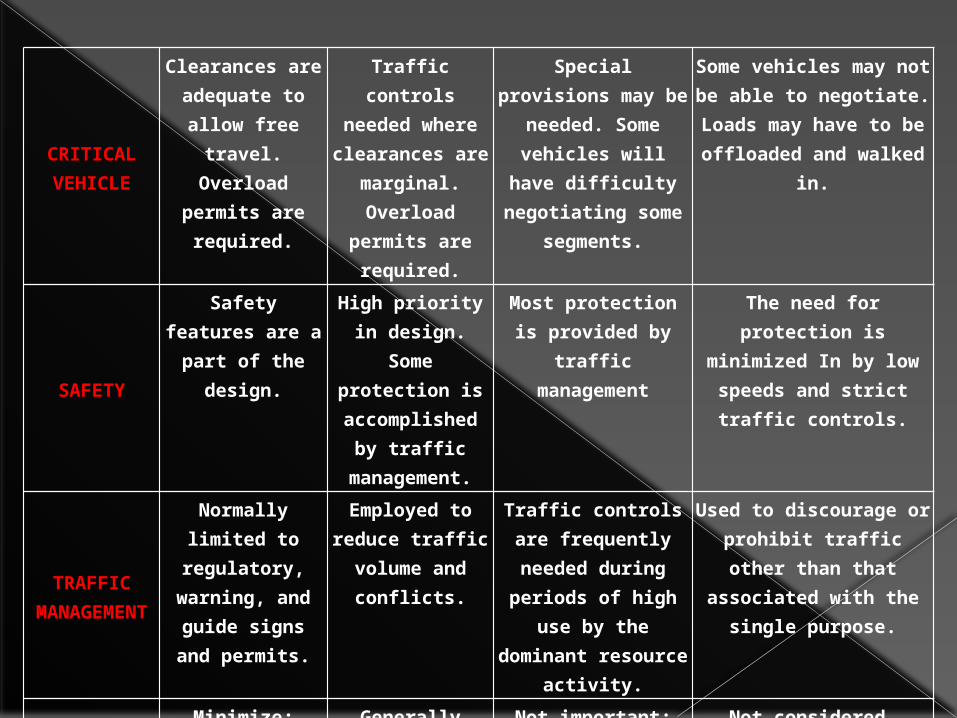
CRITICALVEHICLE
Clearances are adequate to allow free
travel. Overload
permits are required.
Traffic controls needed where clearances are
marginal. Overload
permits are required.
Special provisions may be needed.
Some vehicles will have difficulty
negotiating some segments.
Some vehicles may not be able to
negotiate. Loads may have to be offloaded
and walked in.
SAFETY
Safety features are a part of the design.
High priority in design. Some protection is accomplished
by traffic management.
Most protection is provided by traffic
management
The need for protection is
minimized In by low speeds and strict traffic controls.
TRAFFICMANAGEME
NT
Normally limited to
regulatory, warning, and guide signs
and permits.
Employed to reduce traffic volume and
conflicts.
Traffic controls are frequently needed during periods of high
use by the dominant
resource activity.
Used to discourage or prohibit traffic other than that associated
with the single purpose.
USER COSTS
Minimize; transportation
efficiency is important.
Generally higher than "A"
because of slower speeds and increased
delays.
Not important; efficiency of
travel may be traded for lower
construction costs.
Not considered.

ALIGNMENT
Design speeds is the predominant factor within
feasible topographic limitations.
Influenced more strongly by topography than by speed and efficiency.
Generally dictated by topographic features and
environmental factors. Design
speeds are generally low.
Dictated by topography,
environmental factors, and the
design and critical vehicle
limitations. Speed is not important.
ROADSURFACE
Stable and smooth with little or no
dust, considering the normal season of
use.
Stable for the predominant traffic for the normal use
season. Periodic dust
control for heavy use or
environmental reasons.
Smoothness is commensurate
with the design speed.
May not be stable under all
traffic or weather
conditions during the normal use
season.. Surface rutting, roughness, and
dust may be present, but
controlled for environmental or investment
protection.
Rough and irregular. Travel
with low clearance vehicles is
difficult. Stable during dry conditions. Rutting and
dusting controlled only
for soil and water
protection.Source: (Transportation Engineering Handbook, USA).
CHARACTERISTICS Road network patterns can affect traffic performance, travel behavior, and traffic safety. Thus, a deep understanding of the properties of different network patterns can provide useful guidance for design and improvement of road systems.
HIERARCHY OF ROAD NETWROKSThe hierarchy of
roads categorizes roads according to their functions and
capacities. While sources differ
on the exact nomenclature, the
following slide gives the basic
nomenclature.

1. Arterials Roads
2. Collectors Roads
3. Local roads.
The basic hierarchy comprises:

HIERARCHY IN SOME COUNTRIESUNITED KINGDOMAll UK roads (excluding motorways) fall into the following four categories:A - roads – major roads intended to provide large-scale transport links within or between areas. B - roads – roads intended to connect different areas, and to feed traffic between A - roads and smaller roads on the network. Classified unnumbered – Smaller roads intended to connect together unclassified roads with A and B roads, and often linking a housing estate or a village to the rest of the network. Similar to ‘minor roads’ on an Ordnance Survey map and sometimes known unofficially as C - roads. Unclassified – Local roads intended for local traffic. The vast majority (60%) of roads in the UK fall within this category.

FRANCEAutoroutesAlong with the rest of Europe, France has Motorways or Autoroutes similar to the British network. Unlike in the UK, the network is mostly accessible on payment of a toll, which is usually distance-dependent.
Route NationaleBefore the construction of Autoroutes, the Routes Nationales were the highest classification of road in France.
Routes DépartementalesFrance (including overseas territory) is split into 100 departments, the second-highest tier of local government, similar to a UK county or US state. These roads vary in quality, from newly built local dual carriageways and downgraded Routes Nationales. Generally, they are quieter than the Routes Nationales, and of a reasonable standard.
Routes CommunalesIn general, each settlement in France is a Commune - akin to a British Civil Parish. They are numbered with a letter C prefix.

ROAD NETWORK PATTERN, ASSESSMENT AND ANALYSISThe analysis of the road network involves the recognition of the patterns and qualities of the
roads.Many techniques had earlier been used in analyzing road network patterns (Mackaness and Beard, 1993; Thomson and Richardson, 1995; and,
Jiang and Harrie, 2004) namely, Connectivity
Shortest path spanning tree, and Minimum cost spanning tree from graph theory
to facilitate structural analysis and road selection in the road networks.

Modern techniques introduced for the
explanation of the effects of accessibility on Urban values
range from geographically weighted regression
technique, multinomial logit models, to geo-spatial analysis adopting the
Geographical Information Systems (GIS).

Monitoring the status of the road network and
prevailing traffic conditions is
fundamental to road network operations.
Network controllers and operators must have continual access to
quantitative and qualitative information
to manage and maintain the road network as
effectively as possible.
NETWORK CONTROL, OPERATION AND MONITORING
CONTROL CENTRE
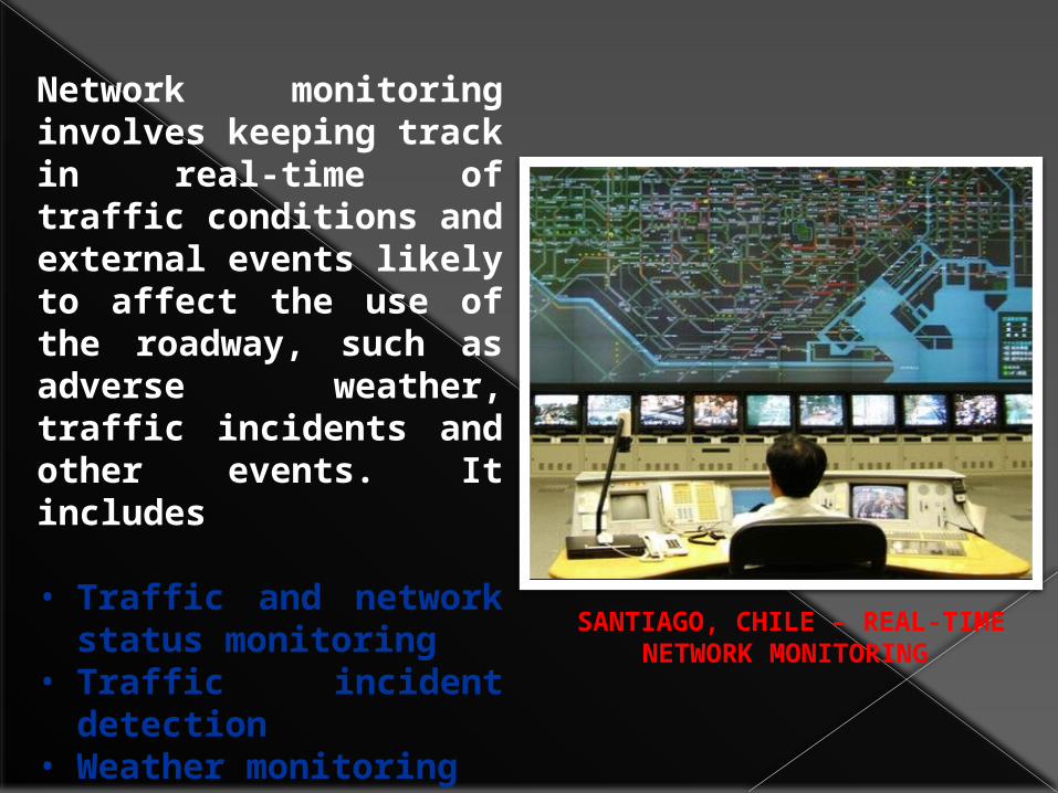
Network monitoring involves keeping track in real-time of traffic conditions and external events likely to affect the use of the roadway, such as adverse weather, traffic incidents and other events. It includes
• Traffic and network status monitoring
• Traffic incident detection
• Weather monitoring• Journey time
monitoring
SANTIAGO, CHILE – REAL-TIME NETWORK MONITORING

CONCLUSIONThis review borrows techniques found useful in other fields like operational research, transportation and urban planning to explain and analyze road networks across the world, for the purpose of determining the concept, design approach, characteristics, hierarchy, scope, accessibility and analysis and then control and operation. These have underscored the importance of this review.

REFERENCES• Hector Igbikiowubo, (2000), Historical Structure of the Nigerian
Road System. Pp.12.
• Prof. Danladi S. Matawal, (2013), National Conference on Road Pavement Failure in Nigeria. Nigerian Building and Road Research Institute, (NBRRI), May, 2013.
• Wikipedia online, the free encyclopedia (2008). Sample Size in http://en.wikipedia.org/w/index.php?title=Sample_size.
• Inventory of Federal Roads by Federal Roads Maintenance agency, FERMA Headquarters, Abuja. 2012.
• Zhang, Q. and GIS Centre Lund University, Sweden (2004). Modeling Structure and Patterns in Road Network Generalization. Paper Presented at ICA Workshop on Generalization and Multiple Representation, held in Leicester, 20-21 August, 2004.