Embed Size (px)
Citation preview

WATER DAMS IN SLOVAKIA
Zemplínska Šírava
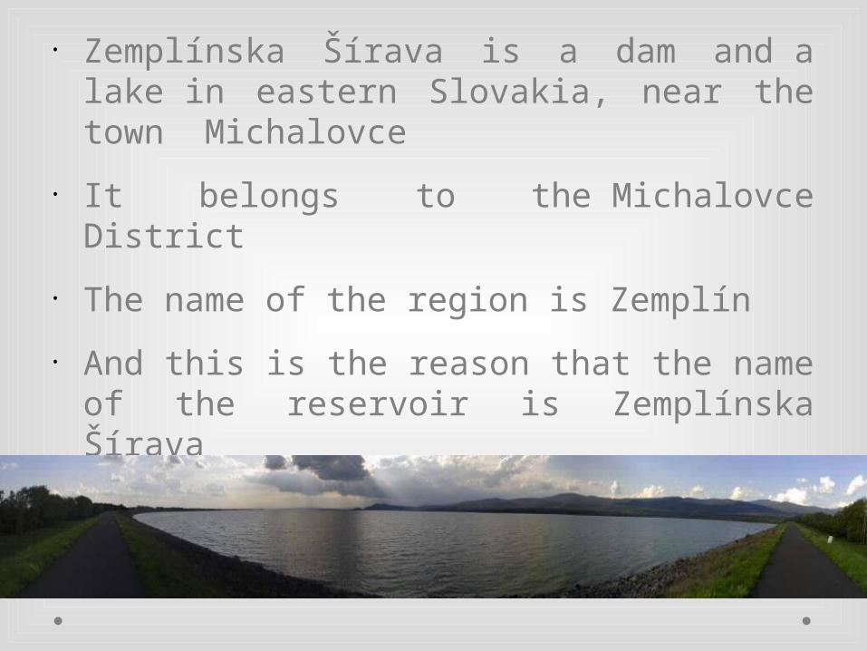
• Zemplínska Šírava is a dam and a lake in eastern Slovakia, near the town Michalovce
• It belongs to the Michalovce District
• The name of the region is Zemplín
• And this is the reason that the name of the reservoir is Zemplínska Šírava

• The dam was built in 1961–1965
• It covers an area of 33 km² and has an average depth of 9.5 m with a maximum depth of 14 m
• Water from the dam flows into the Laborec River, which in turn flows into the Bodrog River

• Zemplínska Šírava is the second largest water dam in Slovakia (after the Orava dam)
• It is a popular tourist destination with seven recreation centers
• In addition to recreation it is used as an irrigation system in the lowland Východoslovenská Nížina, flood protection and as a water source for the industry

Orava It is the biggest dam in Slovakia
This dam is located near Námestovo, Tvrdošín and Trstená
It was created between 1941 and 1953 on two sources of the Orava River
The average depth of the reservoir is 38 meters


Veľká Domaša Domaša is a dam located in the north of the town Vranov
nad Topľou, in Eastern Slovakia The construction of water works Veľká Domaša began in
February 1962 It is known for its clear water with lots of fish
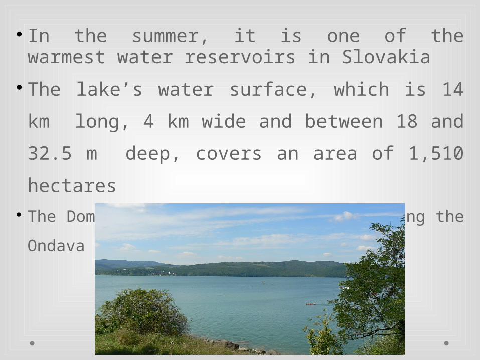
In the summer, it is one of the warmest water reservoirs in Slovakia
The lake’s water surface, which is 14 km long, 4 km
wide and between 18 and 32.5 m deep, covers an area of
1,510 hectares The Domaša Dam Lake was built by blocking the
Ondava River

Starina Starina reservoir is in eastern Slovakia, located in the
Poloniny National Park It is the most important source of drinking water in the area It is built on the Cirocha River

building started in 1981 3463 inhabitants were evacuated from 769 dwellings
from the 7 following villages: Starina, Dara, Ostružnica, Smolník, Ruské, Veľká Poľana and Zvala

the depth of the water is 50 m the water tank has a volume of 59,8 million m³ of water
and it spreads on an area of 240 ha this source of drinking water is very important because
it supplies nearly whole area of East Slovakia with
drinking water

Resourses:
https://geolocation.ws/v/P/6709537/panorama-zemplnskej-ravy-hrdza-pri-obci/en
http://commons.wikimedia.org/wiki/File:Okres_michalovce.png
http://forrai.blog.sme.sk/c/99102/Z-vtacej-perspektivy.html
http://sk.wikipedia.org
http://sk.wikipedia.org/wiki/Ve%C4%BEk%C3%A1_Doma%C5%A1a
http://www.domasa.sk/region/
http://www.tatra-domasa.sk/valkov/domasa/?cur=eur
http://www.slovakia.com/lake/domasa/
http://en.wikipedia.org/wiki/Ve%C4%BEk%C3%A1_Doma%C5%A1a
Wikipedia pictures