Embed Size (px)
Citation preview

The Making of The Pluckemin Animation
• This project started as a result of an informal request from the Friends of the Jacobus Vanderveer House so they could provide an interpretation of the Pluckemin Artillery Cantonment for visitors to their museum.
• Washington College got involved for some very good reasons:– Dr. John Seidel, Director of the Washington College Center for Environment and
Society, did his PhD Dissertation on “The archaeology of the American Revolution: A reappraisal & case study at the Continental Artillery Cantonment of 1778-1779, Pluckemin, New Jersey” for the University of Pennsylvania in 1987 and has extensive knowledge of the historic site.
– The Washington College Geographic Information Systems Laboratory, part of the Center for Environment and Society, has extensive experience in creating 3D visualizations and a qualified team of energetic student apprentices to work on the project.
http://www.jvanderveerhouse.com/
http://ces.washcoll.edu/
http://gis.washcoll.edu/

Project Goal
To create a preliminary visualization of the Pluckemin Artillery Cantonment that can be
used as a tool to further explore how the site looked, how the buildings were constructed, and to act as a first step to creating a more accurate
visualization of the site.

Washington College Team• John Siedel, Director, Center for Environment and Society• Stewart Bruce, GIS Program Coordinator• Katherine Wares• Tyler Brice• Jimmy Bigwood• Mariah Perkins• Caitlyn Riehl• Cara Murray• Heather Black• Gavin Townsend• Alexander Lucas• Erin Cooper

Software Used
• ESRI ArcGIS Desktop, Spatial Analyst, and ArcScene
• Google Sketch-Up• Geoweb3D• Fraps• Camtasia Studio• Adobe After Effects

Hardware Used• HP xw8600 Workstations with dual Quad-Core
Intel® Xeon® Processors and 8 GB of ECC RAM• Special thanks to NVIDIA for their donation of
a Quadro 6000 with 6 GB of graphic memory and worth $4,000

Primary Challenges
• None of the buildings exist now to use as references and the exact location of the footprints is only estimated from the archeological evidence.
• The site has been almost completely developed so the base aerial image had to be created
• The topography of the site has been severely altered due to development so a new digital terrain model had to be constructed

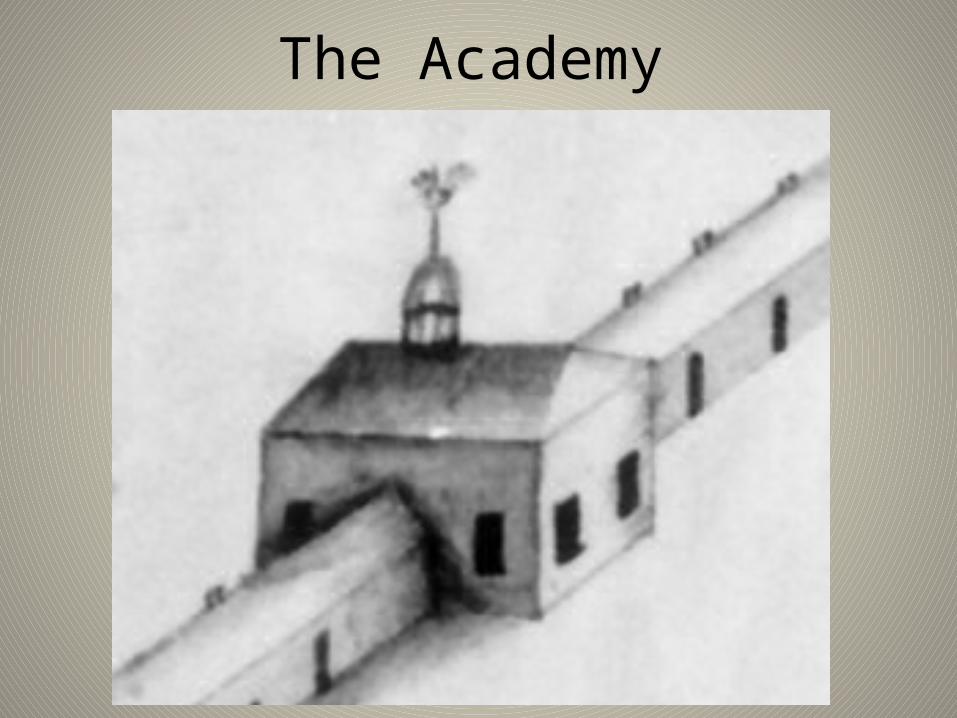
The Academy


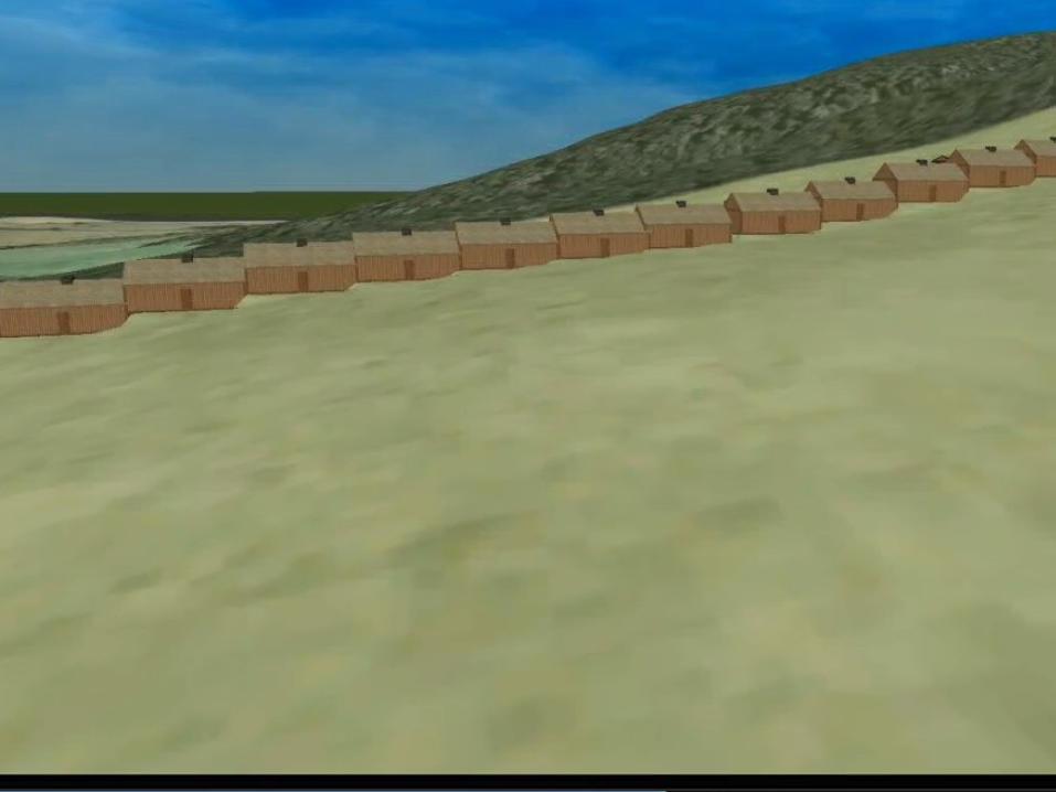
Soldiers Barracks

SlopeWe estimate a 40 to 60 foot drop in elevation from the top to the
bottom of the barracks
Therefore the barracks did not look like the Lille drawing as they had to step down the slope.

Report on Probable ConstructionPrepared by:
A. Craig Evans/M. Jason EvansFine Woodwork/Restorations
464 Montclair AvenueBethlehem, PA 18015
August 26, 2011

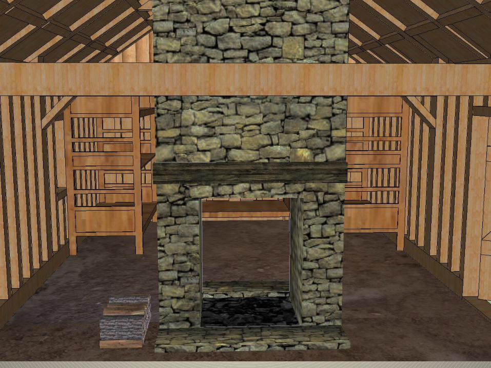
It is likely that the room segments were approximately 30’ long (white oak or locust sill stock would have been readily available on site or close by) with the configuration of a one doorway serving two rooms and the fireplace providing the bulk of a partition between the rooms. Given the slope, an
up-hill side would need to have been leveled down approximately 15” and the lower end filled about the same to achieve a reasonably level surface. This effort would simplify
for the intermediate sections as the excavation from one could easily go to the upper one needing fill. Although not actually depicted in the Lillie drawing, the roofline would
necessarily have steps along the grade.


Video from Katherine about the process


Insert animation sequence of barracks construction
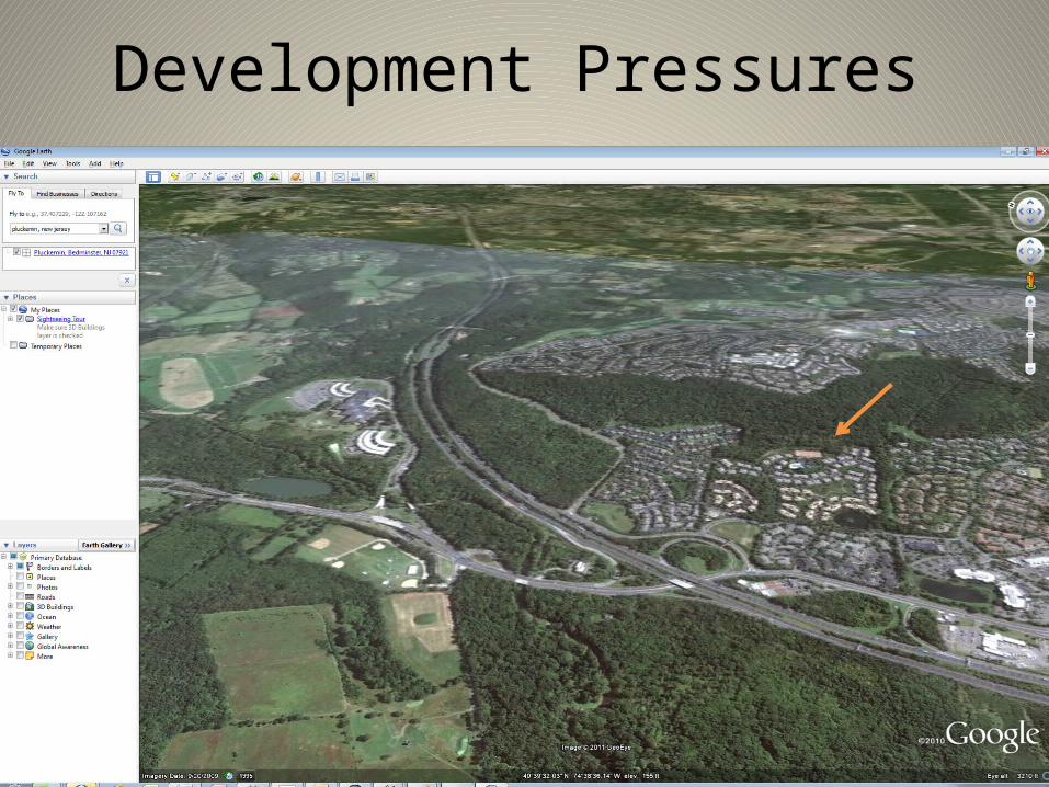
Development Pressures


Development Pressure


Terrain Issues


The Animation

The Components
• The 3D Buildings developed in Google Sketch-Up• The base aerial imagery modified from a 1953 aerial image• A newly created Digital Elevation Model (DEM)• Trees and tree stumps• Artillery• Soldiers• Horses and wagons
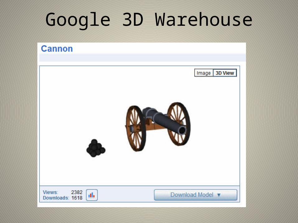
Google 3D Warehouse

Continental Army Soldiers
Put here results from Alex, Erin, and Katherine

Video from Tyler about the process
Next Steps• Review finished buildings with a team of experienced architects
knowledgeable about construction during the late 1700’s. Create more detailed building plans that can be used to recreate more accurate 3D models.
• Further review the detailed archeological surveys and reports to improve placement of building footprints.
• Come up with an interior blueprint for each building to be used by 3D modelers that will allow the viewer to go inside each building.
• Improve and enhance the base aerial imagery.• Improve and enhance the digital elevation model to increase topographic
accuracy and realism.• Research the various types of artillery used during the Revolutionary War
and create 3D models of each type for the visualization.• Improve upon the 3D soldiers and other accessories used in the animation.