Embed Size (px)
Citation preview

Sarita Mc Gowan
Wed 5-6:50
Fall 2012
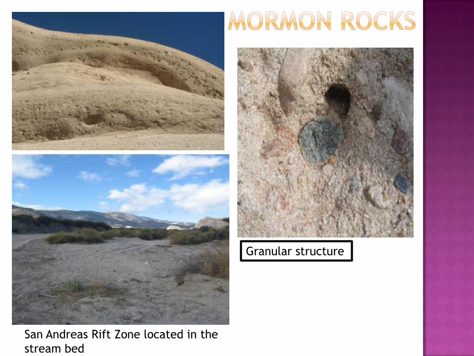
Granular structure
San Andreas Rift Zone located in the
stream bed
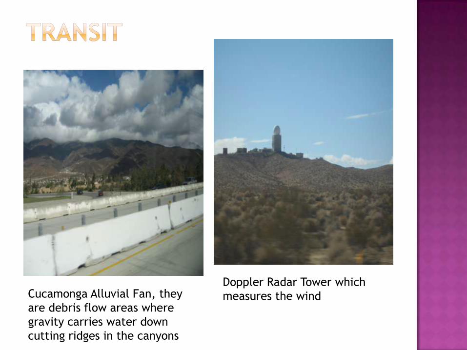
Cucamonga Alluvial Fan, they
are debris flow areas where
gravity carries water down
cutting ridges in the canyons
Doppler Radar Tower which
measures the wind
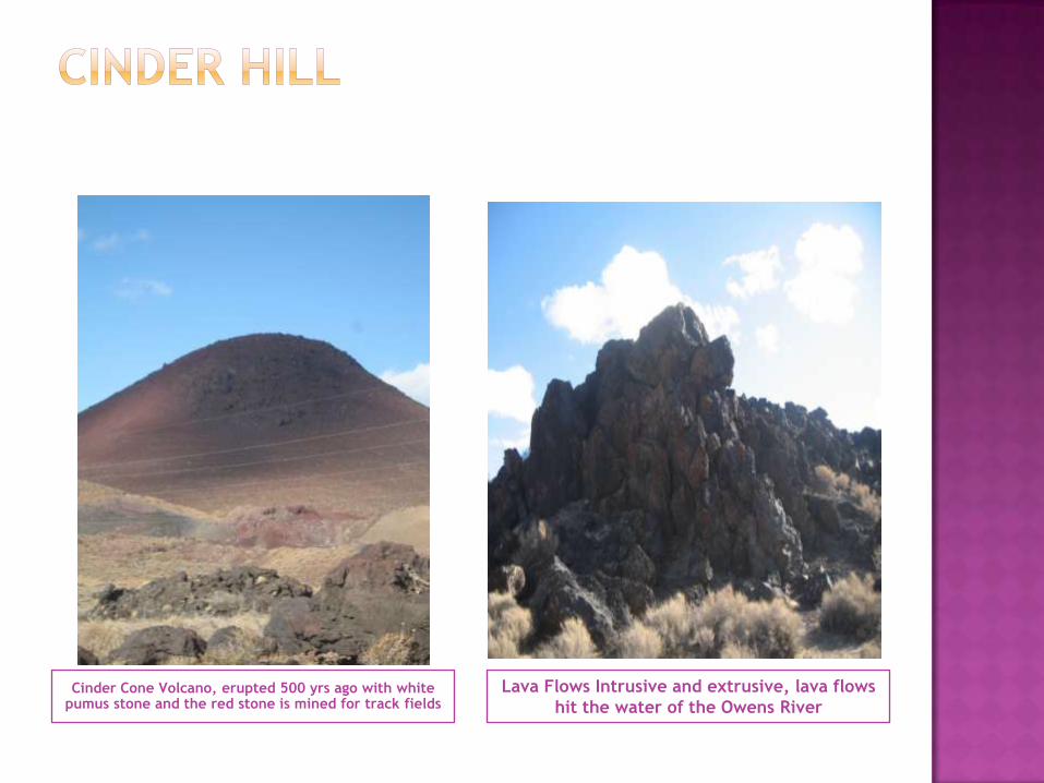
Cinder Cone Volcano, erupted 500 yrs ago with white pumus stone and the red stone is mined for track fields
Lava Flows Intrusive and extrusive, lava flows
hit the water of the Owens River
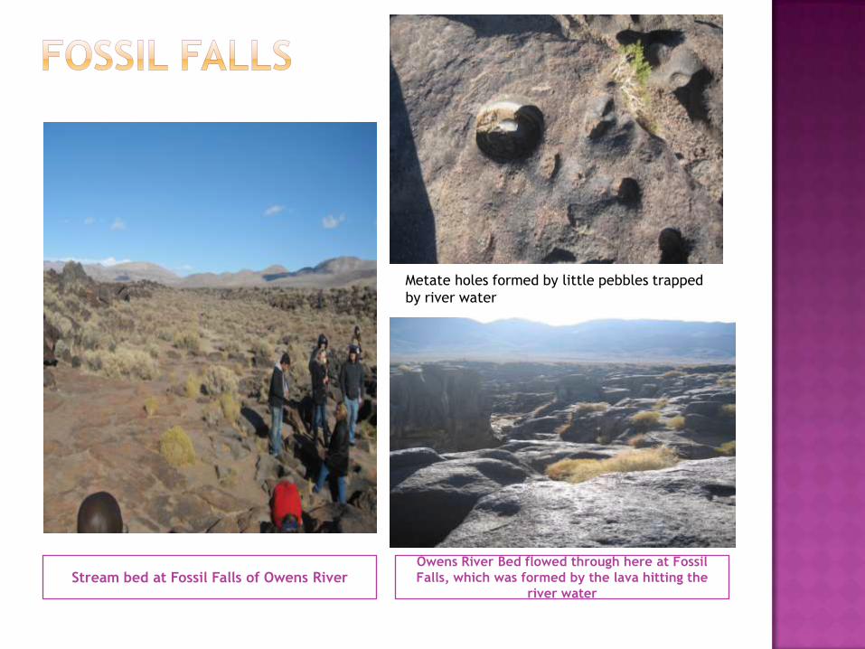
Stream bed at Fossil Falls of Owens RiverOwens River Bed flowed through here at Fossil
Falls, which was formed by the lava hitting the
river water
Metate holes formed by little pebbles trapped
by river water
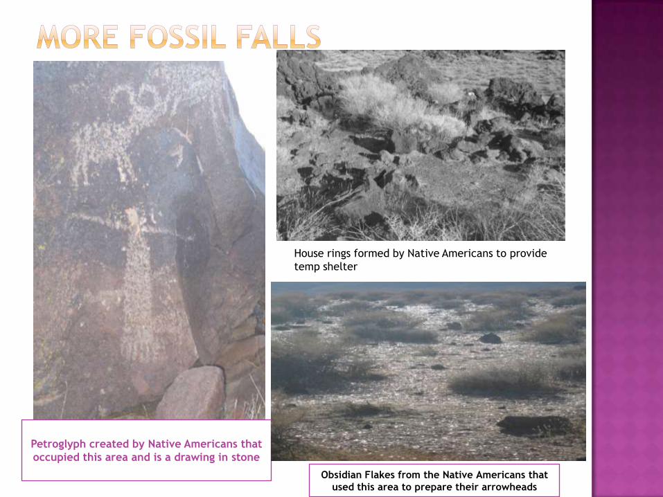
Obsidian Flakes from the Native Americans that
used this area to prepare their arrowheads
Petroglyph created by Native Americans that
occupied this area and is a drawing in stone
House rings formed by Native Americans to provide
temp shelter
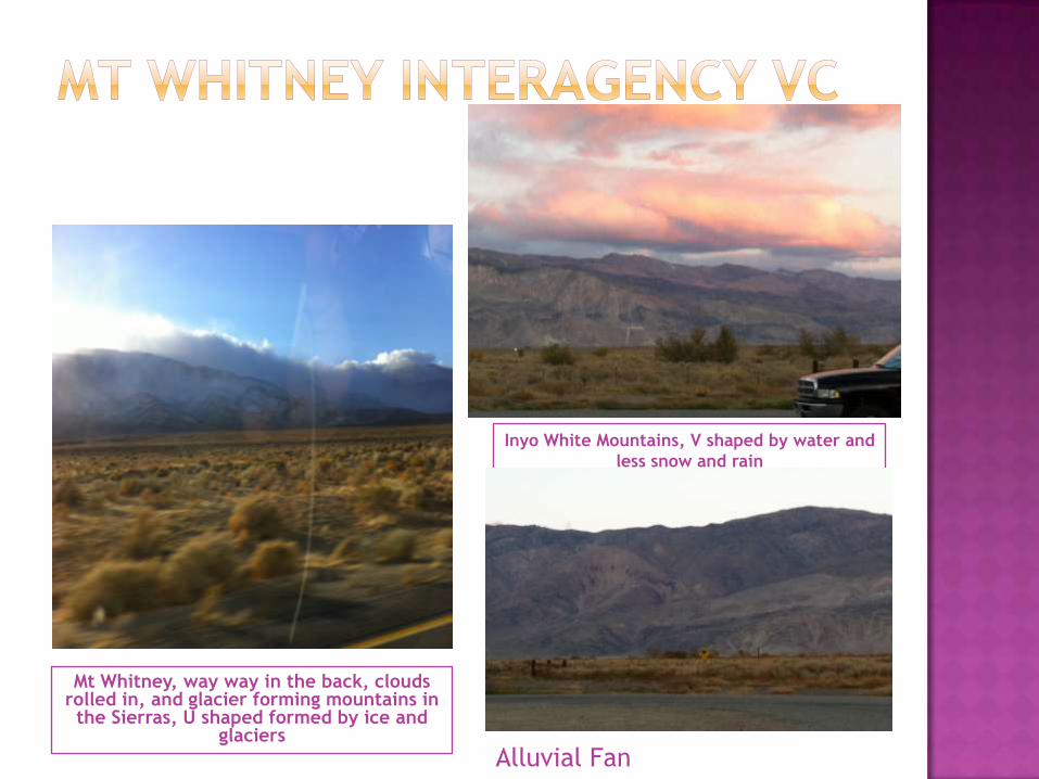
Mt Whitney, way way in the back, clouds rolled in, and glacier forming mountains in the Sierras, U shaped formed by ice and
glaciers
Inyo White Mountains, V shaped by water and
less snow and rain
Alluvial Fan
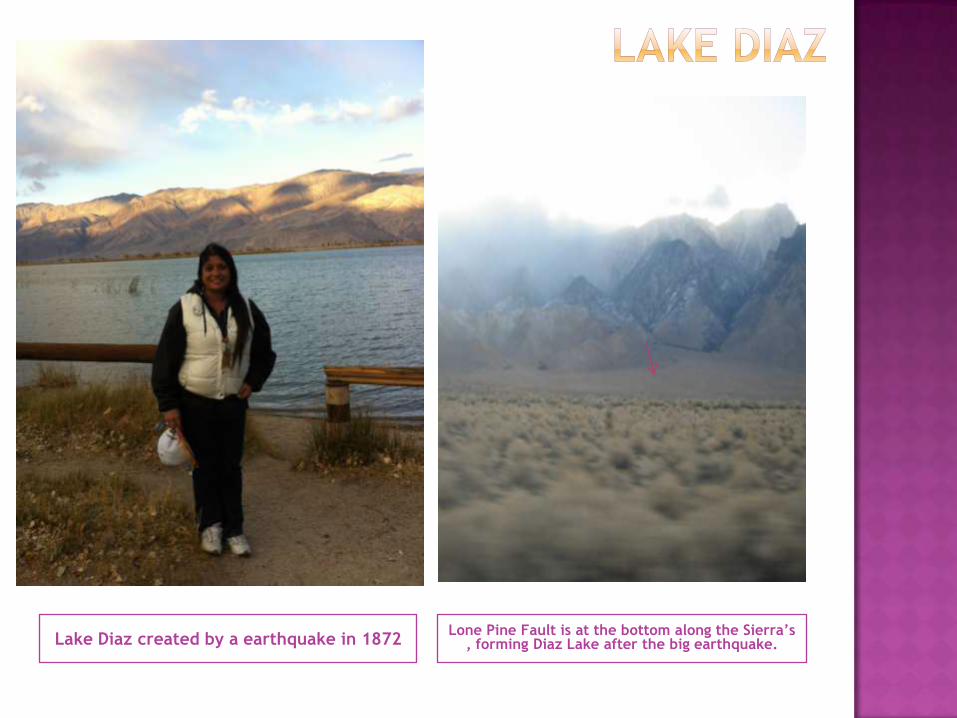
Lake Diaz created by a earthquake in 1872Lone Pine Fault is at the bottom along the Sierra’s
, forming Diaz Lake after the big earthquake.

Back by the wood pile is a coyote!Garlock Fault , 2nd largest fault in
California
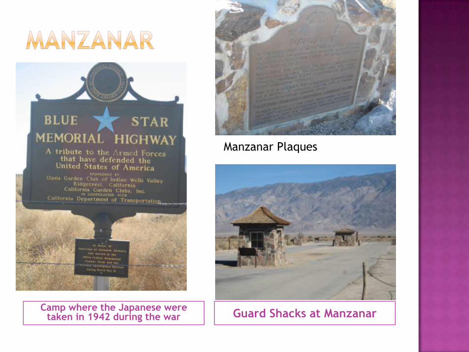
Camp where the Japanese were taken in 1942 during the war Guard Shacks at Manzanar
Manzanar Plaques
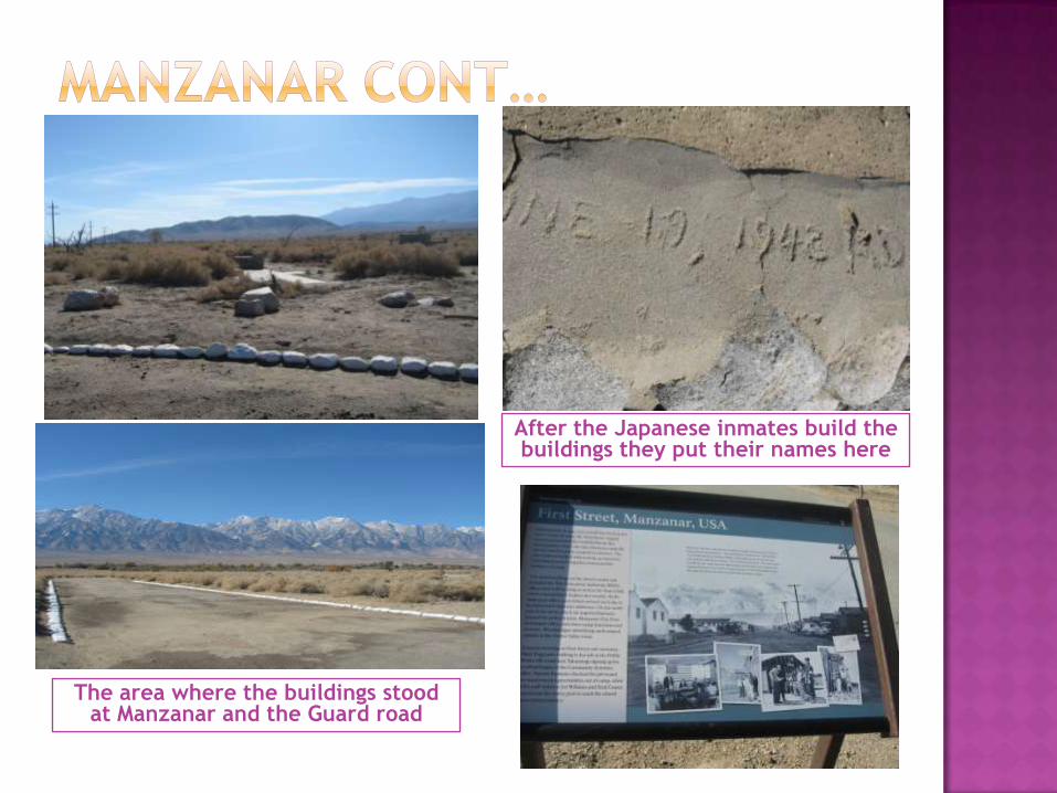
The area where the buildings stood at Manzanar and the Guard road
After the Japanese inmates build the buildings they put their names here
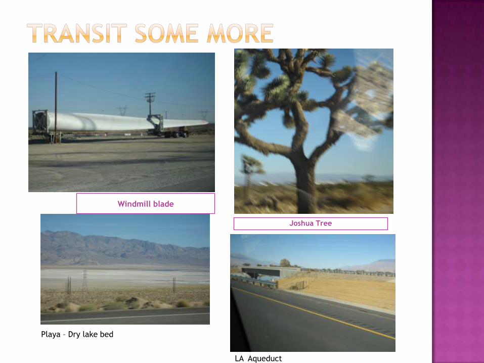
Windmill blade
Joshua Tree
Playa – Dry lake bed
LA Aqueduct
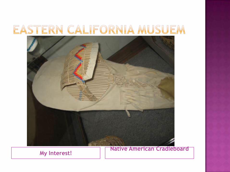
My Interest!Native American Cradleboard
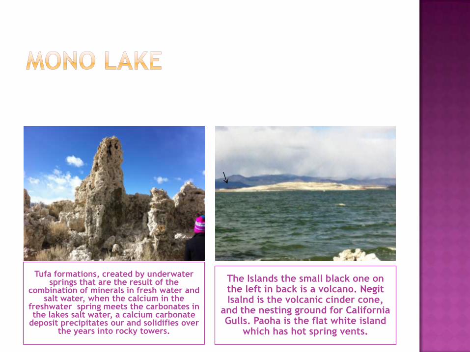
Tufa formations, created by underwater springs that are the result of the
combination of minerals in fresh water and salt water, when the calcium in the
freshwater spring meets the carbonates in the lakes salt water, a calcium carbonate
deposit precipitates our and solidifies over the years into rocky towers.
The Islands the small black one on the left in back is a volcano. NegitIsalnd is the volcanic cinder cone,
and the nesting ground for California Gulls. Paoha is the flat white island
which has hot spring vents.
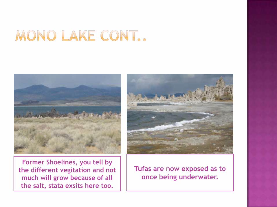
Former Shoelines, you tell by
the different vegitation and not
much will grow because of all
the salt, stata exsits here too.
Tufas are now exposed as to
once being underwater.
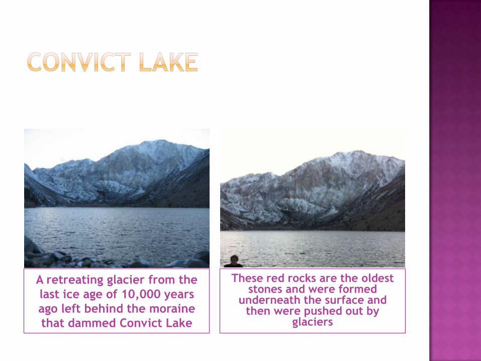
A retreating glacier from the
last ice age of 10,000 years
ago left behind the moraine
that dammed Convict Lake
These red rocks are the oldest stones and were formed
underneath the surface and then were pushed out by
glaciers
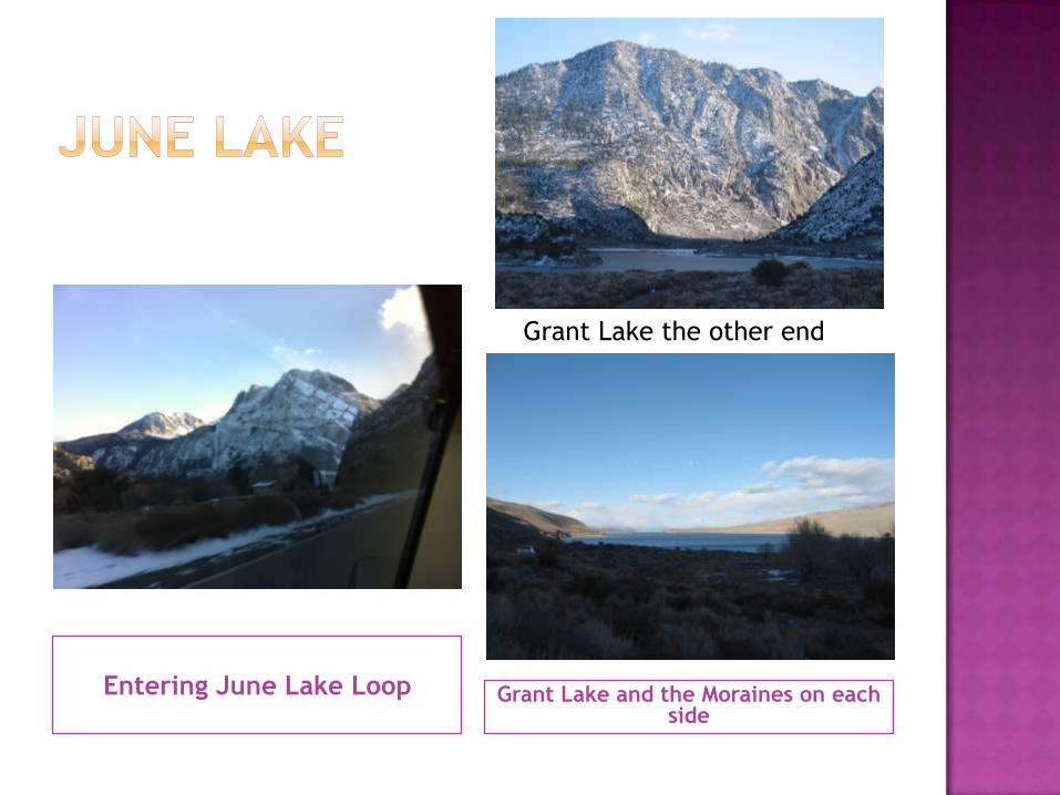
Entering June Lake Loop Grant Lake and the Moraines on each side
Grant Lake the other end
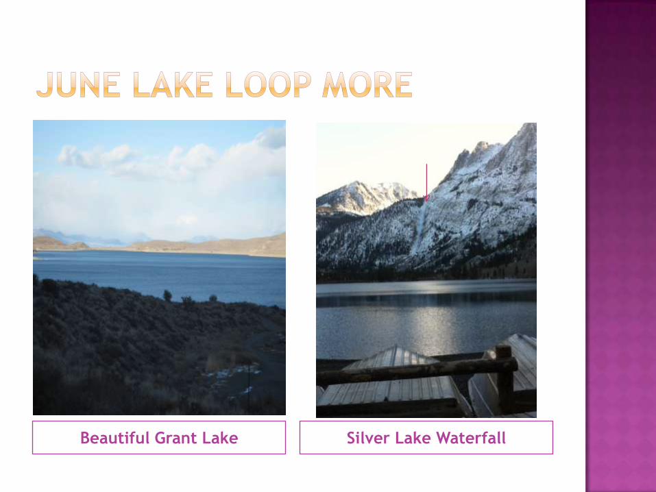
Beautiful Grant Lake Silver Lake Waterfall
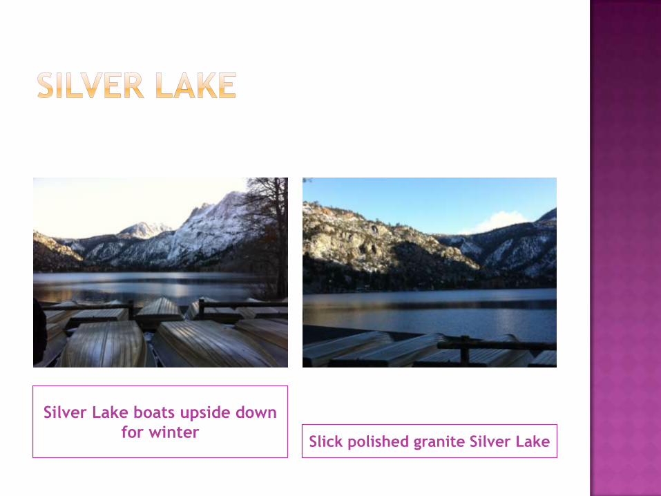
Silver Lake boats upside down
for winterSlick polished granite Silver Lake