Embed Size (px)
Citation preview
History of Rajahmundry GIS (Geographic Information System) View latest work at http://youtu.be/Sn1-bIzgKgs
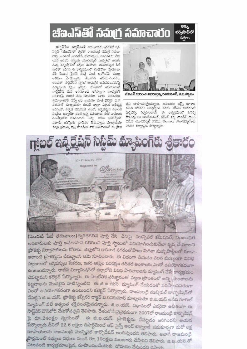
Years 2012-2014. Rajahmundry WEB-GIS Project. Cost:24 Lakhs including 1 lakh given by MCR,Rajahmundry, 23 Lakhs by DST, GOI.
Agencies: Adi Kavi Nannaya University represented by Principal Investigator, Prof K.V.Swamy, Co-Investigator Prof P.S.Varma, and OSGeo India, represented by Co-Investigators, Mr V.Ravi Kumar(Director (retd) G.S.I, Hyderabad) Secretary and Prof K.S.Rajan, (IIIT, Hyderabad)Treasurer.
Result: GIS data of Rajahmundry on themes most pertinent for City administration, like; Roads, Slums, Sanitation, Sewage, Hospitals, Banks, Govt offices, Educational institutes, Bazars, Police stations etc.
WEB-GIS: All the data are ready for serving on the internet.
Software and Data type: The entire work is done using (no-cost) Free and Open Source GIS software. The data is Open Data. Much of the data is derived from open data website Openstreetmap.org.
Municipal Corporation Rajahmundry's Benefit: A Rs1.5 Lakh worth Computer server, ready to serve the data on the internet, along with all Geospatial data (Open Data ready for distribution) and software await a favourable communication from Municipal Corporation Rajahmundry, to Adi Kavi Nannaya university.
Press coverage of the project, during a Project workshop convened in January 2014.
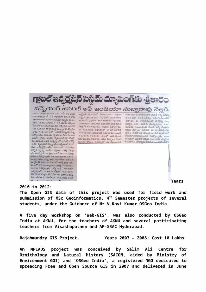
Years 2010 to 2012: The Open GIS data of this project was used for field work and submission of MSc Geoinformatics, 4th Semester projects of several students, under the Guidance of Mr V.Ravi Kumar,OSGeo India.
A five day workshop on 'Web-GIS', was also conducted by OSGeo India at AKNU, for the teachers of AKNU and several participating teachers from Visakhapatnem and AP-SRAC Hyderabad.
Rajahmundry GIS Project. Years 2007 – 2008: Cost 10 Lakhs
An MPLADS project was conceived by Sálim Ali Centre for Ornithology and Natural History (SACON, aided by Ministry of Environment GOI) and 'OSGeo India', a registered NGO dedicated to spreading Free and Open Source GIS in 2007 and delivered in June 2008 to Rajahmundry.
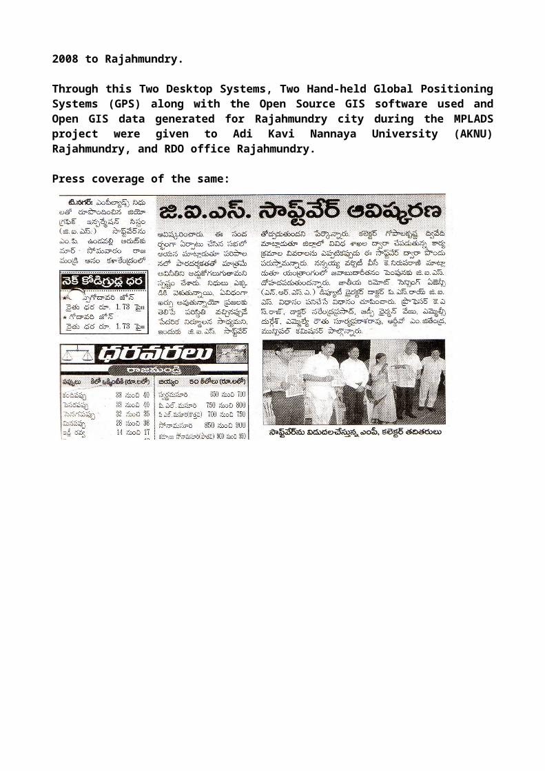
Through this Two Desktop Systems, Two Hand-held Global Positioning Systems (GPS) along with the Open Source GIS software used and Open GIS data generated for Rajahmundry city during the MPLADS project were given to Adi Kavi Nannaya University (AKNU) Rajahmundry, and RDO office Rajahmundry.
Press coverage of the same:


![RJ Weekly History Photos - Clark County, NevadaRJ Weekly History Photos 5/25/2012 2:37:57 PM] Helen Stewart Helen Stewart arrived at](https://img.pdfslide.us/doc/110x75/5e6dcfc71800114aac48f473/rj-weekly-history-photos-clark-county-rj-weekly-history-photos-5252012-23757.jpg)


![RJ1 RJ 2 RJ 5L RJ 5R RJ 19 RJ 18 RJ 6 RJ 7 RJ 11 RJ 5R RJ ...Parts]--Jr.pdf · RJ 3 RJ 8 RJ 11 RJ 6 RJ 5R RJ 4 RJ 26 RJ 27 RJ 28 RJ 29 RJ 5L SPECIAL PAWL For clockwise rotation, a](https://img.pdfslide.us/doc/110x75/5f7bfd0580b79229701f388e/rj1-rj-2-rj-5l-rj-5r-rj-19-rj-18-rj-6-rj-7-rj-11-rj-5r-rj-parts-jrpdf-rj.jpg)