Embed Size (px)
Citation preview
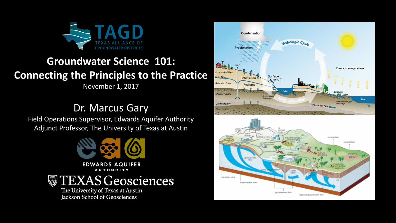
Groundwater Science 101:Connecting the Principles to the Practice
November 1, 2017
Dr. Marcus GaryField Operations Supervisor, Edwards Aquifer Authority
Adjunct Professor, The University of Texas at Austin
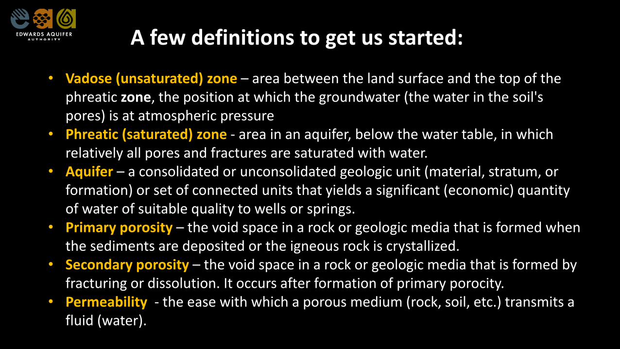
• Vadose (unsaturated) zone – area between the land surface and the top of the phreatic zone, the position at which the groundwater (the water in the soil's pores) is at atmospheric pressure
• Phreatic (saturated) zone - area in an aquifer, below the water table, in which relatively all pores and fractures are saturated with water.
• Aquifer – a consolidated or unconsolidated geologic unit (material, stratum, or formation) or set of connected units that yields a significant (economic) quantity of water of suitable quality to wells or springs.
• Primary porosity – the void space in a rock or geologic media that is formed when the sediments are deposited or the igneous rock is crystallized.
• Secondary porosity – the void space in a rock or geologic media that is formed by fracturing or dissolution. It occurs after formation of primary porocity.
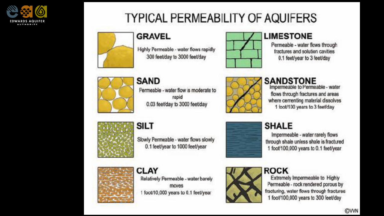
• Permeability - the ease with which a porous medium (rock, soil, etc.) transmits a fluid (water).
A few definitions to get us started:
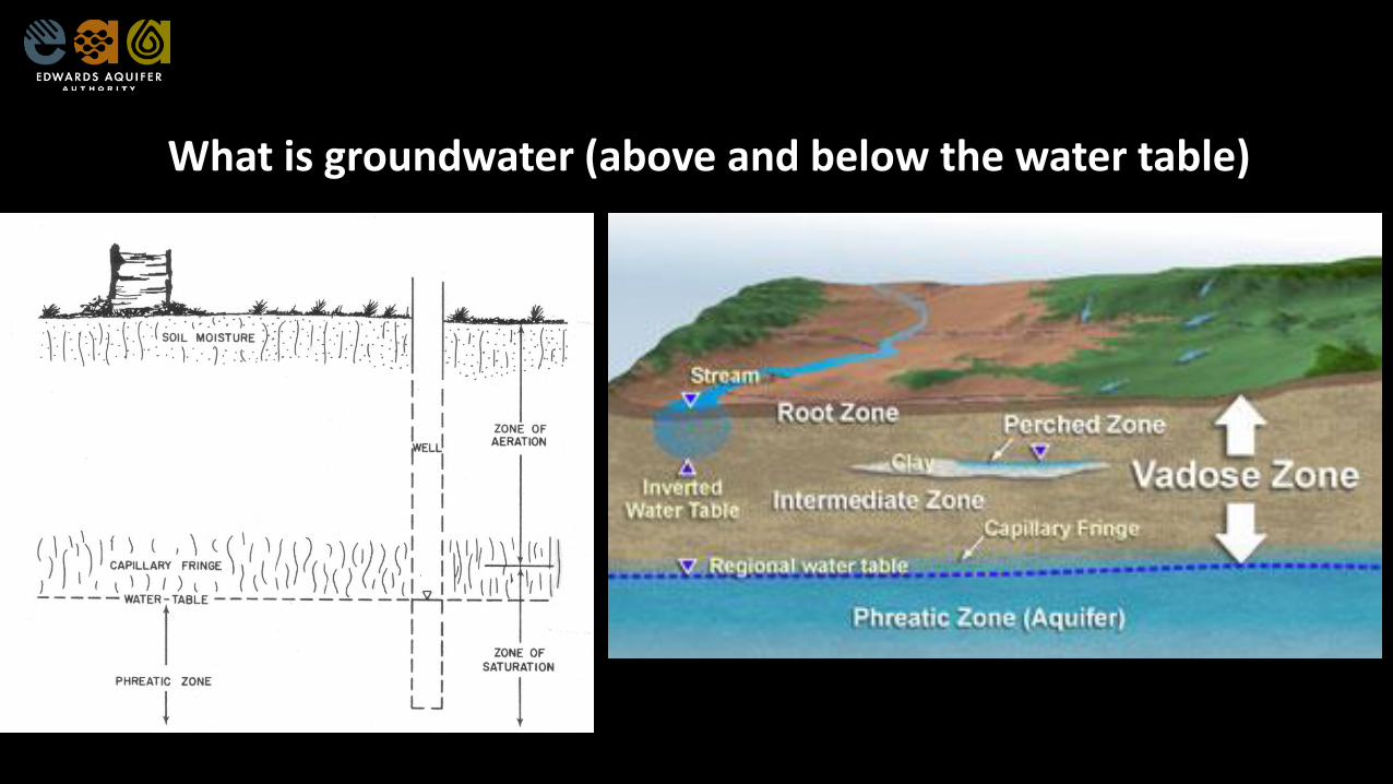
What is groundwater (above and below the water table)
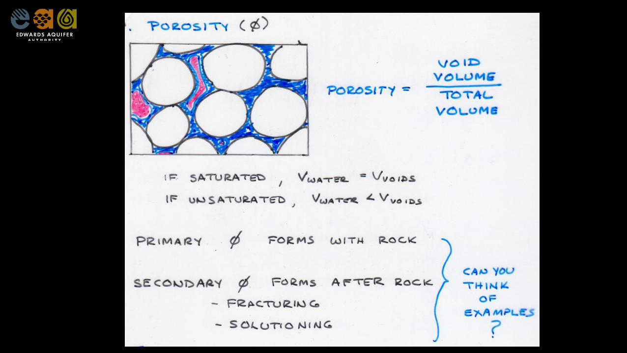
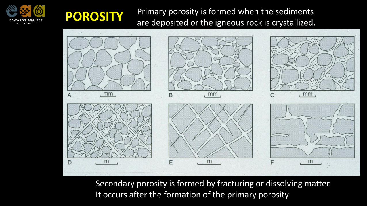
POROSITY Primary porosity is formed when the sedimentsare deposited or the igneous rock is crystallized.
Secondary porosity is formed by fracturing or dissolving matter. It occurs after the formation of the primary porosity
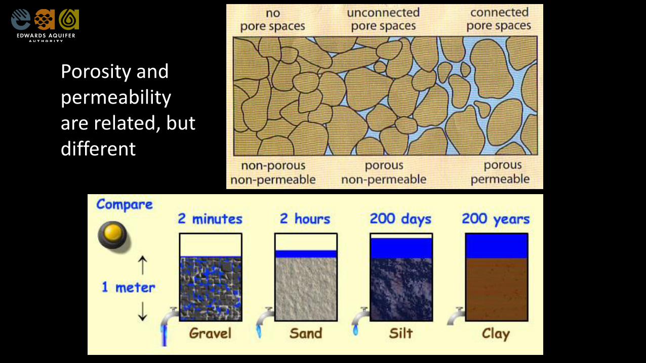
Porosity and permeability are related, but different
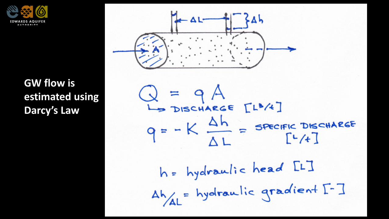
GW flow is estimated using Darcy’s Law
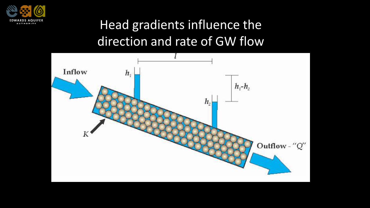
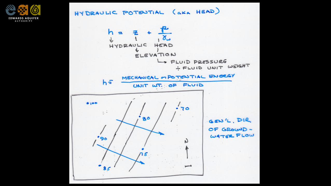
Head gradients influence the direction and rate of GW flow
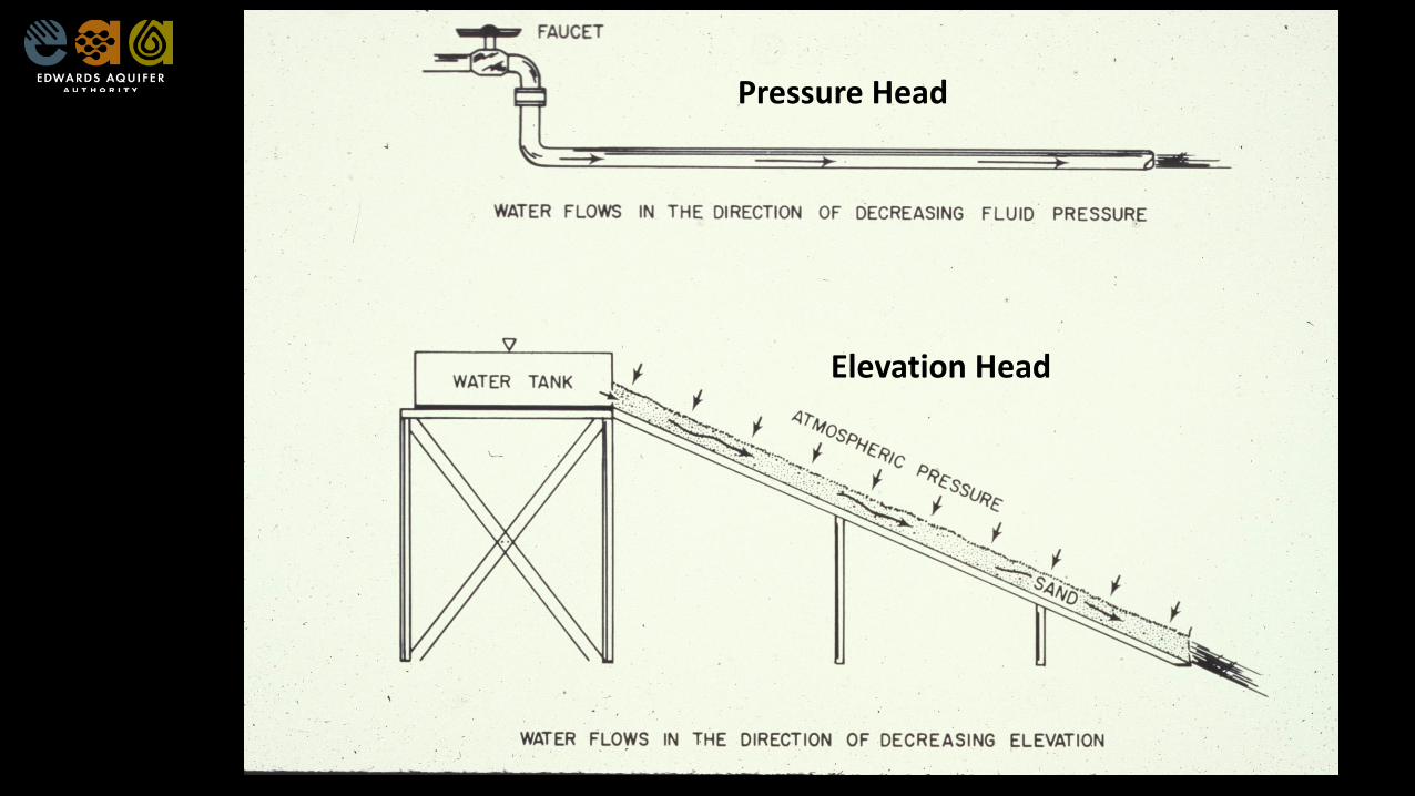
Pressure Head
Elevation Head
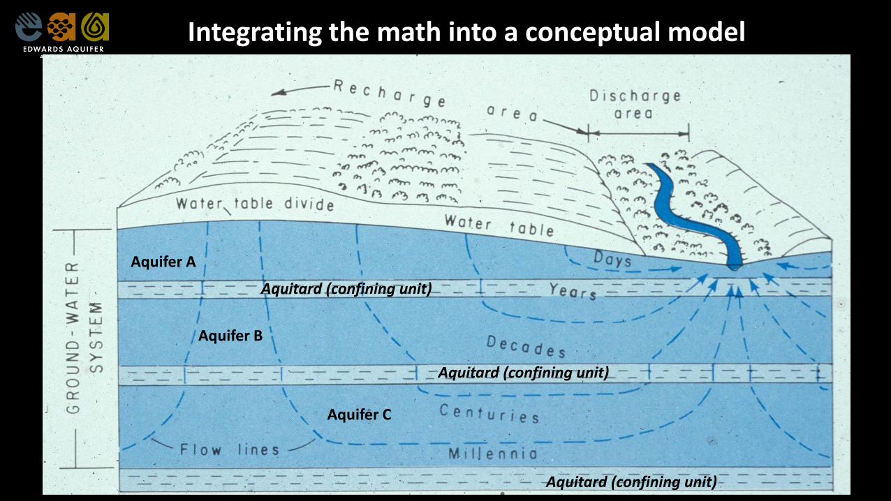
Aquifer A
Aquifer B
Aquifer C
Aquitard (confining unit)
Aquitard (confining unit)
Aquitard (confining unit)
Integrating the math into a conceptual model
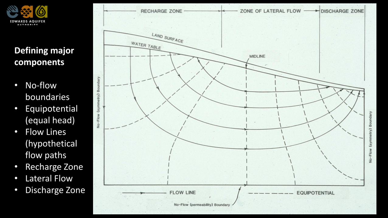
Defining major components
• No-flow boundaries
• Equipotential (equal head)
• Flow Lines (hypothetical flow paths
• Recharge Zone• Lateral Flow• Discharge Zone
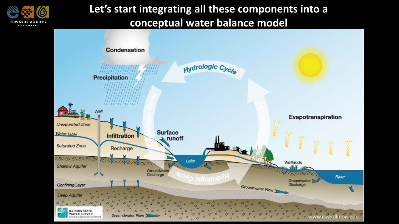
Let’s start integrating all these components into a conceptual water balance model
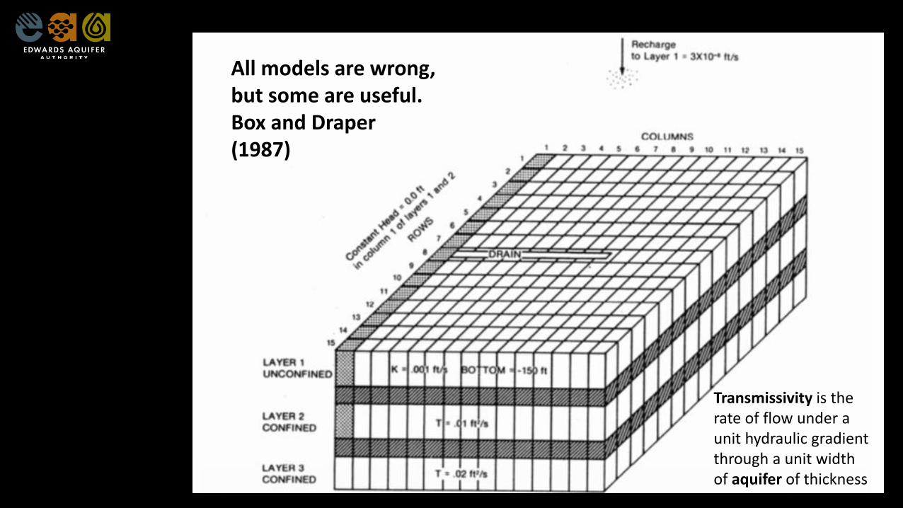
Transmissivity is the rate of flow under a unit hydraulic gradient through a unit width of aquifer of thickness
All models are wrong, but some are useful.Box and Draper (1987)
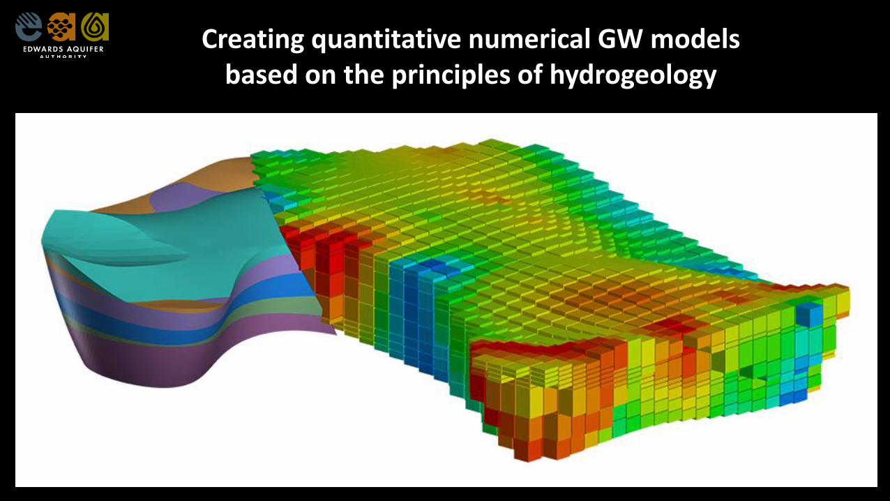
Creating quantitative numerical GW models based on the principles of hydrogeology
GAMs are based on conceptual models based on hydro-geologic observations and hypotheses.
The numerical models are built from these conceptual models
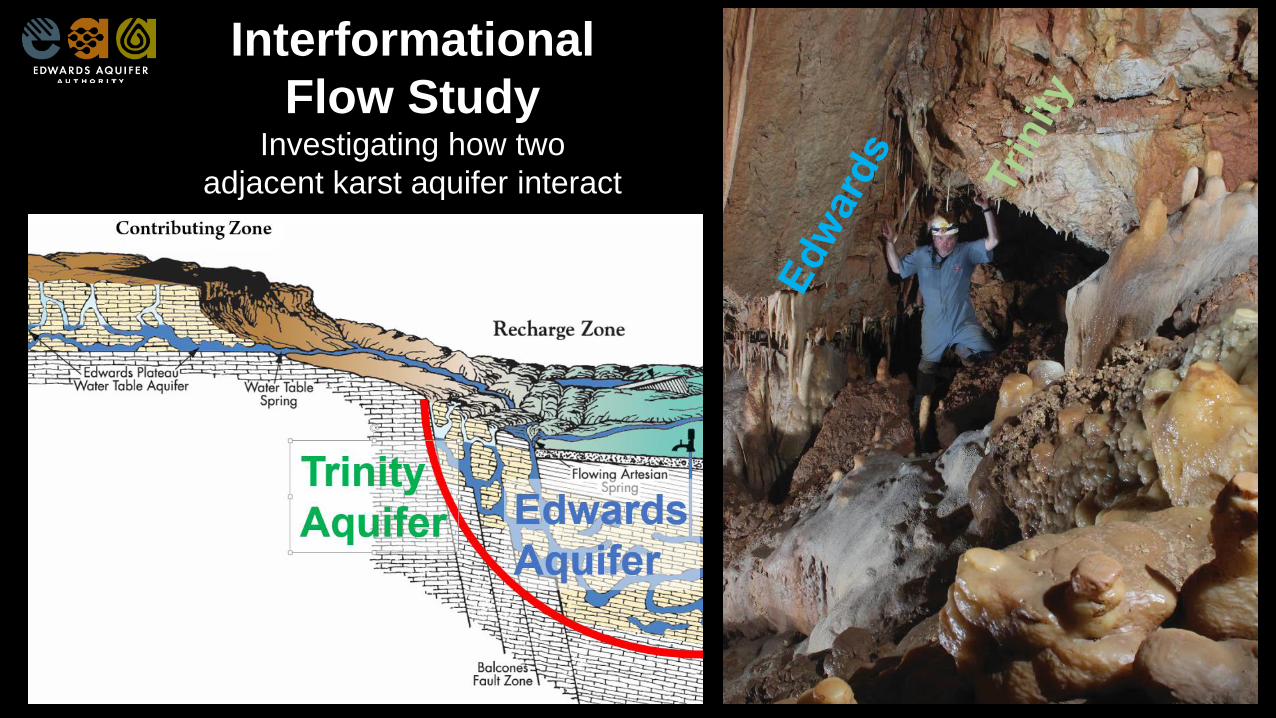
Interformational
Flow StudyInvestigating how two
adjacent karst aquifer interact
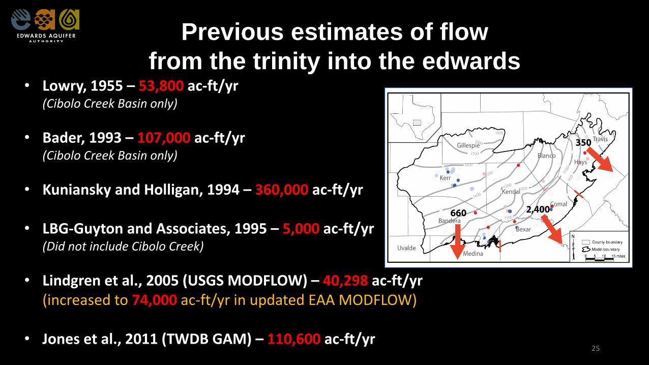
Previous estimates of flow
from the trinity into the edwards• Lowry, 1955 – 53,800 ac-ft/yr
(Cibolo Creek Basin only)
• Bader, 1993 – 107,000 ac-ft/yr(Cibolo Creek Basin only)
• Kuniansky and Holligan, 1994 – 360,000 ac-ft/yr
• LBG-Guyton and Associates, 1995 – 5,000 ac-ft/yr(Did not include Cibolo Creek)
• Lindgren et al., 2005 (USGS MODFLOW) – 40,298 ac-ft/yr(increased to 74,000 ac-ft/yr in updated EAA MODFLOW)
• Jones et al., 2011 (TWDB GAM) – 110,600 ac-ft/yr25
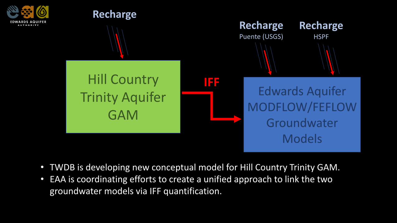
Hill Country Trinity Aquifer
GAM
Edwards Aquifer MODFLOW/FEFLOW
Groundwater Models
IFF
RechargePuente (USGS)
RechargeHSPF
Recharge
• TWDB is developing new conceptual model for Hill Country Trinity GAM.• EAA is coordinating efforts to create a unified approach to link the two
groundwater models via IFF quantification.
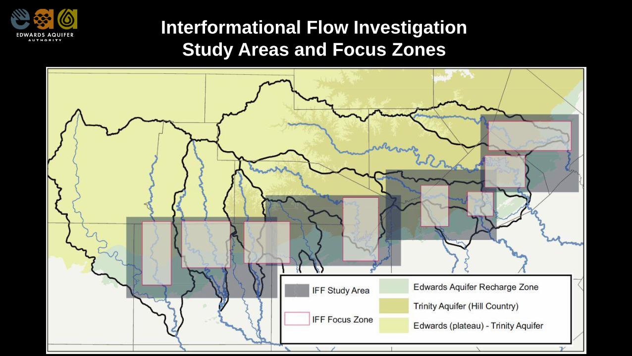
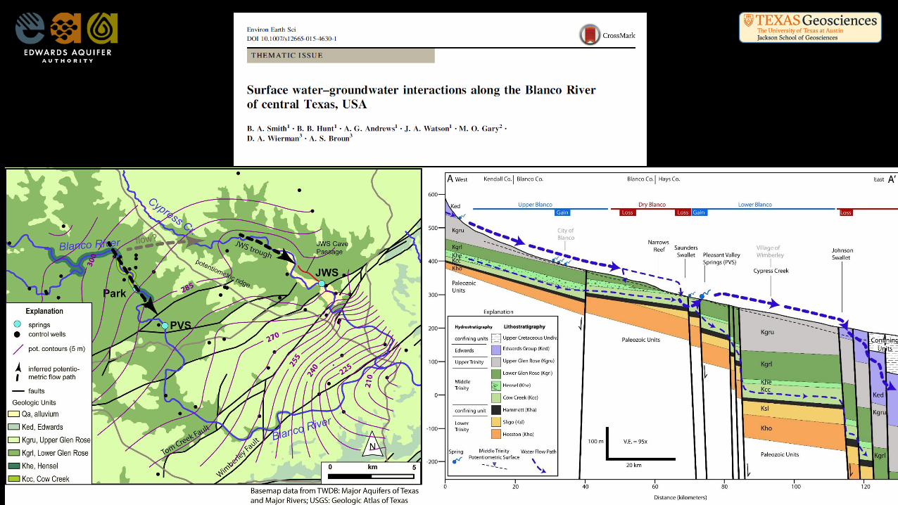
Interformational Flow Investigation
Study Areas and Focus Zones
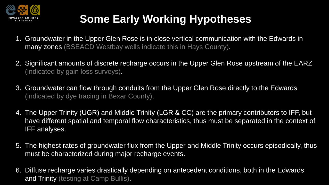
Some Early Working Hypotheses
1. Groundwater in the Upper Glen Rose is in close vertical communication with the Edwards in
many zones (BSEACD Westbay wells indicate this in Hays County).
2. Significant amounts of discrete recharge occurs in the Upper Glen Rose upstream of the EARZ
(indicated by gain loss surveys).
3. Groundwater can flow through conduits from the Upper Glen Rose directly to the Edwards
(indicated by dye tracing in Bexar County).
4. The Upper Trinity (UGR) and Middle Trinity (LGR & CC) are the primary contributors to IFF, but
have different spatial and temporal flow characteristics, thus must be separated in the context of
IFF analyses.
5. The highest rates of groundwater flux from the Upper and Middle Trinity occurs episodically, thus
must be characterized during major recharge events.
6. Diffuse recharge varies drastically depending on antecedent conditions, both in the Edwards
and Trinity (testing at Camp Bullis).
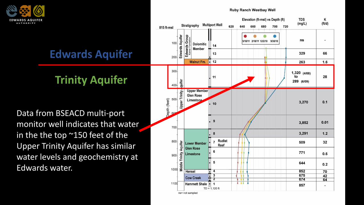
Edwards Aquifer
Trinity Aquifer
Data from BSEACD multi-port monitor well indicates that water in the the top ~150 feet of the Upper Trinity Aquifer has similar water levels and geochemistry at Edwards water.
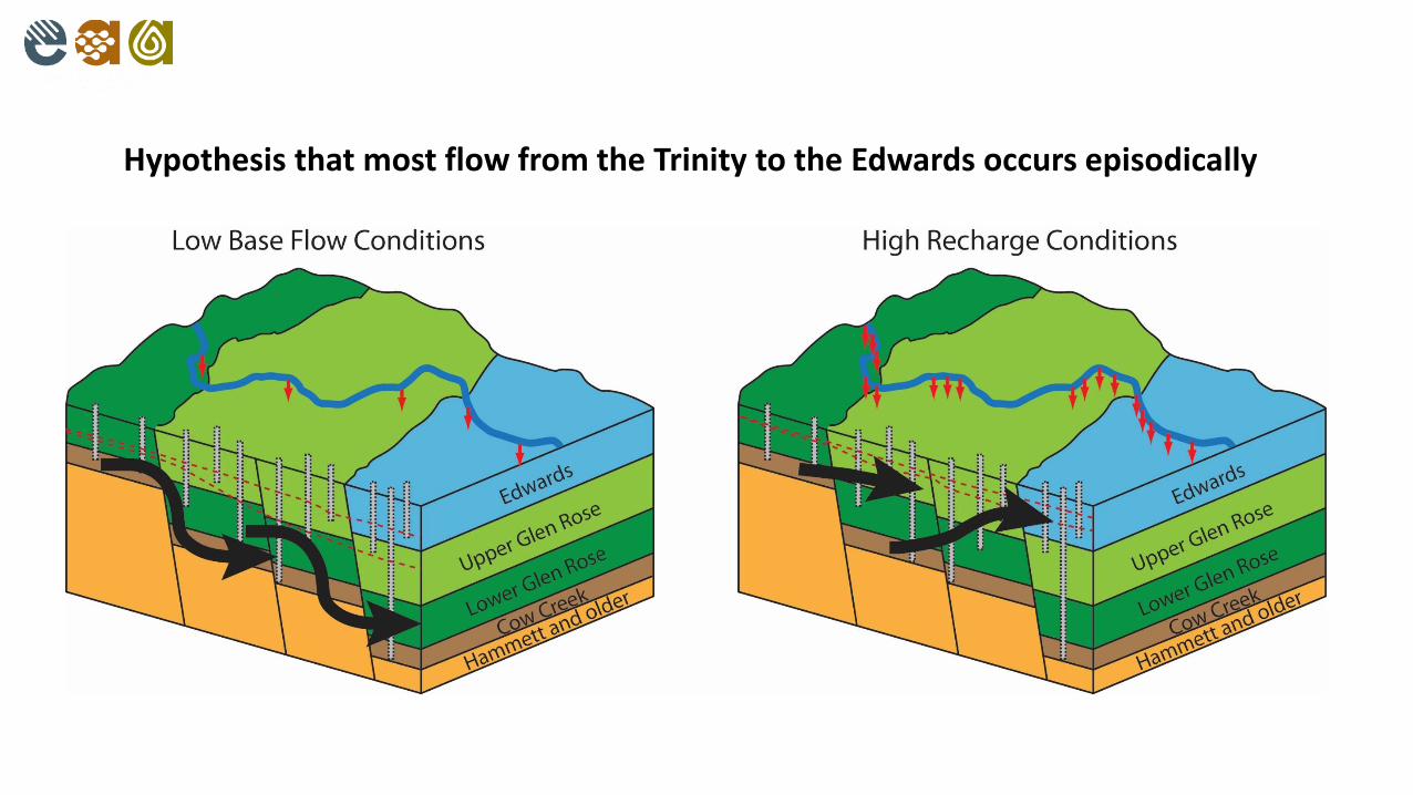
Hypothesis that most flow from the Trinity to the Edwards occurs episodically
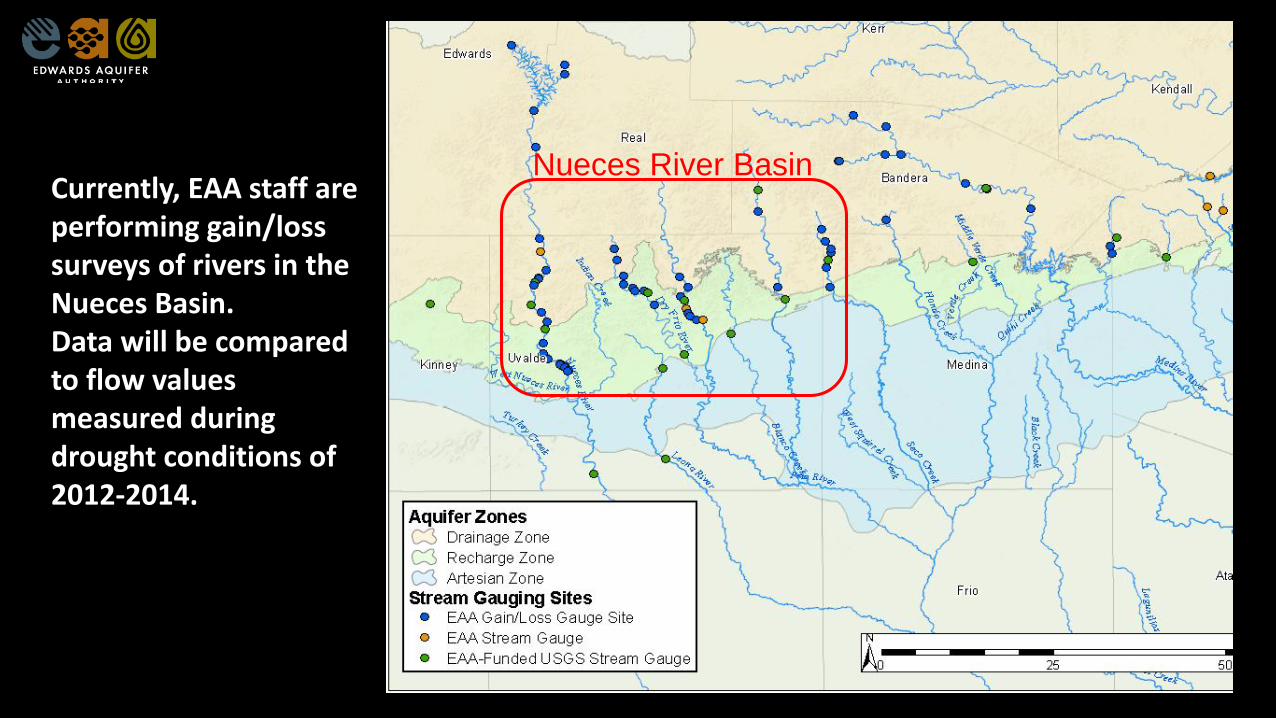
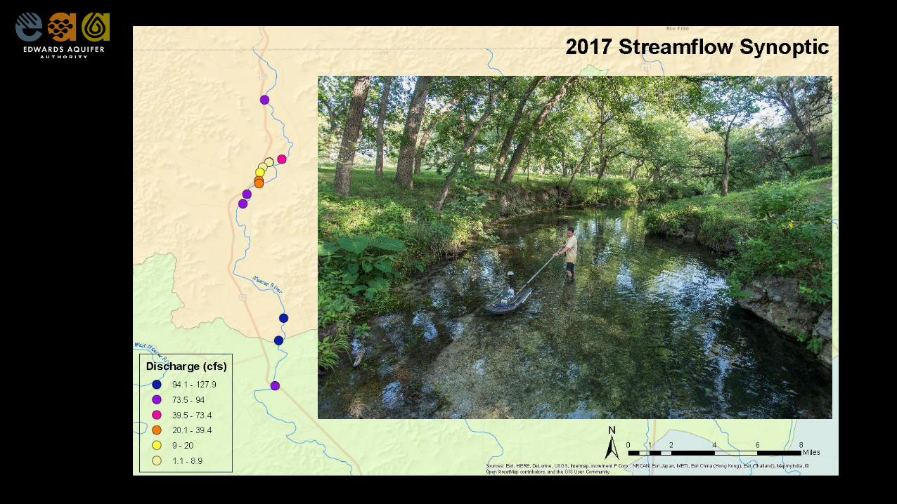
Nueces River BasinCurrently, EAA staff are performing gain/loss surveys of rivers in the Nueces Basin.Data will be compared to flow values measured during drought conditions of 2012-2014.
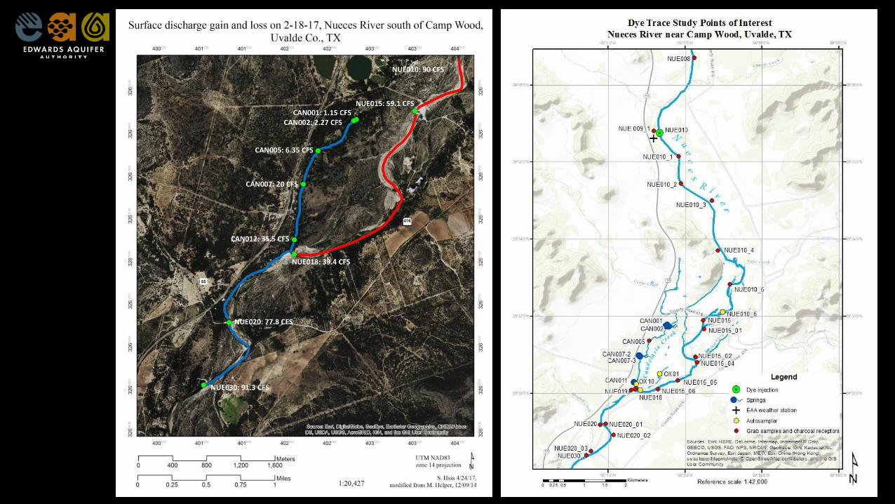
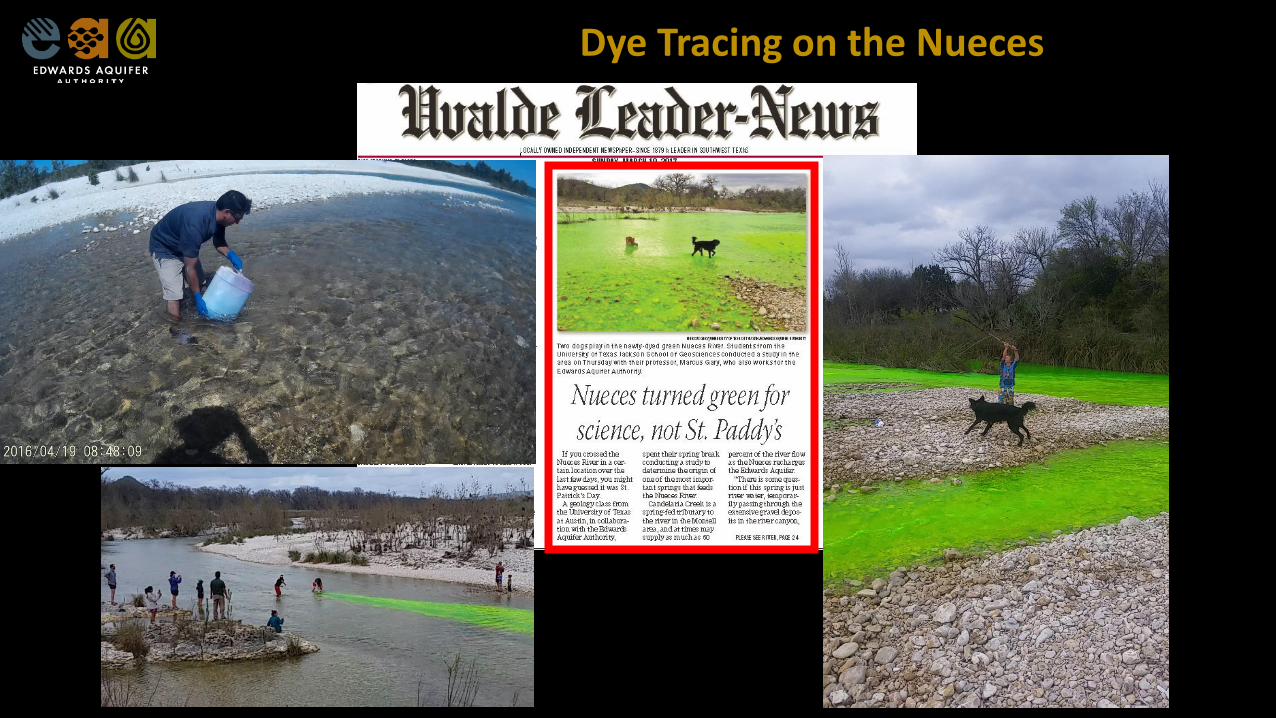
Dye Tracing on the Nueces
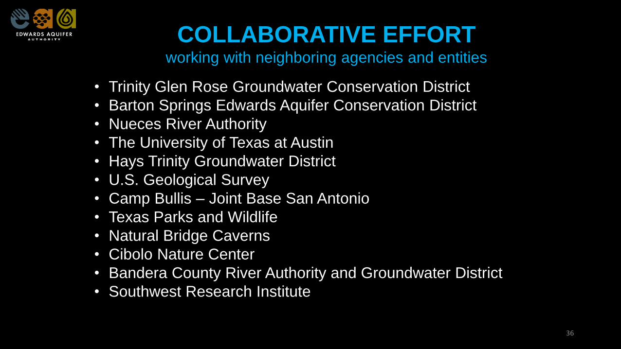
COLLABORATIVE EFFORTworking with neighboring agencies and entities
• Trinity Glen Rose Groundwater Conservation District
• Barton Springs Edwards Aquifer Conservation District
• Nueces River Authority
• The University of Texas at Austin
• Hays Trinity Groundwater District
• U.S. Geological Survey
• Camp Bullis – Joint Base San Antonio
• Texas Parks and Wildlife
• Natural Bridge Caverns
• Cibolo Nature Center
• Bandera County River Authority and Groundwater District
• Southwest Research Institute
36
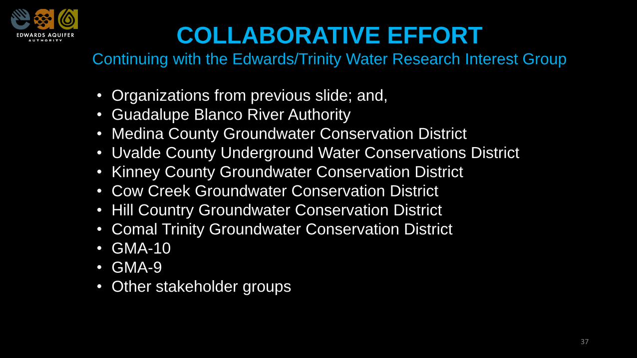
COLLABORATIVE EFFORTContinuing with the Edwards/Trinity Water Research Interest Group
• Organizations from previous slide; and,
• Guadalupe Blanco River Authority
• Medina County Groundwater Conservation District
• Uvalde County Underground Water Conservations District
• Kinney County Groundwater Conservation District
• Cow Creek Groundwater Conservation District
• Hill Country Groundwater Conservation District
• Comal Trinity Groundwater Conservation District
• GMA-10
• GMA-9
• Other stakeholder groups
37
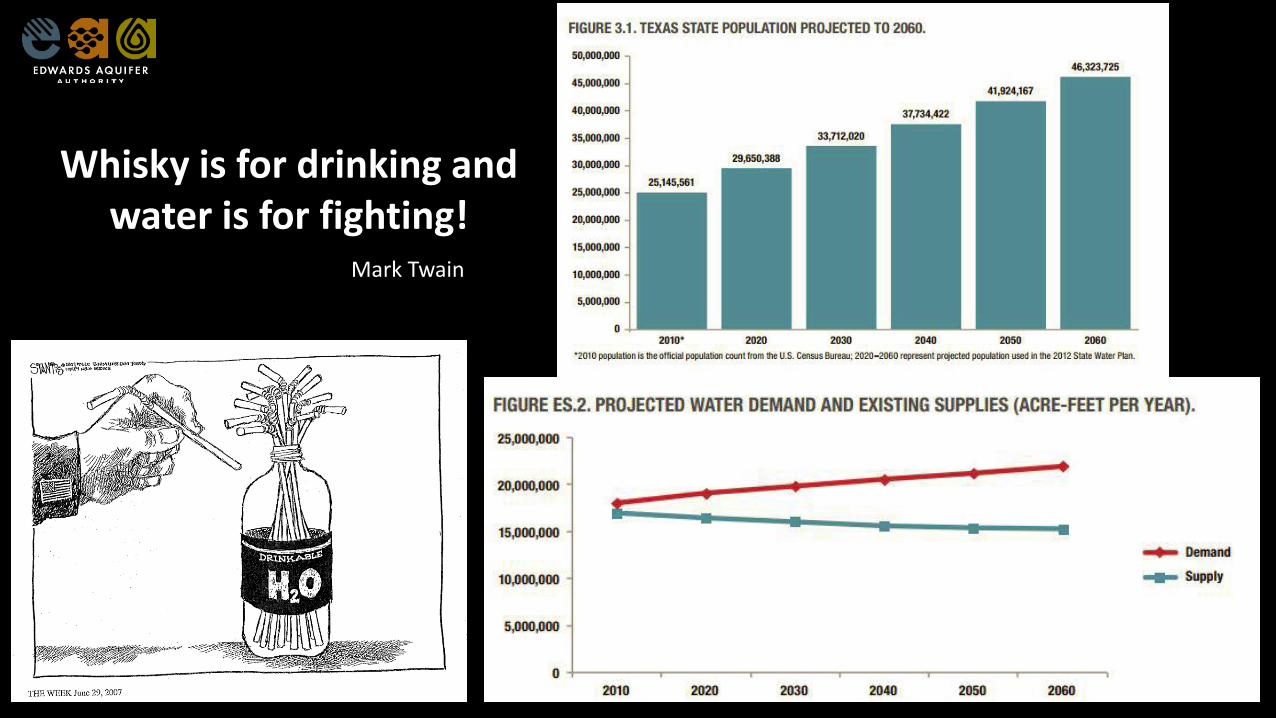
Whisky is for drinking and water is for fighting!
Mark Twain