Embed Size (px)
Citation preview

ARCH 416Spring ‘15
Class 03 Climate, Cities, Collapse

location of Chaco Canyon“Four Corners” regionnorthwestern New Mexico

Map of Chaco Canyon showing unique land formations and more than a dozenAnasazi building sites. We will focus on Pueblo Bonito and Casa Rinconada.

Anasazi roads excavated at Chaco Canyon, NM

timeline of settlement, habitation,abandonment at Chaco Canyon

aerial view, Chaco Canyon showing Anasazi ruins

slightly different aerial view of Chacowith clear focus on Pueblo Bonito(semicircular form at bottom of picture)

Fajada Butte. Nearby landmark.

“Sun Dagger” top of Fajada Butte
view this simulationto understand it better
http://accad.osu.edu/~aprice/works/sundagger/index.html

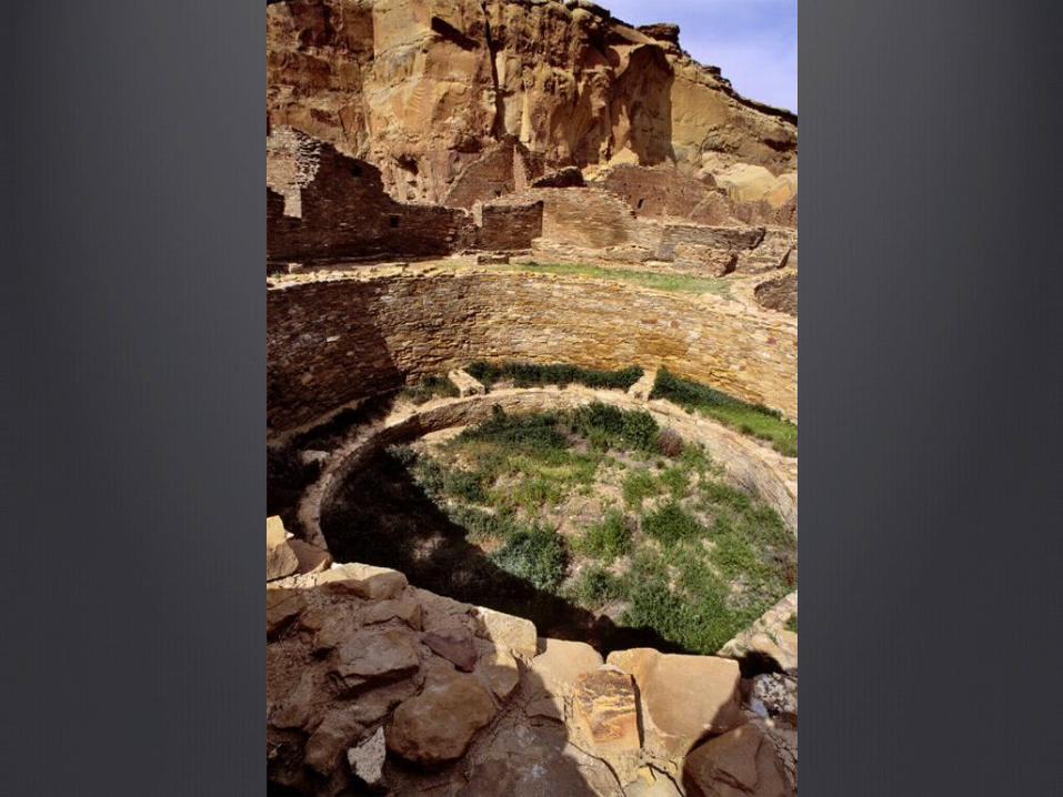
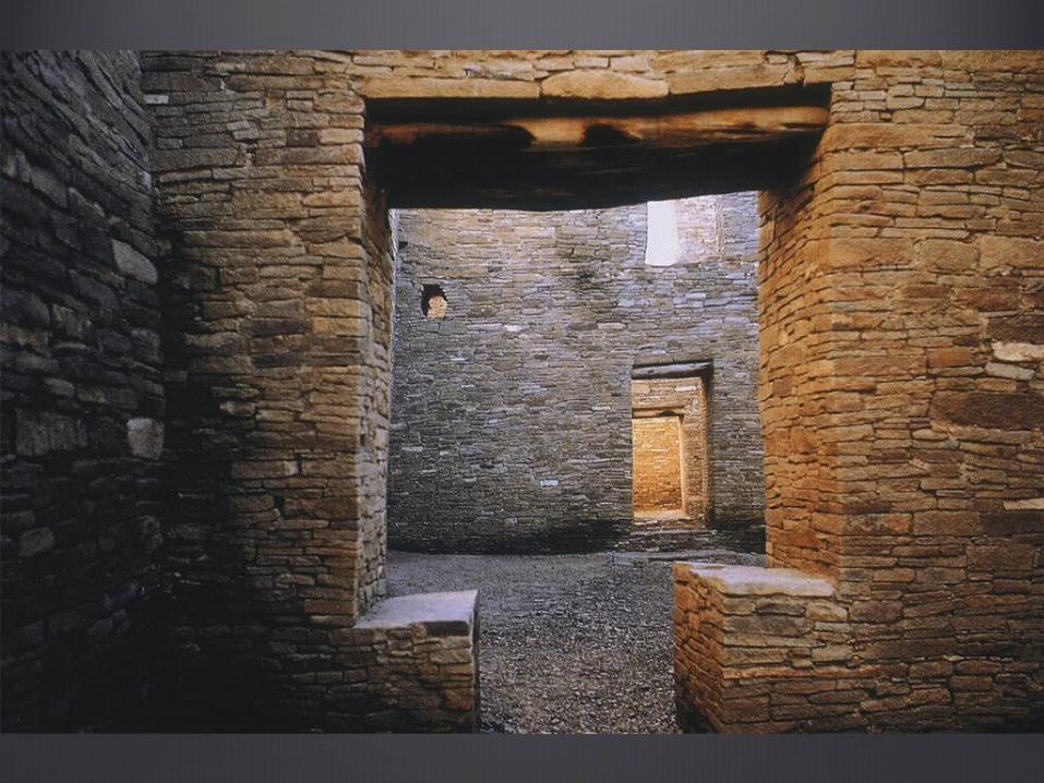
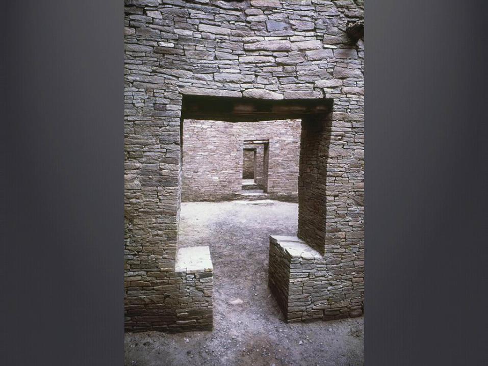
arial viewPueblo Bonito

reconstruction drawing of Pueblo Bonito

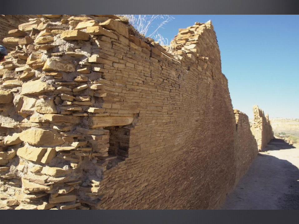
Aerial view: the great kiva at Casa Rinconada

Casa Rinconada--Great Kivadiameter of 63 ft

Casa Rinconada: Northeast window and T-Shaped doorway

Casa Rinconada
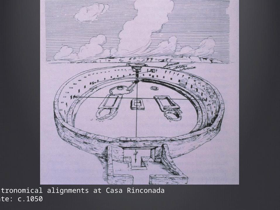
Astronomical alignments at Casa RinconadaDate: c.1050
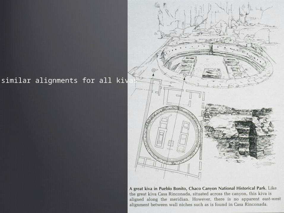
similar alignments for all kivas

typical kiva plan

potsherdsChaco Canyon

potsherdsChaco Canyon

potsherdsChaco Canyon

potsherdsChaco Canyon

potsherdsChaco Canyon

cylindrical vesselPueblo BonitoChaco Canyon

cylindrical vesselsChaco Canyon

ceramic mugChaco Canyon

ceramic pitcherPueblo BonitoChaco Canyon

human effigy bottleceramicChaco Canyon

human effigy bottleceramicChaco Canyon

grooved pounding stoneChaco Canyon

shell pendantsPenasco Blanco

shell pendantsstone pendantsPenasco BlancoChaco Canyon

shell beadsPenasco BlancoChaco Canyon
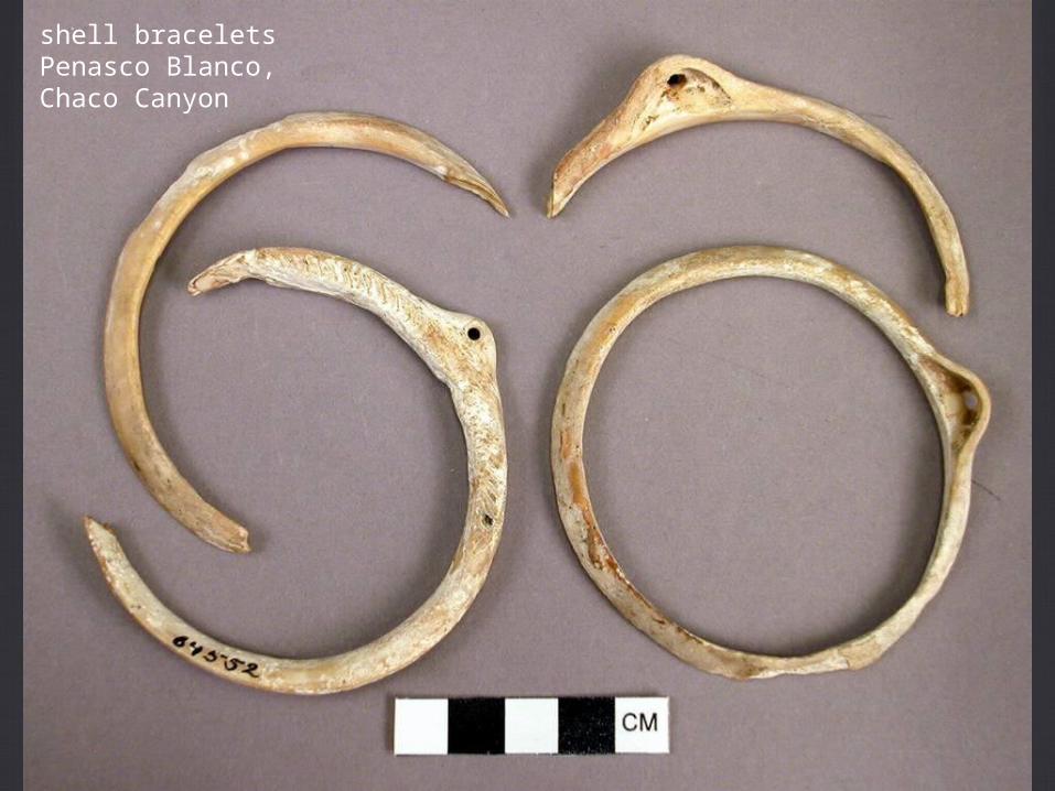
shell braceletsPenasco Blanco,Chaco Canyon

bowlPueblo Bonito
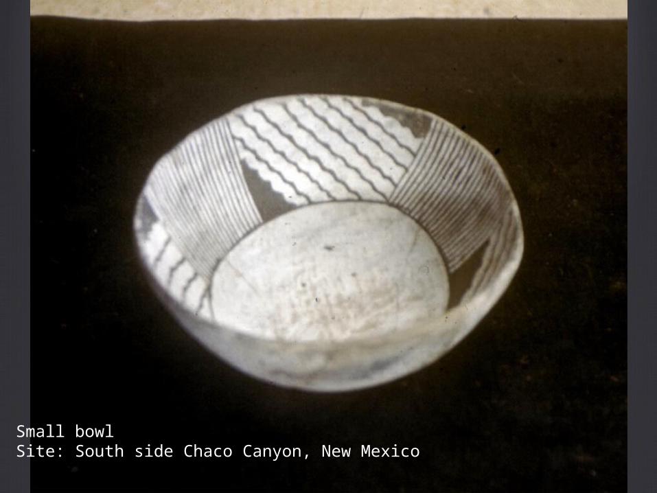
Small bowlSite: South side Chaco Canyon, New Mexico

petroglyphs carved into rock

collection of petroglyphs
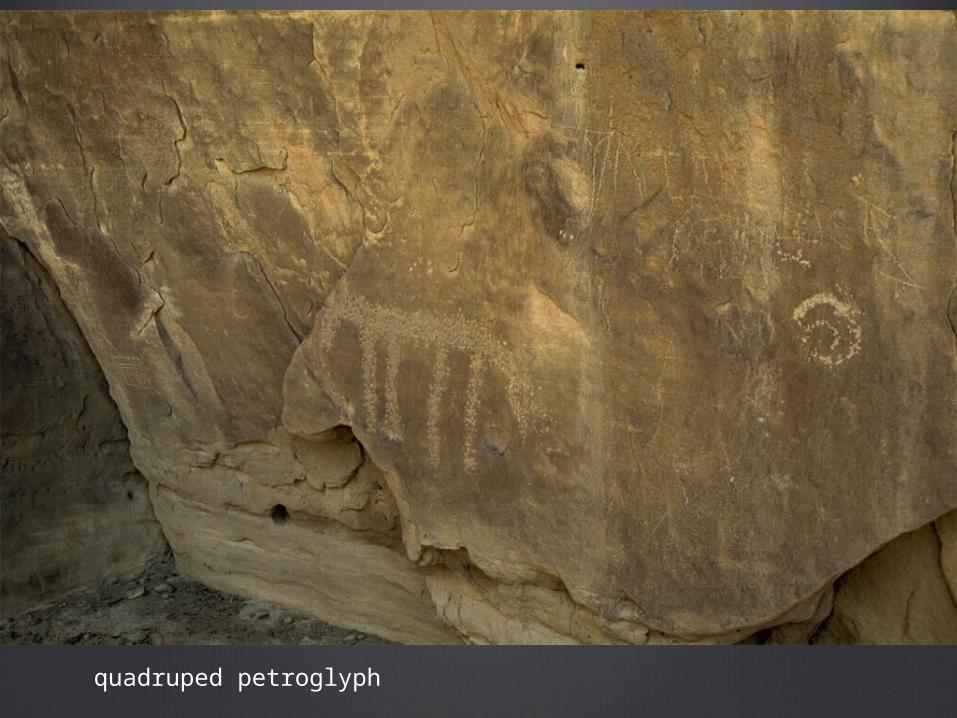
quadruped petroglyph

petroglyph2 spirals

petroglyph, figure with upraised hands

snake petroglyph
Chaco Canyon, overview
Anasazi agriculture remained in “transitional” phase for a long time, due to harsh climate
pit houses were built first, and returned to as needed.
more resource-intensive buildings appeared when times were good
pit houses dated to 1150, 1220 and 1310: not a uniform progression from simpler to more complex structures

pit houses
examplesJomon (prehistoric Japan) has examples of these
digging pits to survive in Siberia
Little House on the Prairie
advantagesquick to construct
well-insulated (warm/cool even with extreme exterior temperatures)
for the Anasazi, they also had a symbolic significance, as they believed they emerged directly from the earth mother

deforestation of Chaco Canyon
each room required 40 beams
for a total of 250,000 beams to build the pueblos in Chaco Canyon
piñon and juniper had twisted trunks and limbs
ponderosa and Douglass fir cut down to a diameter of 50 miles around Chaco Canyon