Welcome to EDINA DigimapDigimap is an EDINA service offering online access to a range of spatial data. It is authenticated using Athens and is available to all
higher and further education institutions.
Digimap contains several data collections. Your institution must subscribe to each collection. This usually involves an annual fee.
The licence conditions for each data collection may differ.
This demonstration shows the various facilities available to access the Ordnance Survey Data Collection.
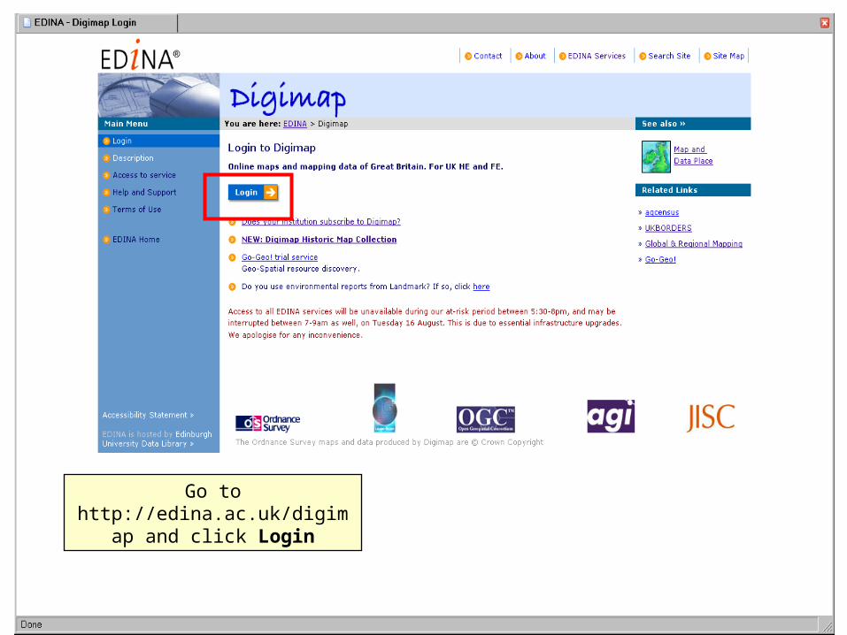
Go to http://edina.ac.uk/digimap and click Login
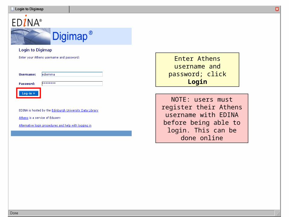
Enter Athens username and password; click Login
NOTE: users must register their Athens username with EDINA before being able to
login. This can be done online
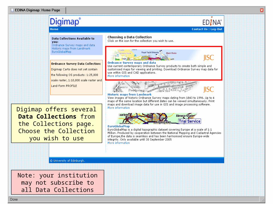
Digimap offers several Data Collections from the
Collections page. Choose the Collection you wish to use
Note: your institution may not subscribe to all Data Collections
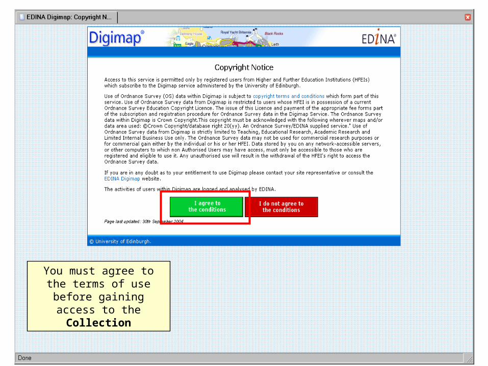
You must agree to the terms of use before gaining
access to the Collection
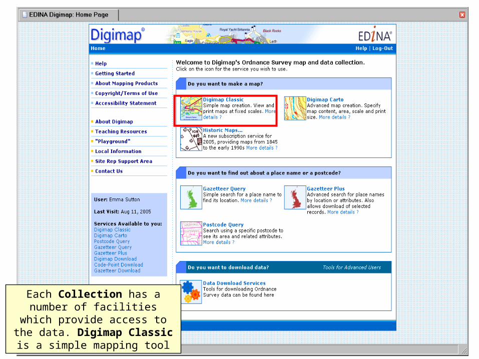
Each Collection has a number of facilities which provide access to the data. Digimap Classic is a
simple mapping tool
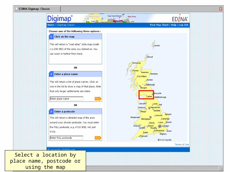
Select a location by place name,
postcode or using the map
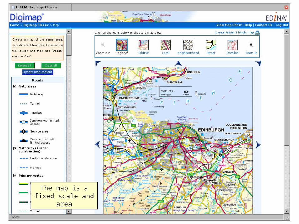
The map is a fixed scale and area
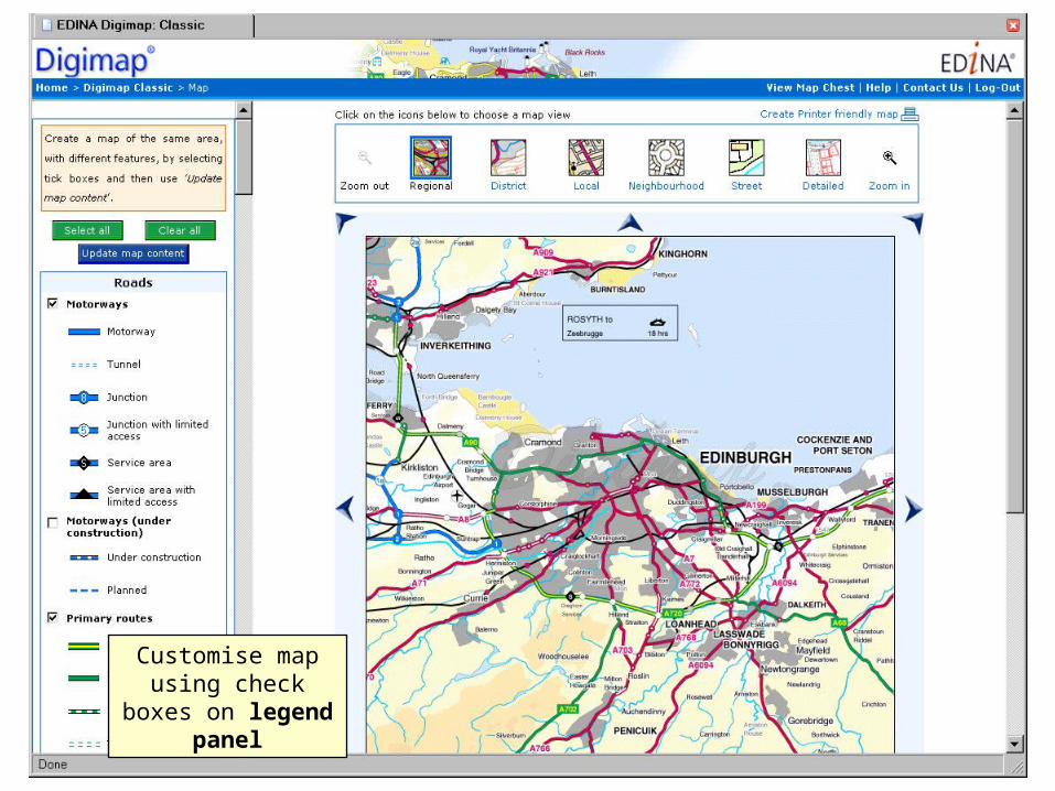
Customise map using check boxes on legend panel
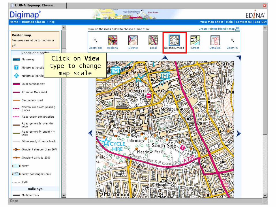
Click on View type to change map scale
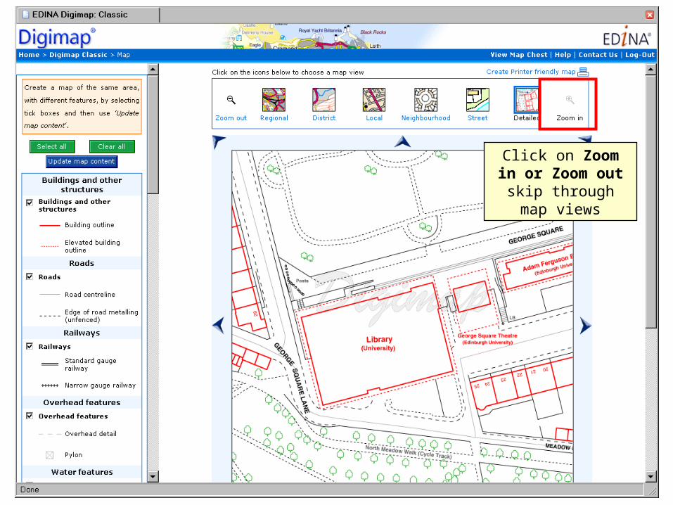
Click on Zoom in or Zoom out skip
through map views
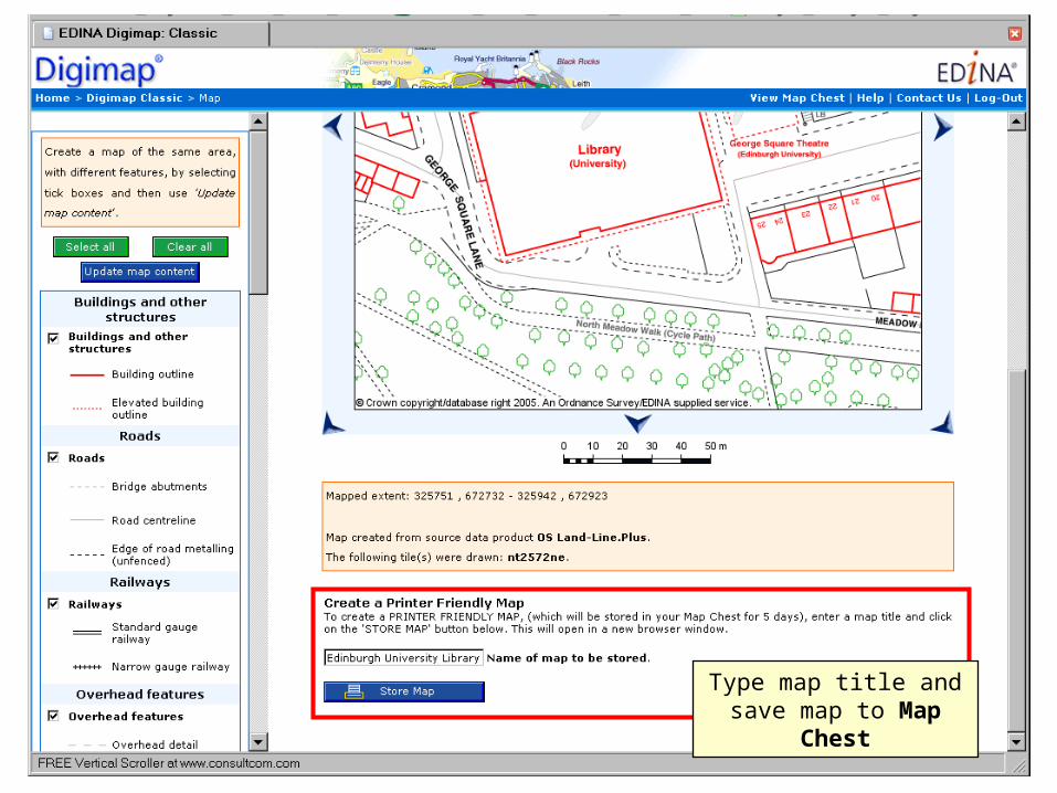
Type map title and save map to Map Chest
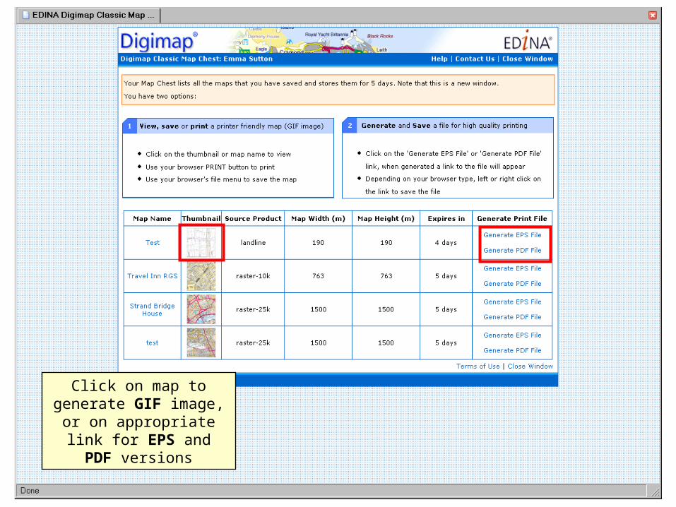
Click on map to generate GIF image, or on
appropriate link for EPS and PDF versions
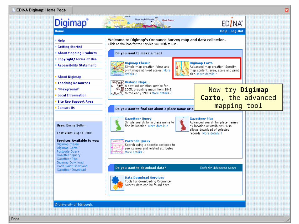
Now try Digimap Carto, the advanced mapping tool
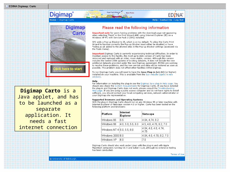
Digimap Carto is a Java applet, and has to be
launched as a separate application. It needs a fast
internet connection
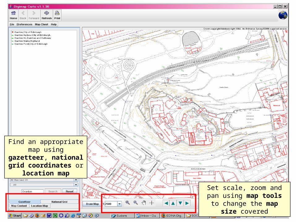
Find an appropriate map using gazetteer, national
grid coordinates or location map
Set scale, zoom and pan using map tools to change
the map size covered

Customise map using check boxes on legend panel

Now try Gazetteer Query: look up place
names and display their locations on a map
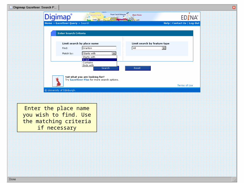
Enter the place name you wish to find. Use the matching
criteria if necessary
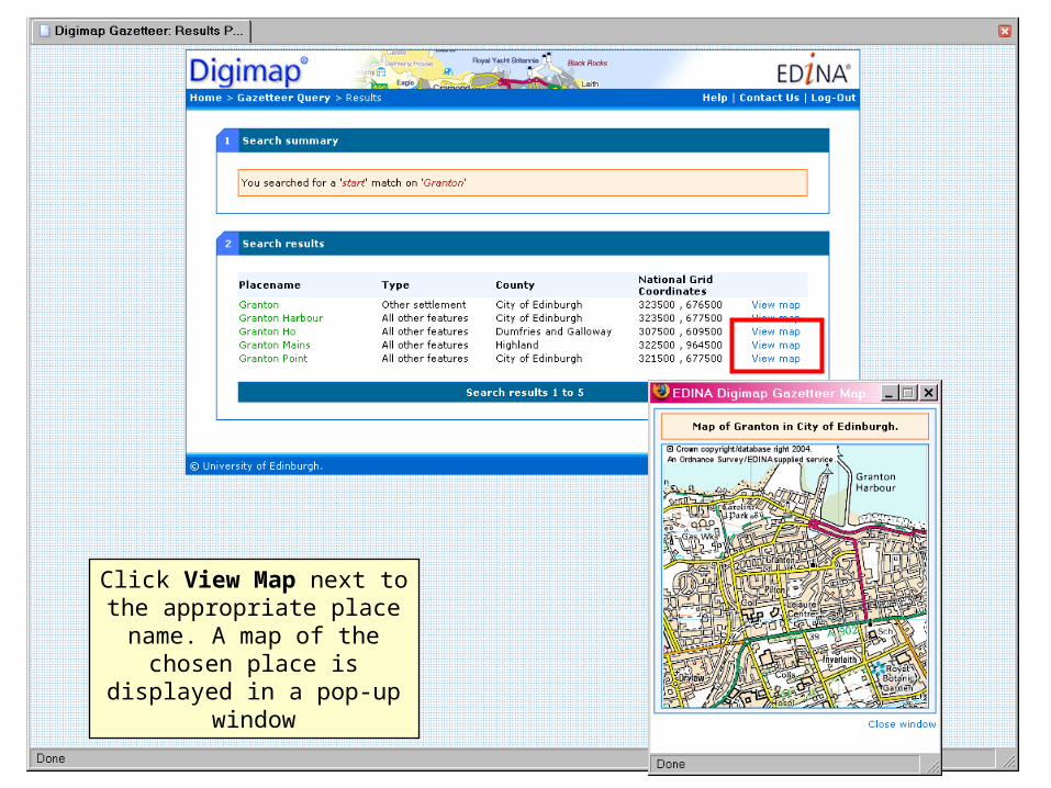
Click View Map next to the appropriate place name. A map of the chosen place is
displayed in a pop-up window
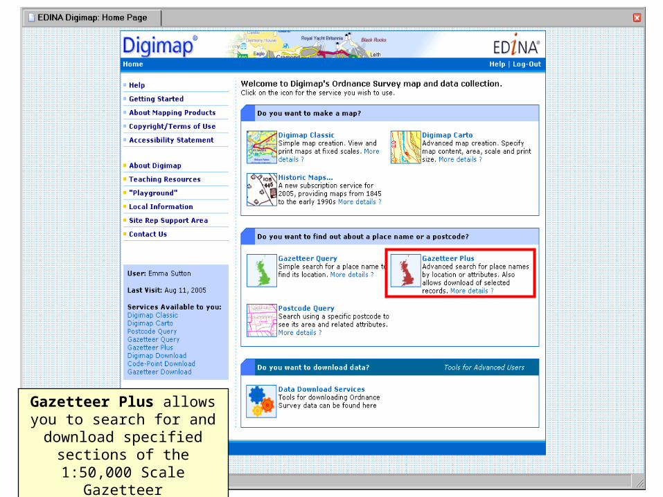
Gazetteer Plus allows you to search for and download specified sections of the
1:50,000 Scale Gazetteer
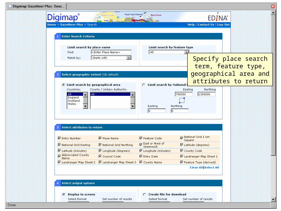
Specify place search term, feature type, geographical
area and attributes to return
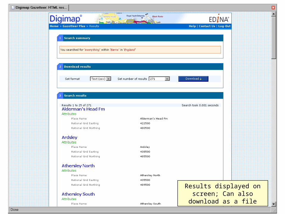
Results displayed on screen; Can also download as a file
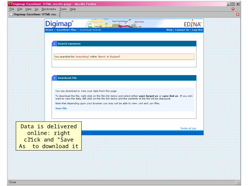
Data is delivered online: right click and “Save As”
to download it
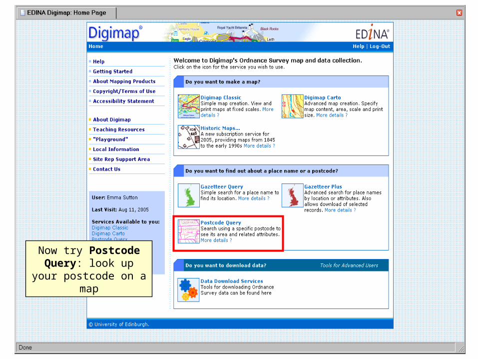
Now try Postcode Query: look up your postcode on a map
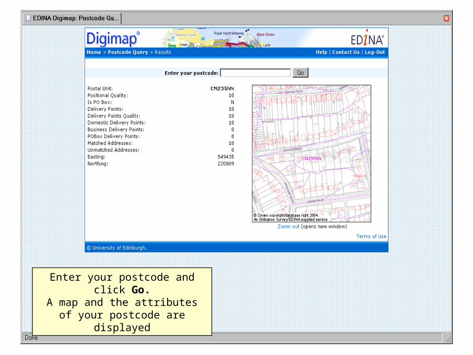
Enter your postcode and click Go.A map and the attributes of your
postcode are displayed
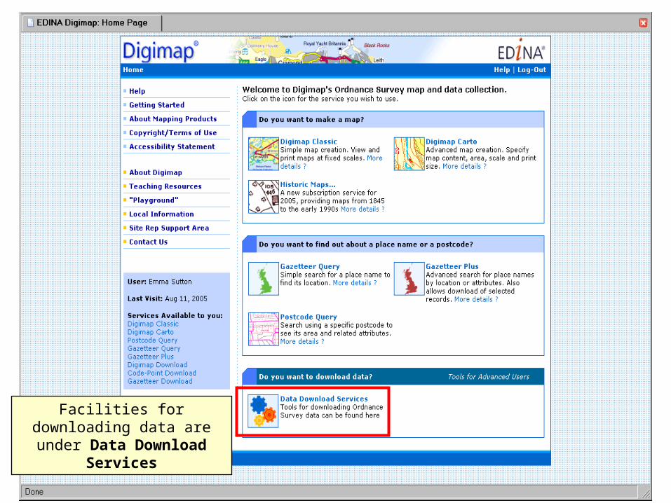
Facilities for downloading data are under Data Download
Services
Facilities for downloading data are under Data Download Services
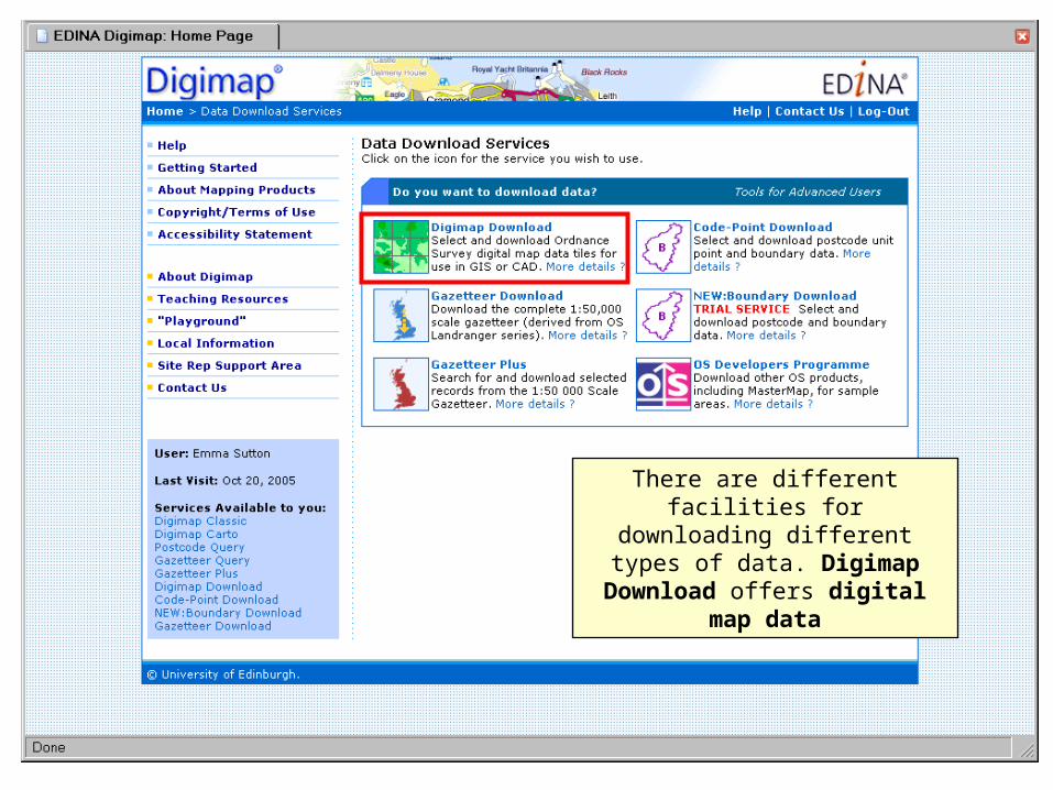
There are different facilities for downloading different types of
data. Digimap Download offers digital map data
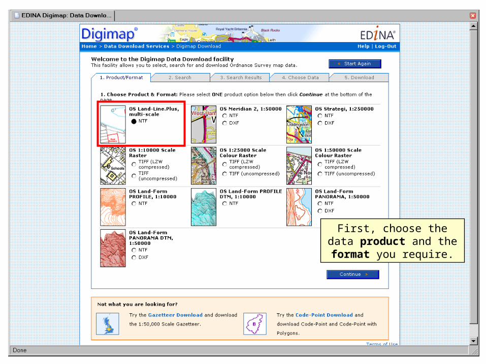
First, choose the data product and the format
you require.
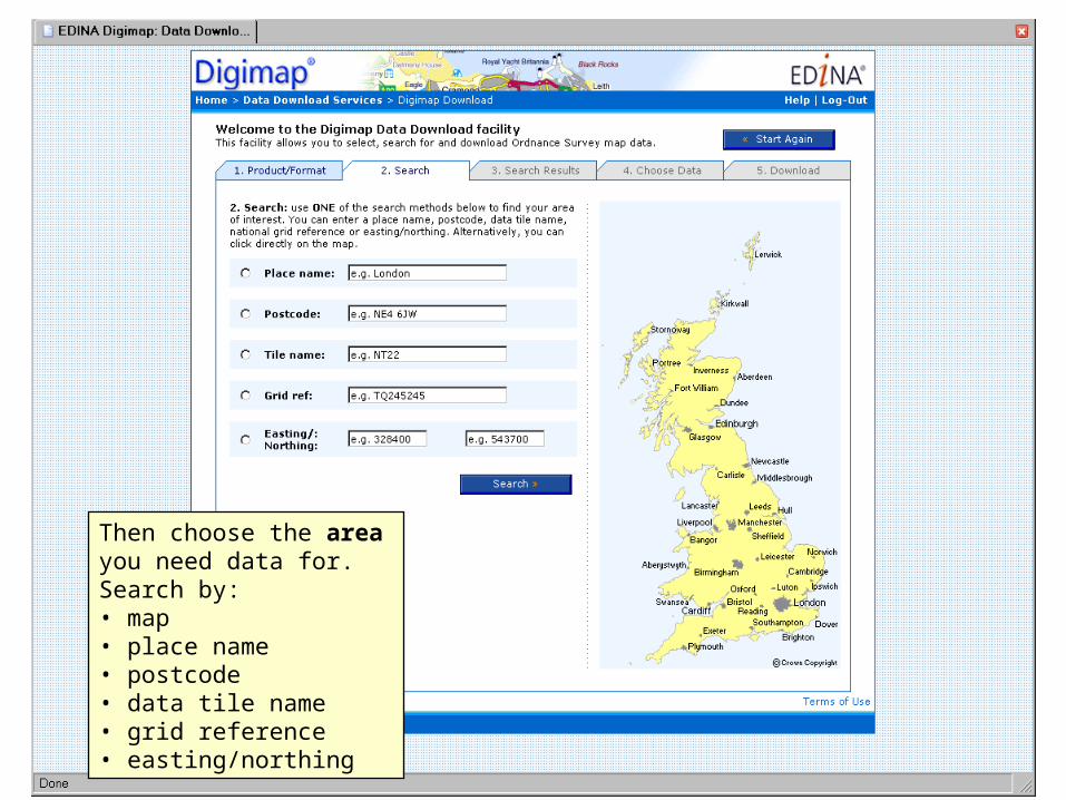
Then choose the area you need data for. Search by: • map• place name• postcode• data tile name• grid reference• easting/northing
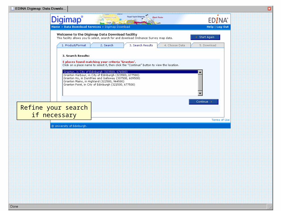
Refine your search if necessary
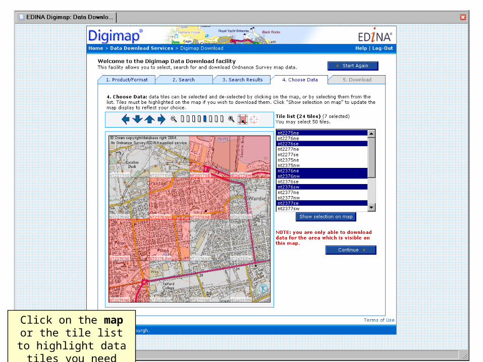
Click on the map or the tile list to highlight data
tiles you need
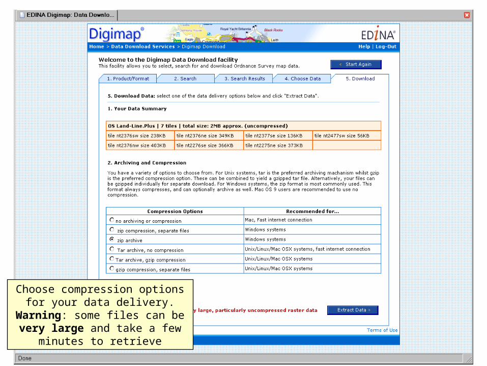
Choose compression options for your data delivery. Warning: some files can be very large and take a
few minutes to retrieve
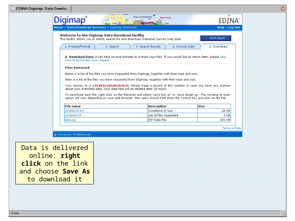
Data is delivered online: right click on the link
and choose Save As to download it
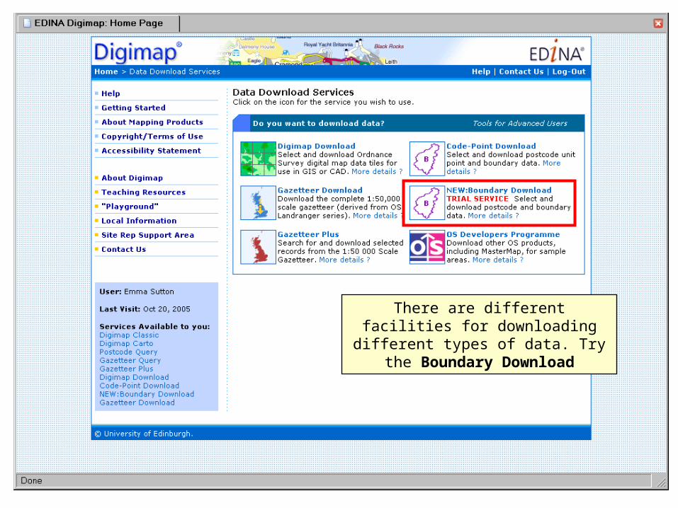
Facilities for downloading data are under Data Download Services
There are different facilities for downloading different types of data.
Try the Boundary Download
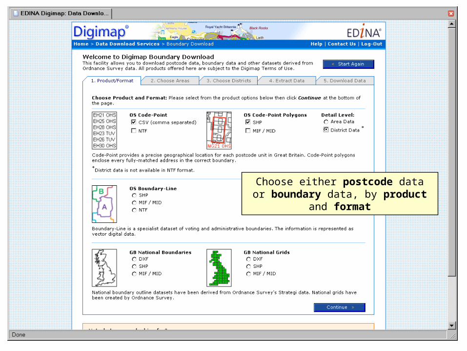
Choose either postcode data or boundary data, by product and format
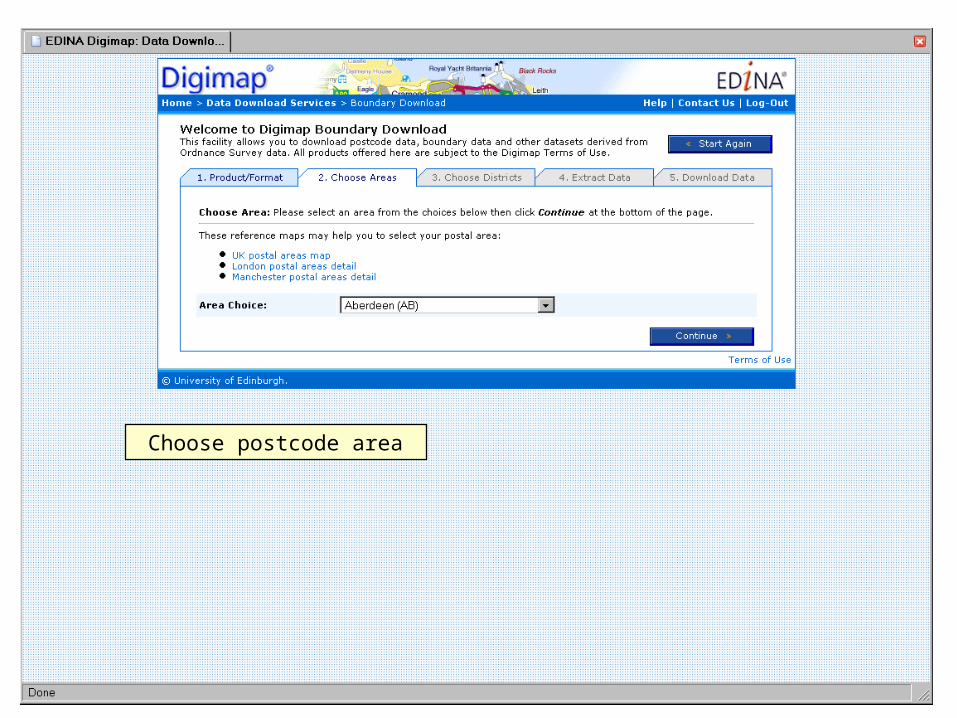
Choose postcode area
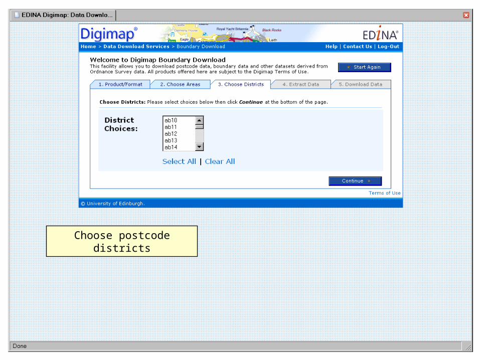
Choose postcode districts
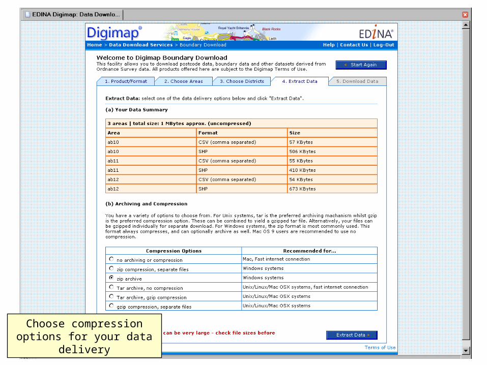
Choose compression options for your data delivery
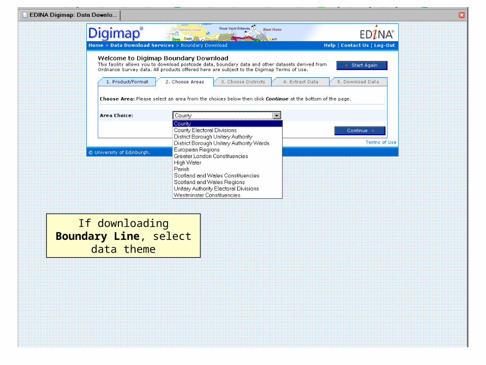
If downloading Boundary Line, select data theme
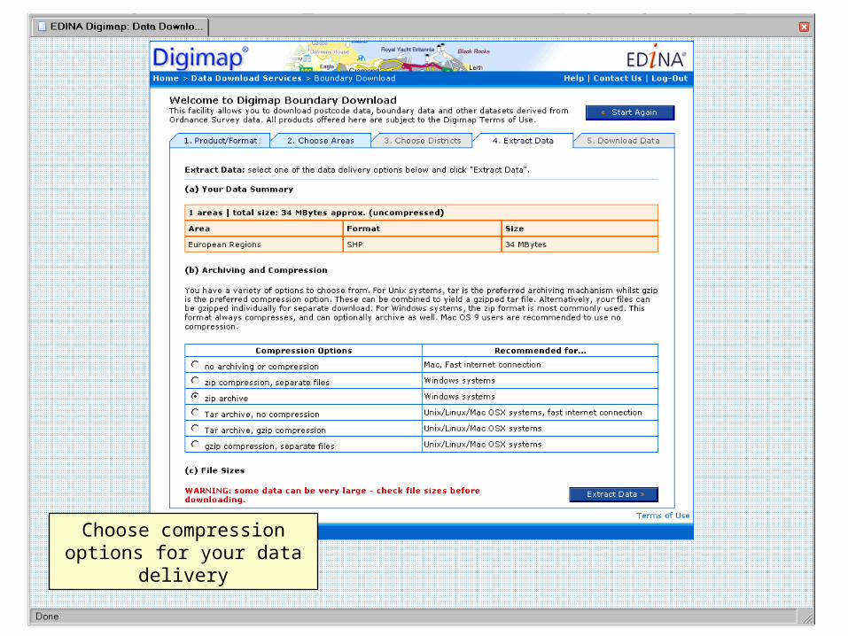
Choose compression options for your data delivery
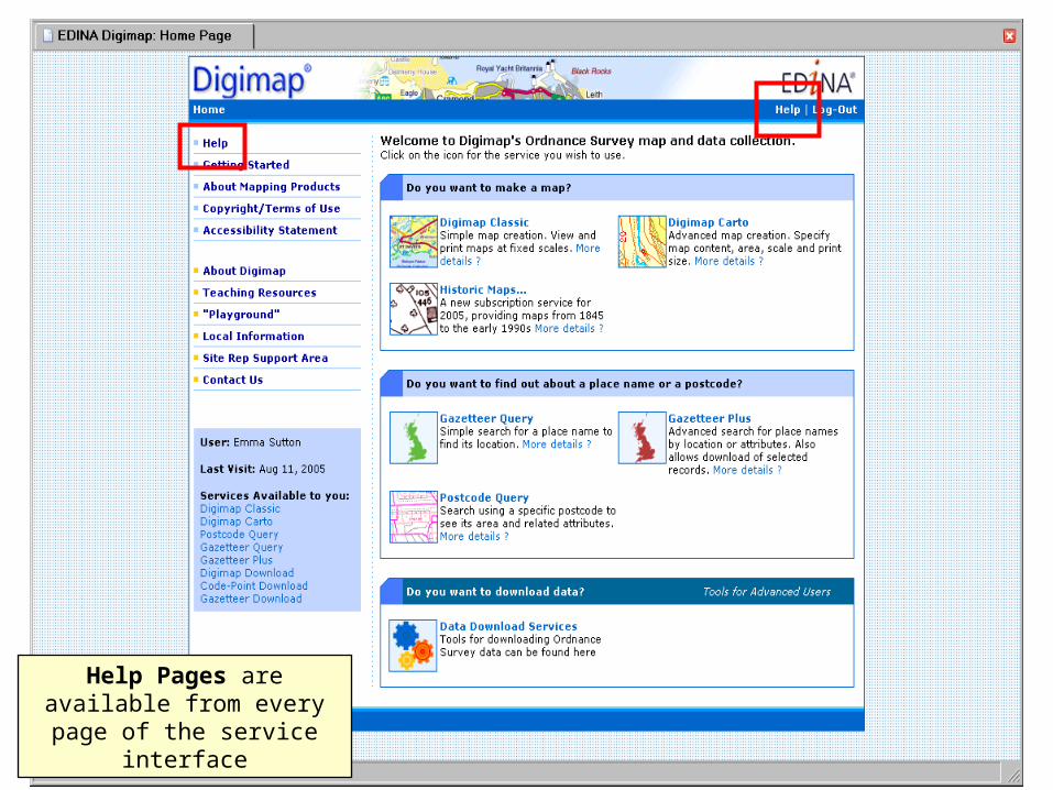
Help Pages are available from every page of the
service interface
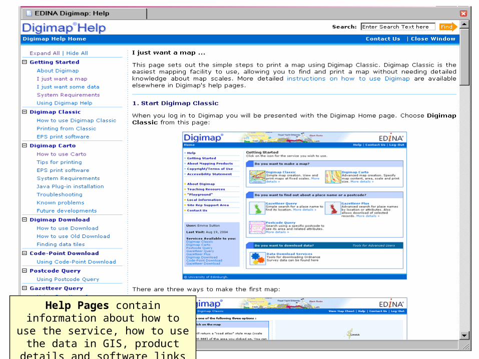
Help Pages contain information about how to use the service, how to use the data in GIS, product details
and software links
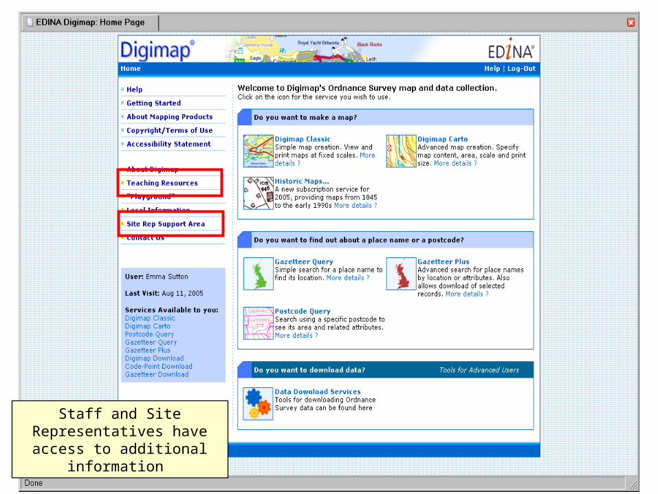
Staff and Site Representatives have access to additional
information
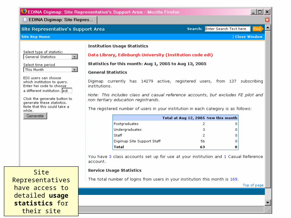
Site Representatives have access to detailed
usage statistics for their site
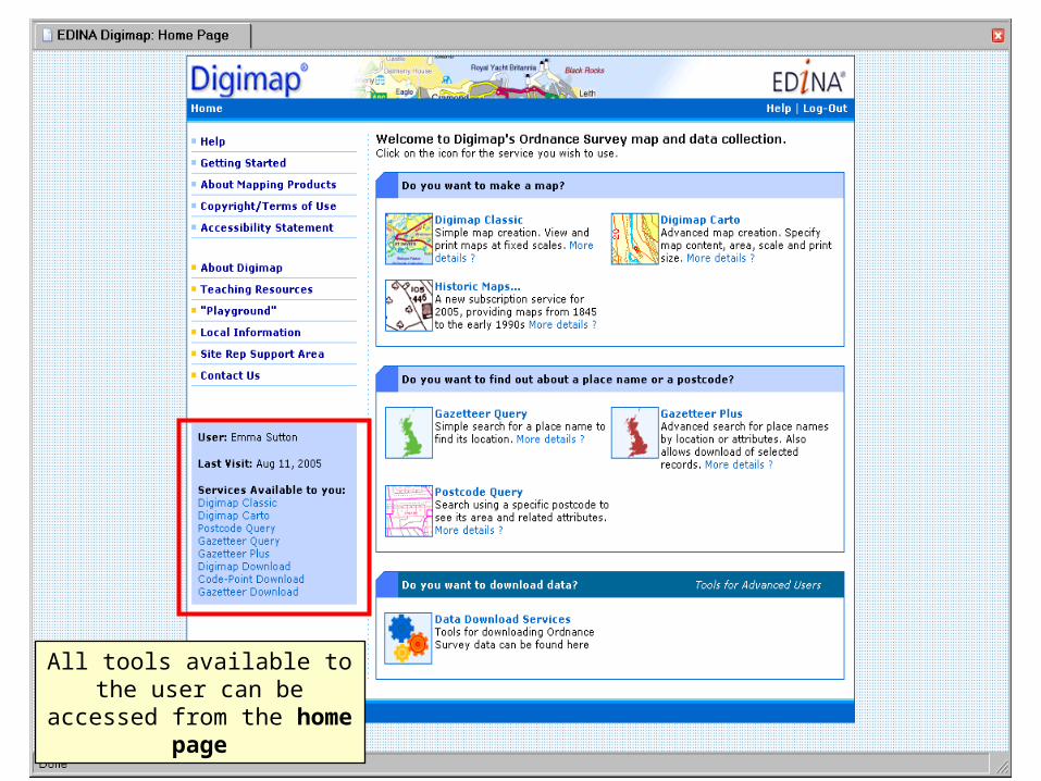
All tools available to the user can be accessed from the
home page
Recommended