1
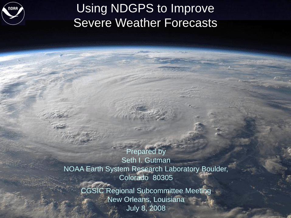
Using NDGPS to Improve
Severe Weather Forecasts
Prepared by
Seth I. Gutman
NOAA Earth System Research Laboratory Boulder,
Colorado 80305
CGSIC Regional Subcommittee Meeting
New Orleans, Louisiana
July 8, 2008
2
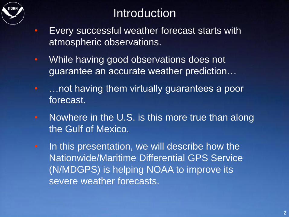
Introduction
• Every successful weather forecast starts with
atmospheric observations.
• While having good observations does not
guarantee an accurate weather prediction…
• …not having them virtually guarantees a poor
forecast.
• Nowhere in the U.S. is this more true than along
the Gulf of Mexico.
• In this presentation, we will describe how the
Nationwide/Maritime Differential GPS Service
(N/MDGPS) is helping NOAA to improve its
severe weather forecasts.
3
Why the Gulf of Mexico?
• Most of the atmospheric moisture for the
Eastern 2/3 of the U.S. comes from the Gulf of
Mexico.
• Moisture flow off the Gulf is responsible for the
generation of severe weather (thunderstorms,
lightning, tornados) along the coast and farther
inland.
• Water vapor derived from the evaporation of
sea water is the “fuel” that drives tropical storms
including hurricanes.
• One of the biggest gaps in current tropical
storm forecasting is lack of knowledge about
the water vapor flux over the open ocean.
4
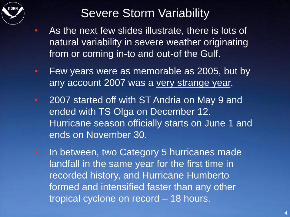
Severe Storm Variability
• As the next few slides illustrate, there is lots of
natural variability in severe weather originating
from or coming in-to and out-of the Gulf.
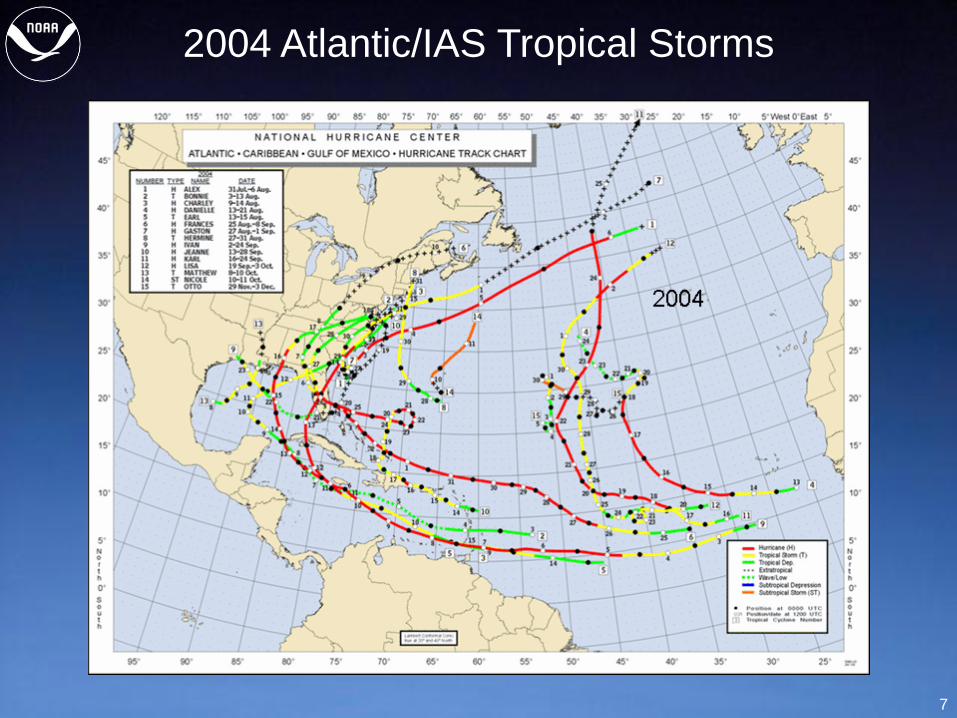
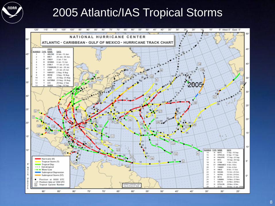
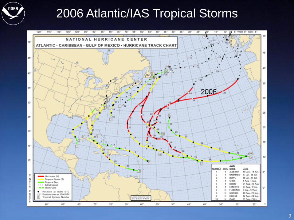
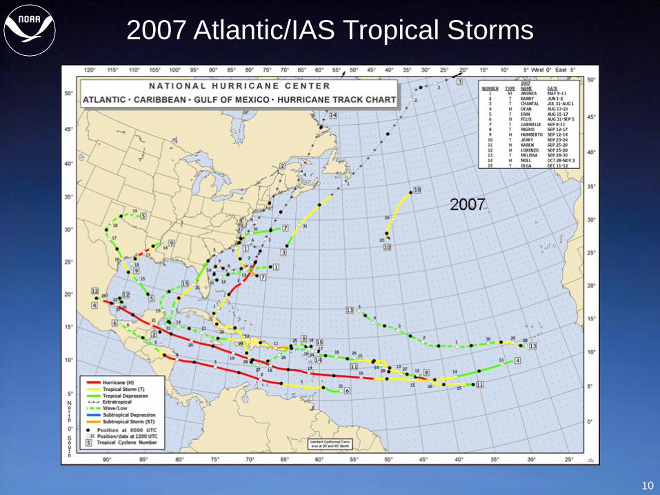
• Few years were as memorable as 2005, but by
any account 2007 was a very strange year.
• 2007 started off with ST Andria on May 9 and
ended with TS Olga on December 12.
Hurricane season officially starts on June 1 and
ends on November 30.
• In between, two Category 5 hurricanes made
landfall in the same year for the first time in
recorded history, and Hurricane Humberto
formed and intensified faster than any other
tropical cyclone on record – 18 hours.
5
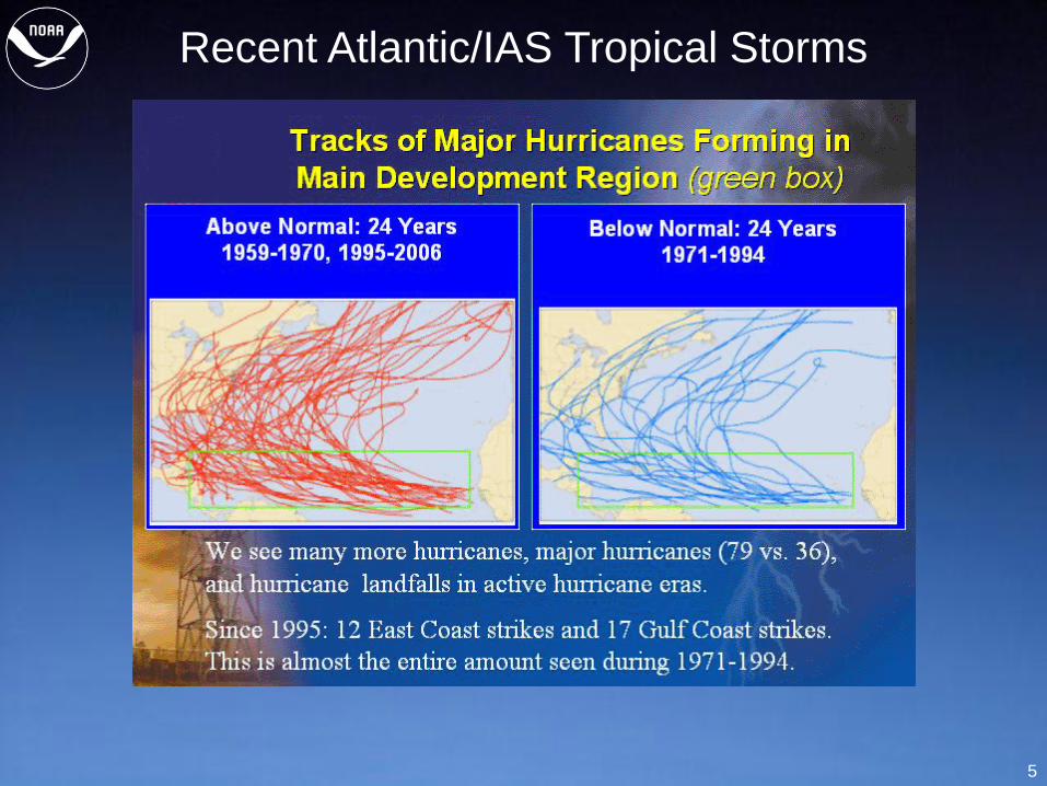
Recent Atlantic/IAS Tropical Storms
6
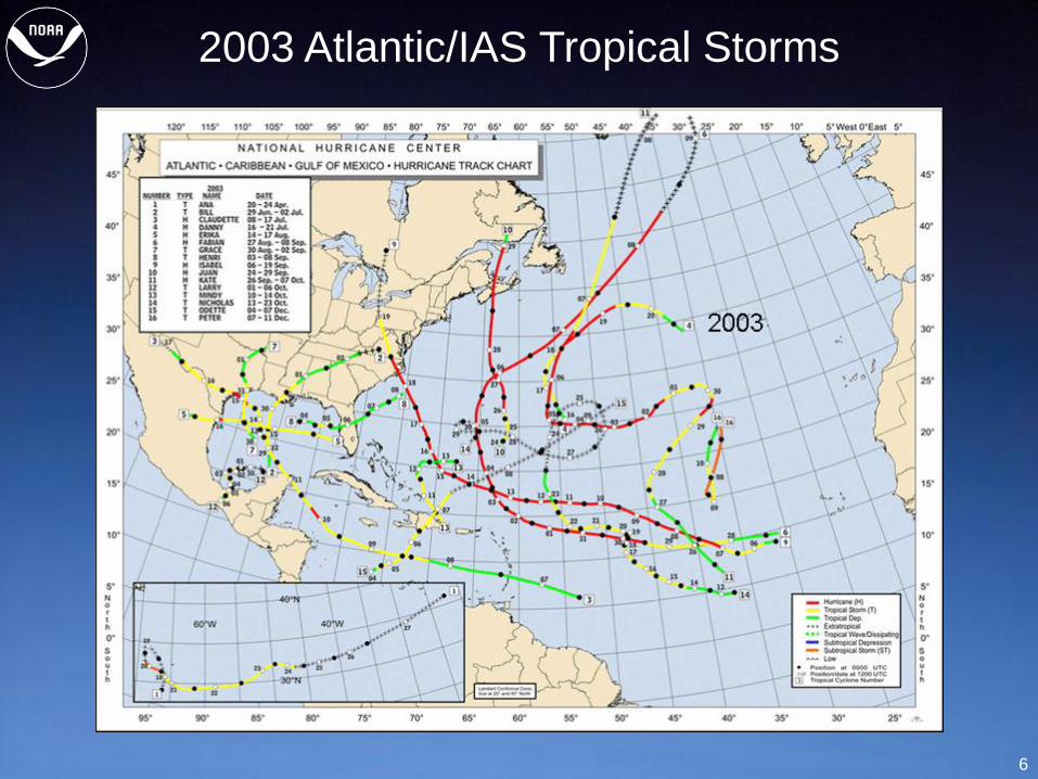
2003 Atlantic/IAS Tropical Storms
7
2004 Atlantic/IAS Tropical Storms
8
2005 Atlantic/IAS Tropical Storms
9
2006 Atlantic/IAS Tropical Storms
10
2007 Atlantic/IAS Tropical Storms
11
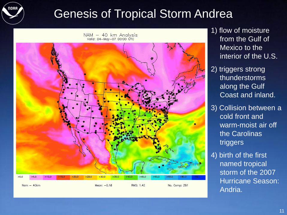
Genesis of Tropical Storm Andrea
1) flow of moisture
from the Gulf of
Mexico to the
interior of the U.S.
2) triggers strong
thunderstorms
along the Gulf
Coast and inland.
3) Collision between a
cold front and
warm-moist air off
the Carolinas
triggers
4) birth of the first
named tropical
storm of the 2007
Hurricane Season:
Andria.
12
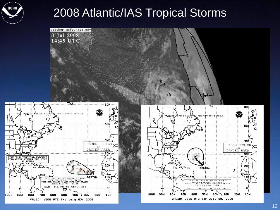
2008 Atlantic/IAS Tropical Storms
13
Why We Need Improved Observations
• Timely observations provide “situational
awareness” to forecasters, decision makers and
the general public.
• Observations help define the initial conditions
for numerical weather prediction models that
provide our long-range weather forecasts.
• Poor or absent observations usually result in
erroneous forecasts.
• The need for observations with higher (temporal
and spatial) resolution increases as the weather
becomes more dynamic.
• GPS observations made under all weather
conditions at N/MDGS sites provide critical
moisture information when it’s needed most.
14
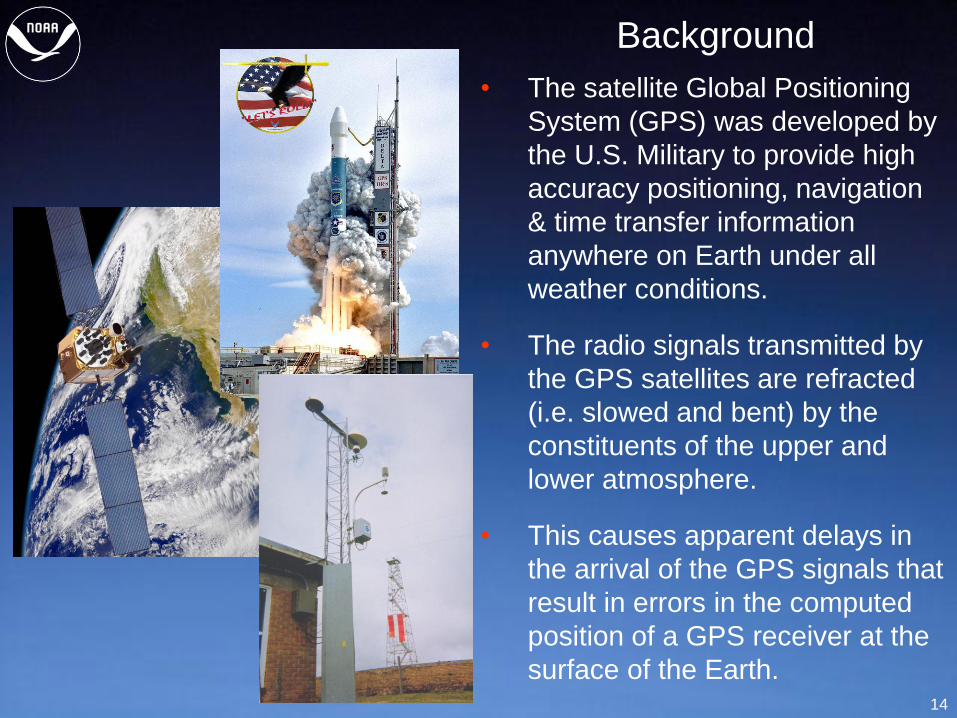
• The satellite Global Positioning
System (GPS) was developed by
the U.S. Military to provide high
accuracy positioning, navigation
& time transfer information
anywhere on Earth under all
weather conditions.
• The radio signals transmitted by
the GPS satellites are refracted
(i.e. slowed and bent) by the
constituents of the upper and
lower atmosphere.
• This causes apparent delays in
the arrival of the GPS signals that
result in errors in the computed
position of a GPS receiver at the
surface of the Earth.
Background
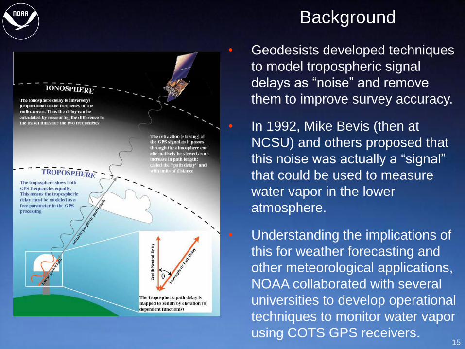
15
• Geodesists developed techniques
to model tropospheric signal
delays as “noise” and remove
them to improve survey accuracy.
• In 1992, Mike Bevis (then at
NCSU) and others proposed that
this noise was actually a “signal”
that could be used to measure
water vapor in the lower
atmosphere.
• Understanding the implications of
this for weather forecasting and
other meteorological applications,
NOAA collaborated with several
universities to develop operational
techniques to monitor water vapor
using COTS GPS receivers.
Background
16
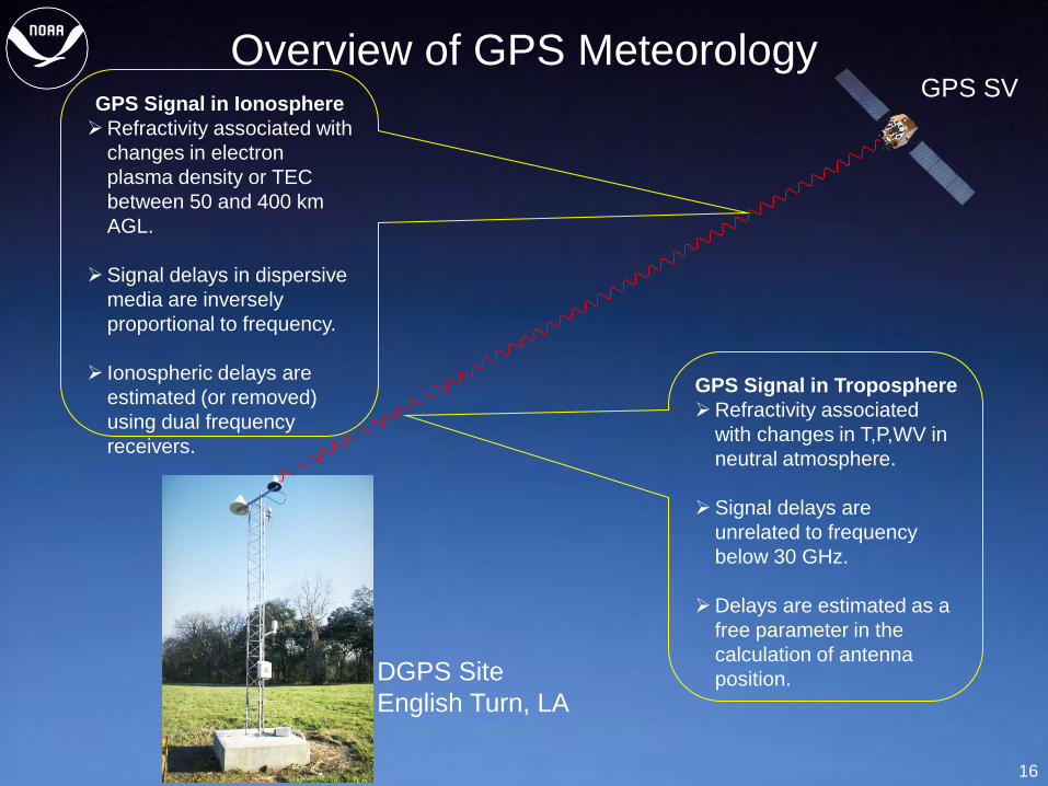
Overview of GPS Meteorology
GPS Signal in Troposphere
Refractivity associated
with changes in T,P,WV in
neutral atmosphere.
Signal delays are
unrelated to frequency
below 30 GHz.
Delays are estimated as a
free parameter in the
calculation of antenna
position.
GPS Signal in Ionosphere
Refractivity associated with
changes in electron
plasma density or TEC
between 50 and 400 km
AGL.
Signal delays in dispersive
media are inversely
proportional to frequency.
Ionospheric delays are
estimated (or removed)
using dual frequency
receivers.
GPS SV
DGPS Site
English Turn, LA
17
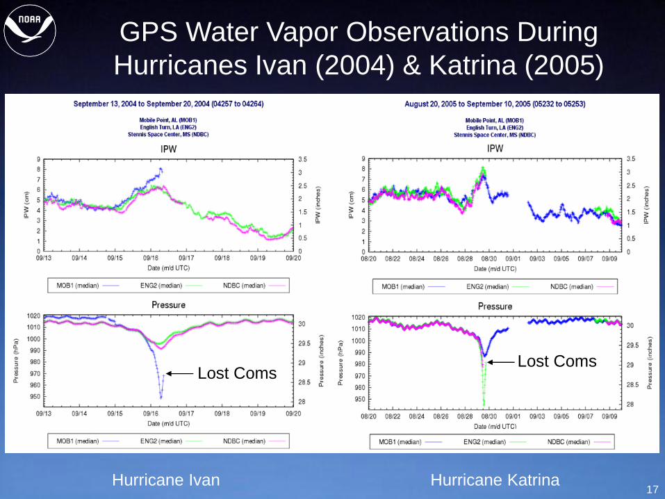
GPS Water Vapor Observations During
Hurricanes Ivan (2004) & Katrina (2005)
Hurricane Ivan Hurricane Katrina
Lost Coms Lost Coms
18
Lessons Learned
• Observing systems need to be more resilient.
Harden sites.
Ability to switch from local power and
communications to backups (e.g. batteries
and satellite communications).
• Need more surface and upper-air observations.
Complete NDGPS.
Put GPS on offshore drilling platforms.
Put GPS on islands in Western Atlantic and
Caribbean.
Expand GPS coverage along the coasts of
the U.S., Mexico, and Central America.
19
Thanks for your attention!
Any questions?
20
Contact Information:
Seth I. Gutman, Physical Scientist
NOAA Earth System Research Laboratory (ESRL)
325 Broadway R/GSD7
Boulder, CO 80305-3328
Phone: (303) 497-7031
FAX: (303) 497-6014
Email: [email protected]
Web: http://gpsmet_test.fsl.noaa.gov.
Recommended