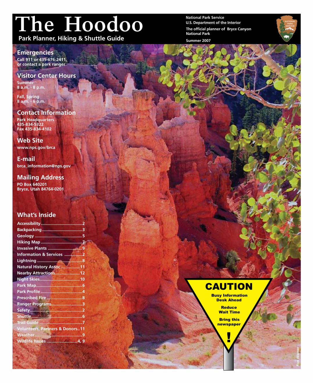
National Park Service U.S. Department of the Interior
The official planner of Bryce Canyon National Park
Summer 2007
The HoodooEmergenciesCall 911 or 435-676-2411, or contact a park ranger
Visitor Center HoursSummer 8 a.m. - 8 p.m.
Fall, Spring8 a.m. - 6 p.m.
Contact InformationPark Headquarters435-834-5322Fax 435-834-4102
Web Sitewww.nps.gov/brca
Mailing AddressPO Box 640201Bryce, Utah 84764-0201
Ro
n W
arn
er
Park Planner, Hiking & Shuttle Guide
Caution Busy information
Desk ahead
Reduce Wait time
Bring this newspaper
!
What’s InsideAccessibility ...................................2Backpacking ..................................3Geology ........................................5 Hiking Map ...................................7Invasive Plants .............................9Information & Services ...............2Lightning ......................................8Natural History Assoc ................11 Nearby Attractions .....................12Night Skies ..................................10Park Map .......................................6Park Profile ...................................4Prescribed Fire ..............................8Ranger Programs ..........................3Safety ............................................2Shuttle ...........................................6Trail Guide ....................................7Volunteers, Partners & Donors ..11Weather ........................................9Wildlife Issues ..........................4, 9
Information and Services
2 The Hoodoo
How many people die at Bryce?Fortunately, Bryce averages less than 1 fatality per year. In order of decreasing abundance, fatalities are caused by:
Unfortunately, hundreds of serious injuries have also needlessly occurred, some out of ignorance, but too many from ignoring park safety warnings.
Top 10 Causes of Bryce Injuries
#10 Unsafe Driving•Speeding (limits are 25, 35 and 45 mph).•Failure to wear seat belts. •Passing on a double yellow line. •Auto vs animal. Watch for Wildlife!•Rear-ending. Stop in pullouts, never in road. •Not reducing speed on wet or icy roads.
#9 Climbing / Sliding down cliffsThe rock at Bryce forms crumbly cliffs and steep gravely slopes. Hand and toe holds support nothing heavier than chipmunks. Climbing the rocks and sliding on the slopes triggers lethal avalanches.
#8 Feeding AnimalsFed animals become aggressive. Even small animals can inflict bites requiring stitches and worse yet transmit disease. Watch wildlife from a distance and discourage animals that approach you.
#7 Ignoring Extreme WeatherAt Bryce it is possible for the difference between the daily high and low to be as much as 50° F / 10° C! Lightning is a year-round danger -- especially during summer monsoons! Seek the shelter of a building or your vehicle whenever the “flash-bang interval” (time between lightning and thunder) is less than 30 seconds.
#6 Dehyrdration Drink 1 quart / liter every 1-2 hours. A well hydrated body is better able to regulate body temperature and is more resistant to heat exhaustion. Sunburns also lead to dehyrdation. Wear a hat, sunscreen, and sunglasses to protect from the sun overhead and reflected UV light.
#5 Leaving the Trail Stay on designated trails and away from cliff edges where footing can be tricky. Even on seemingly gentle slopes, it can be impossible to keep your footing. Bring the maps on page 6 and 7 to avoid getting lost.
#4 Over-exertion Park elevations reach 9115 ft (2778 m) subjecting you to 70% of the oxygen you might be used to. Bryce’s trails start at the top which means all returns will be uphill. Turn back BEFORE you become tired. Know and respect your own physical limitations.
#3, #2, & #1 Bad Choice of Footwear Wear hiking boots with good ankle support and “lug” traction. Hiking without hiking boots is like SCUBA diving without an air tank. Sport-sandals & “trainers,” are NOT safe hiking footwear.
Death at Bryce Canyon
•Heart attacks •Falling off cliffs •Lightning •Vehicle accidents
Visitor Center In summer, open daily 8:00 am -
8:00 pm. Information, museum, publications, an award-winning film, backcountry permits, first aid, and lost-and-found services are available here.
Emergencies 24-hour emergency response, call 911 or 435 676-2411. Garfield Hospital, 435 676-8811, and Clinic, 435 676-8842 are in Panguitch.
AccessibiltyRestrooms: the Visitor Center,
Sunset Point, Bryce Canyon Lodge, and General Store are fully accessible. Sunset Campground has two sites reserved for people with mobility impairments. The ½-mile section of Rim Trail between Sunset and Sunrise points is paved and level. Inquire at the Visitor Center for information on accessible ranger-led programs, and to obtain an Access Guide and temporary handicapped parking permits.
RestroomsAvailable year-round at the Visitor
Center, North Campground and Sunset, Farview, and Rainbow Points. Restrooms are also available April - October at Bryce Canyon Lodge, General Store and Sunset Campground.
PhonesAvailable year-round at the Visitor
Center. Phones are also available April -October at Bryce Canyon Lodge, General Store, and Sunset Campground.
PetsPets are not recommended in the park.
If you must bring your pet, be aware that it must be on a leash and under control at all times. Pets are not permitted in buildings, at park viewpoints, or on trails. They are allowed in campgrounds.
Horseback RidingWranglers lead 2-hour and 4-hour horse
and mule rides April - October. For same-day reservations, inquire at Bryce Canyon Lodge or call 435 834-5500. For advance reservations, contact: Canyon Trail Rides, P.O. Box 128, Tropic, UT 84776; 435 679-8665. Information: www.canyonrides.com.
Post Office / ATM / InternetRuby’s Inn has a post office open
Mon-Sat (Bryce, UT 84764), an ATM, and internet services. Personal mail addressed to park visitors will not be accepted at Bryce Canyon National Park.
Entrance FeesPrivate Vehicle: $25 per vehicle, good for 7 days in Bryce Canyon National Park.
Individual: $12 per person (pedestrian, bicycle, motorcycle, and organized group), good for 7 days in Bryce Canyon National Park.
America the Beautiful Annual Pass: $80, good for one year from date of purchase in all federal fee areas.
Bryce Canyon Annual Pass: $30, good for one year from date of purchase at Bryce Canyon National Park.
Commercial Tours: Ask at the entrance station for rates.
America the Beautiful Senior Pass: $10 lifetime pass for U.S. residents 62 or older.
America the Beautiful Access Pass: Free lifetime pass for permanently disabled U.S. residents.
CampingNorth Campground: Open all year,
107 campsites. Available first-come, first-served October 1 - May 14. Campsites may be reserved May 15 - Sept 30 by calling 877 444-6777 or www.recreation.gov. Reservations can be made up to 240 days in advance.
Sunset Campground: Open late spring to early fall, 101 campsites. Available first-come, first-served.
Fees: Camping is $10 a night per campsite (half price for America the Beautiful Senior and Access pass holders). There is an additional booking fee per advance reservation for North Campground.
Group Campsite: One site available by reservation only. Group size is limited to 7-30 people and 8 vehicles. Cost is $3 per person, with a minimum of $30 per night. Campsite may be reserved by calling 877 444-6777 or www.recreation.gov
Dump Station: No hookups are in the park, but a fee-for-use dump station is available seasonally near North Campground.
Other Campgrounds: For camping reservations in nearby National Parks, call 877 444-6777 or visit www.recreation.gov. Public campgrounds are available on US Forest Service, BLM, and Utah State Park lands nearby. Private campgrounds with showers and hookups are available outside the park.
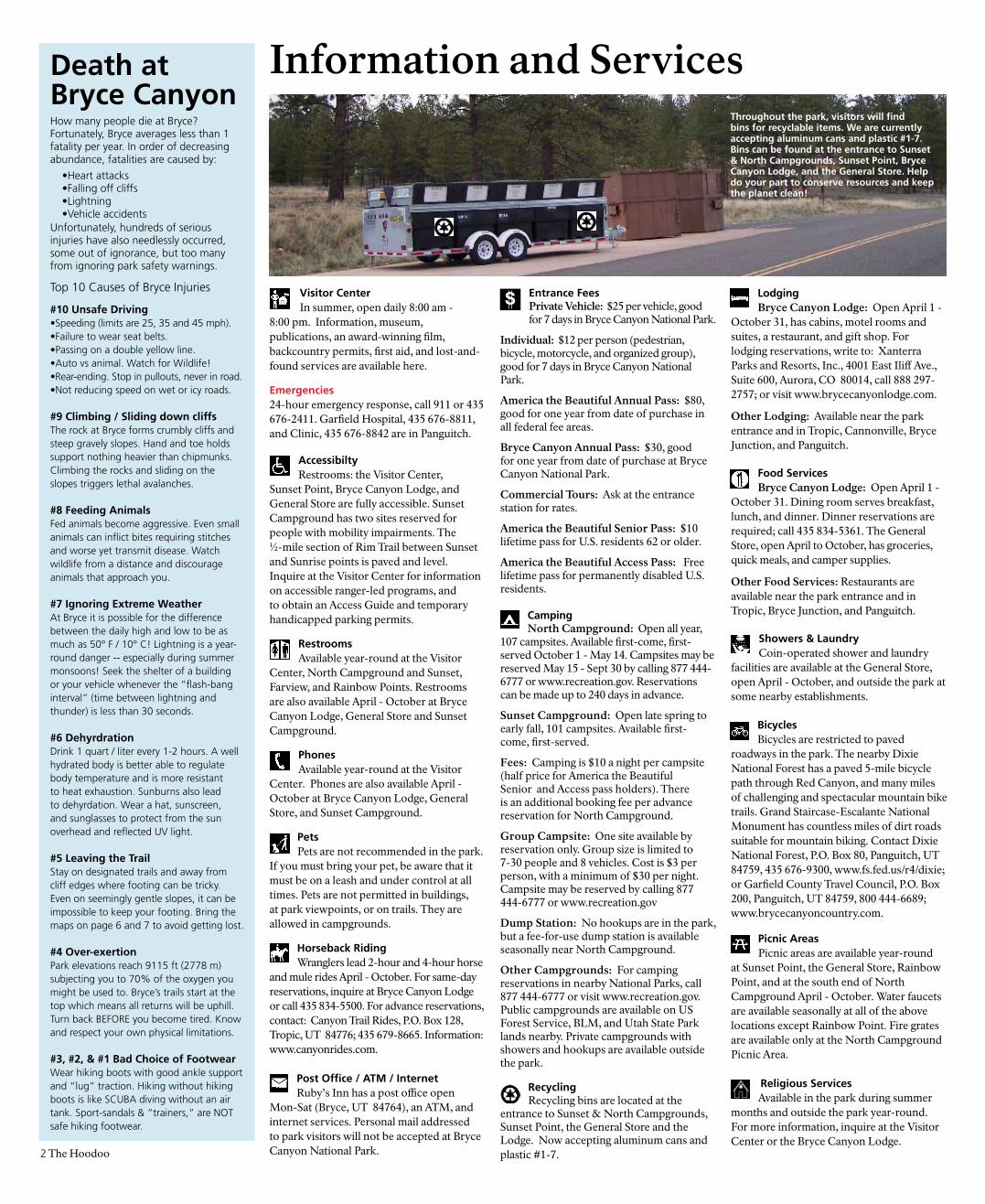
RecyclingRecycling bins are located at the
entrance to Sunset & North Campgrounds, Sunset Point, the General Store and the Lodge. Now accepting aluminum cans and plastic #1-7.
LodgingBryce Canyon Lodge: Open April 1 -
October 31, has cabins, motel rooms and suites, a restaurant, and gift shop. For lodging reservations, write to: Xanterra Parks and Resorts, Inc., 4001 East Iliff Ave., Suite 600, Aurora, CO 80014, call 888 297-2757; or visit www.brycecanyonlodge.com.
Other Lodging: Available near the park entrance and in Tropic, Cannonville, Bryce Junction, and Panguitch.
Food ServicesBryce Canyon Lodge: Open April 1 -
October 31. Dining room serves breakfast, lunch, and dinner. Dinner reservations are required; call 435 834-5361. The General Store, open April to October, has groceries, quick meals, and camper supplies.
Other Food Services: Restaurants are available near the park entrance and in Tropic, Bryce Junction, and Panguitch.
Showers & LaundryCoin-operated shower and laundry
facilities are available at the General Store, open April - October, and outside the park at some nearby establishments.
BicyclesBicycles are restricted to paved
roadways in the park. The nearby Dixie National Forest has a paved 5-mile bicycle path through Red Canyon, and many miles of challenging and spectacular mountain bike trails. Grand Staircase-Escalante National Monument has countless miles of dirt roads suitable for mountain biking. Contact Dixie National Forest, P.O. Box 80, Panguitch, UT 84759, 435 676-9300, www.fs.fed.us/r4/dixie; or Garfield County Travel Council, P.O. Box 200, Panguitch, UT 84759, 800 444-6689; www.brycecanyoncountry.com.
Picnic AreasPicnic areas are available year-round
at Sunset Point, the General Store, Rainbow Point, and at the south end of North Campground April - October. Water faucets are available seasonally at all of the above locations except Rainbow Point. Fire grates are available only at the North Campground Picnic Area.
Religious ServicesAvailable in the park during summer
months and outside the park year-round. For more information, inquire at the Visitor Center or the Bryce Canyon Lodge.
S
Throughout the park, visitors will find bins for recyclable items. We are currently accepting aluminum cans and plastic #1-7. Bins can be found at the entrance to Sunset & North Campgrounds, Sunset Point, Bryce Canyon Lodge, and the General Store. Help do your part to conserve resources and keep the planet clean!
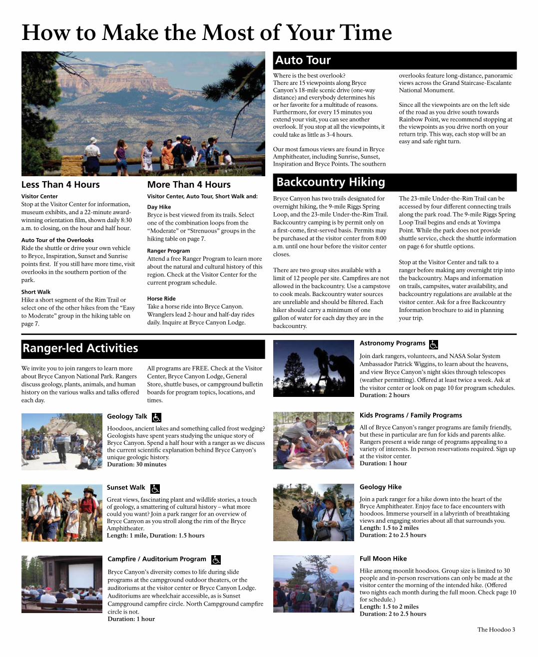
Less Than 4 HoursVisitor CenterStop at the Visitor Center for information, museum exhibits, and a 22-minute award-winning orientation film, shown daily 8:30 a.m. to closing, on the hour and half hour.
Auto Tour of the Overlooks Ride the shuttle or drive your own vehicle to Bryce, Inspiration, Sunset and Sunrise points first. If you still have more time, visit overlooks in the southern portion of the park.
Short WalkHike a short segment of the Rim Trail or select one of the other hikes from the “Easy to Moderate” group in the hiking table on page 7.
More Than 4 HoursVisitor Center, Auto Tour, Short Walk and:
Day HikeBryce is best viewed from its trails. Select one of the combination loops from the “Moderate” or “Strenuous” groups in the hiking table on page 7.
Ranger ProgramAttend a free Ranger Program to learn more about the natural and cultural history of this region. Check at the Visitor Center for the current program schedule.
Horse RideTake a horse ride into Bryce Canyon. Wranglers lead 2-hour and half-day rides daily. Inquire at Bryce Canyon Lodge.
Where is the best overlook?There are 15 viewpoints along Bryce Canyon’s 18-mile scenic drive (one-way distance) and everybody determines his or her favorite for a multitude of reasons. Furthermore, for every 15 minutes you extend your visit, you can see another overlook. If you stop at all the viewpoints, it could take as little as 3-4 hours.
Our most famous views are found in Bryce Amphitheater, including Sunrise, Sunset, Inspiration and Bryce Points. The southern
overlooks feature long-distance, panoramic views across the Grand Staircase-Escalante National Monument.
Since all the viewpoints are on the left side of the road as you drive south towards Rainbow Point, we recommend stopping at the viewpoints as you drive north on your return trip. This way, each stop will be an easy and safe right turn.
Auto Tour
Bryce Canyon has two trails designated for overnight hiking, the 9-mile Riggs Spring Loop, and the 23-mile Under-the-Rim Trail. Backcountry camping is by permit only on a first-come, first-served basis. Permits may be purchased at the visitor center from 8:00 a.m. until one hour before the visitor center closes.
There are two group sites available with a limit of 12 people per site. Campfires are not allowed in the backcountry. Use a campstove to cook meals. Backcountry water sources are unreliable and should be filtered. Each hiker should carry a minimum of one gallon of water for each day they are in the backcountry.
The 23-mile Under-the-Rim Trail can be accessed by four different connecting trails along the park road. The 9-mile Riggs Spring Loop Trail begins and ends at Yovimpa Point. While the park does not provide shuttle service, check the shuttle information on page 6 for shuttle options.
Stop at the Visitor Center and talk to a ranger before making any overnight trip into the backcountry. Maps and information on trails, campsites, water availability, and backcountry regulations are available at the visitor center. Ask for a free Backcountry Information brochure to aid in planning your trip.
Backcountry Hiking
How to Make the Most of Your Time
Astronomy Programs
Join dark rangers, volunteers, and NASA Solar System Ambassador Patrick Wiggins, to learn about the heavens, and view Bryce Canyon’s night skies through telescopes (weather permitting). Offered at least twice a week. Ask at the visitor center or look on page 10 for program schedules.Duration: 2 hours
Geology Hike
Join a park ranger for a hike down into the heart of the Bryce Amphitheater. Enjoy face to face encounters with hoodoos. Immerse yourself in a labyrinth of breathtaking views and engaging stories about all that surrounds you.Length: 1.5 to 2 milesDuration: 2 to 2.5 hours
Kids Programs / Family Programs
All of Bryce Canyon’s ranger programs are family friendly, but these in particular are fun for kids and parents alike. Rangers present a wide range of programs appealing to a variety of interests. In person reservations required. Sign up at the visitor center.Duration: 1 hour
Full Moon Hike
Hike among moonlit hoodoos. Group size is limited to 30 people and in-person reservations can only be made at the visitor center the morning of the intended hike. (Offered two nights each month during the full moon. Check page 10 for schedule.)Length: 1.5 to 2 milesDuration: 2 to 2.5 hours
Geology Talk
Hoodoos, ancient lakes and something called frost wedging? Geologists have spent years studying the unique story of Bryce Canyon. Spend a half hour with a ranger as we discuss the current scientific explanation behind Bryce Canyon’s unique geologic history. Duration: 30 minutes
We invite you to join rangers to learn more about Bryce Canyon National Park. Rangers discuss geology, plants, animals, and human history on the various walks and talks offered each day.
All programs are FREE. Check at the Visitor Center, Bryce Canyon Lodge, General Store, shuttle buses, or campground bulletin boards for program topics, locations, and times.
Ranger-led Activities
Sunset Walk
Great views, fascinating plant and wildlife stories, a touch of geology, a smattering of cultural history – what more could you want? Join a park ranger for an overview of Bryce Canyon as you stroll along the rim of the Bryce Amphitheater.
Length: 1 mile, Duration: 1.5 hours
Campfire / Auditorium Program
Bryce Canyon’s diversity comes to life during slide programs at the campground outdoor theaters, or the auditoriums at the visitor center or Bryce Canyon Lodge. Auditoriums are wheelchair accessible, as is Sunset Campground campfire circle. North Campground campfire circle is not.Duration: 1 hour
The Hoodoo 3
4 The Hoodoo
Park ProfileEstablished1923 as Bryce Canyon National Monument administered by the U.S. Forest Service; 1924 as Utah National Park administered by the National Park Service1928 name changed to Bryce Canyon National Park
SignificanceEstablished to preserve and protect out-standing scenic and scientific values. Best known for the beautiful and bizarre rock spires called hoodoos and the dark night sky.
Hoodoo[hoo’doo] n. 1. A pinnacle or odd-shaped rock left standing by the forces of erosion. 2. v. To cast a spell or cause bad luck. 3. Voodoo.
Elevation / SizeLowest: 6,620 feet (2018 m) Yellow Creek. Highest: 9,115 feet (2778 m) atRainbow Point.55 square miles (35,835 acres)
NameEbenezer and Mary Bryce lived in the area from 1875-1880 and aided in the settlement of southwestern Utah and northern Arizona.
HumansAncestral Puebloans, known as the Anasazi, probably lived in the area from 2,000 years ago. They were followed by the Fremont Culture through the 1200s, then the Southern Paiutes until 100 years ago. Mormon settlers arrived in the 1870s. Park visitation in 1929 was 22,000. In 2006 it reached 1.4 million.
Plant LifeMore than 400 native plant species live in the park. Pinyon pine and juniper grow among the hoodoos at low elevations; ponderosa pine forests dominate the plateau top; and spruce, fir, and aspen thrive at the highest elevations. Bristlecone pines, some more than 1,600 years old, live at elevations throughout the park.
Animal LifeUtah prairie dogs, a threatened species, can be seen in open meadows. Mule deer and Pronghorn (mistakingly known as Antelope) are the most common large mammals seen. Mountain lions and black bears live in the park, but are rarely seen. About 170 species of birds visit Bryce.
Bryce Canyon LodgeDesigned by Gilbert Stanley Underwood and built in 1925, it is a National Historic Landmark. Of the four original lodges in the Union Pacific Loop Tour (Bryce Canyon, Cedar Breaks, Zion, and Grand Canyon-North Rim), the Bryce Canyon Lodge is the only one still standing.
Please spread the word. True animal lovers don’t feed wild animals. Help protect your national parks.
Do not feed the animals.Bitte nicht die Tiere füttern.Ne donnez pas à manger aux animaux.No dé comida a los animales.
Help Stop Animal CrueltyThe act of feeding wildlife can also be dangerous to people. Rodents are notorious for transmitting diseases. You put yourself in jeopardy every time you get within flea-jumping distance 6-9 feet (2-3 m) of a squirrel or prairie dog. Worse yet, feeding can cause normally docile animals, like deer, to become aggressive. In one sad instance at Yosemite National Park, a young child was gored and killed by a “spike” deer buck when he refused to relinquish his sandwich to the animal.
Unfortunately, once animals become habituated to humans, their behavior often leads to management actions that may result in their removal from the park.
Giving in just once to the big, brown, pleading eyes of a cute animal can have major consequences. Be responsible. Learn to be a friend of wildlife by not trying to befriend animals with food.
Feeding wild animals is a classic example of how good intentions can unwittingly cause serious harm. In fact, feeding wildlife is actually a form of animal cruelty!
Fed animals frequent roads and parking lots where they are much more likely to get run over by cars. Furthermore, wild animals have very strict natural diets and therefore very specific types of digestive bacteria. Human food causes the wrong type of digestive bacteria to become dominant. Soon, fed animals can no longer digest their natural foods and ultimately will starve to death with full stomachs. What could be more cruel?
Fed animals will even teach their offspring to beg for food. These young animals may never learn the necessary skills to find natural foods and grow up totally dependent on humans for survival.
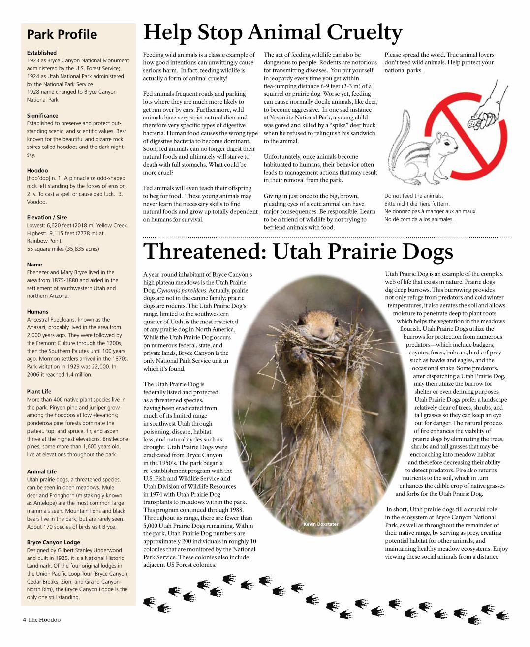
A year-round inhabitant of Bryce Canyon’s high plateau meadows is the Utah Prairie Dog, Cynomys parvidens. Actually, prairie dogs are not in the canine family; prairie dogs are rodents. The Utah Prairie Dog’s range, limited to the southwestern quarter of Utah, is the most restricted of any prairie dog in North America. While the Utah Prairie Dog occurs on numerous federal, state, and private lands, Bryce Canyon is the only National Park Service unit in which it’s found.
The Utah Prairie Dog is federally listed and protected as a threatened species, having been eradicated from much of its limited range in southwest Utah through poisoning, disease, habitat loss, and natural cycles such as drought. Utah Prairie Dogs were eradicated from Bryce Canyon in the 1950’s. The park began a re-establishment program with the U.S. Fish and Wildlife Service and Utah Division of Wildlife Resources in 1974 with Utah Prairie Dog transplants to meadows within the park. This program continued through 1988. Throughout its range, there are fewer than 5,000 Utah Prairie Dogs remaining. Within the park, Utah Prairie Dog numbers are approximately 200 individuals in roughly 10 colonies that are monitored by the National Park Service. These colonies also include adjacent US Forest colonies.
Threatened: Utah Prairie DogsUtah Prairie Dog is an example of the complex web of life that exists in nature. Prairie dogs dig deep burrows. This burrowing provides not only refuge from predators and cold winter
temperatures, it also aerates the soil and allows moisture to penetrate deep to plant roots
which helps the vegetation in the meadows flourish. Utah Prairie Dogs utilize the
burrows for protection from numerous predators—which include badgers,
coyotes, foxes, bobcats, birds of prey such as hawks and eagles, and the occasional snake. Some predators, after dispatching a Utah Prairie Dog, may then utilize the burrow for shelter or even denning purposes. Utah Prairie Dogs prefer a landscape relatively clear of trees, shrubs, and tall grasses so they can keep an eye out for danger. The natural process of fire enhances the viability of
prairie dogs by eliminating the trees, shrubs and tall grasses that may be
encroaching into meadow habitat and therefore decreasing their ability
to detect predators. Fire also returns nutrients to the soil, which in turn
enhances the edible crop of native grasses and forbs for the Utah Prairie Dog.
In short, Utah prairie dogs fill a crucial role in the ecosystem at Bryce Canyon National Park, as well as throughout the remainder of their native range, by serving as prey, creating potential habitat for other animals, and maintaining healthy meadow ecosystems. Enjoy viewing these social animals from a distance!
Kevin Doxstater
The Hoodoo 5
Erosion:Hoodoo’s Creator and Executioner!
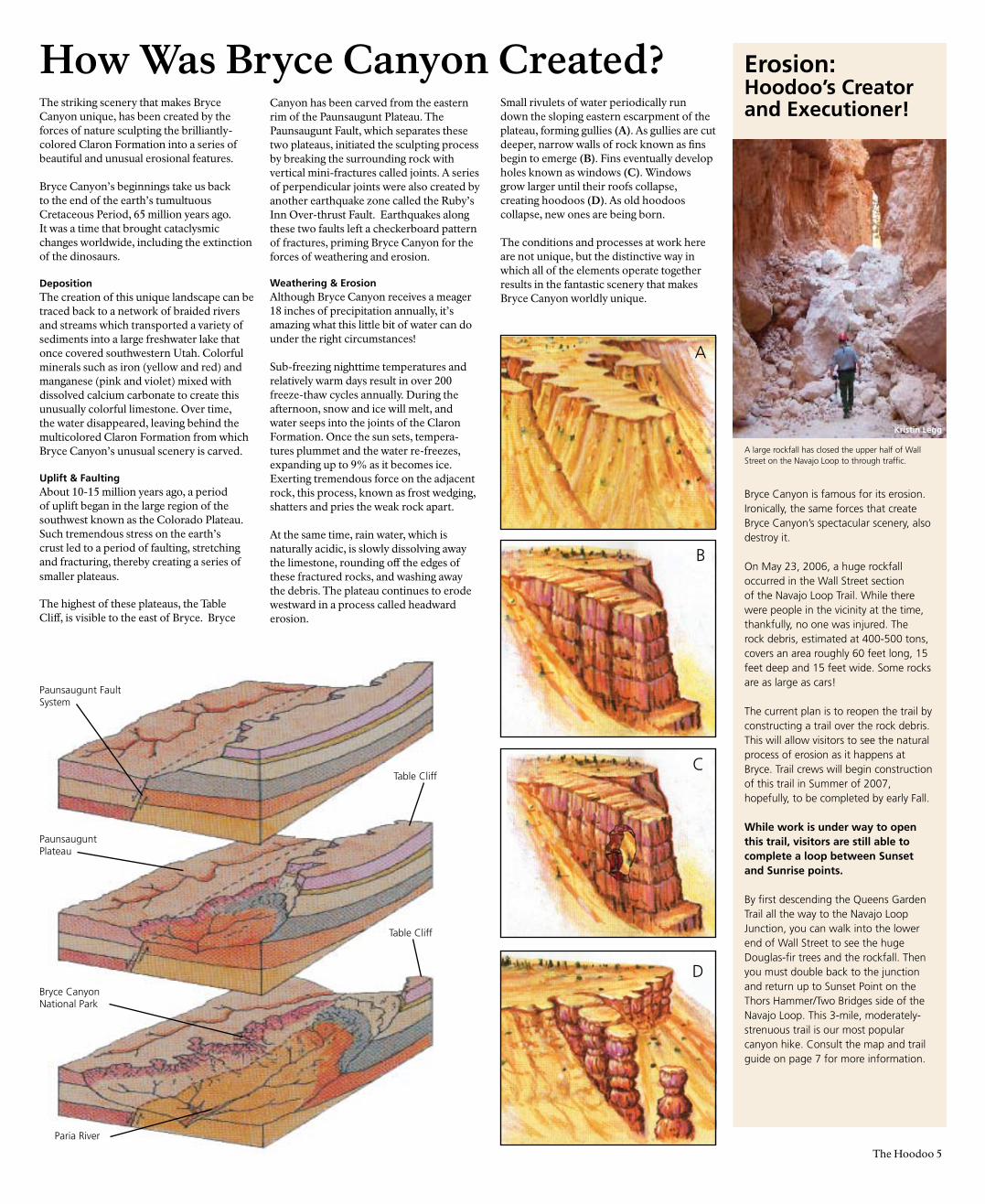
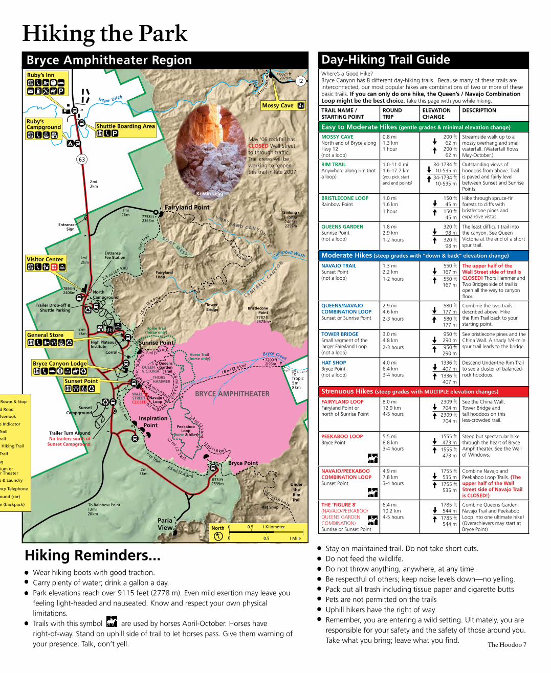
A large rockfall has closed the upper half of Wall Street on the Navajo Loop to through traffic.
Bryce Canyon is famous for its erosion. Ironically, the same forces that create Bryce Canyon’s spectacular scenery, also destroy it.
On May 23, 2006, a huge rockfall occurred in the Wall Street section of the Navajo Loop Trail. While there were people in the vicinity at the time, thankfully, no one was injured. The rock debris, estimated at 400-500 tons, covers an area roughly 60 feet long, 15 feet deep and 15 feet wide. Some rocks are as large as cars!
The current plan is to reopen the trail by constructing a trail over the rock debris. This will allow visitors to see the natural process of erosion as it happens at Bryce. Trail crews will begin construction of this trail in Summer of 2007, hopefully, to be completed by early Fall.
While work is under way to open this trail, visitors are still able to complete a loop between Sunset and Sunrise points.
By first descending the Queens Garden Trail all the way to the Navajo Loop Junction, you can walk into the lower end of Wall Street to see the huge Douglas-fir trees and the rockfall. Then you must double back to the junction and return up to Sunset Point on the Thors Hammer/Two Bridges side of the Navajo Loop. This 3-mile, moderately-strenuous trail is our most popular canyon hike. Consult the map and trail guide on page 7 for more information.
Kristin Legg
How Was Bryce Canyon Created?The striking scenery that makes Bryce Canyon unique, has been created by the forces of nature sculpting the brilliantly-colored Claron Formation into a series of beautiful and unusual erosional features.
Bryce Canyon’s beginnings take us back to the end of the earth’s tumultuous Cretaceous Period, 65 million years ago. It was a time that brought cataclysmic changes worldwide, including the extinction of the dinosaurs.
DepositionThe creation of this unique landscape can be traced back to a network of braided rivers and streams which transported a variety of sediments into a large freshwater lake that once covered southwestern Utah. Colorful minerals such as iron (yellow and red) and manganese (pink and violet) mixed with dissolved calcium carbonate to create this unusually colorful limestone. Over time, the water disappeared, leaving behind the multicolored Claron Formation from which Bryce Canyon’s unusual scenery is carved.
Uplift & FaultingAbout 10-15 million years ago, a period of uplift began in the large region of the southwest known as the Colorado Plateau. Such tremendous stress on the earth’s crust led to a period of faulting, stretching and fracturing, thereby creating a series of smaller plateaus.
The highest of these plateaus, the Table Cliff, is visible to the east of Bryce. Bryce
Canyon has been carved from the eastern rim of the Paunsaugunt Plateau. The Paunsaugunt Fault, which separates these two plateaus, initiated the sculpting process by breaking the surrounding rock with vertical mini-fractures called joints. A series of perpendicular joints were also created by another earthquake zone called the Ruby’s Inn Over-thrust Fault. Earthquakes along these two faults left a checkerboard pattern of fractures, priming Bryce Canyon for the forces of weathering and erosion.
Weathering & ErosionAlthough Bryce Canyon receives a meager 18 inches of precipitation annually, it’s amazing what this little bit of water can do under the right circumstances!
Sub-freezing nighttime temperatures and relatively warm days result in over 200 freeze-thaw cycles annually. During the afternoon, snow and ice will melt, and water seeps into the joints of the Claron Formation. Once the sun sets, tempera-tures plummet and the water re-freezes, expanding up to 9% as it becomes ice. Exerting tremendous force on the adjacent rock, this process, known as frost wedging, shatters and pries the weak rock apart.
At the same time, rain water, which is naturally acidic, is slowly dissolving away the limestone, rounding off the edges of these fractured rocks, and washing away the debris. The plateau continues to erode westward in a process called headward erosion.
PaunsauguntPlateau
Bryce CanyonNational Park
Table Cliff
Paria River
Table Cliff
A
D
B
C
Small rivulets of water periodically run down the sloping eastern escarpment of the plateau, forming gullies (A). As gullies are cut deeper, narrow walls of rock known as fins begin to emerge (B). Fins eventually develop holes known as windows (C). Windows grow larger until their roofs collapse, creating hoodoos (D). As old hoodoos collapse, new ones are being born.
The conditions and processes at work here are not unique, but the distinctive way in which all of the elements operate together results in the fantastic scenery that makes Bryce Canyon worldly unique.
Paunsaugunt FaultSystem
North
Bryce Lodge
Ruby’sRuby’s Inn
Sunset
Rainbow & Yovimpa Points
Ponderosa Cyn
Sunset
Bryce Lodge
Agua Canyon
Natural BridgeFarview Point
Whiteman Bench
North
Ruby’s
Swamp Canyon
BristleconeLoop Trail
RiggsSpringLoopTrail
9 I I5 ft 2778 m
Agua Canyon
Natural Bridge
Piracy Point
Paria View
Inspiration Point
Sunrise Point
Sunset
Bryce Canyon Airport
3 mi 5 km
2 mi 3 km
2 mi3 km
I mi 2 km
I mi2 km
3 mi5 km
To Antimony 34 mi 55 km
Fairyland Point
North
Swamp Canyon Loop
Fairyland Loop
4 mi 6 km
King Creek
3 mi 5 km
9 mi I4 km
Under the Rim Trail
Under the Rim Trail
Under the Rim Trail
63
I2
Paria
River
Tropic Ditch
Tropic Reservior
Black Birch Canyon
I2
3 mi 5 km
7998 ft 2438 m
7200 ft 2I95 m
Tropic
88I9 ft 2688 m
833I ft 2539 m
Sheep Creek
Willis Creek
EastFo
rkSe
vier Ri
ver
East
Fork
Sevi
erR
iver
EastFork
SevierR
iver
6360 ft I938 m
Tro
pic
Dit
ch
Bryce Creek 7 mi I I km
Bull Valley Gorge
Yellow Creek
To I I mi I8 km
89
087
To Cannonville
5 mi
8 km
Bryce Point
Swamp Canyon
Whiteman Bench
Ponderosa Canyon
22
Sinking Ship 7405 ft 2257 m
7480 ft 2257 m
Tower Bridge
7855 ft 2394 m
Horse Mountain 7563 ft 2305 m
Shakespear Point 7842 ft 2390 m
DIXIE NATIONAL FOREST
DIX
IE NA
TION
AL FO
REST
DIX
IE NA
TION
AL FO
REST
DIXIE NATIONAL FOREST
GR
AN
D STA
IRC
ASE - ESC
ALA
NTE
NA
TION
AL M
ON
UM
ENT
GRAND STAIRCASE-ESCALANTE
NATIONAL MONUMENT
GRAND STAIRCASE-ESCALANTE
NATIONAL MONUMENT
PA
UN
SA
UG
UN
T
PL
AT
EA
U
DIXIE NATIONAL FOREST
DIXIE NATIONAL FOREST
Rim Trail
Rim
Tr
ail
Agua Canyon Connecting Trail
Whiteman Bench Connecting Trail
No trailers south of Sunset
Campground
Trailer Drop-off &Shuttle Parking
General Store
Ruby’sCampground
Bryce Canyon Lodge
North
0
0 I Mile
I Kilometer0.5
0.5
Bryce Amphitheater Region
Bryce Canyon National Park
KPOE
Rainbow &Yovimpa Points
Visitor Center
Farview Point
Ruby’s Inn
Sunset Point
Mossy Cave
Shuttle BoardingArea
Touring the ParkBryce Canyon National ParkBryce Canyon Shuttle
Campsite (backpack)
Distance Indicator 3 mi 5 km
Hiking Trail
Campground (car)
Emergency Telephone
Nature Trail
Showers & Laundry
Auditorium or Outdoor Theater
Unpaved Road
Scenic Overlook
Horse Trail
Shuttle Route & Stop
Horse & Hiking Trail
Recycling
Campsite (backpack)
Distance Indicator3 mi5 km
Hiking Trail
Campground (car)
Emergency Telephone
Nature Trail
Showers & Laundry
Auditorium or Campfire Circle
Grocery Store
Unpaved Road
Scenic Overlook
Paved Road(not plowed in winter)
Ski Trail (groomed)
Ski Trailhead
Ski Trail (not groomed)
Horse Trail
Visitor Center Visitor Center
Ruby’sRuby’s Inn
Sunset Point Sunset PointBryce Lodge
Sunrise Point
North
Sunset
Bryce Point
Inspiration PointSunset
6 The Hoodoo
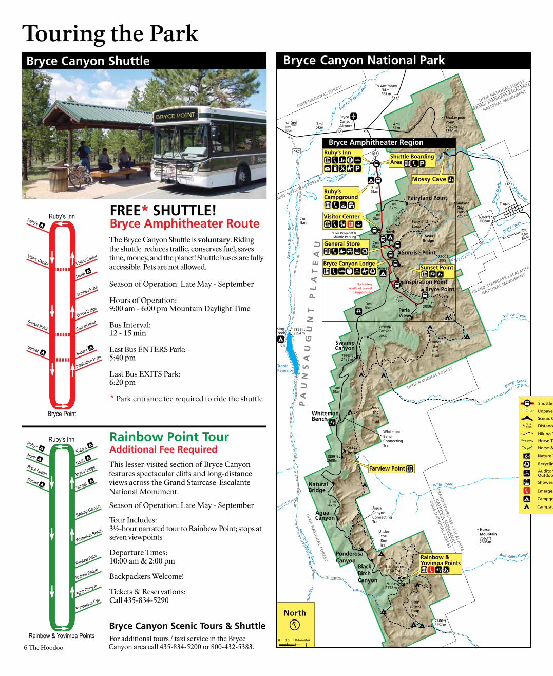
FREE* SHUTTLE!Bryce Amphitheater Route
Season of Operation: Late May - September
Hours of Operation: 9:00 am - 6:00 pm Mountain Daylight Time
Bus Interval:12 - 15 min
Last Bus ENTERS Park:5:40 pm
Last Bus EXITS Park:6:20 pm
* Park entrance fee required to ride the shuttle
The Bryce Canyon Shuttle is voluntary. Riding the shuttle reduces traffic, conserves fuel, saves time, money, and the planet! Shuttle buses are fully accessible. Pets are not allowed.
Bryce Canyon Scenic Tours & Shuttle
Season of Operation: Late May - September
Tour Includes:3½-hour narrated tour to Rainbow Point; stops at seven viewpoints
Departure Times:10:00 am & 2:00 pm
Backpackers Welcome!
Tickets & Reservations:Call 435-834-5290
Rainbow Point Tour Additional Fee Required
This lesser-visited section of Bryce Canyon features spectacular cliffs and long-distance views across the Grand Staircase-Escalante National Monument.
For additional tours / taxi service in the Bryce Canyon area call 435-834-5200 or 800-432-5383.
Paria View
Inspiration Point
Sunrise Point
2 mi3 km
I mi 2 km
I mi 2 km
Fairyland Point
North Campground
Fairyland Loop
4 mi 6 km
Under the Rim Trail
Trailer Drop-off &Shuttle Parking
63
I2
Trailer Turn AroundNo trailers south of
Sunset Campground
Bryce Point
Sinking Ship
7405 ft 2257m
Tower Bridge
RimTrail
Rim
Trail
2 mi 3 km
7758 ft 2365m
7894 ft 2406m
6821 ft 2079m
833I ft 2539m
B O ATM
E S A
Tropic Ditch
Campbell Wash
Bryce Creek
Bristlecone Point
Hat Shop
Corral
High PlateausInstitute
PA
UN
SA
UG
UN
T
PL
AT
EA
U
Horse Trail(horse only)
Peekaboo Loop(horse & hiker)
2.5 mi (4.0 km)
4.0m
i (6.4 km)
I.5m
i (2.4
km)
0.6 mi (I.0 km)
I.8 mi (2.9 km)
I.5 mi (2.4 km)
0.7m
i ( I.2km
)
0.5m
i (0.
8km
)
I.I mi ( I.8 km )
2.0 mi (3.8 km)
0.9 mi ( I.4km)
0.8m
i(I.3km
)
QUEENVICTORIA
Queens Garden
Trail
I.3mi (2.I km
)
I.7 mi ( 2.7
km)
Navajo Loop
C A MP B E L L
C AN
YO
N
F A I R Y L A N D C A N Y ON
7200 ft 2I95m
7787 ft 2373m
To Rainbow PointI 3 mi20 km
Entrance Sign
Entrance Fee Station
To I I mi I8 km
89
To Tropic 5 mi 8 km
I2
0.4 mi (
0.6k
m)
Horse Trail(horse only)
2 mi3 km
BRYCE AMPHITHEATER0.7 mi (I.I km
)
THORSHAMMER
WALLSTREETCLOSED
KPOE
Bryce Amphitheater Region
North 0
I Mile
I Kilometer0.5
0.50
Visitor Center
Ruby’s Inn
Mossy Cave
Sunset Point
Ruby’sCampground
SunsetCampground
Bryce Canyon Lodge
General Store
Shuttle Boarding Area
Hiking the Park
The Hoodoo 7
Hiking Reminders...Stay on maintained trail. Do not take short cuts. Do not feed the wildlife. Do not throw anything, anywhere, at any time.Be respectful of others; keep noise levels down—no yelling.Pack out all trash including tissue paper and cigarette buttsPets are not permitted on the trailsUphill hikers have the right of wayRemember, you are entering a wild setting. Ultimately, you are responsible for your safety and the safety of those around you. Take what you bring; leave what you find.
Campsite (backpack)
Distance Indicator 3 mi 5 km
Hiking Trail
Campground (car)
Emergency Telephone
Nature Trail
Showers & Laundry
Auditorium or Outdoor Theater
Unpaved Road
Scenic Overlook
Horse Trail
Shuttle Route & Stop
Horse & Hiking Trail
Recycling
Campsite (backpack)
Distance Indicator3 mi5 km
Hiking Trail
Campground (car)
Emergency Telephone
Nature Trail
Showers & Laundry
Auditorium or Campfire Circle
Grocery Store
Unpaved Road
Scenic Overlook
Paved Road(not plowed in winter)
Ski Trail (groomed)
Ski Trailhead
Ski Trail (not groomed)
Horse Trail
Bryce Amphitheater Region Day-Hiking Trail GuideWhere’s a Good Hike?Bryce Canyon has 8 different day-hiking trails. Because many of these trails are interconnected, our most popular hikes are combinations of two or more of these basic trails. If you can only do one hike, the Queen’s / Navajo Combination Loop might be the best choice. Take this page with you while hiking.
TRAIL NAME /STARTING POINT
ROUNDTRIP
ELEVATION CHANGE
DESCRIPTION
Easy to Moderate Hikes (gentle grades & minimal elevation change)
MOSSY CAVENorth end of Bryce along Hwy 12 (not a loop)
0.8 mi1.3 km1 hour
200 ft62 m
200 ft62 m
Streamside walk up to a mossy overhang and small waterfall. (Waterfall flows May-October.)
RIM TRAILAnywhere along rim (not a loop)
1.0-11.0 mi1.6-17.7 km(you pick startand end points)
34-1734 ft10-535 m
34-1734 ft10-535 m
Outstanding views of hoodoos from above. Trail is paved and fairly level between Sunset and Sunrise Points.
BRISTLECONE LOOPRainbow Point
1.0 mi1.6 km1 hour
150 ft45 m
150 ft45 m
Hike through spruce-fir forests to cliffs with bristlecone pines andexpansive vistas.
QUEENS GARDENSunrise Point(not a loop)
1.8 mi2.9 km1-2 hours
320 ft98 m
320 ft98 m
The least difficult trail into the canyon. See Queen Victoria at the end of a short spur trail.
Moderate Hikes (steep grades with “down & back” elevation change)
NAVAJO TRAILSunset Point(not a loop)
1.3 mi2.2 km1-2 hours
550 ft167 m550 ft167 m
The upper half of the Wall Street side of trail is CLOSED! Thors Hammer and Two Bridges side of trail is open all the way to canyon floor.
QUEENS/NAVAJOCOMBINATION LOOPSunset or Sunrise Point
2.9 mi4.6 km2-3 hours
580 ft177 m580 ft177 m
Combine the two trails described above. Hike the Rim Trail back to your starting point.
TOWER BRIDGESmall segment of the larger Fairyland Loop(not a loop)
3.0 mi4.8 km2-3 hours
950 ft290 m950 ft290 m
See bristlecone pines and the China Wall. A shady 1/4-mile spur trail leads to the bridge.
HAT SHOPBryce Point(not a loop)
4.0 mi6.4 km3-4 hours
1336 ft407 m
1336 ft407 m
Descend Under-the-Rim Trail to see a cluster of balanced-rock hoodoos.
Strenuous Hikes (steep grades with MULTIPLE elevation changes)
FAIRYLAND LOOPFairyland Point or north of Sunrise Point
8.0 mi12.9 km4-5 hours
2309 ft704 m
2309 ft704 m
See the China Wall, Tower Bridge and tall hoodoos on this less-crowded trail.
PEEKABOO LOOPBryce Point
5.5 mi8.8 km3-4 hours
1555 ft473 m
1555 ft473 m
Steep but spectacular hike through the heart of Bryce Amphitheater. See the Wall of Windows.
NAVAJO/PEEKABOO COMBINATION LOOPSunset Point
4.9 mi7.8 km3-4 hours
1755 ft535 m
1755 ft535 m
Combine Navajo and Peekaboo Loop Trails. (The upper half of the Wall Street side of Navajo Trail is CLOSED!)
THE ‘FIGURE 8’(NAVAJO/PEEKABOO/QUEENS GARDENCOMBINATION)Sunrise or Sunset Point
6.4 mi10.2 km4-5 hours
1785 ft544 m
1785 ft544 m
Combine Queens Garden, Navajo Trail and Peekaboo Loop into one ultimate hike! (Overachievers may start at Bryce Point)
May ‘06 rockfall has CLOSED Wall Street to through traffic. Trail crews will be working to reopen this trail in late 2007.
Kristin Legg
Wear hiking boots with good traction. Carry plenty of water; drink a gallon a day. Park elevations reach over 9115 feet (2778 m). Even mild exertion may leave youfeeling light-headed and nauseated. Know and respect your own physical limitations.Trails with this symbol are used by horses April-October. Horses have right-of-way. Stand on uphill side of trail to let horses pass. Give them warning of your presence. Talk, don’t yell.
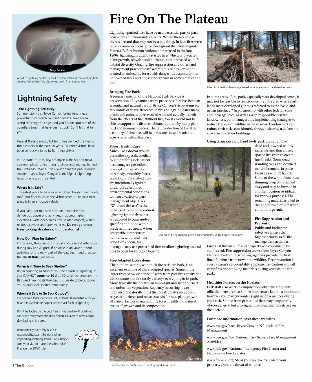
Lightning-sparked fires have been an essential part of park ecosystems for thousands of years. Where there’s smoke there’s fire and that may not be a bad thing. In fact, fires were once a common occurrence throughout the Paunsaugunt Plateau. Before human settlement increased in the late 1800s, lightning frequently started fires which rejuvenated plant growth, recycled soil nutrients, and increased wildlife habitat diversity. Grazing, fire suppression and other land management practices have altered this natural cycle and created an unhealthy forest with dangerous accumulations of downed trees and dense underbrush in some areas of the park.
Bringing Fire Back A primary mission of the National Park Service is preservation of dynamic natural processes. Fire has been an essential and natural part of Bryce Canyon’s ecosystems for thousands of years. Research in fire ecology indicates many plants and animals have evolved with and actually benefit from the effects of fire. Without fire, forests would not be able to support the diverse habitats required by many plant, bird and mammal species. The reintroduction of fire after a century of absence, will help restore these fire adapted ecosystems within this Park.
Forest Health Care Much like a doctor would prescribe a specific medical treatment for a sick patient, fire managers prescribe a planned course of action to remedy unhealthy forest conditions. Prescribed fires are intentionally ignited under predetermined environmental conditions to meet a variety of park management objectives. “Wildland fire use” is the term used to describe natural lightning ignited fires that are allowed to burn under specific conditions within predetermined areas. When acceptable temperature, humidity, wind and other conditions occur, fire managers may use prescribed fires or allow lightning-caused fires to burn for resource benefit.
Fire-Adapted Ecosystems The ponderosa pine, with thick fire resistant bark, is an excellent example of a fire-adapted species. Some of the larger trees show evidence of scars from past fire activity and demonstrate that fire rarely destroys everything in its path. More typically, fire creates an important mosaic of burned and unburned vegetation. Regularly occurring lower-intensity fire naturally thins the forest, creates meadows, recycles nutrients and releases seeds for new plant growth; all critical factors in maintaining forest health and natural cycles of growth and decomposition.
In some areas of the park, especially near developed zones, it may not be feasible to reintroduce fire. The area where park lands meet developed zones is referred to as the “wildland-urban interface.” In partnership with other federal, state and local agencies, as well as with responsible private landowners, park managers are implementing strategies to reduce the risk of wildfire in these areas. Landowners can reduce their risks considerably through clearing a defensible space around their buildings.
Using chain saws and hand tools, park crews remove dead and downed woody materials and thin closely spaced live trees to create fuel breaks. Some dead standing trees and downed material remains in place for use as wildlife habitat. Some of the wood from these thinning projects is hauled away and may be burned in another location or utilized for various purposes. The remaining material is piled to dry and burned on site when conditions permit.
Fire Suppression and Prevention Public and firefighter safety are always the highest priority in all fire management activities.
Fires that threaten life and property will continue to be suppressed. Fire suppression crews from Bryce Canyon National Park and partnering agencies provide the first line of defense from unwanted wildfire. Fire prevention is every citizen’s responsibility, so please use caution with all campfires and smoking materials during your visit to the park.
Healthier Forests on the Horizon Park staff also work in conjunction with state air quality officials to ensure that smoke impacts are kept to a minimum, however you may encounter slight inconveniences during your visit. Smoke from prescribed fires may temporarily obscure a vista, but also signals that healthier forests are on the horizon.
For more information, visit these websites:
www.nps.gov/brca Bryce Canyon NP-click on Fire Management
www.nps.gov/fire National Park Service Fire Management Activities
www.nifc.gov National Interagency Fire Center and Nationwide Fire Updates
www.firewise.org Steps you can take to protect your property from the threat of wildfire 8 The Hoodoo
Lightning SafetyTake Lightning SeriouslySummer storms at Bryce Canyon bring lightning, a powerful force which can and does kill. Take a look along the canyon’s edge, and you’ll soon spot one of the countless trees that have been struck. Don’t let that be you!
Here at Bryce Canyon, lightning has claimed the lives of three visitors in the past 18 years. Six other visitors have been seriously injured by lightning strikes.
In the state of Utah, Bryce Canyon is the second most common place for lightning fatalities and injuries, behind the Uinta Mountains. Considering that the park is much smaller in area, Bryce Canyon is the highest lightning hazard density in the state!
Where is it Safe?The safest place to be is in an enclosed building with walls, roof, and floor (such as the visitor center). The next best place is in an enclosed vehicle.
If you can’t get to a safe location, avoid the most dangerous places and activities, including higher elevations, wide-open areas, tall isolated objects, water-related activities and open vehicles. Do not go under trees to keep dry during thunderstorms!
How Do I Plan for Safety?In this area, thunderstorms usually occur in the afternoon during July and August. If possible, plan your outdoor activities for the early part of the day. Learn and practice the 30/30 Rule (see below).
When is it Time to Seek Shelter?Begin counting as soon as you see a flash of lightning. If you CANNOT count to 30 (i.e., 30 seconds) between the flash and hearing its thunder, it is unsafe to be outdoors. You should seek shelter immediately.
When is it Safe to Go Back Outside?It is not safe to be outdoors until at least 30 minutes after you hear the last thunderclap or see the last flash of lightning.
Don’t be fooled by the bright sunshine overhead! Lightning can strike away from the dark clouds. Be alert to new storms developing in the area.
Remember, your safety is YOUR responsibility. Learn the signs of an impending lightning storm. Be willing to alter your visit to make the safe choice. Practice the 30/30 rule.
A bolt of lightning contains about a billion volts and can reach 50,000 degrees Fahrenheit! This photo was taken from Sunset Point.
Fire On The Plateau
Gary Becker
Low-intensity fire contributes to healthy Ponderosa forests
Drip-torch being used to ignite a prescribed fire, under proper conditions.
Piles of thinned understory gathered to reduce risks in the developed area.
Bruce Fields
The Hoodoo 9
As you drive along Bryce Canyon’s scenic roadways or hike any of the trails, you may see Bryce Canyon’s revegetation crew and volunteers hard at work. They’re identifying and documenting information such as species, location, and size of exotic vegetation infestations; manually pulling non-native plants; conducting erosion control measures on steep slopes; and revegetating disturbed soils.
Bryce Canyon has currently documented 73 exotic plant species that have been in the park at one time. How did these “weeds” become established here? Wildlife may have played a small role. Animals with large ranges such as mule deer, black bears, and mountain lions can bring in exotic plant seeds embedded in their fur. Birds may eat berries and seeds that, when passed through their digestive systems and excreted, can sprout exotics. Rodents may cache seeds for winter use in various locations, thus spreading the seed base. Probably more significant, though, is the role that humans play in this cycle. For instance, the revegetation crew is working to ensure that soils disturbed by road construction activities are repopulated with native, rather than exotic invasive species. Clothing and boot soles carry and spread non-native seeds into the backcountry, and vehicles do the same along roadways. How can you help prevent the loss of native plant diversity to invasive species at Bryce Canyon? Scraping boots and cleaning the undercarriages of vehicles prior to entering the park will help.
Once identified, exotic species are eradicated using a number of techniques, including manual (hand-pulling and chopping), mechanical (chainsaw), fire, and—as a last resort—chemical means. Sometimes a combination of techniques is utilized such as in the case of tamarisk, Tamarix ramosissima. Small tamarisk plants can be pulled by hand if care is taken to remove the entire taproot. However, larger trees must be cut with a chainsaw, and the stumps treated with chemical herbicides to prevent resprouting. Tamarisk favors fragile riparian areas and outcompetes native species due to its rapid growth rate, deep taproots, and salt secretions that create a hostile environment for native plants.
Along the park’s roadsides, our crew is planting and reseeding soils with native plants. To prevent roadside weeds from becoming established, the crew will reseed with native seeds and transplant native shrubs, trees, and grasses. Seeds gathered from grasses and forbs native to the Paunsaugunt Plateau were sent to a nursery in Meeker, Colorado, in order to produce the number of seeds needed for the area of coverage.
Erosion control has also been undertaken along the road. You may have seen the “waddles” (straw-filled, net-covered cylinders that are certified weed free) staked into the bare hillsides. Waddles prevent topsoil from sloughing downhill or being washed down drainage ditches until roots from the reseeding efforts take hold and naturally bind the soil.
A Weed By Any Other Name...
Spotted knapweed is one of 73 exotic plant species in the park.When driving, stay alert for park employees working along the roadsides. Give them a brake!
Is This Weather Normal? WeatheR at BRyCe Canyon
Month
J F M a M J J a S o n D
teMPeRatuRe (0F)Normal Daily Maximum 39 41 46 56 66 76 83 80 74 63 51 42Normal Daily Minimum 9 13 17 25 31 38 47 45 37 29 19 11
Extreme High 62 66 76 82 89 96 97 94 91 85 75 67Extreme Low -30 -29 -13 -5 5 20 25 17 17 -2 -20 -23
Avg. # of Days that rise above 90 0F 0 0 0 0 0 1 4 0 0 0 0 0Avg. # of Days that drop below 32 0F 31 28 31 20 20 6 0 9 9 22 29 31
PReCiPitation (inches) Normal 1.7 1.4 1.4 1.2 0.8 0.6 1.4 2.2 1.4 1.4 1.2 1.6
Maximum 9.2 6.8 6.8 3.8 2.3 2.7 3.8 4.8 4.2 4.5 5.4 6.2Maximum 24 hr. Precipitation 2.3 1.5 1.5 1.8 1.2 1.7 1.8 3.8 3.4 1.7 1.5 3.2
Maximum Snowfall 63 75 75 62 18 6 T T 4 22 22 49Days with Measurable Precipitation 7 7 8 6 5 3 5 6 4 4 5 6
Average # of Thunderstorms 0 0 0 1 5 6 14 19 7 2 0 0
SunShine / ClouDineSSNumber of Clear Days 9 7 9 10 12 17 16 16 18 17 11 10
Number of Partly Cloudy Days 8 8 8 9 10 8 10 10 8 7 8 8Number of Cloudy Days 14 13 14 11 9 5 5 5 4 7 8 13
% Possible Sunshine 56 64 60 68 74 83 77 79 80 75 63 60
What Animals Live Here?For a small park, Bryce Canyon has several types of habitat which support a diversity of wildlife. While you may not see lots of any one species, you will see a variety of animals if you know when and where to look.
Main habitat: Sagebrush, Meadow, Forest, Canyon, All habitats
Season: W=Fall/Winter, S=Spring/Summer, A=all seasons
Best time to look: d=day, t=twilight, b=both day and twilight
Difficulty in finding: e=easy, h=hard, u=unlikely
Do NOT approach or attempt to feed any wild animal!
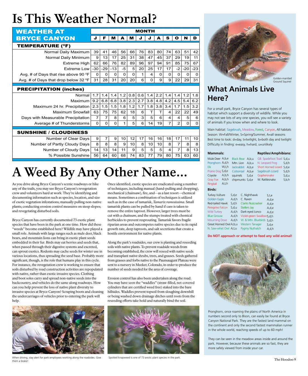
Pronghorn, once roaming the plains of North America in numbers second only to Bison, can easily be found at Bryce Canyon National Park. They are the fastest land mammal on the continent and only the second fastest mammalian runner in the whole world, reaching speeds of up to 60 mph!
They can be seen in the meadow areas inside and around the park. However, because these animals are so fast, they are more safely viewed from inside your car.
Mammals:
Mule Deer Pronghorn Elk Prairie Dog Coyote Gray FoxRingtail
Birds:
Turkey VultureGolden EagleRed-tailed HawkPeregrine FalconWild TurkeyBlue GrouseMourning DoveGreat Horned OwlN. Saw-whet Owl
Reptiles/Amphibians:
GB. Spadefoot ToadN. Leopard FrogShort Horned LizardSagebrush LizardGophersnakeW. Rattlesnake
A,b,eA,d,hW,t,hS,d,eA,b,hA,b,hA,t,h
S,d,eA,d,hS,d,hS,d,uA,d,hA,d,hA,d,hA,b,uA,t,u
C. Nighthawk C. Raven Clarks Nutcracker Stellers Jay Dark-eyed JuncoViolet-green Swallow W. & Mtn. BluebirdsWestern TanagerPygmy Nuthatch
S,t,e A,d,eA,d,e A,d,e A,d,eS,d,hS,d,hS,d,eA,d,h
S,d,uS,d,hS,d,eS,d,hS,d,uS,b,h
Black BearMtn. LionJackrabbitCottontail squirrels chipmunks
A,b,uA,b,uA,b,eA,b,eS,d,eS,d,e
Golden-mantled Ground Squirrel
10 The Hoodoo
Protecting Park Resources
Earth at night. Researchers estimate less than half the residents of the Northern Hemisphere can see the Milky Way.
Behold, the Milky Way! This stellar strip of light is only a portion of our galaxy, which contains 200 billlion stars.
In most places it’s never dark enough to see, but at Bryce, only hours after sunset, your eyes will be able to see 2.2 million light years to the Andromeda Galaxy. Near the hind legs of the constellation Pegasus you will discover this fuzzy cloud that astronomers know as M31. Andromeda is simultaneously the largest and most distant object you will ever see with your unaided eye, measuring 110,000 light years in diameter! At Bryce, the Andromeda Galaxy is just the beginning. From the vantage point of this sanctuary of darkness, a universe of stellar wonders await. Join park rangers for one of our popular astronomy programs where you can marvel at all the heavens have to offer. Before being veiled by the light pollution of the modern world, these deep sky objects were once visible everywhere. Now over much of the planet they are hard to detect. It is estimated that less than half of the residents of the northern hemisphere can even see any of the Milky Way!
It is easy to feel insignificant underneath such vastness, yet ironically, it is within an individual’s power to help preserve such a view. Close your blinds at night and replace porch lights with motion sensor security lights. Become involved in local efforts to establish good lighting. Who knows? Perhaps your home town has the potential for Bryce Canyon quality stargazing. In most places, all it takes to restore the heavens is a shared passion for the dark and the unified responsible management of light.
Some people are afraid of the dark. Interestingly, Bryce Canyon’s park rangers are scared of the light! Perhaps you’d be fearful, too, if it was your job to protect some of the best dark left in the world.
Preserving darkness isn’t easy. Education is our best tool, as Bryce Canyon’s biggest threats to darkness come from outside its boundaries. Protecting the dark requires using light wisely. Light that shines down is often necessary; however, light that escapes sideways or upward only pollutes the night and dims the stars. Many municipalities have found that by switching to shielded light fixtures, they can more effectively illuminate neighborhoods with less electricity. This not only reduces light pollution, but their residents’ tax burden, as well.
Being far from civilization, Bryce’s night skies are not only dark, but our high desert location makes our thin air very easy to see through. Consequently, this is a phenomenal place for stargazing. With a limiting magnitude rating of 7.4, Bryce’s sky is as dark as world class astronomical research locations. By comparison, a moonless night in a small town setting rates at a 6.0 magnitude, where 2500 individual stars can be seen twinkling in the void. But here at Bryce, 7500 are visible to the unaided eye!
As darkness falls, the first star may actually be the planet Venus, shining so brightly at Bryce it will cast your shadow. Venus is soon followed by Vega, Arcturus, and other bright stars. When the transition from light to dark is complete, look for the combined light of billions of stars all so distant they appear as one long cloud stretching across the sky.
Park rangers and volunteers offer astronomy programs twice a week in summer. These popular programs include an indoor multimedia presentation followed by telescope viewing of the heavens (weather permitting).
Afraid of^the Dark?Losing
April 18April 21
May 4May 9May 11May 16May 18May 23May 25
June 6June 8June 13 - 16 FestivalJune 20June 22
July 4July 6July 11
July 13July 18July 20July 25
August 3August 8August 10August 12August 15August 17August 22August 31
September 5September 7September 12September 14September 19September 21
May 1May 2
May 30May 31
June 29June 30
July 29July 30
August 27August 28
September 26September 27
Astronomy Program Schedule(Most Wednesdays & Fridays)
Full Moon Hike Schedule(Two days near the full moon)
Always check at the Visitor Center for program
location and start time. This is only a partial list.
The Bryce Canyon astronomy team will be
giving astronomy programs at other locations in
the local area on Saturday evenings. Check at
the Visitor Center for details.
Stargazing is weather permitting and can be
very cold. Bring warm clothes. Temperatures
may dip down as low as 40° F / 4° C!
Bryce Canyon Natural History AssociationPO Box 640051, Bryce, UT 84764-0051 435-834-4601 Fax 435-834-4606 www.brycecanyon.org
The Hoodoo 11
Established in 1961, Bryce Canyon Natural History Association is a non-profit organization dedicated to assisting Bryce Canyon National Park and Dixie National Forest in furthering their scientific, educational, historical, and interpretive activities. This is accomplished, in part, by making educational publications and materials available for sale and/or free distribution, and supporting existing interpretive activities, like the Junior Ranger Program.
Every purchase from a Bryce Canyon Natural History Association bookstore helps support our mission.
As a Natural History Association member, you can help us:
• Publish nearly a half million pieces of free literature for park visitors each year.
• Support resource management research activities.
• Support educational outreach programs to schools in southern Utah and beyond.
• Continue National Park Service research projects that document the natural and human history of Bryce Canyon National Park.
• Support the Junior Ranger Program.
• Help publish interpretive books, maps, posters, and audio-visual products that educate visitors about Bryce Canyon National Park and Dixie National Forest.
• Support the Bryce Canyon Interpretation Division of the National Park Service.
• Provide scholarships to deserving students and universities.
A membership with Bryce Canyon Natural History Association includes these benefits:
• 15% discount on all books, maps, posters, and other products sold by Bryce Canyon Natural History Association in our stores, by phone (888 362-2642), or online (www.brycecanyon.org).
• 10% discount at the Bryce Canyon Lodge gift shop operated by Xanterra Parks and Resorts (you must present your membership card to receive discount).
• Discounts to hundreds of other stores operated by more than 60 nonprofit cooperating associations at numerous national parks and other public lands throughout the United States (you must present your membership card to receive discount).
• Bryce Canyon Natural History Association members receive a discount on most High Plateaus Institute courses. These courses offer in-depth outdoor education to visitors. Call or check our website for listings.
Become a personal
partner with Bryce Canyon
National Park to help
preserve and protect the
wonder and resources for
this and future generations
In the spring of 2004, the Bryce Canyon Natural History Association and Bryce Canyon National Park, in collaboration with the local business community, school officials, universities, and city, county, state and federal government entities, initiated efforts to facilitate the inaugural year of the High Plateaus Institute (HPI). This exciting educational endeavor provides researchers, students, teachers, local residents, and visitors with expanded opportunities for exploration, discovery, and science-based learning.
High Plateaus Institute
High Plateaus Institute, Bryce Canyon National Park
Many exciting programs will be offered through the HPI during the 2007 season. Some examples include: educational programs in geology, astronomy, plants, wildlife, cultural history (ranching and cowboy poetry) and photography. The HPI plays host to a variety of researchers each year, as well as provides a location for ranger-led programs for kids and families.
For further information, contact the (Acting) HPI Director at (435) 834-4603 or email [email protected].
Many of the photos used in this publication were courtesy of Ron Warmer.
Thank You to Our Donors & PartnersBryce Canyon National Park wants to thank its generous donors and park partners for helping to improve programs and services here at the park.
The Bryce Canyon Natural History Association provides the park with booklets and badges for the Junior Ranger program, printing costs for this Hoodoo newspaper and other publications, and housing for Volunteers and interns. The Association also funds a full time Education/Outreach Specialist for the park.
The donation box in the lobby of the visitor center has funded interpretive equipment that directly benefits the visiting public. A “state of the art” projector for the visitor center auditorium will be purchased in 2007.
Two Geoscientist-in-Parks interns have been granted by the Geologic Society of America. These interns will assist with research, present public geology programs throughout the summer, and provide training for park staff on the geology of the Colorado Plateau. Our Natural History Association is also helping to fund these two positions.
The Bryce Canyon Lodge and Ruby’s Inn Resort have implemented a Dollar Check-Off Program. Guests at their hotels have the option of donating a dollar per night of their visit. These programs have funded seasonal employees for interpretation and the trail crew.
A hearty “thanks” to our generous donors and park partners. We couldn’t do it without you!
V.I.P.s(Volunteer-In-Parks)
Last year, more than 280 volunteers donated over 28,000 hours to Bryce Canyon National Park! If you’ve got time and talents to share, why not become a Volunteer-In-Park (V.I.P.)?
For more information, log on to: www.nps.gov/brca (click on volunteer) or www.volunteer.gov/gov.
To learn more about our astronomy volunteer program, log on to: www.nps.gov/brca/planyourvisit/astronomyvolunteer.htm.
89
89
Coral Pink Sand Dunes SP
St.George
LasVegas
Cedar City
Richfield
NephiPrice
EphraimManti
Kanab
Page
Green River
Moab
Blanding
Monticello
TubaCity
Fredonia
Parowan
Panguitch
Hurricane
Mesquite
Beaver
Fillmore
Gunnison
Salina
Bluff
Kayenta15
15
70
70
15
15
2424
24
12
24
89
89
89
89
89
89
89
191
191
191
191
191
191
191
95
95
491
163
160
160
160
89A
98
276
276
62
62
22
917
389
18
5618
67
14
14 143
20
28
6
6
10
10
128
160
12
130
257
Delta
Milford
Garrison
21
50
6
6
50
506
506
ColoradoCity
162
64
Mt. Carmel Jct.
Tropic
Cannonville
Escalante
Boulder
Torrey
Bicknell
LoaKoosharem
Antimony
Junction
Circleville
Hatch
Glendale
Springdale
Aurora
Scipio
Hanksville
Bullfrog
Halls Crossing
MexicanHat
Hite
Henrieville
BigWater
Cameron
Jacob Lake
NorthRim
SouthRim
Baker
132
Grand Jct.
Ganado
Chinle
191
191
264
26493
64
Shiprock
Gallup
Towaoc
Cortez
491
160
FerryCrossing
191
180
180
64
Flagstaff
Winslow
Holbrook
Kingman40
40
40
17
Williams
Grosvenor Arch
Calf Creek Falls
BullheadCity
Needles
95
Laughlin
68
50 1000
160800 kmmiles
Navajo Mtn.
Tuweep
Hwy 67Closed
Nov-April
Kolob Cyn
Zion NP
Grand Canyon NP
GlenCanyon NRA
LakeMeadNRA
GreatBasinNP
CedarBreaksNM
Capitol Reef NP
BryceCanyonNP
Canyonlands NP
Arches NP
KaibabNF
GrandStaircaseEscalante NM
DixieNF
FishLakeNF
Manti-La Sal NF
Manti-La SalNF
Grand Canyon-ParashantNM
NavajoNM
Manti-La SalNF
FishLakeNF
FishLakeNF
DixieNF
DixieNF
Dixie NF
Kaibab NF
Hovenweep NM
VermilionCliffs NM
RainbowBridge NM
MonumentValley TP
Antelope Slot Canyon TP
NaturalBridges NM
PipeSpringNM
Red Canyon
AnasaziIndianVillageSP
Petrified Forest SP
NAVAJO NATION
HOPI RESERVATION
Kodachrome SP
GoblinValley SP
Edge of theCedars SP
CanyonDe ChellyNM
HubbellTrading Post NHS
HUALAPAIRESERVATION
HAVASUPAI
RESERVATION
FremontIndianVillageSP
MesaVerdeNP
UTE MOUNTAIN RESERVATION
Manti-La SalNF
DeadHorsePointSP
SnowCanyonSP
PetrifiedForest NP
Walnut Canyon NM
Wupatki NM
Sunset Crater NM
Valley fo Fire SP
GrandCanyonSkywalk
OtterCreek SP
Printed on recycled paper. Please recycle again.
05-2007 205K
Printed with SOY INK
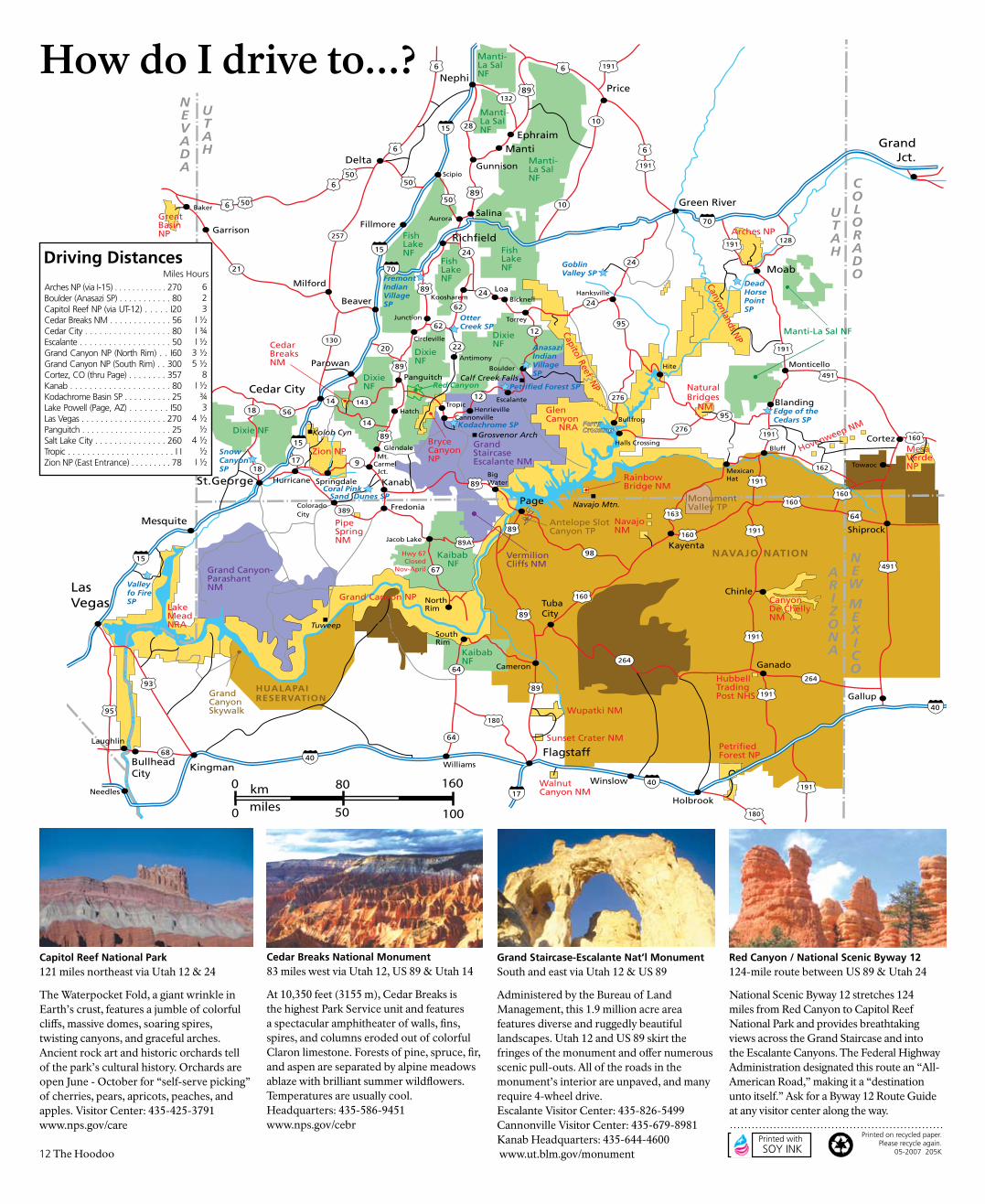
Capitol Reef National Park 121 miles northeast via Utah 12 & 24
The Waterpocket Fold, a giant wrinkle in Earth’s crust, features a jumble of colorful cliffs, massive domes, soaring spires, twisting canyons, and graceful arches. Ancient rock art and historic orchards tell of the park’s cultural history. Orchards are open June - October for “self-serve picking” of cherries, pears, apricots, peaches, and apples. Visitor Center: 435-425-3791 www.nps.gov/care
Cedar Breaks National Monument 83 miles west via Utah 12, US 89 & Utah 14
At 10,350 feet (3155 m), Cedar Breaks is the highest Park Service unit and features a spectacular amphitheater of walls, fins, spires, and columns eroded out of colorful Claron limestone. Forests of pine, spruce, fir, and aspen are separated by alpine meadows ablaze with brilliant summer wildflowers. Temperatures are usually cool. Headquarters: 435-586-9451 www.nps.gov/cebr
Grand Staircase-Escalante Nat’l MonumentSouth and east via Utah 12 & US 89
Administered by the Bureau of Land Management, this 1.9 million acre area features diverse and ruggedly beautiful landscapes. Utah 12 and US 89 skirt the fringes of the monument and offer numerous scenic pull-outs. All of the roads in the monument’s interior are unpaved, and many require 4-wheel drive. Escalante Visitor Center: 435-826-5499 Cannonville Visitor Center: 435-679-8981 Kanab Headquarters: 435-644-4600 www.ut.blm.gov/monument
Red Canyon / National Scenic Byway 12124-mile route between US 89 & Utah 24
National Scenic Byway 12 stretches 124 miles from Red Canyon to Capitol Reef National Park and provides breathtaking views across the Grand Staircase and into the Escalante Canyons. The Federal Highway Administration designated this route an “All-American Road,” making it a “destination unto itself.” Ask for a Byway 12 Route Guide at any visitor center along the way.
12 The Hoodoo
How do I drive to...?
Arches NP (via I-15) . . . . . . . . . . . . 270 Boulder (Anasazi SP) . . . . . . . . . . . 80 Capitol Reef NP (via UT-12) . . . . . I20Cedar Breaks NM . . . . . . . . . . . . . 56Cedar City . . . . . . . . . . . . . . . . . . 80Escalante . . . . . . . . . . . . . . . . . . . 50Grand Canyon NP (North Rim) . . I60Grand Canyon NP (South Rim) . . 300Cortez, CO (thru Page) . . . . . . . . 357Kanab . . . . . . . . . . . . . . . . . . . . . 80Kodachrome Basin SP . . . . . . . . . . 25Lake Powell (Page, AZ) . . . . . . . . I50Las Vegas . . . . . . . . . . . . . . . . . . 270Panguitch . . . . . . . . . . . . . . . . . . . 25Salt Lake City . . . . . . . . . . . . . . . 260Tropic . . . . . . . . . . . . . . . . . . . . . . I I Zion NP (East Entrance) . . . . . . . . . 78
6 23
I ½ I ¾ I ½
3 ½5 ½
8I ½¾3
4 ½½
4 ½½
I ½
Driving DistancesMiles Hours
Recommended