Texas Instream Flow Studies:Texas Instream Flow Studies:Technical OverviewTechnical Overview
Wendy Gordon, Ph.D.Wendy Gordon, Ph.D.Texas Commission on Environmental QualityTexas Commission on Environmental Quality
October 2006October 2006
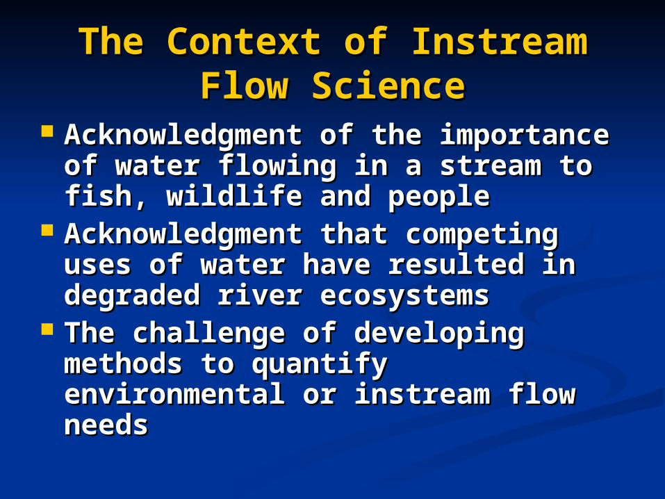
The Context of Instream Flow The Context of Instream Flow ScienceScience
Acknowledgment of the importance of Acknowledgment of the importance of water flowing in a stream to fish, water flowing in a stream to fish, wildlife and peoplewildlife and people
Acknowledgment that competing uses Acknowledgment that competing uses of water have resulted in degraded river of water have resulted in degraded river ecosystemsecosystems
The challenge of developing methods The challenge of developing methods to quantify environmental or instream to quantify environmental or instream flow needsflow needs
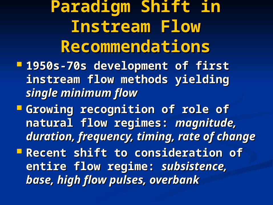
Paradigm Shift in Instream Paradigm Shift in Instream Flow RecommendationsFlow Recommendations
1950s-70s development of first 1950s-70s development of first instream flow methods yielding instream flow methods yielding single single minimum flowminimum flow
Growing recognition of role of natural Growing recognition of role of natural flow regimes: flow regimes: magnitude, duration, magnitude, duration, frequency, timing, rate of changefrequency, timing, rate of change
Recent shift to consideration of entire Recent shift to consideration of entire flow regime: flow regime: subsistence, base, high subsistence, base, high flow pulses, overbankflow pulses, overbank

Senate Bill 2Senate Bill 2
Establish data collection and evaluation Establish data collection and evaluation programprogram
Determine flow conditions necessary toDetermine flow conditions necessary tosupport a support a sound ecological environmentsound ecological environmentin Texas rivers and streamsin Texas rivers and streams
Complete priority studies by December Complete priority studies by December 31, 201031, 2010
In 2001, the Texas Legislature directed In 2001, the Texas Legislature directed TCEQ, TPWD & TWDB to:TCEQ, TPWD & TWDB to:

“…“…conduct studies and analyses conduct studies and analyses to determine appropriate to determine appropriate
methodologies for determining methodologies for determining flow conditions in the state’s flow conditions in the state’s
rivers and streams necessary to rivers and streams necessary to support a sound ecological support a sound ecological
environment.”environment.”
Legislative DirectiveLegislative Directive
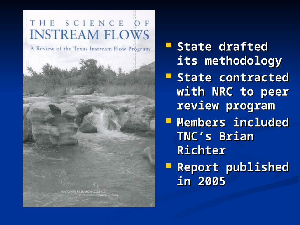
State drafted its State drafted its methodologymethodology
State contracted State contracted with NRC to peer with NRC to peer review programreview program
Members included Members included TNC’s Brian RichterTNC’s Brian Richter
Report published in Report published in 20052005
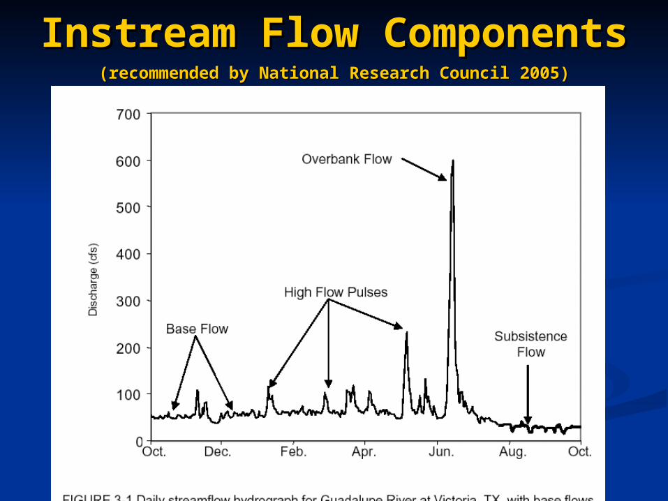
(recommended by National Research Council 2005)(recommended by National Research Council 2005)
Instream Flow ComponentsInstream Flow Components

ComponentComponent HydrologyHydrology GeomorphologyGeomorphology BiologyBiology Water QualityWater Quality
Subsistence Subsistence FlowsFlows
Infrequent,Infrequent,low flowslow flows
Increased deposition of Increased deposition of fine & organic particlesfine & organic particles
•Restricted aquatic Restricted aquatic habitathabitat•Limited connectivityLimited connectivity
•Elevated tempElevated temp•Reduced levels ofReduced levels ofDODO
Base FlowsBase Flows Normal Normal flow flow conditions conditions with with variabilityvariability
•Maintain soil moisture & Maintain soil moisture & groundwater table groundwater table•Maintain diversity of Maintain diversity of habitatshabitats
•Suitable aquatic habitat Suitable aquatic habitat •Connectivity along Connectivity along channel corridorchannel corridor
Suitable in-channel Suitable in-channel water qualitywater quality
High Flow High Flow PulsesPulses
In-channel,In-channel,short short duration,duration,high flowshigh flows
•Maintain channel & Maintain channel & substrate characteristicssubstrate characteristics•Prevent encroachment of Prevent encroachment of riparian vegetationriparian vegetation
•Recruitment events for Recruitment events for organismsorganisms•Connectivity to near- Connectivity to near- channel water bodieschannel water bodies
Restore in-channel Restore in-channel water quality after water quality after prolonged low-prolonged low-flowflow
Overbank Overbank FlowsFlows
Infrequent,Infrequent,high flows high flows that exceed that exceed normal normal channelchannel
•Floodplain maintenanceFloodplain maintenance•Lateral channel movementLateral channel movement•New habitat constructionNew habitat construction•Flush organic material Flush organic material into channelinto channel•Deposit nutrients in Deposit nutrients in floodplainfloodplain
•Life phase cues forLife phase cues fororganismsorganisms•Riparian recruitment & Riparian recruitment & maintenancemaintenance•Connectivity with Connectivity with floodplainfloodplain
Restore water Restore water quality in quality in floodplainfloodplainwater bodieswater bodies
Flow Regime FunctionsFlow Regime Functions

Statewide Goal: Support a Sound Statewide Goal: Support a Sound Ecological EnvironmentEcological Environment
““A resilient, functioning ecosystem A resilient, functioning ecosystem characterized by intact, natural characterized by intact, natural
processes, and a balanced, integrated, processes, and a balanced, integrated, and adaptive community of organisms and adaptive community of organisms
comparable to that of the natural habitat comparable to that of the natural habitat of a region."of a region."
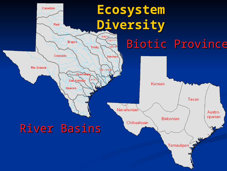
River BasinsRiver Basins
Biotic ProvincesBiotic Provinces
Ecosystem DiversityEcosystem Diversity


Summary of the State of KnowledgeSummary of the State of Knowledge
Develop Conceptual Model &Develop Conceptual Model &
Tie Knowledge to Flow ComponentsTie Knowledge to Flow Components
Identify and Prioritize Knowledge GapsIdentify and Prioritize Knowledge Gaps
Develop Prioritized Research AgendaDevelop Prioritized Research Agenda
Interdisciplinary EffortInterdisciplinary Effort
Study DesignStudy Design

Data Integration to Generate Flow Conditions
Reconnaissance andInformation Evaluation
Study Design
Multidisciplinary Data Collectionand Evaluation
Goal Development Consistent with Sound Ecological Environment
Stakeholder Input
Peer Review
Draft Study Report
Final Study Report
Next Steps: Implementation, Monitoring, and Adaptive Management
Stakeholder Input
Stakeholder Input
Stakeholder Input
Stakeholder Input
Peer Review
Peer ReviewSB2 ends
Post SB2
Steps in TIFP Sub-Basin StudiesSteps in TIFP Sub-Basin Studies

Temporal and keyword queryTemporal and keyword queryfish studies conducted 1950s-90sfish studies conducted 1950s-90s


Simple Simple Conceptual ModelConceptual Model
Base FlowsSubsistence Flows Overbank FlowsHigh Flow Pulses
Conserve biologicalfunction
Conserve biological /habitat diversity and
water quality
Life history /geomorphic processes
Floodplain maintenance
•Moisture and nutrients to floodplain•Riparian recruitment
•Water quality tolerances met•Key habitat thresholds maintained
•Habitat for flow dependent species•Bank storage/moisture•Suitable temperatures / dissolved oxygen
•Fish spawning cues•Maintain channel•Sediment/nutrient transport
Sound Ecological Environment
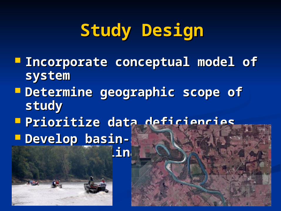
Study DesignStudy Design
Incorporate conceptual model of system Incorporate conceptual model of system Determine geographic scope of studyDetermine geographic scope of study Prioritize data deficienciesPrioritize data deficiencies Develop basin-specific interdisciplinary Develop basin-specific interdisciplinary
study plan study plan

Data Integration to Generate Flow Conditions
Reconnaissance andInformation Evaluation
Study Design
Multidisciplinary Data Collectionand Evaluation
Goal Development Consistent with Sound Ecological Environment
Stakeholder Input
Peer Review
Draft Study Report
Final Study Report
Next Steps: Implementation, Monitoring, and Adaptive Management
Stakeholder Input
Stakeholder Input
Stakeholder Input
Stakeholder Input
Peer Review
Peer ReviewSB2 ends
Post SB2
Steps in TIFP Sub-Basin StudiesSteps in TIFP Sub-Basin Studies

Primary DisciplinesPrimary Disciplines
Hydrology & HydraulicsHydrology & HydraulicsPhysical Processes Physical Processes (Geomorphology)(Geomorphology)
BiologyBiology Water QualityWater Quality
ConnectivityConnectivity

BiologyBiology
Examine integrity of biological Examine integrity of biological communitycommunity
Examine biodiversity within Examine biodiversity within ecosystemecosystem
Assess habitat-flow relationshipsAssess habitat-flow relationships

BiologyBiology
Habitat DiversityHabitat DiversityBiodiversityBiodiversity
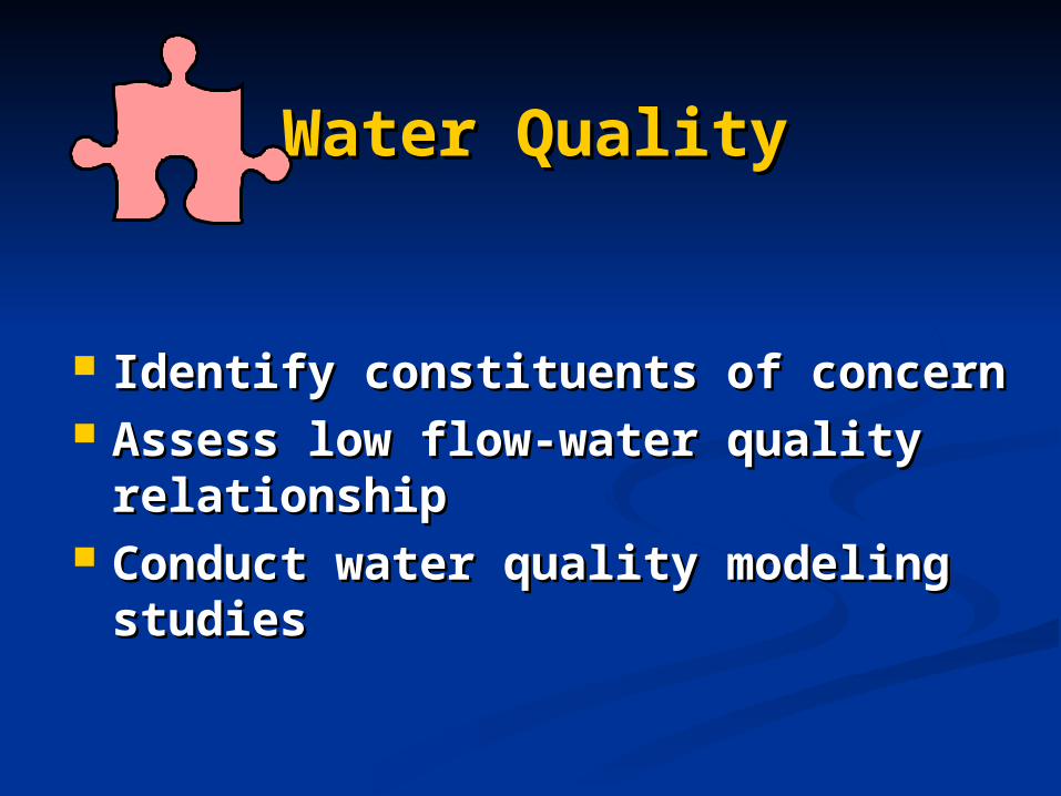
Water QualityWater Quality
Identify constituents of concernIdentify constituents of concern Assess low flow-water quality Assess low flow-water quality
relationshiprelationship Conduct water quality modeling studiesConduct water quality modeling studies

Water QualityWater Quality
Dissolved oxygenDissolved oxygen pHpH TemperatureTemperature Total dissolved solidsTotal dissolved solids Turbidity/clarityTurbidity/clarity NutrientsNutrients

Hydrology & HydraulicsHydrology & Hydraulics
Calculate flow statisticsCalculate flow statistics Describe Wet, Normal, & Dry conditionsDescribe Wet, Normal, & Dry conditions Model hydraulic characteristicsModel hydraulic characteristics
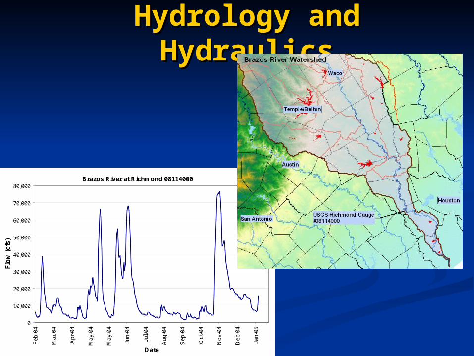
Hydrology and HydraulicsHydrology and Hydraulics
Brazos River at Richmond 08114000
0
10,000
20,000
30,000
40,000
50,000
60,000
70,000
80,000
Feb
-04
Mar
-04
Apr
-04
May
-04
May
-04
Jun-
04
Jul-0
4
Aug
-04
Sep
-04
Oct
-04
Nov
-04
Dec
-04
Jan-
05
Date
Flo
w (
cfs)

Hydraulic and Habitat ModelingHydraulic and Habitat Modeling
Habitat changes with flowHabitat changes with flow

Habitat Habitat ModelingModeling

Habitat Habitat ModelingModeling
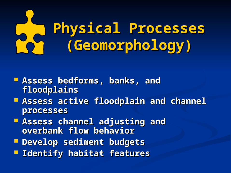
Physical Processes Physical Processes (Geomorphology)(Geomorphology)
Assess bedforms, banks, and floodplainsAssess bedforms, banks, and floodplains Assess active floodplain and channel Assess active floodplain and channel
processesprocesses Assess channel adjusting and overbank Assess channel adjusting and overbank
flow behaviorflow behavior Develop sediment budgetsDevelop sediment budgets Identify habitat featuresIdentify habitat features

River Styles HierarchyRiver Styles HierarchyWatershedWatershed Watershed area determined by drainage divide. Determines Watershed area determined by drainage divide. Determines
the boundary conditions within which rivers operate.the boundary conditions within which rivers operate.
Geomorphic UnitGeomorphic Unit Instream and floodplain landforms (pools, bars, levees, Instream and floodplain landforms (pools, bars, levees, backwaters, etc.) that reflect distinct form-process associations. backwaters, etc.) that reflect distinct form-process associations.
River StyleRiver Style Length of channel with a characteristic assemblage of Length of channel with a characteristic assemblage of geomorphic units. geomorphic units.
Landscape UnitLandscape Unit Topographic unit determined on the basis of local relief, Topographic unit determined on the basis of local relief, valley slope and morphology. Defines the valley-setting.valley slope and morphology. Defines the valley-setting.
Hydraulic UnitHydraulic Unit Uniform patches of flow and substrate material within a Uniform patches of flow and substrate material within a geomorphic unit. geomorphic unit.
MicrohabitatMicrohabitat Individual elements (e.g., logs, rocks, gravel patches) within a Individual elements (e.g., logs, rocks, gravel patches) within a stream. stream.

Kilometers0 100 200 300 400
Watershed Namoi River Basin, New South Wales

Watershed
LandscapeUnit
Namoi River Basin, New South Wales
Kilometers0 1005025
Legend – Landscape Units
Rugged metasediments
Rugged volcanics
Uplands
Pillaga outwash
Pillaga
Mid to lower Peel
Lowland plains
Liverpool plains

Middle NamoiSub-basin
Watershed
LandscapeUnit
River Style
Kilometers0 5025

Channel and Valley Width
Channel Slope
Valley Cross Section
Planform
Uplands Escarpment Base of the Escarpment Rounded Foothills Lowland Plain
LandscapeUnit
River StyleHead-water
GorgeFan
Cut & Fill (Incised)
Cut & Fill (Intact)
Vertically Accreated Floodplain
ThroughputFloodout
Transfer
Floodplain Accumulation
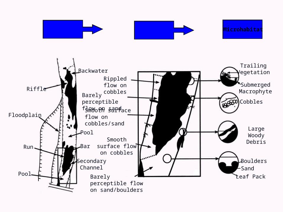
GeomorphicUnit
HydraulicUnit
Microhabitat
Riffle
Floodplain
Run
Pool
Bar
Secondary Channel
Pool
BackwaterTrailing
Vegetation
Submerged Macrophyte
Cobbles
Large Woody Debris
BouldersSand
Leaf Pack
Rippled flow on cobbles
Smooth surface flow on cobbles
Smooth surface flow on cobbles/sand
Barely perceptible flow on sand/boulders
Barely perceptible flow on sand

ConnectivityConnectivity
Hydrologic connectivity Hydrologic connectivity Upstream to downUpstream to down Channel to floodplainChannel to floodplain
Groundwater/surface water interactionsGroundwater/surface water interactions

Data Integration to Generate Flow Conditions
Reconnaissance andInformation Evaluation
Study Design
Multidisciplinary Data Collectionand Evaluation
Goal Development Consistent with Sound Ecological Environment
Stakeholder Input
Peer Review
Draft Study Report
Final Study Report
Next Steps: Implementation, Monitoring, and Adaptive Management
Stakeholder Input
Stakeholder Input
Stakeholder Input
Stakeholder Input
Peer Review
Peer ReviewSB2 ends
Post SB2
Steps in TIFP Sub-Basin StudiesSteps in TIFP Sub-Basin Studies
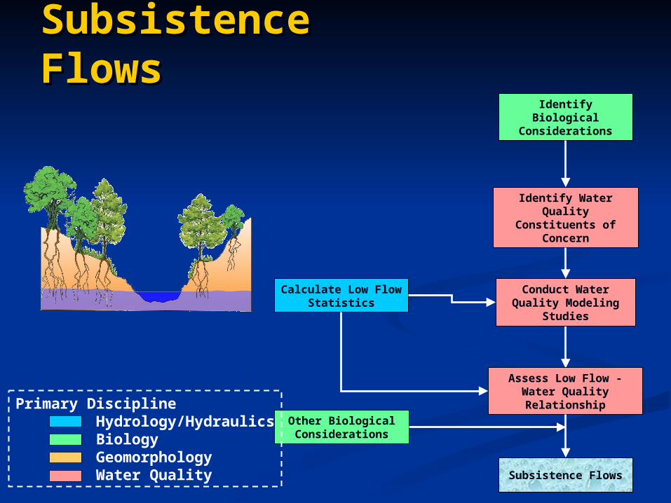
Identify Biological Considerations
Calculate Low Flow Statistics
Identify Water Quality Constituents of Concern
Conduct Water Quality Modeling Studies
Assess Low Flow - Water Quality Relationship
Subsistence Flows
Other Biological Considerations
Primary Discipline Hydrology/Hydraulics Biology Geomorphology Water Quality
Subsistence FlowsSubsistence Flows

Assess Bedform and Banks
Model Hydraulic Characteristics in Relation to Flow
Determine Habitat Criteria
Describe Wet, Normal, and Dry Years
Calculate Base Flow Statistics
Collect Biological Data
Assess Habitat-Flow Relationships,
including Diversity
Consider Water Quality Issues
Consider Biological and Riparian Issues
Base Flows
Identify Biological Issues and Key Species
Base FlowsBase Flows
Primary Discipline Hydrology/Hydraulics Biology Geomorphology Water Quality

Assess Active Channel Processes
Develop Sediment Budgets
Assess Channel Adjusting Flow Behavior
High Flow Pulses
Calculate High Flow Statistics
Consider Water Quality Issues
Consider Biological Issues
Describe Significant Habitat Conditions
High Flow PulsesHigh Flow Pulses
Primary Discipline Hydrology/Hydraulics Biology Geomorphology Water Quality

Assess Overbank Flow Behavior
Overbank Flows
Model Extent of Flood Events
Conduct Riparian Studies
Consider Biological Issues
Estimate Riparian Requirements
Consider Water Quality Issues
Calculate Flood Frequency Statistics
Assess Active Floodplain and Channel Processes
Overbank FlowsOverbank Flows
Primary Discipline Hydrology/Hydraulics Biology Geomorphology Water Quality

Integration to GenerateIntegration to Generatea Flow Regimea Flow Regime

Integration of Flow ComponentsIntegration of Flow Components
OverbankFlows
High FlowPulses
BaseFlows
SubsistenceFlows
JAN FEB MAR APR MAY JUN JUL AUG SEP OCT NOV DEC
35 - 55 cfsMaintain water quality (35 cfs) and key habitats in May (55 cfs)
40-50 cfsFish habitat
90-100 cfsFish habitat
150-300 cfsSpring spawning
100-150 cfsFish habitat
300-450 cfsmaintain biodiversity and longitudinal connectivity
700-1500 cfs for 2-3 days2-3 X per year every year
Sediment transportLateral connectivity
Fish spawning
1800 cfs for 2 days1 X per yr every other year“Big River fish” spawningbetween Jul 15 - Aug 15
4,000-10,000 cfs for 2-3 daysOnce every 3-5 yearsChannel Maintenance
Riparian Connectivity, Seed dispersalFlooplain habitat
Wet year Average year Dry year
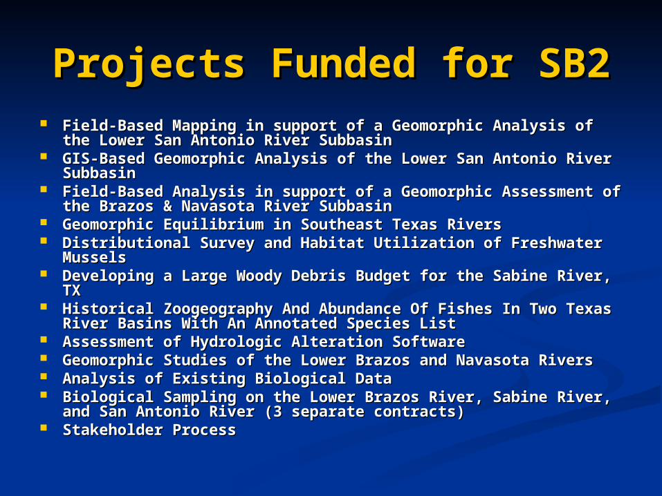
Projects Funded for SB2Projects Funded for SB2 Field-Based Mapping in support of a Geomorphic Analysis of the Field-Based Mapping in support of a Geomorphic Analysis of the
Lower San Antonio River Subbasin Lower San Antonio River Subbasin GIS-Based Geomorphic Analysis of the Lower San Antonio River GIS-Based Geomorphic Analysis of the Lower San Antonio River
SubbasinSubbasin Field-Based Analysis in support of a Geomorphic Assessment of the Field-Based Analysis in support of a Geomorphic Assessment of the
Brazos & Navasota River SubbasinBrazos & Navasota River Subbasin Geomorphic Equilibrium in Southeast Texas RiversGeomorphic Equilibrium in Southeast Texas Rivers Distributional Survey and Habitat Utilization of Freshwater MusselsDistributional Survey and Habitat Utilization of Freshwater Mussels Developing a Large Woody Debris Budget for the Sabine River, TXDeveloping a Large Woody Debris Budget for the Sabine River, TX Historical Zoogeography And Abundance Of Fishes In Two Texas River Historical Zoogeography And Abundance Of Fishes In Two Texas River
Basins With An Annotated Species ListBasins With An Annotated Species List Assessment of Hydrologic Alteration SoftwareAssessment of Hydrologic Alteration Software Geomorphic Studies of the Lower Brazos and Navasota RiversGeomorphic Studies of the Lower Brazos and Navasota Rivers Analysis of Existing Biological DataAnalysis of Existing Biological Data Biological Sampling on the Lower Brazos River, Sabine River, and San Biological Sampling on the Lower Brazos River, Sabine River, and San
Antonio River (3 separate contracts)Antonio River (3 separate contracts) Stakeholder ProcessStakeholder Process

Additional Questions & CommentsAdditional Questions & Comments
Contact:Contact: Wendy Gordon, TCEQ, 512-239-4174Wendy Gordon, TCEQ, 512-239-4174
[email protected]@tceq.state.tx.us Kevin Mayes, TPWD, 512-754-6844, ext. 25Kevin Mayes, TPWD, 512-754-6844, ext. 25
[email protected]@tpwd.state.tx.us Mark Wentzel, TWDB, 512-936-0823Mark Wentzel, TWDB, 512-936-0823
[email protected]@twdb.state.tx.us
http://www.twdb.state.tx.us/instreamflowshttp://www.twdb.state.tx.us/instreamflows/index.html/index.html
Recommended