TABLET BASED GIS SYSTEM FOR STREAMLINED COMPLIANCE WORKFLOW
Whitney Oswald, Patrick Barickman; Utah Department of Environmental Quality
2017 Exchange Network National MeetingInnovation and Partnership
May 15-18, 2017Sheraton Philadelphia Society Hill Hotel
Philadelphia, Pennsylvania
#EN2017http://www.exchangenetwork.net/en2017
ABSTRACTUtah DEQ completed a beta version of a 2015 EN grant project developing a general platform architecture for tablet-based field collection of environmental data. The application provides UDEQ’s air quality inspectors an integrated system for accessing, gathering, and editing compliance data while in remote field locations. It also enables quick on the spot decision making through the use of spatial data and GIS feature layers. In my presentation I will give an update of our progress on the project, and discuss how our exploration of solutions may be useful for similar projects being developed by other organizations.
2

3
• 16,715 producing and shut-in wells in 2015
• 4,580 on State Jurisdiction
• 3 Dedicated O&G Inspectors– Efficiency is KEY
Oil and Gas Wells in Utah

Compliance: In the Field
4
GO FROM THIS TO THIS• Attach electronic documents
as needed to features– Linked to our compliance
records database (Documentum)
– Can also use file browser
• No need to print paper documents
• Take notes and markup with: stylus, finger, voice-to-text, keyboard
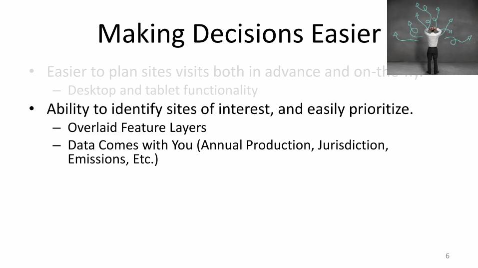
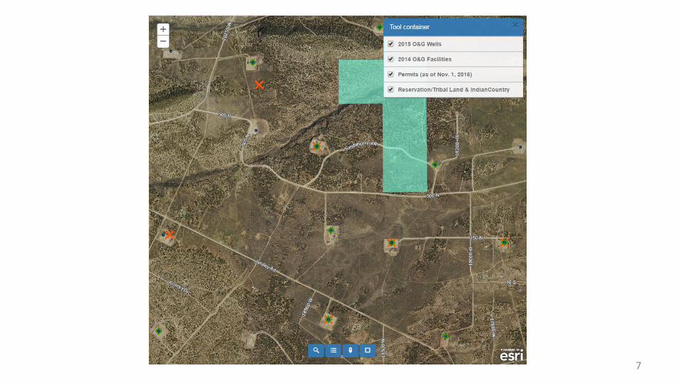
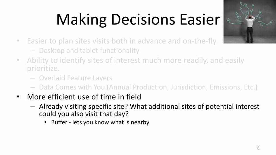
Making Decisions Easier• Easier to plan sites visits both in advance and on-the-fly.
– Desktop and tablet functionality
• Ability to identify sites of interest much more readily, and easily prioritize.– Overlaid Feature Layers– Data Comes with You (Annual Production, Jurisdiction, Emissions, Etc.)
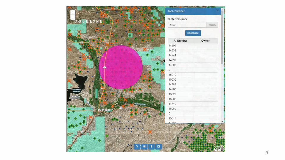
• More efficient use of time in field– Already visiting specific site? What additional sites of potential interest
could you also visit that day?• Buffer - lets you know what is nearby
5
Making Decisions Easier• Easier to plan sites visits both in advance and on-the-fly.
– Desktop and tablet functionality
• Ability to identify sites of interest, and easily prioritize.– Overlaid Feature Layers– Data Comes with You (Annual Production, Jurisdiction,
Emissions, Etc.)
• More efficient use of time in field– Already visiting specific site? What additional sites of potential
interest could you also visit that day?• Buffer - lets you know what is nearby
6
7
Making Decisions Easier• Easier to plan sites visits both in advance and on-the-fly.
– Desktop and tablet functionality
• Ability to identify sites of interest much more readily, and easily prioritize.– Overlaid Feature Layers– Data Comes with You (Annual Production, Jurisdiction, Emissions, Etc.)
• More efficient use of time in field– Already visiting specific site? What additional sites of potential interest
could you also visit that day?• Buffer - lets you know what is nearby
8
9
Application Needs• Offline Use
– Editing– Cached Basemaps
• Directions and Routing• Buffers• Access to Documents• Ability to Add Attachments (Images or Videos)• Queries
10
Stumbling Blocks• Stuck with ESRI Collector for offline solution
– Cons: somewhat buggy and closed system– Pros: Maps are still on AGOL platform, seems better than other options for our
needs
• Routing – supported in Collector (Navigator) need a subscription. Otherwise step-by-step written directions.
• Queries limited by Feature Layers
• Edited documents can only be attached as image files through Collector
11

Stumbling Blocks• Stuck with ESRI Collector for offline solution
– Cons: somewhat buggy and closed system– Pros: Maps are still on AGOL platform, seems better than other
options for our needs• Routing – supported in Collector (Navigator) need a subscription.
Otherwise step-by-step written directions.
• Queries limited by Feature Layers
• Edited documents can only be attached as image files through Collector
12
Stumbling Blocks• Stuck with ESRI Collector for offline solution
– Cons: somewhat buggy and closed system– Pros: Maps are still on AGOL platform, seems better than other
options for our needs• Routing – supported in Collector (Navigator) need a subscription.
Otherwise step-by-step written directions.• Queries limited by Feature Layers
• Queries limited by Feature Layers
• Edited documents can only be attached as image files through Collector
13
Stumbling Blocks• Stuck with ESRI Collector for offline solution
– Cons: somewhat buggy and closed system– Pros: Maps are still on AGOL platform, seems better than other
options for our needs• Routing – supported in Collector (Navigator) need a subscription.
Otherwise step-by-step written directions.• Queries limited by Feature Layers• Edited documents can only be attached as image files through Collectorcan only be attached as image files through Collector
14
Stumbling Blocks• Stuck with ESRI Collector for offline solution
– Cons: somewhat buggy and closed system– Pros: Maps are still on AGOL platform, seems better than other
options for our needs• Routing – supported in Collector (Navigator) need a subscription.
Otherwise step-by-step written directions.• Queries limited by Feature Layers• Edited documents can only be attached as image files through Collector• Number of results restrictedattached as image files through Collector
15
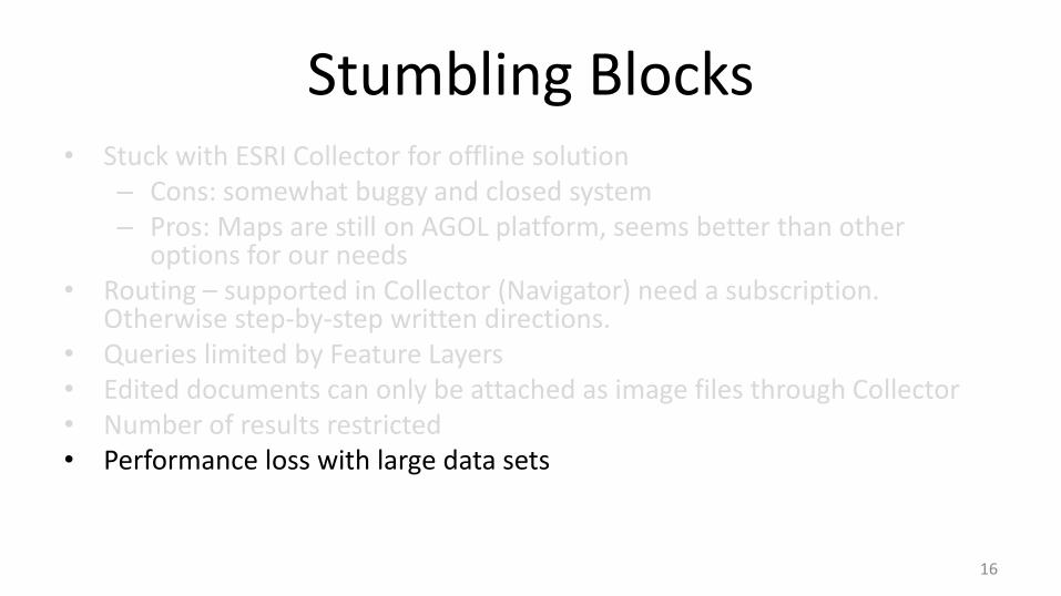
Stumbling Blocks• Stuck with ESRI Collector for offline solution
– Cons: somewhat buggy and closed system– Pros: Maps are still on AGOL platform, seems better than other
options for our needs• Routing – supported in Collector (Navigator) need a subscription.
Otherwise step-by-step written directions.• Queries limited by Feature Layers• Edited documents can only be attached as image files through Collector• Number of results restricted• Performance loss with large data sets
16
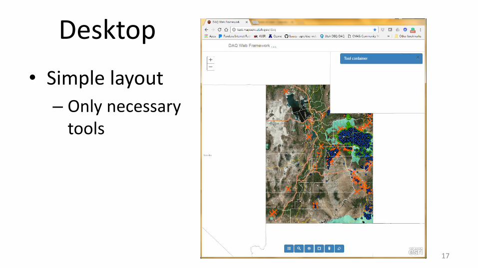
• Simple layout
– Only necessary tools
17
Desktop
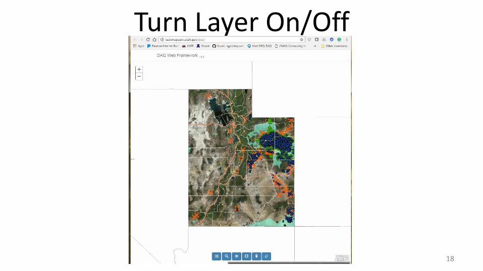
Turn Layer On/Off
18

Query Layers
19

Buffer
20

Section/Township/Range Search
21
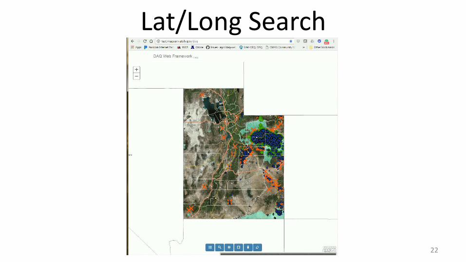
Lat/Long Search
22

Bookmarks
23
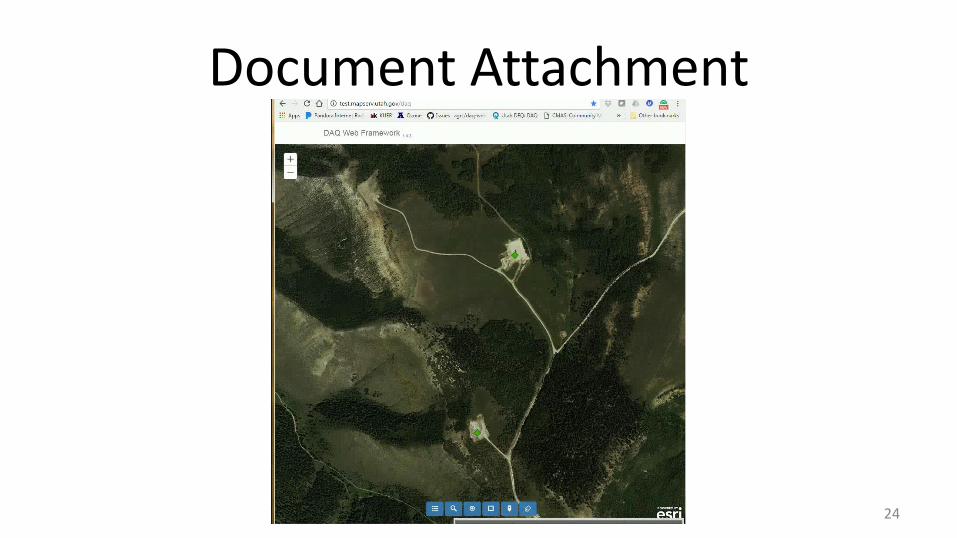
Document Attachment
24
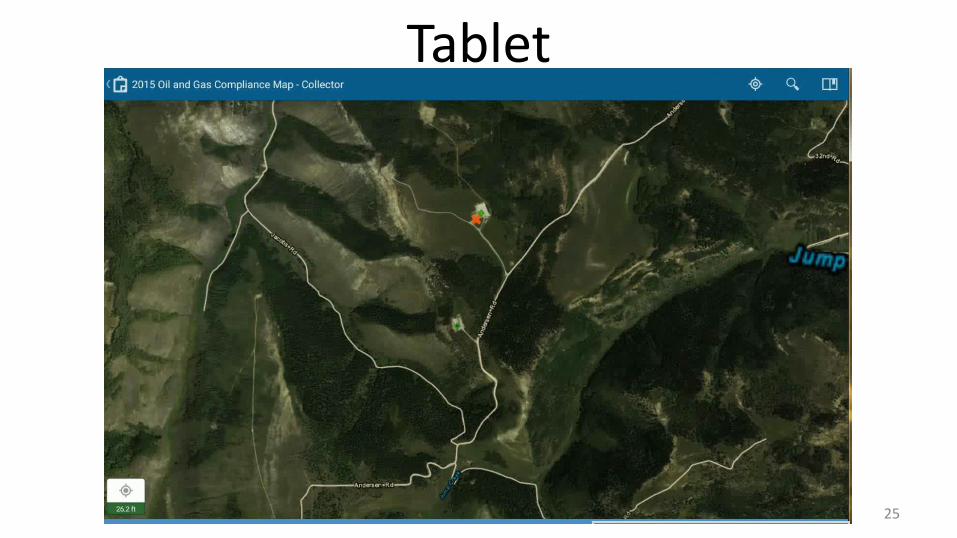
Tablet
25

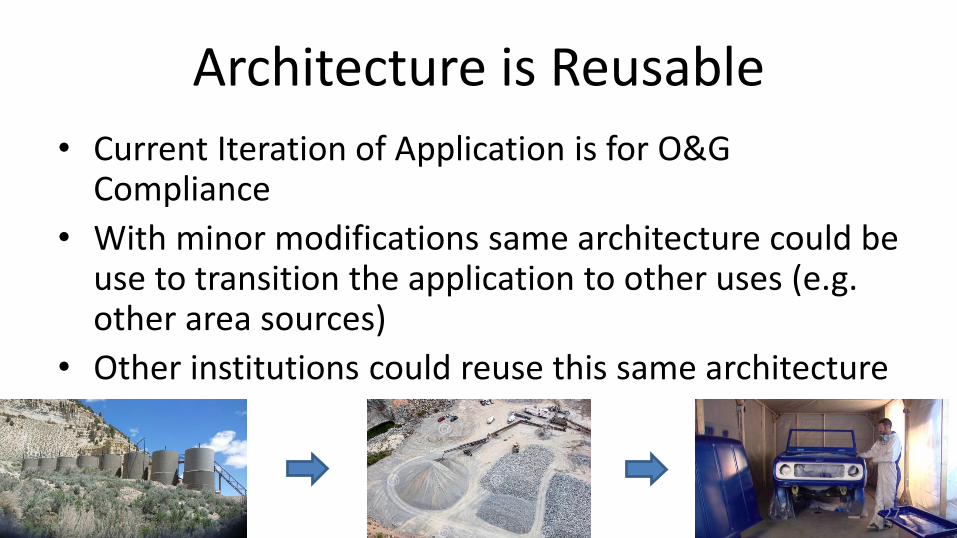
Architecture is Reusable
• Current Iteration of Application is for O&G Compliance
• With minor modifications same architecture could be use to transition the application to other uses (e.g. other area sources)
• Other institutions could reuse this same architecture
26
Architecture is Reusable
• Current Iteration of Application is for O&G Compliance
• With minor modifications same architecture could be use to transition the application to other uses (e.g. other area sources)
• Other institutions could reuse this same architecture
27
Questions?
• Whitney Oswald: [email protected]
• Patrick Barickman: [email protected]
• Thanks to:
– Matt Peters and Steve Gourley, AGRC
28
Recommended