Summary of relevant works
Fabián Santos
05.06.2014
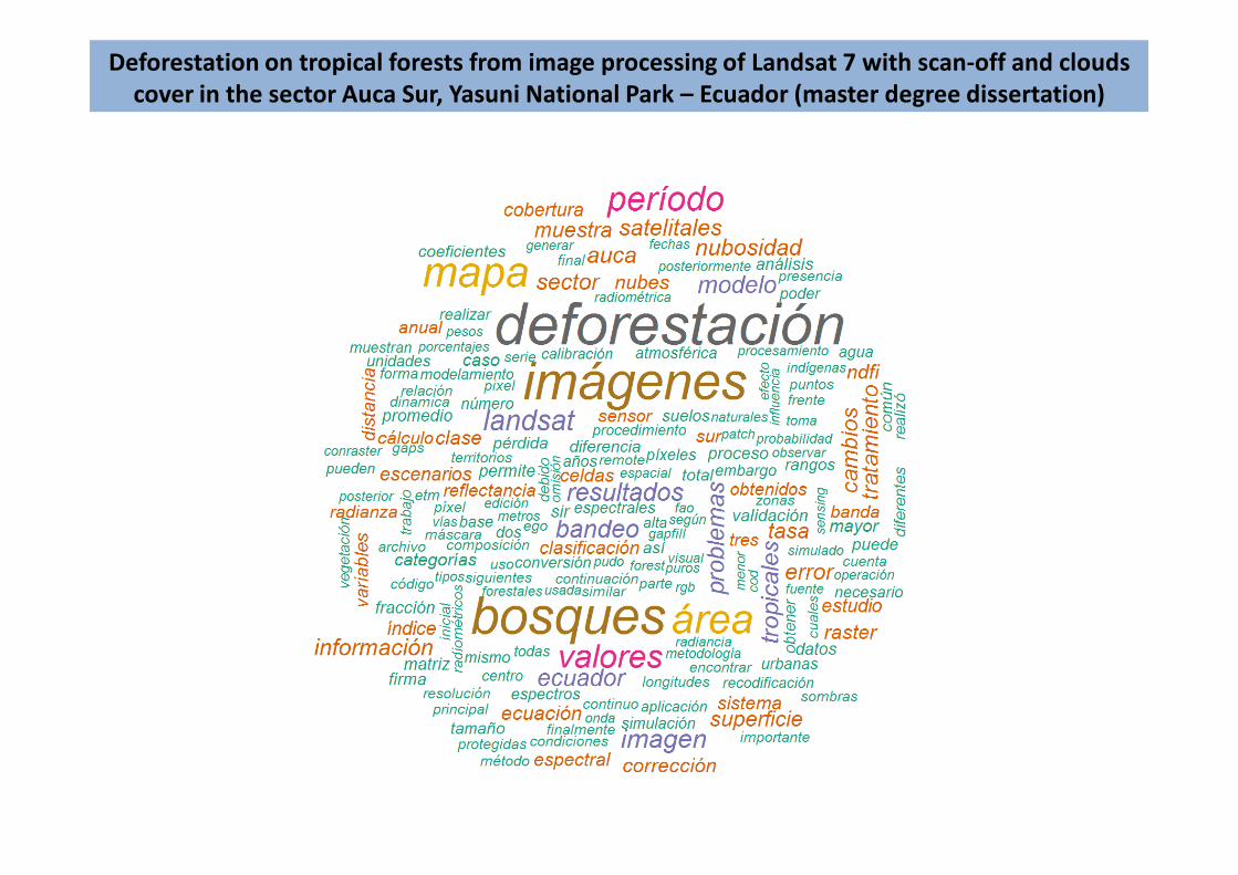
Deforestation on tropical forests from image processing of Landsat 7 with scan-off and clouds
cover in the sector Auca Sur, Yasuni National Park – Ecuador (master degree dissertation)
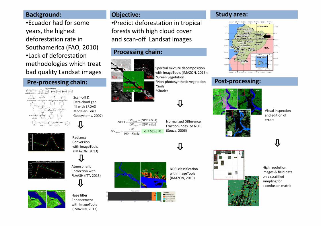
Background:
•Ecuador had for some
years, the highest
deforestation rate in
Southamerica (FAO, 2010)
•Lack of deforestation
methodologies which treat
bad quality Landsat images
Objective:
•Predict deforestation in tropical
forests with high cloud cover
and scan-off Landsat images
Study area:
Pre-processing chain:
Processing chain:
Soil – GV – NPV
R – G – B
Scan-off &
Data cloud gap
fill with ERDAS
Modeler (Leica
Post-processing:
Visual inspection
and edition of
Spectral mixture decomposition
with ImageTools (IMAZON, 2013):
*Green vegetation
*Non-photosynthetic vegetation
*Soils
*Shades
Radiance
Conversion
with ImageTools
(IMAZON, 2013)
Atmospheric
Correction with
FLAASH (ITT, 2013)
Normalized Difference
Fraction Index or NDFI
(Souza, 2006)
Modeler (Leica
Geosystems, 2007)
Haze filter
Enhancement
with ImageTools
(IMAZON, 2013)
NDFI classification
with ImageTools
(IMAZON, 2013)
and edition of
errors
High resolution
images & field data
on a stratified
sampling for
a confusion matrix
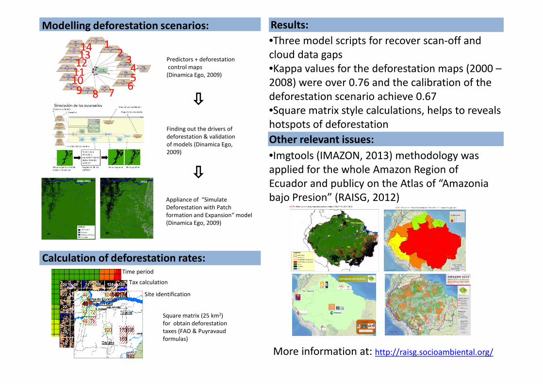
Modelling deforestation scenarios:
12
345
6789
1011121314
Finding out the drivers of
deforestation & validation
of models (Dinamica Ego,
2009)
Predictors + deforestation
control maps
(Dinamica Ego, 2009)
Results:
•Three model scripts for recover scan-off and
cloud data gaps
•Kappa values for the deforestation maps (2000 –
2008) were over 0.76 and the calibration of the
deforestation scenario achieve 0.67
•Square matrix style calculations, helps to reveals
hotspots of deforestation
Other relevant issues:
•Imgtools (IMAZON, 2013) methodology was
applied for the whole Amazon Region of
Ecuador and publicy on the Atlas of “Amazonia
bajo Presion” (RAISG, 2012)
Calculation of deforestation rates:
Appliance of “Simulate
Deforestation with Patch
formation and Expansion“ model
(Dinamica Ego, 2009)
Square matrix (25 km2)
for obtain deforestation
taxes (FAO & Puyravaud
formulas)
More information at: http://raisg.socioambiental.org/
bajo Presion” (RAISG, 2012)
Time period
Tax calculation
Site identification
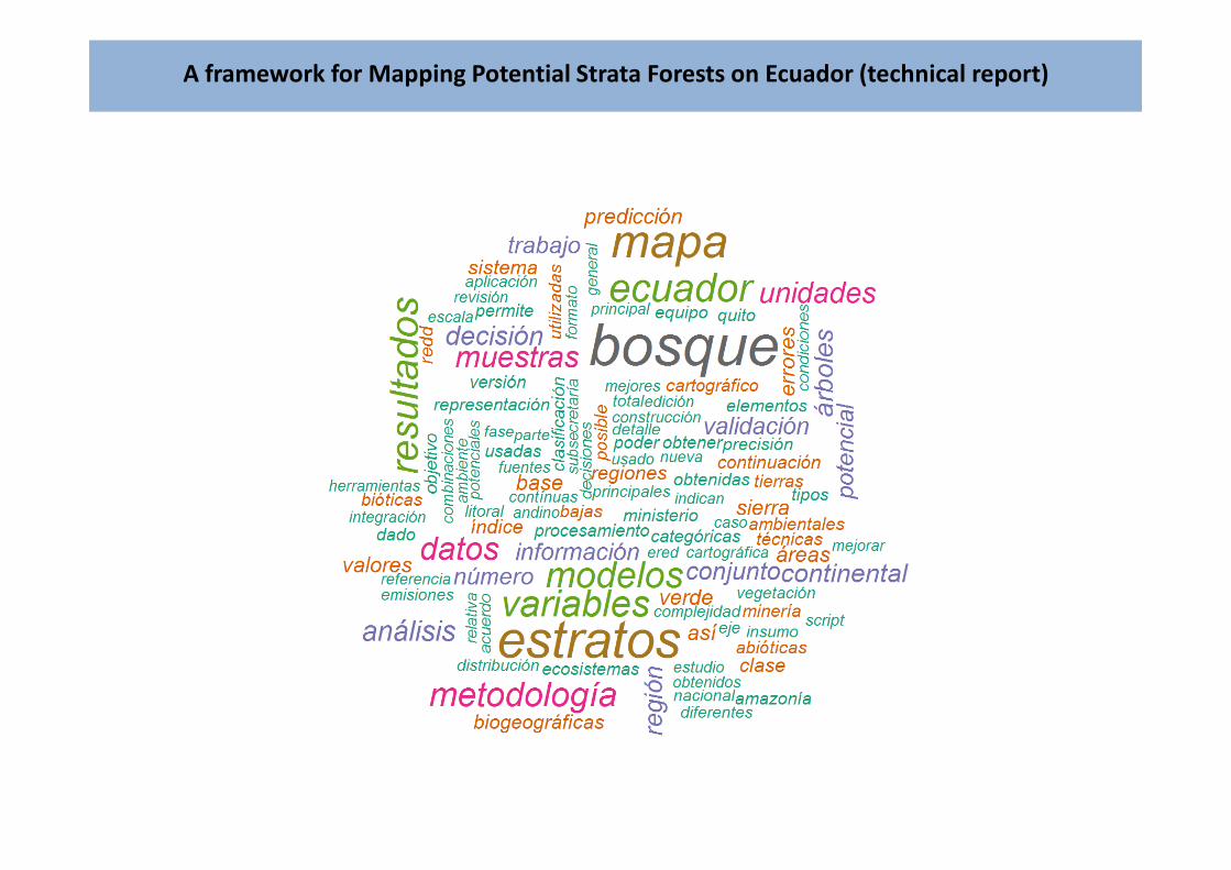
A framework for Mapping Potential Strata Forests on Ecuador (technical report)
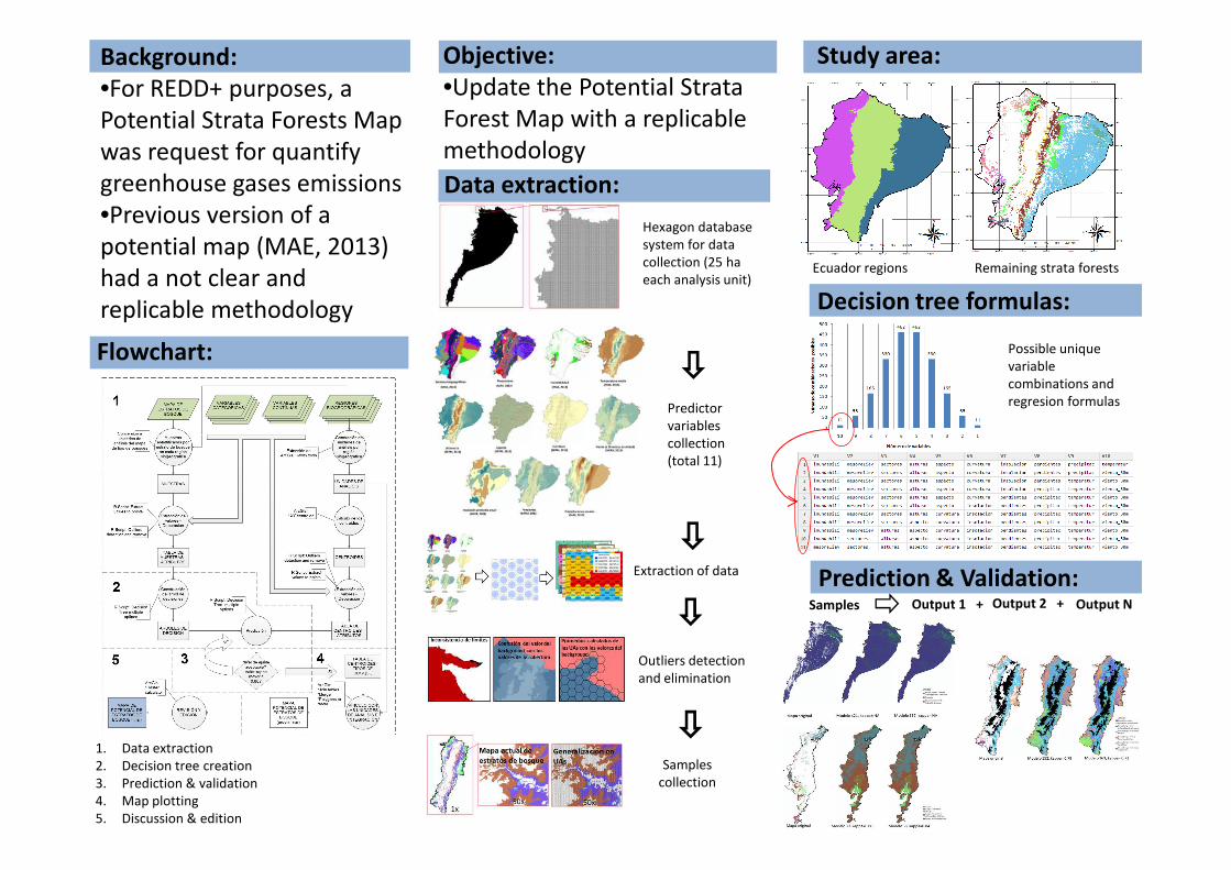
Background:
•For REDD+ purposes, a
Potential Strata Forests Map
was request for quantify
greenhouse gases emissions
•Previous version of a
potential map (MAE, 2013)
had a not clear and
replicable methodology
Objective:
•Update the Potential Strata
Forest Map with a replicable
methodology
Study area:
Flowchart:
Decision tree formulas:
Predictor
variables
collection
Hexagon database
system for data
collection (25 ha
each analysis unit)
Possible unique
variable
combinations and
regresion formulas
Data extraction:
Ecuador regions Remaining strata forests
collection
(total 11)
Extraction of data
Outliers detection
and elimination
Samples
collection
Samples Output 1 + Output 2 +
1. Data extraction
2. Decision tree creation
3. Prediction & validation
4. Map plotting
5. Discussion & edition
Output N
Prediction & Validation:
Results:
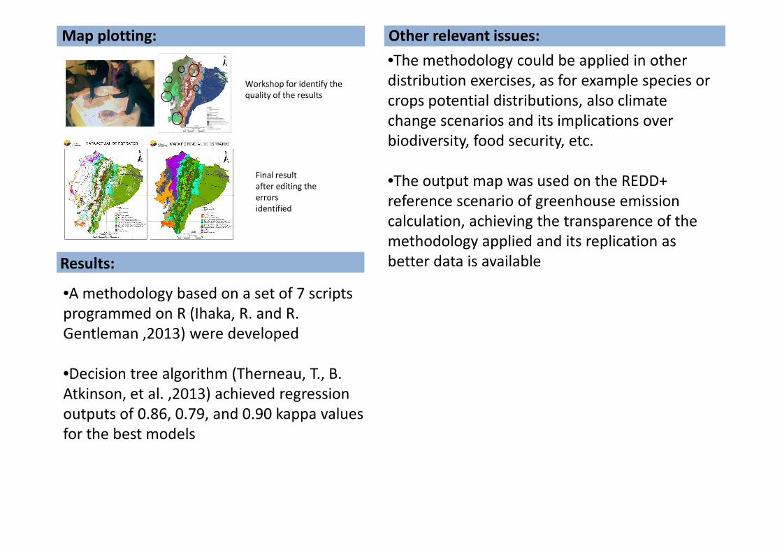
Map plotting:
Final result
after editing the
errors
identified
Workshop for identify the
quality of the results
Other relevant issues:
•The methodology could be applied in other
distribution exercises, as for example species or
crops potential distributions, also climate
change scenarios and its implications over
biodiversity, food security, etc.
•The output map was used on the REDD+
reference scenario of greenhouse emission
calculation, achieving the transparence of the
methodology applied and its replication as
better data is available
•A methodology based on a set of 7 scripts
programmed on R (Ihaka, R. and R.
Gentleman ,2013) were developed
•Decision tree algorithm (Therneau, T., B.
Atkinson, et al. ,2013) achieved regression
outputs of 0.86, 0.79, and 0.90 kappa values
for the best models
Acknowledgments
References
•Dinamica Ego (2009). Dinamica EGO. 1.6 ed. Minas Gerais - Brazil, Centro de Sensoriamento Remoto, Universidade Federal
de Minas Gerais.
•FAO (2010)."Global Forest Resources Assessment 2010.Progress towards sustainable forest management. Global
tables.".Retrieved 10/07/2013, 2013, from http://www.fao.org/forestry/fra/fra2010/en/.
•Ihaka, R. and R. Gentleman (2013). "The R Project for Statistical Computing." 3.0.1. from http://www.r-project.org/.
•IMAZON (2010). Imgtools - Monitoramento da Amazônia
•ITT Visual Information Solutions (2009). ENVI 4.6 ed.
•Leica Goesystems (2007). ERDAS IMAGINE 9.2 ed.
•MAE (2013). Representación Cartográfica de los Estratos de Bosque del Ecuador Continental. Subsecretaría de Patrimonio
Natural. Quito - Ecuador, Ministerio del Ambiente del Ecuador (MAE).
•RAISG (2012). Amazonía Bajo Presión. A. Rolla, B. Ricardo, D. Larrea, J. Ulloa and N. Hernández. Sao Paulo - Brasil.
•Souza, C., D. Roberts, et al. (2005). Combining spectral and spatial information to map canopy damage from selective
logging and forest fires. Remote Sensing of Enviroment 98 (2005) - ELSEVIER, 15.
•Therneau, T., B. Atkinson, et al. (2013). "rpart: Recursive Partitioning." from http://cran.r-
project.org/web/packages/rpart/index.html.
Recommended