SM-16, U.S.S. Tulip Monument St. Mary's County Capsule Summary
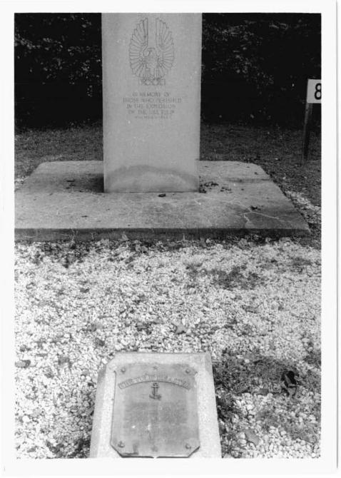
The U.S.S. Tulip Monument marks a small cemetery on St. Inigoes Creek accessed by a grassy lane off Cross Manor Road just outside the gate of Cross Manor in St. Inigoes. The light gray granite stele type monument stands approximately 7' high on a concrete pad. The front of the monument is embellished with an incised design of a stylized eagle. An interpretive bronze shield mounted on a low concrete plinth is set into a gravel-paved area on the ground in front of the monument.
The U.S.S. Tulip Monument is associated with the fourth rate gunboat assigned to the Potomac Flotilla Base at Cross Manor on St. Inigoes Creek during the Civil War, and commemorates the crew who lost their lives in the explosion of the starboard boiler and sinking of the vessel, eight of whom were buried on the Flotilla Base grounds. Tulip is more significant for its role in the changing technology of American warships than for its engagements, marking the period when steam engines overtook sail power, and specifically the development of screw steam vessels. The burial site was purchased by the U.S. government in 1939 and the monument was erected on June 15, 1940 per act of Congress of June 15, 1937.

-
-
Maryland Historical Trust Maryland Inventory of Historic Properties Form
Inventory No. SM-16
1. Name of Property (indicate preferred name)
historic U.S.S. Tulip Monument
other
2. Location street and number Cross Manor Road not for publication
city, town St. Inigoes _ vicinity
county St. Macy's County
3. Owner of Property (give names and mailing addresses of all owners)
name Naval Air Station (Point of Contact: Doug Lister)
street and number 22268 Cedar Point Road telephone 301-342-3670
city, town Patuxent River state MD zip code 20670
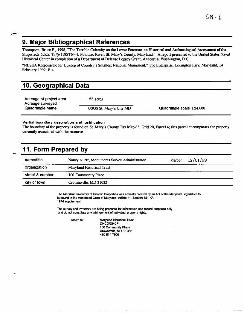
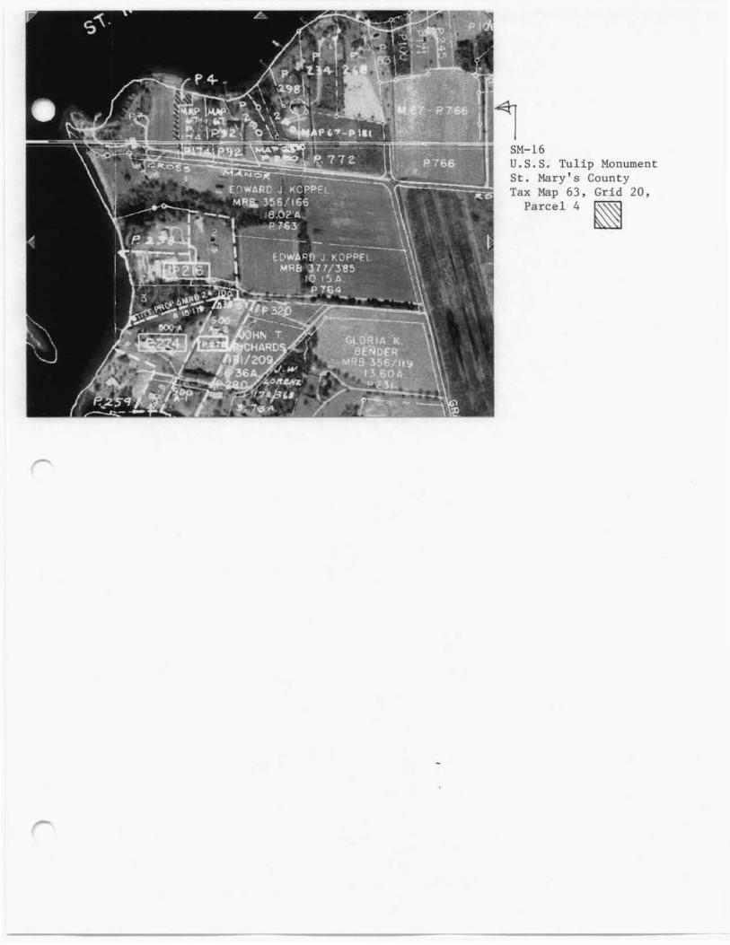
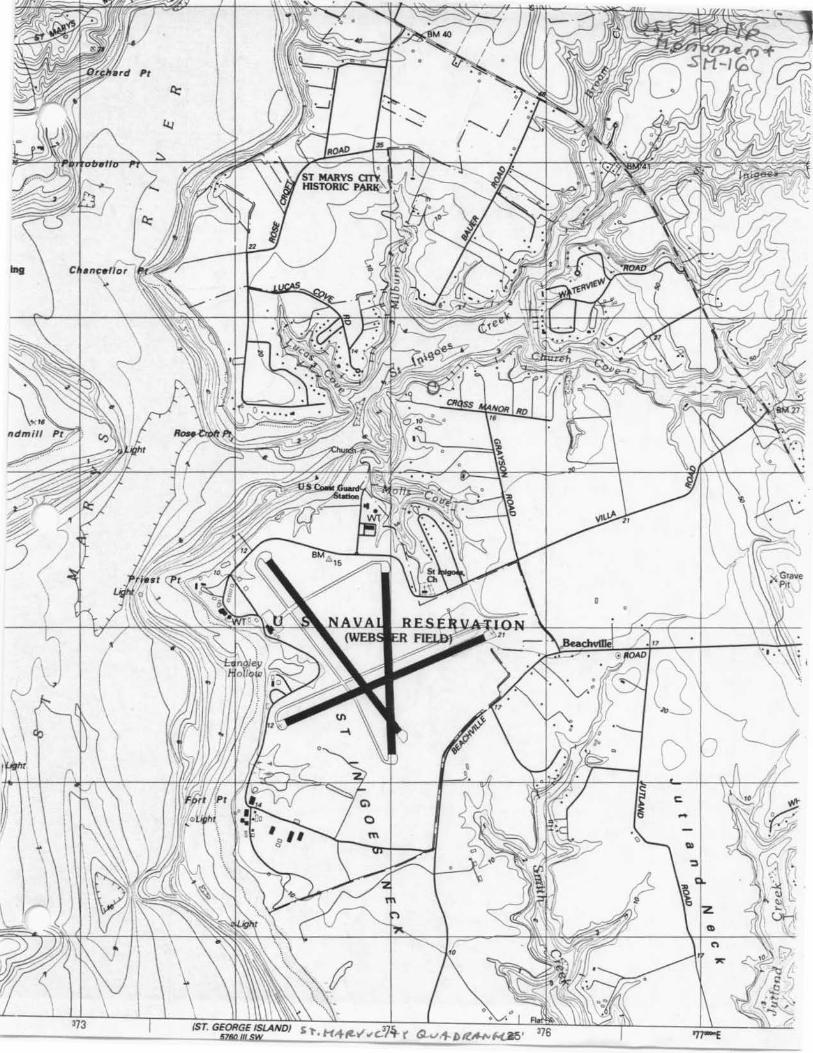
4. Location of Legal Description courthouse, registry of deeds, etc. St. Macy's County Courthouse tax map and parcel Map 63, Grid 20, Parcel 4
city, town Leonardtown
5. Primary Location of Additional Data ___ Contributing Resource in National Register District ___ Contributing Resource in Local Historic District ___ Determined Eligible for the National Register/Maryland Register ___ Determined Ineligible for the National Register/Maryland Register ___ Recorded by HASS/HAER --"x'-- Historic Structure Report or Research Report at MHT ___ other: __
6. Classification
Current Function __ agriculture __ landscape
liber
Category __ district __ building(s) __ structure __ site
Ownership _x_public __ private __ both
__ commerce/trade __ recreation/culture __ defense __ religion __ domestic __ social
_x_object __ education __ transportation _x _funerary __ work in progress __ government __ unknown __ health care vacant/not in use __ industry __ other.
folio
Resource Count Contributing
2
Noncontributing ___ buildings ___ sites ___ structures ____ objects ____ Total
Number of Contributing Resources previously listed in the Inventory
7. Description
Condition
excellent
.K.._ good
fair
deteriorated
ruins
altered
Inventory No. SM-16
Prepare both a one paragraph summary and a comprehensive description of the resource and its various elements as it exists today.
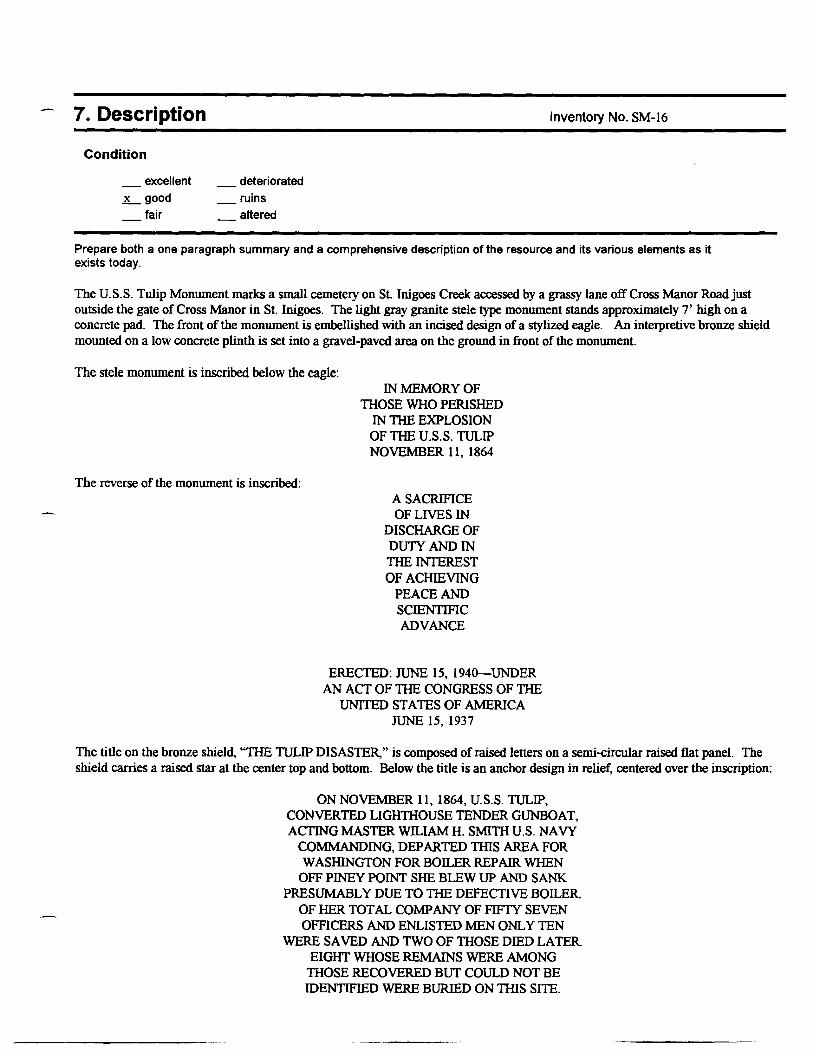
The U.S.S. Tulip Monument marks a small cemetery on St. lnigoes Creek accessed by a grassy lane off Cross Manor Road just outside the gate of Cross Manor in St. Inigoes. The light gray granite stele type monument stands approximately 7' high on a concrete pad. The front of the monument is embellished with an incised design of a stylized eagle. An interpretive bronze shield mounted on a low concrete plinth is set into a gravel-paved area on the ground in front of the monument.
The stele monument is inscribed below the eagle:
The reverse of the monument is inscribed:
IN MEMORY OF THOSE WHO PERISHED
IN THE EXPLOSION OF THE U.S.S. TULIP NOVEMBER 11, 1864
A SACRIFICE OF LIVES IN
DISCHARGE OF DUTY AND IN THE INTEREST OF ACIIlEVING
PEACE AND SCIENTIFIC ADVANCE
ERECTED: JUNE 15, 1940-UNDER AN ACT OF THE CONGRESS OF THE
UNITED ST A TES OF AMERICA JUNE 15, 1937
The title on the bronze shield, "THE TULIP DISASTER," is composed of raised letters on a semi-circular raised flat panel. The shield carries a raised star at the center top and bottom. Below the title is an anchor design in relief, centered over the inscription:
ON NOVEMBER 11, 1864, U.S.S. TULIP, CONVERTED LIGHTHOUSE TENDER GUNBOAT, ACTING MASTER WILIAM H. SMITH U.S. NA VY
COMMANDING, DEPARTED THIS AREA FOR WASHINGTON FOR BOILER REPAIR WHEN
OFF PINEY POINT SHE BLEW UP AND SANK PRESUMABLY DUE TO THE DEFECTIVE BOILER
OF HER TOT AL COMPANY OF FIFTY SEVEN OFFICERS AND ENLISTED MEN ONLY TEN
WERE SAVED AND TWO OF THOSE DIED LATER EIGHT WHOSE REMAINS WERE AMONG
THOSE RECOVERED BUT COULD NOT BE IDENTIFIED WERE BURIED ON THIS SITE.
8. Significance
Period
1600-1699 1700-1799 1800-1899
~1900-1999
2000-
Areas of Significance
_agriculture _archeology
architecture art commerce communications
_community planning conservation
Significance dates 1940
Specific dates
Evaluation for:
___ National Register
Check and justify below
health/medicine _industry
invention
Inventory No. SM-16
economics education
_engineering entertainment/
recreation _ethnic heritage _exploration/
settlement
_landscape architecture law
_performing arts _philosophy _politics/government _religion
science _social history _transportation
other:
literature ~maritime history _military
Architect
Builder
____ Maryland Register -~x __ not evaluated
Prepare a one-paragraph summary statement of significance addressing applicable criteria, followed by a narrative discussion of the · history of the resource and its context. (For compliance reports, complete evaluation on a DOE Form - see manual.)
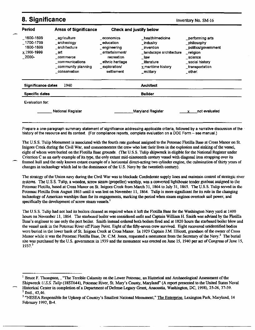
The U.S.S. Tulip Monument is associated with the fourth rate gunboat assigned to the Potomac Flotilla Base at Cross Manor on St. lnigoes Creek during the Civil War, and commemorates the crew who lost their lives in the explosion and sinking of the vessel, eight of whom were buried on the Flotilla Base grounds. (The U.S.S. Tulip shipwreck is eligible for the National Register under Criterion C as an early example of its type, the only extant mid-nineteenth century vessel with diagonal iron strapping over its framed hull and the only known extant example of a horizontal direct-acting two cylinder engine, the culmination of thirty years of changes in technology which led to the dominance of the U.S. Navy by the twentieth century).
The strategy of the Union navy during the Civil War was to blockade Confederate supply lines and maintain control of strategic river systems. The U.S.S. Tulip, a wooden. screw steam (propeller) warship, was a converted lighthouse tender gunboat assigned to the Potomac Flotilla, based at Cross Manor on St. Inigoes Creek from March 31, 1864 to July 31, 1865. The U.S.S. Tulip served in the Potomac Flotilla from August 1863 until it was lost on November 11, 1864. Tulip is more significant for its role in the changing technology of American warships than for its engagements, marking the period when steam engines overtook sail power, and specifically the development of screw steam vessels. 1
The U.S.S. Tulip had not had its boilers cleaned as required when it left the Flotilla Base for the Washington Navy yard at 1400 hours on November 11, 1864. The starboard boiler was considered unfit and Captain William H. Smith was advised by the Flotilla Base's engineer to use only the port boiler. Smith instead ordered both boilers fired and at 1820 hours the starboard boiler blew and the vessel sank in the Potomac River off Piney Point. Eight of the fifty-seven crew survived. Eight recovered unidentified bodies were buried in the lower bank of St. Inigoes Creek at Cross Manor. In 1929 Captain J.M. Ellicott, grandson of the owner of Cross Manor while it was the Potomac Flotilla Base, Dr. C.M. Jones, requested a monument from the Secretary of the Navy. 2 The burial site was purchased by the U.S. government in 1939 and the monument was erected on June 15, 1940 per act of Congress of June 15, 1937.3
1 Bruce F. Thompson. , "The Terrible Calamity on the Lower Potomac, an Historical and Archaeological Assessment of the Shipwreck U.S.S. Tulip (18ST644), Potomac River, St. Mary's County, Maryland" (A report presented to the United States Naval Historical Center in completion ofa Department of Defense Legacy Grant, Anacostia, Washington. DC, 1998), 25-26, 37-39. 2 Ibid., 42,46. 3 "NESEA Responsible for Upkeep of Country's Smallest National Monument," The Entemrise, Lexington Park, Maryland, 14 February 1992, B-4.
Maryland Historical Trust Maryland Inventory of Historic Properties Form
Name U.S.S. Tulip Monument Continuation Sheet
Number i Page 1
HISTORIC CONTEXT:
Inventory No. SM-16
MARYLAND COMPREHENSIVE PRESERVATION PLAN DATA
Geographic Organization: Western Shore
Chronological/Developmental Period(s): Modem Period
Historic Period Theme(s): Militaiy; Social/Education/Cultural
Resource Type:
Category: Object
Historic Environment: Rural
Historic Function(s) and Use(s): RECREATION AND CULTURE/monument
Known Design Source: none
9. Major Bibliographical References Thompson, Bruce F., 1998, "The Temble Calamity on the Lower Potomac, an Historical and Archaeological Assessment of the Shipwreck U.S.S. Tulip (18ST644), Potomac River, St. Macy's County, Mmyland." A report presented to the United States Naval Historical Center in completion ofa Department of Defense Legacy Grant, Anacostia, Washington, D.C.
"NESEA Responsible for Upkeep of Country's Smallest National Monument," The Enterorise, Lexington Parle, Mmyland, 14 February 1992, B-4.
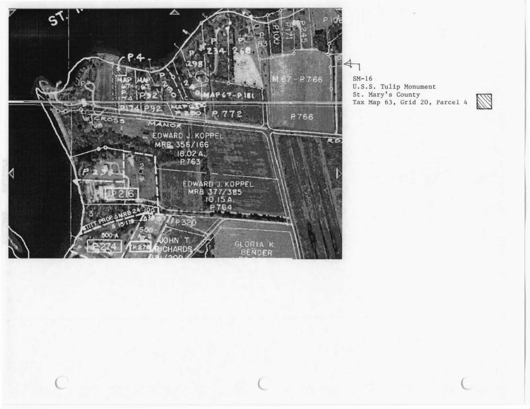
10. Geographical Data
Acreage of project area Acreage surveyed Quadrangle name
.53 acres
USGS St. Mary's Citv MD
Verbal boundary description and justification
Quadrangle scale 1:24.000
The boundary of the property is found on St. Macy's County Tax Map 63, Grid 20, Parcel 4; this parcel encompasses the property currently associated with the resource.
11. Form Prepared by
name/title
organization
street & number
city or town
Nancy Kurtz, Monuments Survey Administrator date: 12/01/99
Mmyland Historical Trust
100 Community Place
Crownsville, MD 21032
The Maryland Inventory of Historic Properties was officially created by an Act of the Maryland Legislature to be found in the Annotated Code of Maryland, Article 41, Section 181 KA, 197 4 supplement.
The survey and inventory are being prepared for information and record purposes only and do not constitute any infringement of individual property rights.
return to: Maryland Historical Trust DHCD/DHCP 100 Community Pllace Crownsville, MD 21032 410-514-7600
--··· ---------
r
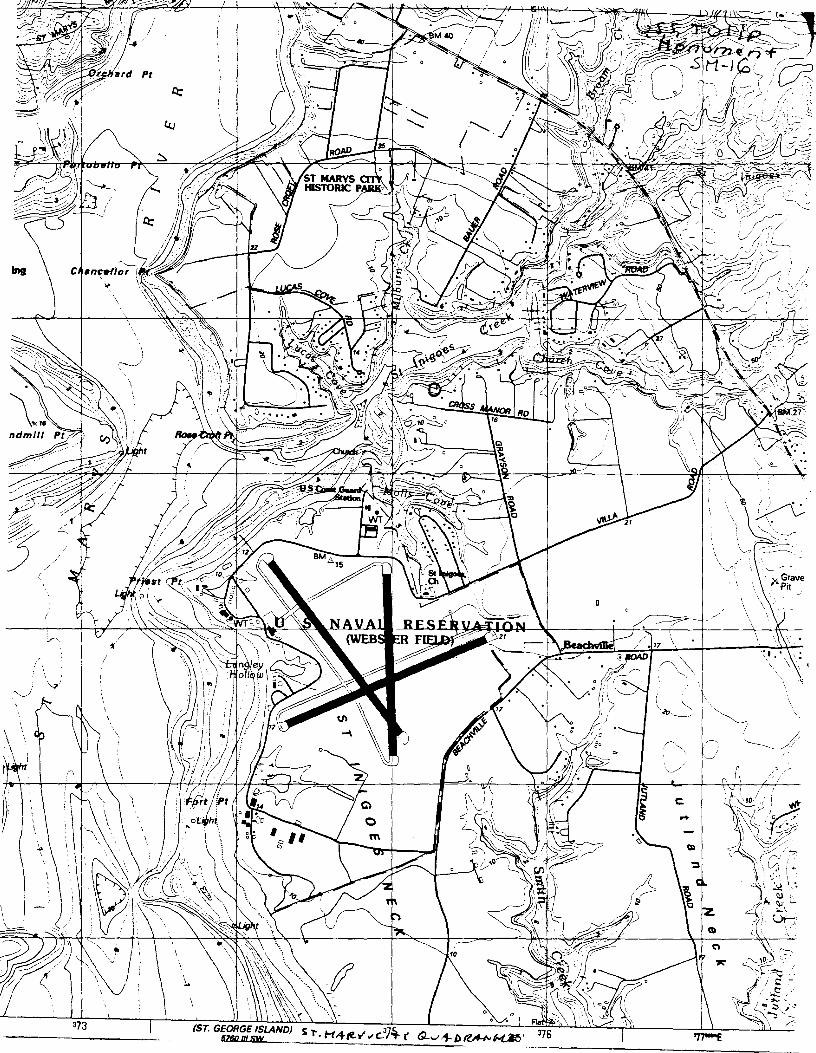
SM-16 U.S.S. Tulip Monument St . Mary ' s County Tax Map 63, Grid 20,
Parcel 4 ~
SM-16 U. S. S. Tulip Monument St . Mary ' s County Tax Map 63 , Grid 20 , Parcel 4
SM-16 U.S.S. Tulip Monument St. Mary's County USGS St. Mary's MD 1:24,000
\ .
-
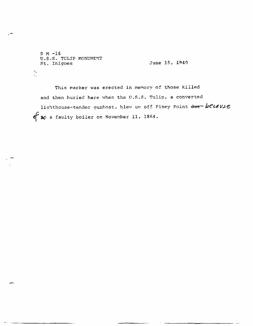
S M -16 U.S.S. TULIP MONUMENT St. Inigoes June 15, 194()
This marker was erected in memory of those killed
and then buried here when the U.S.S. Tulip, a converted
lighthouse-tender gunboat, blew un off Piney Point 9-tte- /t?el.d V.se
of l('.> a faulty boiler on November 11, 1864.
MARYLAND HISTORICAL TRUST WORKSHEET
NOMINATION FORM for the
NATIONAL REGISTER OF HISTORIC PLACES, NATIONAL PARKS SERVICE
z 0
t.u
0:::
t-
z
$TREET ANO NUMBER: . CITY OR TOWN:
STATE
CATEGORY (Check One)
0 District 0 Building
0 Site 0 Structure
QI Object
0 Public
0 Private
0 Bo.it
PRESENT USE (Check One or More•• Appropriate)
0 Agricultural 0 Government
0 Commercial 0 Industrial
0 Educational 0 Military
0 Entertainment 0 Museum
WNER S NAME:
--- _ _,_~__:-----,- ~- -
W STREET ANO NUMBER:
w "' Cl TY OR TOWN:
COURTHOUSE, RECilSTAY OF DEEDS, ETC:
STREET ANO NUMBER:
Cl TY OR TOWN:
DATE OF SURVEY:
DEPOSITORY FOR SURVEY RECORDS:
S'l'R T ANO NUMBER:
CITY OA TOWN:
COUNTY:
OWNERSHIP
Public Acquisition:
0 In Process
O Being Considered
Park
Private Rea idence
Religious
0 Federal 0 State
STATE:
STATUS
0 Occupied
0 Unoccupied
ACCESSIBLE TO THE PUBLIC
Yea:
0 Reatricted
0 Preaervotion work 0 Unreatricted
in progress
0 Transportation
GI Other (Speclly)
~~ -1
0 County
0 No
0 Comments
0 Local
PS - 709
CONDITION 0 Excellent
0 Altered
0 Good 0 Fair
(Check One)
0 Uncltered
(Check One)
0 Deteriorated
DESCRIBE THE PRESENT~ ~D ORIGINAL (If known) PHYSICAL APPEARANCE
SH-lb
0 Ruins 0 ·Unexposed
(Check One)
0 Moved O Original Site
m m
%
Vt
-t ::a c: n -t
0
z Vt
z 0
1-
u __ :::>
.I.·
I-
z
w w
. · .. ·
PERIOD (Checlr One or 1tlore ee Appropriate)
0 Pre-Columbian 0 16th Century
0 1 Sth Century 0 17th Century
SPECIFIC DATE(SI (ll Applicable and Known)
AREAS OF SIGNIFICANCE (Checlr One or 1tlore ee Appropriate)
Aboriginal 0 Education 0 0 Prehistoric 0 Engineering 0 0 Historic 0 Industry
0 Agriculture 0 Invention 0 0 Architecture 0 Landscape 0 0 Att Architecture 0 0 Commerce 0 Literature
0 Communications D Military 0 0 Conservation 0 Music 0
STATEMENT OF SIGNIFICANCE
0 18th Century
0 19th Century
Political
Religion/Phi.
lasophy
Science
Sculpture
Socia I/Human-
itarian
Theater
Transportation
0 20th Century
0 Urban Planning
0 Other (Specify)
PS-7011
LATITUDE ANO LONGITUDE COORDINATES
DEFINING A RECTANGLE LOCATING THE PROPERTY
SM - I(,
··, ·~~.---~ ....... =-"':'--:::-:-~--~~~-"" ..... -"""""'"""""""'"""--"~"""~~
LATITUDE AND LONGITUDE COORDINATES
0 DEFINING THE CENTER POINT l!>F A PROPERTY
~~~·--.~~~~~~~~~~"T"""~~~~~~~~~-iRt-~~~~~~-o_F~L_E_s_s_T~H~A~N--'-T~E~N:....:;A~C~R~E~S=--~~~~~--J. CORNER LATITUDE LON GI TU OE
Degrees Minutes Seconds Degrees Minutes Seconds
NW 0 0
NE 0 0
SE 0 0
~"' 9 0
APPROXIMATE ACREAGE OF NOMINATED PROPERTY:
,Acreage Justification:
mtL FORM PREPARED BY NAME AND Tl TL E:
ORGANIZATION
STREET ANO NUMBER:
CITY OR TOWN:
~State Liaison Officer Review:
LATITUDE
Degrees Minutes Seconds 0
{Off ice Use Only)
Significance of this property is: National O State D Local D
Signature
LONGITUDE
Degrees Minutes Seconds 0
--I
m m
z
-f
::a c: n -f
0
%
C) J
373 /ST. GEORGE ISLAND) S 't H""-• ·" ,:n.r;. r ,.., 376 VMUll~ • 'Tr-Y .,,..;,..,- U1-vt+-/)ft.~l-C.Z!51


~M lb USS 1 v \. p f·'nrw ~"P"'i· • ~ M ... j:, (,,.,,-... ,/",\ 'f r\( Ro·11l1 tio..
/\Jov 1'1<J~ Vt J S: hPO l_uo;',,J f

• I.\ ;,, l J i:-r I t',,,...v,.,._r • .) - " ! s + kc..,~· .. (,.,,,.~.J1 AJ 1t...r v, "".Ro. ... u tt ~. No,, l<i'iCj ,•AJ ~ l\Po
I rd' r~ SW ;; a/; ;).
Recommended