×
Log in
Upload File
Most Popular
Art & Photos
Automotive
Business
Career
Design
Education
Hi-Tech
+ Browse for More
Download pdf -
Scanned Document - Toronto · LIST OF FIGURES December 2011 10 12 17 18 Figure I Figure 2 Figure 3 Figure 4 Figure 5 Figure 6 Figure 7 Figure 8 Figure 9 Figure 10 Location Map Location
Download pdf
Transcript
Page 1
Page 2
Page 3
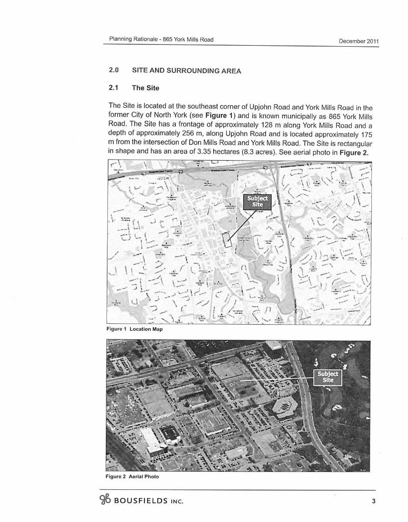
Page 4
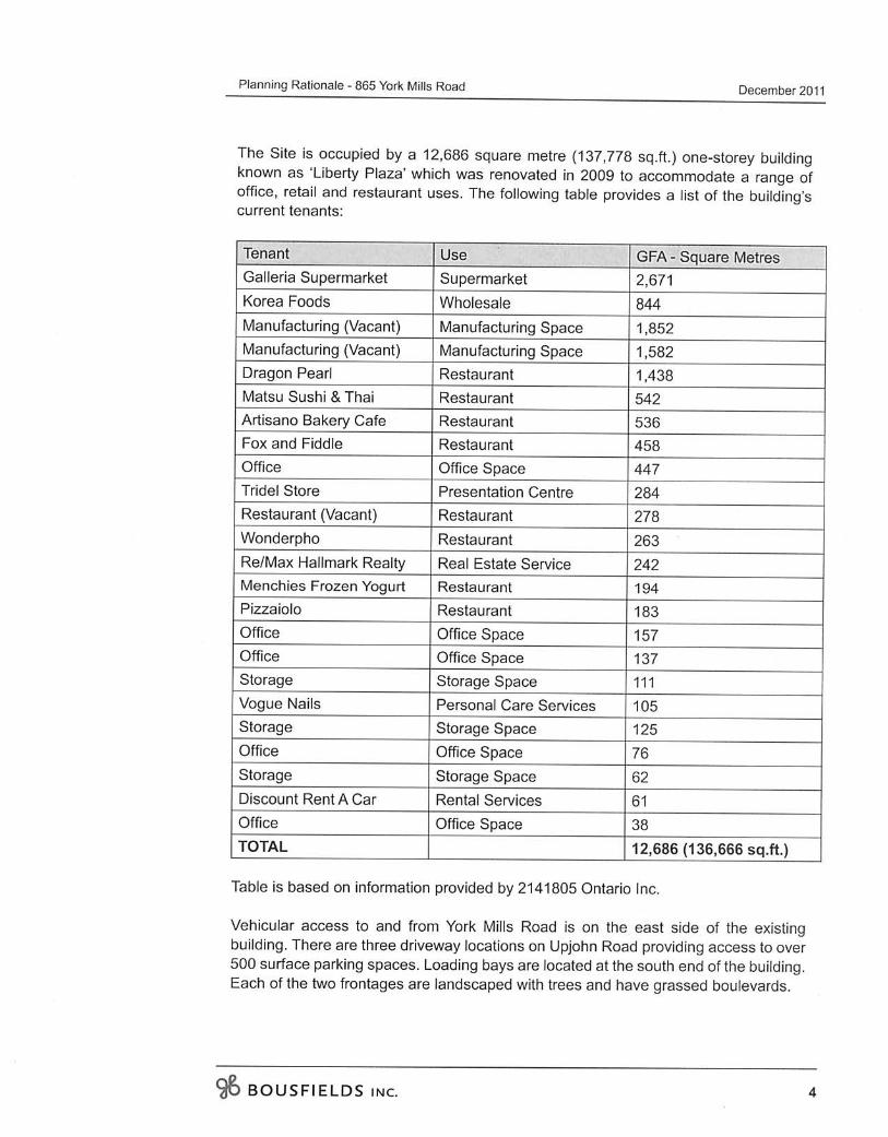
Page 5
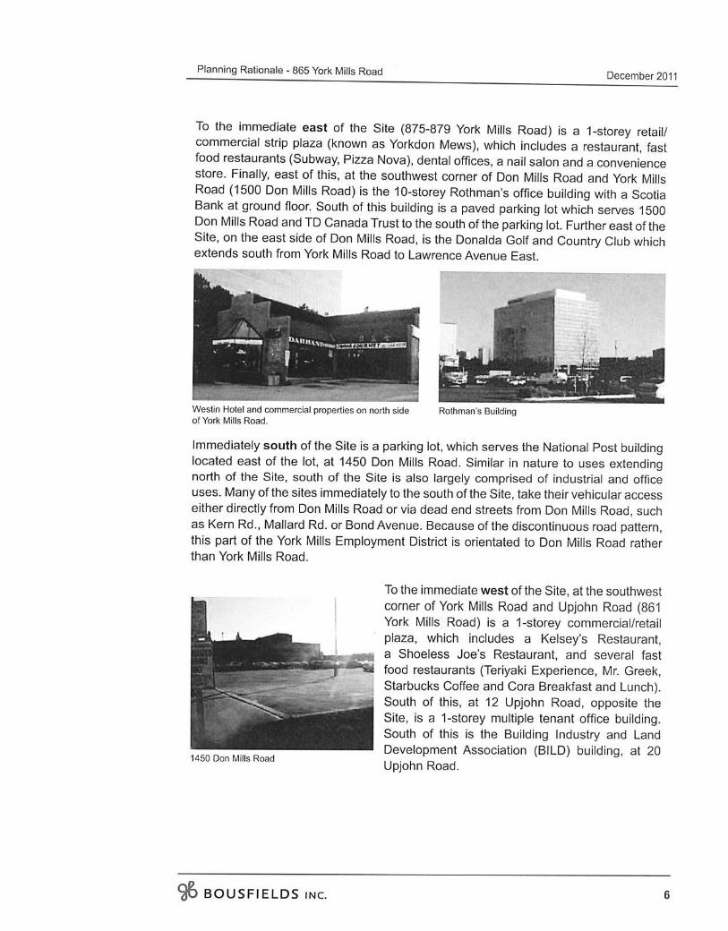
Page 6
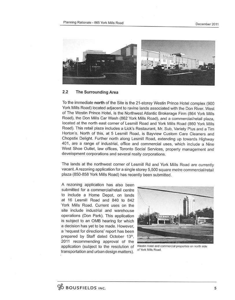
Page 7
Page 8
Page 9
Page 10
Page 11
Page 12
Page 13
Page 14
Page 15
Page 16
Page 17
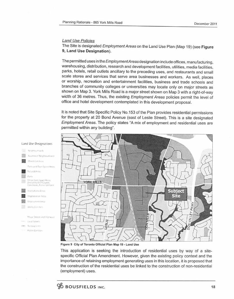
Page 18
Page 19
Page 20
Page 21
Page 22
Page 23
Page 24
Page 25
Page 26
Page 27
Page 28
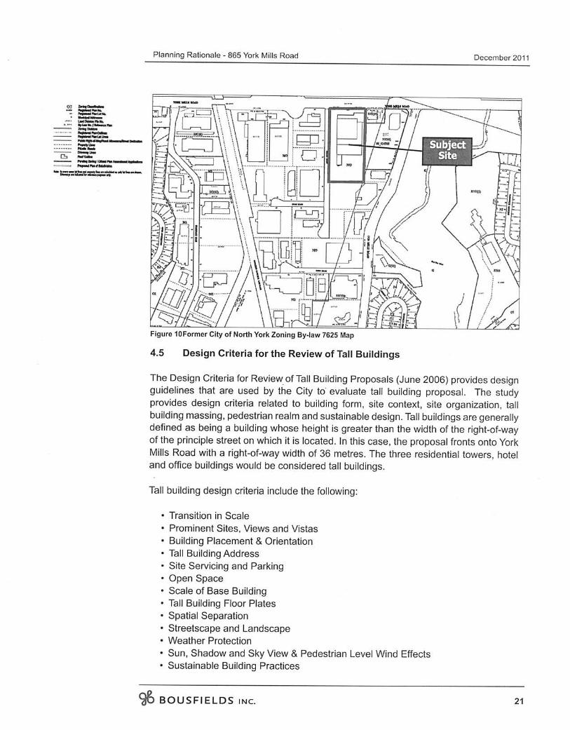
Page 29
Page 30
Page 31
Page 32
Page 33
Page 34
Page 35
Page 36
Page 37
Page 38
Page 39
Page 40
Page 41
Page 42
Page 43
Page 44
Page 45
Page 46
Page 47
Page 48
Page 49
Page 50
Page 51
Page 52
Page 53
Page 54
LOAD MORE
Recommended
APPENDIX ‘A’ GEOTECHNICAL REPORT - Winnipeg...Figure 01 Test Hole Location Plan – Bournais Drive, Beghin Avenue, De Baets Street and Paquin Road Figure 02 Test Hole Location
Documents
ResearchOnline@JCU · 2012-08-10 · Figure 1: Simplified geological map of western Maine and its location within the Central Maine Belt (inset) showing the location of cordierite
Documents
Figure 5A: Location of Projects - EPD
Documents
Annex D Environmental Impact Assessment (EIA) · D1 Introduction ... Figure D1.1 Location of Aquatic Ecology Profiling Sampling Stations..... DF-1 Figure D1.2 Location of Air/Noise
Documents
Figure 1: Location of Marimaca and Minera Rayrock Claimsmedia3.marketwire.com/docs/1068290a.pdf · Figure 1: Location of Marimaca and Minera Rayrock Claims Figure 2: Marimaca Drill
Documents
Waikiki Camera Analysis - United States Army · 2015. 10. 22. · Figure 1. Map of Oahu, HI identifying location of NOAA tide station and south shore . wave climate. Location of study
Documents
Figure 1- Location Map: 189 Langfield Street, Kingston...Figure 1- Location Map: 189 Langfield Street, Kingston Figure 2 - Zoning Map Excerpt from City Of Kingston Zoning By-law 97-102,
Documents
Monmouthshire County Council - IEMA to Abergavenny Foot… · Figure 1 Site Location 2 Figure 2 Environmental Designations 3 Figure 3 Other Developments Considered 10. LLANFOIST TO
Documents
Figure 8 – Well Location Map; and Exhibit 2 – Best
Documents
Project Name: Location Map Plan Index Figure 1 Existing
Documents
1. Facility Location Location...1 1. Facility Location 1.1 The Supply Chain Figure 1.1 shows a typical supply chain for a single plant. In the figure, items D and E provided by two
Documents
Location: Illustrations: Figure 236. GENERAL SETTING AND ... · Location: About 200 m north -northwest of Sherlock crater. Illustrations: Figure 236. Comments: Sample is regolith
Documents
FIGURE 1 STORMWATER DRAINAGE SYSTEM AND … · stormwater drainage system and outfall locations. figure 2 isra site location figure . figure 3 rmmp location figure . figure 4 bmp
Documents
Figure 1: Location map of hydrographic and coastal sampling stations
Documents
Table of Contents - kjccs.comkjccs.com/documents/ECM_Field_Guide.pdf · Table of Contents Field Guide ... Figure 9 – ECM Location on Cummins ISX Engine ... Figure 10 – Celect
Documents
· Figure 1: Map of study location (a) .................................................................................................... 6 Figure 2: Map of study
Documents
Projector-Based Location Discovery and Trackingreports-archive.adm.cs.cmu.edu/anon/hcii/CMU-HCII-08-102.pdf · Figure 5. Multi-Projector location discovery applications 24 Figure
Documents
Figure 1: hole TOD-023 location (oblique long section
Documents