7/27/2019 Redevelopment In Iowa City, Iowa
http://slidepdf.com/reader/full/redevelopment-in-iowa-city-iowa 1/2
1
“We hope this sustainablecommunities pilot will help us
learn how to bring new life tocommunities while preservingthe environment. We especiallypraise the city for their efforts.Local government makes thekey land use decisions.” – KarlBrooks, EPA Region 7Administrator
EPA Region 7
Iowa City, Iowa: From Disaster to Redevelopment - A New Neighborhood
Fall 2013
Background
Iowa City is located in east central Iowa
with a population of 68,000. It is home
to the University of Iowa, which hasmore than 30,000 students. The Iowa
River flows through the center of the
city and the University of Iowa campus. In 2008, extensive flooding
impacted many areas of eastern Iowa, including portions of Iowa
City which was declared a national disaster area by the Federal
Emergency Management Agency (FEMA). In 2009, the U.S.
Environmental Protection Agency (EPA) was tasked by FEMA to
provide technical assistance to Iowa City and five other cities in
eastern Iowa as they embarked on the sustainable redevelopment of areas
impacted by the flooding. The initial technical assistance provided by EPA
included a Transportation Policy Options Memo, Market Study Overview,
and initial urban design options for the flood-impacted areas in the
Riverfront Crossings District (RCD), all of which helped motivate the city to
apply for additional technical assistance from EPA. The first project team
after the flood included consultants from ICF International, Nelson/Nygaard
Associates, and Dover Kohl. The Rebuild Iowa Office and Iowa Economic
Development Authority were also involved in the initial flood recovery grant
from EPA.
EPA Technical Assistance and Partners
In 2010, Iowa City was selected by EPA as one of five communities in the U.S. to receive technical assistance as an
EPA Brownfield Pilot Project under the Partnership for Sustainable Communities. Through this Pilot, the project
team focused on a nearly 10-square-block area in the southwest part of the RCD that consisted primarily of underutilized industrial and commercial properties.
Consulting teams from SRA International, Inc., and HDR, Inc., all provided technical
assistance to the project team. The project team included staff from the City of
Iowa City Departments of Planning, Transportation, Public Works, Parks and
Recreation, the Johnson County Council of Governments, and EPA Region 7.
Support was also provided by the Iowa Department of Natural Resources (IDNR)
Brownfields program, the Rebuild Iowa Office, and the Iowa Economic
Development Authority. Support partners for the brownfield grant included
representatives from the U.S. Department of Housing and Urban Development
and Department of Transportation, as well as the IDNR Brownfields program.
The goal of the Pilot was to create a plan to help transition the RCD into a more pedestrian-oriented, mixed-use
neighborhood, with a new riverfront park to minimize future flood damage and more sustainable transportation
options. The Pilot was conducted between August 2010 and April 2011, and included the development of three
key products: Brownfields Inventory
RCD Sub-Area Plan Design guidelines and zoning code recommendations
The inventory provided a framework for identifying brownfield sites and a strategy for acquiring resources for
assessment, cleanup and technical assistance.
Flood-impacted wastewater treatment plant in Iowa City
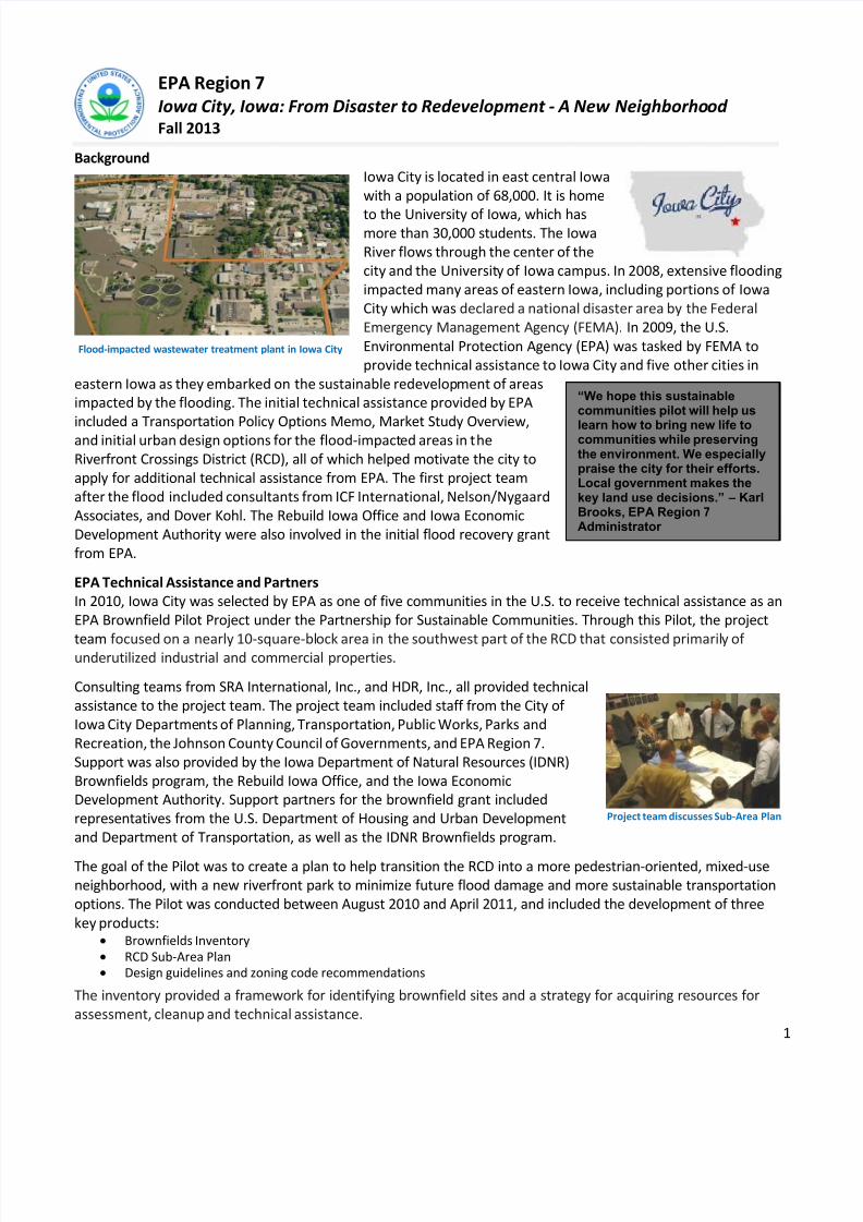
Project team discusses Sub-Area Plan
7/27/2019 Redevelopment In Iowa City, Iowa
http://slidepdf.com/reader/full/redevelopment-in-iowa-city-iowa 2/2
2
“EPA technical assistance was helpful in many ways.It got us to get the ball rolling, so to speak, and thinkabout development and the river in a different way,and think about infill differently as well. Overall, theworkshop and other technical assistance were verypositive.” – Karen Howard, City Planner of Iowa City
The Sub-Area Plan was based on six key goals:• Develop a mixed-use, pedestrian-oriented district
• Create a resilient riverfront park system
• Enhance Ralston Creek to become a community asset
• Develop a multi-modal transportation network
• Create a network of green streets
• Promote sustainable design practices
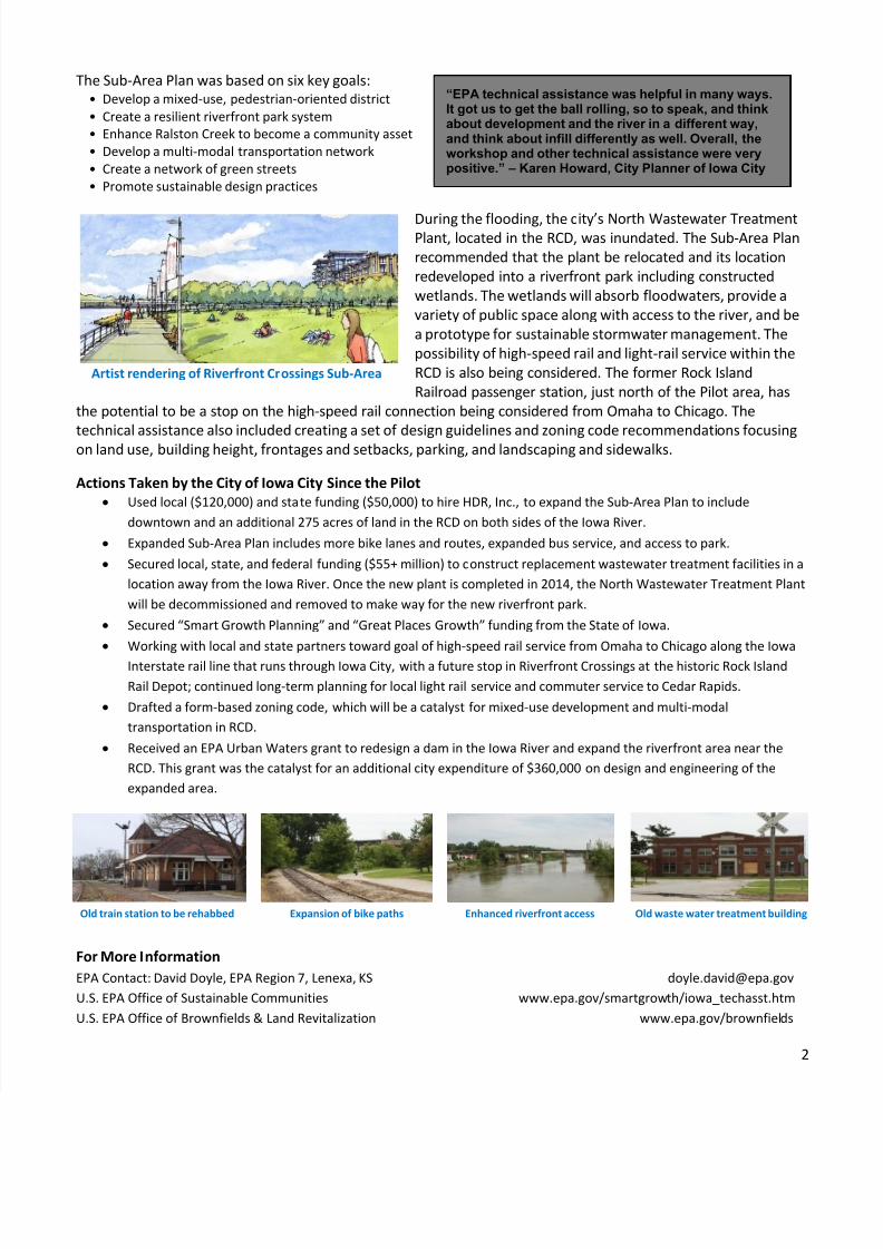
During the flooding, the city’s North Wastewater TreatmentPlant, located in the RCD, was inundated. The Sub-Area Plan
recommended that the plant be relocated and its location
redeveloped into a riverfront park including constructed
wetlands. The wetlands will absorb floodwaters, provide a
variety of public space along with access to the river, and be
a prototype for sustainable stormwater management. The
possibility of high-speed rail and light-rail service within the
RCD is also being considered. The former Rock Island
Railroad passenger station, just north of the Pilot area, has
the potential to be a stop on the high-speed rail connection being considered from Omaha to Chicago. The
technical assistance also included creating a set of design guidelines and zoning code recommendations focusingon land use, building height, frontages and setbacks, parking, and landscaping and sidewalks.
Actions Taken by the City of Iowa City Since the Pilot
Used local ($120,000) and state funding ($50,000) to hire HDR, Inc., to expand the Sub-Area Plan to include
downtown and an additional 275 acres of land in the RCD on both sides of the Iowa River.
Expanded Sub-Area Plan includes more bike lanes and routes, expanded bus service, and access to park.
Secured local, state, and federal funding ($55+ million) to construct replacement wastewater treatment facilities in a
location away from the Iowa River. Once the new plant is completed in 2014, the North Wastewater Treatment Plant
will be decommissioned and removed to make way for the new riverfront park.
Secured “Smart Growth Planning” and “Great Places Growth” funding from the State of Iowa.
Working with local and state partners toward goal of high-speed rail service from Omaha to Chicago along the Iowa
Interstate rail line that runs through Iowa City, with a future stop in Riverfront Crossings at the historic Rock Island
Rail Depot; continued long-term planning for local light rail service and commuter service to Cedar Rapids.
Drafted a form-based zoning code, which will be a catalyst for mixed-use development and multi-modal
transportation in RCD.
Received an EPA Urban Waters grant to redesign a dam in the Iowa River and expand the riverfront area near the
RCD. This grant was the catalyst for an additional city expenditure of $360,000 on design and engineering of the
expanded area.
Expansion of bike paths Enhanced riverfront access Old waste water treatment building
For More Information
EPA Contact: David Doyle, EPA Region 7, Lenexa, KS [email protected]
U.S. EPA Office of Sustainable Communities www.epa.gov/smartgrowth/iowa_techasst.htm
U.S. EPA Office of Brownfields & Land Revitalization www.epa.gov/brownfields
Artist rendering of Riverfront Crossings Sub-Area
Old train station to be rehabbed
Recommended