Dr. A. Bhattacharya
RADAR ALTIMETRY
1
Altimetry is a technique for measuring height
Satellite radar altimetry measures the time taken by a radar pulse to travel from the satellite antenna to the surface and back to the satellite receiver
This measurement yields a wealth of other information that can be used for a wide range of applications
ALTIMETRY BASICS
2
The altimeter emits a radar wave and analyses the return signal that bounces off the surface
Surface height is the difference between the satellite’s position on orbit w.r.t an arbitrary reference surface (the Earth’s center or the Earth’s ellipsoid)
We can also measure wave height and wind speed over the oceans, backscatter coefficient and surface roughness for most surfaces off which the signal is reflected, by looking at the return signal’s amplitude and waveform
3
HOW AN ALTIMETER WORKS ?
If the altimeter emits in two frequencies, the comparison between the signals, w.r.t. the frequencies used can generate interesting results Rain rate over the oceans Detection of crevasses over ice shelves
Water vapor and electrons in the atmosphere, sea state and a range of other parameters can affect the signal round trip time, distorting range measurements
The distortions can be corrected by measuring the altimeter signal with supporting instruments or at several different frequencies or by modeling them
4
HOW AN ALTIMETER WORKS ?
5
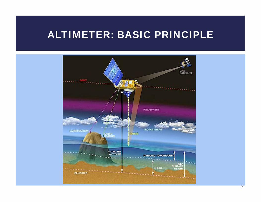
ALTIMETER: BASIC PRINCIPLE
Radar altimeters onboard the satellite transmit signals at high frequencies (over 1700 pulses per sec.) to Earth, and receive the echo from the surface
This is analyzed to derive a precise measurement of the time taken to make the round trip between the satellite and the surface
This time measurement, scaled to the speed of light, yields a range R measurement
6
ALTIMETER: BASIC PRINCIPLESATELLITE TO SURFACE DISTANCE: RANGE
As EM waves travel through the atmosphere they can be decelerated by water vapor or ionization The final range can be estimated with great accuracy once these
phenomenon have been corrected
The ultimate aim to measure surface height relative to a terrestrial reference frame requires independent measurements of the satellite orbital trajectory Exact latitude, longitude and altitude coordinates
7
ALTIMETER: BASIC PRINCIPLESATELLITE TO SURFACE DISTANCE: RANGE
The critical orbital parameters for satellite altimeter missions are altitude, inclination and period
The altitude of a satellite depends upon inclination, atmospheric drag, gravity forces acting on the satellite, area of the world to be mapped etc.
Period or repeat orbit is the time needed for the satellite to pass over the same position on the ground, uniformly sampling the Earth’s surface
Inclination gives the highest latitude at which the satellite can take measurements
8
ALTIMETER: BASIC PRINCIPLESATELLITE ALTITUDE
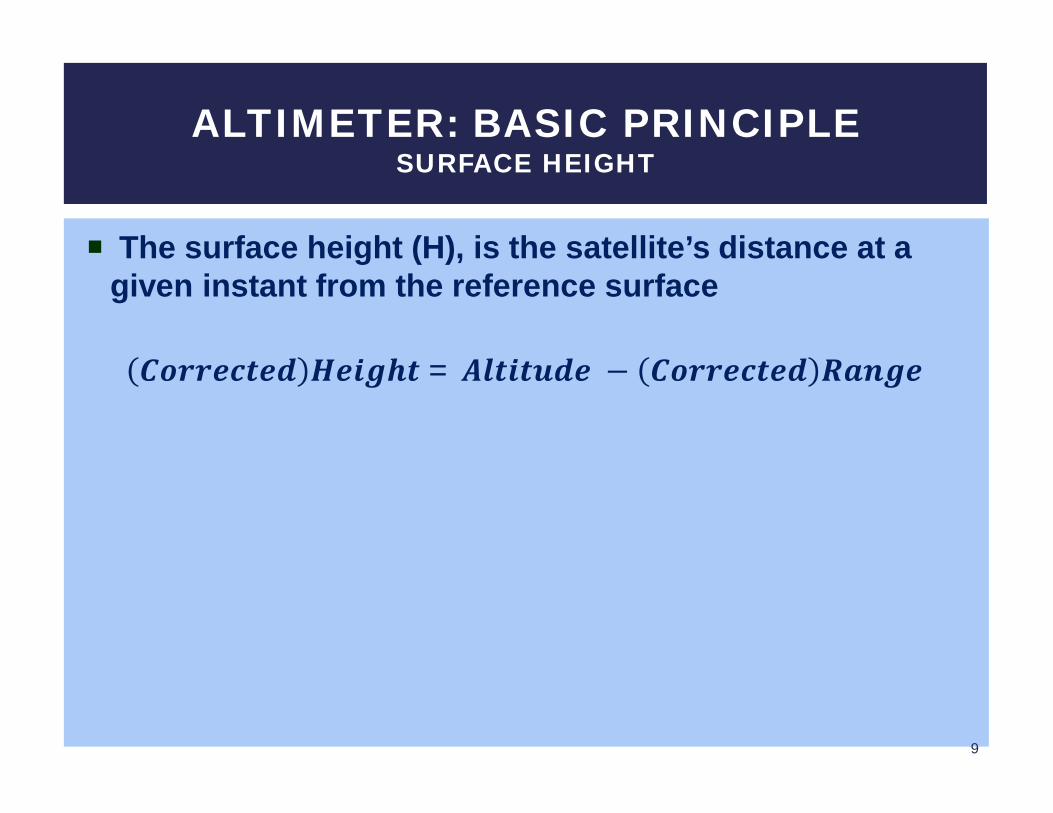
The surface height (H), is the satellite’s distance at a given instant from the reference surface
푪풐풓풓풆풄풕풆풅 푯풆풊품풉풕 = 푨풍풕풊풕풖풅풆 − 푪풐풓풓풆풄풕풆풅 푹풂풏품풆
9
ALTIMETER: BASIC PRINCIPLESURFACE HEIGHT
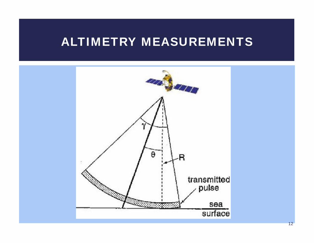
The radar altimeter emits a pulse towards the Earth’s surface
The time which elapses from the transmission of a pulse to the reception of its echo reflected off the Earth’s surface is proportional to the satellite’s altitude
The magnitude and shape of the echoes also contain information about the characteristics of the surface which caused the reflection
10
ALTIMETRY MEASUREMENTS
Homogenous surfaces such as ocean show good surface characteristics
Non-homogenous surfaces which contain discontinuities or significant slopes, such as some land surfaces, make accurate interpretation more difficult
The range resolution of the altimeter is about half a meter but the range measurement performance over the ocean is better
11
ALTIMETRY MEASUREMENTS
12
ALTIMETRY MEASUREMENTS
Recommended


![Satellite Altimetry and Gravimetry · Clear sky attenuation, Courtesy: Chelton et al. [2001] radar affected by rain, cloud Maul [1985] Pulse-Limited Radar Altimetry Courtesy: Chelton](https://img.pdfslide.us/doc/110x75/606292618133d92c61084ed7/satellite-altimetry-and-gravimetry-clear-sky-attenuation-courtesy-chelton-et-al.jpg)