QGIS Workflows
QGIS and Python… like peanut butter and jelly
Z-Pulley Inc2
Peanut Butter (QGIS)
• It’s Smooth (all the basics of GIS)• It’s Organic (by the people for the people)• Grow your own (it is encouraged!)
Z-Pulley Inc3
Jelly (Python)
• Everything tastes better with it• Holds your sandwich together
Z-Pulley Inc4
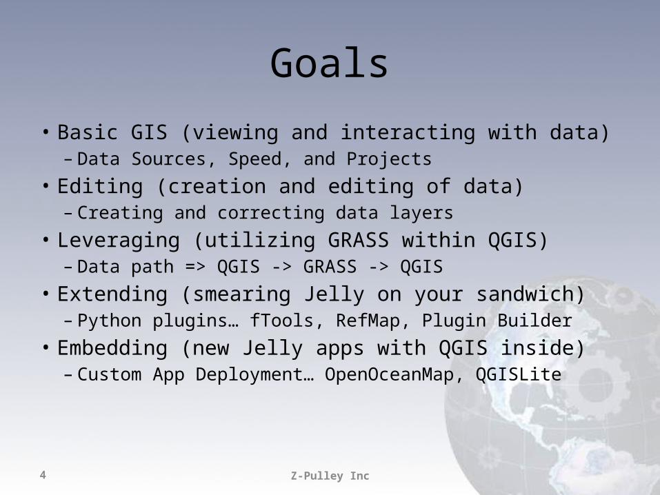
Goals
• Basic GIS (viewing and interacting with data)– Data Sources, Speed, and Projects
• Editing (creation and editing of data)– Creating and correcting data layers
• Leveraging (utilizing GRASS within QGIS)– Data path => QGIS -> GRASS -> QGIS
• Extending (smearing Jelly on your sandwich)– Python plugins… fTools, RefMap, Plugin Builder
• Embedding (new Jelly apps with QGIS inside)– Custom App Deployment… OpenOceanMap, QGISLite
Z-Pulley Inc5
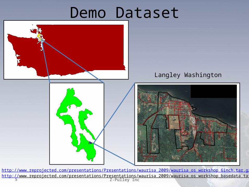
Demo Dataset
Langley Washington
http://www.reprojected.com/presentations/Presentations/waurisa_2009/waurisa_os_workshop_6inch.tar.gzhttp://www.reprojected.com/presentations/Presentations/waurisa_2009/waurisa_os_workshop_basedata.tar.gz
Z-Pulley Inc6
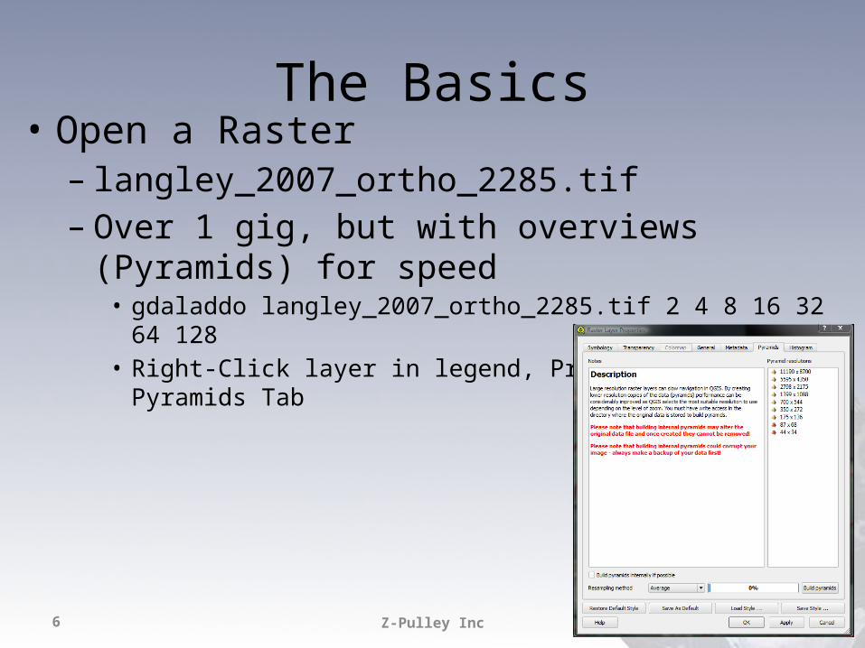
The Basics• Open a Raster– langley_2007_ortho_2285.tif– Over 1 gig, but with overviews (Pyramids) for speed
• gdaladdo langley_2007_ortho_2285.tif 2 4 8 16 32 64 128• Right-Click layer in legend, Properties, Pyramids Tab
Z-Pulley Inc7
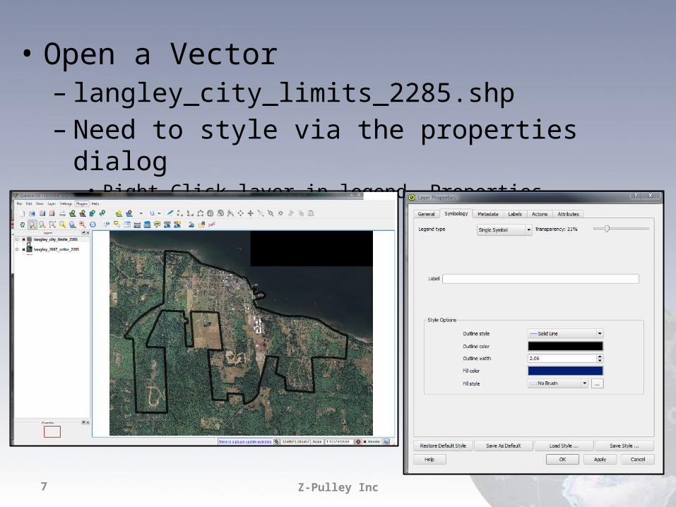
• Open a Vector– langley_city_limits_2285.shp– Need to style via the properties dialog
• Right-Click layer in legend, Properties, Symbology Tab
Z-Pulley Inc8
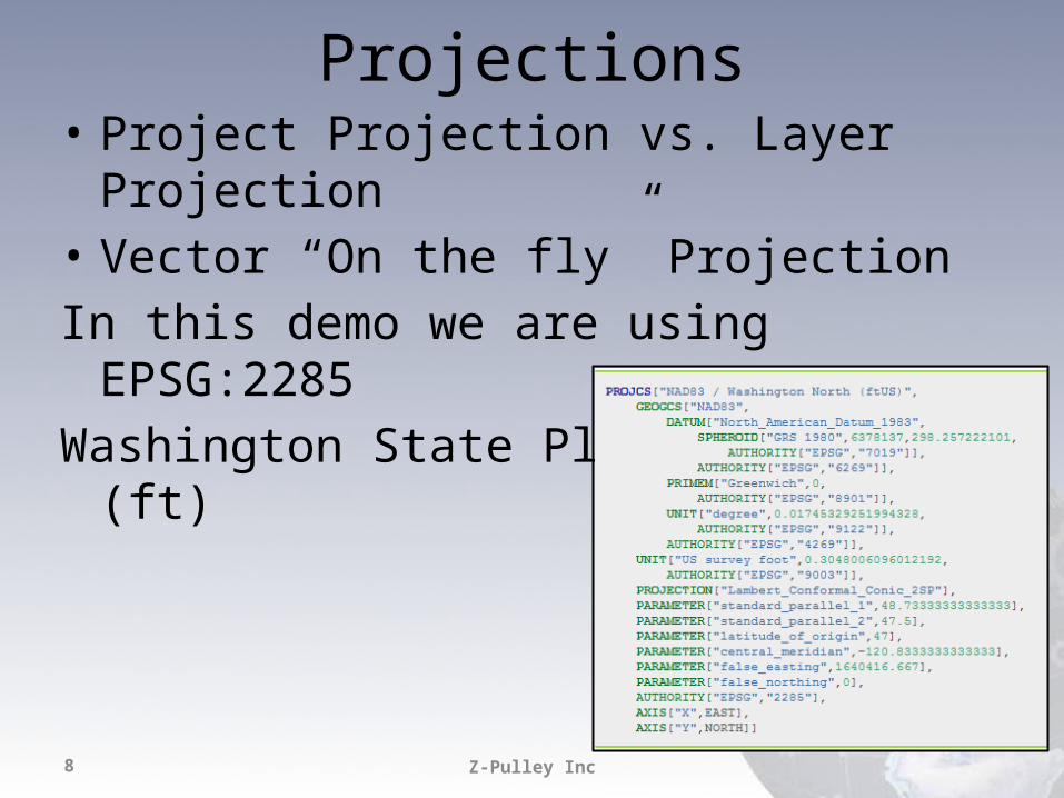
Projections• Project Projection vs. Layer Projection• Vector “On the fly” ProjectionIn this demo we are using EPSG:2285Washington State Plane North (ft)
Z-Pulley Inc9
Play with the data…
• Zoom, Pan, Identify• Open Attribute Tables• Select– Click on map– Query Builder in attribute table
• Label– Label tab in Properties Dialog
• Style– Modify and Save
Z-Pulley Inc10
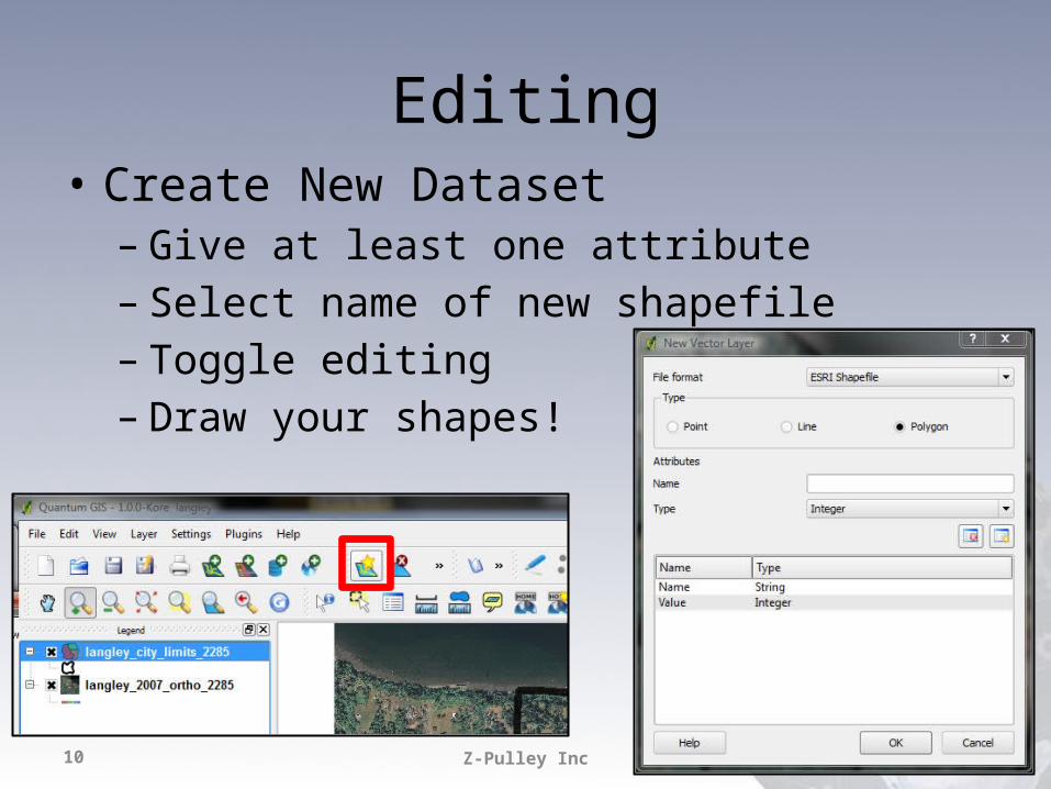
Editing• Create New Dataset– Give at least one attribute– Select name of new shapefile– Toggle editing– Draw your shapes!
Z-Pulley Inc11
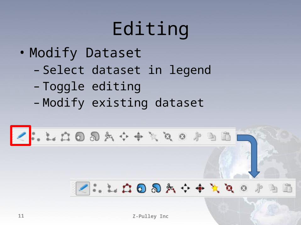
Editing• Modify Dataset– Select dataset in legend– Toggle editing– Modify existing dataset
Z-Pulley Inc12
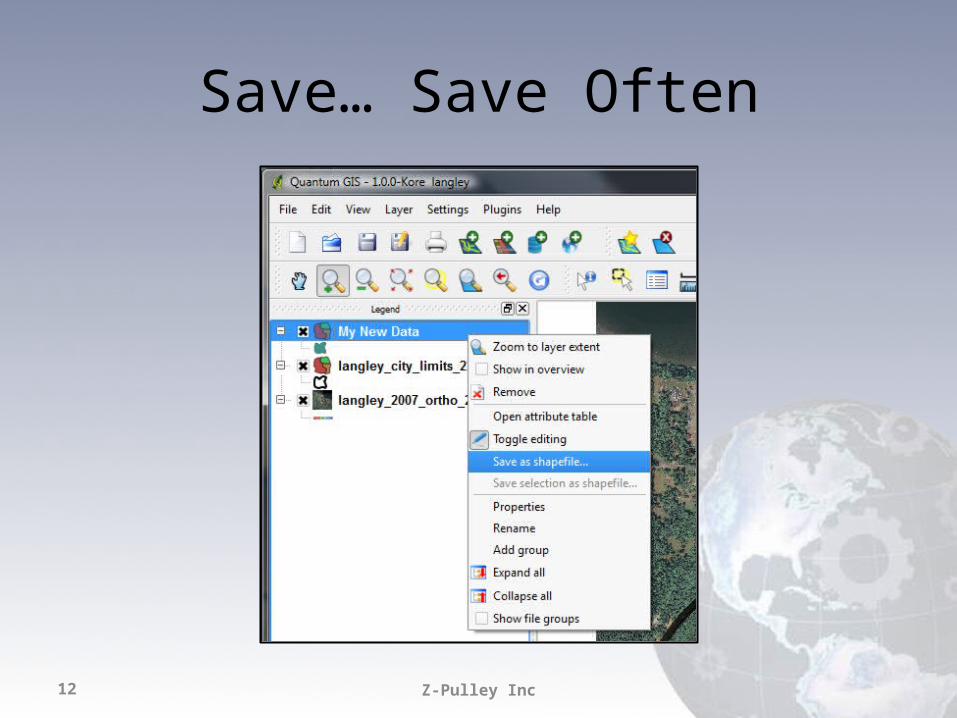
Save… Save Often
Z-Pulley Inc13
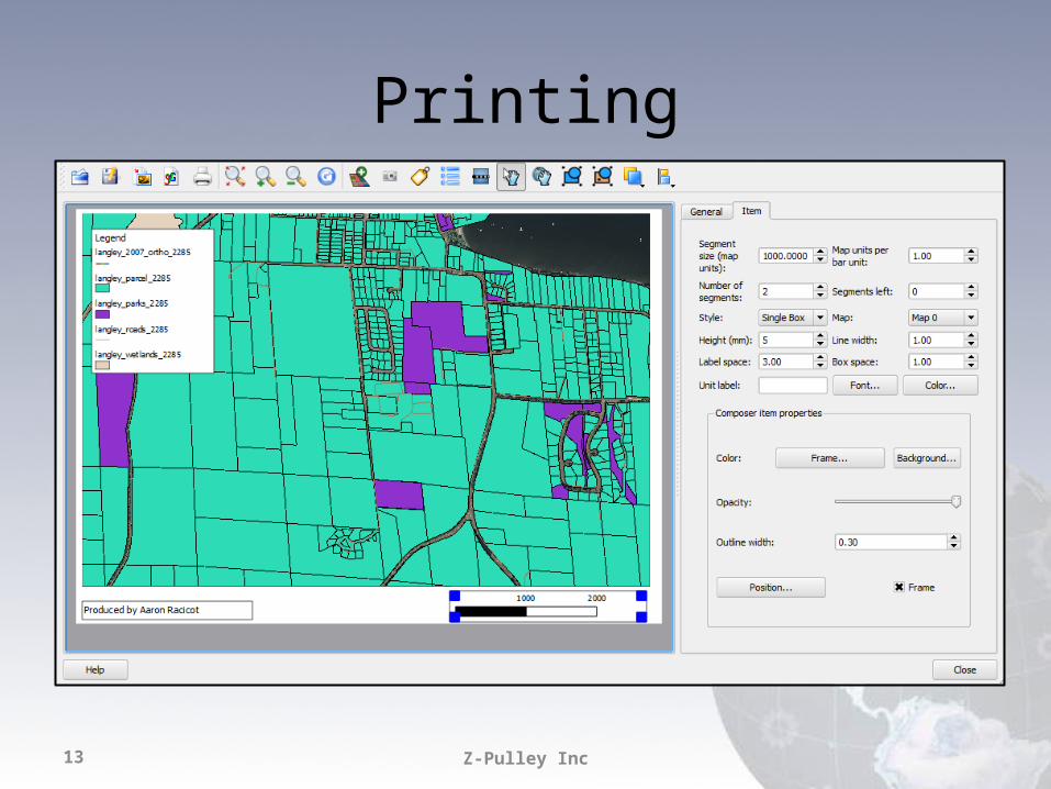
Printing
Z-Pulley Inc14
GRASSThe crunch in the Peanut Butter…
Enable via Plugin Manager…
Z-Pulley Inc15
Z-Pulley Inc16
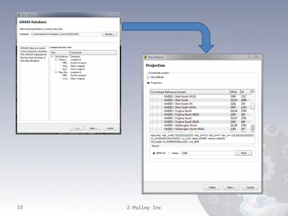
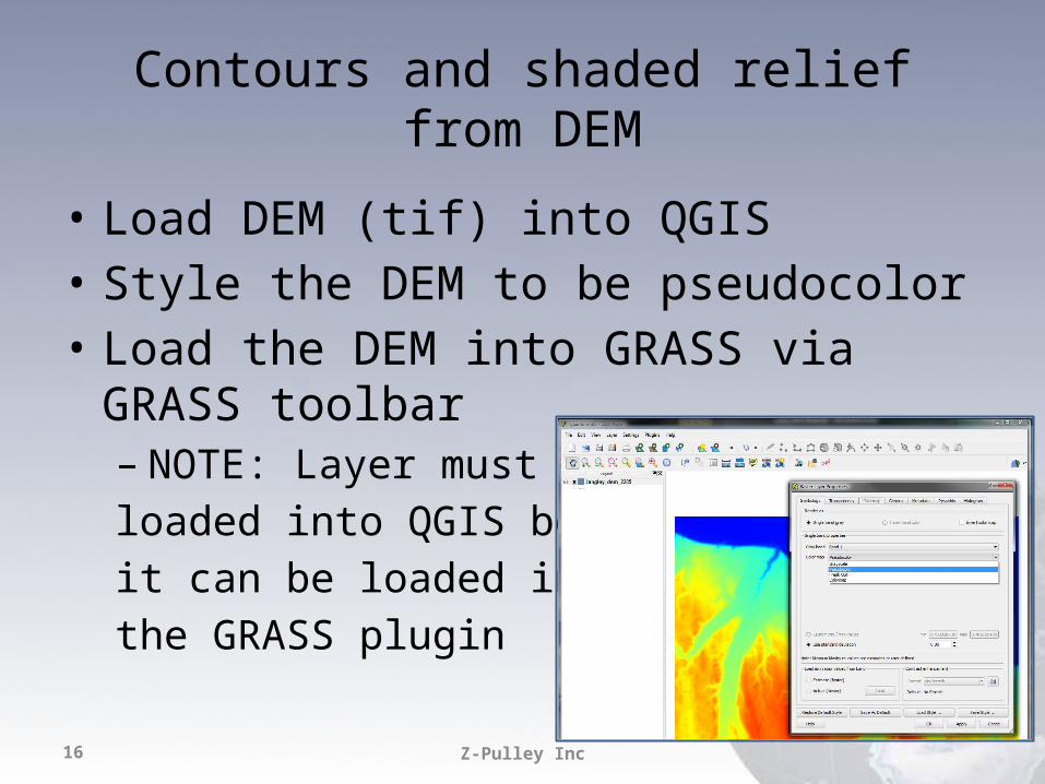
Contours and shaded relief from DEM
• Load DEM (tif) into QGIS• Style the DEM to be pseudocolor• Load the DEM into GRASS via GRASS toolbar– NOTE: Layer must beloaded into QGIS beforeit can be loaded intothe GRASS plugin
Z-Pulley Inc17
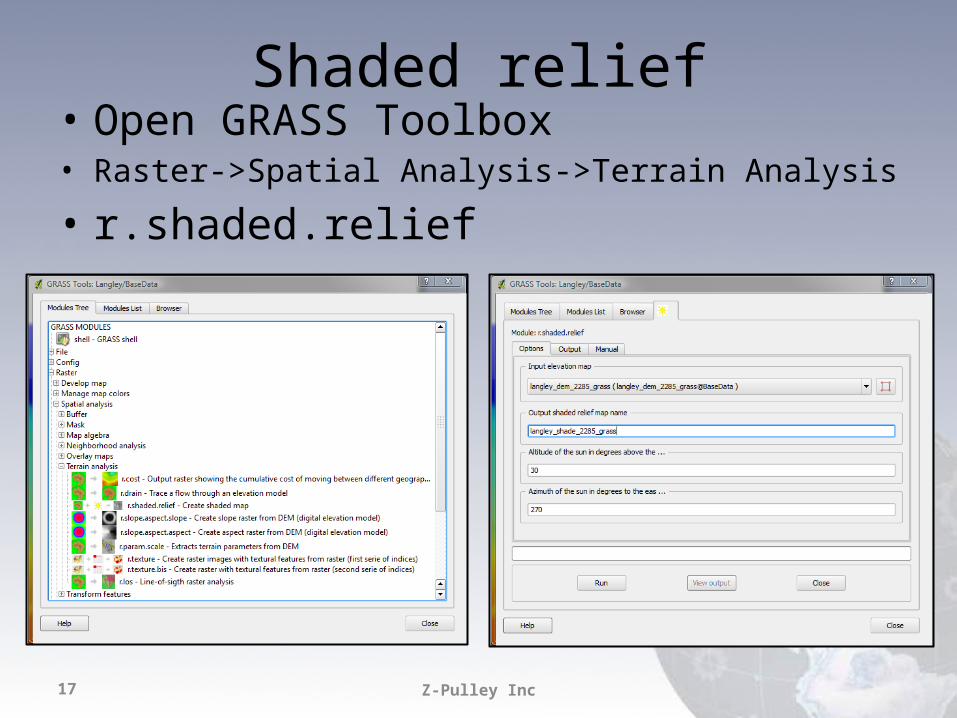
Shaded relief• Open GRASS Toolbox• Raster->Spatial Analysis->Terrain Analysis
• r.shaded.relief
Z-Pulley Inc18
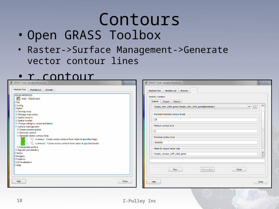
Contours• Open GRASS Toolbox• Raster->Surface Management->Generate vector contour lines
• r.contour
Z-Pulley Inc19
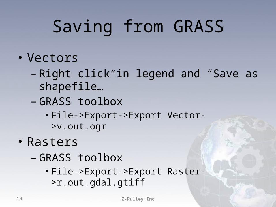
Saving from GRASS
• Vectors– Right click in legend and “Save as shapefile…”– GRASS toolbox• File->Export->Export Vector->v.out.ogr
• Rasters– GRASS toolbox• File->Export->Export Raster->r.out.gdal.gtiff
Z-Pulley Inc20
Extending
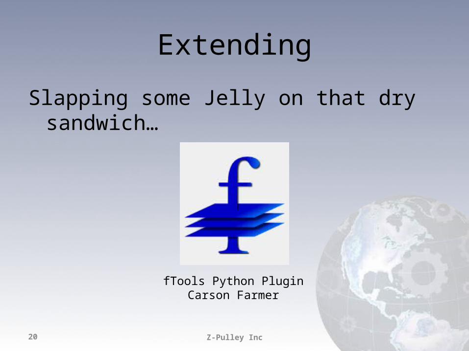
Slapping some Jelly on that dry sandwich…
fTools Python PluginCarson Farmer
Z-Pulley Inc21
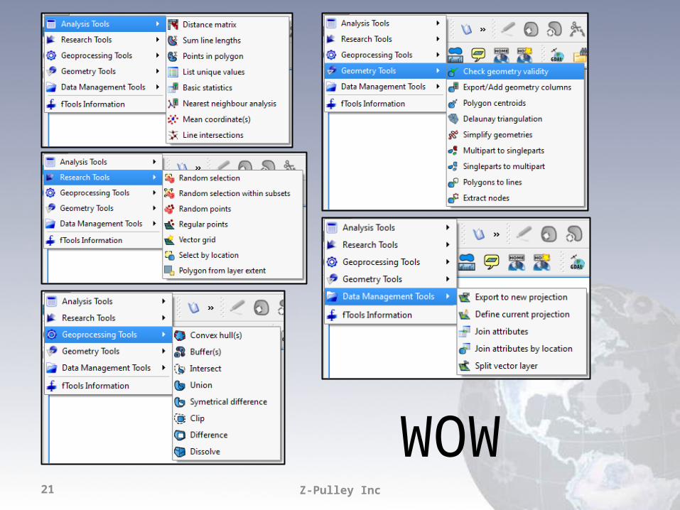
WOW
Z-Pulley Inc22
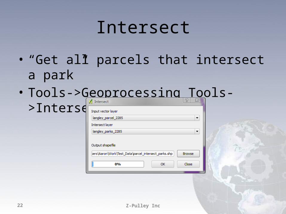
Intersect
• “Get all parcels that intersect a park”• Tools->Geoprocessing Tools->Intersect
Z-Pulley Inc23
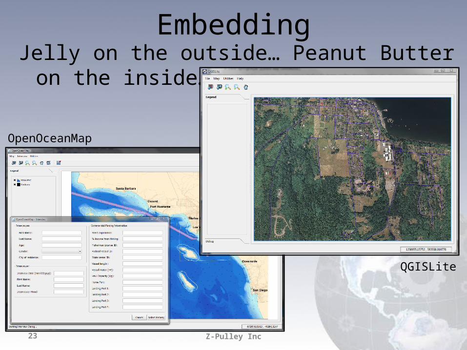
EmbeddingJelly on the outside… Peanut Butter on the inside…
OpenOceanMap
QGISLite
Z-Pulley Inc24
Other Formats
• Great support for PostGIS• GDAL Plugins supported (.sid, .ecw, etc.)• VRT’s are your friend
Z-Pulley Inc25
Things we are still searching for…
• Great print production– New work on composer– Integration with Mapnik
• More spatial functions in Core or Python… less reliance on GRASS
• Raster “on the fly” projection• Better labeling• Relative paths in project files• Many many many more …
Z-Pulley Inc26
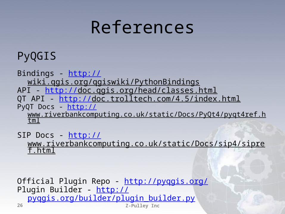
ReferencesPyQGISBindings - http://wiki.qgis.org/qgiswiki/PythonBindings API - http://doc.qgis.org/head/classes.html QT API - http://doc.trolltech.com/4.5/index.html PyQT Docs - http://www.riverbankcomputing.co.uk/static/Docs/PyQt4/pyqt4ref.html SIP Docs - http://www.riverbankcomputing.co.uk/static/Docs/sip4/sipref.html
Official Plugin Repo - http://pyqgis.org/Plugin Builder - http://pyqgis.org/builder/plugin_builder.py
Z-Pulley Inc27
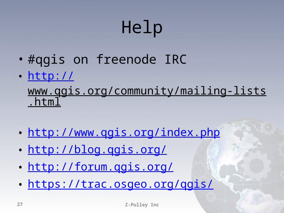
Help
• #qgis on freenode IRC• http://www.qgis.org/community/mailing-lists.html • http://www.qgis.org/index.php• http://blog.qgis.org/• http://forum.qgis.org/• https://trac.osgeo.org/qgis/

Recommended