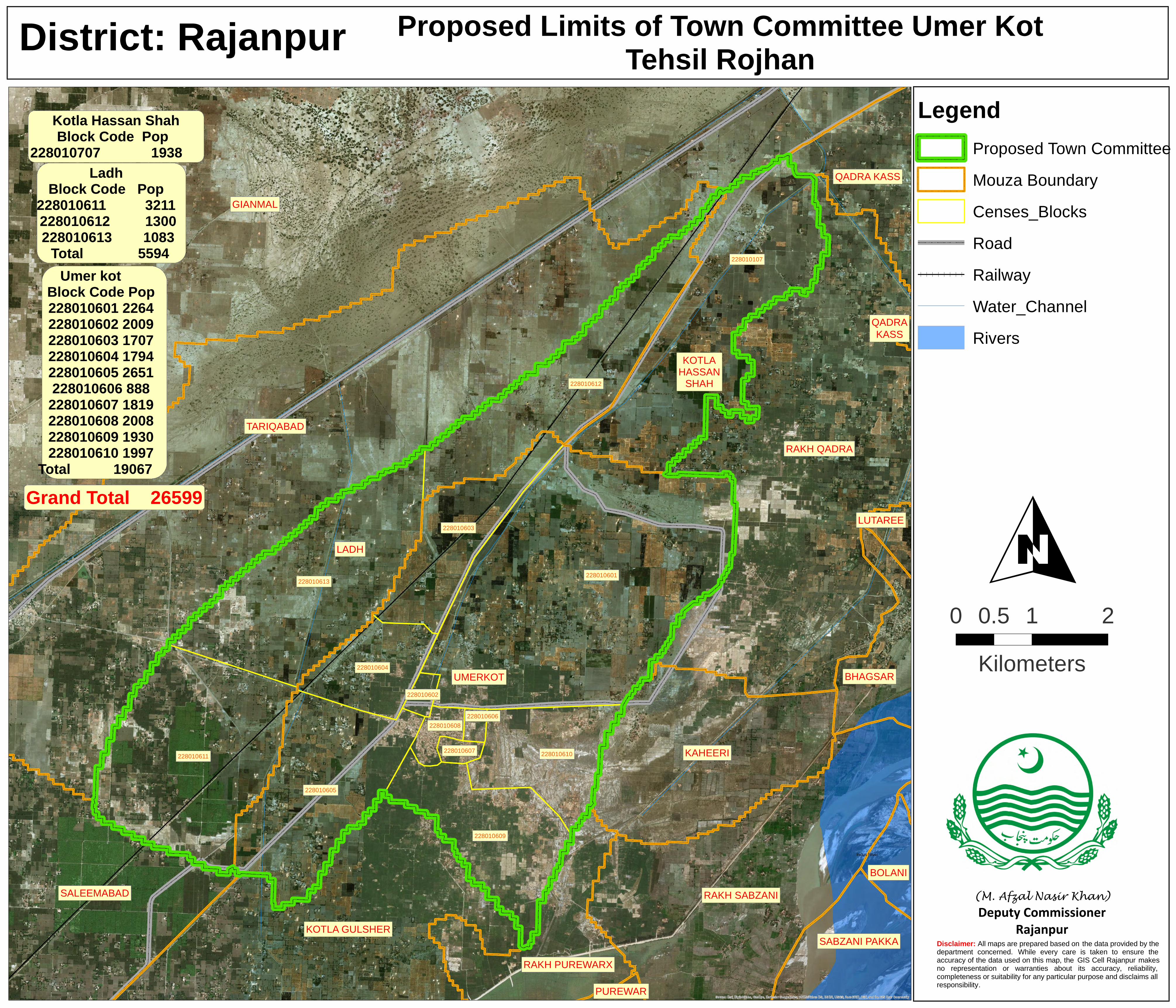
Indus River
KOTLA GULSHER
GIANMAL
LUTAREE
SABZANI PAKKA
BOLANIRAKH SABZANI
BHAGSAR
RAKH QADRA
KAHEERI
PUREWAR
SALEEMABAD
UMERKOT
KOTLAHASSAN
SHAH
LADH
QADRAKASS
QADRA KASS
TARIQABAD
RAKH PUREWARX
228010601
228010107
228010613
228010611
228010612
228010603
228010604
228010605
228010602
228010607
228010608
228010609
228010610
228010606
Source: Esri, DigitalGlobe, GeoEye, Earthstar Geographics, CNES/Airbus DS, USDA, USGS, AeroGRID, IGN, and the GIS User Community
District: Rajanpur Proposed Limits of Town Committee Umer KotTehsil Rojhan
Disclaimer: All maps are prepared based on the data provided by the department concerned. While every care is taken to ensure the accuracy of the data used on this map, the GIS Cell Rajanpur makes no representation or warranties about its accuracy, reliability, completeness or suitability for any particular purpose and disclaims all responsibility.
O
LegendProposed Town CommitteeMouza BoundaryCenses_BlocksRoadRailwayWater_ChannelRivers
0 1 20.5Kilometers
(M. Afzal Nasir Khan) Deputy Commissioner
Rajanpur
Kotla Hassan ShahBlock Code Pop
228010707 1938
Grand Total 26599
LadhBlock Code Pop
228010611 3211 228010612 1300 228010613 1083 Total 5594
Umer kot Block CodePop22801060122642280106022009228010603170722801060417942280106052651228010606888
2280106071819228010608200822801060919302280106101997
Total 19067
Recommended