Potential for Comprehensive Evaluation of Pavement Surface with 3D Laser Imaging
Kelvin C.P. WangOklahoma State University and
WayLink Systems [email protected]
The 23rd Annual Road Profile Users' Group (RPUG) MeetingThe Harvey's Lake Tahoe in Stateline, NV, September 27 to 29, 2011.
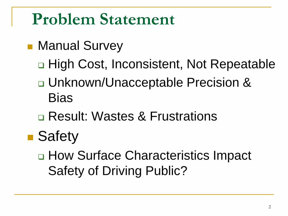
Problem Statement Manual Survey High Cost, Inconsistent, Not Repeatable Unknown/Unacceptable Precision &
Bias Result: Wastes & Frustrations
Safety How Surface Characteristics Impact
Safety of Driving Public?
2
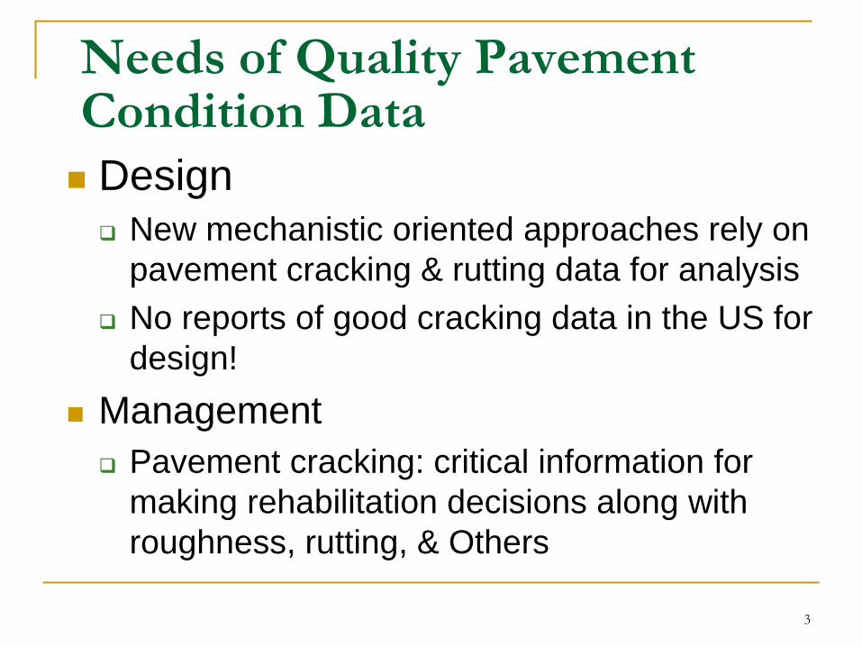
Needs of Quality Pavement Condition Data Design New mechanistic oriented approaches rely on
pavement cracking & rutting data for analysis No reports of good cracking data in the US for
design! Management Pavement cracking: critical information for
making rehabilitation decisions along with roughness, rutting, & Others
3
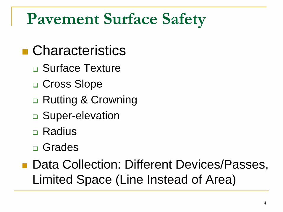
Pavement Surface Safety
Characteristics Surface Texture Cross Slope Rutting & Crowning Super-elevation Radius Grades
Data Collection: Different Devices/Passes, Limited Space (Line Instead of Area)
4

Support for New Technology Federal Highway Administration
Substantial Effort and Interest in Recent Years Pavement Design, Management, and Safety
Federal Aviation Administration Largest Indoor Pavement Test Facility Focused on Pavement Materials, &Management
University of Arkansas & Oklahoma State University
AR and OK Departments of Transportation Clients who Demand the State-of-Art Field-
Deployable Technologies5
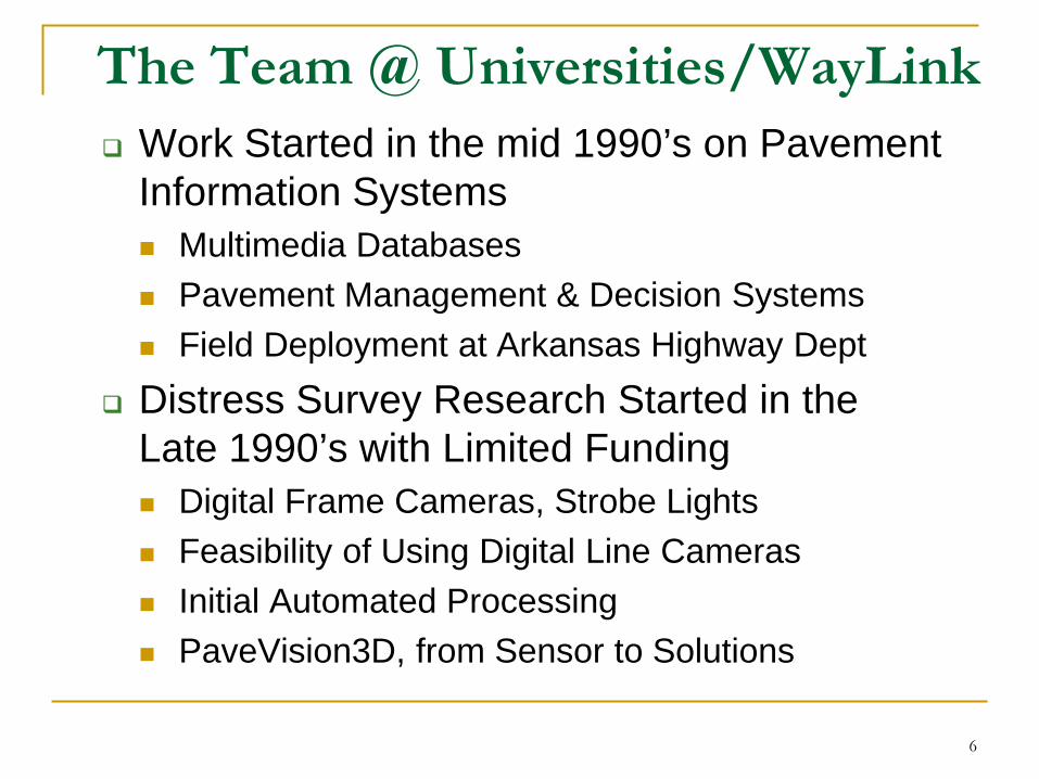
The Team @ Universities/WayLink Work Started in the mid 1990’s on Pavement
Information Systems Multimedia Databases Pavement Management & Decision Systems Field Deployment at Arkansas Highway Dept
Distress Survey Research Started in the Late 1990’s with Limited Funding Digital Frame Cameras, Strobe Lights Feasibility of Using Digital Line Cameras Initial Automated Processing PaveVision3D, from Sensor to Solutions
6

Opportunities for Fully Automated Cracking Survey Precision & Bias Issues Results from Manual, Semi-Automated, &
Automated Technologies with 2D Images
Vast Improvements in Cost & Performance of Components in Lasers, Cameras, Computing, & Software Tools
Therefore, Push for A New Way to Gather Data Actual 3D Representation of Pavement Surface at
1mm Resolution
7
Data Collection
A groundbreaking new technology to overcome many existing limitations, with the capability of obtaining 3D pavement surface models at true 1mm resolution with full-lane coverage & at highway speed (60MPH) Current Available Technology Only
Collects True 1mm Resolution 3D Pavement Data at 10-15MPH
8
Data Analysis
Conducting real-time analysis on macro-texture, longitudinal and transverse profiles, the majority of surface distresses, and roadway geometric data Single Vehicular Platform Huge Cost Savings Acceptable Levels of Precision & Bias for
Field Deployment
9
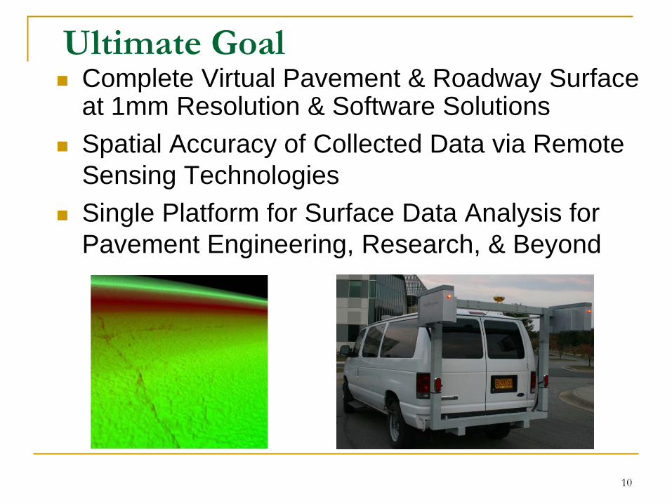
Ultimate Goal Complete Virtual Pavement & Roadway Surface
at 1mm Resolution & Software Solutions Spatial Accuracy of Collected Data via Remote
Sensing Technologies Single Platform for Surface Data Analysis for
Pavement Engineering, Research, & Beyond
10
Status of Pavement Survey: Roughness
Transition from Response Type Device to Inertial Measurement Device
Fully Automated with Measurable Precision & Bias based on Standards
Limitations Largely a Measurement of Single Lines in the
Longitudinal Direction; Typically on Two Wheel Paths
Accuracy Issue at Low Speed, such as 25MPH or Lower
11
Status of Pavement Survey: Rutting
Fully Automated with Point Laser Rangers Recent Implementations of 1000 plus
Points with 3D Laser Imaging Limitations
Largely a Single Functional Device
12
Status of Pavement Survey: Texture
Macro-Texture Measurement: Fully Automated with 64KHz Laser Ranger
With Measurable Precision & Bias based on Standards
Limitations Point Laser Forming A Single Line on Pavement
Surface A Single Functional Device
13
Status of Pavement Survey: Cracking
2D Laser Imaging for Data Collection at 1mm Resolution
Most Users: No Automation for Processing; Limitations with Full Automation
Unknown Precision & Bias Difficulty on Open-Graded or Chip-Seal Surfaces Hitting a Wall in Further Improving Algorithms
based on 2D Information
14
15
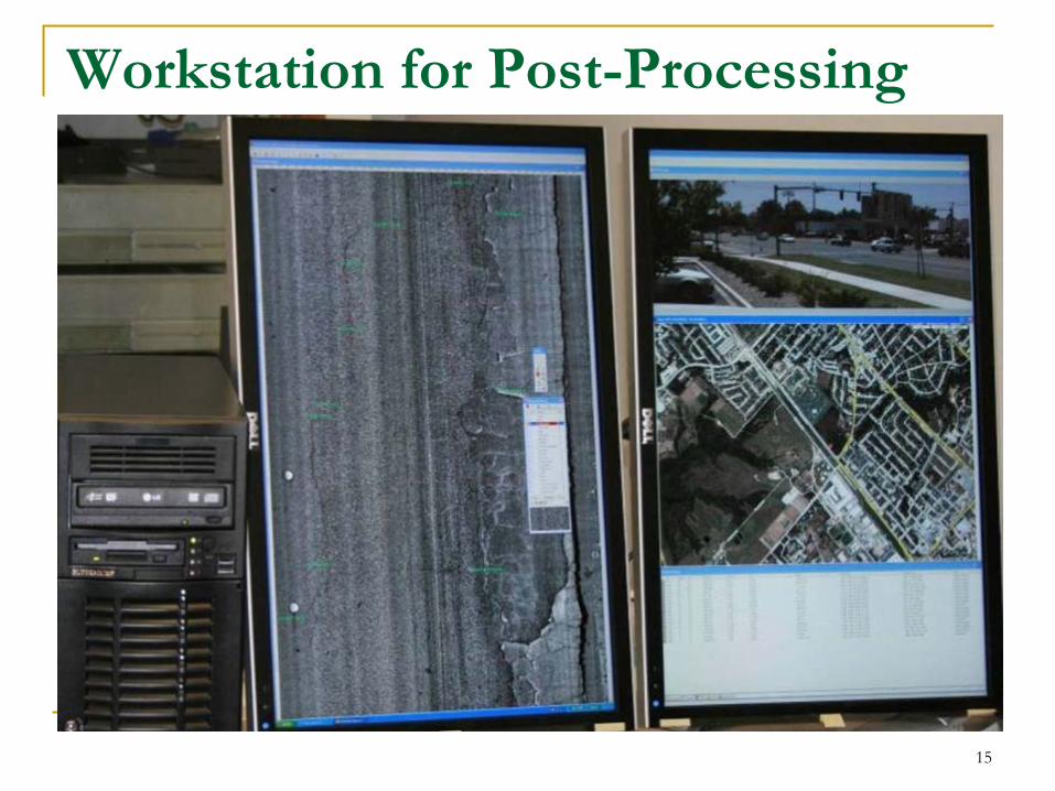
Workstation for Post-Processing

16
Grid based SCANNER Method

NCHRP-88: “Automated Pavement Distress Survey through Stereovision”
U of Arkansas Team: mid-2000
17
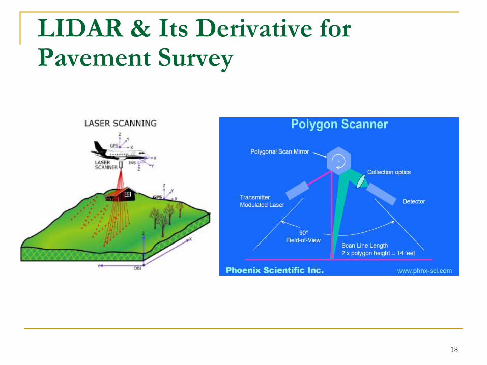
LIDAR & Its Derivative for Pavement Survey
18
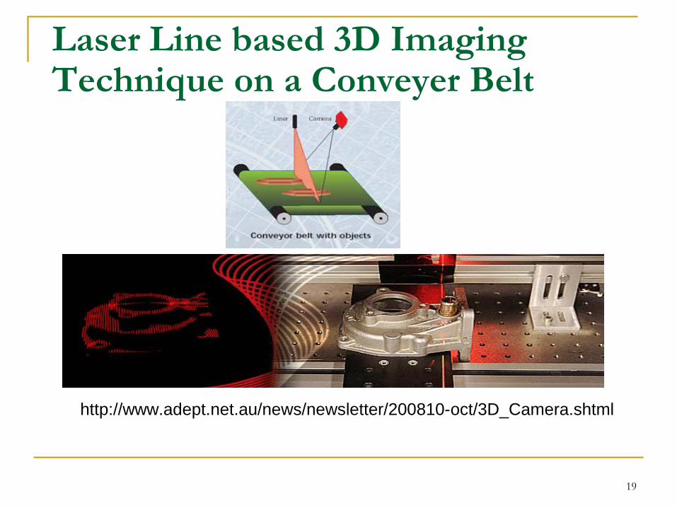
Laser Line based 3D Imaging Technique on a Conveyer Belt
http://www.adept.net.au/news/newsletter/200810-oct/3D_Camera.shtml
19
Basis for Using the Laser Line based 3D Imaging for the Proposed Research Unrealistic Illumination
Requirement for Stereovision based Principle
Struggling of the Technology based on LIDAR due to Resolution & Accuracy Issues
Prototyping Laser Line 3D System by the Team: Positive!
20
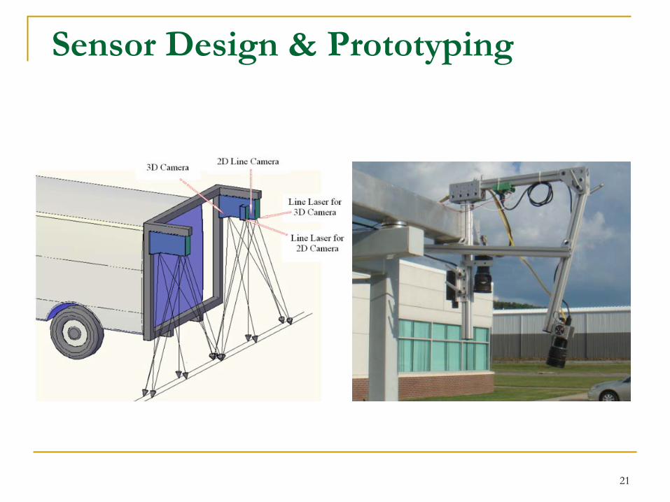
Sensor Design & Prototyping
21
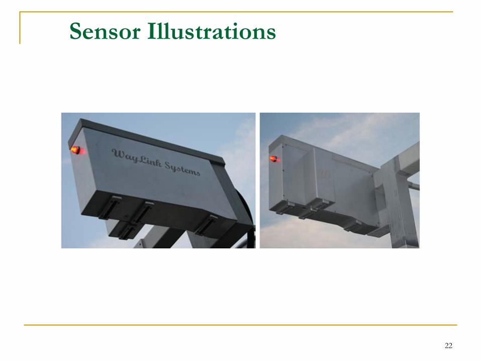
Sensor Illustrations
22
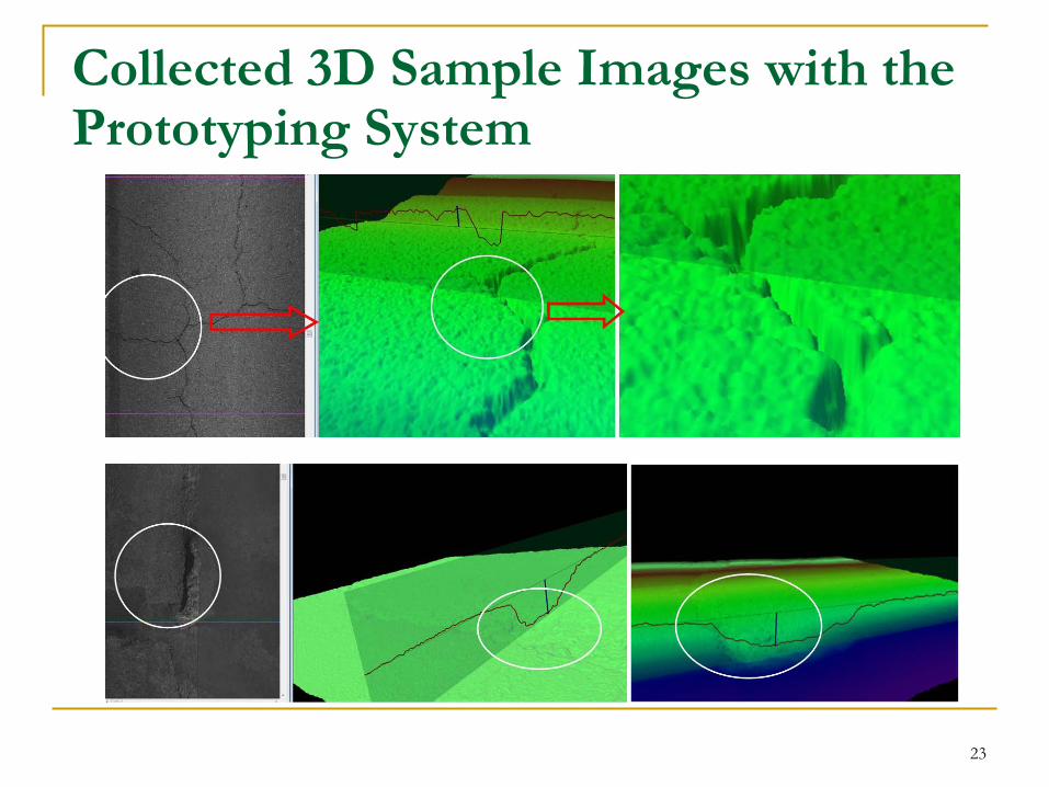
Collected 3D Sample Images with the Prototyping System
23
Spatial Positioning Data with Remote Sensing
GPS Receiver DMI Linear Referencing Inertial Measurement Instrument
(IMU) Key to availability of positioning data
at all times, such as during GPS outages
Critical for Building Virtual Pavement
24
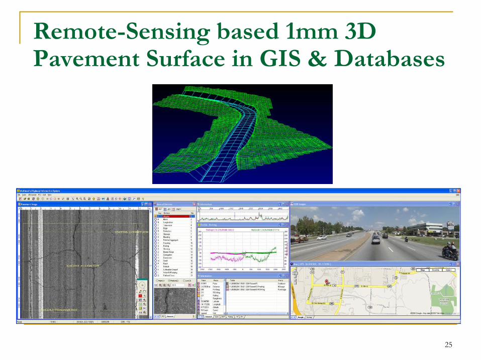
Remote-Sensing based 1mm 3D Pavement Surface in GIS & Databases
25
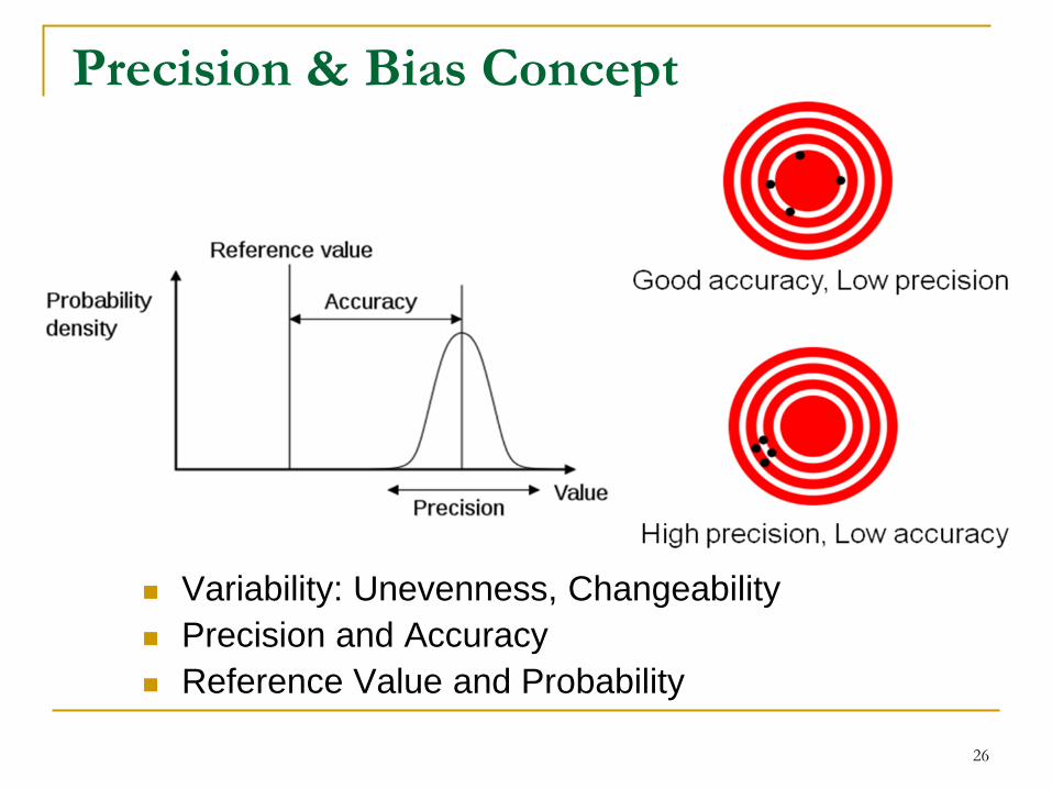
Precision & Bias Concept
26
Variability: Unevenness, Changeability Precision and Accuracy Reference Value and Probability

Video Demos
27
Recommended