
Data de SubmissãoDate of SubmissionOut. 2017
Data de AceitaçãoDate of ApprovalJan. 2018
Arbitragem CientíficaPeer ReviewAngelo Bertoni
Institut d’Urbanisme et Aménagement Régional
Aix-Marseille Université
Marta Macedo
Instituto de Ciências Sociais
Universidade de Lisboa
palavras-chave
nizza/nicefortificaçõesjardimturismo
keywords
nizza/nicefortificationsgardenstourism
Resumo
O mais importante porto do ducado de Sabóia (1388-1720) e do reino da Sardenha
(1720-1860) no Mediterrâneo, Nizza Marittima – a Nice francesa, depois de 1860
– era um assentamento defendido de maneira sofisticada: a partir de uma colina
proeminente o castelo dominava a baía, enquanto uma linha de imponentes mu-
ralhas cercava a cidade triangular fortificada. Em 1706, o castelo foi destruído em
definitivo: gradualmente, todo o sistema de fortificações começou a ser conside-
rado uma relíquia antiquada do passado. Enquanto isso, um número crescente de
turistas estrangeiros começou a desfrutar da suavidade do clima na costa, durante
o Inverno. Um século depois, o castelo não passava de um amontoado inútil de
ruínas, enquanto as muralhas não eram mais do que um obstáculo ao crescimento
da nova Nizza. Assim, desde a década de 1820, a área do morro foi transformada
num jardim luxuoso, permitindo desfrutar o maravilhoso panorama de 360°. Ines-
peradamente, em 1860, o turista já tinha substituído vitoriosamente o soldado. •
Abstract
The most important harbour on the Mediterranean of the Duchy of Savoy (1388-1720)
and Kingdom of Sardinia (1720-1860), Nizza Marittima – the French Nice, after 1860 –
was a sophisticatedly defended settlement: from a prominent hill the fortified castle
dominated the bay, while a line of mighty walls surrounded the fortified triangular
town. In 1706, the castle was positively destroyed: gradually, the whole system of forti-
fications came to be regarded as an old-fashioned relic of the past. In the meanwhile,
an increasing number of foreign tourists started to enjoy the mildness of the weather
on the coast, during the winter season. One century later, the castle was nothing but
a useless heap of ruins, while the walls were just an obstacle to the growth of the
new Nizza. Thus, from the 1820s onwards, the area on the hill was transformed into
a luxurious garden, allowing for the enjoyment of the marvellous 360° panorama.
Quite unexpectedly, by 1860 the tourist had already victoriously replaced the soldier.•
r e v i s t a d e h i s t ó r i a d a a r t e n.o 1 3 – 2 0 1 8 2 2 1
the soldier, the king, the gardener and the tourist: how the castle, fortifications and walls of nizza/nice became a touristic site (1821-1888)
s e r g i o pac e
Politecnico di Torino
1 “Nice d’aujourd’hui n’est plus Nice d’autrefois.
Elle a abandonné depuis longtemps à la sépulture
de ses morts le rocher escarpé qui fut son
berceau. Les cités comme les individus changent
au moral et au physique. Elle a laissé sur la
hauteur dont elle est descendue avec les débris
de ses maisons les vertus mâles et guerrières de
ses ancêtres. Il faut à la Nice d’aujourd’hui, au
lieu d’un roc stérile, une plaine riante dont elle
puisse fouler le gazon de ses pieds délicats; des
plaisirs au lieu de combats; des chants d’amour
au lieu de cris de guerre.” [Tourtoulon] 1852, 30
(author’s translation).
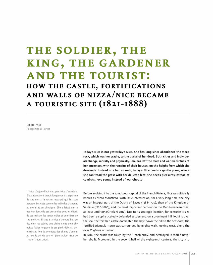
Today’s Nice is not yesterday’s Nice. She has long since abandoned the steep
rock, which was her cradle, to the burial of her dead. Both cities and individu-
als change, morally and physically. She has left the male and warlike virtues of
her ancestors, with the remains of their houses, on the height from which she
descends. Instead of a barren rock, today’s Nice needs a gentle plane, where
she can tread the grass with her delicate feet; she needs pleasures instead of
combats, love songs instead of war-shouts1.
Before evolving into the sumptuous capital of the French Riviera, Nice was officially
known as Nizza Marittima. With little interruption, for a very long time, the city
was an integral part of the Duchy of Savoy (1388-1720), then of the Kingdom of
Sardinia (1720-1860), and the most important harbour on the Mediterranean coast
at least until 1815 (Ortolani 2012). Due to its strategic location, for centuries Nizza
had been a sophisticatedly defended settlement: on a prominent hill, looking over
the sea, the fortified castle dominated the bay; down the hill to the seashore, the
fortified triangular town was surrounded by mighty walls looking west, along the
river Paglione or Paillon.
In 1706, the castle was taken by the French army, and destroyed: it would never
be rebuilt. Moreover, in the second half of the eighteenth century, the city also

t h e s o l d i e r , t h e k i n g , t h e g a r d e n e r a n d t h e t o u r i s t
r e v i s t a d e h i s t ó r i a d a a r t e n.o 1 3 – 2 0 1 82 2 2
started to expand eastward, thanks to the new Porto di Limpia. As a result, after
the Napoleonic years, the whole system of fortifications was regarded as an old-
fashioned relic of the past: the newly-restored Nizza seemed to be destined to
become something completely different.
An increasing number of foreign visitors – in French known as hivernants, as they
usually spent their winter in town – arrived on the coast (Aillagon 2017, 138-170).
Mainly from the United Kingdom, they enjoyed the mildness of the weather, spend-
ing weeks and months in this sunny corner of Europe. Inevitably, the old town
Fig. 1 – Plan parcellaire de la ville de Nice chef-lieu du département des Alpes-Maritimes, 1812. Nice, Archives Municipales, G.27.

r e v i s t a d e h i s t ó r i a d a a r t e n.o 1 3 – 2 0 1 8 2 2 3
t h e s o l d i e r , t h e k i n g , t h e g a r d e n e r a n d t h e t o u r i s t
2 “Toute recherche pour donner une idée de
l’ancienne Ville sur le château serait superflue.
Les fortifications qui l’ont remplacée, et les
bouleversemens que les mines y ont opérés
ont changé la face des lieux et fait oublier les
anciennes dénominations.”.
started to look inadequate (Boyer 2005, 163-180). The narrow streets and few
squares turned out to be not exactly what English tourists would expect as the
setting for their vacations (Hale 2009, 59-67). Such a wealthy and demanding inter-
national élite started to look elsewhere for more enchanting locations in which to
live and spend its abundant leisure time (Bottaro 2014).
Until the second decade of the nineteenth century, the place where the glorious
castle had been was little more than a promontory between the town and the
port. After all those years and troubles, almost nothing had been preserved of the
original fortified town of Nikaia, first founded on the top of this cliff presumably
in the fourth century B.C. (Guide des étrangers 1827, 8)2. On the top of the hill,
Fig. 2 – Clément Roassal, Vue des Ponchettes, 1820 ca. Private collection.
t h e s o l d i e r , t h e k i n g , t h e g a r d e n e r a n d t h e t o u r i s t
r e v i s t a d e h i s t ó r i a d a a r t e n.o 1 3 – 2 0 1 82 2 4
3 On the long and complicated vicissitudes of the
site, and namely of its archaeological remains,
see Ghiraldi (2006) and especially Bouiron (2007-
2008), who recorded an impressive amount of
visual and written documents, as well as rough
but essential data; the editor’s studies have
also been condensed in Bouiron (2013). A well-
illustrated summary on the whole case study has
been recently published by Bodinier (2015).
4 Millin’s description of the route connecting the
terrace of the Poncette and the Porto di Limpia –
now the windy Quai de Rauba Capeu, meaning
the hat-stealing quay in Nissart – is noticeably
romantic: “En descendant vers le levant de cette
belle et majestueuse terrasse, on arrive à un
chemin qui a été fait autour du rocher, dont on
suit les sinuosités comme sur un balcon; lorsque
la mer est élevée, les vagues viennent s’y briser
avec effort: la violence du choc fait jaillir l’eau
à une hauteur considérable; et, en retombant en
cascades sur ces aspérités, elle produit un effet
difficile à rendre”.
5 The most recent and detailed history of tourism
in the Contea di Nizza, or Département des
Alpes-Maritimes since 1860, is Bottaro et al. 2013,
in particular, for its early years, see the chapter
“La recherche du confort climatique”, pages 9-97.
the remains were regarded as nothing but a useless heap of ruins while, down the
hill, the remains of the walls along the river and shore were just an obstacle to the
growth of the new Nizza3. The “once invincible” fortress was regarded as nothing
more than a melancholic relic (Sulzer 1780, 176), while the new port (to the east)
and the old town (to the west) were divided by “the cliff”, whose only charm was
to be appreciated when the sea waves crashed on it furiously (Millin 1816, 87)4.
Un pubblico passeggio, or how the old Castle of Nizza was thoroughly redesigned
Nevertheless, in the early nineteenth century, a new age arrived. Charles Felix – alias
Carlo Felice Giuseppe Maria, duke of Savoy – was crowned king of Sardinia on 25 April
1821. Until his death in 1831, many things began to change in his small but strategic
kingdom: among them, the political, economic, and cultural destiny of the remote
county of Nizza, more and more evidently bound to be transformed into a privileged
location for foreign, wealthy hivernants (Pace 2017). In particular, two major processes
were planned and financed by the Municipality and the Crown in the 1820-1830s.
On the one hand, on 30 July 1823 the king decreed that the old bastions along the
river Paglione were gradually to be transformed into a riverfront, connecting the
old town to the new borough of the Croce di Marmo, whose expansion was being
determined by the newly-born Cammino degli Inglesi, namely the future world-
famous Promenade des Anglais. On the other, and even more interestingly, the
king donated the area upon the cliff to the municipality, which almost immediately
started to transform it into a luxurious garden.
Evidently, the pivotal event which triggered the whole process had been the loss of
centrality that the ports of Nizza and Villafranca [Villefranche] had suffered, due to
the inclusion of Genoa within the borders of the newly restored kingdom. Becom-
ing part of Liguria, that is the “immense amphitheatre” spanning from Tuscany to
France (Bertolotti 1834, 2: 67), Nizza could do nothing but look for a brand-new
role in local economies and politics. The chronological coincidence of the construc-
tion of the Cammino degli Inglesi along the seashore, the transformation of the
castle into a park and, finally, the complete demolition of the city wall along the
river was not fortuitous at all. The aims were concurrently economic and political:
local élites regarded tourism – whatever this might have meant at the beginning of
the nineteenth century – as crucial to the development of the city after 1814-1815.
In fact, the term tourism may not be adequate to properly describe such a mul-
tifaceted context (Boyer 2005, 6). Foreign hivernants, spending their winter on
the Riviera, were not exactly tourists, first because they generally inhabited these
places for a long while, though without becoming locals5. They would rent apart-
r e v i s t a d e h i s t ó r i a d a a r t e n.o 1 3 – 2 0 1 8 2 2 5
t h e s o l d i e r , t h e k i n g , t h e g a r d e n e r a n d t h e t o u r i s t
6 “Le but de cet ouvrage fut de faire travailler
les pauvres, et de procurer aux étrangers, et
surtout aux malades habitans au faubourg,
une promenade saine et agréable” (author’s
translation).
7 On the development of winter and/or summer
sea-bathing, in Nizza and other locations, see
Urbain 1994 and Toulier 2016.
ments or, less frequently, sumptuous villas in the countryside for the whole season
and spend their abundant leisure time enjoying the extraordinary charm of the
natural surroundings or the minor pleasures of a rather modest social life. Other
foreigners would pass through Nizza more quickly, spending only a few weeks or
days in town, on their way from north-western Europe, and especially the British
Isles, to Italy. Although Marseille and Genoa were much safer and better equipped
harbours, Nizza could be a comfortable stop-over in their grand tour towards Flor-
ence, Rome, Pompei and other Italian mirabilia.
In such circumstances, the Cammino should not be regarded as a public intervention
on the outskirts of the town, since it came out of the reconfiguration of a number
of private properties between the seashore and the Strada di Francia. Neverthe-
less, local authorities encouraged it explicitly, regarding it as an essential tool for
growth: “the aim of this work was to make poor people work and provide the foreign
and sick inhabitants of the faubourg with a healthful and pleasant walk” (Guide
des étrangers 1827, 115)6. Actually, the strategy turned out to be quite successful:
the transformation of the bord de mer into the Cammino finally launched Nizza as
a world-famous station balnéaire (Barelli 2015)7.
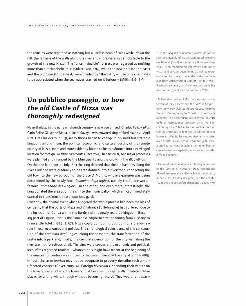
As a private investment, the completion of the Cammino degli Inglesi turned out to
be rather fast, which was definitely not the case for the other interventions. Never-
theless, and quite paradoxically, the new park on the hill – whose renovation took
over sixty years – gained fame and attracted visitors well before its completion.
The process began under the impulse of Alessandro Crotti di Costigliole (1774-1830),
Fig. 3 – Clément Roassal, Vue de la colline du Château, 1828-1832. Nice, Bibliothèque du Chevalier de Cessole.

t h e s o l d i e r , t h e k i n g , t h e g a r d e n e r a n d t h e t o u r i s t
r e v i s t a d e h i s t ó r i a d a a r t e n.o 1 3 – 2 0 1 82 2 6
8 Regie patenti, 12 August 1819: cf. Raccolta di
Regj Editti [1820], 142. The divisione di Nizza
was an administrative division of the Kingdom of
Sardinia, established in 1818 and replaced in 1859
by the provincia di Nizza: see Bracq et al. 2010,
173-185.
9 “Riuscirebbe molto vantaggiosa la concessione
del Castello mentre formandosi in esso delle vie
ed aditi con piantagioni d’alberi se ne formerebbe
un pubblico passeggio, che sarebbe altrettanto
ameno quanto la di lui posizione trovasi singolare
ed unica per i bellissimi punti di vista che da
tutte le sue parti scopre l’occhio”: see Archives
Municipales de Nice (AMN), s. O, n. 3/17, Pièces
relatives à la concession des terrains du château
à la ville (1821-1839).
10 For instance, see Hippolyte Caïs de Pierlas
(drawer) and Comte de Lasteyrie (engraver), Vue
de la Terrasse et du Château de Nice, 1821.
11 “Nella mira di abbellire i contorni di quella città
con pubblici passeggi e piantaggioni per rendere
vieppiù salubre e gradevole il soggiorno, che
varie ricche famiglie forestiere si fanno durante la
stagione d’inverno”: see the manuscript copy of
the decree in AMN, s. O, n. 3/17, Pièces relatives
à la concession des terrains du château à la ville
(1821-1839).
12 A manuscript copy of a deeply detailed
Ragionamento in sostegno del Piano di
abbellimento e di via pubblica sui nuovi Baluardi
della Città di Nizza Marittima, signed on 31 March
1826, is in AMN, s. O, n. 4/1, cart. 2.
13 Piano Regolatore della Città di Nizza Marittima
redatto sulle basi del voto emesso dal Congresso
permanente d’acque e strade, in AMN, s. O, n.
4/1 (1820-1864. Plan régulateur. Documents
généraux, pièces officielles). As regards the
history of the urban landscape of Nizza until 1860,
see also Castela 2012, 57-149.
who was appointed intendente generale of the divisione di Nizza in 18198, while
the first phase of the new life of the castle began on 6 December 1821, when the
municipality made a plea to the king to donate the area: the aim was to create “a
public walk, which would be just as pleasant as its position is unique, and unique
for the beautiful views that, from all its parts, any eye can discover”9. The state of
the place seemed to demand some kind of urgent intervention, as it looked – in
some of the many engravings, mostly destined for foreign visitors10 – completely
separated from the city and somewhat wild, if compared to the dense urban fabric
below and the new uses of the terrace of the Poncette, more and more dedicated
to leisurely walks and the romantic contemplation of the seascape.
After a few months, the king responded to the plea and signed his lettere patenti
in Genoa on 3 May 1822. Surprisingly, the goal was explicit: in the king’s words,
his resolution was only determined by the presence of the wealthy hivernants in
Nice, who provided money (il lucro) to the city and, therefore, needed a beautiful
and salubrious environment in which to live11. The Ministry of War and Navy only
succeeded in saving the bastion and a few other military devices, still in place but
at this point effectively useless.
In spite of the rapid royal decision, it was not clear yet how the municipality could
rearrange the area, to say nothing about some of the complicated issues arising
from the private properties still located there: consequently, the debate went on
for years. Such difficulties must not be underestimated, considering that the reform
of the hill would probably have been impossible if it was not to be included in the
general reform of the city, down the hill and beyond the river Paglione, where the
old military bastions rapidly started to change into a charming promenade12. The
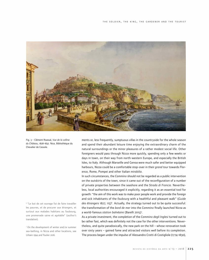
late 1820s have been identified as crucial and the new piano regolatore della città
di Nizza Marittima – designed by the municipal architect, Gio. Antonio Escoffier,
helped by the geometer Louis Trabaud, in 1824-1825, approved by the municipality on
4-5 June 1829 and by King Charles Albert three years later – would set the rules for
the next decades, even after the annexation to France in 1860 (Graff 2000, 52-57)13.
In particular, the lettere patenti, signed on 26 May 1832, both created the municipal
Consiglio d’Ornato, the institutional engine for the urban change in the following
years, and included a regolamento, whose clause n. 22 explicitly mentioned the castle
and the city walls, confirming the intentions decreed by King Charles Felix ten years
before14. Anticipating the final royal approval of the plan, in 1831 the municipality
gave the usufruct of the property of the castle to the Regia Camera di Agricoltura
e di Commercio, which was thus entrusted with the new plantation15.
Gradually, the few inhabitants of the hill were relocated elsewhere in the old town,
while all military uses became forbidden. Thanks to its relatively isolated position,
the area had been a haven for many illegal activities: in the late 1830s the police still
made frequent attempts to throw criminals and prostitutes out, in order to regain
complete possession of what evidently seemed a waste land; in the meantime, the
Regia Camera decided to fence the whole hill, leaving just two gated entrances
from the port and the old town, to be opened at sunrise and closed at sunset. The
Fig. 4 – Pianta generale del Promontorio su cui giacea il distrutto Castello della Città di Nizza, 1832. Nice, Archives Municipales, 1.Fi.2-24.

r e v i s t a d e h i s t ó r i a d a a r t e n.o 1 3 – 2 0 1 8 2 2 7
t h e s o l d i e r , t h e k i n g , t h e g a r d e n e r a n d t h e t o u r i s t

t h e s o l d i e r , t h e k i n g , t h e g a r d e n e r a n d t h e t o u r i s t
r e v i s t a d e h i s t ó r i a d a a r t e n.o 1 3 – 2 0 1 82 2 8
14 “Rimarranno tuttavia ferme in ogni loro parte
le condizioni imposte nella Sovrana concessione
fatta da S. M. il Re Carlo Felice alla Città di Nizza,
del promontorio su cui giaceva l’antico castello,
come pure quelle concernenti alla batteria da
ricostruirsi in vicinanza del luogo ove il torrente
Paglione sbocca nel mare, ed all’attiguo muro
di cinta verso mezzogiorno”: see Regie Lettere
Patenti, in data del 26 di maggio 1832, per le
quali S. M. approva il piano regolatore delle
opere d’abbellimento, e d’ingrandimento della
città di Nizza marittima, insieme coll’annesso
regolamento, che dovrà essere di norma
all’esecuzione del piano, Torino: Stamperia Reale
[1832], in AMN, s. O, n. 4/1, cart. 1.
15 Archives Départementales des Alpes-Maritimes,
Nice (ADN), s. 033J, Archives de la Chambre de
Commerce et d’Industrie de Nice Côte d’Azur;
n. 0023, Château de Nice. Aménagement des
terrains du château en parc public, travaux de
plantations, surveillance du parc: instructions,
rapports, états des travaux, schémas concernant
les fontaines, actes de locations, correspondance
(1828-57); more useful documents are in the
same archives, s. 01FS (Intendance générale de
Nice), n. 0590 (Colline du château de Nice).
16 Millo was the “custode e inrigatore delle piante
ed erbe radicate nel vecchio castello”, according
to one of his many Rapports du garde du
Vieux-Château à la chambre d’agriculture et de
commerce de Nice, in AMN, s. F, n. 3/03.
17 In 1855 the municipality placed a commemora-
tive plaque of such works in one of the avenues
in the park, where it still stands.
18 Pianta generale del Promontorio su cui giacea
il distrutto Castello della Città di Nizza Marittima
indicante lo stato in cui trovasi al giorno d’oggi le
proprietà particolari limitrofe, le ultime concessioni
di terreno fattevi per parte del Regio Demanio
e la superficie di cui la Città di Nizza chiede la
Concessione a conferma delle Regie patenti del 26
maggio 1832, in AMN, s. 1FI2, n. 24.
many reports, signed by Agostino Millo as “caretaker and waterer of the plants and
herbs rooted on the old Castle”, made reference to an enchanting garden that was
difficult to protect, due to its position16.
Between the lines of the abundant documentation concerning the security of the
castle and exchanged between the Regia Camera, the police and the municipality, it
became evident that the brand-new garden must not only be pleasant but also safe
for any visitor. Foreign tourists were implicitly but inevitably regarded as the first and
most important referees: by means of such a deep environmental and social cleans-
ing, they were to be saved from any kind of moral and/or criminal inconvenience.
In the meanwhile, the trees and plants grew more and more abundant. A number of
the most illustrious administrators of the Regia Camera shared all the responsibili-
ties: in particular, the famous scientist Giuseppe Antonio [or Joseph-Antoine] Risso
(1777-1845) was appointed as the main botanist for the park’s new plantation in the
early 1830s, when he took charge of the afforestation of the site with innumerable
exotic species. After his death, other members of the Regia Camera, such as Baron
Luigi Millonis, carried on his work until 1858, when the institution had to give the
now restored area back to the municipality17.
Over the years, the transformation of the military ruins into a garden became a long
and expensive task, though its ultimate objective was never called into question. In
particular, the Pianta generale del promontorio, signed by the municipal architect
Giuseppe [or Joseph] Vernier on 20 November 1845, quite meticulously described
what the new piano regolatore had planned for the top of the glorious hill and,
moreover, what had already been realized in the meanwhile18. Most of the avenues
had been created and trees had been planted, in particular in the northern part of
the site, towards the cemeteries and the Porto de Limpia; few military relics still
remained on site – a magazzeno d’artiglieria, a batteria, some fragments of the walls
with their rastelli [gates], the torre Sant’Elmo, renamed Bellanda – but all the rest
had disappeared, reshaped into a luxuriant green plateau. However, the ascent to
the top was still to be completed: according to the drawing, a new flight of easily
accessible steps would allow the visitor to reach the torre directly from the seaside,
where the strada delle Poncette ended; once at the top, he or she would find a
large boulevard, planted with a double row of trees, leading either north, towards
the cemeteries, or east, towards the terrace overlooking the Porto de Limpia; from
there, via a polygonal spiral path, the boulevard would go up to the highest point
of the hill, where an elliptical open space would be dominated by a commemorative
obelisk, in memory of either the Savoy family or the city of Nizza.
The feeble monumentalization of the place came as no surprise. Evidently, nobody
seemed to care about who or what the municipality had to celebrate, while every
single detail, carefully determined, was intended to create a pleasant walk in the
newly planted tree-lined avenues, looking for the most beautiful belvedere, as if a
full-scale enchanting panorama had been newly generated.
In all those years, though aiming for the radical transformation of a military
zone into a green area, apparently nobody dealt with one crucial issue: its water

r e v i s t a d e h i s t ó r i a d a a r t e n.o 1 3 – 2 0 1 8 2 2 9
t h e s o l d i e r , t h e k i n g , t h e g a r d e n e r a n d t h e t o u r i s t
19 ADN, s. 033J (Archives de la Chambre de
Commerce et d’Industrie de Nice Côte d’Azur), n.
0023 (Château de Nice).
20 The author dedicated the sixième promenade
of his book to the castle (Negrin 1867, 43-56). In
the following years, the sixteenth century well –
the so-called devil’s well – would be occupied by
the elevator leading from the Ponchettes to the
upper level.
21 On the works for the source of Sainte-Thècle
see Lacroix and Bracq 2007, 77-79.
22 Projet de diversion de la cascade du château,
plan des diversions, conduites des eaux aux
égouts de la vieille ville, plan général du château,
vieille ville, in AMN, s. O, ss. 1.O (Réseaux de
distribution et d’assainissement, 1862-1976),
cart. 8 (1881-1895. Canal de la Vésubie, rigoles
secondaires et tertiaires. bouches, filtres), n. 5-7.
supply. A sixteenth century pit had been filled in 1706, then cleared during the
revolutionary years and, finally, vaulted in 1830: it could still give access to a
water source, indispensable to all flowers and plants. For this purpose, in 1837-
1838 the Regia Camera decided to build a circular water tank, with a capacity of
up to 240 m3; another smaller semi-circular tank was realized in August 184019.
Thus, plants and trees could be bedded out, also thanks to some generous ben-
efactor. At the end of the 1860s, the administration still considered scheduling
more works, to be executed by either the municipality or some private contrac-
tor (Negrin 1867, 45)20.
In fact, during the summer seasons, Nice often suffered from extreme drought,
while the network for its water supply was not proportionate to the needs of an
aspiring year-round vacation city (Lacroix 2003). The solution to all these problems
was found in the secondary outcome of the construction of the Canal de la Vésu-
bie, a colossal infrastructure already conceived in the 1840s and finally realized in
1869-1885 (Lacroix 2003, 188-199). Derived at Saint-Jean-la-Rivière, the waters of
this river were to be brought down to Nice, after a journey of over 30 km. After its
opening in 1884, it was to provide 275,000 m3 per day to the whole town.
By means of such new equipment, the irrigation of the park rapidly became effi-
cient, allowing for a rich and diversified horticultural activity21. Thanks to the new
source, in 1885 some neglected ruins of the old donjon could be transformed into
a small decorative cascade; in 1887 the project was expanded and the municipal
engineer Berne imagined a monumental cascade, made of three different levels
and articulated in different grottos, destined to become both an overflow to the
basins of the first modern water supply in Nice and, moreover, the superb back-
drop of the whole baie des Anges22. In 1888, the large amount of money, left by
the benefactor Jean-Charles Lesage (1789-1883) as a gift to the city, allowed for
Fig. 5 – Pietro Righini, Festa della pesca a Nizza con Carlo Felice e Maria Cristina di Savoia, 1839-1842. Polo Museale del Piemonte, Castello ducale di Agliè.

t h e s o l d i e r , t h e k i n g , t h e g a r d e n e r a n d t h e t o u r i s t
r e v i s t a d e h i s t ó r i a d a a r t e n.o 1 3 – 2 0 1 82 3 0
23 The ADN have an impressive iconographic
collection of the park and the cascade, to
be explored and thoroughly analysed: in this
perspective, many methodological suggestions
on “iconography and landscape”, first made
by Daniels and Cosgrove 1988, could still be
extremely useful.
24 Plan de la ville de Nice, dressé par Ch.
Montolivo; gravé par Ch. Dyonnet, lithography,
Nice: B. Visconti, 1856.
the construction of the homonymous escalier, finally giving direct access from the
Ponchettes to the tour Bellanda.
Thus, the system was completed. All narratives – paintings and photographs, dia-
ries and novels, posters and postcards, movies and selfies – finally found their
landscape icon23.
L’artillerie des ondes, or how the old Castle of Nizza was thoroughly revisited
It took time to turn into reality what the piano regolatore had conceived for the
hill. When Montolivo and Dyonnet published their Plan de la ville de Nice in 1856,
a good deal of work was evidently still to be done24. Nevertheless, according to
other visual and literary sources, the new life of the site had already begun, many
years before, as if it had been long-awaited.
The narratives around one of the most eminent constructions of the former cas-
tle, the torre Bellanda, epitomised the early birth of the myth. In August 1823,
the member of the Regia Camera di Commercio and consul of Naples in Nizza,
Onorato Clerici (or Clerissi according to the French spelling), acquired the ruins
of the torre Sant’Elmo, once the colossal fortified bastion on the castle hill where
the State Treasury and even the Holy Shroud had been enshrined in the sixteenth
century. Quite soon, he started to transform the military structure into something
completely different: not a house, not a public building, but just a belvedere,
Fig. 6 – Claude Perrin, Vue panoramique de la colline du Château, 1840 ca. Nice, Archives Départementales des Alpes-Maritimes, 05Fi.330.

r e v i s t a d e h i s t ó r i a d a a r t e n.o 1 3 – 2 0 1 8 2 3 1
t h e s o l d i e r , t h e k i n g , t h e g a r d e n e r a n d t h e t o u r i s t
25 Paolo-Emilio [or Paul-Emile] Barberi (drawer)
and François Le Vilain (engraver), Vue de la
tour de Clerissi, à Nice, in Album ou Souvenir
de la Ville de Nice (Maritime) et de ses environs,
Dessiné et Lithographié par le Ch.r Barberi (P.
E.) Professeur d’Architecture et de Peinture des
Ecoles de la Ville de Nice, et ancien Professeur
de dessin du Lycée et du Collège, Nice: Société
typographique, [1834], ill. 9.
26 A later record of the event was Pietro Righini’s
Festa della pesca a Nizza con Carlo Felice e Maria
Cristina di Savoia [The fishing party in Nice with
Charles Felix and Mary Christine of Savoy], where
the tower can be appreciated as dominating the
hill in the background (fig. 5).
27 On guidebooks for travellers a heated debate
has been carried on, at least since the 1980s, when
a clear distinction between travel and tourism
was finally made. As Paul Fussell put it, “tourism
simulates travel, sometimes quite closely [...]. But
it is different in crucial ways. It is not self-directed
but externally directed. You go not where you
want to go but where the industry has decreed
you shall go. Tourism soothes you by comfort and
familiarity and shields you from the shocks of
novelty and oddity. It confirms your prior view of
the world instead of shaking it up. Tourism requires
that you see conventional things, and that you
see them in a conventional way” (Fussell 1987,
651). Generally, such a distinction is considered to
work for later years, but some specific places in
Europe – such as the seaside resorts, Brighton and
the English coast first, but also the coast around
Nizza – might have developed this dichotomy
even before the invention of mass tourism: see
Urry (1990) 2012, 16-37.
28 “Ce lieu qui a été si long-tems un objet de
terreur et le centre de tous les fléaux de la guerre
deviendra un site enchanteur, où de bosquets à
l’anglaise, des bois touffus, des allées délicieuses
remplaceront les batteries, les casemates et les
mines” (author’s translation).
made both to enjoy the stunning view of the bay and spot the hill from the bay25.
Clerici had his first opportunity to show off the grandness of his work during
the official visit of King Charles Felix, in late 1826. In his honour, the city organ-
ized a sumptuous party on 30 November, held in an ephemeral ballroom built on
a terrace next to Palazzo Radicati. There, in front of more than 600 guests, a
purposely composed opera – Ercole al passaggio delle Alpi – was staged: at the
end of the third act, the passage of the Alps was represented quite dramatically,
thanks to the lighting of the whole terrace and the newly restored torre Clerici,
decorated as a part of the stage set, in the background (Giornale del Regno delle
Due Sicilie 1826, 1158-1159)26.
A half-artificial and half-natural theatre, a number of bewitched spectators, the
cliff as the protagonist of a unique sound-and-light show … everything suggested
that something was worth watching. In fact, many authors reported this and other
events, quite carefully: as it happened in other European countries, between the
late eighteenth and early nineteenth century, the multifarious travel literature is a
precious companion in order to discover what early tourists ought to have visited
and, moreover, how they were supposed to visit it. The many guides for foreign
travellers, also increasingly popular on the Riviera in Italian, French or English by the
end of the 1820s27, explicitly testified that the old castle – having been “an object
of terror” for a long time – was rapidly becoming “an enchanting site, where groves
à l’anglaise, thick woods, delicate alleys [would] replace the batteries, casemates
and mines” (Guide des étrangers 1827, 85)28. The place, once a defensive structure
and military observation deck, was being thoroughly reshaped and reconsidered
as a touristic area, where both residents and hivernants could enjoy the breath-
taking view of the whole bay. Together with other signs, this was perhaps the first
real sparkle for the new life of Nizza. The old peripheral military outpost started
to become the new holiday town, in particular when its inaccessible fortifications,
Fig. 7 – Nice en 1848. Archives Départementales des Alpes-Maritimes, 05Fi.47.

t h e s o l d i e r , t h e k i n g , t h e g a r d e n e r a n d t h e t o u r i s t
r e v i s t a d e h i s t ó r i a d a a r t e n.o 1 3 – 2 0 1 82 3 2
29 More generally, an essential introduction to
travel literature of all genres is provided by
Speake 2003, passim.
made for watching without being spotted, were transformed into the platform for
a magnificent 360° experience.
Coupled with paintings and engravings, the many tourists’ writings – diaries, let-
ters, novels… – are an inexhaustible mine for exploring the newly reborn town, too
(Jones 2004, 105-128)29. In 1831 an illustrious visitor, Héctor Berlioz, was hosted at
Clerici’s residence, where he rented “a lovely room […] on a small fortified moun-
tain”. Immediately, he was captivated by the beauty of the scenery: as he wrote to
his family on 21 April, “I have a delightful room with windows overlooking the sea.
Fig. 8 – Charles Montolivo, Charles Dyonnet. Plan de la ville de Nice, Nice: B. Visconti, 1856.
r e v i s t a d e h i s t ó r i a d a a r t e n.o 1 3 – 2 0 1 8 2 3 3
t h e s o l d i e r , t h e k i n g , t h e g a r d e n e r a n d t h e t o u r i s t
30 “J’ai un appartement délicieux dont les fenêtres
donnent sur la mer. Je suis tout accoutumé au
continuel râlement des vagues; le matin, quand
j’ouvre ma fenêtre, c’est superbe de voir les
crêtes accourir comme la crinière ondoyante
d’une troupe de chevaux blancs. Je m’endors au
bruit de l’artillerie des ondes, battant en brèche le
rocher sur lequel est bâtie ma maison” (author’s
translation).
I have got used to the continuous moan of the waves. When I open my window in
the morning, it is wonderful to watch the crests approaching like the undulating
mane of a squadron of white horses. I go to sleep to the sound of the artillery of the
waves, which crash against the rock on which my house is built” (Berlioz 1972, 219)30.
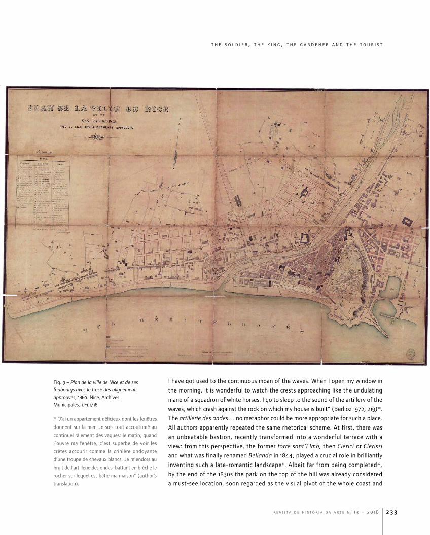
The artillerie des ondes… no metaphor could be more appropriate for such a place.
All authors apparently repeated the same rhetorical scheme. At first, there was
an unbeatable bastion, recently transformed into a wonderful terrace with a
view: from this perspective, the former torre sant’Elmo, then Clerici or Clerissi
and what was finally renamed Bellanda in 1844, played a crucial role in brilliantly
inventing such a late-romantic landscape31. Albeit far from being completed32,
by the end of the 1830s the park on the top of the hill was already considered
a must-see location, soon regarded as the visual pivot of the whole coast and
Fig. 9 – Plan de la ville de Nice et de ses faubourgs avec le tracé des alignements approuvés, 1860. Nice, Archives Municipales, 1.Fi.1/18.
t h e s o l d i e r , t h e k i n g , t h e g a r d e n e r a n d t h e t o u r i s t
r e v i s t a d e h i s t ó r i a d a a r t e n.o 1 3 – 2 0 1 82 3 4
31 Among others, see Durante (1847, 64-65),
whose words could be paired with the plan de la
propriété Clérissi et des terrains adjacents, August
7, 1847, in AMN, s. O, n. 3/19.
32 Both a lithography, drawn by Ferdinand Perrot
and published in Promenade de Nice à Gênes
(Chapuy and Cuviller 1838), and a watercolour
by Joseph Fricerio, possibly dating from the
late 1840s and now in a private collection
(cf. Benvenuto 2009, 34), vividly show the
promontory as a half-wild spot, overlooking the
Mediterranean.
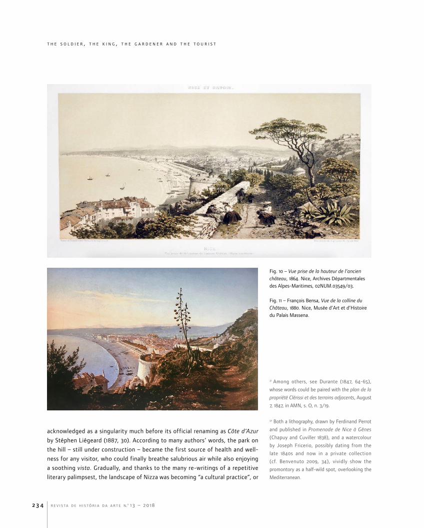
acknowledged as a singularity much before its official renaming as Côte d’Azur
by Stéphen Liégeard (1887, 30). According to many authors’ words, the park on
the hill – still under construction – became the first source of health and well-
ness for any visitor, who could finally breathe salubrious air while also enjoying
a soothing vista. Gradually, and thanks to the many re-writings of a repetitive
literary palimpsest, the landscape of Nizza was becoming “a cultural practice”, or
Fig. 10 – Vue prise de la hauteur de l’ancien château, 1864. Nice, Archives Départmentales des Alpes-Maritimes, 02NUM.03549/03.
Fig. 11 – François Bensa, Vue de la colline du Château, 1880. Nice, Musée d’Art et d’Histoire du Palais Massena.
r e v i s t a d e h i s t ó r i a d a a r t e n.o 1 3 – 2 0 1 8
t h e s o l d i e r , t h e k i n g , t h e g a r d e n e r a n d t h e t o u r i s t
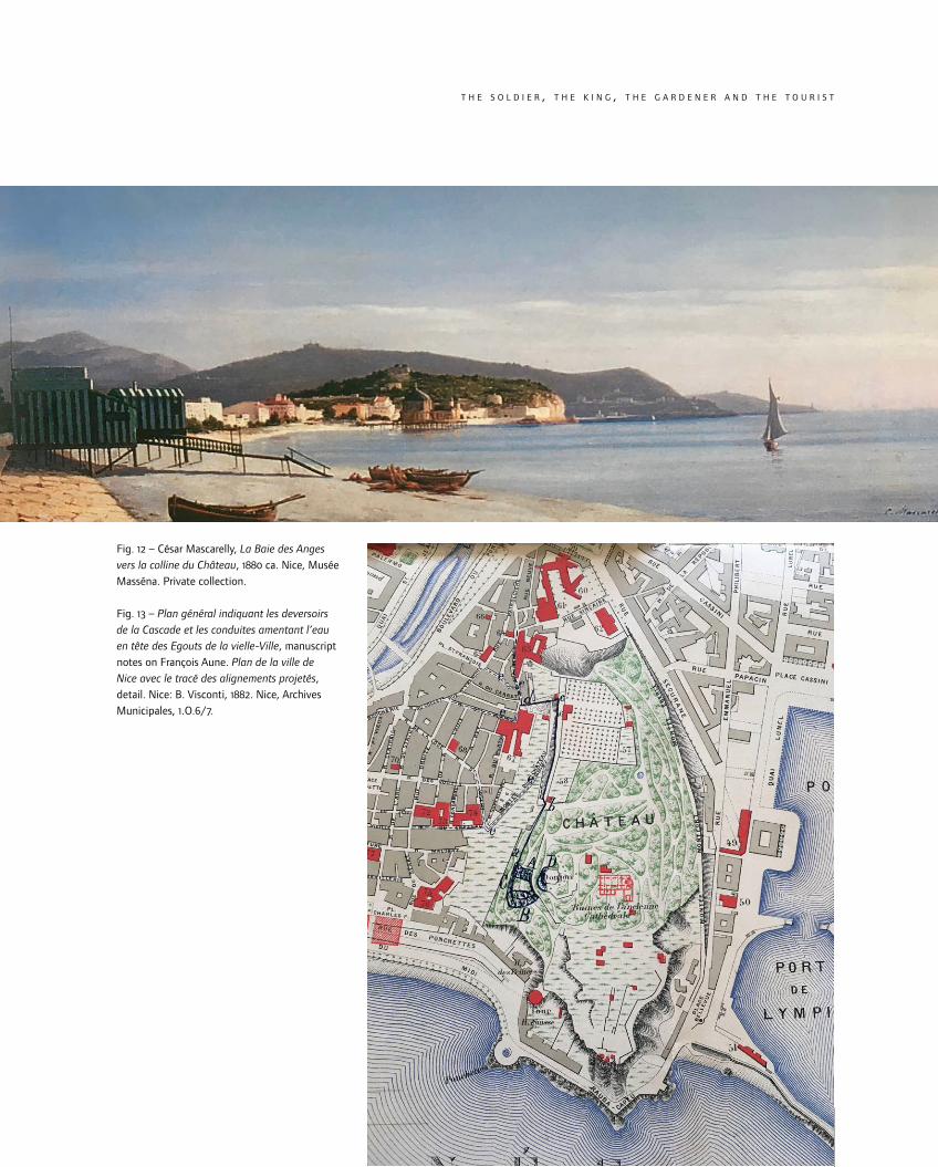
Fig. 12 – César Mascarelly, La Baie des Anges vers la colline du Château, 1880 ca. Nice, Musée Masséna. Private collection.
Fig. 13 – Plan général indiquant les deversoirs de la Cascade et les conduites amentant l’eau en tête des Egouts de la vielle-Ville, manuscript notes on François Aune. Plan de la ville de Nice avec le tracé des alignements projetés, detail. Nice: B. Visconti, 1882. Nice, Archives Municipales, 1.O.6/7.
t h e s o l d i e r , t h e k i n g , t h e g a r d e n e r a n d t h e t o u r i s t
r e v i s t a d e h i s t ó r i a d a a r t e n.o 1 3 – 2 0 1 82 3 6
33 Among others, Solms (1854, 265-271) also wrote
a sensuous description of the site, regarded as
a major highlight in the history and geography
of Nice; also, see Boyer 2002, 214-215. As regards
the possible connection between local or national
identities and touristic development, see Koshar
1998.
“a social hieroglyph”, realized “by naturalizing its conventions and conventional-
izing its nature” (Mitchell 1994, 1 and 5).
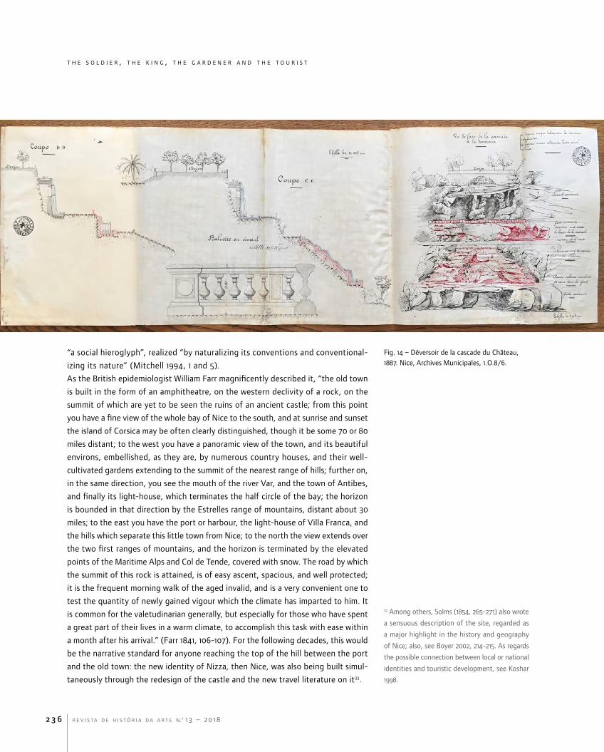
As the British epidemiologist William Farr magnificently described it, “the old town
is built in the form of an amphitheatre, on the western declivity of a rock, on the
summit of which are yet to be seen the ruins of an ancient castle; from this point
you have a fine view of the whole bay of Nice to the south, and at sunrise and sunset
the island of Corsica may be often clearly distinguished, though it be some 70 or 80
miles distant; to the west you have a panoramic view of the town, and its beautiful
environs, embellished, as they are, by numerous country houses, and their well-
cultivated gardens extending to the summit of the nearest range of hills; further on,
in the same direction, you see the mouth of the river Var, and the town of Antibes,
and finally its light-house, which terminates the half circle of the bay; the horizon
is bounded in that direction by the Estrelles range of mountains, distant about 30
miles; to the east you have the port or harbour, the light-house of Villa Franca, and
the hills which separate this little town from Nice; to the north the view extends over
the two first ranges of mountains, and the horizon is terminated by the elevated
points of the Maritime Alps and Col de Tende, covered with snow. The road by which
the summit of this rock is attained, is of easy ascent, spacious, and well protected;
it is the frequent morning walk of the aged invalid, and is a very convenient one to
test the quantity of newly gained vigour which the climate has imparted to him. It
is common for the valetudinarian generally, but especially for those who have spent
a great part of their lives in a warm climate, to accomplish this task with ease within
a month after his arrival.” (Farr 1841, 106-107). For the following decades, this would
be the narrative standard for anyone reaching the top of the hill between the port
and the old town: the new identity of Nizza, then Nice, was also being built simul-
taneously through the redesign of the castle and the new travel literature on it33.
Fig. 14 – Déversoir de la cascade du Château, 1887. Nice, Archives Municipales, 1.O.8/6.

r e v i s t a d e h i s t ó r i a d a a r t e n.o 1 3 – 2 0 1 8 2 3 7
t h e s o l d i e r , t h e k i n g , t h e g a r d e n e r a n d t h e t o u r i s t
34 “Colle già intraprese opere il suolo del Castello
prende ogni giorno un sempre più leggiadro
aspetto, e costituisce uno dei più grandiosi
punti di vista sul Mediterraneo, talmente che
quella località fa l’ammirazione di tutti gli illustri
forestieri ed anche da Sovrani e Principi i quali,
invernando in Nizza, o trovandosi soltanto di
passaggio, vanno tutti a visitare con sempre
maggior diletto quel promontorio il quale coperto
ancora in parte di alcune vestigia delle antiche
fortificazioni, ricorda gloriosissimi fatti d’arma, e
presenta al dì d’oggi una prospettiva pittoresca
ed unica sotto ogni rapporto.”: cf. Examen par
le Conseil Restreint de la demande formulée
par soeur Mathilde, religieuse carmélite, pour la
concession d’un terrain tout en haut du château
afin d’y créer un monastère, 1846, in AMN, s. O,
n. 3/20 (author’s translation).
35 “La promenade du château est devenue
charmante et tous les jours elle s’embellit encore”
(author’s translation).
36 “Aujourd’hui l’espace occupé jadis par l’ancien
Château est couvert en grande partie par des
allées ombreuses , par des pelouses vertes, par
des palmiers, des myrtes, des chênes-verts, des
cactus, des aloès, des pins parasols, des lauriers-
roses [sic].” (author’s translation).
The site had gradually been changing for more than forty years, growing more
and more pleasant as “one of the grandest points of view on the Mediterranean”,
described and beloved by all kinds of visitors, enchanted by both the military relics
and “the picturesque perspective”34. According to Auguste Burnel, who wrote in 1857,
“the walk of the castle has become charming and every day it grows more beautiful”
(Burnel 1857, 34)35; trees, flowers and rather exotic plants were blossoming like never
before, as the area “[was] covered to a great extent by shady alleys, green lawns,
palm trees, myrtles, green oaks, cacti, aloes, umbrella pines, roses” (Burnel 1857,
52)36, while only a few relics evoked its military past. Not only the history, but even
the nature of the place had been forcedly adjusted to its new purposes: the highest
point of the cliff, as an obstacle to the newly conceived belvedere, had been abruptly
undermined and razed to the ground; heretofore, not all conflicting activities had
been sufficiently reconceived and redesigned – for instance, quite incredibly, an
atelier d’equarrissage [a slaughterhouse] was still on active duty in the area – but
the road map had been successfully traced (Burnel 1857, 53-54).
Quite unexpectedly, when Nizza Marittima became the French city of Nice in 1860,
the tourist had already replaced the soldier, victoriously. The countess of Droho-
jowska, the first foreign visitor recording the annexion of the County of Nice to
the French Empire, could enjoy few more details in the new garden, albeit empha-
sising the amazing view of the city and the sea (Drohojowska 1860, 24-25). Three
months later, a sumptuous visit of the Emperor Napoleon III and his wife Eugenia de
Montijo, during the “memorable days of September 12th-13th”, finally celebrated the
power shift in Nice (Saint-Germain 1860, [3]). The schedule was pretty intense but,
not surprisingly, the “ancient castle” was the first destination of the imperial cou-
Fig. 15 – Alexis Mossa. Le bassin au Château, 1898. Nice, Musée d’Art et d’Histoire du Palais Massena.
t h e s o l d i e r , t h e k i n g , t h e g a r d e n e r a n d t h e t o u r i s t
r e v i s t a d e h i s t ó r i a d a a r t e n.o 1 3 – 2 0 1 82 3 8
37 “Au Château, l’on mène de front la charpente
de la terrasse supérieure et le parquet qui
recouvre la plateforme de la tour d’où l’Empereur,
considérant à la fois le plan régulateur de la
cité de Nice et la ville elle-même, sera à même
d’indiquer les améliorations à y introduire”
(author’s translation). For the whole visit to the
castle see Saint-Germain 1860, 78-88.
38 “Une terrasse macadamisée, plantée d’arbres
et garnie de bancs, a été ménagée au sommet
des ruines; elle sert de promenade aux étrangers
assez courageux pour braver l’ardeur du soleil
et l’escarpement des pentes poudreuses par
lesquelles on y accède, et qui sont bordées de
grands cactus” (author’s translation).
39 “Rien de magique comme le spectacle qui
se déroulait de là sous nos pieds” (author’s
translation).
ple, soon after their arrival. The ceremony was designed as a genuine takeover: the
local authorities led their guests “to the upper terrace, on the platform covering the
tower; from there the Emperor, considering both the city masterplan and the city
itself, [was] able to indicate the improvements to be introduced” (Saint-Germain
1860, 45)37. The press dwelled on the visit as much as possible, stressing the pivotal
position of the castle hill, indispensable to redesigning the new Imperial capital of
the Riviera: actually, very little was said about the site itself, as it was probably far
from being completely rearranged. As the journalist Auguste Vitu put it, “a mac-
adamized terrace, planted with trees and furnished with benches, was arranged at
the top of the ruins; it serve[d] as a promenade for those foreigners, courageous
enough to brave the heat of the sun and the escarpment of the dusty slopes by
which they [were] accessed, and which [were] lined with large cacti” (Saint-Germain
1860, 79-80)38. For many years the celebrated terrace remained “nothing as magical
as the spectacle displayed from there, under our feet” (Banville 1861, 19)39.
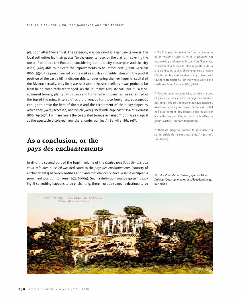
As a conclusion, or the pays des enchantements
In 1892 the second part of the fourth volume of the Guides artistique Simons aux
eaux, à la mer, au soleil was dedicated to the pays des enchantements [country of
enchantments] between Antibes and Sanremo: obviously, Nice la belle occupied a
prominent position (Simons 1892, 61-109). Such a definition sounds quite intrigu-
ing: if something happens to be enchanting, there must be someone destined to be
Fig. 16 – Cascade du chateau, 1900 ca. Nice, Archives Départementales des Alpes-Maritimes, 02Fi.01262.

r e v i s t a d e h i s t ó r i a d a a r t e n.o 1 3 – 2 0 1 8 2 3 9
t h e s o l d i e r , t h e k i n g , t h e g a r d e n e r a n d t h e t o u r i s t
40 “C’est vous qui découvrirez de ce point élevé
une vue panoramique d’une indescriptible
beauté” (author’s translation).
enchanted. There is no landscape without a subject, there is no landscape without
Nature and, moreover, there is no landscape “without contact, link, meeting between
the subject and the Nature” (Jakob 2008, 34). Thus, over the course of the nineteenth
century, the gradual invention of the Côte d’Azur implied the invention of its brand-
new inhabitant, the hivernant or vacancier, who reinvented the landscape day by day.
In fact, the tourist’s routine was unequivocally designed as the sequence of a “per-
formed art”, aimed at “the discovery of new territory, the search for a ‘homeland
of the soul’, the desire to fortify the mind with an anodyne of beautiful memories,
the study of the ‘book’ of the world, and the exploration of terrestrial paradise”
(Adler 1989, 1375-1376). Thus, once in Nizza, anyone’s first stop had to be at the
Ponchettes, between the seaside and the old town; thence, he/she could start a
challenging but rewarding ascent to the top of the hill, where Nikaia had been
founded and the belvedere of the new Nice was now astonishingly resplendent.
The relics of the Greek and Roman colony, first covered by the medieval town and
then reshaped by the citadel of the Savoy, had been transformed into a sort of an
extra, on the spectacular stage of the terrace where anyone could enjoy “a pano-
ramic view of indescribable beauty” (Simons 1892, 71)40. Quite obviously, the most
popular observation deck was no longer the terrace on the tour Bellanda, but the
terrace in front of the new waterfall.
Fig. 17 – Charles Legresle, Nice. Plan d’orientation. Plateforme du château, Nice: s.n., 1903.
t h e s o l d i e r , t h e k i n g , t h e g a r d e n e r a n d t h e t o u r i s t
r e v i s t a d e h i s t ó r i a d a a r t e n.o 1 3 – 2 0 1 82 4 0
41 More generally, the new revised edition of Urry’s
main work (2002) offers essential guidelines to
further investigation on tourism as “fun, pleasure
and entertainment”, always determined by visual
experiences (in particular see pages 1-30).
42 In the 1850s, the appreciation of Nice’s weather,
either in winter or in summer, started to appear
in different guides and accounts, such as Burnel
(1857, 127-135, namely 127): “Nice winters are
popular all over the world; but very few people
know the summer of this delightful region [Les
hivers de Nice sont populaires dans le monde
entier; mais bien peu de gens connaissent l’été
de cette contrée délicieuse]”.
43 “La mer, n’ayant ainsi de limite que l’horizon
lointain, est belle à regarder […] mais toujours
à travers ce parfum, à travers cette verdure, à
travers tout cet éclat de la vie présente” (author’s
translation). It is worth pointing out that
Bazancourt concluded his history of Nice where
he had started it, going back to the vestiges of the
castle, regarded as an almost eternal witness of
greatness and continuity (Bezancourt 1853, 337).
Thus, another panorama of the nineteenth century was born (Sternberger 1938),
a breathtakingly real one, to be perceived with all five senses, though still led
by the power of sight: “it is the gaze that orders and regulates the relationships
between the various sensuous experiences while away, identifying what is visu-
ally out-of-ordinary, what are relevant differences and what is ‘other’” (Urry and
Larsen 2011, 14)41. After all, in 1843 the chemist Luigi Roubaudi’s words had already
been scientifically unequivocal: “From this elevation, one can still enjoy a magnifi-
cent spectacle by contemplating the immense surface of the sea and observing,
on the waves, the effects of the sun at different times of the day. When the sea is
calm, struck by the sun’s rays, like a vast mirror, it reflects the brightest and most
beautiful light” (Roubaudi 1843, 51-52). The relaxed and relaxing contemplation of
the sea from the mainland was becoming a cultural topos for the modern tourist,
finally shifting from hivernant to vacancier and, therefore, just caring for his or
her personal wellness, independently from any disease or season42. For them, “the
sea, having no limits apart from the distant horizon, is beautiful to look at”, while
surrounded by perfumes and colours, bathed by the Mediterranean light, bewil-
dered by such a “burst of life” (Bazancourt 1853, 7-10)43. The communion between
Man and Nature could start from the top of that old, glorious cliff, redesigned as
a timeless and unmissable locus amoenus (Maderuelo 2005, 173-176). Providing
a 360° view, the new belvedere finally gave everybody the magic opportunity of
perceiving the irrepressible lure of the sea (Corbin 1988).•
Bibliography
Adler, Judith. 1989. “Travel as Performed Art”. American Journal of Sociology 94 (6): 1366-1391.
Aillagon, Jean-Jacques, ed. 2017. Nice à l’école de l’histoire. Catalogue of the exhibition (Nice: Musée Massena: 23 June – 15 October 2017). Paris – Nice: Somogy – Ville de Nice.
Banville, Théodore de. 1861. La mer de Nice. Lettres à un ami. Paris: Poulet-Malassis et De Broise.
Barelli, Hervé. 2015. “De la promenade des Ponchettes à la Promenade des Anglais, le premier triomphe de la societé des loisirs”. In Promenade(s) des Anglais, ed. Lisa Azorin and Julie Reynes, 70-82. Paris-Nice: Lienart-Ville de Nice.
Bazancourt, [César Lecat] baron de. 1853. Nice et ses souvenirs. Nice: Societé Typographique – Charles Giraud.
Benvenuto, Alex. 2009. Peintres paysagistes de la Côte d’Azur au XIXe siècle. Nice: Serre.
Berlioz, Hector, 1972. Correspondance générale, vol. 1 (1803 – May 1832, 1-231), ed. Pierre Citron. Paris: Flammarion.

r e v i s t a d e h i s t ó r i a d a a r t e n.o 1 3 – 2 0 1 8 2 4 1
t h e s o l d i e r , t h e k i n g , t h e g a r d e n e r a n d t h e t o u r i s t
Bertolotti, Davide. 1834. Viaggio nella Liguria marittima, 2 vols. Torino: Eredi Botta.
Bodinier, Stephen. 2015. “Le parc du Château ou la restauration d’une friche urbaine”. In Promenade(s) des Anglais, ed. Jean-Jacques Aillagon, 139-145. Paris – Nice: Lienart – Ville de Nice.
Bottaro, Alain, Hélène Cavalié, Guillaume Arrivé, and Fabrice Ospédale. 2013. Trois siècles de tourisme dans les Alpes-Maritimes, catalogue of the exhibition (Nice, Archives Départementales des Alpes-Maritimes: December 2013 – May 2014). Cinisello Balsamo: Sivana Editoriale.
Bottaro, Alain. 2014. “La villégiature anglaise et l’invention de la Côte d’Azur”. In situ 24. http://insitu.revues.org/11060. DOI: 10.4000/insitu.11060.
Bouiron, Marc, ed. 2007-2008. La colline du Château à Nice. Projet collectif de recherche, 2 vols. Nice: Ville de Nice.
Bouiron, Marc. 2013. Nice. La colline du château. Histoire millénaire d’une place forte. Nice: Mémoires Millénaires Éditions.
Boyer, Marc. (2002) 2009. L’hiver dans le Midi (XVIIe-XXIe siècles). Paris: L’Harmattan.
Boyer, Marc. 2005. Histoire générale du tourisme du XVIe au XXIe siècle. Paris: L’Harmattan.
Bracq, Jerôme, Hélène Cavalié, Jean-Bernard Lacroix, and Simonetta Tombaccini Villefranque. 2010. Le comté de Nice et la maison royale de Savoie. Cinisello Balsamo – Nice: Silvana Editoriale – Conseil Général des Alpes-Maritimes.
Burnel, A[uguste]. 1857. Nice. Nice: Société Typographique.
Castela, Paul. (2012) 2016. Histoire du paysage niçois. De la campagne à la ville. Nice: Institut d’Études Niçois.
Chapuy, Nicolas, and Armand Cuvillier. 1838. Promenade de Nice à Gênes. Paris: Bulla.
Corbin, Alain. 1988. Le territoire du vide. L’Occident et le désir du ravage (1750-1840). Paris: Aubier [English translation: 1985. The Lure of the Sea: The discovery of the seaside in the Western world 1750-1840. London: Penguin].
Daniels, Stephen, and Denis Cosgrove. 1988. “Introduction: iconograhy and landscape”. In The Iconography of Landscape: Essays on the symbolic representation, design and use of past environment, ed. Stephen Daniels and Denis Cosgrove, 1-10. Cambridge: Cambridge University Press.
Drohojowska, [Antoinette-Joséphine-Françoise-Anne Symon de Latreiche] comtesse de. 1860. Une saison à Nice, Chambéry et Savoie. Paris: Charles Douniol.
Durante, Louis [or Luigi]. 1847. Chorographie du comté de Nice. Torino: Favale.
Farr, William. 1847. A Medical Guide to Nice; containing every information to the invalid and resident stranger. With separate remarks on all those diseases to which its climate is calculated to prove injurious or beneficial, especially consumption and scrofula. Also observations on the climate of bagneres de bigorre, as the most eligible summer residence for consumptive patients. London: John Churchill.

t h e s o l d i e r , t h e k i n g , t h e g a r d e n e r a n d t h e t o u r i s t
r e v i s t a d e h i s t ó r i a d a a r t e n.o 1 3 – 2 0 1 82 4 2
Fussell, Paul, ed. 1987. The Norton Book of Travel. New York: W. W. Norton and Company.
Ghiraldi, Denis. 2006. “Les cathédrales médievales du château de Nice”. Recherches Régionales. Alpes-Maritimes et contrées limitrophes 47 (183): 2-50.
Giornale del Regno delle Due Sicilie. 1826, December 16, n. 290.
Guide des étrangers à Nice contenant quelques notions sur l’histoire et la statistique du pays avec l’indication des Promenades et des Objets les plus remarquables de la Ville et de ses environs. [1827]. Nice: Imprimerie de la Société Typographique.
Graff, Philippe. 2000. L’exception urbaine. Nice de la Renaissance au Consiglio d’Ornato. Nice: Éditions Parenthèses.
Hale, Julian. 2009. The French Riviera: A Cultural History. Oxford: Signal Books.
Jakob, Michael. 2008. Le paysage. Gollion: Infolio [Italian translation: 2009. Il paesaggio. Bologna: Il Mulino].
Jones, Ted. 2004. The French Riviera: a Literary Guide for Travellers. London – New York: Tauris.
Koshar, Rudy. 1998. “ ‘What Ought to Be Seen’: Tourists’ Guidebooks and National Identities in Modern Germany and Europe”. Journal of Contemporary History 33 (3): 323-340.
Lacroix, Jean-Bernard. 2003. “La question de l’eau à Nice”. Nice Historique (L’eau à Nice. Des fontaines au Canal de la Vésubie) 106 (4): 177-207.
Lacroix, Jean-Bernard, and Jérôme Bracq, 2007. L’eau douce et la mer du Mercantour à la Méditerranée. Nice: Archives Départementales des Alpes-Maritimes.
Liégeard, Stéphen. 1887. La Côte d’Azur. Paris: Maison Quantin.
Maderuelo, Javier. 2005. El paisaje. Génesis de un concepto. Madrid: Abada.
Millin [de Grandmaison], A[ubin]-L[ouis]. 1816. Voyage en Savoie, en Piémont, à Nice, et à Gênes, vol. 2. Paris: C. Wasserman.
Mitchell, W. J. T[homas]. 1994. “Introduction” and “Imperial Landscape”. In Landscape and Power, ed. W. J. T. Mitchell, 1-4 and 5-34. Chicago: The University of Chicago Press.
Negrin, Émile. [1867]. Les promenades de Nice. [Nice]: Cauvin.
Ortolani, Marc. 2012. “Nice avant son annexion à la France (1848-1859)”. In La Savoie, la France, l’Europe, ed. Sylvain Milbach, 47-70. Bruxelles: Peter Lang.
Pace, Sergio. 2017. “Il mare d’inverno, e poi anche d’estate. Nizza Marittima, città di villeggiatura nell’età della Restaurazione sabauda (1815-60)”. In Immaginare il Mediterraneo. Architettura arti fotografia, ed. Andrea Maglio, Fabio Mangone and Antonio Pizza, 267-280. Napoli: ArtStudioPaparo.
Raccolta di Regj Editti, Manifesti, ed altre provvidenze de’ magistrati ed uffizj. [1820], vol. 12. Torino: Davico e Picco.

r e v i s t a d e h i s t ó r i a d a a r t e n.o 1 3 – 2 0 1 8 2 4 3
t h e s o l d i e r , t h e k i n g , t h e g a r d e n e r a n d t h e t o u r i s t
Roubaudi, Louis [Luigi]. 1843. Nice et ses environs. Paris – Torino: Allouard – Gianini e Fiore.
Saint-Germain, Marie. 1860. Relation du voyage de LL. MM. L’Empereur & l’Impératrice Nice (12 et 13 septembre 1860). Nice: Imprimerie Canis Frères.
Simons, Gustave. 1892. Au pays des enchantements. Antibes à S. Remo, vol. 2. Paris: Dentu.
Solms, Marie de [Marie-Lætitia Bonaparte-Wyse]. 1854. Nice ancienne et moderne. Nice: Imprimerie Société Typographique.
Speake, Jennifer, ed. 2003. Literature of Travel and Exploration: an Encyclopedia. 3 vols. New York – London: Fitzroy Dearborn.
Sternberger, Dolf. 1938. Panorama oder Ansichten vom 19. Jahrhundert. Hamburg: Goverts [English translation: 1977. Panorama of the 19th Century. (London): Blackwell].
Sulzer, Johann Georg. 1780. Tagebuch einer von Berlin nach dem mittäglichen Ländern von Europa in den Jahren 1775 und 1776 gethanen Reise und Rückreise. Leipzig: Weidmanns Erben und Reichit [Italian translation: 1819. Carlo Amoretti, Viaggio da Milano a Nizza […] ed altro da Berlino a Nizza e ritorno da Nizza a Berlino di Giangiorgio Sulzer fatto negli anni 1775 e 1776. Milano: Giovanni Silvestri].
Toulier, Bernard. 2016. “Le phénomène balnéaire. Invention et âge d’or des stations de bord de mer (1760-1929)”. In Tous à la plage! Villes balnéaires du XVIIIe siècle à nos jours. Catalogue of the exhibition (Paris: Cité de l’architecture & du patrimone: 19 October 2016 – 13 February 2017), ed. Bernard Toulier, 47-70. Paris: Lienart.
[Tourtoulon, Antoine de]. 1852. Lettres sur Nice et ses environs. Montpellier: Imprimerie Cristin.
Urbain, Jean-Didier. 1994. Sur la plage. Mœurs et costumes balnéaires (XIXe-XXe siècles). Paris: Payot & Rivages.
Urry, John. (1990) 2002. The Tourist Gaze. London: SAGE.
Urry, John, and Jonas Larsen. 2011. The Tourist Gaze 3.0. London: SAGE.
Recommended


![GEOMORFOLOGIA DE FUNDO DA PLATAFORMA ...abequa.org.br/trabalhos/0017_geomorfologia_de_fundo_da...Palavras-chave: [Geomorfologia, Cânion Submarino] 1. Introdução A margem continental](https://img.pdfslide.us/doc/110x75/5f81151cc2efc9770244a196/geomorfologia-de-fundo-da-plataforma-palavras-chave-geomorfologia-cnion.jpg)


