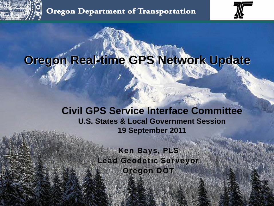
Oregon Real-time GPS Network Update
Ken Bays, PLSLead Geodetic Surveyor
Oregon DOT
Civil GPS Service Interface CommitteeU.S. States & Local Government Session
19 September 2011

Oregon DOT Geometronics Unit
Ron Singh, Chief of Surveys, Manager
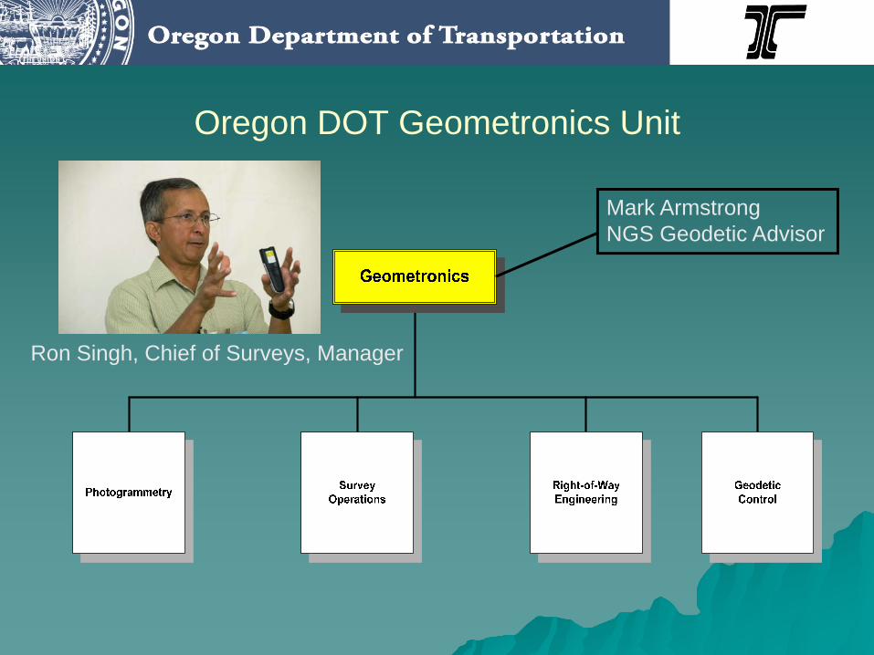
Oregon DOT Geometronics Unit
Ron Singh, Chief of Surveys, Manager
Mark ArmstrongNGS Geodetic Advisor
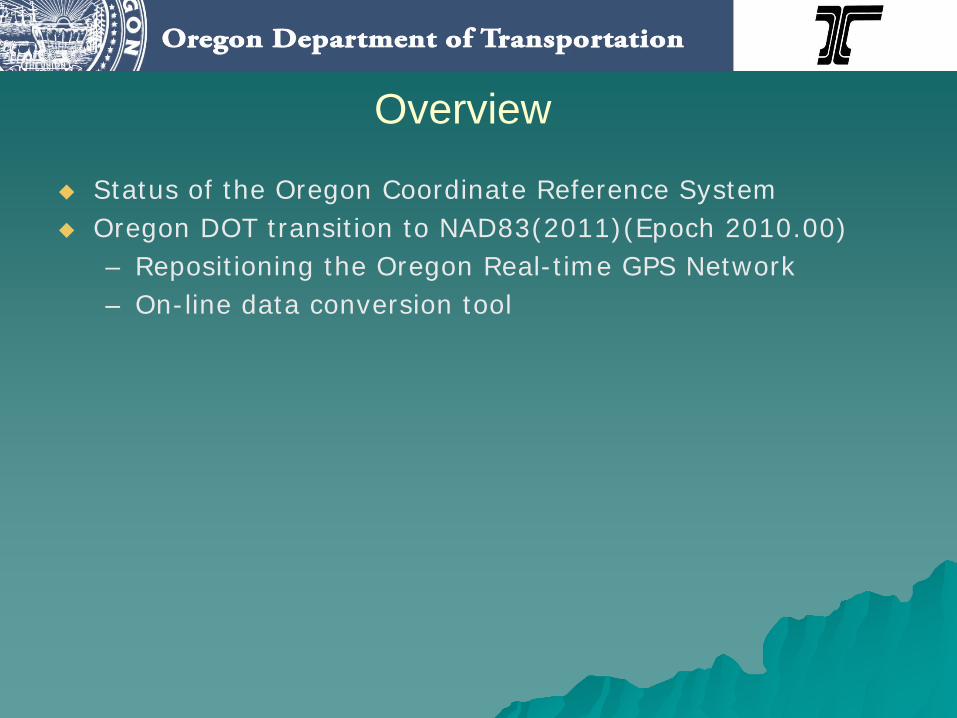
Overview
Status of the Oregon Coordinate Reference SystemOregon DOT transition to NAD83(2011)(Epoch 2010.00)– Repositioning the Oregon Real-time GPS Network– On-line data conversion tool
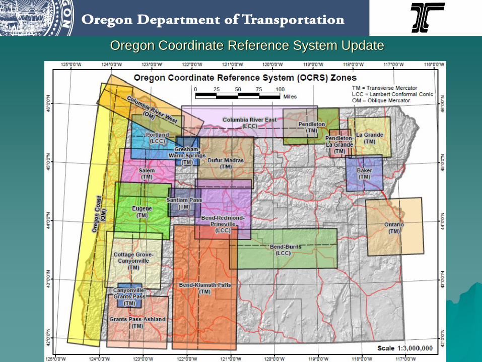
Oregon Coordinate Reference System Update
6
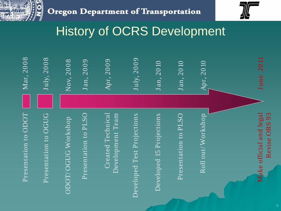
History of OCRS DevelopmentM
ar, 2
008
June
201
1
July
, 200
8Pr
esen
tati
on to
OG
UG
Nov
, 200
8
July
, 200
9
OD
OT/
OG
UG
Wor
ksho
p
Dev
elop
ed T
est P
roje
ctio
ns
Pres
enta
tion
to P
LSO
Cre
ated
Tec
hnic
al
Dev
elop
men
t Tea
m
Pres
enta
tion
to O
DO
T
Apr
, 200
9
Jan,
200
9
Mak
e of
ficia
l and
lega
l R
evis
e O
RS
93
Jan,
201
0D
evel
oped
15
Proj
ecti
ons
Jan,
201
0Pr
esen
tati
on to
PLS
O
Apr
, 201
0R
oll o
ut/W
orks
hop
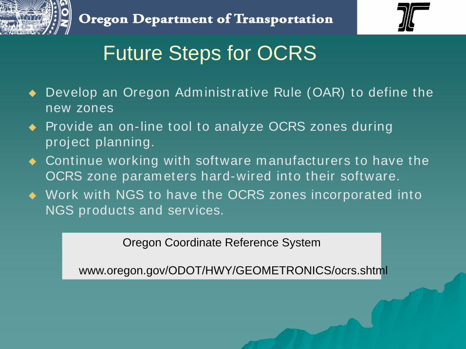
Future Steps for OCRS
Develop an Oregon Administrative Rule (OAR) to define the new zonesProvide an on-line tool to analyze OCRS zones during project planning.Continue working with software manufacturers to have the OCRS zone parameters hard-wired into their software.Work with NGS to have the OCRS zones incorporated into NGS products and services.
Oregon Coordinate Reference System
www.oregon.gov/ODOT/HWY/GEOMETRONICS/ocrs.shtml
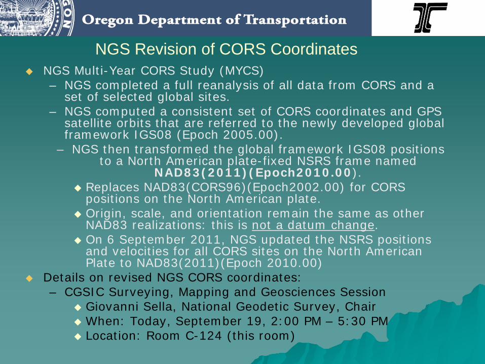
NGS Revision of CORS CoordinatesNGS Multi-Year CORS Study (MYCS)– NGS completed a full reanalysis of all data from CORS and a
set of selected global sites.– NGS computed a consistent set of CORS coordinates and GPS
satellite orbits that are referred to the newly developed global framework IGS08 (Epoch 2005.00).
– NGS then transformed the global framework IGS08 positions to a North American plate-fixed NSRS frame named
NAD83(2011)(Epoch2010.00).Replaces NAD83(CORS96)(Epoch2002.00) for CORS positions on the North American plate.Origin, scale, and orientation remain the same as other NAD83 realizations: this is not a datum change.On 6 September 2011, NGS updated the NSRS positions and velocities for all CORS sites on the North American Plate to NAD83(2011)(Epoch 2010.00)
Details on revised NGS CORS coordinates:– CGSIC Surveying, Mapping and Geosciences Session
Giovanni Sella, National Geodetic Survey, ChairWhen: Today, September 19, 2:00 PM – 5:30 PMLocation: Room C-124 (this room)

Old NSRS forNorth American Plate=
NAD83(CORS96)(Epoch2002.00)defined in respect to ITRF00 (NGS)
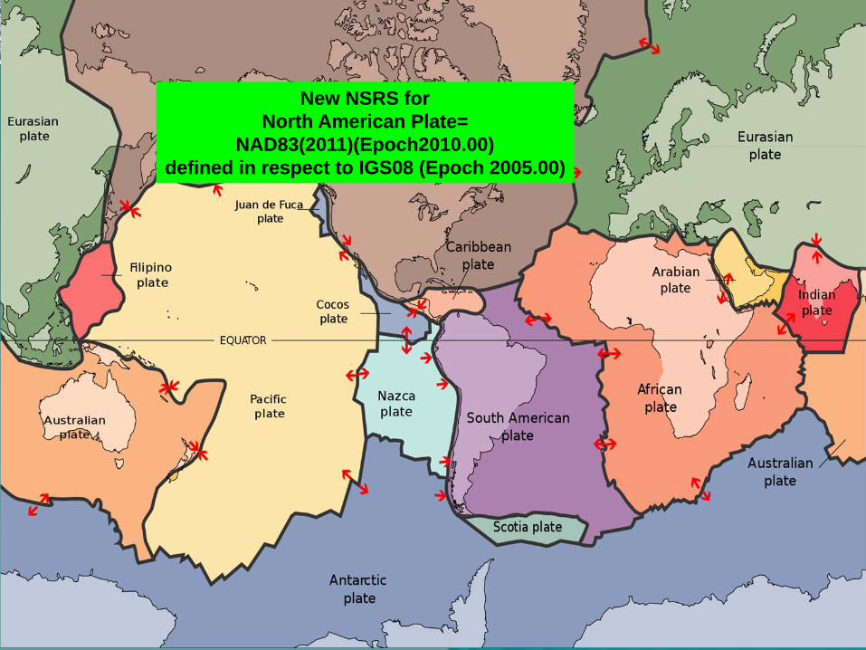
New NSRS forNorth American Plate=
NAD83(2011)(Epoch2010.00)defined in respect to IGS08 (Epoch 2005.00)

Horizontal Position Shift:NAD83(CORS96)(Epoch2002.00) to NAD83(2011)(Epoch2010.00)
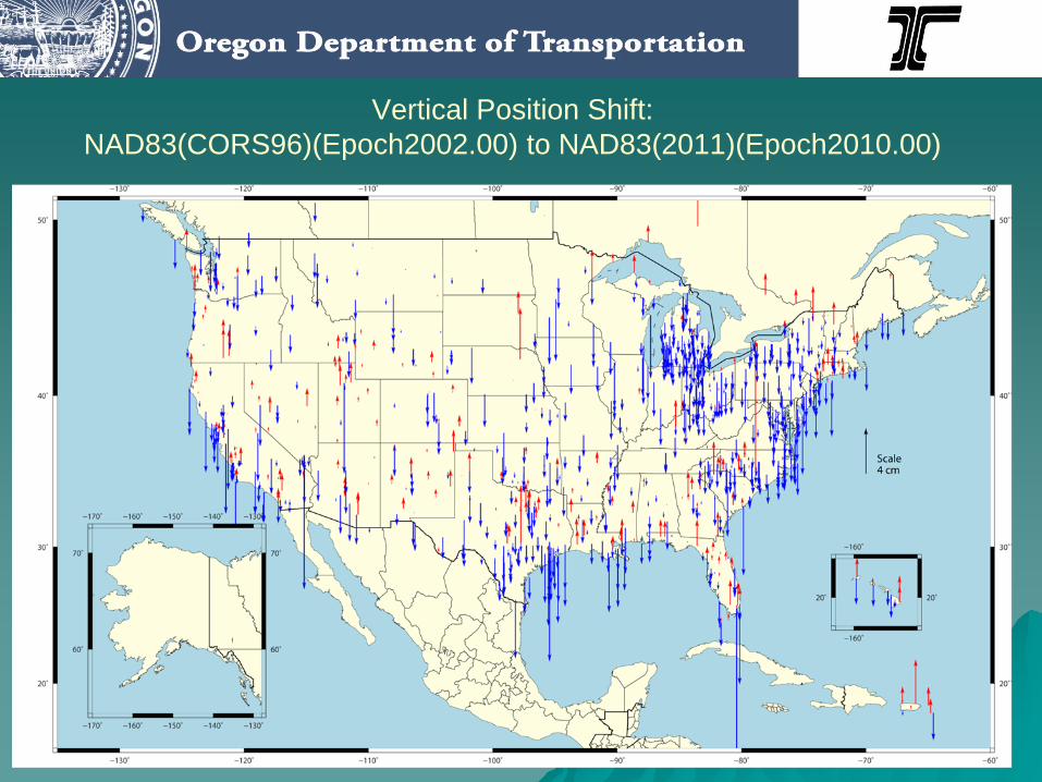
Vertical Position Shift:NAD83(CORS96)(Epoch2002.00) to NAD83(2011)(Epoch2010.00)
Oregon DOT Plan to Transition to NAD83(2011)(Epoch2010.00)
Reposition the Oregon Real-time GPS Network to Epoch 2010.00– THE ORGN is now and will stay aligned to the most current NGS
datum realization for the National Spatial Reference System CORS stations
– Ensures ORGN user compatibility with CORS and OPUS solutions.Provide Oregon with an on-line data conversion tool– Will allow users of the ORGN and NGS products in Oregon to move
data back and forth between epoch 2002 and epoch 2010.
Goals for ORGN RepositioningAlign the positions of the ORGN stations to NAD83(2011)(Epoch 2010.00)Develop & follow best practices which adhere substantially to the NGS “Guidelines for Real Time GNSS Networks
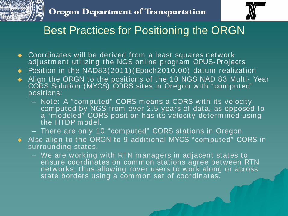
Best Practices for Positioning the ORGN
Coordinates will be derived from a least squares network adjustment utilizing the NGS online program OPUS-Projects Position in the NAD83(2011)(Epoch2010.00) datum realizationAlign the ORGN to the positions of the 10 NGS NAD 83 Multi- Year CORS Solution (MYCS) CORS sites in Oregon with “computed” positions:– Note: A “computed” CORS means a CORS with its velocity
computed by NGS from over 2.5 years of data, as opposed to a “modeled” CORS position has its velocity determined using the HTDP model.
– There are only 10 “computed” CORS stations in OregonAlso align to the ORGN to 9 additional MYCS “computed” CORS in surrounding states.– We are working with RTN managers in adjacent states to
ensure coordinates on common stations agree between RTN networks, thus allowing rover users to work along or across state borders using a common set of coordinates.
Best Practices for Positioning the ORGN
We will not align the ORGN purposely with passive control– However, once NGS completes the National Adjustment
of 2011 project for passive marks, both the active and passive control will be on the same datum realization: NAD83 (2011)(Epoch 2010.00)
– Oregon DOT will then occupy passive marks in each region of the state to develop a comparison of positions of the marks published in the NGS data base and positions derived using real-time correctors from the ORGN.
Best Practices for Positioning the ORGN
Use NGS IGS08 ANTEX absolute antenna calibration models when processing GPS baselines in preparation for the adjustmentUse GPS data for processing that was collected during the dry, high pressure periods– Late August and early September 2011 have provided
ideal data conditions.– Will process five (5) days of twenty-four (24) hour data
sets
Best Practices for Positioning the ORGNSeek NGS ‘validation’ by following procedures in the NGS “Guidelines for Real Time GNSS Networks”– We are working with Bill Henning of the NGS Real-time
GNSS Network support team as this validation process develops.
Best Practices for Positioning the ORGN
Monitor the positions of all ORGN stations in real-time to assure positions do not vary more than 1 cm horizontally or 2 cm vertically.– Leica GNSS QC in conjunction with Leica GNSS Spider
software.– Publish QC monitoring results on ORGN website.
Publish the NAD83(2011)(Epoch 2020.00) positions of all ORGN sites at both the 95% ad 99.997% confidence levels (based on OPUS Projects output).
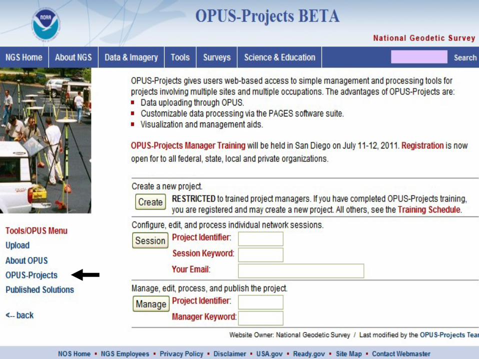
OPUS-Projects (OP)
A valuable addition to the NGS OPUS suiteCurrently in beta format– NGS is integrating Epoch 2010.00 positions for CORS
and ANTEX IGS08 antenna calibrationsOP Provides:– Uploading of GPS data via the OPUS portal– Processing baselines via NGS PAGES software– Least squares adjustment of data via GPSCOM software– Google Earth-based map view of project and baselines– Improved positioning over OPUS-Static averaging of
single base line positionsSoftware author: Dr. Mark Schenewerk, NGS
OPUS-Projects Training
Currently NGS requires attendance to a formal OPUS-Projects (OP) training class in order to access and use OP.Mark Armstrong, NGS Geodetic Advisor for Oregon has taught two OP classes– July 2011: ACSM, San Diego (with Dr. Mark Schenewerk)– August 2011: Oregon State University, Corvallis, OR
NGS Corbin Training Center schedule– http://www.ngs.noaa.gov/corbin/calendar.shtml
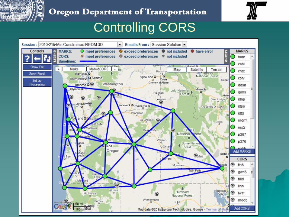
Controlling CORS
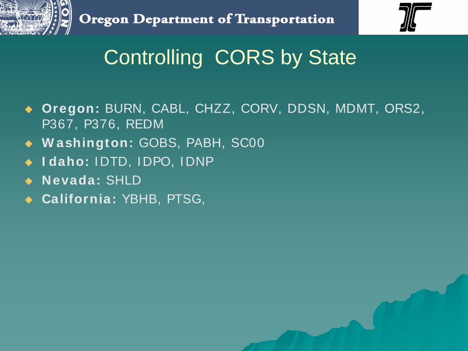
Controlling CORS by State
Oregon: BURN, CABL, CHZZ, CORV, DDSN, MDMT, ORS2, P367, P376, REDMWashington: GOBS, PABH, SC00Idaho: IDTD, IDPO, IDNPNevada: SHLDCalifornia: YBHB, PTSG,
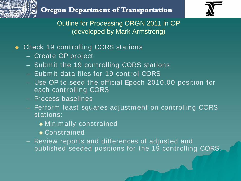
Outline for Processing ORGN 2011 in OP(developed by Mark Armstrong)
Check 19 controlling CORS stations– Create OP project– Submit the 19 controlling CORS stations– Submit data files for 19 control CORS– Use OP to seed the official Epoch 2010.00 position for
each controlling CORS– Process baselines– Perform least squares adjustment on controlling CORS
stations:Minimally constrainedConstrained
– Review reports and differences of adjusted and published seeded positions for the 19 controlling CORS.
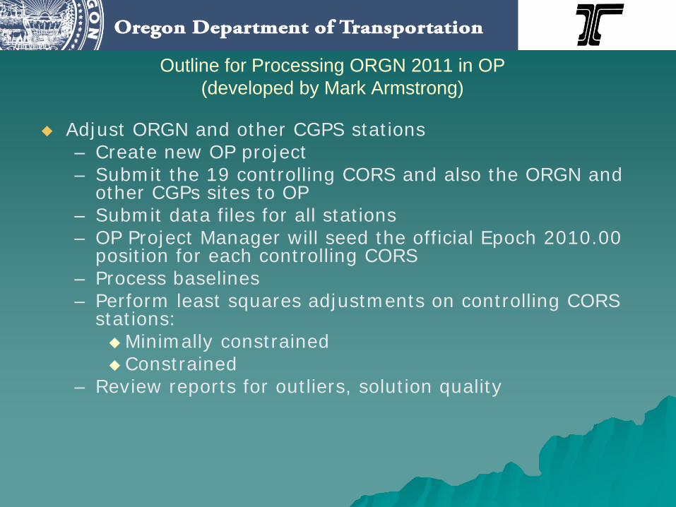
Outline for Processing ORGN 2011 in OP(developed by Mark Armstrong)
Adjust ORGN and other CGPS stations– Create new OP project– Submit the 19 controlling CORS and also the ORGN and
other CGPs sites to OP– Submit data files for all stations– OP Project Manager will seed the official Epoch 2010.00
position for each controlling CORS– Process baselines– Perform least squares adjustments on controlling CORS
stations:Minimally constrainedConstrained
– Review reports for outliers, solution quality
Oregon Data Conversion Tool
Oregon Data Conversion Tool
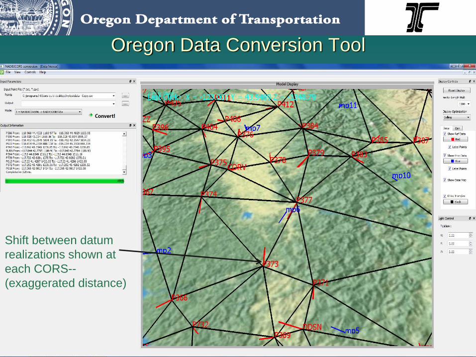
Insert screen captures
Shift between datum realizations shown at each CORS--(exaggerated distance)
What the “Tool” will do:
Converts users positions back and forth from:
– NAD 83(CORS96)(Epoch2002.00
to/from
– NAD 83(2011)Epoch2010.00)

Who is developing the “Tool”
Michael Olsen, Assistant Professor of Geomatics, Oregon State University, is developing the mathematical algorithms and software.Cooperation, input, and assistance from:– Oregon DOT Geometronics Unit– Mark Armstrong, NGS State Geodetic Advisor for Oregon
Why do ORGN users in Oregon need this Tool?
– Will ensure continuity within projectsUser may keep a single datum realization for a project spaced over the change from the superseded to the new datum realization.
– Provides an immediate datum realization transition solution until user projects are solely within the new datum realization
– “Keep my phone from ringing off the hook!”
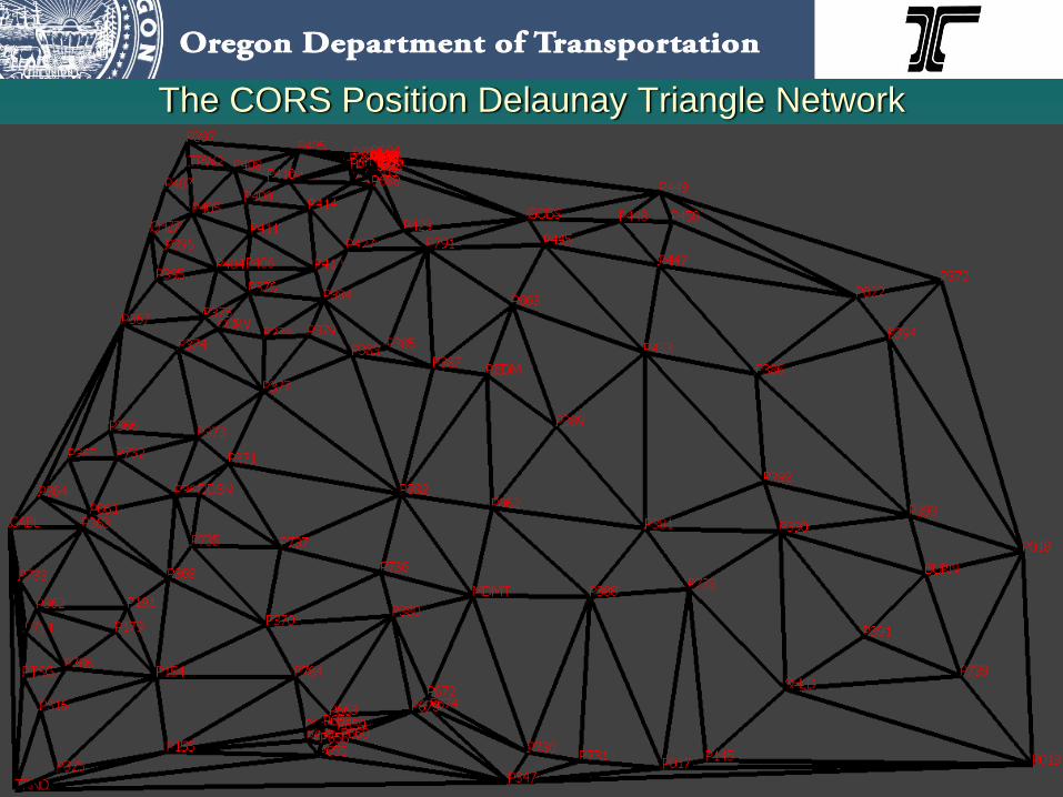
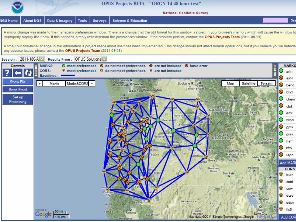
The CORS Position Delaunay Triangle Network
Summary
Status of the Oregon Coordinate Reference SystemOregon DOT plans to transition to NAD83(2011)(Epoch 2010.00)– Repositioning the Oregon Real-time GPS Network– On-line data conversion tool

ACKNOWLEDGEMENTS
Randy Oberg, PLSOregon Department of Transportation
Mark Armstrong, NGS State Geodetic Advisor for Oregon
Michael Olsen, Asst Professor of GeomaticsOregon State University

Ken BaysLead Geodetic Surveyor, Oregon DOT
Oregon Real-time GPS Networkwww.TheORGN.net
Recommended