ONMS MSP Science SymposiumNov. 16, 2009
Ocean Uses Atlas:Informing Comprehensive Coastal and Marine Spatial Planning
NOAA National Marine Protected Areas Center
Charles WahleMimi D’Iorio
Nicholas HaydenJordan Gass
Cheryl Butner
Marine Conservation Biology Institute
Lance MorganJohn Guinotte
Fan TsaoLarissa Sano
Oceans Are Becoming Crowded Places:
Fishing Uses
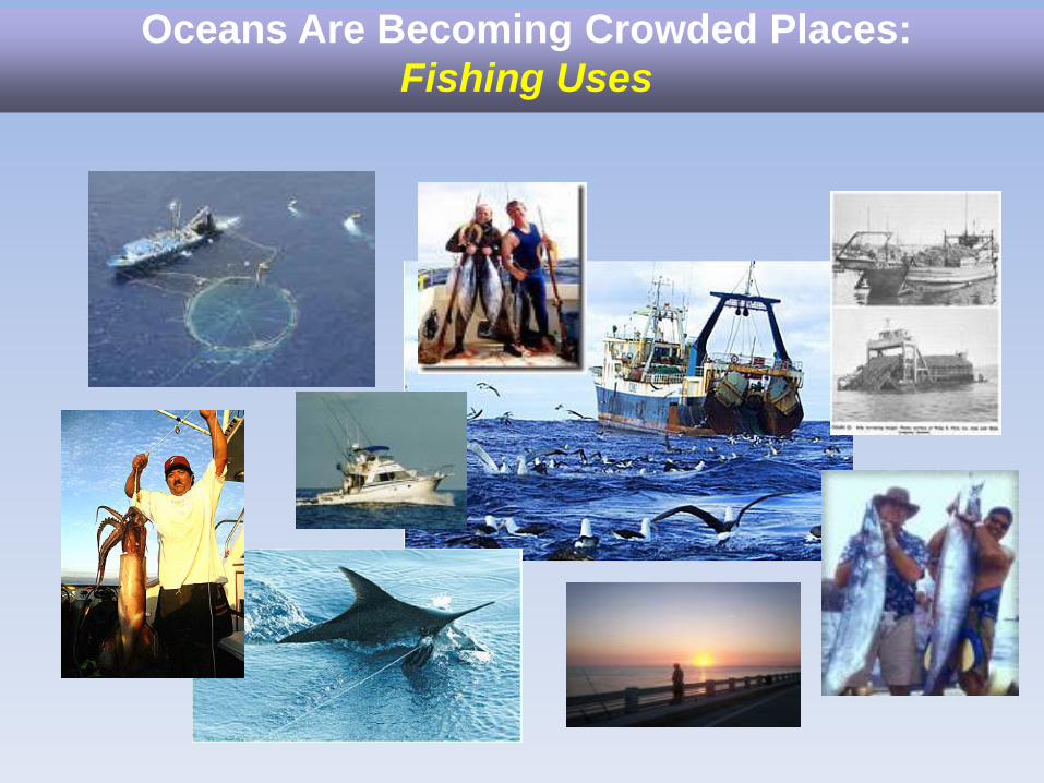
Oceans Are Becoming Crowded Places:
Industrial and Military Uses
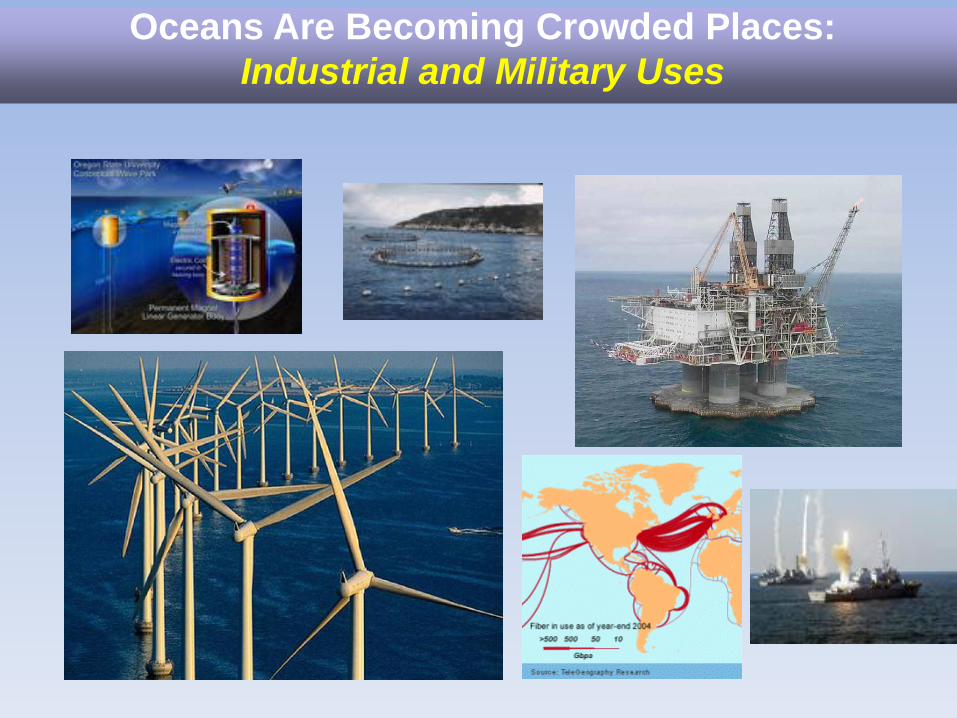
Oceans Are Becoming Crowded Places:
Non-Consumptive Uses
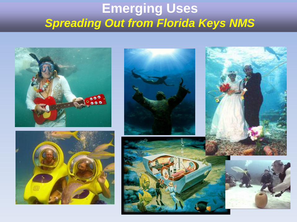
Emerging UsesSpreading Out from Florida Keys NMS
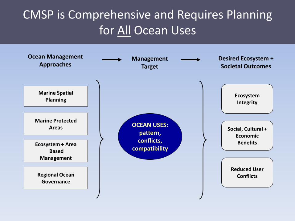
EcosystemIntegrity
Ocean Management Approaches
ManagementTarget
Desired Ecosystem + Societal Outcomes
OCEAN USES:pattern,conflicts,
compatibility
Social, Cultural +EconomicBenefits
Reduced UserConflicts
Marine SpatialPlanning
Regional OceanGovernance
Ecosystem + AreaBased
Management
Marine ProtectedAreas
CMSP is Comprehensive and Requires Planningfor All Ocean Uses
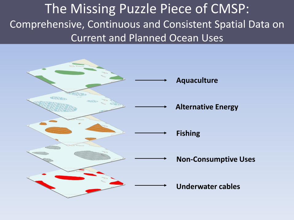
The Missing Puzzle Piece of CMSP:Comprehensive, Continuous and Consistent Spatial Data on
Current and Planned Ocean Uses
Alternative Energy
Fishing
Aquaculture
Underwater cables
Non-Consumptive Uses
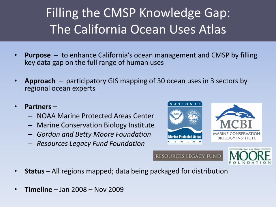
Filling the CMSP Knowledge Gap:The California Ocean Uses Atlas
• Purpose – to enhance California’s ocean management and CMSP by filling key data gap on the full range of human uses
• Approach – participatory GIS mapping of 30 ocean uses in 3 sectors by regional ocean experts
• Partners –– NOAA Marine Protected Areas Center– Marine Conservation Biology Institute– Gordon and Betty Moore Foundation– Resources Legacy Fund Foundation
• Status – All regions mapped; data being packaged for distribution
• Timeline – Jan 2008 – Nov 2009
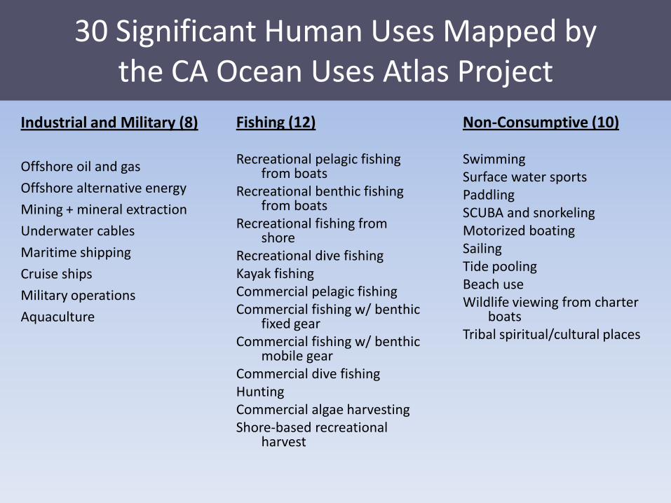
30 Significant Human Uses Mapped bythe CA Ocean Uses Atlas Project
Fishing (12)
Recreational pelagic fishing from boats
Recreational benthic fishing from boats
Recreational fishing from shore
Recreational dive fishingKayak fishingCommercial pelagic fishingCommercial fishing w/ benthic
fixed gearCommercial fishing w/ benthic
mobile gearCommercial dive fishingHuntingCommercial algae harvestingShore-based recreational
harvest
Non-Consumptive (10)
SwimmingSurface water sports PaddlingSCUBA and snorkelingMotorized boatingSailingTide pooling Beach use Wildlife viewing from charter
boatsTribal spiritual/cultural places
Industrial and Military (8)
Offshore oil and gas
Offshore alternative energy
Mining + mineral extraction
Underwater cables
Maritime shipping
Cruise ships
Military operations
Aquaculture
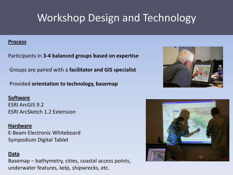
Workshop Design and Technology
Process
Participants in 3-4 balanced groups based on expertise
Groups are paired with a facilitator and GIS specialist
Provided orientation to technology, basemap
SoftwareESRI ArcGIS 9.2ESRI ArcSketch 1.2 Extension
HardwareE-Beam Electronic WhiteboardSympodium Digital Tablet
DataBasemap – bathymetry, cities, coastal access points, underwater features, kelp, shipwrecks, etc.
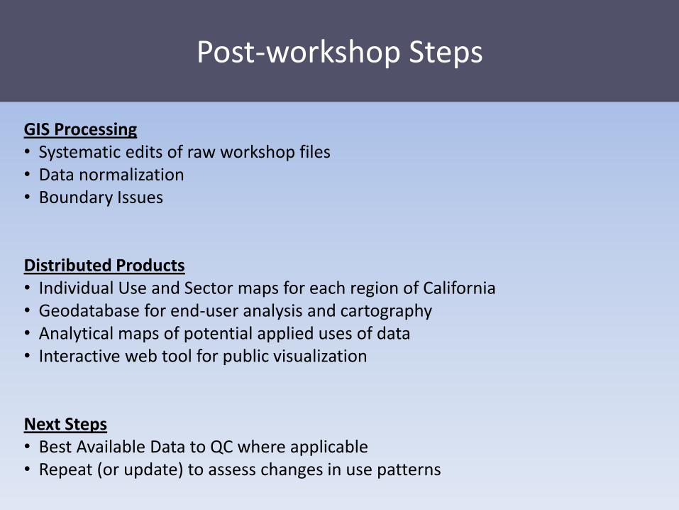
Post-workshop Steps
GIS Processing• Systematic edits of raw workshop files• Data normalization• Boundary Issues
Distributed Products• Individual Use and Sector maps for each region of California• Geodatabase for end-user analysis and cartography• Analytical maps of potential applied uses of data• Interactive web tool for public visualization
Next Steps• Best Available Data to QC where applicable• Repeat (or update) to assess changes in use patterns
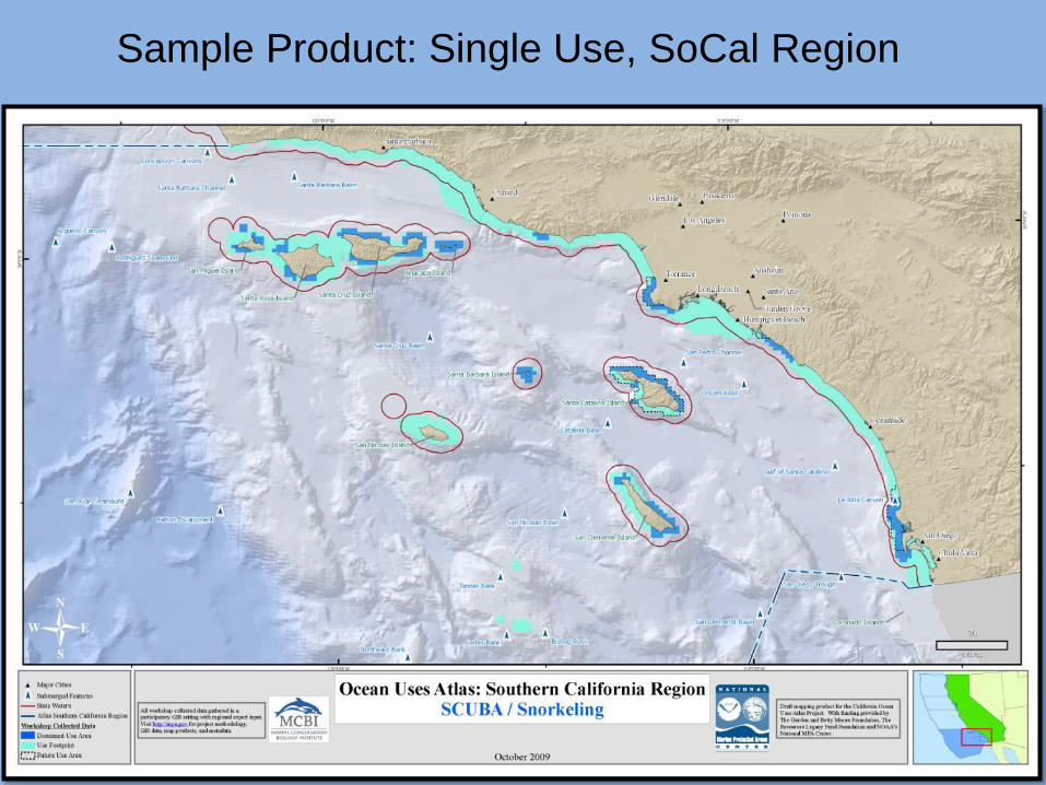
Sample Product: Single Use, SoCal Region
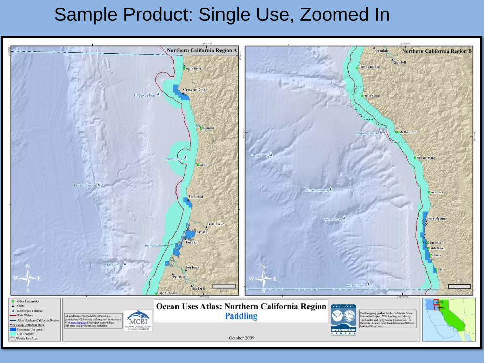
Sample Product: Single Use, Zoomed In
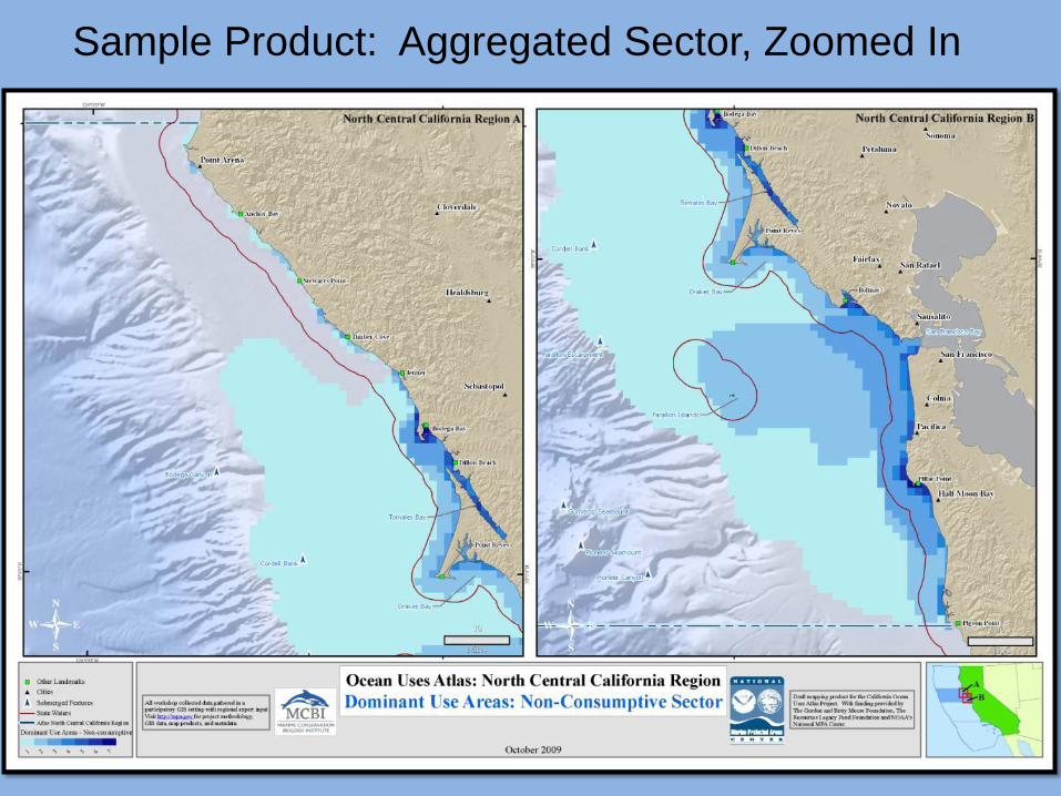
Sample Product: Aggregated Sector, Zoomed In
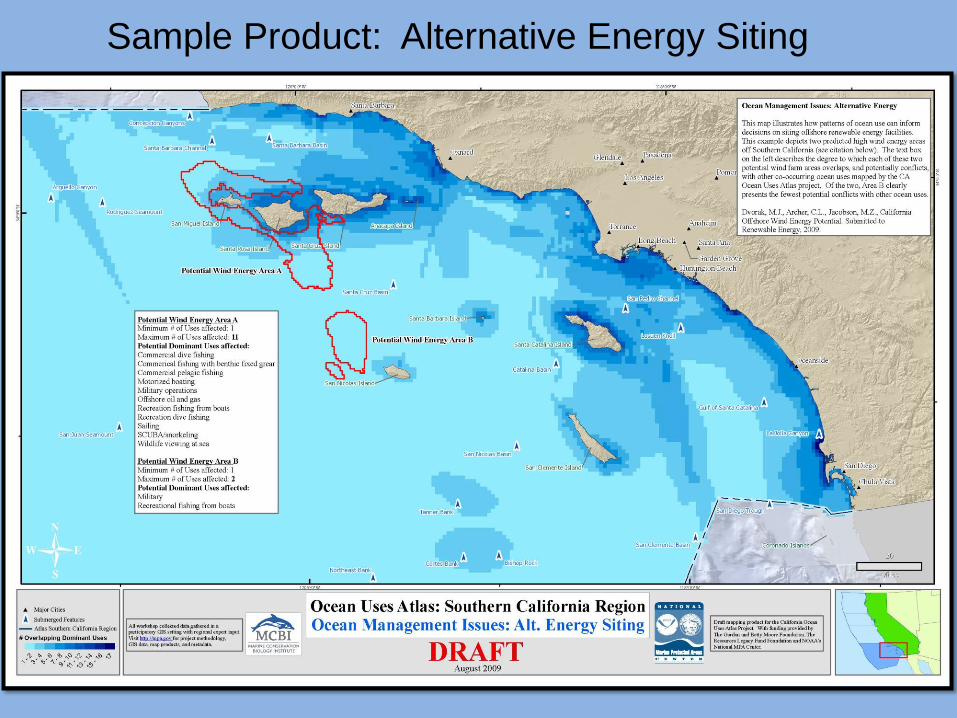
Sample Product: Alternative Energy Siting
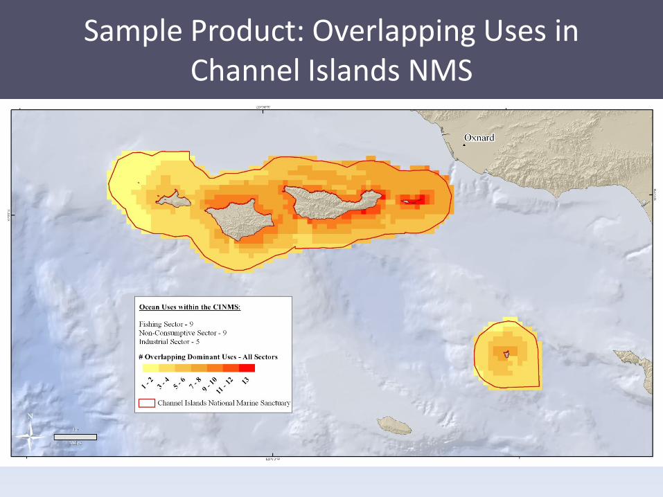
Sample Product: Overlapping Uses inChannel Islands NMS
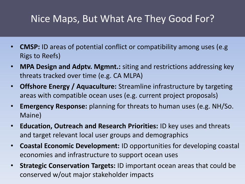
• CMSP: ID areas of potential conflict or compatibility among uses (e.gRigs to Reefs)
• MPA Design and Adptv. Mgmnt.: siting and restrictions addressing key threats tracked over time (e.g. CA MLPA)
• Offshore Energy / Aquaculture: Streamline infrastructure by targeting areas with compatible ocean uses (e.g. current project proposals)
• Emergency Response: planning for threats to human uses (e.g. NH/So. Maine)
• Education, Outreach and Research Priorities: ID key uses and threats and target relevant local user groups and demographics
• Coastal Economic Development: ID opportunities for developing coastal economies and infrastructure to support ocean uses
• Strategic Conservation Targets: ID important ocean areas that could be conserved w/out major stakeholder impacts
Nice Maps, But What Are They Good For?
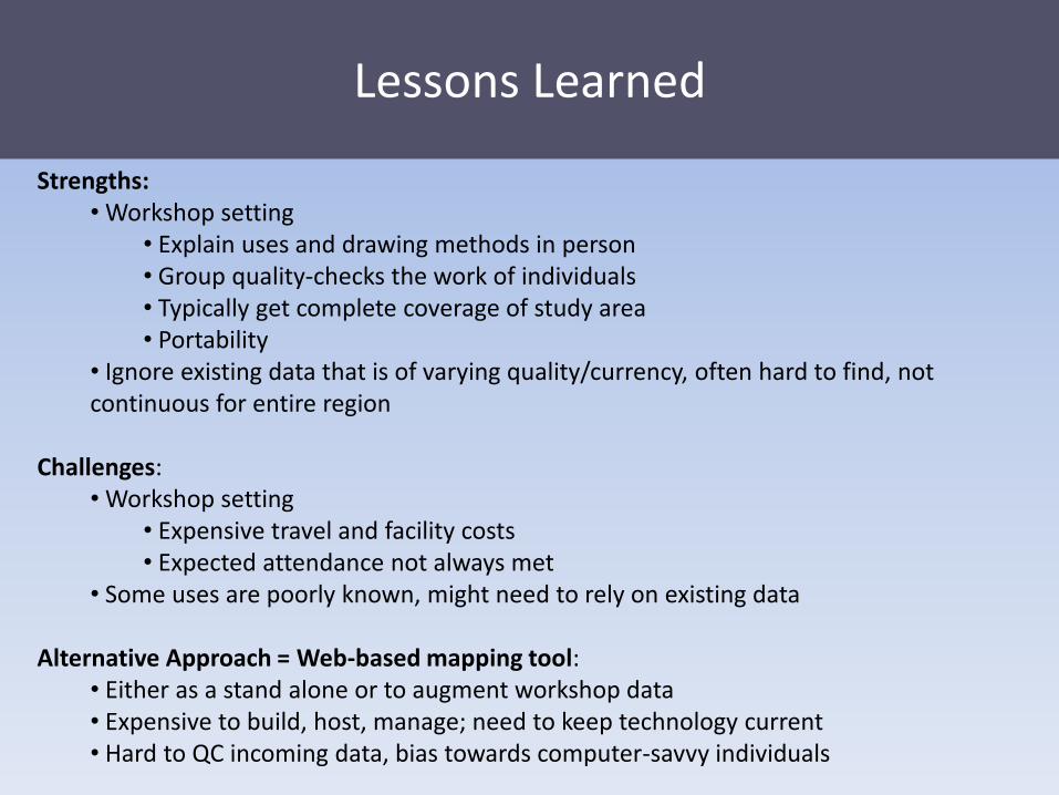
Lessons Learned
Strengths:• Workshop setting
• Explain uses and drawing methods in person• Group quality-checks the work of individuals• Typically get complete coverage of study area• Portability
• Ignore existing data that is of varying quality/currency, often hard to find, not continuous for entire region
Challenges:• Workshop setting
• Expensive travel and facility costs• Expected attendance not always met
• Some uses are poorly known, might need to rely on existing data
Alternative Approach = Web-based mapping tool:• Either as a stand alone or to augment workshop data• Expensive to build, host, manage; need to keep technology current• Hard to QC incoming data, bias towards computer-savvy individuals
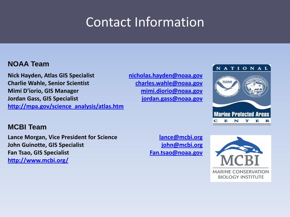
Contact Information
Nick Hayden, Atlas GIS SpecialistCharlie Wahle, Senior ScientistMimi D’iorio, GIS ManagerJordan Gass, GIS Specialisthttp://mpa.gov/science_analysis/atlas.htm
Lance Morgan, Vice President for ScienceJohn Guinotte, GIS SpecialistFan Tsao, GIS Specialisthttp://www.mcbi.org/
[email protected]@noaa.gov
[email protected]@noaa.gov
[email protected]@mcbi.org
NOAA Team
MCBI Team
Recommended