Ocean Sciences
What is CUAHSI?
• CUAHSI – Consortium of Universities for the Advancement of Hydrologic Science, Inc
• Formed in 2001 as a legal entity
• Program office in Washington (5 staff)
• NSF supports CUAHSI to develop infrastructure and services to advance hydrologic science in US universities
Earth Sciences
AtmosphericSciences
UCAR
CUAHSI
Unidata
HISNational Science Foundation
Geosciences Directorate
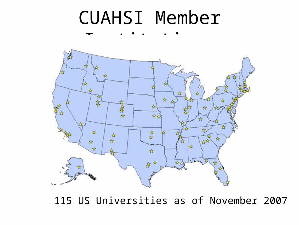
CUAHSI Member Institutions
115 US Universities as of November 2007
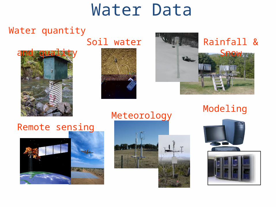
Rainfall & SnowWater quantity
and quality
Remote sensing
Water Data
Modeling Meteorology
Soil water
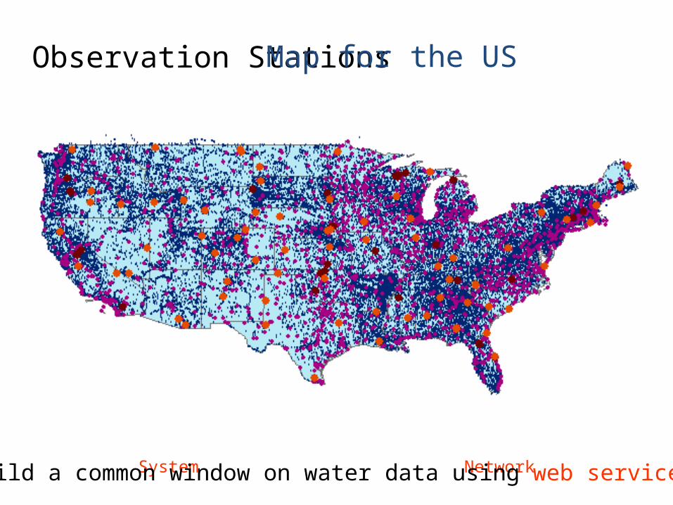
Observation Stations
Ameriflux Towers (NASA & DOE) NOAA Automated Surface Observing System
USGS National Water Information System NOAA Climate Reference Network
Map for the US
Build a common window on water data using web services
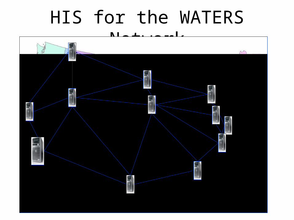
HIS for the WATERS Network
HIS Central at San Diego Supercomputer Center

CUAHSI Point Observation Data Services
1. Data Loading– Put data into the CUAHSI Observations Data
Model
2. Data Publishing– Provide web services access to the data
3. Data Indexing– Summarize the data in a centralized cataloging
system

Data Loading
• Data Entry– Put the data into the ODM
database (SQL/Server)– OD Data Loader, Streaming
data loader, SQL/Server Integration Services
• Data Editing– ODM Tools– Check (1) View and graph
data in ODM Tools
CUAHSI Observations Data Model (ODM)http://www.cuahsi.org/his/odm.html

Data Publishing• Data Storage
– Move the ODM to a publication server
– Wrap it with CUAHSI web services code
• Data Access– Provide the WSDL
address– Use CUAHSI
WaterOneFlow web service functions
– Check (2) Web services spreadsheet for site locations and data series

Locations
Variable Codes
Date Ranges
WaterML and WaterOneFlow
GetSiteInfoGetVariableInfoGetValues
WaterOneFlowWeb Service
Client
STORET
NAMNWIS
DataRepositories
Data
DataData
EXTRACTTRANSFORMLOAD
WaterML
WaterML is an XML language for communicating water dataWaterOneFlow is a set of web services based on WaterML
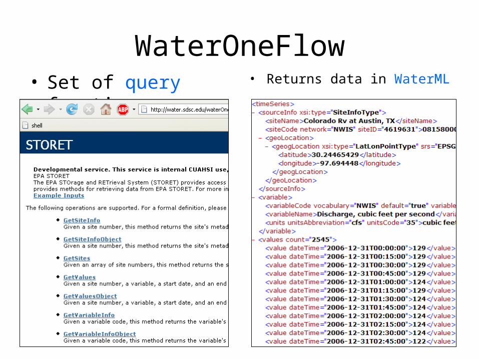
WaterOneFlow• Set of query functions • Returns data in WaterML

SNOTEL in WaterML
http://river.sdsc.edu/snotel/cuahsi_1_0.asmx?WSDL
809 sites 10 variables
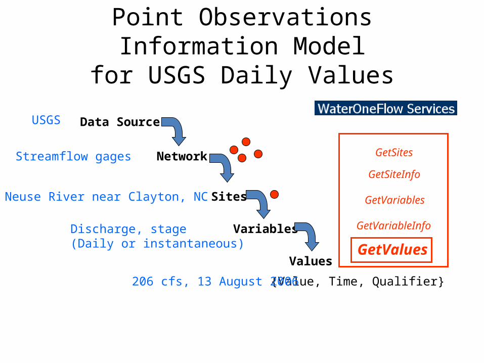
Point Observations Information Modelfor USGS Daily Values
Data Source
Network
Sites
Variables
Values
{Value, Time, Qualifier}
USGS
Streamflow gages
Neuse River near Clayton, NC
Discharge, stage (Daily or instantaneous)
206 cfs, 13 August 2006
GetSites
GetSiteInfo
GetVariables
GetVariableInfo
GetValues
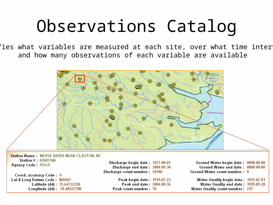
Observations CatalogSpecifies what variables are measured at each site, over what time interval,
and how many observations of each variable are available

Hydrologic Information Server
Microsoft SQLServer Relational Database
Observations Data Geospatial Data
GetSites
GetSiteInfo
GetVariables
GetVariableInfo
GetValues
DASH – data access system for hydrologyWaterOneFlow services
ArcGIS Server

We are at a tipping point ….
• Web pages • Web services
Computer Person Computer
Internet Internet
Computer
People interact with a remote information server
Networks of information serversprovide services to one another
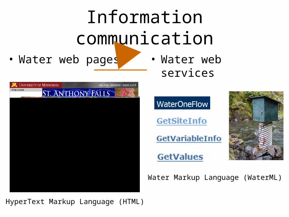
Information communication
• Water web pages • Water web services
HyperText Markup Language (HTML)
Water Markup Language (WaterML)

• Search multiple heterogeneous data sources simultaneously regardless of semantic or structural differences between them
Objective
NWIS
NARR
NAWQANAM-12
request
request
request
request
request
requestrequest
request
request
return
return
return
return
return
returnreturn
return
return
What we used to do …..
Michael PiaseckiDrexel University

Semantic MediatorWhat we are doing now …..
NWIS
NAWQA
NARR
generic
request
GetValues
GetValues
GetValues
GetValues
GetValues
GetValuesGetValues
GetValues
GetValues HODM
Michael PiaseckiDrexel University

Hydroseekhttp://www.hydroseek.org
Supports search by location and type of data across multiple observation networks including NWIS, Storet, and university data
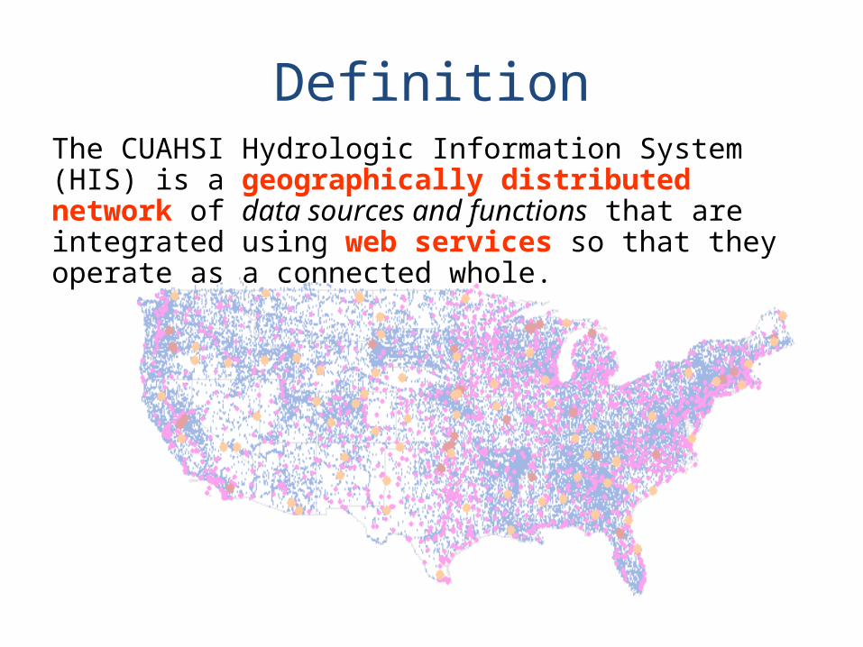
DefinitionThe CUAHSI Hydrologic Information System (HIS) is a geographically distributed network of data sources and functions that are integrated using web services so that they operate as a connected whole.
Recommended