Managing an Outside Plant Fiber Optic Network with GIS
Bobby Ripy –Frankfort Plant Board, KYTom Taber – Telvent Miner & Miner
Frankfort Plant Board History
Electric & Water Service since 1943Cable service since 1952High Capacity Fiber since1997Largest municipally owned cable company in U.S.Services the State Capital of Kentucky
FPB Services
High-Speed Internet AccessTelephony ServiceCable TelevisionWaterElectricSecurity Services
FPB Fiber Optic Network
Expanding the Full Service NetworkProvides service to 20,000 customersFiber Optic Network supports:
Internet AccessDark FiberHigh Capacity InternetCable Television NodesTelephony Applications
Need for GIS Based Management
Massive Fiber System ExpansionNetwork Expert was retiringRecord Keeping was Inefficient and ComplexIntegration with Gas and Water GISCompany-wide Access to DataFiber Network Analysis and Reporting
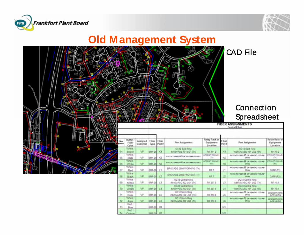
Old Management SystemCAD File
ConnectionSpreadsheet
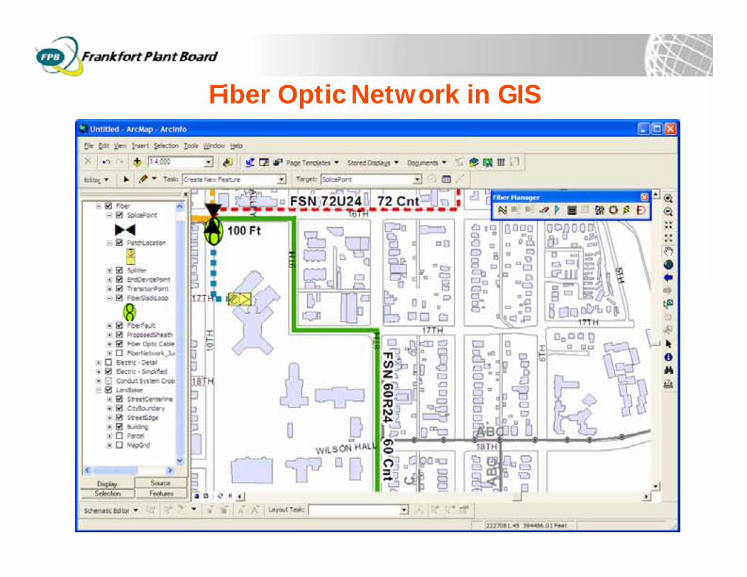
Fiber Optic Network in GIS
Uses of the GIS Data
Call Before You Dig ProgramOperations MapsAnnual and Ad Hoc ReportingSystem Planning and ExpansionSystem Visualization with Electric and WaterSystem Analysis
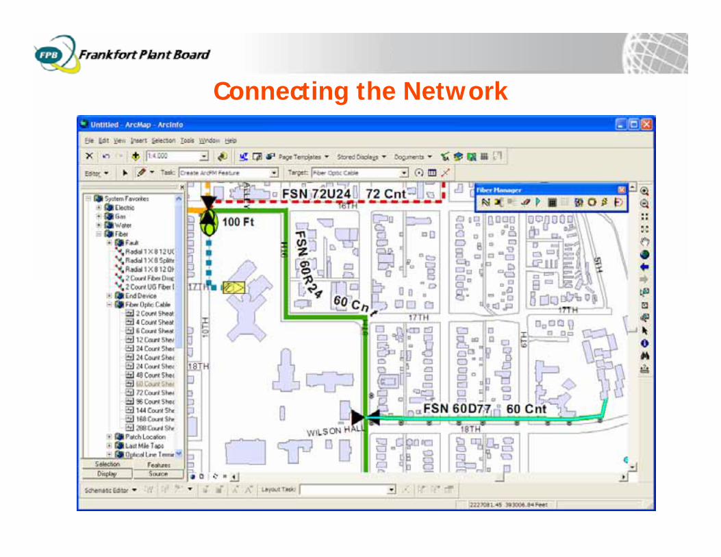
Connecting the Network
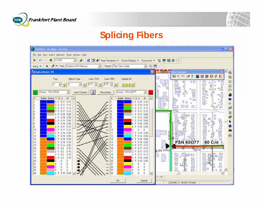
Splicing Fibers
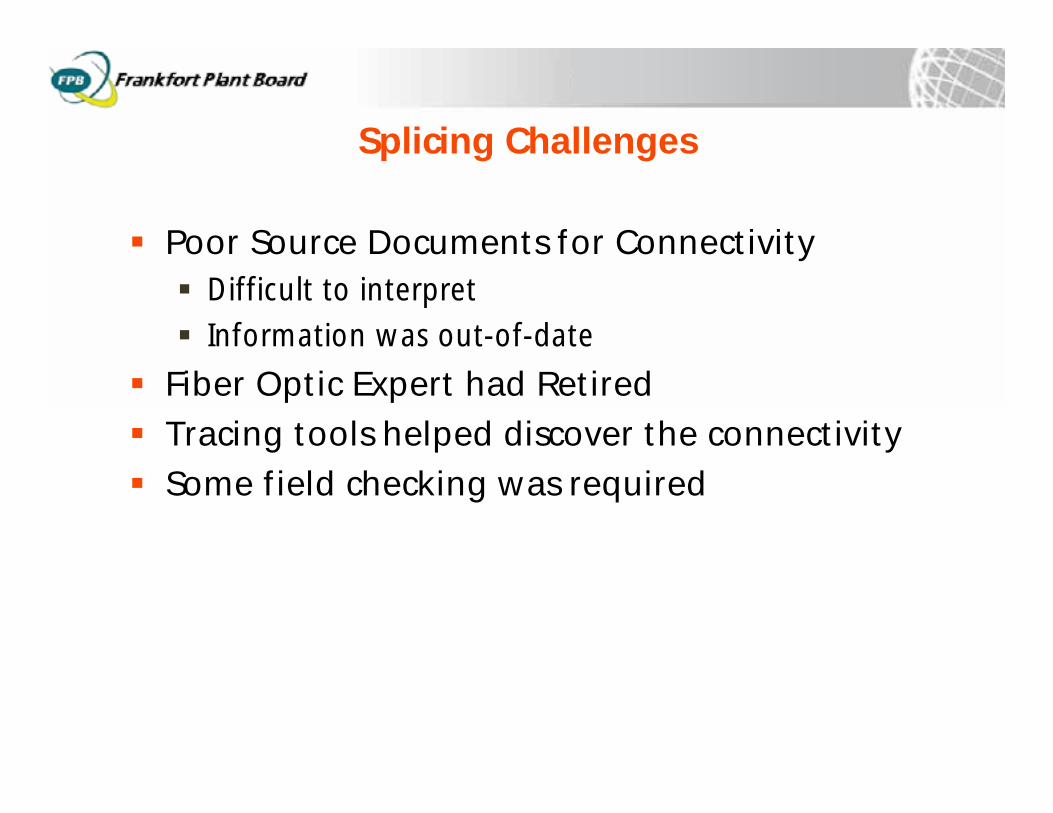
Splicing Challenges
Poor Source Documents for ConnectivityDifficult to interpretInformation was out-of-date
Fiber Optic Expert had RetiredTracing tools helped discover the connectivitySome field checking was required
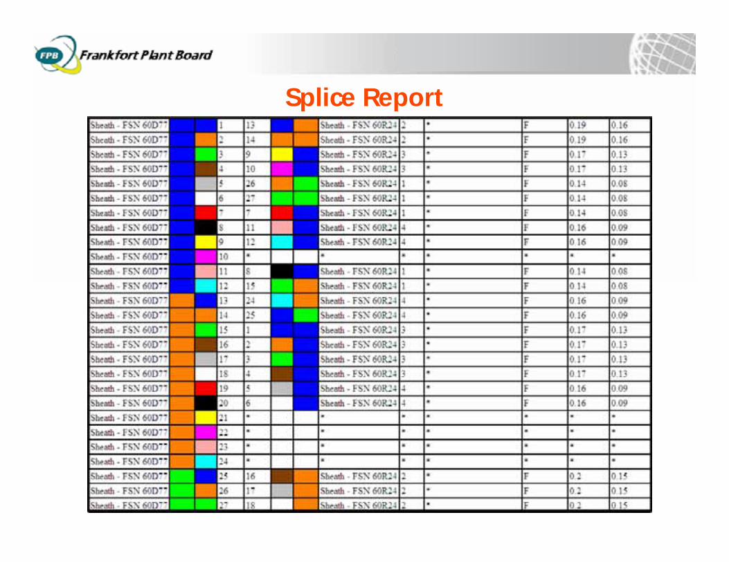
Splice Report
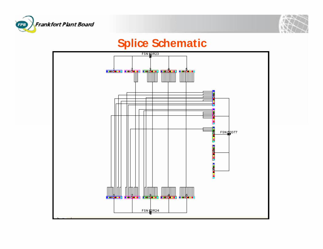
Splice Schematic
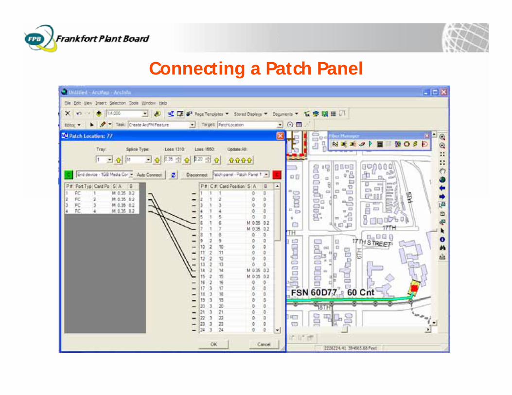
Connecting a Patch Panel
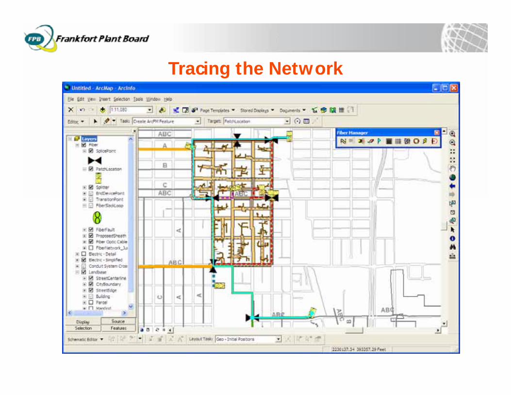
Tracing the Network
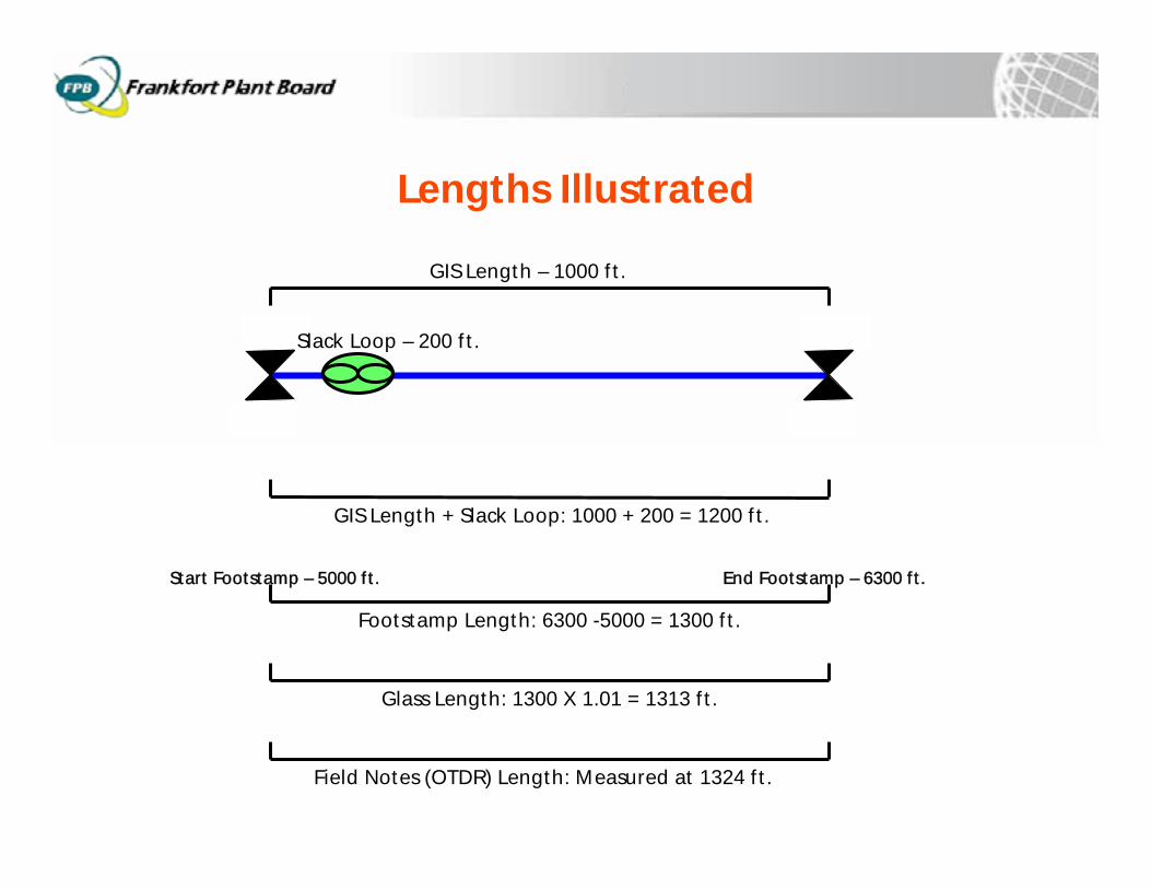
Lengths Illustrated
GIS Length – 1000 ft.
GIS Length + Slack Loop: 1000 + 200 = 1200 ft.
Slack Loop – 200 ft.
Field Notes (OTDR) Length: Measured at 1324 ft.
Footstamp Length: 6300 -5000 = 1300 ft.
Start Footstamp – 5000 ft. End Footstamp – 6300 ft.
Glass Length: 1300 X 1.01 = 1313 ft.
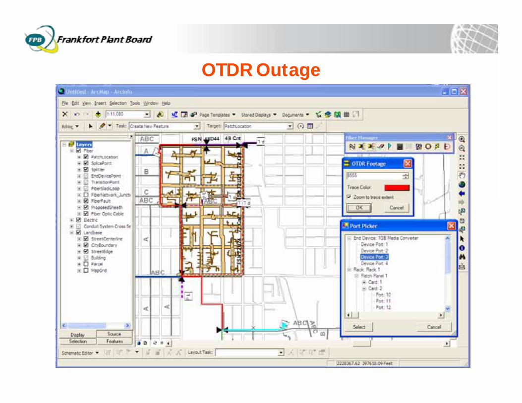
OTDR Outage
Conclusions
Enterprise GIS improved system managementData available company-wide for many usesGIS provides a rich way to capture, analyze and report on the network dataMany benefits despite partial data captureThe data will improve as the system is used
Questions?
Managing an Outside Plant Fiber Optic Network with GIS
Bobby Ripy - GIS CoordinatorFrankfort Plant Board, KY
Tom Taber – Product SpecialistTelvent Miner & [email protected]
Recommended