Levee Inspection Program & Status Update of the East Coast
Protective Levee
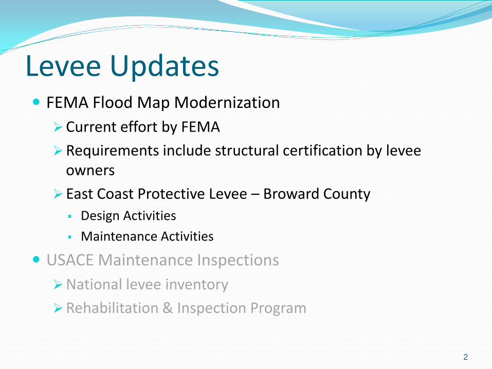
FEMA Flood Map Modernization Current effort by FEMA
Requirements include structural certification by levee owners
East Coast Protective Levee – Broward County Design Activities
Maintenance Activities
USACE Maintenance Inspections National levee inventory
Rehabilitation & Inspection Program
2
Levee Updates

FEMA Mapping FEMA requires levee owners to certify that the levee
system can withstand a 100-Year Storm Event plus a Category 1 hurricane
If the structures cannot be certified for 100-yr storm, then the mapping analysis will consider the levee’s protection level to prorate insurance costs This would result in an increase in flood insurance rates for
existing policy owners and
Would require flood insurance for property owners within the expanded flood plain
3

FEMA Mapping – Sequence of Events Participating County requests levee certification from the
levee owner
If the levee owner believes that the structure is certifiable, then they can obtain a Provisional Accreditation from FEMA
Allows up to 2 years for the levee owner to provide a certification to FEMA
During this period, no changes occur to existing flood insurance rates or flood plain extent
Preliminary flood maps for Broward County have been issued and show the levees with full protection
4

East Coast Protective Levee – Palm Beach and Broward Counties
L-36 L-35A L-35 L-37 L-33
East Coast Protective Levee - Broward County
5

FEMA Levee Evaluation Objectives Review Existing Records
Determine Current Condition
Complete Engineering
Analyses using Current Design Standards
Confirm FEMA Requirements
If found, Note Deficiencies and Possible Remediation
Provide Certification per 44 CFR 65.10
6

SFWMD Levee Assessment – Broward County
Freeboard
Structures
Levee Embankment
Seepage
Stability
Settlement
Interior Drainage
Adjacent Drainage Systems
7

Criteria for Freeboard Assessment A levee crest will be deemed to meet the freeboard criteria described in CFR 44 Ch.1 §65.10 if its elevation is at least a foot higher than the height of maximum wave run-up associated with the computed 100-year static water level.
8

Engineering Conclusions Raise crest of about 2000 feet of L-36
Recommend Construction of Downstream Toe Berm along Levee Alignments Reduce exit gradients near levee toe
Provide positive cutoff through peat layer for piping control
Improve levee stability
Protect against internal erosion
Engineering design will determine: Most appropriate areas for remediation and their priority
Cost & Schedule
Flatten Upstream Slope for parts of L-36
Perform additional geo-tech analysis in specific areas 9

Maintenance Activities To-Date • Wave action repair
• Addition of fill to raise levee elevation to design
• Undesirable vegetation removal
• Herbicide treatment
• Monitoring stations installed
• Installation of temporary seepage measures – ring dikes
10
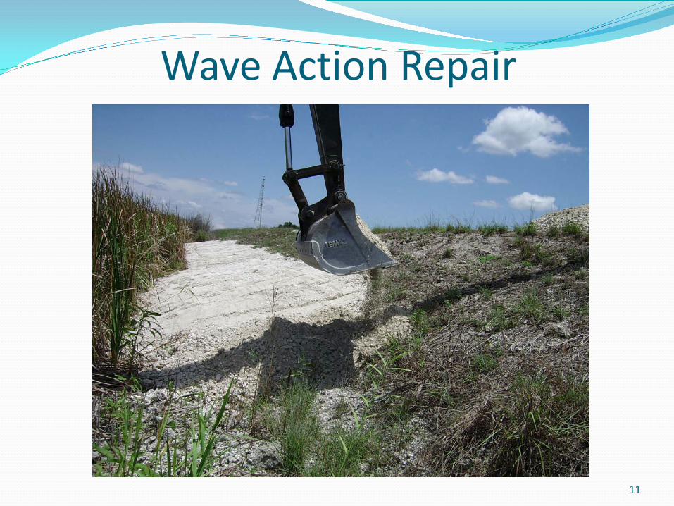
Wave Action Repair
11

Raise Levee Elevation
12

Vegetation Clearing BEFORE AFTER
13

Herbicide Treatment
14

Permanent Monitoring Installed
15

Installing Ring Dikes on L-36
16

Design Progress To-Date Completed engineering design
and construction documents Funding is in place
Submitted permit applications Environmental permits
U.S. Army Corps of Engineers
Florida Department of Environmental Protection
Local governments
Facility modification permit U.S. Army Corps of Engineers
17

Next Steps Receive permit approvals
Solicit construction bids
Execute three (3) construction contracts
Continue close coordination with: Participating communities
USACE
FEMA
Provide certification to FEMA in 2013
Current Preliminary FEMA Maps show the levee system providing protection from the 100-yr storm
18

FEMA Flood Map Modernization Current effort by FEMA
Requirements include structural certification by levee owners
East Coast Protective Levee – Broward County Design Activities
Maintenance Activities
USACE Maintenance Inspections National levee inventory
Rehabilitation & Inspection Program
19
Levee Updates

Historical Perspective Levee inspection program – SFWMD bi-annual
Inspections State and Federal levees as part of the Central & Southern Flood Control Project
Hurricanes Katrina and Rita (2005) hit the Gulf Coast and changed the way that the USACE viewed levees
National Levee Safety Act passed in 2007 directed the USACE to inventory and inspect existing Federal levees
USACE Jacksonville District began inspections of SFWMD Federal levees in 2009
20
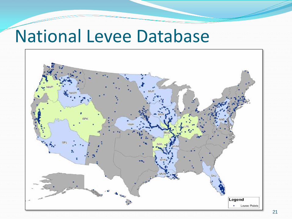
National Levee Database
21

USACE Jacksonville District Levee Inventory
22
979

SFWMD Levee Program Minimize the potential for levee failure while achieving
requirements for: Federal Emergency Management Agency (FEMA) Federal
Guidelines for Dam Safety, April 2004
US Army Corps of Engineers (USACE) Levee Owner’s Manual for Non-Federal Flood Control Works, March 2006
Perform annual inspections of the levees (979 miles) identified in the National Levee Database (Field Station)
Perform 5-year inspections of a more rigorous nature
23

Rehabilitation & Inspection Program District levee systems are currently active in RIP
Active status for flood control projects in the RIP must meet USACE criteria and continue to meet ongoing criteria for continued eligibility
Only Active projects may receive PL 84-99 rehabilitation assistance to repair damage caused by a flood event or coastal storm
USACE Maintenance Inspection Rating System Acceptable/Marginally Acceptable Rating = Active Status
Unacceptable Rating = Inactive Status
24

Levee Inspection Program - Objectives Prevent failures
Prioritize and implement cost-effective preventative measures
Detect and correct deficiencies
Implement appropriate risk-reduction measures
Protect public and property
Comply with regulatory requirements and legal obligations
Ensure disaster preparedness
25

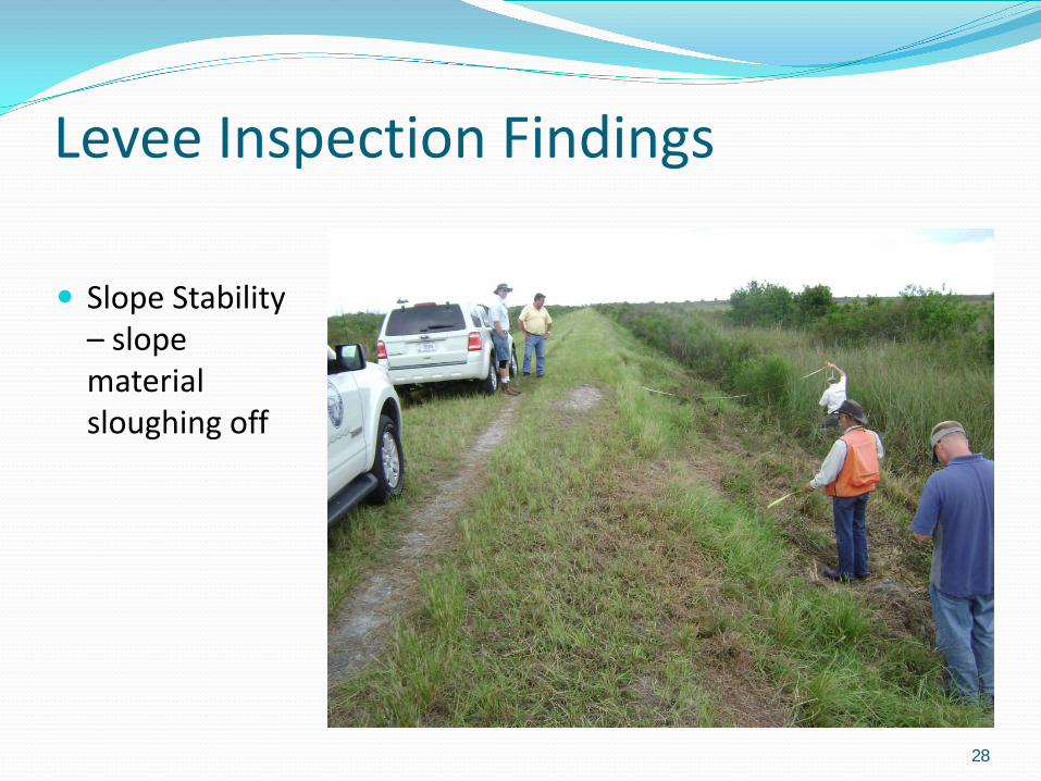
Levee Inspection Findings
26
Unwanted vegetation growth – trees and shrubs on levee side slope

Levee Inspection Findings
27
Depressions / Rutting – rut in excess of 6 inches deep
28
Slope Stability – slope material sloughing off
Levee Inspection Findings

29
Levee Inspection Findings
Animal Control – animal burrow in side slope

30
Levee Inspection Findings
Seepage – seepage at toe of slope

31
Recommended