International Charter –Space and Major DisastersSentinel AsiaJoint Project Team MeetingJuly 7, 2010
Brenda JonesU.S. Geological Survey Charter Executive Secretariat
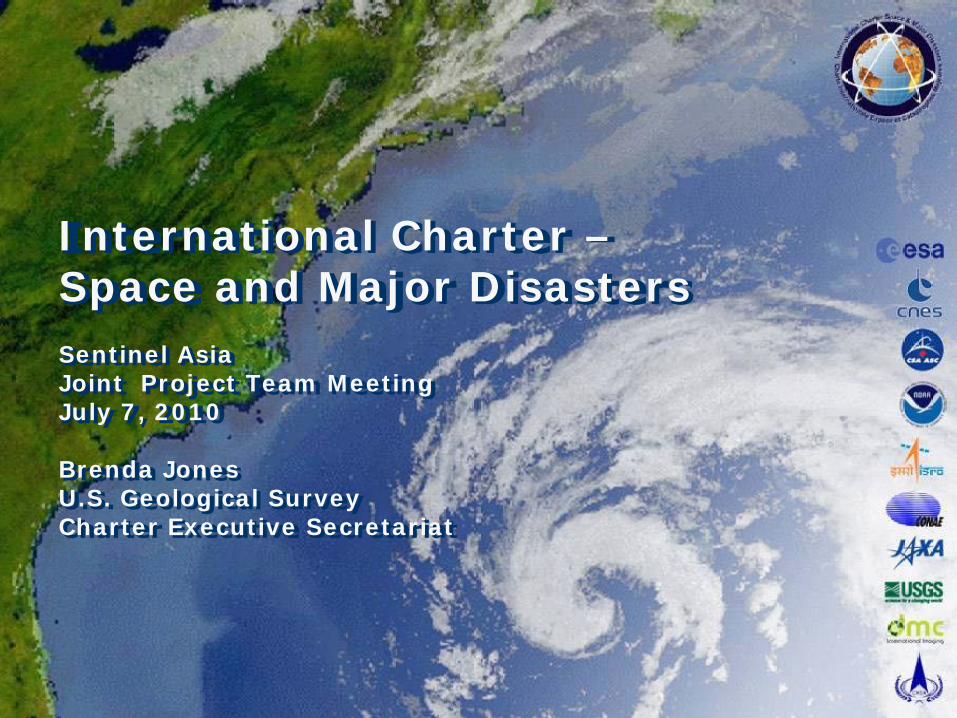
Purpose
• An International agreement among Space Agencies to support with space-based data and information relief efforts in the event of emergencies caused by major disasters.
Disaster response
Multi-satellite data acquisition planning
– Fast data turn-around – priority acquisition
Archive retrievals and spacecraft tasking
Data processing at pre-determined level
Space Agency contribution in image/data
Space Agency initiative for value-added-data fusion
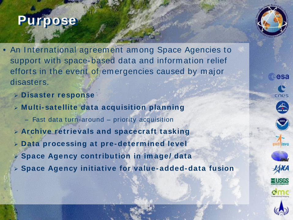
Charter History
• Following the UNISPACE III conference held in Vienna, Austria in June 1999.
European Space Agency (ESA) and French Space Agency (CNES) initiated the International Charter in July 1999.
– ESA – ERS and Envisat
– CNES – SPOT 4 and 5
– CNES - Formosat
• CSA (Canadian Space Agency) signed the Charter on October 20, 2000.
– Radarsat 1 and 2
• Charter declared operational as of November 1, 2000 after formal rehearsals and qualification tests.
• First activation of the Charter: Slovenian landslide November 11, 2000.
RADARSAT
ERS and ENVISAT
SPOT
IRS
POES, GOES
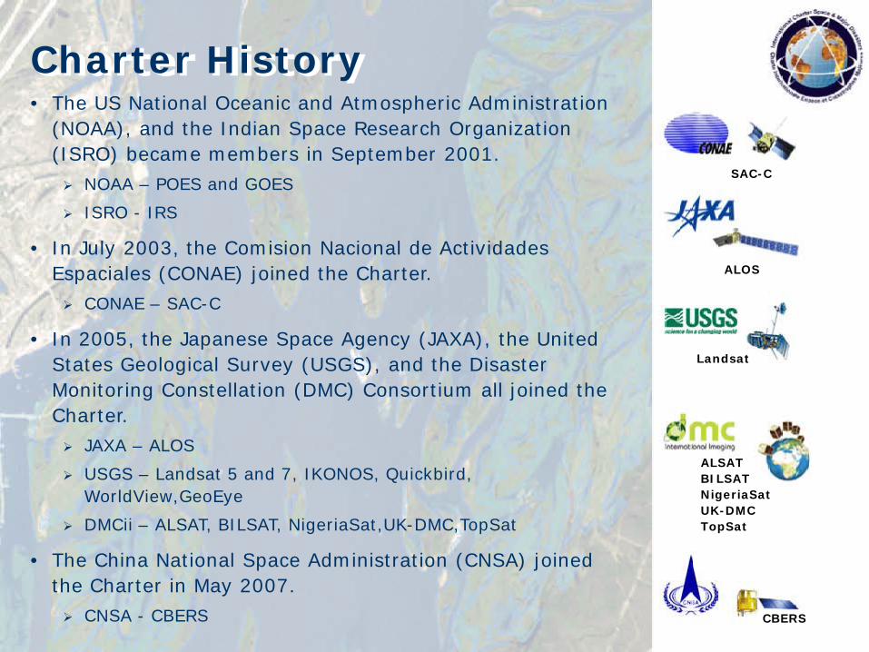
Charter History• The US National Oceanic and Atmospheric Administration
(NOAA), and the Indian Space Research Organization (ISRO) became members in September 2001.
NOAA – POES and GOES
ISRO - IRS
• In July 2003, the Comision Nacional de Actividades Espaciales (CONAE) joined the Charter.
CONAE – SAC-C
• In 2005, the Japanese Space Agency (JAXA), the United States Geological Survey (USGS), and the Disaster Monitoring Constellation (DMC) Consortium all joined the Charter.
JAXA – ALOS
USGS – Landsat 5 and 7, IKONOS, Quickbird, WorldView,GeoEye
DMCii – ALSAT, BILSAT, NigeriaSat,UK-DMC,TopSat
• The China National Space Administration (CNSA) joined the Charter in May 2007.
CNSA - CBERS
Landsat
SAC-C
ALOS
ALSATBILSATNigeriaSatUK-DMCTopSat
CBERS
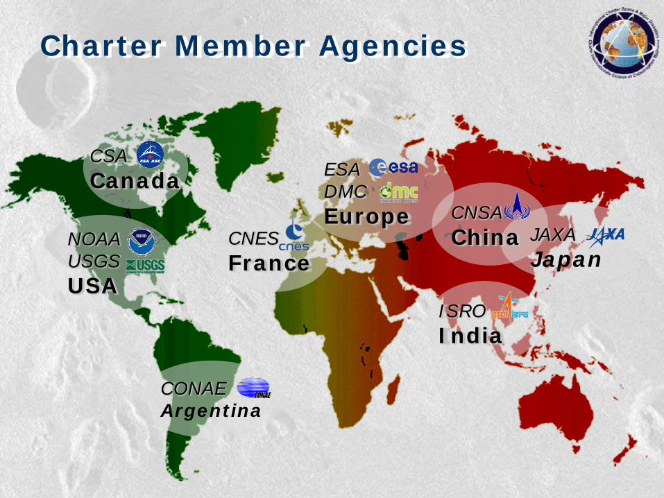
CSACanada
NOAAUSGSUSA
CONAEArgentina
CNESFrance
ESADMCEurope
ISROIndia
JAXAJapan
Charter Member Agencies
CNSAChina
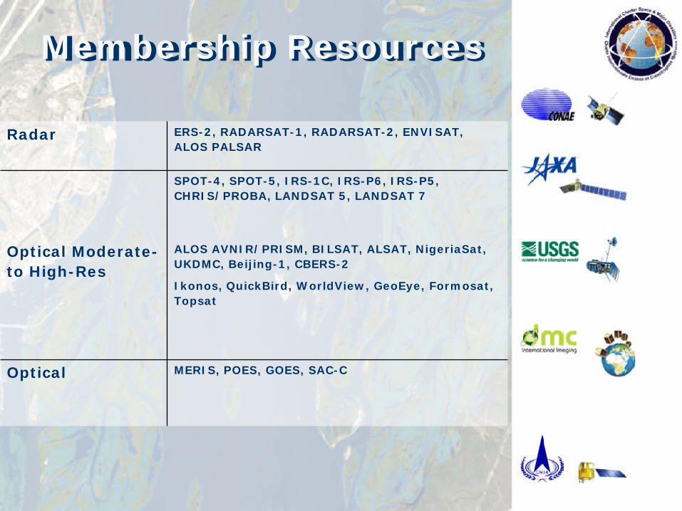
Membership Resources
Radar ERS-2, RADARSAT-1, RADARSAT-2, ENVISAT, ALOS PALSAR
SPOT-4, SPOT-5, IRS-1C, IRS-P6, IRS-P5, CHRIS/PROBA, LANDSAT 5, LANDSAT 7
Optical Moderate-to High-Res
ALOS AVNIR/PRISM, BILSAT, ALSAT, NigeriaSat, UKDMC, Beijing-1, CBERS-2
Ikonos, QuickBird, WorldView, GeoEye, Formosat, Topsat
Optical MERIS, POES, GOES, SAC-C
Satellite_poster_09042008.pdf
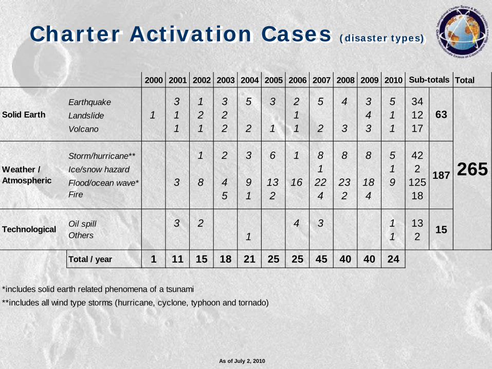
Charter Activation Cases (disaster types)
As of July 2, 2010
2000 2001 2002 2003 2004 2005 2006 2007 2008 2009 2010 Total
Earthquake 3 1 3 5 3 2 5 4 3 5 34Landslide 1 1 2 2 1 4 1 12Volcano 1 1 2 2 1 1 2 3 3 1 17
Storm/hurricane** 1 2 3 6 1 8 8 8 5 42Ice/snow hazard 1 1 2Flood/ocean wave* 3 8 4 9 13 16 22 23 18 9 125Fire 5 1 2 4 2 4 18
Oil spill 3 2 4 3 1 13Others 1 1 2
Total / year 1 11 15 18 21 25 25 45 40 40 24
*includes solid earth related phenomena of a tsunami**includes all wind type storms (hurricane, cyclone, typhoon and tornado)
265
Sub-totals
Weather / Atmospheric
Solid Earth
Technological 15
187
63
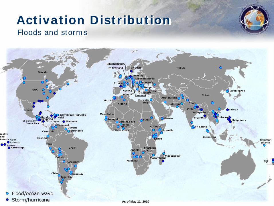
Activation DistributionFloods and storms
Costa Rica
Peru
As of May 11, 2010
Benin
Taiwan
Mauritania
Burkina Faso
Turkey
Samoa
Laos
El Salvador
Albania
Gaza Strip
Cook Islands
Wallis and Futuna
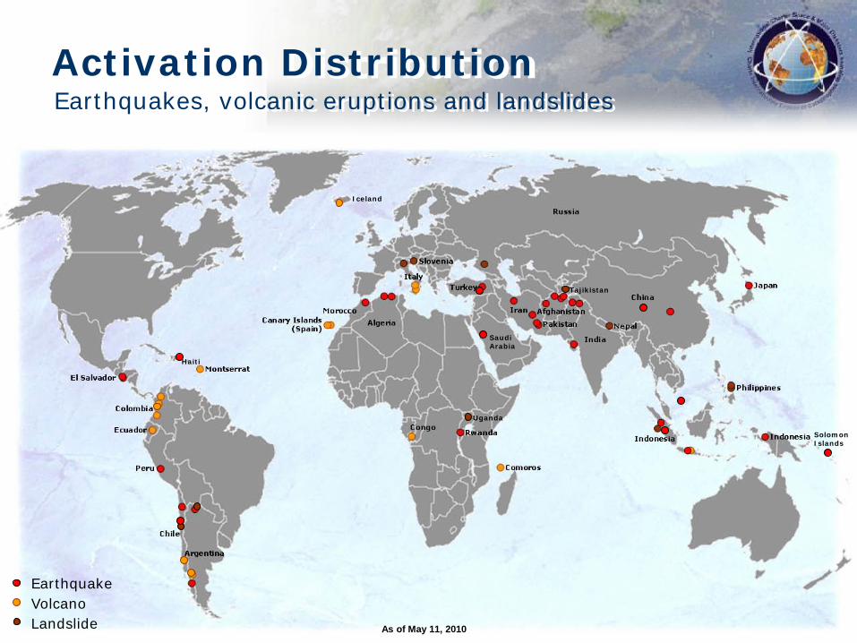
Activation DistributionEarthquakes, volcanic eruptions and landslides
VolcanoLandslide
Earthquake
Tajikistan
SaudiArabia
As of May 11, 2010
Solomon Islands
Haiti
Uganda
Iceland
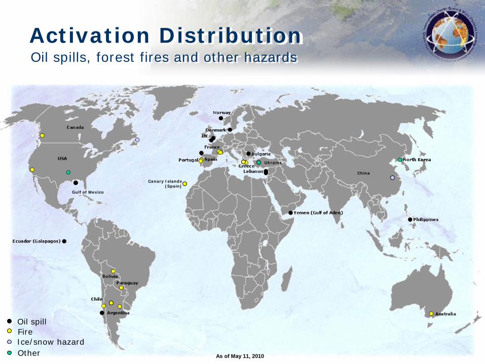
Activation DistributionOil spills, forest fires and other hazards
Oil spillFireIce/snow hazardOther
Canary Islands(Spain)
As of May 11, 2010
China
Ukraine
Gulf of Mexico
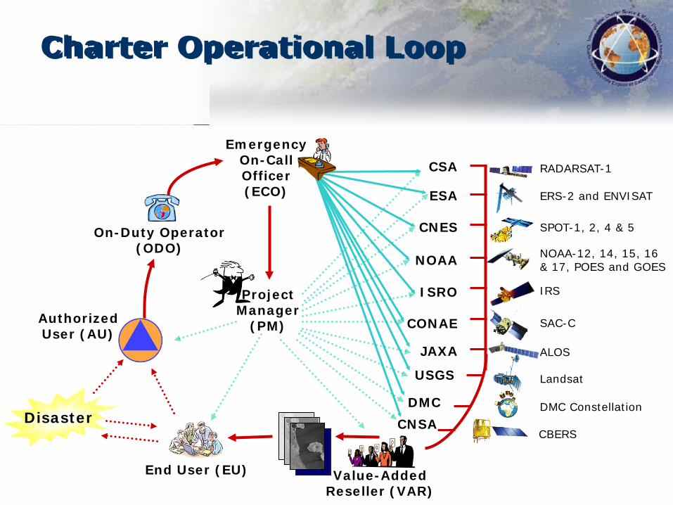
CSA RADARSAT-1
ESA ERS-2 and ENVISAT
NOAA NOAA-12, 14, 15, 16 & 17, POES and GOES
ISRO IRS
CONAE SAC-C
JAXA ALOS
CNES SPOT-1, 2, 4 & 5
DMC DMC Constellation
USGS Landsat
CNSACBERS
Value-Added Reseller (VAR)
End User (EU)
Authorized User (AU)
Disaster
On-Duty Operator (ODO)
Emergency On-Call Officer (ECO)
Project Manager
(PM)
Charter Operational Loop
The International Charter‘Space and Major Disasters’
website:
www.disasterscharter.org
Recommended