INTERNATIONAL BOUNDARY AND WATER COMMISSION, UNITED STATES AND MEXICO
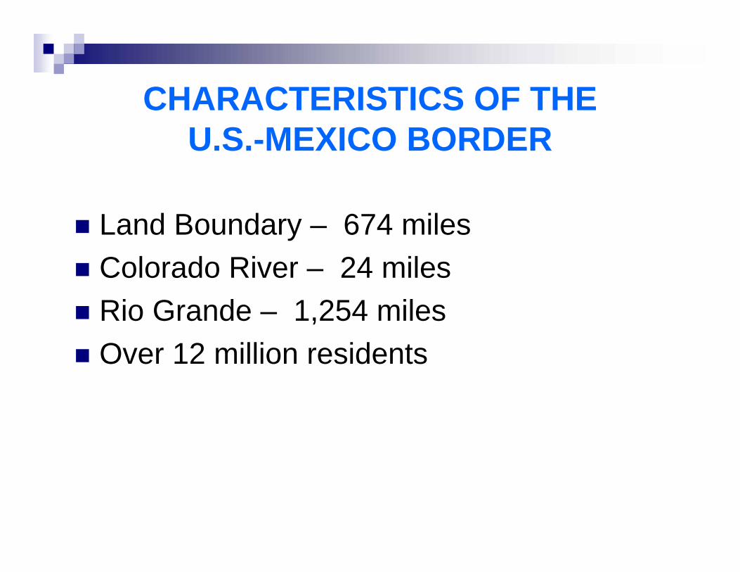
CHARACTERISTICS OF THE U.S.-MEXICO BORDER
Land Boundary – 674 milesColorado River – 24 milesRio Grande – 1,254 milesOver 12 million residents
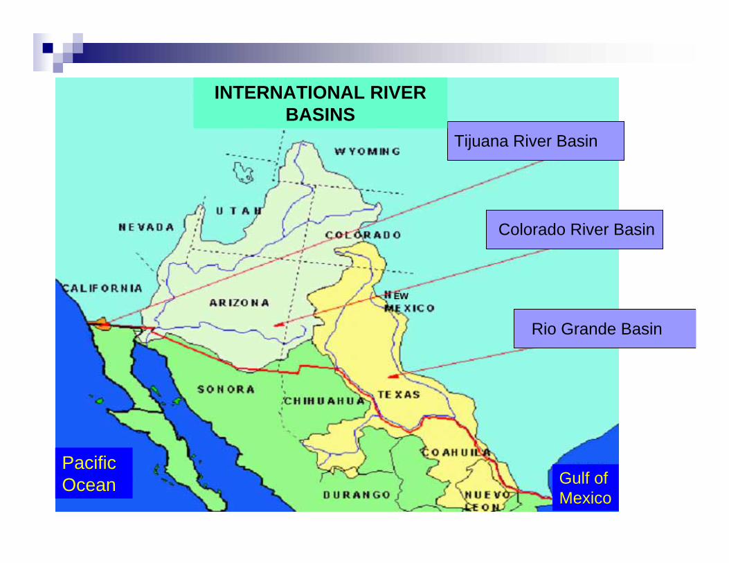
Tijuana River Basin
Colorado River Basin
Rio Grande Basin
INTERNATIONAL RIVER BASINS
PacificOcean Gulf of
Mexico
MISSION OF THE COMMISSION
The International Boundary and Water Commission is responsible for applying the boundary and water treaties between the United States and Mexico and settling differences that arise in their application.

IBWC STRUCTURE
INTERNATIONAL BOUNDARY AND WATER COMMISSION
(IBWC)
MEXICAN
SECTION
•Mexican Commissioner
•Secretary
•Two Principal Engineers
•Legal Adviser
US
SECTION
•US Commissioner
•Secretary
•Two Principal Engineers
•Legal Adviser
IBWC STRUCTURE
Each Commissioner is appointed by his respective presidentWhen the two Sections meet as a Commission, they have the status of an International OrganizationEach Section employs its own staffIBWC staff operate projects, including joint operation of dams

IBWC STRUCTURE
Decisions of the Commission shall be recorded in the form of MinutesMinutes are subject to approval by the Governments (State, SRE) and are binding130 Minutes entered into since treaty ratification

IBWC STRUCTURE
Joint Reports or Joint Memoranda of the Principal Engineers include technical recommendations to the CommissionersCommissioners, Principal Engineers, Secretaries, and Legal Advisers are diplomatic officersSignificant day-to-day contact between the two Sections

CONVENTION OF 1906
Distribution between Mexico and the U.S. of the waters of the Rio Grande in the El Paso-Juarez regionU.S. to deliver 60,000 acre-feet per yearProportional reduction in deliveries in case of extraordinary droughtWater stored in Elephant Butte Dam, NM

American Dam (El Paso-Juarez)
OTHER BOUNDARY TREATIES
Convention of 1933/Rio Grande Rectification Project – Stabilize the international boundary in the El Paso-Juarez ValleyChamizal Convention (1963) – Relocate the Rio Grande in a new channel in El Paso-JuarezTreaty of 1970 – Maintain the Rio Grande and Colorado River as the international boundary
PROYECTO DE RECTIFICACION EN EL VALLE DE JUAREZPROYECTO DE RECTIFICACION EN EL VALLE DE JUAREZ
PROYECTO DE RECTIFICACION EN EL CHAMIZAL
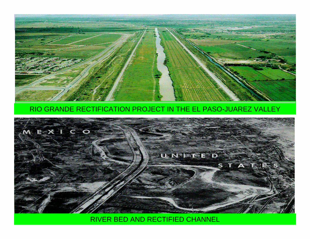
RIO GRANDE RECTIFICATION PROJECT IN THE EL PASO-JUAREZ VALLEY
RIVER BED AND RECTIFIED CHANNEL

1944 WATER TREATYColorado River
U.S. to deliver to Mexico a volume of 1.5 million acre-feet per yearWhen there are surplus waters, U.S. to deliver to Mexico a total volume of up to 1.7 million acre-feet per year

M O R E L O S D A M
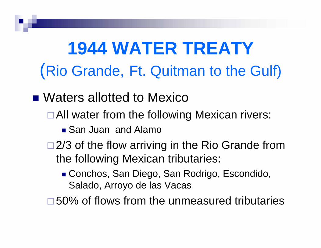
1944 WATER TREATY(Rio Grande, Ft. Quitman to the Gulf)
Waters allotted to MexicoAll water from the following Mexican rivers:
San Juan and Alamo2/3 of the flow arriving in the Rio Grande from the following Mexican tributaries:
Conchos, San Diego, San Rodrigo, Escondido, Salado, Arroyo de las Vacas
50% of flows from the unmeasured tributaries
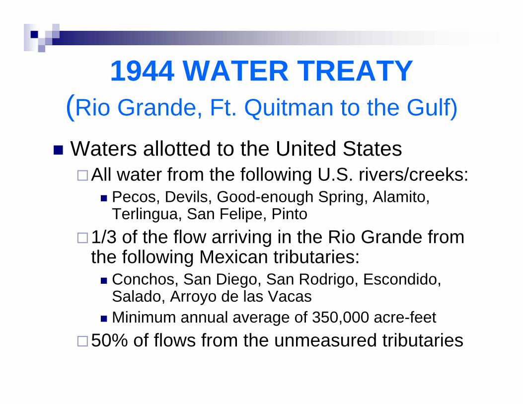
1944 WATER TREATY(Rio Grande, Ft. Quitman to the Gulf)
Waters allotted to the United StatesAll water from the following U.S. rivers/creeks:
Pecos, Devils, Good-enough Spring, Alamito, Terlingua, San Felipe, Pinto
1/3 of the flow arriving in the Rio Grande from the following Mexican tributaries:
Conchos, San Diego, San Rodrigo, Escondido, Salado, Arroyo de las VacasMinimum annual average of 350,000 acre-feet
50% of flows from the unmeasured tributaries
66
289
628
985
1,263
1,546
1,774
1,587
1,431
1,6391,577
884
37 600
400
800
1,200
1,600
2,000
92-93 93-94 94-95 95-96 96-97 97-98 98-99 99-00 00-01 01-02 02-03 03-04 04-05 05-06
* **
*Conforme al Acuerdo del 10-Marzo-05 entre ambos Gobiernos, el 27-Sept-05 México cubrió el volumen faltante de 884 Mm³ y por lo tanto quedan cerrados los ciclos 25 y 26.**2005-2006 está actualizado hasta el 21 de enero de 2006.
CICLO 25 CICLO 26 CICLO 27NOTA:
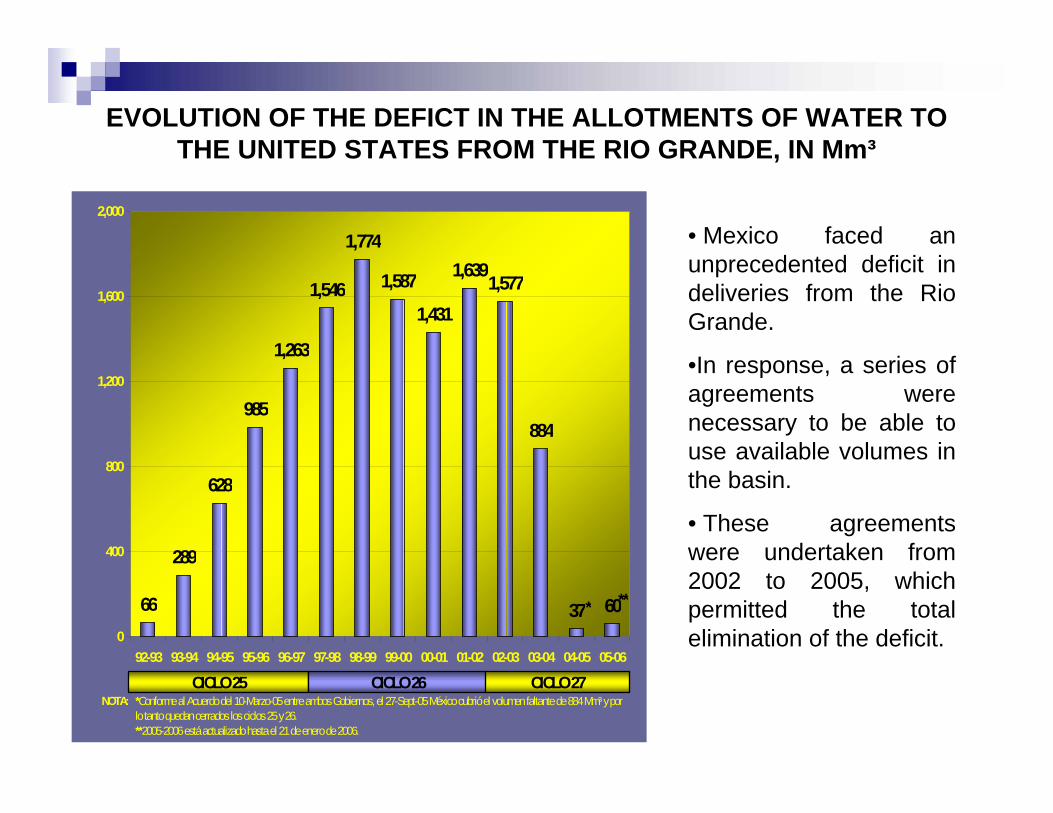
EVOLUTION OF THE DEFICT IN THE ALLOTMENTS OF WATER TO THE UNITED STATES FROM THE RIO GRANDE, IN Mm³
• Mexico faced an unprecedented deficit in deliveries from the Rio Grande.
•In response, a series of agreements were necessary to be able to use available volumes in the basin.
• These agreements were undertaken from 2002 to 2005, which permitted the total elimination of the deficit.
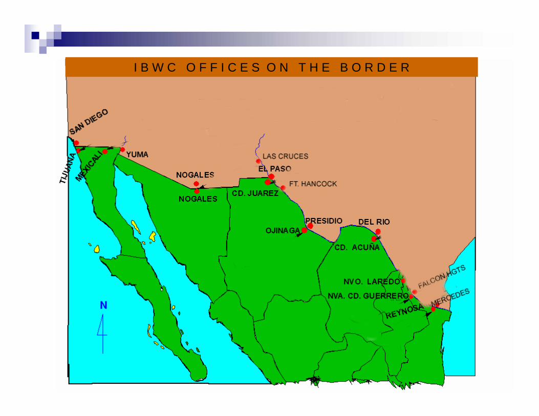
I B W C O F F I C E S O N T H E B O R D E R
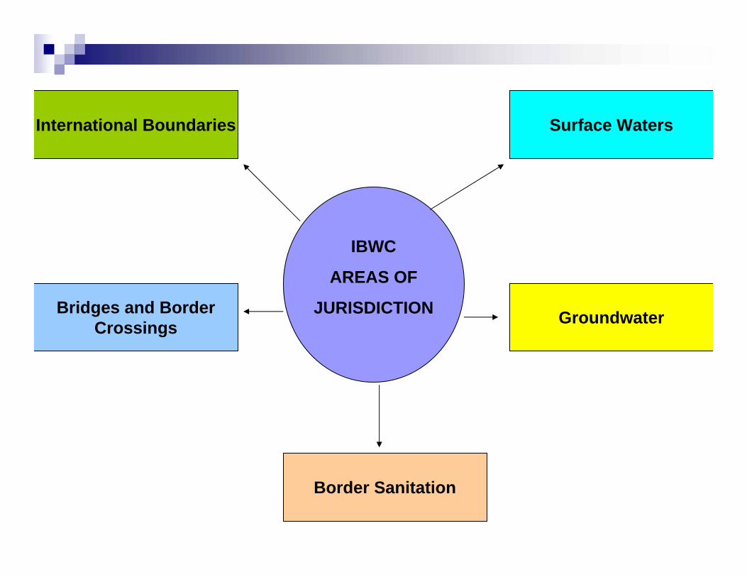
International Boundaries Surface Waters
Groundwater
Border Sanitation
Bridges and BorderCrossings
IBWC
AREAS OF
JURISDICTION
2. CURRENT PROJECTS
AMISTAD DAM
International Storage ReservoirTotal Capacity – 4.9 million acre-feet (6025 million cubic meters)Silt and Conservation – 3.15 million acre-feet (3887 million cubic meters)
Flood ControlRecreationHydroelectric Power
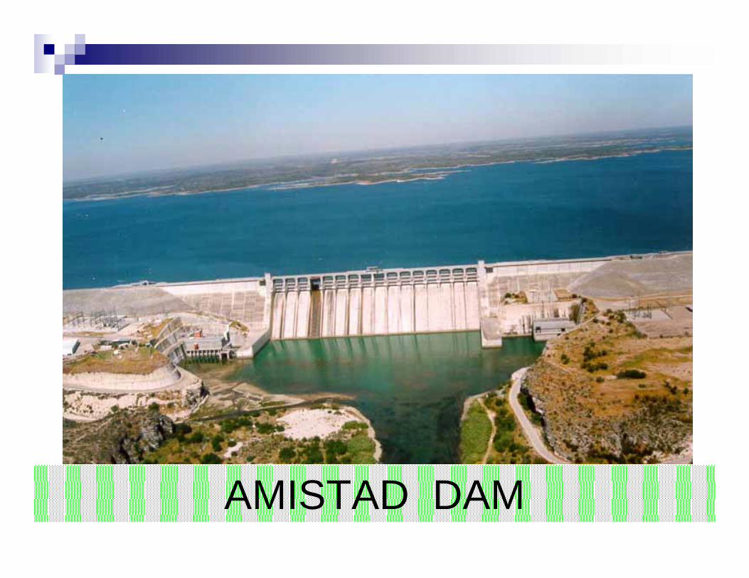
AMISTAD DAM
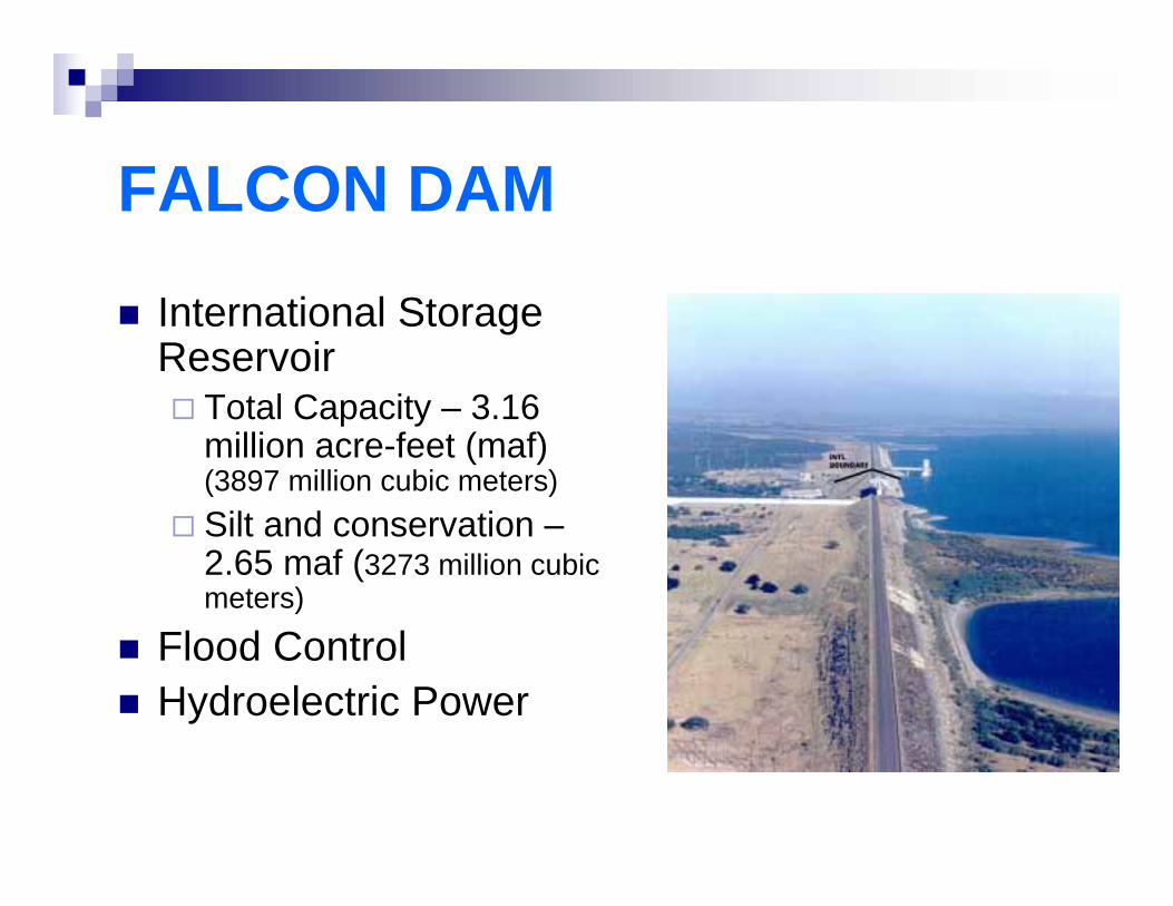
FALCON DAM
International Storage Reservoir
Total Capacity – 3.16 million acre-feet (maf) (3897 million cubic meters)Silt and conservation –2.65 maf (3273 million cubic meters)
Flood ControlHydroelectric Power

U.S.
Hydroelectric
Plant
LOWER RIO GRANDEFLOOD CONTROL PROJECT
340 miles of leveeAnzalduas Diversion DamRetamal Diversion DamFloodwaysFlood protection for hundreds of thousands of people in the U.S. and Mexico

PRESA DERIVADORA ANZALDUAS
1966 Flood at
Brownsville-Matamoros
Anzalduas Diversion Dam
SANITATION PROJECTS
3 international wastewater treatment plants
San Diego, CANogales, AZNuevo Laredo, Tamaulipas

SOUTH BAY INTERNATIONAL WASTEWATER TREATMENT PLANT
WATER QUALITY MONITORING
3 Rio Grande binational toxic substances studies Binational toxic substances study of the New and Colorado RiversIntensive water quality monitoring study of the Rio Grande at Laredo-Nuevo Laredo
COLORADO RIVER SALINITY CONTROL
Minute 242 (1973) regulates the salinity of water delivered to MexicoWellton Mohawk Canal bypasses saline flows to the Santa Clara Slough in MexicoDesalination plant in the U.S. can be made operational when needed
WATER ACCOUNTING
More than 50 gaging stations in the Rio Grande basin in the United States and Mexico11 gaging stations on the Colorado RiverData reviewed weekly by the U.S. and Mexican SectionsDetermination of the national ownership of waters of the Rio GrandePublication of flow data, rainfall, reservoir storage, evaporation, and water quality data in annual water bulletins

WATER ACCOUNTING
Rio Grande gaging station at Presidio-Ojinaga
Telemetry system at North Floodway, Lower Rio Grande
INTERNATIONAL BOUNDARY AND WATER COMMISSION, UNITED STATES AND MEXICO
Mexican Section U.S. Section
(656) 613-7311 (915) 832-4100
www.sre.gob.mx/cila/ www.ibwc.state.gov
Recommended