Integrating invasive species
management in forest and
landscape conservation
October 26, 2016
Danijela Puric-Mladenovic
NHIC, Science and Research Branch, OMNRF
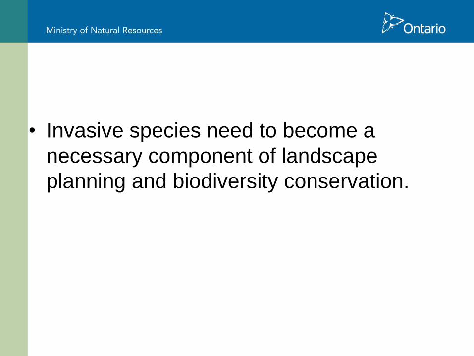
• Invasive species need to become a
necessary component of landscape
planning and biodiversity conservation.
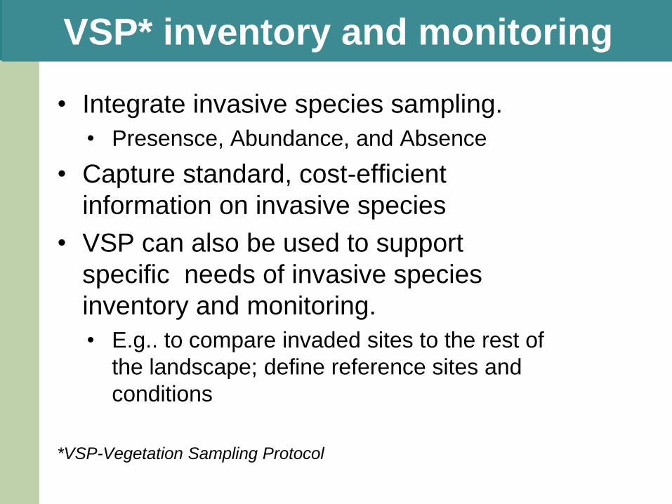
VSP* inventory and monitoring
• Integrate invasive species sampling.
• Presensce, Abundance, and Absence
• Capture standard, cost-efficient
information on invasive species
• VSP can also be used to support
specific needs of invasive species
inventory and monitoring.
• E.g.. to compare invaded sites to the rest of
the landscape; define reference sites and
conditions
*VSP-Vegetation Sampling Protocol
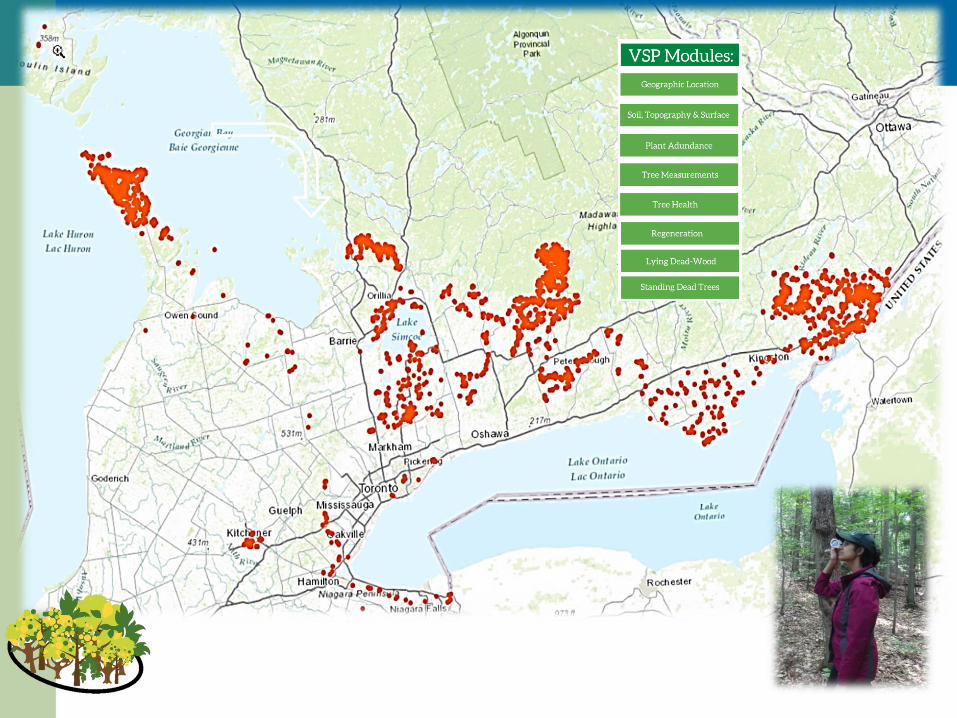
Inventory and monitoringprotocol and partnership

• Applicable to
– Landscape/ regional needs
– Stand / property / parcel sampling
– Plot level sampling

Loss of Ash due EAB impact
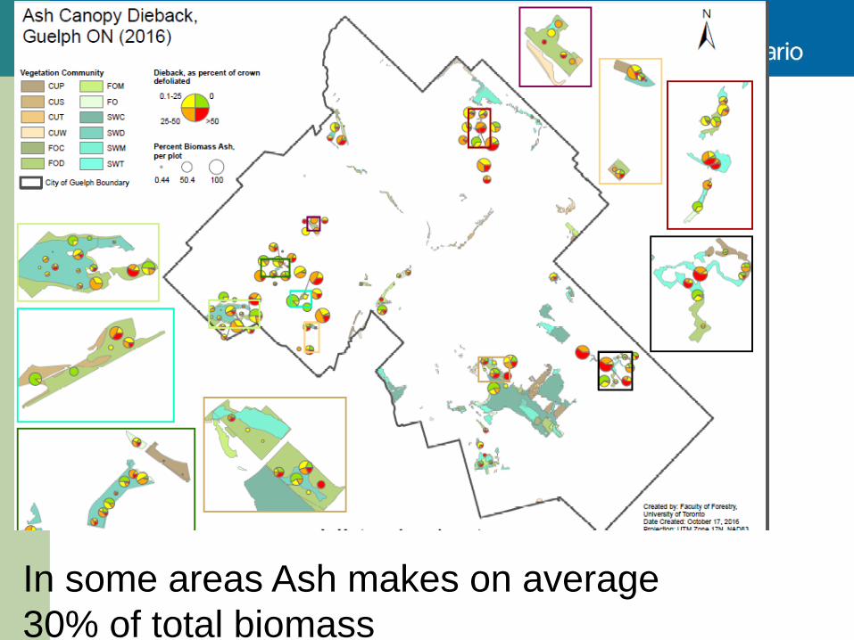
In some areas Ash makes on average
30% of total biomass
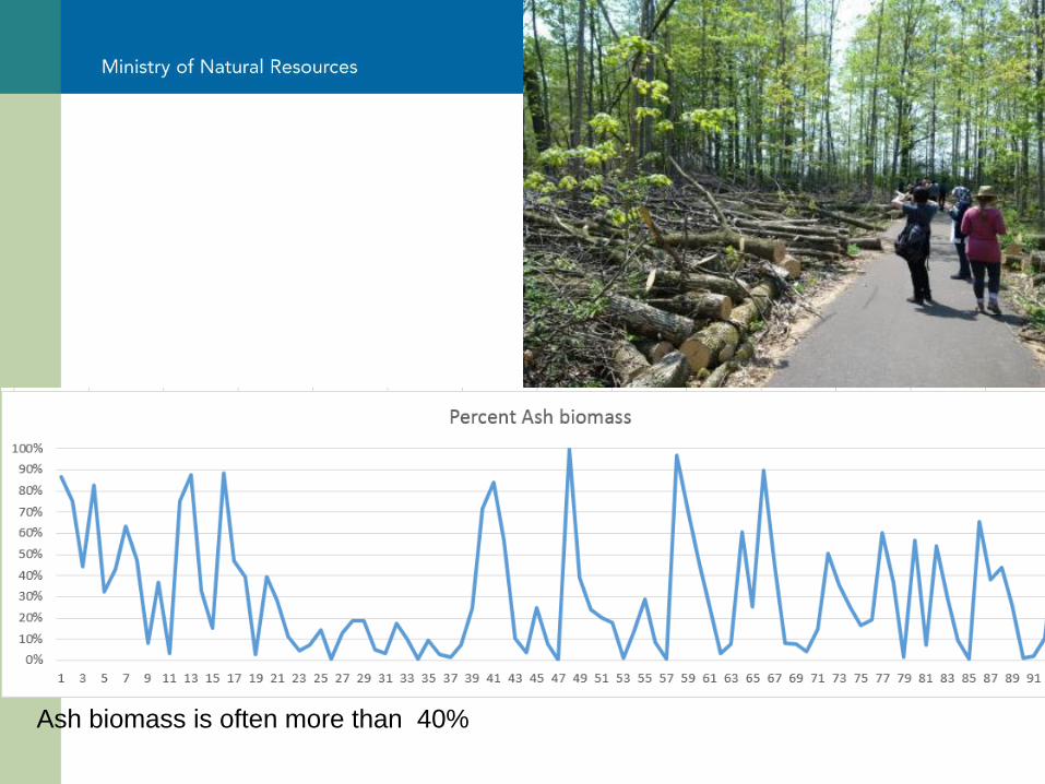
Ash biomass is often more than 40%
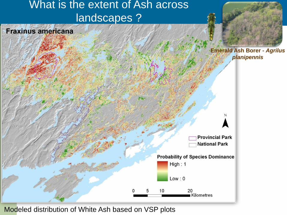
Emerald Ash Borer - Agrilus
planipennis
What is the extent of Ash across
landscapes ?
Modeled distribution of White Ash based on VSP plots
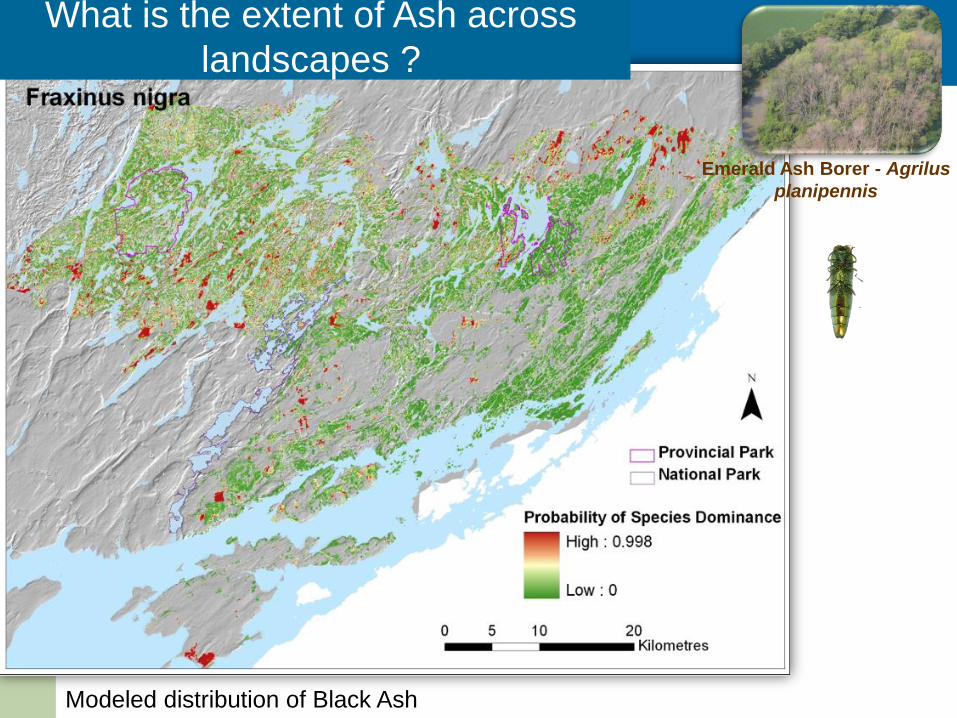
Emerald Ash Borer - Agrilus
planipennis
What is the extent of Ash across
landscapes ?
Modeled distribution of Black Ash
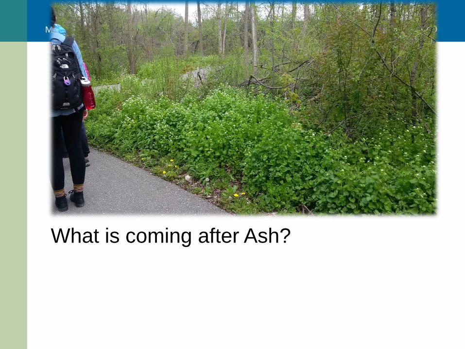
What is coming after Ash?
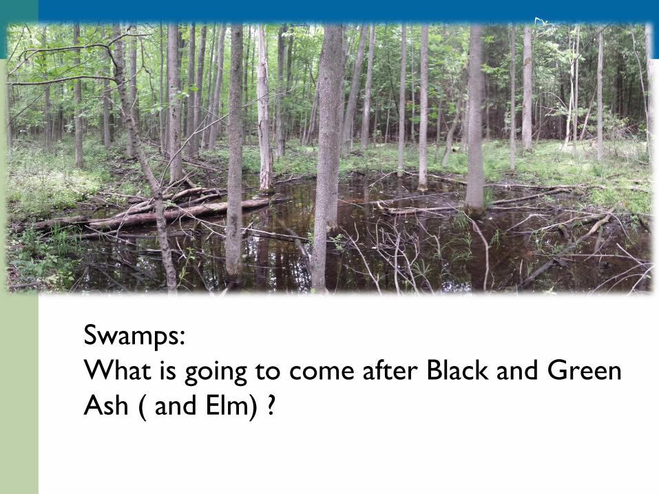
Swamps:
What is going to come after Black and Green
Ash ( and Elm) ?
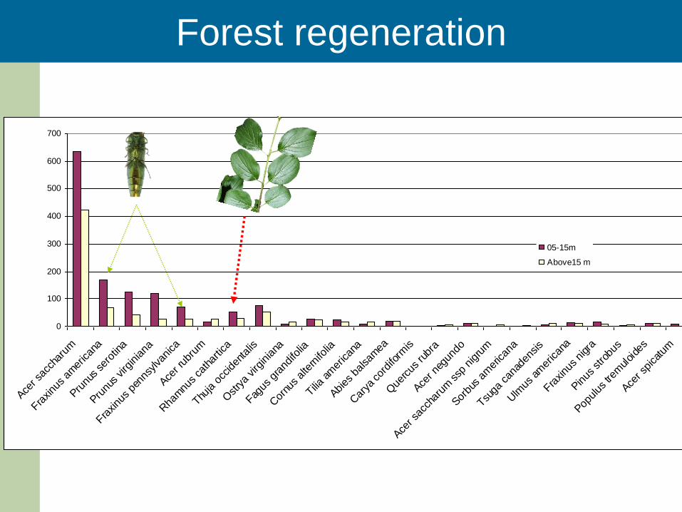
0
100
200
300
400
500
600
700
Acer s
acch
arum
Fraxinu
s am
erican
a
Prunu
s se
rotin
a
Prunu
s virg
iniana
Fraxinu
s pe
nnsy
lvan
ica
Acer r
ubru
m
Rha
mnu
s ca
thar
tica
Thuja o
cciden
talis
Ostrya
virg
iniana
Fagus
gra
ndifo
lia
Cor
nus alte
rnifo
lia
Tilia am
erican
a
Abies
balsa
mea
Car
ya cor
diform
is
Que
rcus
rubr
a
Acer n
egun
do
Acer s
acch
arum
ssp
nigru
m
Sorbu
s am
erican
a
Tsuga
can
aden
sis
Ulm
us am
erican
a
Fraxinu
s nigr
a
Pinus
stro
bus
Populus
trem
uloide
s
Acer s
pica
tum
05-15m
Above15 m
Forest regeneration
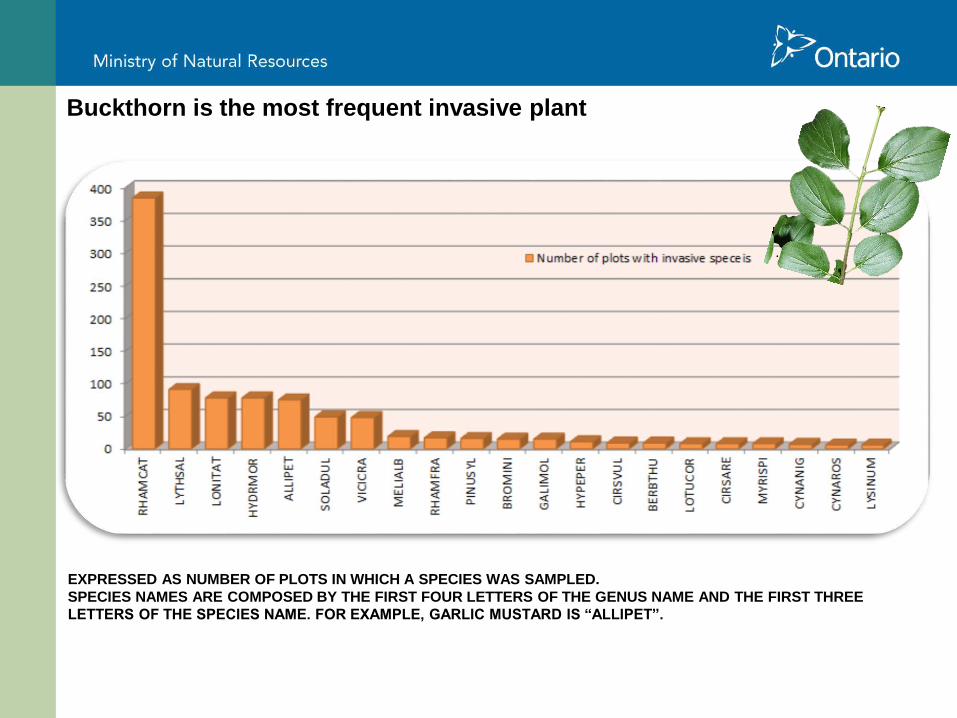
Buckthorn is the most frequent invasive plant
EXPRESSED AS NUMBER OF PLOTS IN WHICH A SPECIES WAS SAMPLED.
SPECIES NAMES ARE COMPOSED BY THE FIRST FOUR LETTERS OF THE GENUS NAME AND THE FIRST THREE
LETTERS OF THE SPECIES NAME. FOR EXAMPLE, GARLIC MUSTARD IS “ALLIPET”.
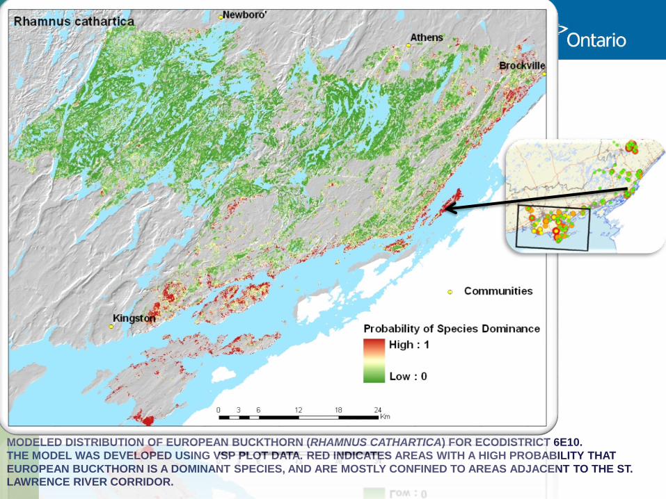
MODELED DISTRIBUTION OF EUROPEAN BUCKTHORN (RHAMNUS CATHARTICA) FOR ECODISTRICT 6E10.
THE MODEL WAS DEVELOPED USING VSP PLOT DATA. RED INDICATES AREAS WITH A HIGH PROBABILITY THAT
EUROPEAN BUCKTHORN IS A DOMINANT SPECIES, AND ARE MOSTLY CONFINED TO AREAS ADJACENT TO THE ST. LAWRENCE RIVER CORRIDOR.
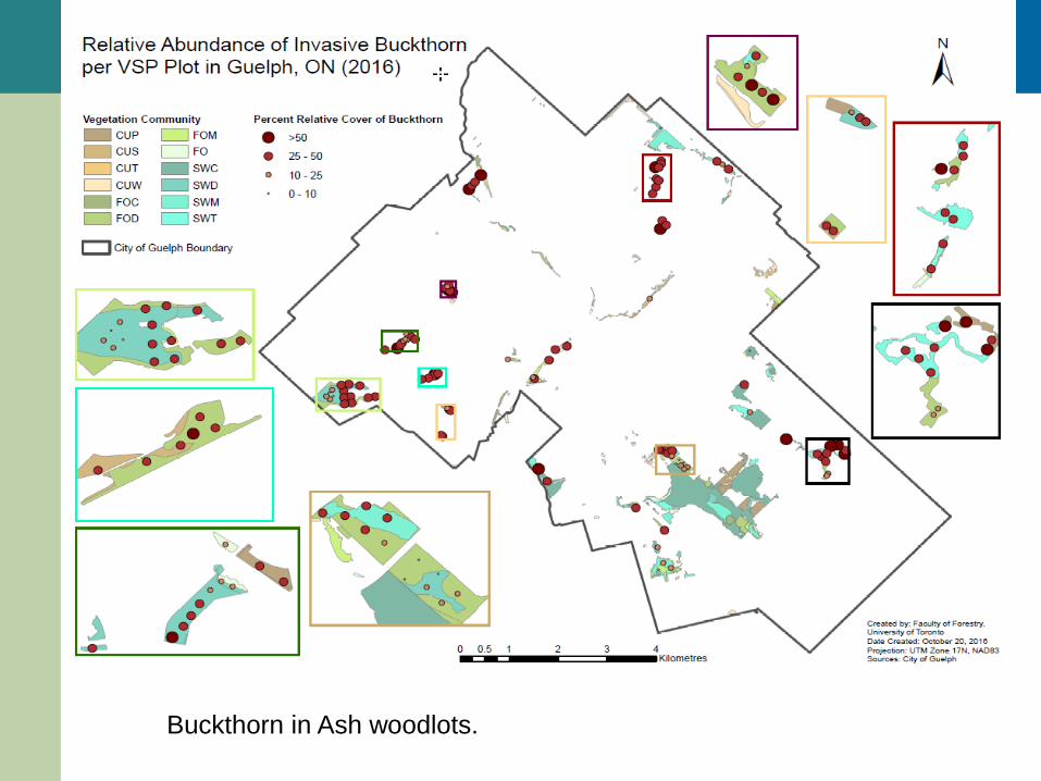
Buckthorn in Ash woodlots.
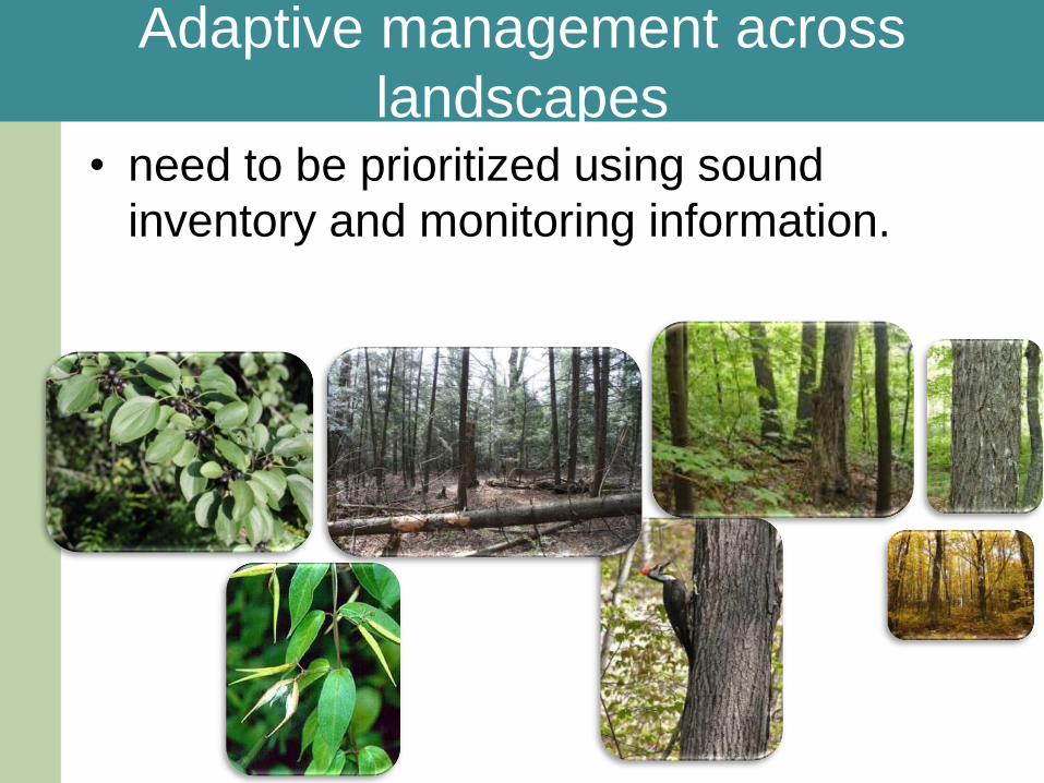
Adaptive management across
landscapes • need to be prioritized using sound
inventory and monitoring information.
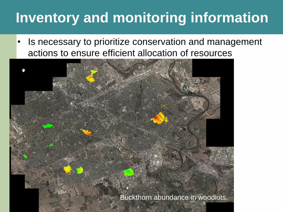
• Is necessary to prioritize conservation and management
actions to ensure efficient allocation of resources
Inventory and monitoring information
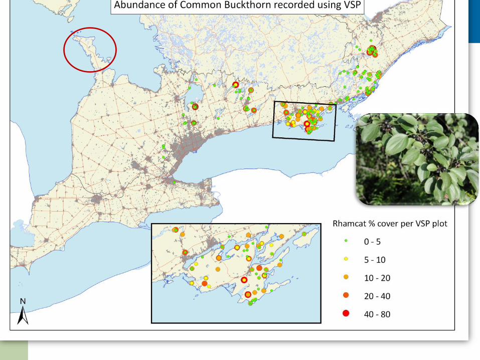
Buckthorn abundance in woodlots.
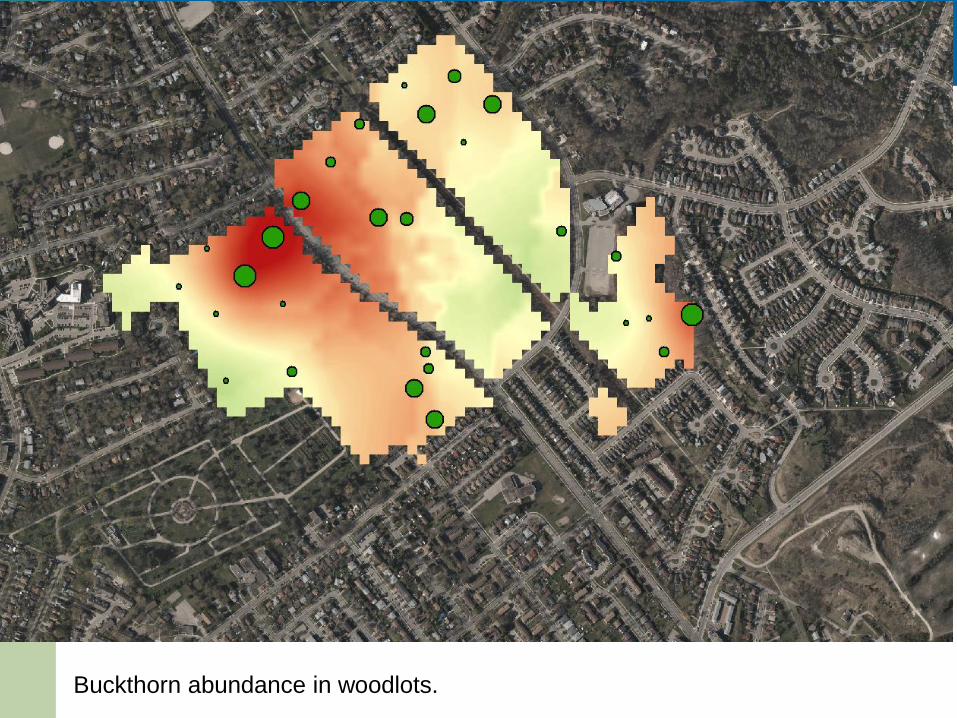
Buckthorn abundance in woodlots.
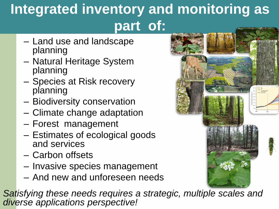
Integrated inventory and monitoring as
part of: – Land use and landscape
planning
– Natural Heritage System planning
– Species at Risk recovery planning
– Biodiversity conservation
– Climate change adaptation
– Forest management
– Estimates of ecological goods and services
– Carbon offsets
– Invasive species management
– And new and unforeseen needs
Satisfying these needs requires a strategic, multiple scales and diverse applications perspective!
Recommended